

IH 35 is one of the busiest Interstates in Texas, joining the growing metropolitan areas of San Antonio, Austin and Dallas-Fort Worth with Mexico at Laredo and Oklahoma City to the north. The freeway corridor replaced US 81 from Laredo north to Fort Worth, and US 77 from Hillsboro north through Dallas.
Interstate 35 Texas Guides
North
South

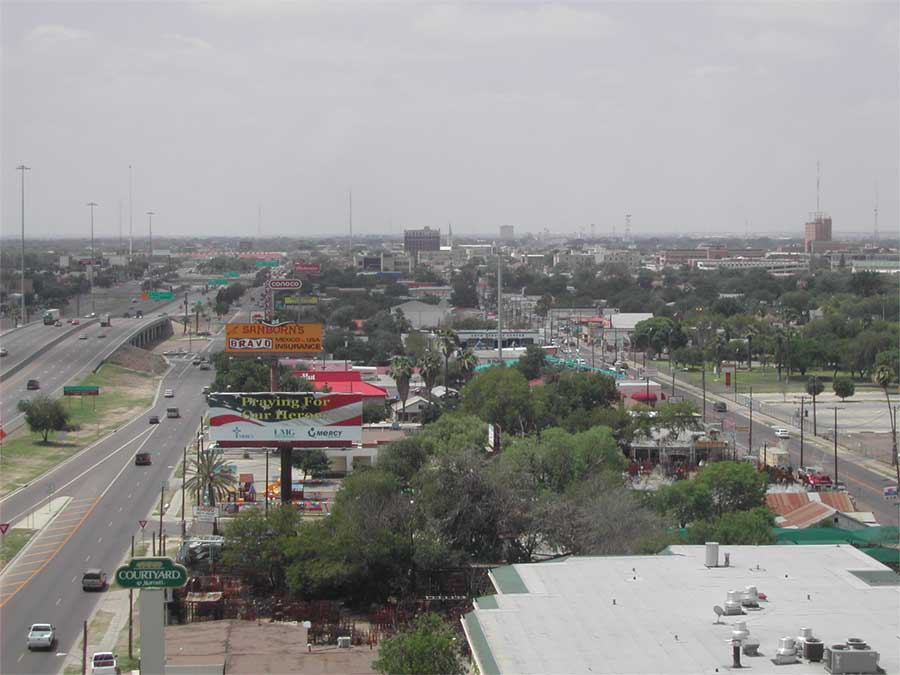
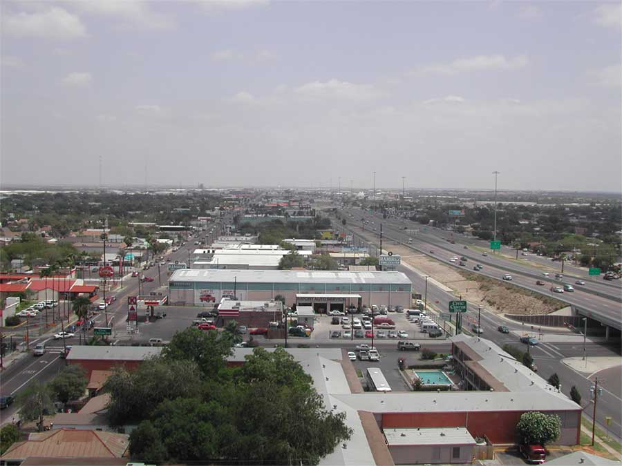
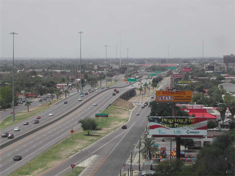
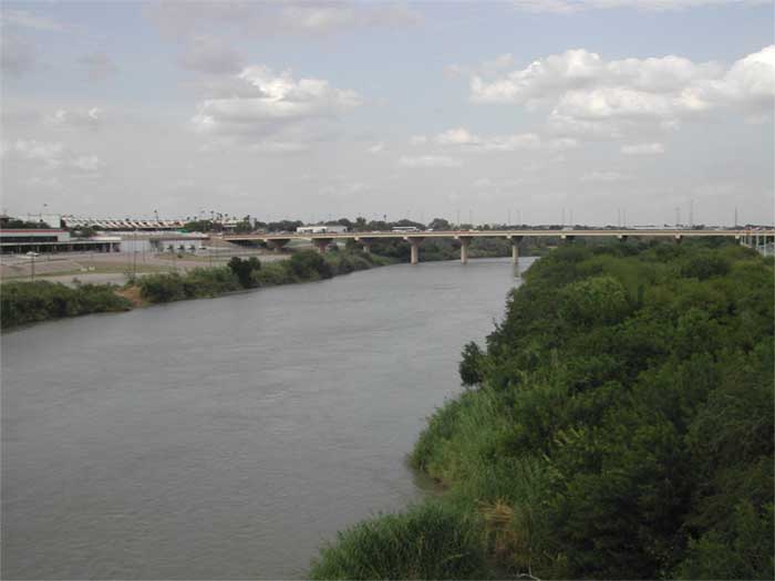
Positioned on the Rio Grande at the Mexican border, Laredo marks the southern end of IH 35. Along with Nuevo Laredo across the river - these cities form "Los Dos Laredos" - one of the largest inland port areas in both the US and Mexico. The southern end of IH 35 lies just northeast of Downtown, five blocks north from the customs station for the Puente International II Bridge across the Rio Grande into Mexico.
Running from the Mexican border at Laredo, the road quickly leaves the border to travel north, then northeast, across the South Texas plains. Passing Cotulla and Pearsall, both large agricultural communities, IH 35 rolls into San Antonio on the southwest side of the city.
IH 35 arcs northeast toward Downtown, and merges with IH 10 on the west side of the central business district. Maps have shown IH 35 as running on the east (co-signed with IH 37) and west (cosigned with IH 10) sides of Downtown at various times, however as designed, IH 35 overlapped with IH 10 west of the city center. IH 35 splits from IH 10 north of Downtown to form the north leg of the Downtown loop to IH 37 on the northeast corner of Downtown. IH 35 then proceeds almost directly east to Loop 410, merging with Loop 410 for a short distance before breaking away from the city to arc northeast toward New Braunfels.
The heavily traveled freeway passes through Universal City on the way to New Braunfels. New Braunfels is a large tourist area, known for Schlitterbahn water park on the Guadalupe River and a strong German heritage. Natural Bridge Caverns and Wildlife Ranch are two other tourist attractions in this scenic section of Hill Country.
San Marcos marks the halfway point between San Antonio and Austin. San Marcos is known for the spring-fed San Marcos river, but is also a college city with Texas State University San Marcos, the alma mater of President Lyndon B. Johnson.
IH 35 enters Austin, the state capitol and one of the most liberal cities in Texas. Austin is known for UT Austin, the pre-eminent public university in the state, as well as its scenic beauty. Technology companies flocked to Austin in the 1980s and 1990s to take advantage of the city's benefits, with the most notable example being Dell Computer. However, IH 35 is an old freeway in Austin, and has reached the limits of its design multiple times. With few other freeway or transit alternatives across the city, IH 35 is often gridlocked.
North of Austin, traffic dies off substantially. IH 35 reaches Georgetown, another college town and center for agriculture, Continuing north, IH 35 approaches Temple which sits just east of Fort Hood, then Waco.
In Hillsboro, IH 35 splits into IH 35E and IH 35W. Officially, given the hostilities between Dallas and Fort Worth, IH 35 is considered equal through the Metroplex, and TxDOT considers IH 35, IH 35E, and IH 35W separate roadways. IH 35E, however, carries the exit numbering of IH 35 through Dallas, while IH 35W resets the numbering at Exit 1.
IH 35E travels through Waxahachie on the way to Dallas, while IH 35W travels directly to Fort Worth. Dallas has historically been the financial and transportation center of Texas, while Fort Worth has been a ranching center. The rivalry between the two cities for parity occurred for well over 100 years and shows no signs of abating, with a later battle over Dallas Love Field and the Wright Amendment limits in air travel running over 30 years.
IH 35E and IH 35W travel through the rapidly growing northern suburbs before rejoining in Denton. Passing through Gainesville, a ranching and cotton town, IH 35 leaves Texas and enters Oklahoma.
With the passage of NAFTA, IH 35 emerged as the primary freeway access to Mexico from the Midwest and East coasts. As a result, truck traffic grew dramatically to the point where certain sections of road, notably San Antonio to Austin, could not handle the demand. IH 35 was designated High Priority Corridor 23, which preceded construction of a relief tollway, SH 130. SH 130 extends north from IH 10 in Seguin, approximately 30 miles east of San Antonio, through the east side of the Austin metropolitan area to IH 35 at Georgetown. SH 130 is controversial due to many factors, not the least of which is the toll. With a parallel free route, traffic counts along SH 130 fell far short of projections during the initial years of its operation.
There are 11 business loops along IH 35 in Texas:
- BI 35-A: Laredo (former US 81/83)
- BI 35-B: Encinal
- BI 35-C: Cotulla (former US 81)
- BI 35-D: Dilley (former US 81)
- BI 35-E: Pearsall (former US 81)
- BI 35-H: New Braunfels (former US 81)
- BI 35-J: Kyle (former US 81)
- BI 35-L: Round Rock
- BI 35-M: Georgetown - decommissioned in 2007
- BI 35-V: Alvarado (off IH 35W)
- BI 35-X: Sanger
 scenes scenes |
 | A cloverleaf interchange joins the IH 35 frontage roads with SL 288 on the north side of Denton. Loop 288 varies between a freeway and expressway as it encircles the city to the east. Stub ends nearby allude to a potential westward extension. 10/20/03 |
 | U.S. 77 angles northwest to combine with IH 35 at Exit 471. The west side frontage road links Exit 471 with FM 1173 toward Krum. 10/20/03 |
Photo Credits:
10/20/03 by AARoads
Connect with:
Interstate 10
Interstate 20
Interstate 30
Interstate 410
Page Updated 07-08-2019.