|
| Park Road 23 is a 1.09 mile route joining U.S. 281 and SL 163 with Blanco State Park in the city of Blanco. 12/31/02 |
|
| A Parker through truss bridge carries southbound traffic along U.S. 281 across the Guadalupe River in Comal County. 12/31/02 |
|
| Built in 1935, the 612 foot long span1 was rehabilitated with a new bridge deck and rails during a $3.27 million project in 2018-19.2 12/31/02 |
|
| SL 1604 (C.W. Anderson Loop) meets U.S. 281 in north San Antonio by Hollywood Park. A heavily traveled commuter freeway, SL 1604 arcs west to IH 10 and east to IH 35 at Live Oak. 12/31/02 |
|
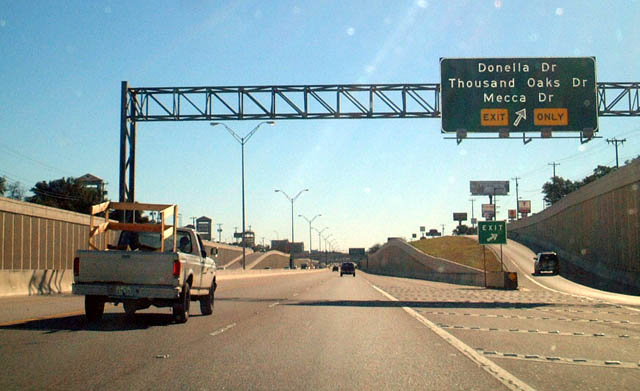
| The off-ramp to Donella, Thousand Oaks and Mecca Drives departs from the southbound U.S. 281 freeway within the systems interchange with Loop 1604. 12/31/02 |
|
| Donnela Drive and Mecca Drive comprise residential roads leading west into the town of Hollywood Park. Thousand Oaks is an arterial arcing southeast to Uptown in San Antonio . 12/31/02 |
|
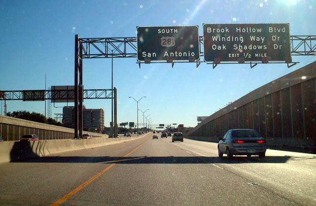
| Traveling below grade along the Hollywood Park and San Antonio city line, U.S. 281 advances south toward Hill Country Village and Brook Hollow Boulevard east. 12/31/02 |
|
| Winding Way ties into the U.S. 281 frontage road system from the city of Hill Country Village opposite Oak Shadows Drive south. 12/31/02 |
|
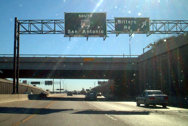
| Bitters Road crosses U.S. 281 amid a heavily developed retail area south of Hill Country Village. 12/31/02 |
|
| The off-ramp for Nakoma Drive separates from U.S. 281 southbound ahead of FM 1502 (Wurzbach Parkway), an expressway running north of San Antonio International Airport (SAT) and Salado Creek. 12/31/02 |
|
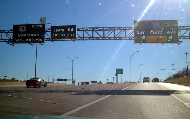
| San Pedro Avenue splits from U.S. 281 at a wye interchange by SAT Airport. Prior to construction of the systems interchange linking the McAllister Freeway directly with IH 410, San Pedro Avenue was the main route linking the two corridors. 12/31/02 |
|
| San Pedro Avenue is a heavily developed commercial arterial leading south to IH 410 at North Star Mall. San Pedro Avenue also is part of the historic alignment of U.S. 281 through San Antonio. 12/31/02 |
Page Updated 07-26-2019.


 South
South