|
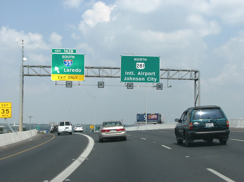
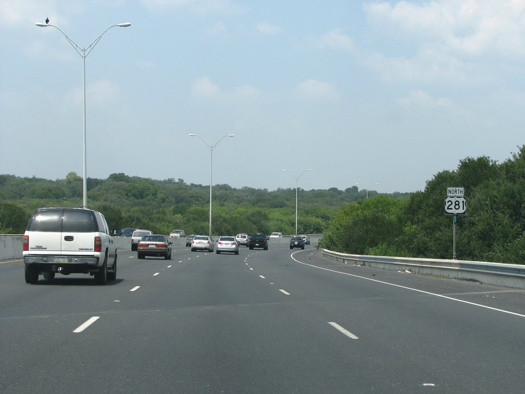
| U.S. 281 transitions from the north end of IH 37 to the McAllister Freeway on the northeast side of San Antonio. The succeeding 14 mile freeway was named after Walter McAllister. He was San Antonio's mayor in the 1950s when the freeway was first proposed. Locals however usually referred to the highway simply as "281". 08/31/08 |
|
| U.S. 281 advances northbound along a viaduct spanning commercial areas north of Downtown. Johnson City, located 63 miles to the north, is the unlikely control point for northbound drivers. A split diamond interchange joins the freeway with St Mary's Street and Stadium Drive next. 08/31/08 |
|
| Curving northwest alongside the city's largest and most popular park, Brackenridge, U.S. 281 crosses over the San Antonio River. Through Downtown, the river forms the basis for the city's famous Riverwalk, but to the north it is barely a creek. Large weirs and channels keep the river from flooding the lucrative tourist areas downstream. 08/31/08 |
|
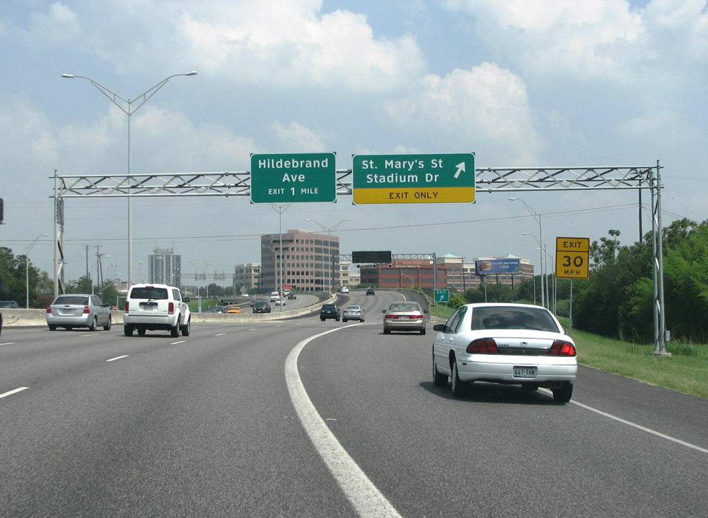
| The eight lane freeway turns northward through an S-curve to the St. Mary's Street and Stadium Drive exit. 08/31/08 |
|
| San Antonio's wealthiest, oldest, and most leafy suburbs are located in the area along St. Mary's Street and Mulberry Avenue. Stadium Drive runs alongside U.S. 281 north to Alamo Stadium at Trinity University. 08/31/08 |
|
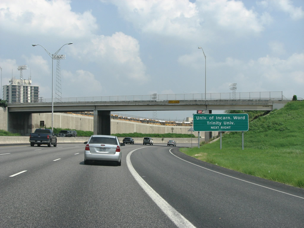
| The ensuing exit along U.S. 281 is with Hilderbrand Avenue to Trinity University and the University of the Incarnate Word. U.S. 281 drops below grade ahead of Stadium Drive by the local school district's stadium. 08/31/08 |
|
| Alamo Stadium sits partially on an overhanging ledge. A similar structure on the right hand side of the road here accommodates several park structures. These two ledges form part of a compromise on the routing of the freeway through important city parkland. 08/31/08 |
|
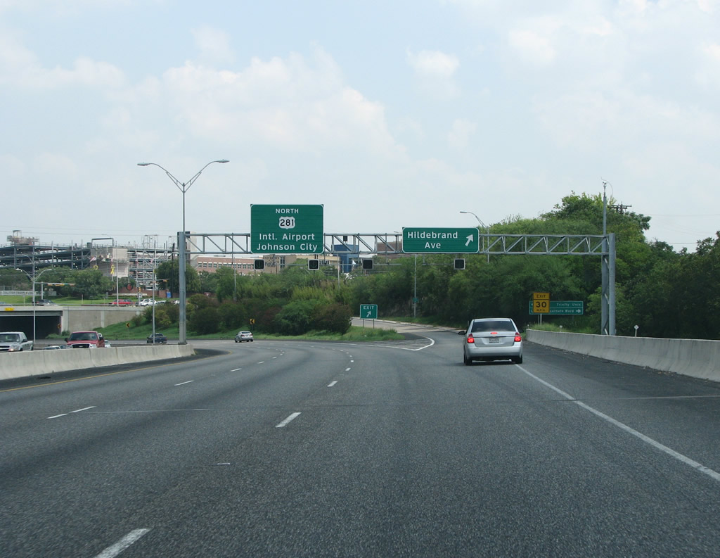
| Entering the diamond interchange with Hildebrand Avenue on U.S. 281 north. The urban arterial forms an important link between the McAllister Freeway and some of the city's important cultural and recreational institutions. This area of the city is also one of the denser sections with a lot of urban infill construction. In 1990, the state spent $23,000 to add grooves to the pavement in this area to improve traction on the road's curves. 08/31/08 |
|
| U.S. 281 proceeds north traversing the Olmos basin floodplain. The floodplain assists Downtown during periods of heavy rain by storing water that would otherwise bog down the city center. Fewer exits along this stretch are also indicative of a road that had a lot of compromises built into it due to local opposition. 08/31/08 |
|
| A confirming marker stands along the eight lane freeway as it goes over the floodplain. San Antonio has more dense forest growth than one would think, given its position in an arid part of the nation. 08/31/08 |
|
| Sound walls protect houses nearby as motorists pass under the first reference of IH 410. As with most Texas loops, there are no control points for the interstate exits ahead. 08/31/08 |
|
| Basse Road (pron. BASS-ey) forms the gateway to the exclusive suburban enclaves of Alamo Heights and Terrell Hills. It also connects the freeway with the Alamo Quarry Market, a large shopping center that was originally a quarry and cement plant. The exchange here omits ramps to U.S. 281 north and from U.S. 281 south, likely a consideration made for area conservation. 08/31/08 |
|
| The exit to Basse Road westbound is a substandard 20 mph loop ramp. Basse was extended east to Broadway in 1992, and the exit became much busier at that time. 08/31/08 |
|
| This VMS just north of Basse normally indicates traffic conditions. U.S. 281 is one of the busiest freeways in San Antonio and is the main route for traffic headed from Downtown to the sprawling northern suburban area. 08/31/08 |
|
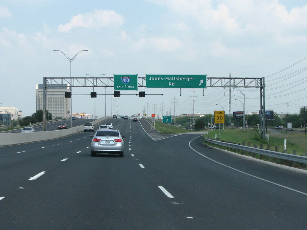
| Northbound U.S. 281 at the Jones-Maltsberger exit. The road, named for early pioneer families, parallels the freeway through here, with another ramp from U.S. 281 south as well as one along IH 410. This is the last exit in the residential area of north San Antonio, and from here the industrialized area around the airport begins. 08/31/08 |
|
| IH 410 is occasionally signed as the Connally Loop, to differentiate it from the city's other Loop, SL 1604 (C.W. Anderson Loop). However, locals normally refer to it simply as 410, or Loop 410. The U.S. 281 freeway was upgraded through here from 2004 to 2008, including adding a collector-distributor lane on the far right side of the road, north of the Jones-Maltsberger on-ramp. 08/31/08 |
|
| San Antonio International Airport (SAT) sits at the northeastern quadrant of the exchange joining U.S. 281 and IH 410. Access to the airport is provided directly with an upcoming ramp from U.S. 281 to the terminal area. 08/31/08 |
|
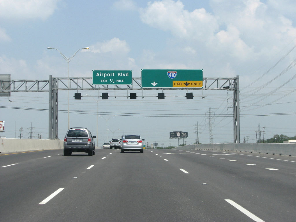
| Also called Airport Boulevard, the International Airport exit falls within the systems interchange at IH 410. Two lanes depart next for IH 410, while U.S. 281 maintains four northbound lanes as it heads through northern San Antonio. Newer guide signs do not show the historic "Connally Loop" designation. 08/31/08 |
|
| Sign bridges with maroon accents signal the beginning of the multi level interchange with IH 410. The stack fully opened in the Summer of 2008. 08/31/08 |
|
| The off-ramp to Airport Boulevard separates from U.S. 281 immediately after the gore point for IH 410. The city sought a new location for its airport because the current location does not allow for any expansion. This is similar to the moving of Austin's airport in the late 90s to a location further outside the city. 08/31/08 |
|
| When both IH 410 and the U.S. 281 freeways were completed, there was no direct connection because of the delays in the construction of U.S. 281 due to community opposition. Planning for the stack began in the 90s and work started in 2004 to build a series of direct connections. The result is impressive. 08/31/08 |
|
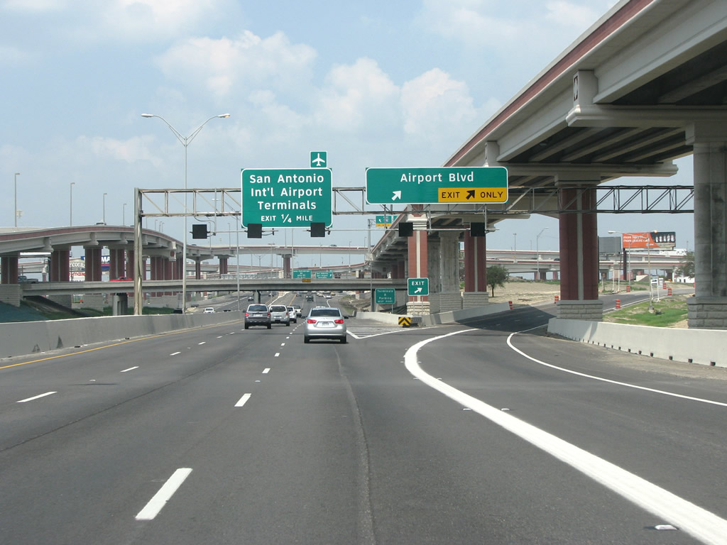
| The exit for Terminal Drive and SAT Airport departs from U.S. 281 next. This flyover opened well before the stack at IH 410 did. Opened in June 2008, the interchange cost over $120 million The four level interchange provides great views for those who enjoy civil engineering, with the best vantage point being from eastbound IH 410, which makes up the lowest level. 08/31/08 |
|
| Parallel Jones-Maltsberger Road, shifts eastward across U.S. 281 at the ensuing interchange beyond IH 410. This section of the road connects with industrial airport land and commercial areas. 08/31/08 |
|
| This view looks northbound at the U.S. 281 ramps from IH 410. The high speed exchange had to accommodate every traffic movement between the two freeways within a small footprint, as area land had been built up since its opening in 1978. 08/31/08 |
|
| Mid-rise office blocks line the McAllister Freeway north of Loop 410. Nakoma Drive approaches as the next exit. 08/31/08 |
|
| Nakoma Drive lies north of the merge with traffic from IH 410. The local road runs along the north side of the airport. 08/31/08 |
|
| Entrance ramps from SAT Airport, Isom Road and San Pedro Avenue add two lanes to U.S. 281 northbound at the Sandau Road overpass. 09/01/08 |
|
| Bitters Road, once a main route, has since been broken into several pieces by the SAT Airport. However, the area around U.S. 281 is still very busy as Bitters runs northwest into rapidly developed land and an interchange at Loop 1604. 09/01/08 |
|
| U.S. 281 runs under the San Antonio airport's runway guidance system. This is one of several places in America where a freeway comes into contact with an airport's necessary surrounding structures. 09/01/08 |
|
| The exit for Bitters Road was relocated further north while the previous ramp here was repurposed for Wurzbach Parkway. Wurzbach Parkway is a limited access road to the east of here. It does not connect directly to any other freeways, but provides an important east/west link between the two loops. 09/01/08 |
|
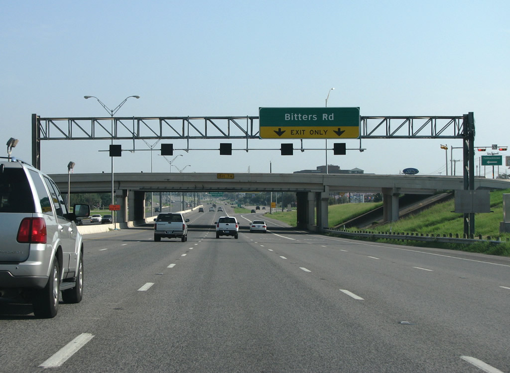
| U.S. 281 northbound at Bitters Road. This is a busy interchange with several airport hotels, chain restaurants, and other businesses located nearby. 09/01/08 |
|
| The succeeding exit north of Bitters Road is for Oak Shadows Drive and Winding Way Drive. The side of the freeway through here is populated with businesses and mid-rise office blocks. 09/01/08 |
|
| Oak Shadows and Winding Way are two relatively minor streets. The suburb of Hill Country Village is located along the west side of the freeway here. It is likely this exit was built primarily to connect the freeway with adjacent businesses that front both sides of U.S. 281. 09/01/08 |
|
| The freeway north from SAT Airport to SL 1604 gets between 160,000 and 200,000 cars on an average day, making it the busiest section of U.S. 281 north of IH 410. Many San Antonio businesses relocated from Downtown to the northern side of the city, reserving the city center for tourism and historic preservation activities. The freeway through here was upgraded from a divided highway between 1987 and 1989. 09/01/08 |
|
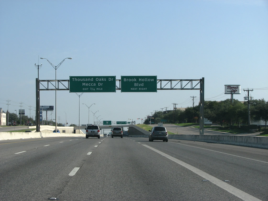
| Brook Hollow Boulevard is another nondescript residential street that runs east into the northern suburbs. Traffic from the on-ramp here expands the freeway to eight overall lanes. 09/01/08 |
|
| U.S. 281 continues north one quarter mile to Thousand Oaks Drive. 09/01/08 |
|
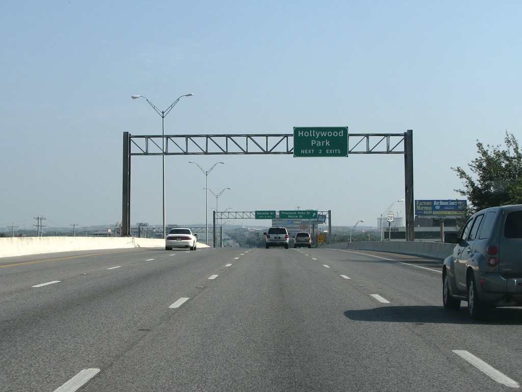
| Hollywood Park is a small enclave of San Antonio with around 3,000 inhabitants. The town was originally developed as a rural escape in the 1940s and was incorporated in 1955. It is known locally for having a huge deer population. 09/01/08 |
|
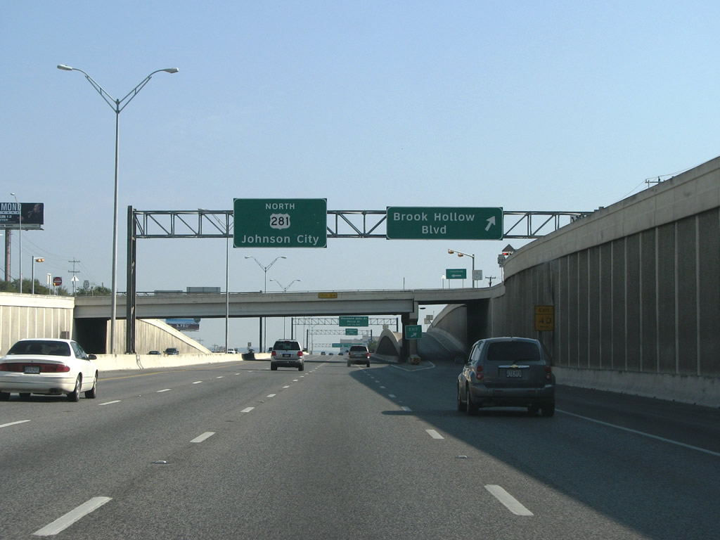
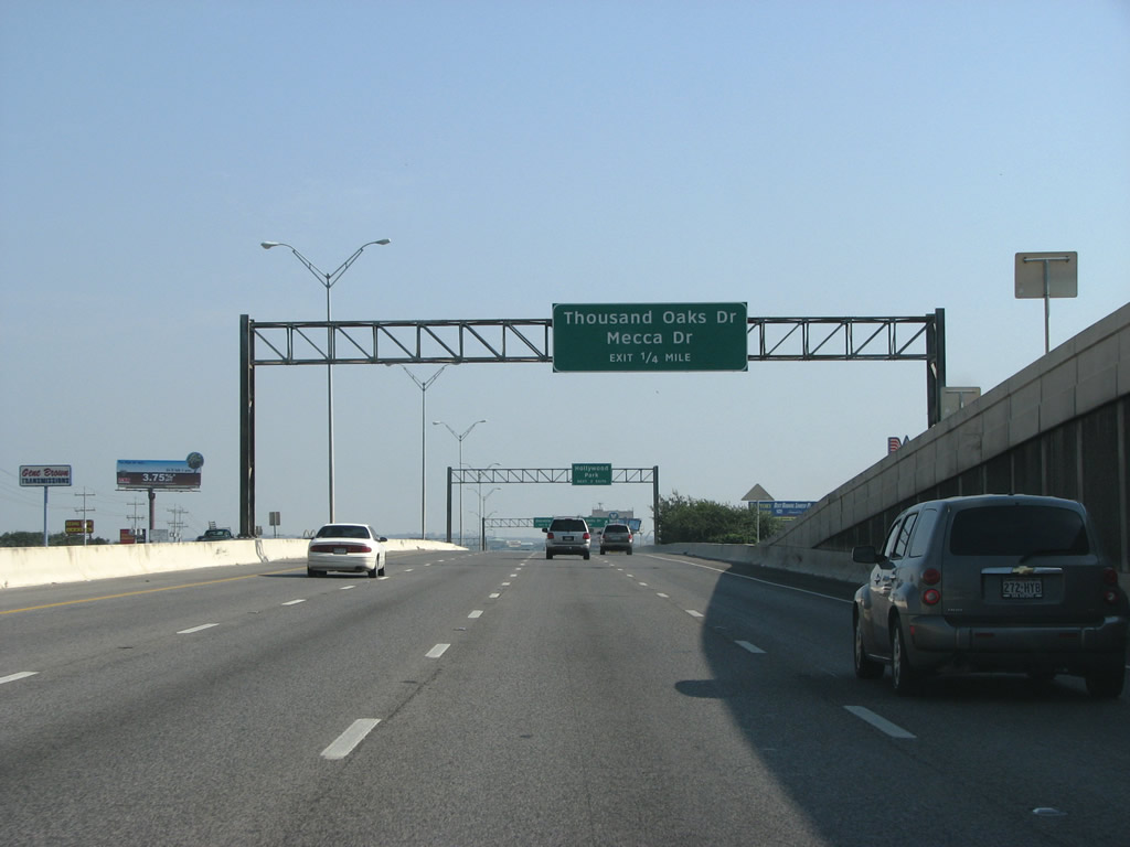
| U.S. 281 northbound at Thousand Oaks. The street name may give the motorist the idea that it is just a residential street, like the previous two exits, but in reality Thousand Oaks is a very important arterial on the north side of the urban area. The road runs east with grade separated intersections at Wurzbach Parkway and IH 35. 09/01/08 |
|
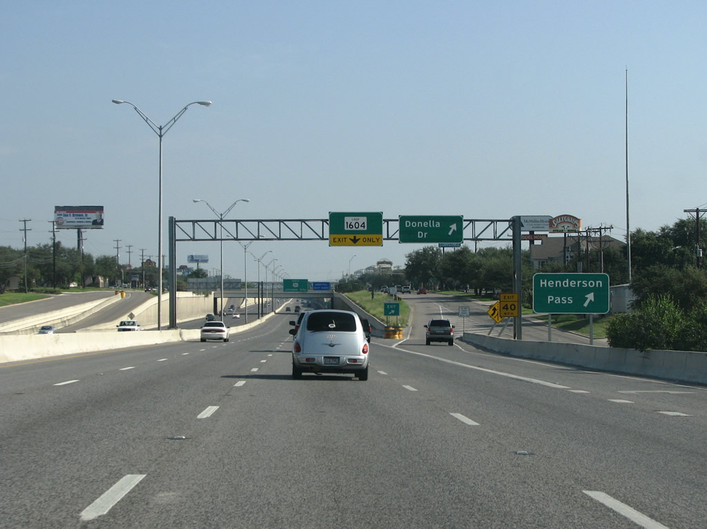
| The succeeding exit links U.S. 281 with Donella Drive west into Hollywood Park and Henderson Pass east to Northwoods Shopping Center at Loop 1604. 09/01/08 |
|
| One quarter mile south of Donella Drive. The fast expanding urban area meant that the county and city governments were late in getting arterial plans written. Thus, there are fewer major streets on the north side of San Antonio than in many other major suburban areas. 09/01/08 |
|
| The slip ramp for Henderson Pass leaves U.S. 281 north at Lorence Creek, a half mile ahead of the exit for the frontage road (San Pedro Avenue) to the retail area adjacent to SL 1604. 09/01/08 |
|
| Construction to build a systems interchange with SL 1604 (C.W. Anderson Loop) added two flyovers for the freeway departing from the left side of U.S. 281 north in one half mile. 09/01/08 |
|
| Loop 1604, also known as the Anderson Loop, completely encircles the metro area - but is only a freeway on the northern side. The freeway section was built in the late 80s without a direct connection with U.S. 281 here. A five-level interchange was eventually built here, with direct connectors to the north under construction through 2020. 09/01/08 |
|
| Drivers previously were directed to navigate the frontage road system to access SL 1604 from U.S. 281 north. SL 1604 constitutes a full freeway from U.S. 90 on the far west side of San Antonio east to IH 35 at Live Oak. 09/01/08 |
|
| US 281 is depressed in a trench as it runs under Loop 1604. 09/01/08 |
|
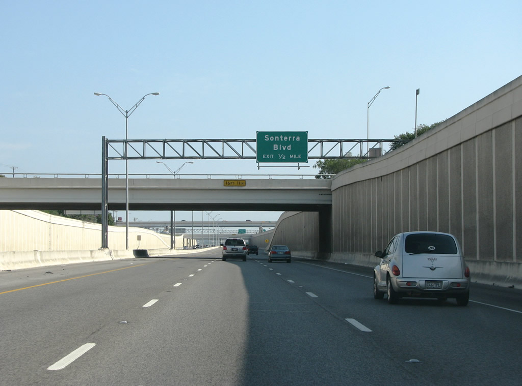
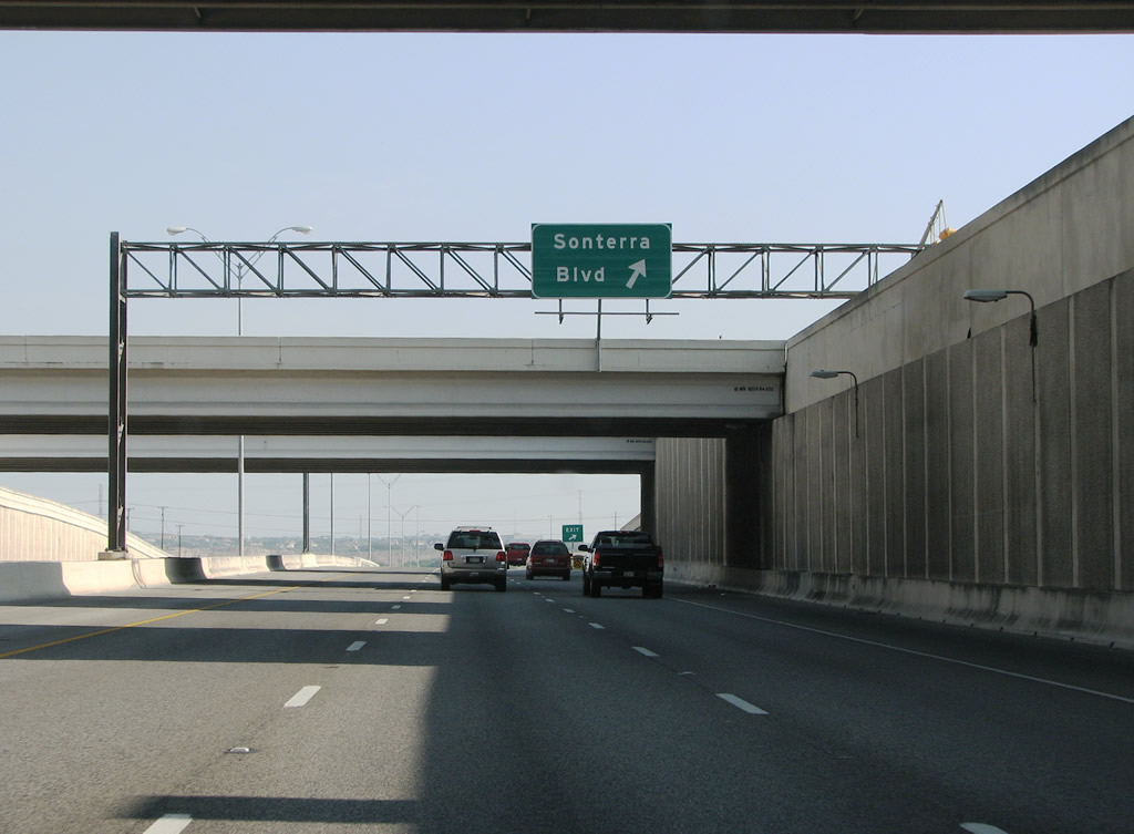
| The last exit along the freeway portion of U.S. 281 is at Sonterra Boulevard. The bridge was built in 1987 but the actual road, Sonterra Boulevard, did not connect to it until the mid 90s. 09/01/08 |
|
| U.S. 281 transitions into an at-grade highway north from Sonterra Boulevard and Mud Creek. A right in right out (RIRO) intersection followed with Redland Road east. Upgrading of this section to a limited access highway started in 2015 and will be completed in 2020. 09/01/08 |
|
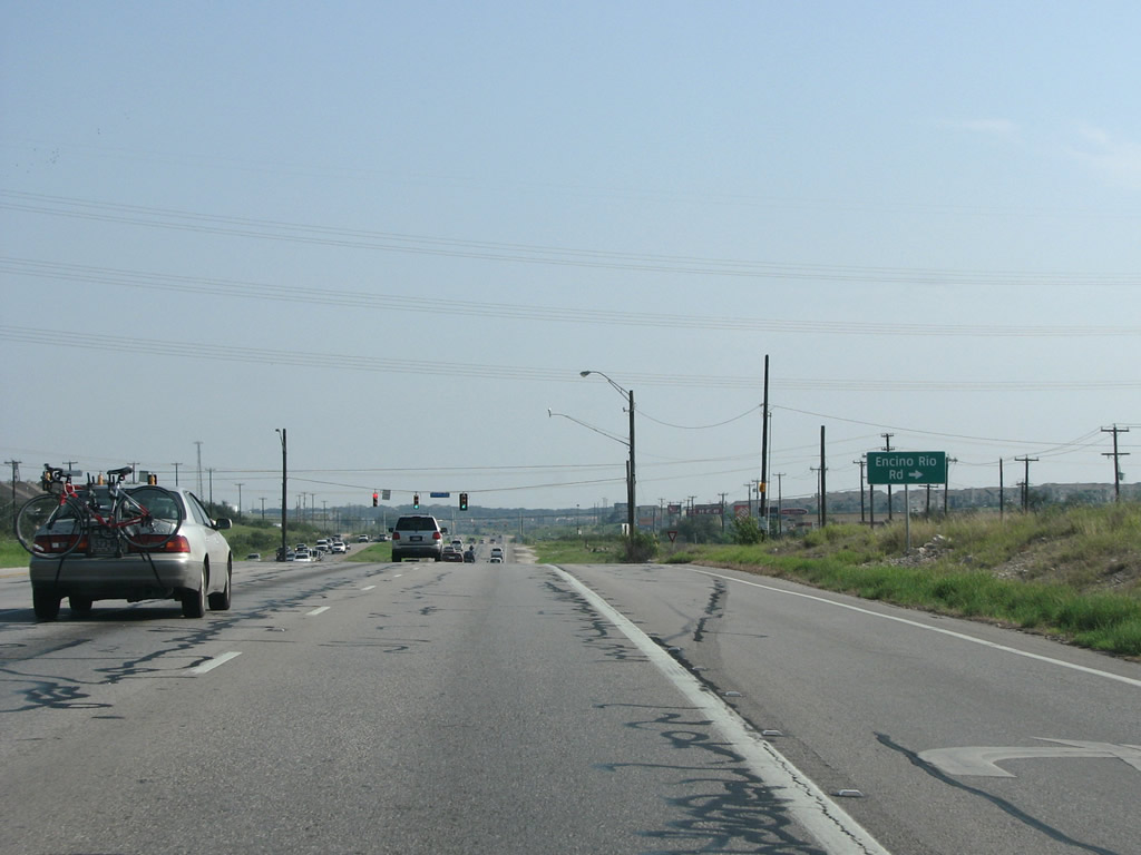
| U.S. 281 traverses a series of traffic lights through land that was heavily developed with subdivisions and several large shopping centers line. Encino Rio Road intersects the highway at Encino Park. 09/01/08 |
|
| Stone Oak Parkway east and TPC Parkway west come together at a commercialized intersection with U.S. 281. 09/01/08 |
|
| U.S. 281 reassurance marker posted after Marshall Road. The land known as the Texas Hill Country begins north of San Antonio. 09/01/08 |
|
| The reason San Antonio has sprawled north is that many nice views are to be had in this rolling part of Texas. However, the metro area is now adjacent to protected areas and development becomes limited further to the north. 09/01/08 |
|
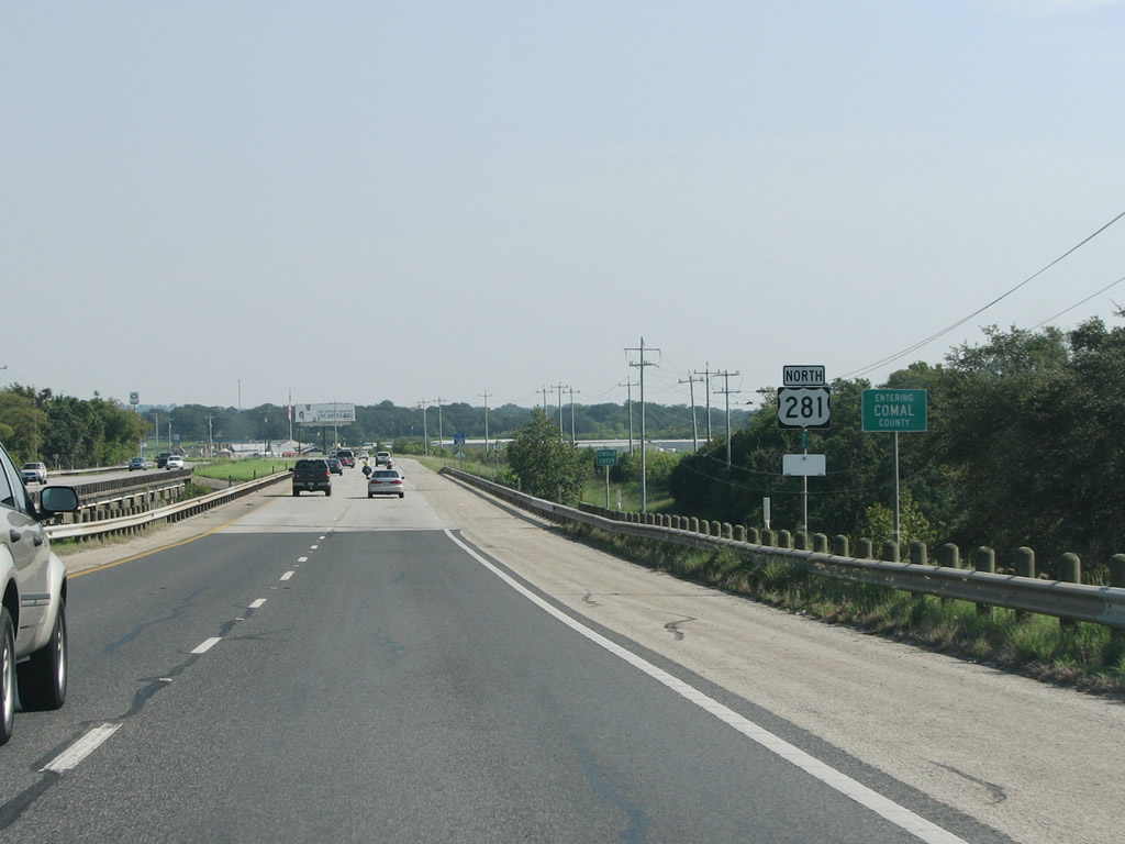
| U.S. 281 passes through the far western reaches of Comal County, a semi-rural county between San Antonio and Austin. The county name is Spanish for "flat dish" and it is thought that the name comes from the many small islands found in the local rivers. Settlement in the area began with a Spanish mission founded in 1756. European settlement in southern Texas generally dates from about the same time as the early English settlement of the Atlantic coastline, something often overlooked in history books about the USA. 09/01/08 |
Page Updated 07-26-2019.

 North
North