|
| 2.6 miles north into Burnet County, U.S. 281 meets SH 71 at a grade separated cloverleaf interchange. The exchange is marked with state highway markers in lieu of freeway style guide signs. 09/01/08 |
|
| SH 71 travels east from U.S. 281 as an expressway into the Austin area. It continues over IH 35 and remains an expressway towards the east and south as it makes it way to IH 10. SH 71 is the main route from Austin into the Hill Country and towards the Highland Lakes region, which U.S. 281 enters here. 09/01/08 |
|
| The eastern leg of RM 2147 spurs 3.80 miles from U.S. 281 to CR 402 and CR 404 on the hills overlooking Lake Travis. 09/01/08 |
|
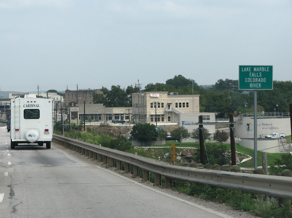
| RM 2147 overlaps with U.S. 281 north 1.56 miles into the city of Marbles Falls. 09/01/08 |
|
| Marble Falls is a notable tourist center, featuring many bed and breakfasts, lodges and RV parks. The falls for which the city was named were destroyed in the 1950s with the impounding of water along the Colorado River for Lake Marble Falls, but the town benefited in other ways from the increased recreational opportunities. The city is also notable for being the home of the first female mayor in the United States, elected in 1917. 09/01/08 |
|
| U.S. 281 and RM 2147 wind northward, lowering 100 feet in elevation down an escarpment towards the city center and the Colorado River. 09/01/08 |
|
| FM 2147 branches west from U.S. 281 alongside the Colorado River toward Cottonwood Shores and SH 71 at Horseshoe Bay. Vacation and weekend homes are popular with Texans and many are located along the lakes towards the west and north of here. 09/01/08 |
|
| U.S. 281 crosses the Colorado River ahead of Downtown Marble Falls. Lake Marble Falls is part of the Highland Lakes project, which is to Texas much like the TVA is to Tennessee. The project, which ran from the 1930s to the 1950s, built six lakes behind a series of dams on the Colorado River. Aside from controlling flooding, the dams also provide power for Central Texas. 09/01/08 |
|
| With traffic counts of 27,036 vpd recorded by TxDOT in 2017, U.S. 281 through Marble Falls is a very busy road, full of RVs and pedestrians. This view looks on the north side of the city by Resource Parkway. The Bluebonnet House, an old farmhouse typical of Central Texas, is visible on the left here. 09/01/08 |
|
| RM 1855 runs just 1.61 miles west from U.S. 281 to County Road 120 at Fairland. CR 120 extends the roadway west across Backbone Valley towards the Colorado River at RM 1431 and the city of Highland Haven. 09/01/08 |
|
| The city center of Burnet, the county seat, lies nine miles north of RM 1855 along U.S. 281. 09/01/08 |
|
| Totaling 15.61 miles, PR 4 is one of the longest Park Roads within the Texas state highway system. PR 4 begins here and runs west to the popular Longhorn Caverns State Park and north along the shores of Inks Lake and Lake Buchanan - both part of the Highland Lakes project. 09/01/08 |
|
| U.S. 281 enters the Burnet city limits at the intersection with Park Road 4. 09/01/08 |
|
| Approaching SH 29 in Downtown Burnet. A city of over 6,000, Burnet sits at the northern end of what is called the Texas Hill Country. Burnet is known for producing football players. Doak Field of the Philadelphia Eagles was from here, as are Aggie quarterback Stephen McGee and UT wide receiver Jordan Shipley. 09/01/08 |
|
| The main crossroads in Burnet is where U.S. 281 (Water Street) and SH 29 (Polk Street) meet. Control points listed here include Llano and Georgetown - county seats of the adjacent west and east counties, respectively. Buchanan is a tourist resort on the shores of Lake Buchanan, the northernmost of the Highland Lakes. 09/01/08 |
|
| SH 29 travels 10.37 miles east from U.S. 281 in Downtown Burnet to Bertram and 34.5 miles to IH 35 at Georgetown. Georgetown is usually considered to be the northernmost suburb of Austin. 09/01/08 |
|
| The 22 mile drive north from Burnet to the next county seat, Lampasas is sparsely populated. 09/01/08 |
|
| RM 963 branches east from U.S. 281 (Water Street) along Graves Street in north Burnet. The 27.58 mile long highway to FM 2657 runs through northern Burnet County, to the communities of Watson and Oakalla. Oakalla is the largest community in northeastern Burnet County, but only has about 40 residents. 09/01/08 |
|
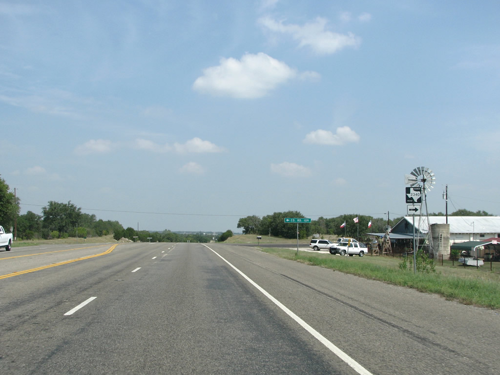
| RM 2340 is a 7.56 mile loop back to RM 963 via Lake Victor from U.S. 281. 09/01/08 |
|
| U.S. 281 remains with four lanes between Lampasas and Burnet. The highway traverses a wetter part of Texas than the arid regions further west. However between Burnet and Lampasas some scrubland is present. This might also be considered the easternmost region of the dry great plains biome in the middle of the state. 09/01/08 |
|
| U.S. 281 bee lines six miles north toward the Lampasas County line. Although the highway has left the Hill Country, some notable elevation changes are present. 09/01/08 |
|
| U.S. 281 enters Lampasas County and proceeds 1.55 miles north to U.S. 190 (Plum Street) within the city of Lampasas. 09/01/08 |
|
| Lampasas is a beautiful town that was built around some springs. Each year the community holds its "Spring Ho" festival to honor them. The city and county were both named after a hill, which was named after a creek, likely named after a Spanish explorer with the last name of Lampazos. 09/01/08 |
|
| Trucks headed north along U.S. 281 are directly onto U.S. 190 (Plum Street) east to connect with nearby U.S. 183 (Key Avenue) north. 09/01/08 |
|
| East from Lampasas, U.S. 190 travels to Copperas Cove, where it becomes a part of IH 14 to Fort Hood, Killeen, Harker Heights and IH 35 at Belton. 09/01/08 |
|
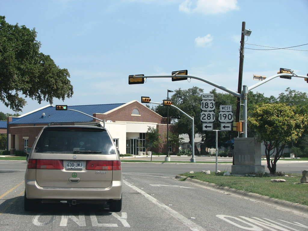
| U.S. 281 crosses Sulphur Creek and converges with U.S. 183/190 (Key Avenue). US 183 enters the Lampasas northward from Austin. 09/01/08 |
|
| Located nearly 50 miles away, Hamilton, seat of Hamilton County, is the next city importance on U.S. 281. Lampasas is the last place to get supplies and fast food until that point. 09/01/08 |
|
| U.S. 281 combines with U.S. 183 north & U.S. 190 west along Key Avenue for 1.73 miles through the central part of Lampasas. 09/01/08 |
|
| The main drag of Lampasas contains all of the usual Central Texas chains that one would expect to find in a city of 7,000. Five blocks north of their merge, U.S. 281/183/190 (Key Avenue) intersects the west end of SL 257 (4th Street). The loop is a 1.33 mile route that heads to the town square. 09/01/08 |
|
| As the US Highways bypass the town square, they meet FM 580 (North Avenue). Doubling as a truck route across Lampasas, FM 580 comprises a 37.42 mile highway to the Colorado River at Bend and U.S. 190 outside San Saba 09/01/08 |
|
| The US highways leave the central portion of Lampasas and continue north across Burleson Creek to intersect the east branch of FM 580 (Avenue J). FM 580 continues out from Lampasas 16.61 miles to Rumley, Topsey and FM 116 along the boundary of Fort Hood, a US Military installation. 09/01/08 |
|
| U.S. 183/190 split from U.S. 281 north of Lampasas and continue together another 14.84 miles northwest to Lometa. The northern reaches of Lampasas have a few commercial and industrial areas spreading north along U.S. 281. 09/01/08 |
|
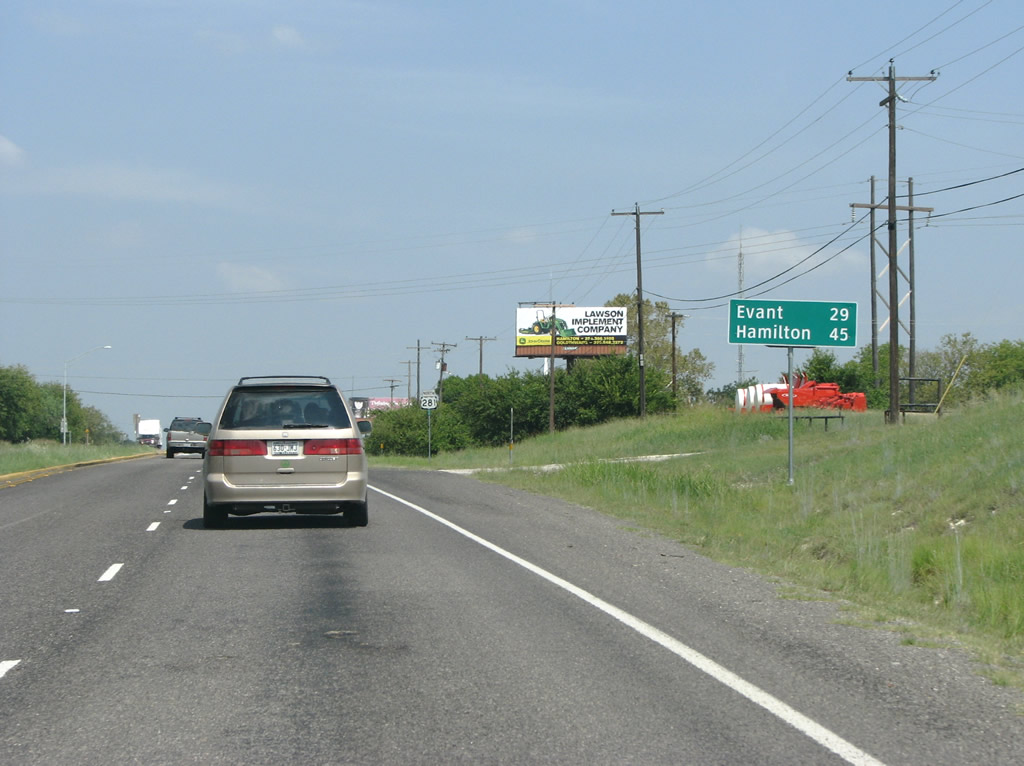
| U.S. 190 ventures west from Lampasas to San Saba while U.S. 183 progresses northward to Goldthwaite and Brownwood. U.S. 281 remains northerly to Adamsville, Evant and Hamilton. 09/01/08 |
|
| Evant is the only incorporated town between Lampasas and Hamilton, but there are not many facilities there. The stretch beginning now is a typical lengthy Texas highway with not much to see besides some scrub and forested land. 09/01/08 |
|
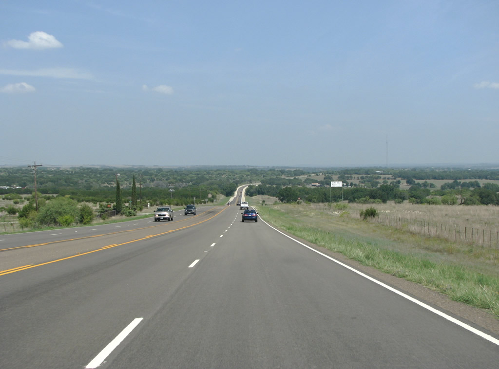
| Through northern Lampasas County, U.S. 281 runs between a cross of vegetation cover that includes stands of Oak, Mesquite and Juniper Trees. The terrain is gently rolling but does not have a lot of elevation. U.S. 281 expands to four lanes from FM 1690 to CR 3700. 09/01/08 |
|
| US 281 enters the western sliver of Coryell County for 2.20 miles. The bulk of land within the county falls within Fort Hood. The county seat, Gatesville, is notable for having many state penitentiaries. 09/01/08 |
Page Updated 07-27-2019.

 North
North


 West
West