Arizona State Route 84 is a short connecting road between Casa Grande and Interstate 8. First designated as a state highway in 1927, SR 84 was subsequently extended and truncated over the years.
The original highway was designated in 1927 between Casa Grande and Tucson, paralleling the Southern Pacific Railroad line. SR 84 was extended west to Gila Bend in 1930, effectively turning it into a shortcut for through traffic between San Diego and Tucson traveling U.S. 80.
In time, SR 84 would become the primary thru route, which led to the demise of most of the road. When the route for Interstate 10 was laid out between Phoenix and Tucson, it followed SR 84 between Casa Grande and Tucson, as the route was shorter than U.S. 80 through Florence. Interstate 8 was designed to overlay the rest of SR 84.
In 1966, Interstate 10 between Eloy and Tucson was completed, truncating SR 84 at Eloy. The original road exists as a frontage road today.
In 1974, SR 84 was decommissioned between Gila Bend and Interstate 8 at Exit 151, the current end point.
In 1997, SR 84 between Downtown Casa Grande and SR 87 was decommissioned. Today, the signed route travels between Interstate 8 and Downtown Casa Grande, and the unsigned route travels between SR 87 and Interstate 10.
|
| Begin Eastbound SR 84 as it approaches its junction with Interstate 8 near Exit 151. 05/23/03 |
|
| After the signage in the previous photobox, eastbound SR 84 has its first shields as it crosses over Interstate 8. SR 84 heads due east, meeting northbound SR 347 approximately six miles east of here. Interstate 8 heads east to Casa Grande and west to Gila Bend and Yuma. 05/23/03 |
|
| This railroad overpass dates back to 1935, with a widening
in 1961 when SR 84 was converted to a divided highway. 08/19/07 |
|
| Distance sign to Yuma. Even though Yuma does not lie
along SR 84, the city remains the control point for
SR 84. 08/19/07 |
|
| This is the first reassurance marker for SR 84
westbound. 08/19/07 |
|
| Distance sign to Stanfield and Yuma. SR 84 travels
through agricultural lands. 08/19/07 |
|
| Reassurance marker for SR 84. The road has a very
similar characteristic to long sections of old U.S. Highway
80 through western Arizona. 08/19/07 |
|
| SR 84 enters the town of Stanfield here. 08/19/07 |
|
| SR 84 passes through the long valley carved by
the Santa Cruz river (the same valley followed by Interstate
10 all the way to Tucson). 08/19/07 |
|
| Distance sign to Interstate 8 and Yuma. Notice there
is no distance marked to SR 347. 08/19/07 |
|
| Advance signage for SR 347, 1/2 mile. 08/19/07 |
|
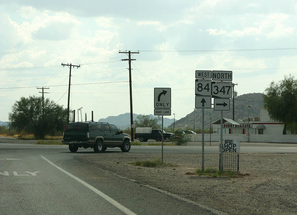
| Use SR 84 to reach Interstate 8, or SR 347
to reach Maricopa. 08/19/07 |
|
| SR 347 departs from SR 84 here. From this point, it is approximately 5 miles to Interstate 8 on SR 84. 08/19/07 |
|
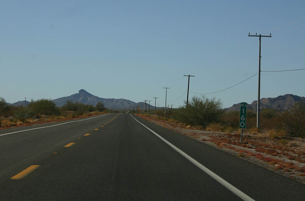
| This is a typical view of SR 84 just west of SR 347, located at mile 160. 12/23/09 |
|
| Advanced signage for Interstate 8, 1/2 mile. 12/23/09 |
|
| Continue ahead on SR 84 westbound to San Diego, or turn left to reach Interstate 8 eastbound to Casa Grande. 12/23/09 |
|
| SR 84 ends at Interstate 8 westbound. The ramp ahead is the original pavement of SR 84, now covered by Interstate 8. 12/23/09 |
Photo Credits:- 05/23/03 by AARoads.
- 08/19/07 by Kevin Trinkle.
- 12/23/09 by Kevin Trinkle.
Connect with:
Interstate 8
State Route 347
Page Updated 10-08-2007.