The Hohokam Expressway has a long history and gestation period. The road was first planned as part of the 1960 Freeway plan as a collector road for traffic from the east side of Phoenix, as well as a proposed eastern exit from Sky Harbor Airport. The present-day interchange with Interstate 10 was completed in 1967.
The final EIS was issued in 1974, for the original route which went from Interstate 10 north along 48th Street, then angled across the Salt River to reach 44th Street where the expressway ended. The original expressway opened in 1978 to University Drive, and was signed as Business Loop 10.
The expressway quickly became a traffic nightmare, despite having only three stoplights. As a stopgap measure, a grade-separated interchange at University Drive was built in 1985.
The expressway was built with a low bridge over the Salt River, so it was subject to closure during floods.
In 1985, the route was surveyed as part of the 1985 freeway plan, and added to the system with a reroute. The route was changed to meet up with Loop 202 at 48th Street, to provide regional access between Loop 202 and Interstate 10, and a sister route, Arizona 153, was added to provide airport access from 44th Street, due to limited expansion capacity on the Arizona 143 corridor.
Construction timeline:
- 1978: Interstate 10 to University Drive (expressway)
- 1980: University Drive to 44th Street (expressway)
- 1985: University Drive Interchange
- February 1991: University Drive to the Sky Harbor Blvd
- November 1991: Sky Harbor Blvd to Washington Street
- February 1992: Washington Street to McDowell Road
The ramp from Arizona 143 Northbound to Sky Harbor Blvd was considered temporary and was designed to be removed upon completion of Arizona 153. However, with the decommissioning of Arizona 153 in August 2007, the interchange between Arizona 143 and Spur 202 (Sky Harbor Blvd) is planned to become fully directional.
Arizona 143 is planned to be widened to three to four lanes each direction as part of the Interstate 10 corridor projects currently under discussion.
|
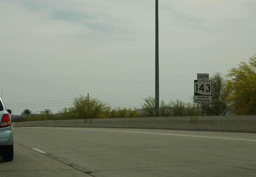
| SR 143 (Hohokam Expressway) south at Loop 202 (Red Mountain Freeway). SR
143 is a very narrow freeway through here, with substandard shoulders on both sides. It is principally a connector from Interstate 10, Loop 202, and McDowell Road to Sky Harbor International Airport. 04/08/07 |
|
| SR 143 passes under the Red Mountain Freeway (Loop
202) at the directional East Papago Traffic Interchange. 04/08/07 |
|
| SR 143 is known as the Hohokam Expressway, a name
it has held since it opened. The expressway passes just
east of Pueblo Grande museum, preserving a Hohokam pueblo. 04/08/07 |
|
| The Hohokam Expressway is an elevated facility for the
northern section, north of the Salt River. To the right
of the picture, SR 153 can be seen. 04/08/07 |
|
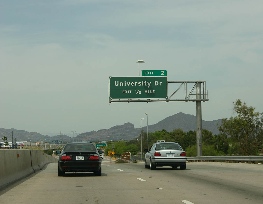
| Advance signage for exit 2, University Drive. 04/08/07 |
|
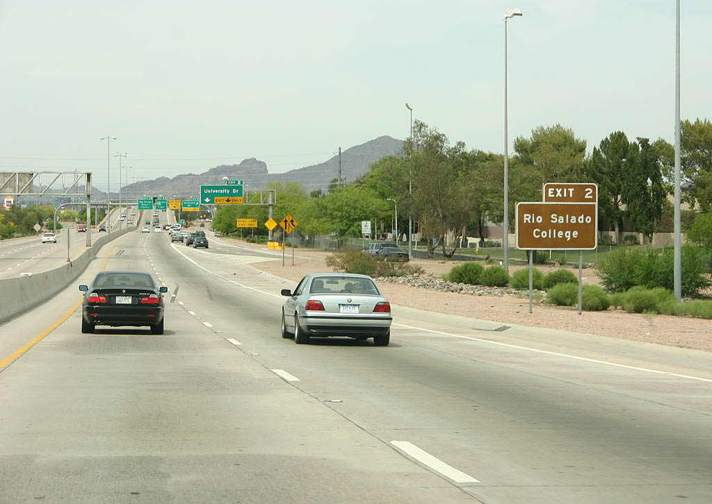
| Use University Drive to reach Rio Salado College, a
community college, as well as SR 153 and Sky Harbor
Airport. 04/08/07 |
|
| University Drive departs from SR 143 here, at exit
2. This exit was first built in 1985 as part of upgrades
on the Hohokam Expressway, with the exit ramps rebuilt
in 1992. 04/08/07 |
|
| SR 143 ends just south of Interstate 10. 04/08/07 |
|
| Exit 1B departs for Interstate 10 west here. Use Interstate
10 west to reach Interstate 17 and downtown Phoenix. 04/08/07 |
|
| After crossing Interstate 10 (on the original 48th Street
bridge built in 1967), exit 1A departs as a loop ramp
to Interstate 10 East. Use Interstate 10 east to reach
US 60 and Ahwatukee. After this ramp, SR 143 ends
and becomes 48th Street. 04/08/07 |
|
| Just south of Broadway Road, we find this sign advising
traffic to turn left for Interstate 10 west (on Broadway
Road), and right for Interstate 10 east. This sign is
actually located on 48th Street - SR 143 begins just
north of Broadway Road. 04/08/07 |
|
| Advance signage for exit 2, University Drive. This sign dates back to when the University Drive ramp was added in 1985, with the exit tab added afterwards. 04/08/07 |
|
| Use exit 2 to reach Rio Salado College. The two lanes that come in the background of the picture carry traffic from Interstate 10 eastbound. 04/08/07 |
|
| University Drive exits here, at exit 2. The next two
exits are Loop 202 East and Sky Harbor Blvd. 04/08/07 |
|
| Advance signage for the next three exits - Loop 202
East, Sky Harbor Airport and Washington Street. 04/08/07 |
|
| Exit 3A (signed as exit 3) departs here for Loop 202
Eastbound. This ramp connects with unsigned Loop 202 Spur. 04/08/07 |
|
| Now crossing over Loop 202 Spur, the next exit is the
loop ramp to Sky Harbor Airport, exit 3B. This ramp was
intended to be temporary until SR 153 was completed,
but with the cancellation of SR 153, this ramp is
now permanent. 04/08/07 |
|
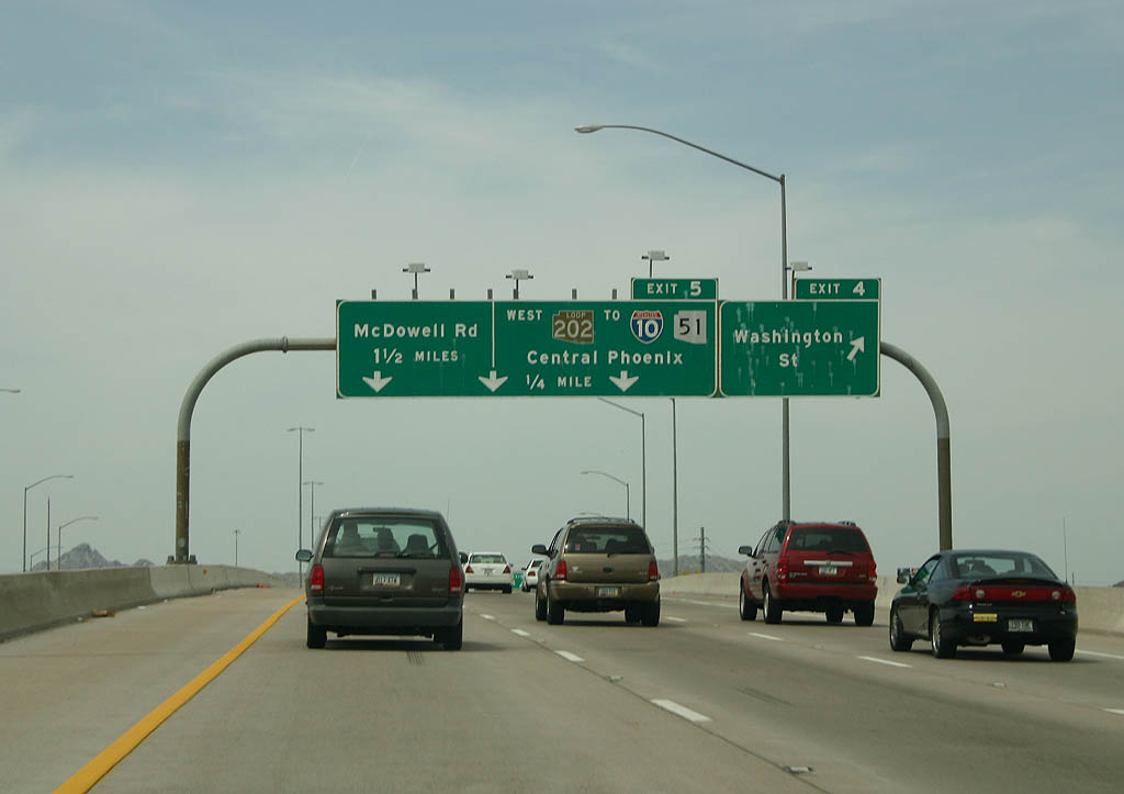
| Distance sign to Washington Street, Loop 202 Westbound
and McDowell Road. 04/08/07 |
|
| Exit 4 departs here to Washington Street. Use Washington
Street to reach Gateway Community College and Pueblo Grande
Museum. 04/08/07 |
|
| The Hohokam Expressway is a short expressway, and it
ends just north of the Loop 202 directional interchange. 04/08/07 |
|
| The last exit on the Hohokam Expressway is exit 5, and
the ramp from Exit 5 passes over the expressway here.
Exit 5 serves Loop 202 westbound as part of the directional
East Papago Interchange. 04/08/07 |
|
| SR 143 passes under Loop 202. Loop 202 passes above
SR 143, and the ramp from Loop 202 eastbound to McDowell
Road passes above Loop 202. 04/08/07 |
|
| SR 143 ends here, at McDowell Road. Plans were
to extend the expressway one mile north to Thomas Road,
but these plans were never completed. 04/08/07 |
Photo Credits:04/08/07 by Kevin Trinkle
Connect with:
Interstate 10
Sky Harbor Expressway - Decommissioned
Loop 202
Page Updated 04-12-2007.