|
| Interstate 15 runs between the split roadways of U.S. 89 adjacent to the Chevron Salt Lake City Refinery. 07/08/16 |
|
| U.S. 89 runs alongside I-15 south along the ensuing stretch to the Salt Lake City and County line. 07/08/16 |
|
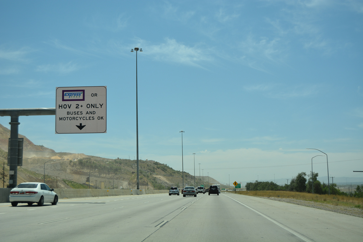
| An ingress point for the I-15 Express Lane precedes the entrance ramp from adjacent U.S. 89 south. 07/08/16 |
|
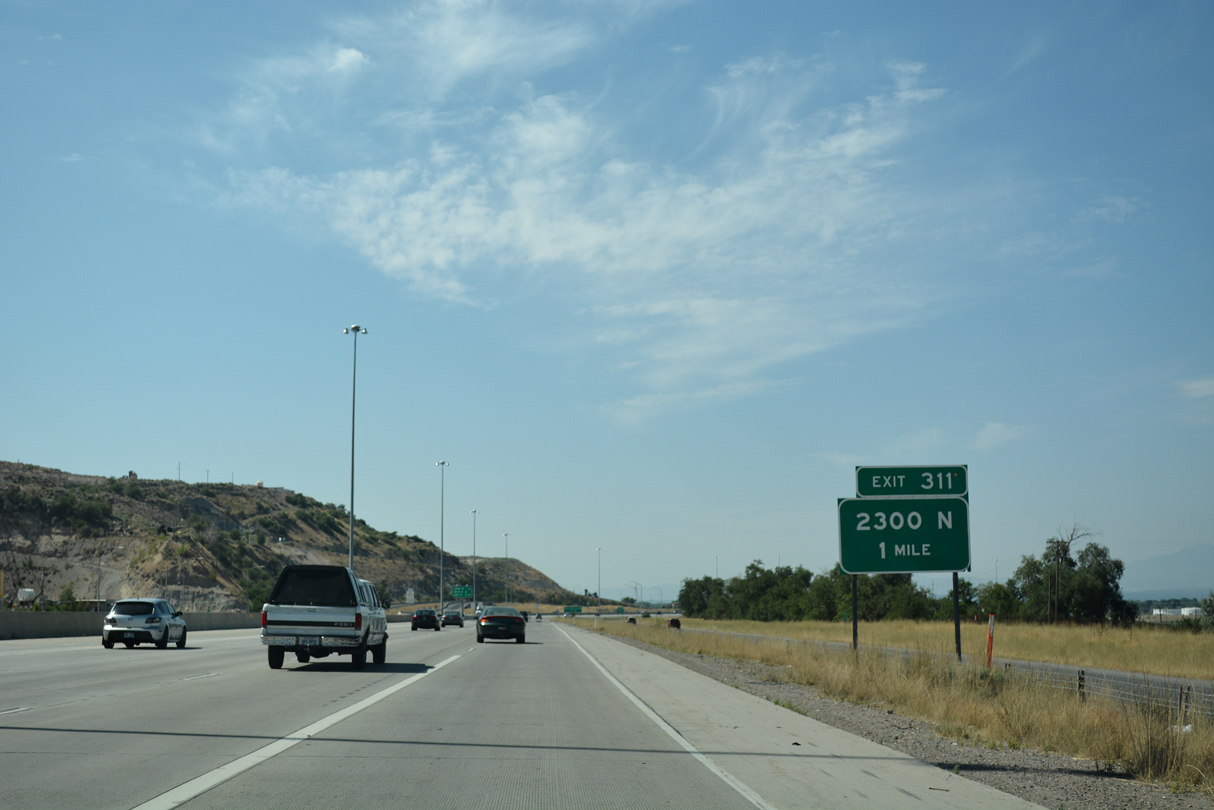
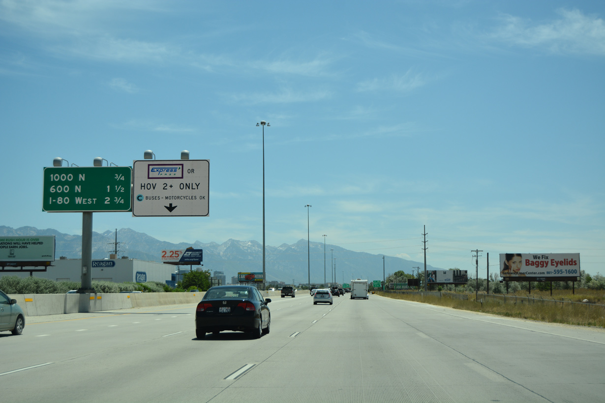
| A folded diamond interchange (Exit 311) joins Interstate 15 with 2300 North and 1100 West in one mile. 07/16/17 |
|
| The subsequent exits beyond 2300 North on I-15 south serve the Rose Park neighborhood in Salt Lake City. 07/08/16 |
|
| Interstate 15 shifts westward over the parallel Union Pacific Railroad beyond the Salt Lake County and Salt Lake City line. The freeway parallels Warm Springs Road south from Exit 311 to the Union Pacific Railyard. 07/08/16 |
|
| Interstate 15 passes by western slope of Meridian Peak (el. 5,948 feet). 07/08/16 |
|
| 2300 North heads east from SR 68 (Redwood Road) to Interstate 15, where it turns south as Warm Springs Road to North Rose Park. 07/08/16 |
|
| The Oquirrh Mountains appear on the western horizon. Smoke visible in this scene was from a five alarm fire that broke out at a West Valley business on the outskirts of SLC Airport, where wood pallets were scrapped. A near 100 degree day coupled with low humidity and strong winds fanned the flames. 07/08/16 |
|
| A dynamic toll schedule sign for the I-15 Express Lanes precedes the ingress point for 2300 North. 07/16/17 |
|
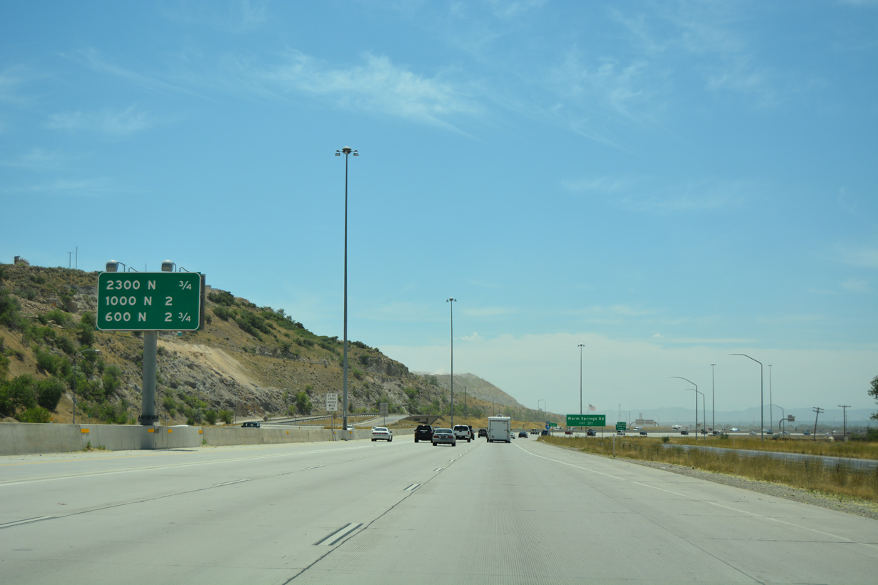
| Exit 311 departs Interstate 15 south for the industrial north side of Salt Lake City. 07/08/16 |
|
| Interstate 15 bends easterly one mile ahead of Exit 310 to 1000 North. 07/08/16 |
|
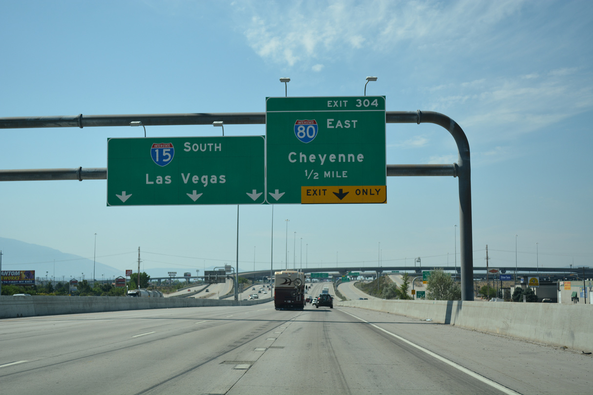
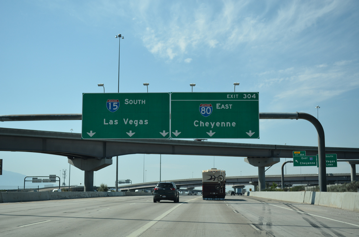
| Continuing south toward Downtown Salt Lake City, I-15 converges with Interstate 80 east in 2.75 miles. 07/08/16 |
|
| 900 West hooks west from Warm Springs Road to pass over Interstate 15 at a half diamond interchange (Exit 310). 07/16/17 |
|
| The Utah State Capitol comes into view to the southeast beyond nearby rail lines and an oil refinery. Founded in 1847 after nearby Great Salt Lake, Salt Lake City (SLC) incorporated as a city on 1851 and was designated the state capital in 1896 when Utah was accepted into statehood. 07/13/08 |
|
| Interstate 15 passes by Rosewood Park after this confirming marker posted near milepost 311. 07/16/17 |
|
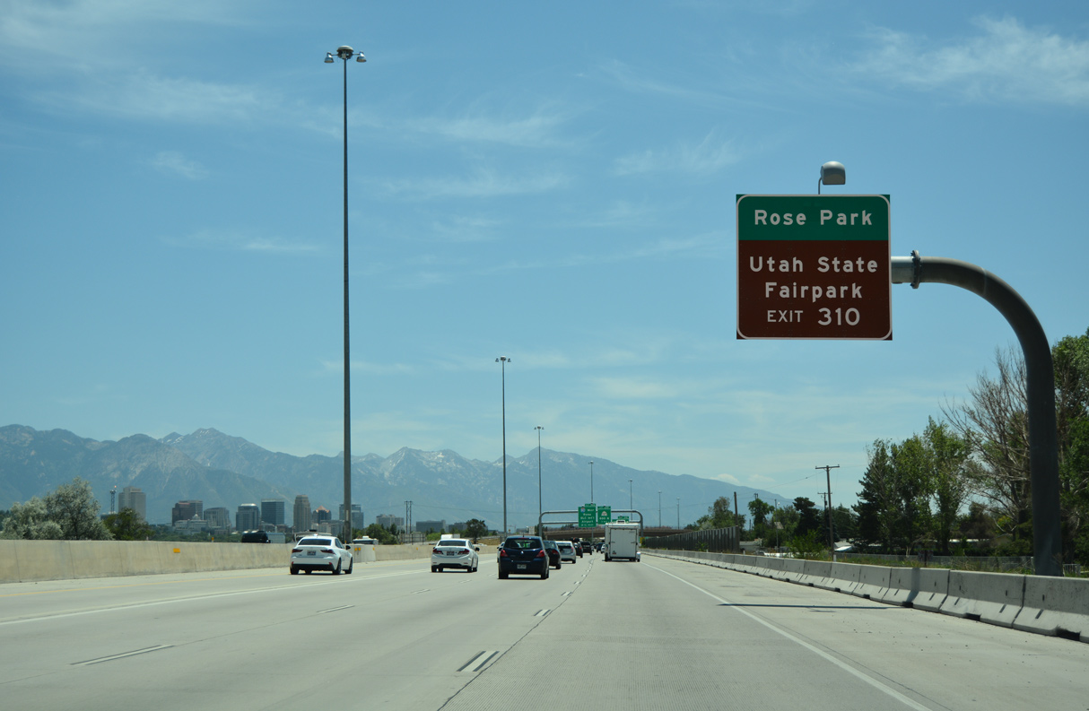
| Residential areas of Rose Park spread to the northwest of Interstate 15 and 600 North. Areas south of 600 North are a part of the Fairpark neighborhood, which is named after Utah State Fairpark (fairgrounds). 07/08/16 |
|
| The state capitol building remains in view from its perch on Capitol Hill. SLC sits at an elevation of 4,330 feet above sea level, but it is most famous for nearby ski resorts in the Wasatch Range, including Alta, Snowbird, Solitude, Brighton, Park City, Deer Valley and The Canyons. 07/13/08 |
|
| Exit 310 leaves I-15 south for 900 West to 1000 North. The freeway advances south one mile to SR 268 at Fairpark and 2.25 miles to I-80 at Exit 308. 07/08/16 |
|
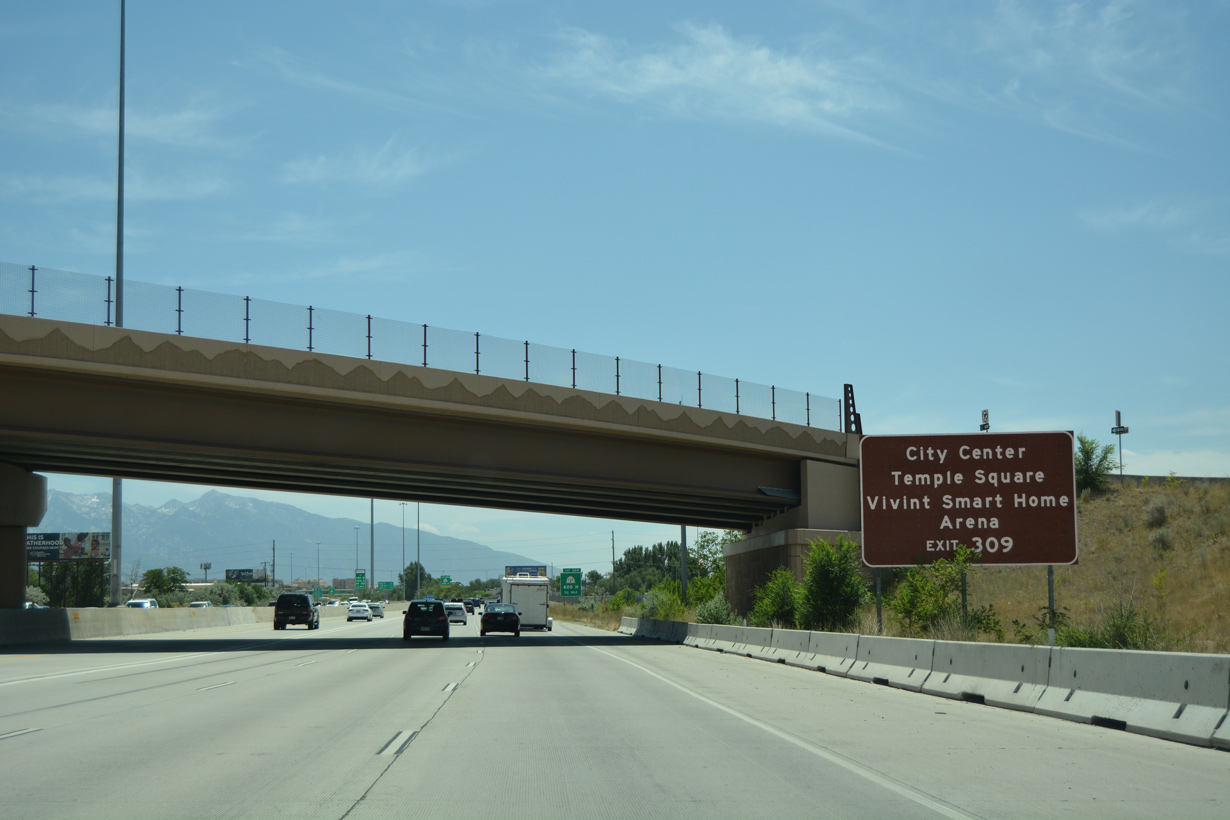
| Interests to the Salt Lake City Center, Temple Square (which includes the Church of Jesus Christ of Latter-day Saints temple, tabernacle choir building, and gardens) and Vinvint Arena (home of the NBA Utah Jazz) are directed onto SR 268 (600 North) east to U.S. 89 (300 West) south. 07/08/16 |
|
| Exit 309 departs I-15 in a half mile for SR 268, a 0.750 mile route along 600 North between 800 West and U.S. 89 (300 West). 600 North represented the northern extent of the original HOV lanes for I-15. 07/08/16 |
|
| High rises from Downtown Salt Lake City appear as Interstate 15 advances 1.75 miles south to 400 South. U.S. 89 parallels to the east, midway between I-15 and the state capitol, en route to the Salt Palace Convention Center. 07/08/16 |
|
| The single point urban interchange (Exit 309) with SR 268 (600 North) is north of the Jackson and Guadalupe neighborhoods. Continuing southward, Interstate 15 reaches Exit 308 for I-80 west to Reno in 1.25 miles. 07/08/16 |
|
| Built during the 1997-2001 reconstruction of Interstate 15 for the 2002 Winter Olympic Games, the SPUI at 600 North replaced a directional cloverleaf. The $1.59 billion project also rebuilt the exchange (Exit 308) with Interstate 80 west. 07/08/16 |
|
| Back to back ramps depart within one mile for Interstate 80 west to Salt Lake International Airport (SLC) and 400 South to the Rio Grande and Riverside neighborhoods. 07/08/16 |
|
| I-80 proceeds west from Exit 308 along the route of Old U.S. 40 toward the Great Salt Desert, a vast plain of white salty flats that extend all the way to the Nevada state line. The drive culminates at West Wendover, which is home to several casinos that serve as a regional draw. 07/08/16 |
|
| A sound wall separates Interstate 15 south from the Euclid neighborhood ahead of the North Temple (old SR 186 / U.S. 40) underpass. 07/16/17 |
|
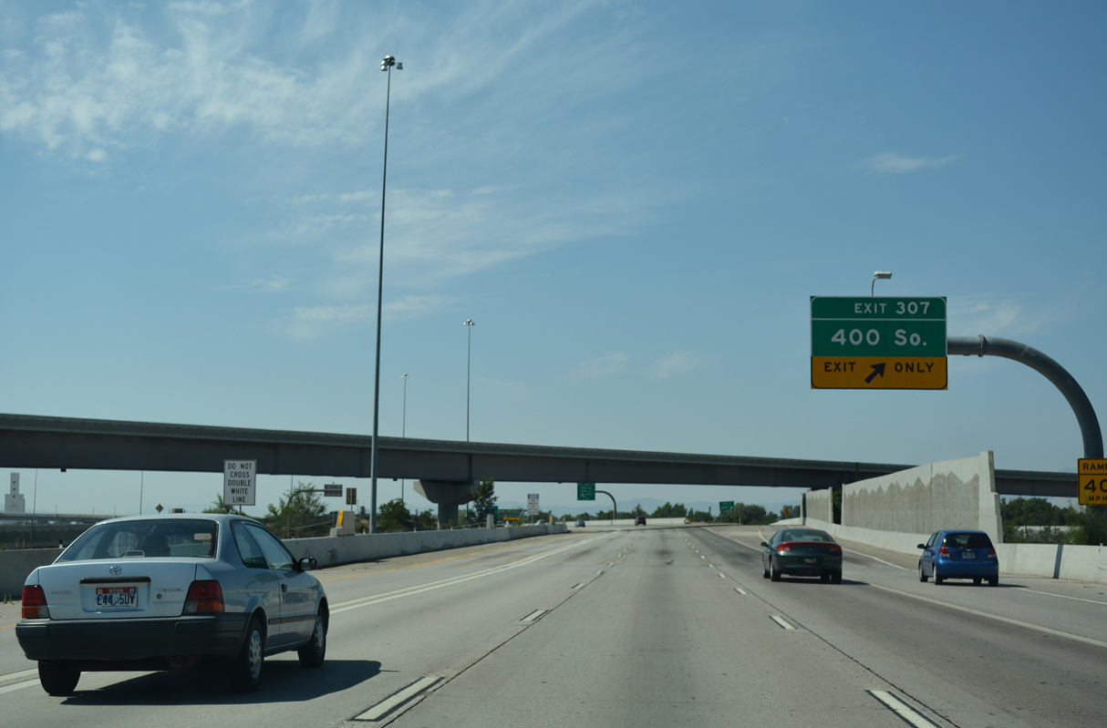
| A modified diamond interchange (Exit 307) connects Interstate 15 and 400 South amid the ramps with Interstate 80. 400 South becomes a part of U.S. 89 east from 300 West to State Street. 07/08/16 |
|
| Four lanes advance southward along Interstate 15 to combine with I-80 east as Exit 308 parts ways for I-80 west. I-80 joins the Salt Lake City area with Elko, Winnemucca and Reno-Sparks in Nevada. The transcontinental route ends in San Francisco, California. 07/08/16 |
|
| Exit 307 lowers from I-15 south to 400 South. 400 South constitutes a six lane boulevard through Downtown and Central City to an S-curve to 500 South at Bennion Gardens. SR 186 lines the street east from U.S. 89 as the former alignment of U.S. 40 Alternate. 07/16/17 |
|
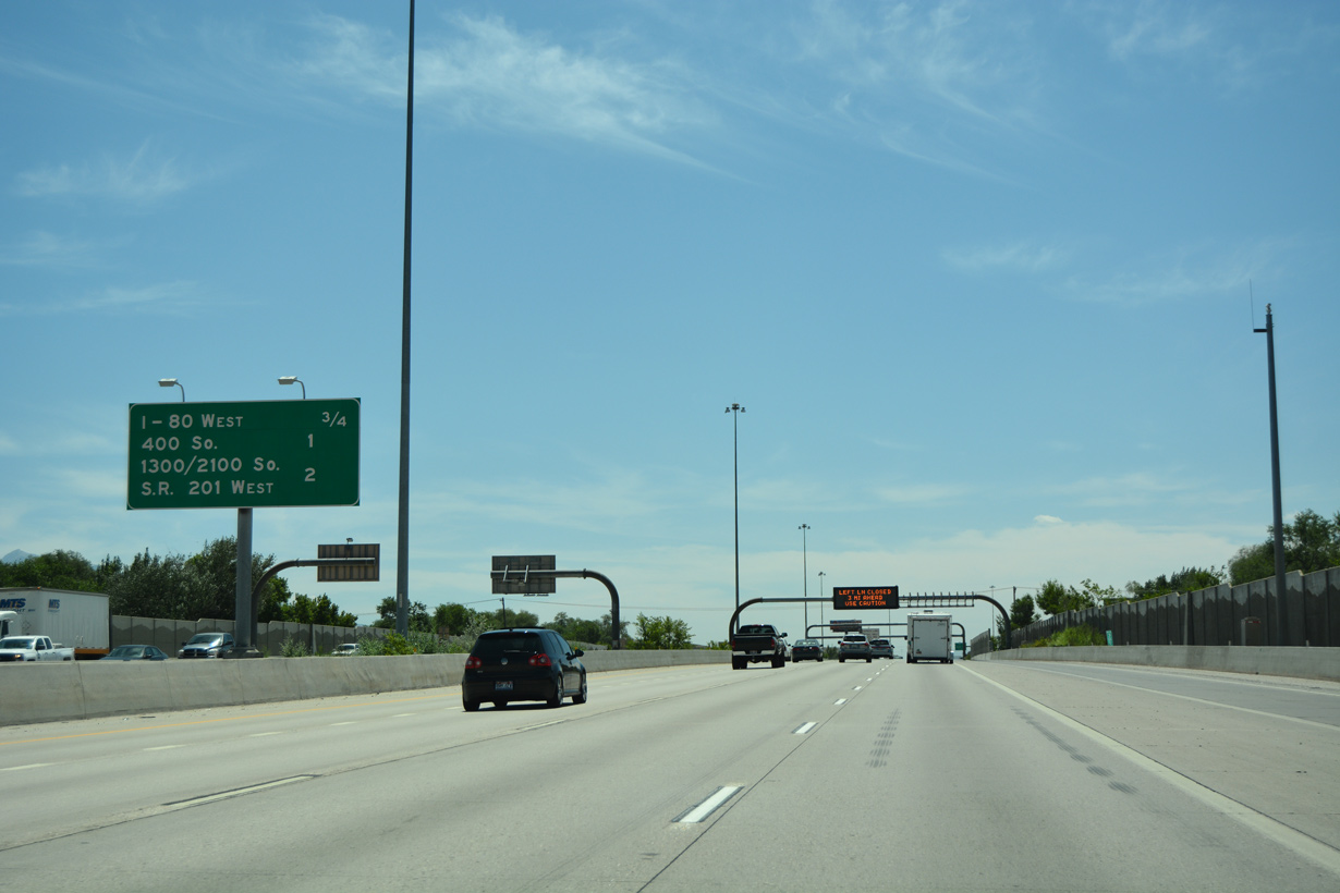
| The I-15 mainline progresses south one mile to split with a lengthy collector distributor roadway for 1300 South, 2100 South and the 21st South Freeway (SR 201). There is no direct access to SR 269 (600 South) east in this direction. 07/16/17 |
|
| Passing through the semi directional T interchange (Exit 306 from I-15 north) with SR 269, an interchange sequence sign references the c/d roadway for Exits 305C-A and the split with I-80 east. 07/13/08 |
|
| Interstate 80 east merges with two lanes from the right opposite a left side entrance ramp from 400 South. The flyovers above with SR 269 were built as part of the I-15 reconstruction for the 2002 Winter Olympics. 07/13/08 |
|
| I-15/80 shift southeast between the Riverside and Gateway neighborhoods to the c/d roadway for Exits 305 C/B/A. 07/16/17 |
|
| Exit 305C is a diamond interchange joining I-15/80 with 1300 South west to the Cannon neighborhood and California Avenue to the Glendale neighborhood. 07/16/17 |
|
| Two lanes separate for Exits 305 C/B/A, 1.75 miles from the south split of I-15/80 at Exit 304. 07/16/17 |
|
| I-15 south and I-80 east overlap for 2.30 miles. 07/16/17 |
|
| Exit 305C separates from the c/d roadway for 1300 South east to the West Temple (Ball Park) and Liberty Park neighborhoods. 08/10/16 |
|
| Toll schedule sign for the I-15 Express Lanes south to 7200 South posted ahead of the ingress point above 1300 South. 07/02/16 |
|
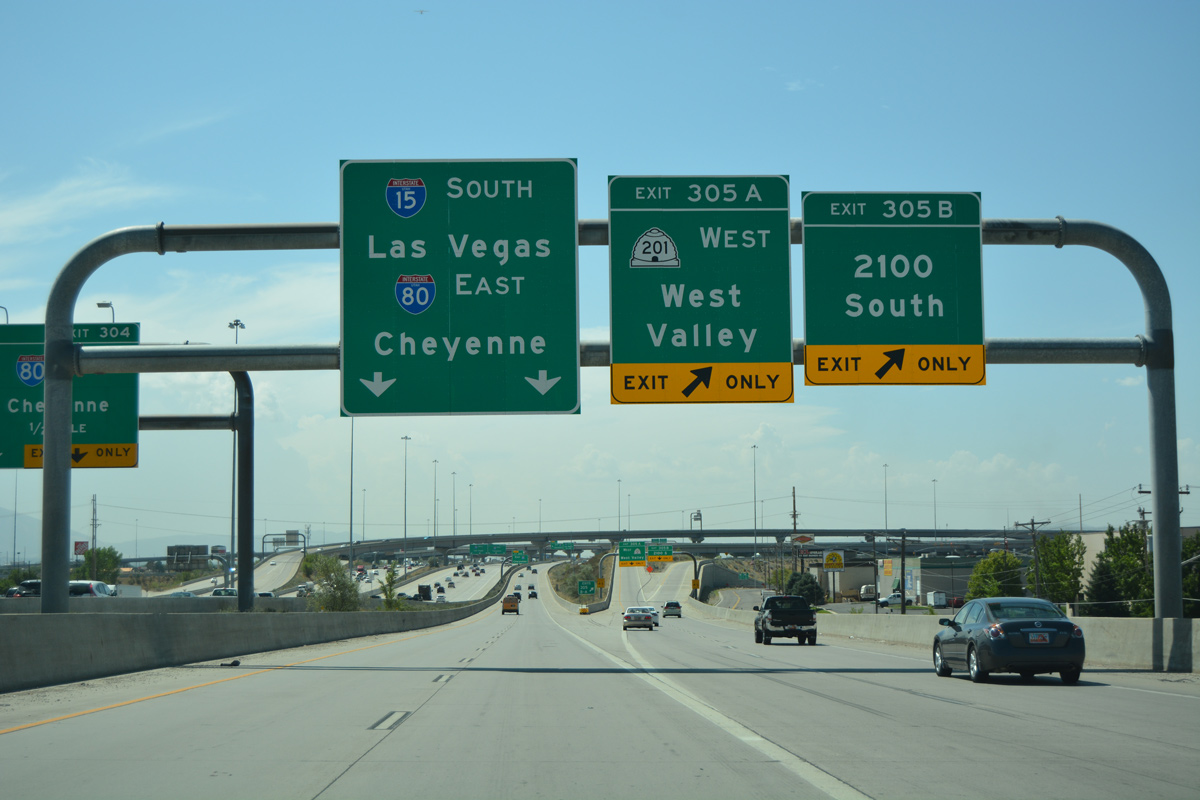
| Exit 305B is a folded diamond interchange with SR 201 along 2100 South. SR 201 heads east along the Salt Lake City / South Salt Lake city line to U.S. 89 (State Street). 08/10/16 |
|
| The subsequent two exits from I-15 south beyond the east split of I-80 fall within the city of South Salt Lake over the next 3.25 miles. 07/16/17 |
|
| SR 201 shifts from 2100 South onto the 2100 South Freeway via 900 West at the Cannon neighborhood. 08/10/16 |
|
| Exit 305A is a high speed flyover linking I-15/80 south with SR 201 along the 2100 South Freeway. The 18.26 mile long route of SR 201 extends west along a freeway or expressway to I-80 at Lake Point Junction. 08/10/16 |
|
| Interstate 80 east separates from I-15 south with two lanes at Exit 304 in northern reaches of the South Salt Lake city limits. 07/16/17 |
|
| SR 201 west to Magna follows part of the old alignment for U.S. 50 Alternate. Decommissioned in 1976, U.S. 50 Alternate formed a loop north from near Spanish Fork to Salt Lake City and west to Wendover and Ely, Nevada. 08/10/16 |
|
| A single lane slip ramp connects the c/d roadway for Exit 305 with Interstate 80 east after the mainline separation at Exit 304. 08/10/16 |
|
| Interstate 80 reenters Salt Lake City across the Sugar House neighborhood ahead of Parleys Canyon across the Wasatch Range. Beyond Park City and Coalville, I-80 travels northeast to Evanston, Wyoming en route to the capital city of Cheyenne. 07/16/17 |
|
| The directional T interchanges with the 21st Street South Freeway west and the continuation of I-80 east overlap one another. 08/10/16 |
|
| Ramps linking I-15 and I-80 with the 21st South Freeway opened in stages between 1999 and 2001 as part of the $1.59 billion upgrade of I-15 through Salt Lake city. 07/02/16 |
|
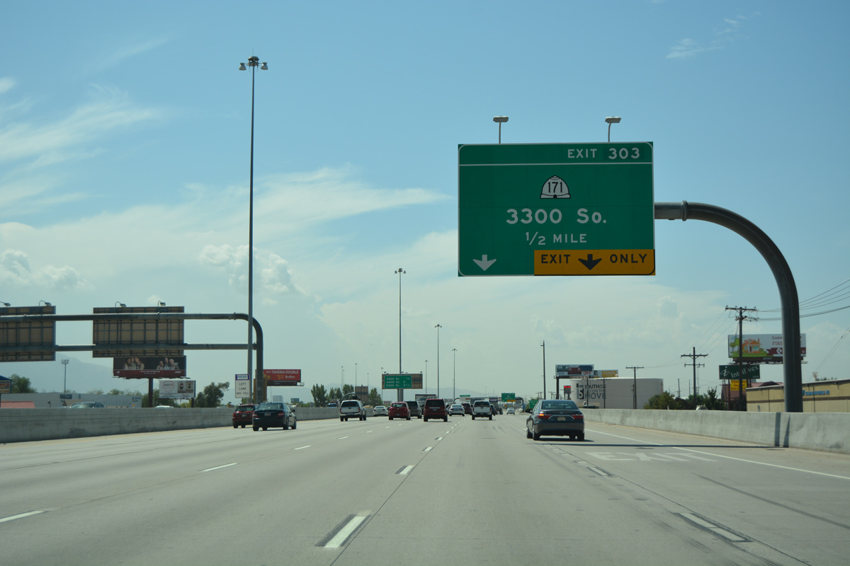
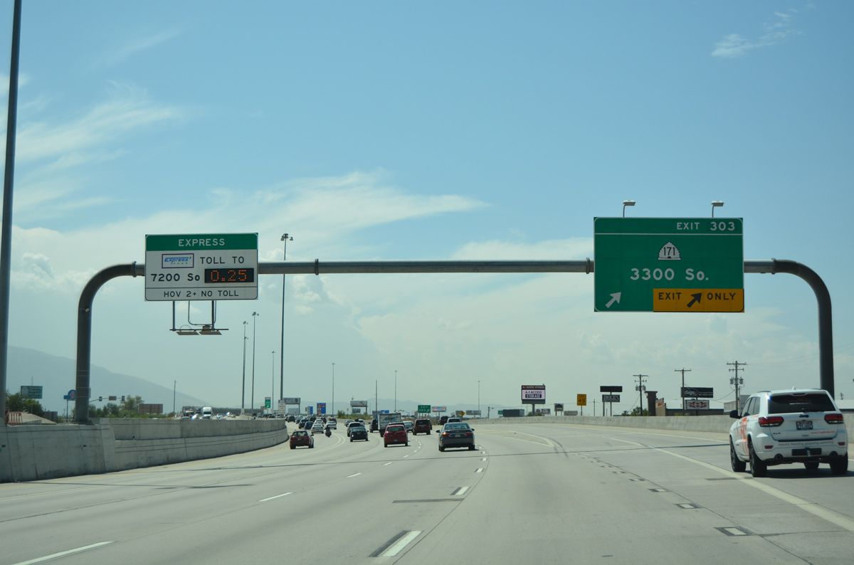
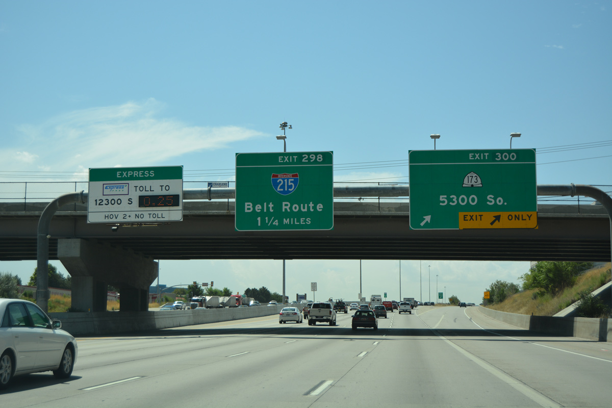
| The return of the c/d roadway from Exit 305 expands I-15 southbound to six overall lanes. The ensuing exit is with SR 171 (3300 South). 08/10/16 |
|
| Interstate 15 leaves South Salt Lake for the city of Murray ahead of Exit 301 for 4500 South and Exit 300 for 5300 South. 08/10/16 |
|
| SR 171 (3300 South) is a four to six lane arterial joining the cities of Millcreek, South Salt Lake and West Valley City. 07/16/17 |
|
| A SPUI connects I-15 and SR 171 (3300 South) at Exit 303. A 15.65 mile long urban route, SR 171 originates at SR 111 (8400 West) in Magna to the west and ends at Interstate 215 in Canyon Rim to the east. 08/10/16 |
|
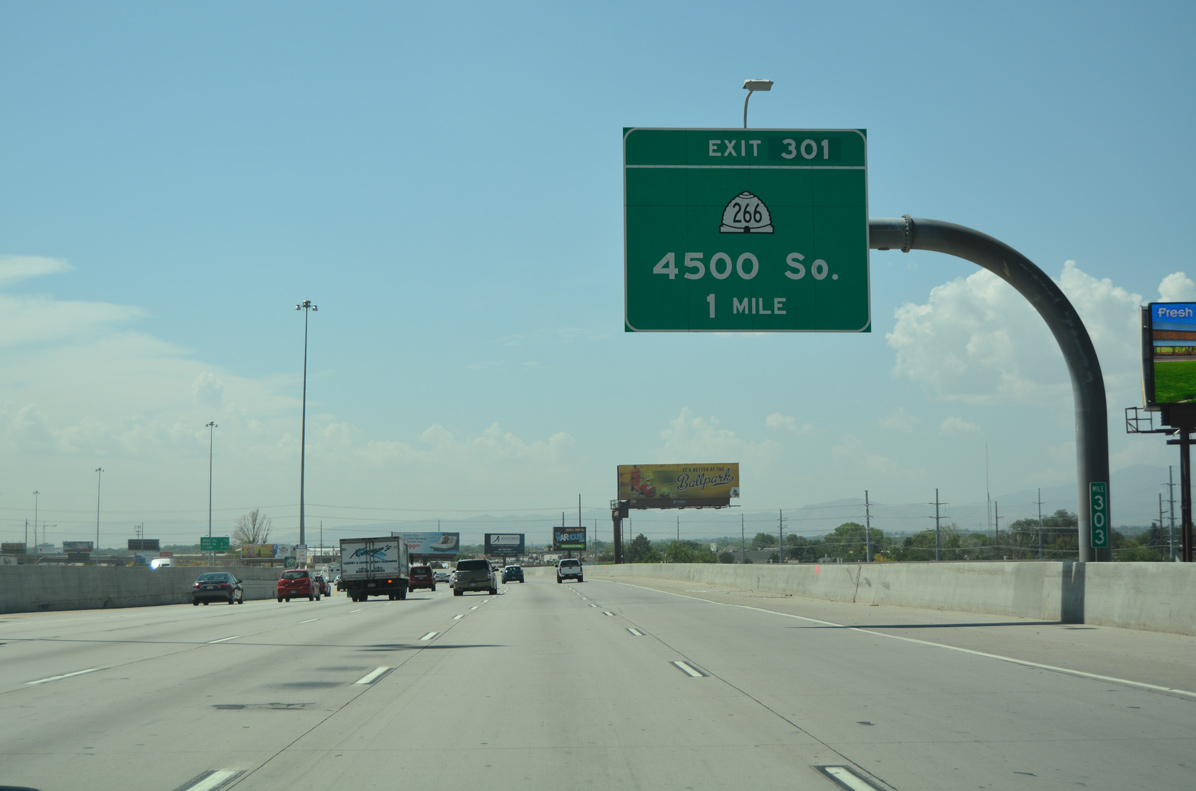
| I-15 shifts southwest across a Union Pacific Railroad line one mile ahead of Exit 301 to SR 266 (4500 South). Originating at the western leg of I-215 in Taylorsville and extending east to the southeast loop of I-215 at Holladay, SR 266 travels 8.13 miles overall. 08/10/16 |
|
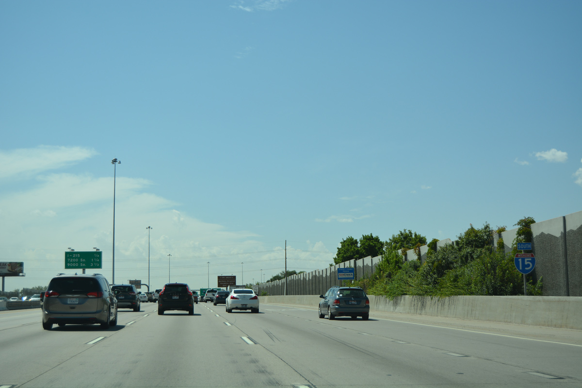
| Interstate 15 remains within the city of Murray south to the directional cloverleaf interchange (Exit 298) with I-215 in 3.5 miles. 08/10/16 |
|
| 12 lanes wide, Interstate 15 passes through western reaches of Millcreek through an industrial area south to Big Cottonwood Creek and the Murray city line. 08/10/16 |
|
| SR 266 (4500 South). joins I-15 with the city of Taylorsville west of the Jordan River. The suburban city incorporated on April 24, 1996 in an effort to better manage development in place of the Salt Lake County Commission.1 08/10/16 |
|
| Similar to Exits 303 and 300, reconstruction of I-15 for the 2002 Winter Olympic Games rebuilt Exit 301 from a diamond interchange into a SPUI. 08/10/16 |
|
| I-15 southbound spans SR 266 with five lanes, one mile north of Exit 300 for SR 173 (5300 South). SR 173 constitutes an urban route stretching 9.94 miles from SR 111 (8400 West) west of Kearns to U.S. 89 (State Street) in Murray. 08/10/16 |
|
| An I-15 Express Lane ingress point lies across from the SR 266 entrance ramp. 07/02/16 |
|
| One half mile north of the SPUI (Exit 300) with SR 173 (5300 South) on I-15 south. 08/10/16 |
|
| The freeway crosses over 4800 South (old SR 173) and Little Cottonwood Creek after this confirming marker amid an area of industrial businesses. 08/10/16 |
|
| Interstate 15 lowers to pass under 5100 South between an area of office parks. The first exit in the city of Midvale is located 2.5 miles to the south at SR 48. 08/10/16 |
|
| Exit 300 departs Interstate 15 south for SR 173 (5300 South) west to Taylorsville and Kearns township and east to Murray City Park. Interstate 215 (Belt Route) encircles the south side of Murray, converging with I-15 in 1.25 miles at Exit 298. 08/10/16 |
|
| The I-15 Express Lanes egress and ingress points are located within the exchange for SR 173 (5300 South). 07/02/16 |
|
| Originally striped for three lanes, Exit 298 serves commuter traffic along the I-215 Belt Route headed east for the cities of Cottonwood Heights and Holladay and west into the city of Taylorsville. 08/10/16 |
|
| Sound walls separate residential areas of Murray along the west side of Interstate 15. Industrial businesses line the east side of the freeway adjacent to a UP Railroad line. 08/10/16 |
|
| Numbered streets continue increasing south from Temple Square in Downtown Salt Lake City to the Utah County line after Exit 288. 08/10/16 |
|
| I-215 east to Exit 7 leads visitors to area ski resorts: Snowbird / Alta via SR 190 east to SR 210 (Little Cottonwood Canyon Road) east and Solitude / Brighton via SR 190 (Big Cottonwood Canyon Road) east. 08/10/16 |
|
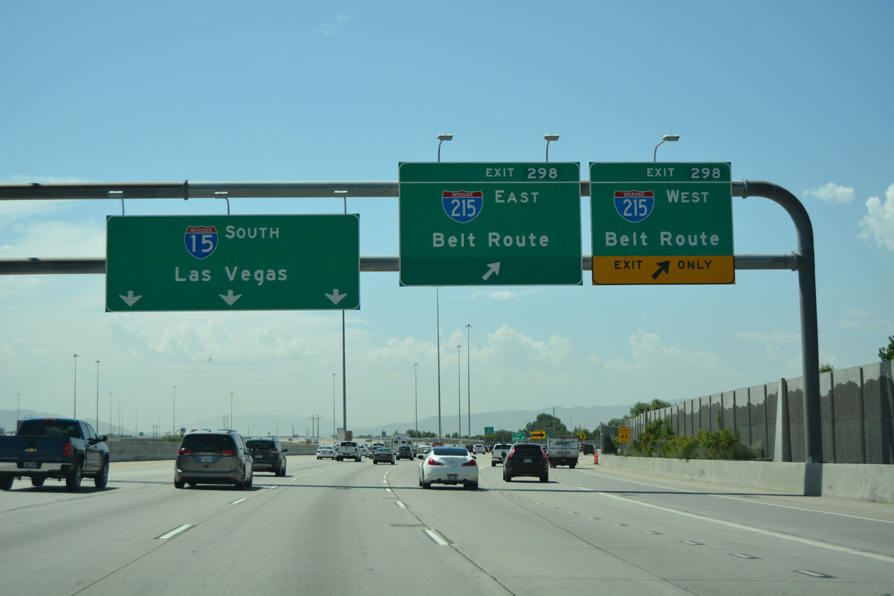
| Signs for Interstate 215 reference Belt Route in lieu of control cities. The southeast leg of the beltway encircles Holladay north to Millcreek and I-80 at the entrance into Parleys Canyon. The west loop of I-215 parallels I-15 north through West Valley City to I-80 next to SLC Airport. 08/10/16 |
|
| Exit 298 partitions for I-215 north to I-80 west for Reno, Nevada and I-215 east to I-80 for Evanston, Wyoming. A left side entrance ramp connects with I-215 east ahead of U.S. 89 (State Street) in south Murray. 07/02/16 |
Page Updated 02-09-2022.

 South
South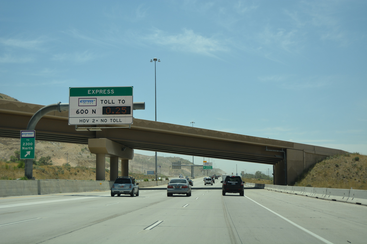


 East
East