|
| Spanning Avenida Cesar Chávez at Exit 223, I-25 (Pan American Freeway) advances two miles north to the "Big I" interchange with Interstate 40. 06/29/08 |
|
| The entrance ramp from Avenida Cesar Chávez forms an auxiliary lane northbound to Exit 224A for Oak Street north to the couplet of Coal Avenue east / Lead Avenue west and Central Avenue (post-1937 Historic U.S. 66). 06/29/08 |
|
| Tourist interests to Historic Old Town Albuquerque and ABQ BioPark Zoo are advised to bypass Downtown and Central Avenue along Interstate 40 west (Exit 226A) to Rio Grande Avenue. 06/29/08 |
|
| Exit 224A departs Interstate 25 north to the Huning Highland Historic District, Sycamore and Silver Hill neighborhoods. Central Avenue (former Business Loop I-40) connects the central business district with the University of New Mexico (UNM). 06/29/08 |
|
| Interstate 25 passes over Historic U.S. 66 (Central Avenue) ahead of Exit 224B to Dr. Martin Luther King Jr. Avenue. MLK Avenue leads east to UNM and west to the Albuquerque Convention Center. 06/29/08 |
|
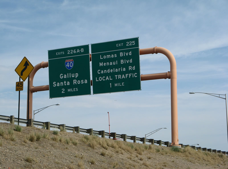
| Exit 225 quickly follows onto Oak Street north ahead of Lomas Boulevard. Lomas Boulevard constitutes a principal arterial east through UNM to Nob Hill and Summit Park and west through northern reaches of Downtown Albuquerque. 06/29/08 |
|
| The I-25 frontage road system extends northward through the systems interchange (Exit 226) with Interstate 40 to Menaul Boulevard and Candelaria Road. 04/28/17 |
|
| I-25 (Pan American Freeway) advances 0.75 miles from the flyover for Lomas Boulevard to the "Big I" interchange with Interstate 40 (Coronado Freeway). 06/29/08 |
|
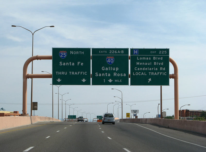
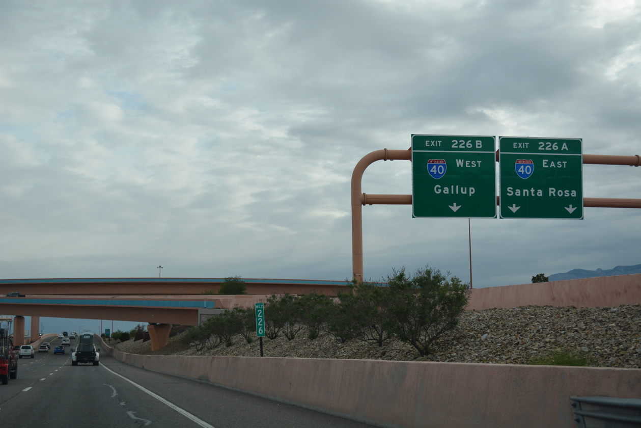
| Northbound Interstate 25 expands to five lanes leading into the "Big I" with I-40 east to Santa Rosa and Amarillo, Texas and I-40 west to Gallop and Flagstaff, Arizona. 04/28/17 |
|
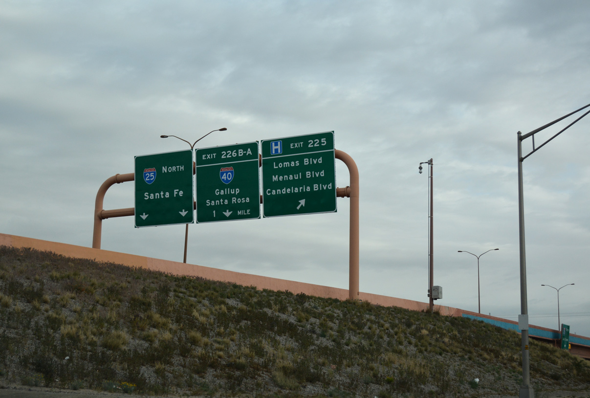
| Two lanes depart from I-25 north for Exits 226B/A and Interstate 40 (Coronado Freeway). I-40 travels across the city of Albuquerque between Nine Mile Hill and Tijeras Canyon. 04/28/17 |
|
| The "Big I" interchange project rebuilt the directional exchange with left side ramps joining I-25/40 into a four-level junction. Work ran from June 2000 to May 2002. 04/28/17 |
|
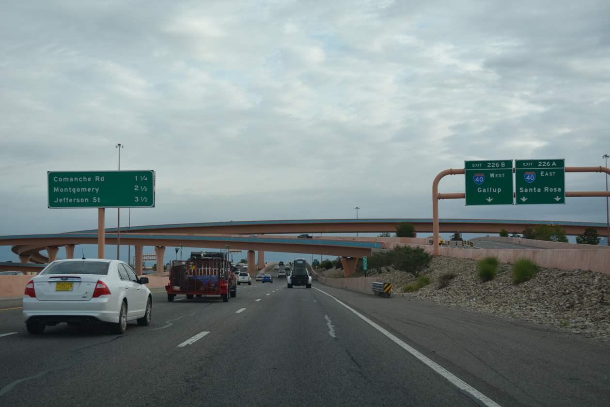
| The I-25 mainline reduces to six overall lanes (three in each direction) across Interstate 40 and its associated frontage roads. Exit 227 follows to Comanche Road in 1.25 miles. 04/28/17 |
|
| Exit 226 partitions for I-40 west to Grant and Gallop (U.S. 491) and I-40 east to Santa Rosa (U.S. 84) and Tucumcari (U.S. 54). 04/28/17 |
|
| Flyovers painted sand and purple carry travelers from Interstate 25 to I-40. 04/28/17 |
|
| Northbound reassurance sign posted for Interstate 25 along the viaduct across I-40 and the adjacent frontage roads. 04/28/17 |
|
| Forthcoming Comanche Road is a minor arterial joining the Hodgin and McKinley neighborhoods to the east with the North Edith Commercial Corridor to the west. 04/28/17 |
|
| The ramps from I-40 add two additional lanes for northbound Interstate 25 to Exit 227. 06/29/08 |
|
| Angling northeastward from Comanche Road (Exit 227), Interstate 25 travels by an array of business and industrial parks through the three succeeding interchanges. 04/28/17 |
|
| Slip ramps to the adjacent Pan American Freeway frontage roads link I-25 with Comanche Road at Exit 227. Greigos Road extends Comanche Road west of Edith Boulevard through the Greater Gardner community to Rio Grande Avenue. 04/28/17 |
|
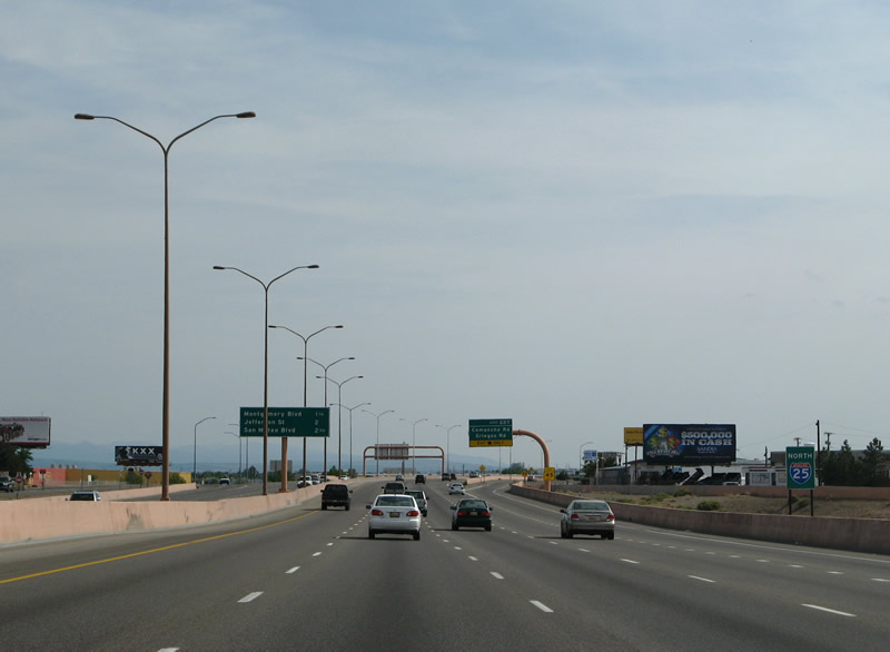
| Montgomery Boulevard crosses paths with Interstate 25 at Exit 228 in one mile. Jefferson Street stems north from the arterial to meet the freeway at the subsequent exit. 04/28/17 |
|
| A major arterial across the city of Albuquerque, Montaño Road leads west from I-25 across the Rio Grande to Taylors Ranch. Montgomery Boulevard extends the six lane boulevard east to Del Norte and NM 556 (Tramway Boulevard) at Glenwood Hills. 04/28/17 |
|
| Entering the parclo interchange (Exit 228) with Montaño Road west and Montgomery Boulevard east on I-25 northbound. 04/28/17 |
|
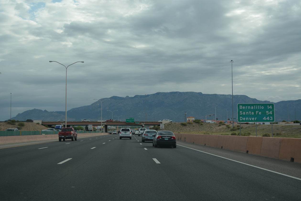
| 14 miles separates Exit 228 with the town of Bernalillo along Interstate 25. The capital city follows in 54 miles and Denver, Colorado in 443 miles. The previous distance sign here listed Bernalillo at 13 and Santa Fe at 57. 04/28/17 |
|
| Jefferson Street is a local arterial route paralleling I-25 north from Montgomery Boulevard the Wildflower Area in north Albuquerque. 04/28/17 |
|
| Continuing from Exit 228, I-25 passes over the culverted North Diversion Channel. 04/28/17 |
|
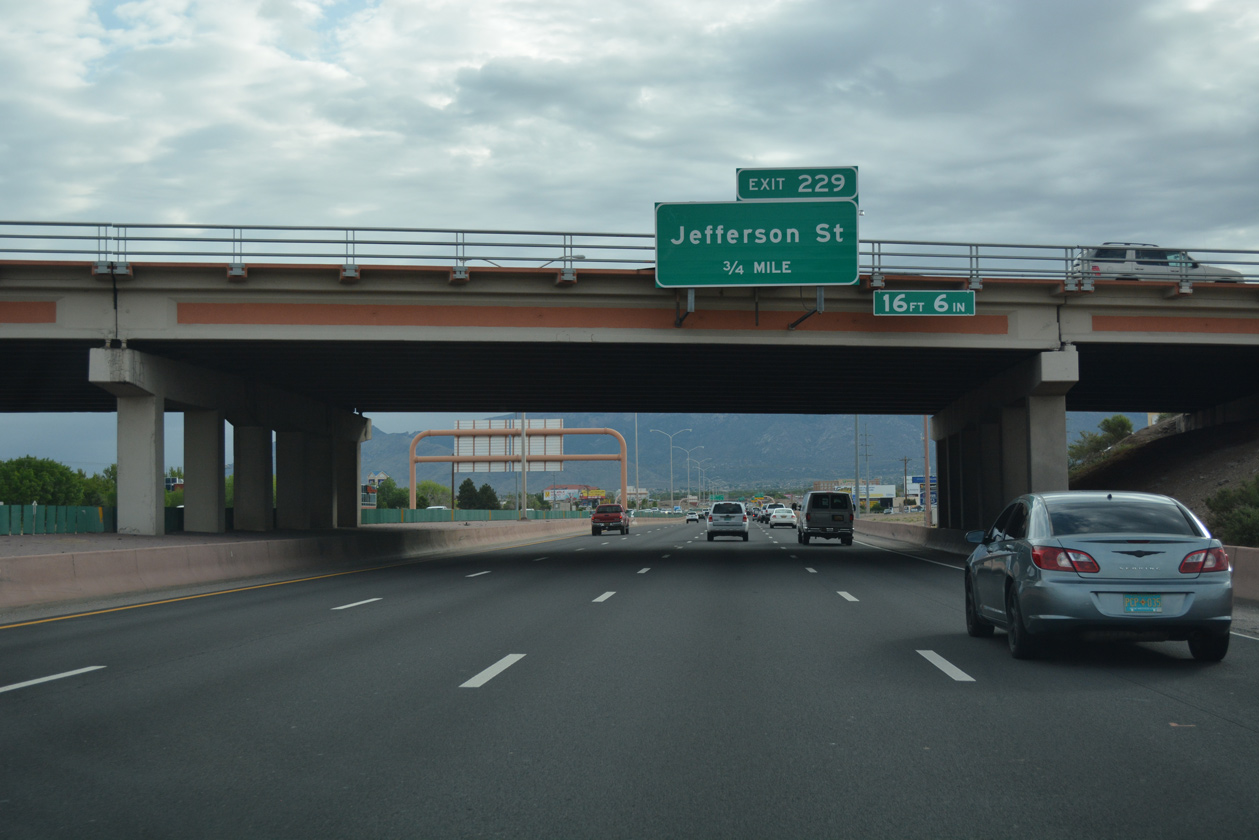
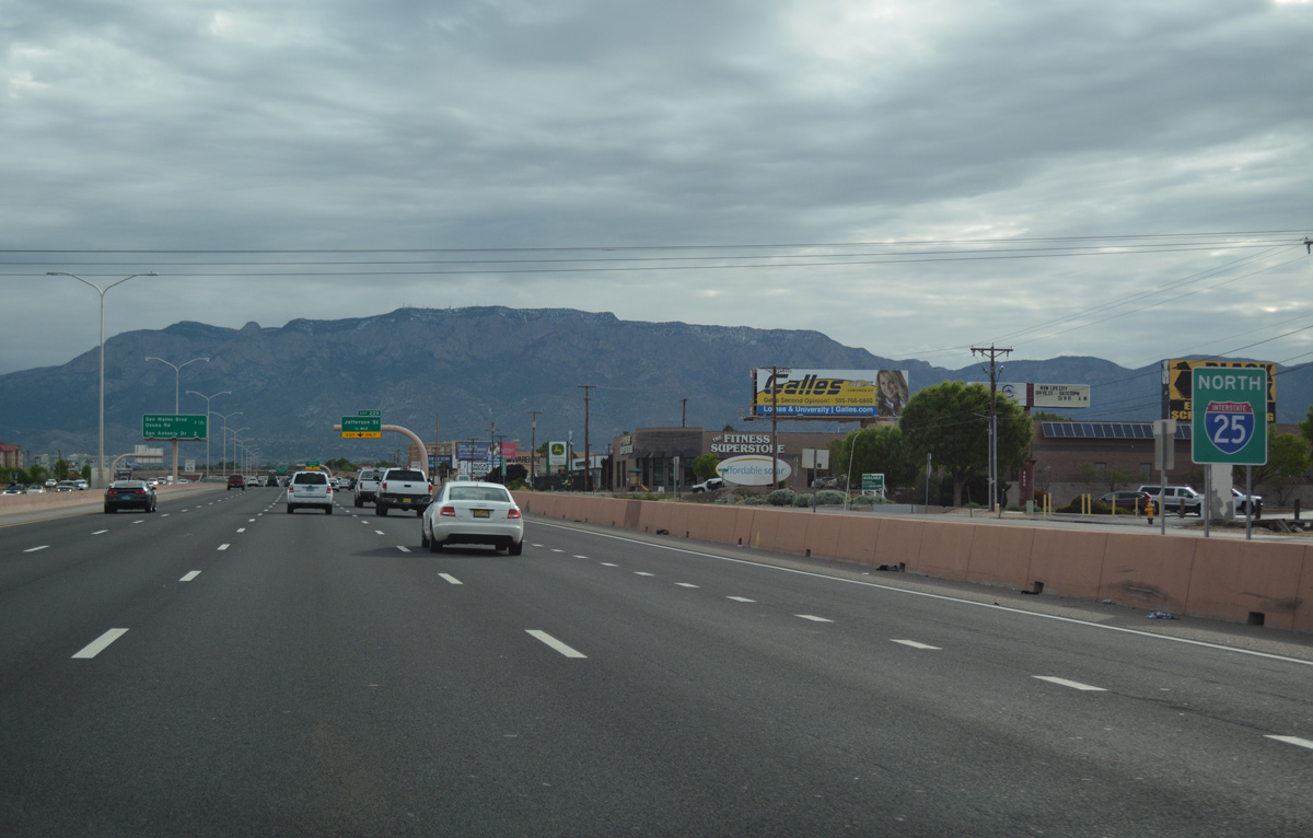
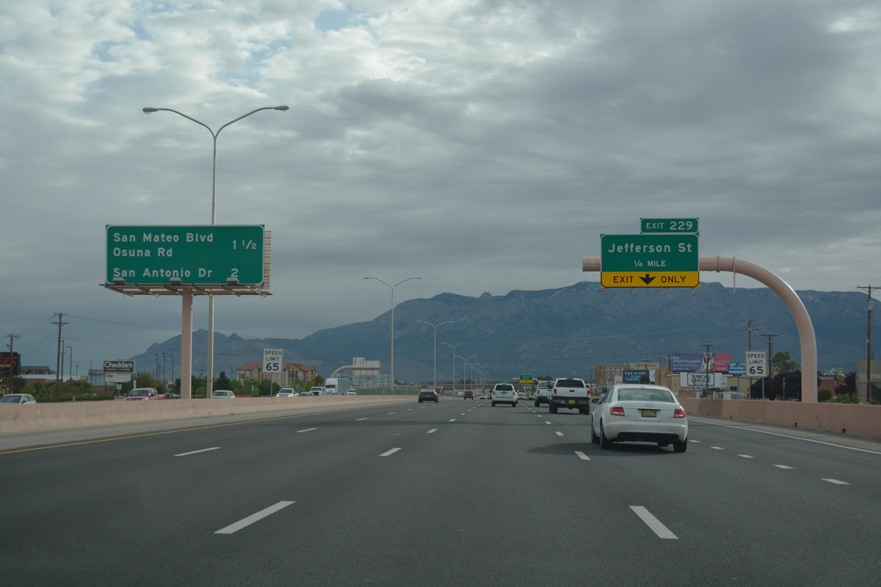
| The diamond interchange (Exit 229) with Jefferson Street lies one mile southwest of the succeeding exit with Osuna Road west and San Mateo Boulevard south. 04/28/17 |
|
| Exit 229 departs I-25 north for Jefferson Street to the Jefferson Commons retail area, Group Nine Industrial Park and Alameda. 04/28/17 |
|
| Osuna Road extends Chavez Road east from 4th Street (Historic U.S. 66) and the village of Los Ranchos De Albuquerque to meet Interstate 25 at San Mateo Boulevard. 04/28/17 |
|
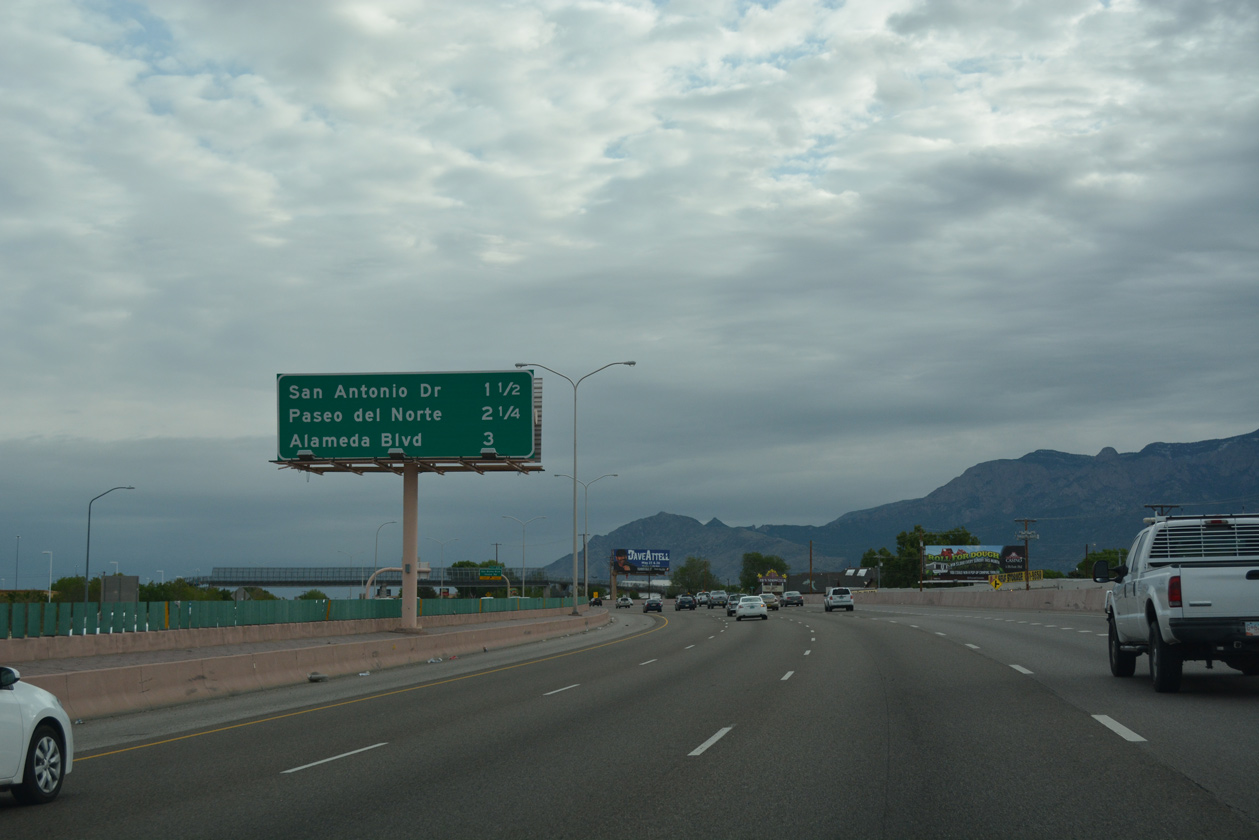
| Located three miles away, Exit 233 to Alameda Boulevard (NM 528) represents the final interchange along Interstate 25 within the city of Albuquerque. 04/28/17 |
|
| Osuna Road arcs southeast to become San Mateo Boulevard at the parclo interchange (Exit 230) with Interstate 25. San Mateo Boulevard south from Academy Acres North to Historic U.S. 66 was formerly a part of NM 367. 04/28/17 |
|
| Ellison Street east and San Antonio Drive east come together at Interstate 25 next. 04/28/17 |
|
| Exit 231 parts ways with I-25 northbound and passes over the entrance ramp from San Mateo Boulevard. San Antonio Drive heads east from the Albuquerque Meadows manufactured home community to Cherry Hills. 04/28/17 |
|
| Paseo Del Norte constitutes a major commuter route across north Albuquerque from Paradise Hills east to North Valley and Sandia Heights. NM 423 overlays Paseo Del Norte 11.02 miles between Golf Course Road and NM 556 (Tramway Boulevard). 04/28/17 |
|
| With auxiliary lanes, Interstate 10 widens to ten overall lanes between San Antonio Drive and the exchange (Exit 232) with NM 423 (Paseo Del Norte). 04/28/17 |
|
| One mile beyond NM 423 (Paseo Del Norte), Tramway Road (NM 556) represents the last exit from I-25 northbound in the Albuquerque urban area. 04/28/17 |
|
| $93 million in road work upgraded the diamond interchange at Exit 232 with a flyover from I-25 north to NM 423 west, a loop ramp from NM 423 west onto I-25 south, and a directional ramp to I-25 south from NM 423 east. The new ramps opened on December 16, 2014.1 04/28/17 |
|
| Exit 232 separates with a two lane flyover connecting to NM 423 (Paseo del Norte) westbound. NM 423 is a limited access freeway 5.3 miles west from Interstate 25 to NM 45 (Coors Boulevard) and Eagle Ranch Road. 04/28/17 |
|
| The previous diagrammatic overhead for NM 423 (Paseo del Norte) on I-25 north. The improvement project at Exit 232 also added a fourth northbound lane through the exchange. 06/29/08 |
|
| I-25 north at Exit 232 prior to the addition of the flyover for NM 423 west. Paseo del Norte extends another 5.66 miles from Golf Course Road to Atrisco Vista Boulevard beyond the northwest suburbs. 06/29/08 |
|
| An auxiliary lane opens north from NM 423 to Alameda Boulevard (former NM 528) at the Nor Este neighborhood. 02/28/17 |
|
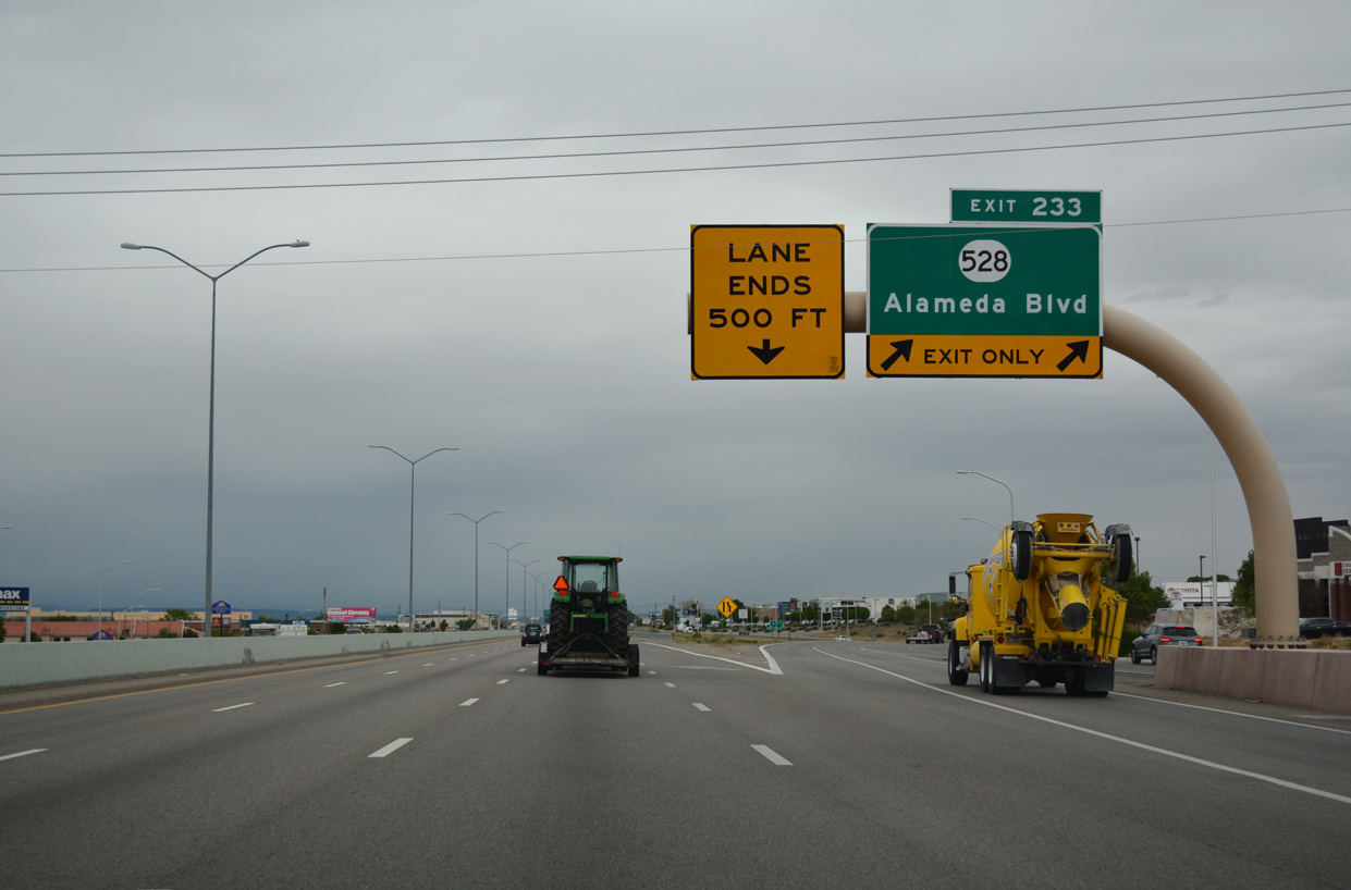
| Alameda Boulevard leads west from the diamond interchange (Exit 233) with I-25 to the Wildflower Area and Balloon Fiesta Park. Located north of Alameda Boulevard via Jefferson Road, the park hosts the Albuquerque International Balloon Fiesta. Hosting an array of concerts, festival events include the Balloon Glow, where hot air balloons compete for the best and brightest illumination and the Special Shape Rodeo, where balloons are constructed to take different shapes. 02/28/17 |
|
| NM 528 was decommissioned along 1.96 miles of Alameda Boulevard between Exit 233 and NM 47 (2nd Street). The arterial route remains under state maintenance north from NM 47 and Alameda through Rio Rancho 13.40 miles to U.S. 550. 02/28/17 |
|
| The ensuing exits north of NM 556 (Tramway Road) are at the town of Bernalillo. Denver, Colorado, 439 miles away, oddly appears first on this interchange sequence sign. 02/28/17 |
|
| NM 556 (Tramway Boulevard/Road) encircles northeastern Albuquerque along a 15.40 mile course originating at the confluence of I-40, NM 333, and Historic U.S. 66. The state road crosses paths with Interstate 25 at Exit 234, where it becomes Roy Avenue to the west. 02/28/17 |
|
| NM 556 continues two miles west from the diamond interchange (Exit 234) with I-25 to end at NM 47 (2nd Street NW) south and 4th Street NW within Sandia Pueblo. Tramway Road derives its name from the Sandia Peak Tramway. The tramway travels 2.7 miles east onto Sandia Peak (el. 10,378). 02/28/17 |
|
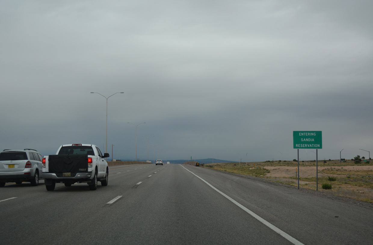
| Interstate 25 enters the Pueblo of Sandia beyond the Albuquerque city limits. Much of the land along the freeway remains undeveloped as the freeway progresses toward Bernalillo. 02/28/17 |
|
| A $28.4 million project widened Interstate 25 from four to six lanes between NM 556 (Tramway Road) and Exit 240 at Bernalillo. Construction ran from August 2009 to mid-2010.2 02/28/17 |
|
| Interstate 25 enters Sandoval County at mile marker 235. Sandoval County was formed in 1903 before New Mexico gained statehood. 02/28/17 |
Page Updated 04-08-2019.

 North
North