|
| I-25/U.S. 87 traverse a series of hills beyond the Castle Rock town line 04/28/17 |
|
| A diamond interchange (Exit 187) joins Interstate 25 with Happy Canyon Road in 0.75 miles. 04/28/17 |
|
| Happy Canyon Road angles northeast from U.S. 85 through the gated Castle Pines golf course community to Interstate 25 and the Happy Canyon community. 04/28/17 |
|
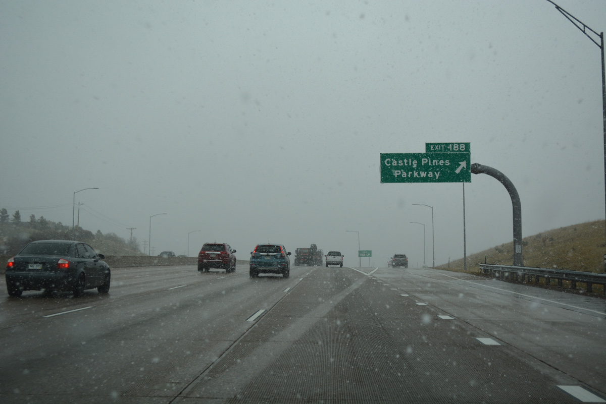
| Continuing north, I-25 next reaches the parclo interchange (Exit 188) with Castle Pines Parkway in the city of Castle Pines. 04/28/17 |
|
| Castle Pines Parkway meanders west to the Castle Pines North golf course community and Daniels Park. Havana Street and Hess Road north tie into Exit 188 from undeveloped areas east toward Rueter-Hess Reservoir. 04/28/17 |
|
| A $19.3 million project extended Hess Road west from a dead end near Chambers Road to Castle Pines Parkway. The new alignment opened to traffic following a ceremony held at the Castle Pines Community Center on January 24, 2012.1 04/28/17 |
|
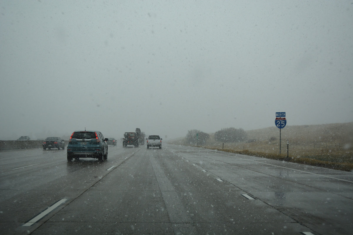
| Interstate 25 continues north from Castle Pines Parkway with eight overall lanes. 04/28/17 |
|
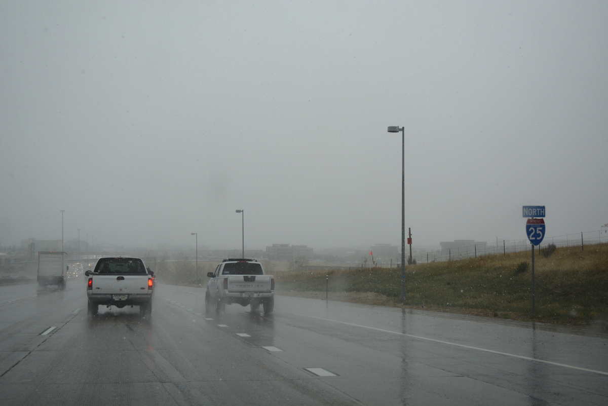
| The succeeding three exits fall within the city of Lone Tree. I-25 meets the Denver beltway, C-470 west and E-470 north, in 3.5 miles. 04/28/17 |
|
| A second confirming marker stands along I-25 north between Exits 188 and 192. This assembly remains from when a RIRO ramps (Exit 190) linked the northbound freeway with adjacent Havana Street by Oak Hill Lane. 04/28/17 |
|
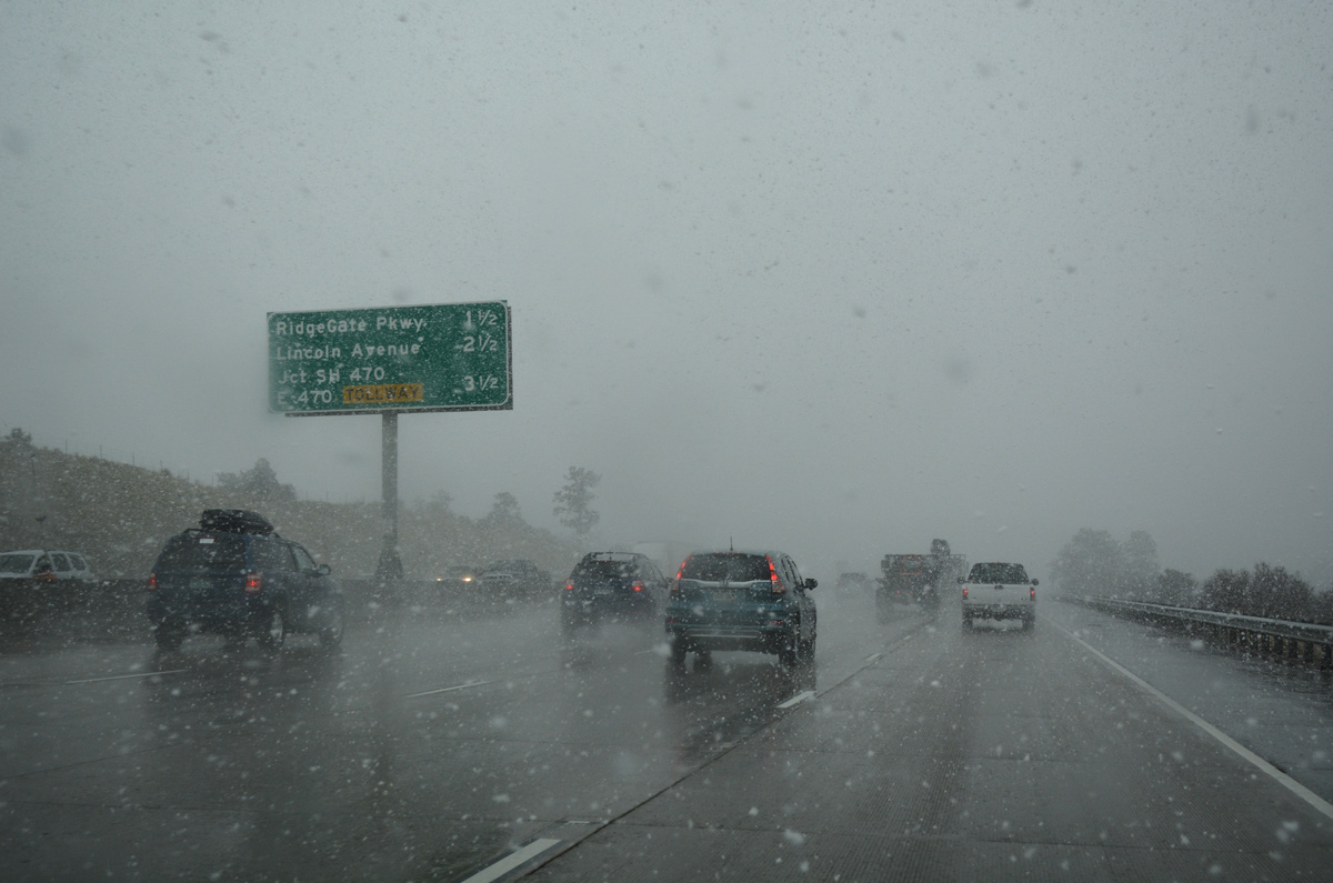
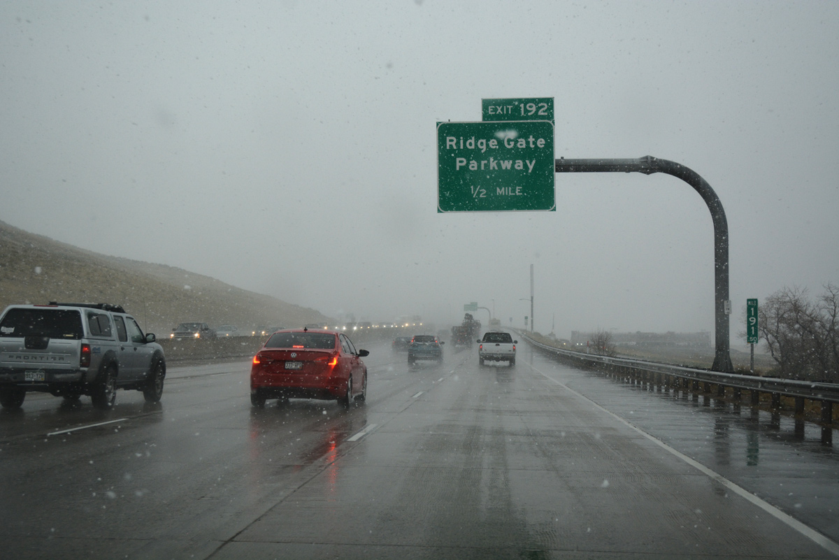
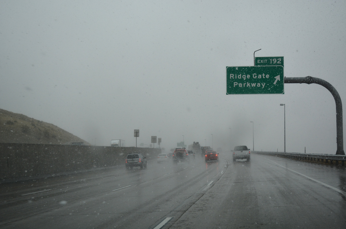
| RidgeGate Parkway replaced a RIRO connection (Exit 191) with Surrey Drive south by 2011. 04/28/17 |
|
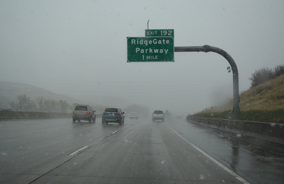
| Interstate 25 threads through a valley fed by Happy CanyonCreek to the six-ramp parclo interchange (Exit 192) with RidgeGate Parkway. 04/28/17 |
|
| RidgeGate Parkway constitutes an arterial serving RidgeGate, a 3,500 acre mixed-use development slated for over 12,000 homes by 2018. 04/28/17 |
|
| The six-ramp parclo interchange (Exit 193) with Lincoln Avenue serves an array of nearby office parks. The arterial west to University Boulevard serves suburban areas including the Heritage Hills neighborhood and Lone Tree golf course community. 04/28/17 |
|
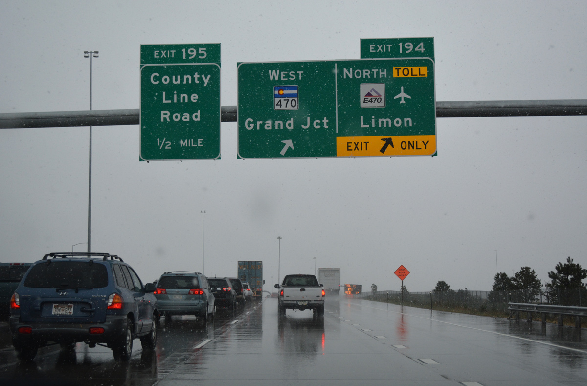
| Interstate 25 northbound meets the off-ramps at Exit 193 for Lincoln Avenue, Exit 194 for C-470 / E-470 and Exit 195 to County Line Road in quick succession. 04/28/17 |
|
| Commuter traffic swells the volume along Interstate 25 to 139,000 vehicles per day (2015) north of Exit 192. An additional 28,000 vpd adds to the route beyond Exit 193 / Lincoln Avenue. 04/28/17 |
|
| Exit 193 to Lincoln Avenue was expanded to two lanes during widening of I-25 north in 2014-16.
Started on September 1, 2016, the Southeast Rail Extension Project included adding a 1,397 foot long overpass across I-25 at Exit 193. Costing $233.1 million, the 2.3 mile extension of the RTD light rail system connects with a new station at RiverGate Parkway east of Exit 192. Lone Tree City station east of I-25 is of two addition stations built. Work ran through 2019.2 04/28/17 |
|
| Costing $32 million, the I-25 Lane Balance project added a lane in each direction of the freeway from Lincoln Avenue north to C-470 / E-470 (Exit 194) and County Line Road. Work ran from August 2014 to Fall 2016.3 04/28/17 |
|
| Additional office buildings populate the landscape along both sides of I-25 as the freeway passes by Meridian Golf Club preceding the pedestrian bridge for the RTD Lincoln transit Station. 04/28/17 |
|
| C-470 east and E-470 west come together with I-25/U.S. 87 at a four level interchange (Exit 194) in one quarter mile. 04/28/17 |
|
| Utilizing all electronic tolling (AET), E-470 north provides a high speed route around metropolitan Denver and the fastest route from Douglas County to Denver International Airport (DEN). 04/28/17 |
|
| Exit 194 departs from Interstate 25 north for C-470 west to Littleton, Lakewood and Golden and E-470 east to Parker and Aurora and north to Denver International Airport (DEN). 04/28/17 |
|
| Exit 194 separates from I-25 within the systems interchange with the 470 beltway. Succeeding exits with Dry Creek and Arapahoe Roads link the freeway with adjacent commercial areas in the city of Centennial. 04/28/17 |
|
| C-470 constitutes a 27.41 mile long freeway wrapping around the southwestern side of the Denver Metropolitan area to U.S. 6 at Golden. E-470 encircles the east side of the urban area along a 46.40 mile course to I-25 and the Northwest Parkway at Broomfield. 04/28/17 |
|
| The six-ramp parclo interchange at Exit 195 lies just north of Park Meadows mall and west of the Inverness business complex and golf course. County Line Road parallels C-470 west to Littleton. 07/04/12 |
|
| Interstate 25 widens to ten overall lanes north from the 470 beltway to the Arapahoe County line. A pedestrian bridge spans the freeway here for the RTD County Line Station serving Park Meadows mall. 07/04/12 |
|
| North from the Douglas County line, Interstate 25 advances through an office and technology corridor through Centennial, Greenwood Village and the Denver Tech Center at Orchard Road (Exit 198) and Belleview Avenue (Exit 199). 06/29/08 |
|
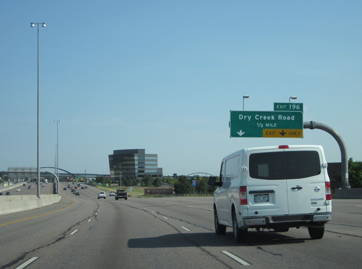
| A diamond interchange at Exit 196 joins Interstate 25 with Dry Creek Road west across residential areas of Centennial to Littleton. 07/04/12 |
|
| Auxiliary lanes in each direction increase the freeway to 12 lanes of capacity to Exit 196. 224,000 vehicles per day (vpd) were recorded by CDOT on this stretch in 2015. 06/29/08 |
|
| East from Exit 196, Dry Creek Road becomes Havana Street on the turn northward from Iverness to SH 88 (Arapahoe Road). 07/04/12 |
|
| Exit 196 departs from I-25 north with two lanes at the RTD pedestrian bridge for Dry Creek Station at Panorama Corporate Center. 07/04/12 |
|
| Interstate 25 passes west of Centennial Airport (APA). 07/04/12 |
|
| SH 88 overlaps with Interstate 25 north from Exit 197 at Arapahoe Road to Exit 199 at Belleview Avenue west in the city of Greenwood Village. 07/04/12 |
|
| Arapahoe Road constitutes a commercial arterial leading SH 88 east from Interstate 25 to Algonquin Acres, Valley Country Club in south Aurora and SH 83 (Parker Road) at the town of Foxfield. 07/04/12 |
|
| Entering the city of Greenwood Village, office buildings rise along both sides of Interstate 25 as the freeway again expands to 12 lanes with auxiliary lanes. 07/04/12 |
|
| West from the six-ramp parclo interchange (Exit 197) with I-25, Arapahoe Road remains commercial by Greenwood Plaza and Fiddler's Green Amphitheatre, an outdoor concert venue, to Quebec Street. 07/04/12 |
|
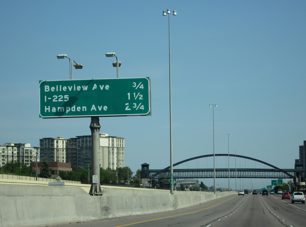
| Travelers headed north enter the Denver city limits beyond Belleview Avenue. Interstate 225 begins in 2.25 miles at Exit 200. 07/04/12 |
|
| Forthcoming Orchard Road lines the south side of Denver Tech Center east from Exit 198 to Yosemite Street. The arterial transitions into a residential street through subdivisions in unincorporated Arapahoe County. 07/04/12 |
|
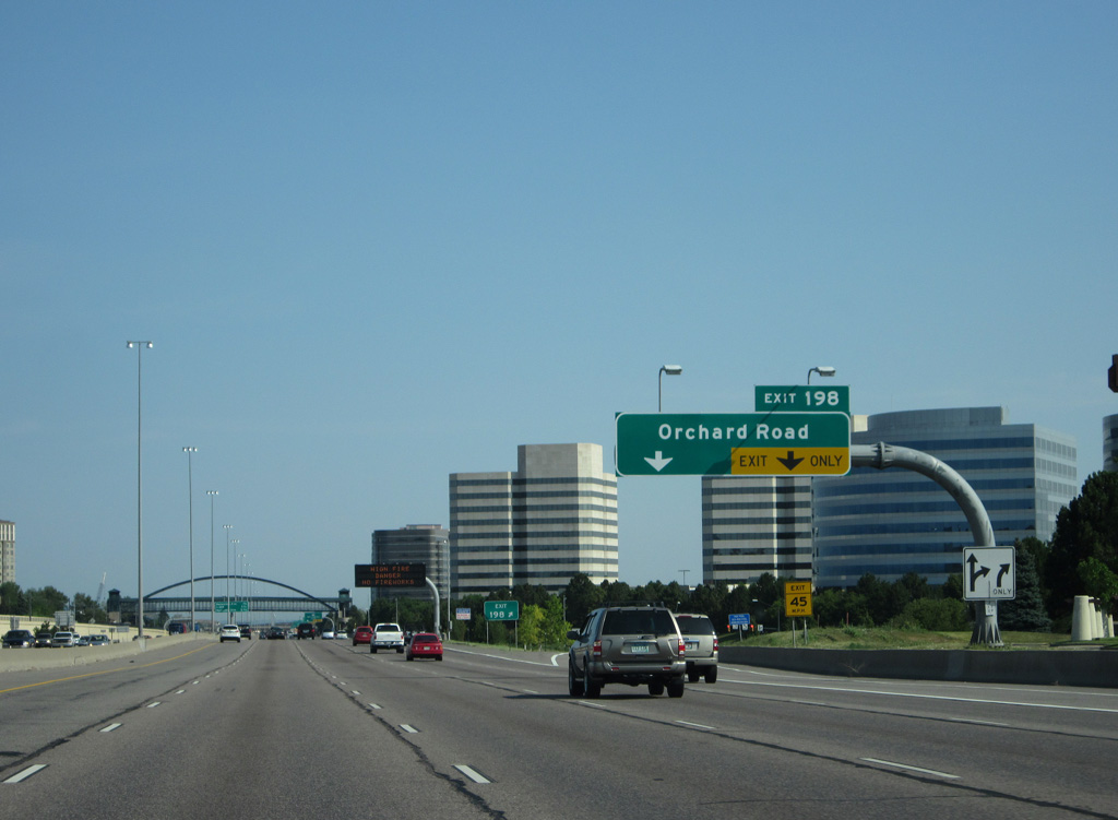
| Entering the diamond interchange (Exit 198) with Orchard Road on I-25 north / SH 88 west. Orchard Road extends west from Greenwood Plaza office park along the Centennial and Greenwood Village city line to Jackson Street. A second section of the road leads west to Broadway in Littleton. 07/04/12 |
|
| SH 88 turns west onto Belleview Avenue in 0.75 miles to Cherry Hills Village. Exit 200 follows for Interstate 225 north to Aurora. 07/04/12 |
|
| The next in a series of pedestrian bridges across I-25 joins Denver Tech Center with the RTD Orchard transit Station for the E, F and R-Lines. 07/04/12 |
|
| The remainder of SH 88 forms an L-shaped route west on Belleview Avenue to Littleton and north on Federal Boulevard to Sun Valley in Denver. 07/04/12 |
|
| The 12.43 mile long route of Interstate 225 arcs northeast to I-70 just west of Peña Boulevard, the locally maintained freeway north to Denver International Airport (DEN). 06/29/08 |
|
| Exit 199 leaves Interstate 25 northbound for Bellevue Avenue east to Cherry Creek State Park and west along the Greenwood Village line to Englewood. SH 88 ends 14.77 miles to the northwest at U.S. 287. 07/04/12 |
|
| Interstate 225 constitutes a busy commuter freeway with six or more lanes north to the Aurora City Center and I-70 at Stapleton in Denver. Initial signs for the urban loop omit Aurora in favor of just Limon, the eastbound destination of Interstate 70 beyond the Denver metropolitan area. 07/04/12 |
|
| Entering the Denver city limits, a three lane entrance ramp from Belleview Avenue and the Denver Tech Center partitions with two lanes joining the I-25 mainline through Hampden South and a single lane for the departing I-225 to Aurora. 04/22/17 |
|
| Union Avenue crosses over I-25 just ahead of the separation with Exit 200 for Interstate 225 north. I-225 straddles the Denver city line northeast to Cherry Creek Reservoir and State Park and the Kennedy neighborhood at SH 83 (Parker Road). 04/22/17 |
|
| Exit 200 curves underneath a flyover carrying motorists from SH 88 east and Belleview Avenue onto I-25 north. The overpass was part of the overall redesign of the directional T interchange with I-225 to eliminate left exit ramps and weaving traffic. 06/29/08 |
|
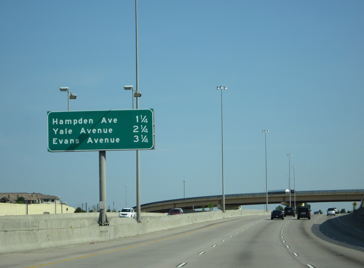
| Continuing north between the Southmoor Park and Hampden South neighborhoods, I-25/U.S. 87 next meet U.S. 285 and SH 30 at Hampden Avenue. 07/04/12 |
Page Updated 01-12-2022.


 North
North