|
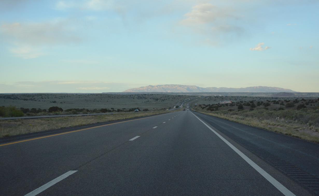
| The Sandia Mountains rise along the eastern horizon beyond Albuquerque as Interstate 40 traverses open desert across Laguna Pueblo. 04/27/17 |
|
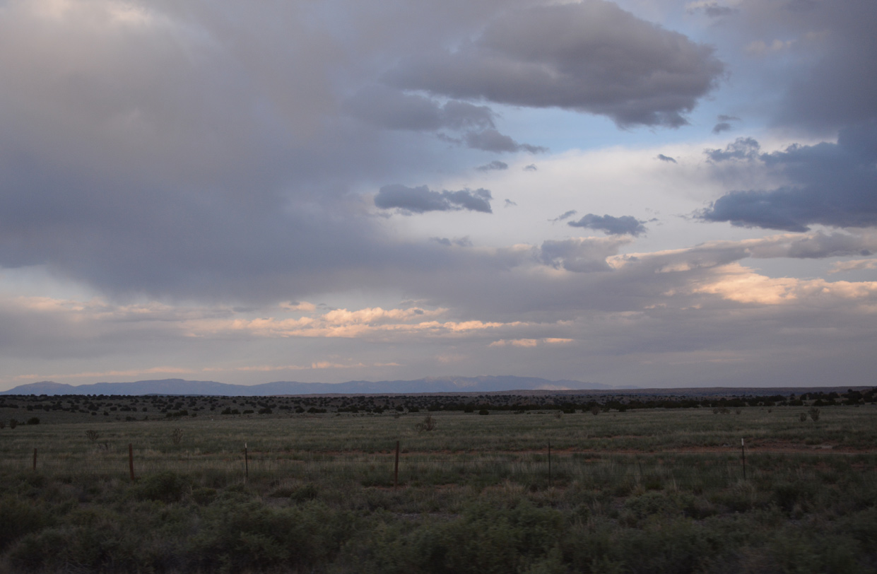
| The Manzano Mountains appear to the far southeast beyond Isleta Pueblo. 04/27/17 |
|
| An at-grade intersection provides access to adjacent ranch lands from Interstate 40 midway between mileposts 134 and 135. 04/27/17, 06/29/08 |
|
| Interstate 40 lowers gradually to cross Cañada de los Apaches at mile marker 137. 04/27/17 |
|
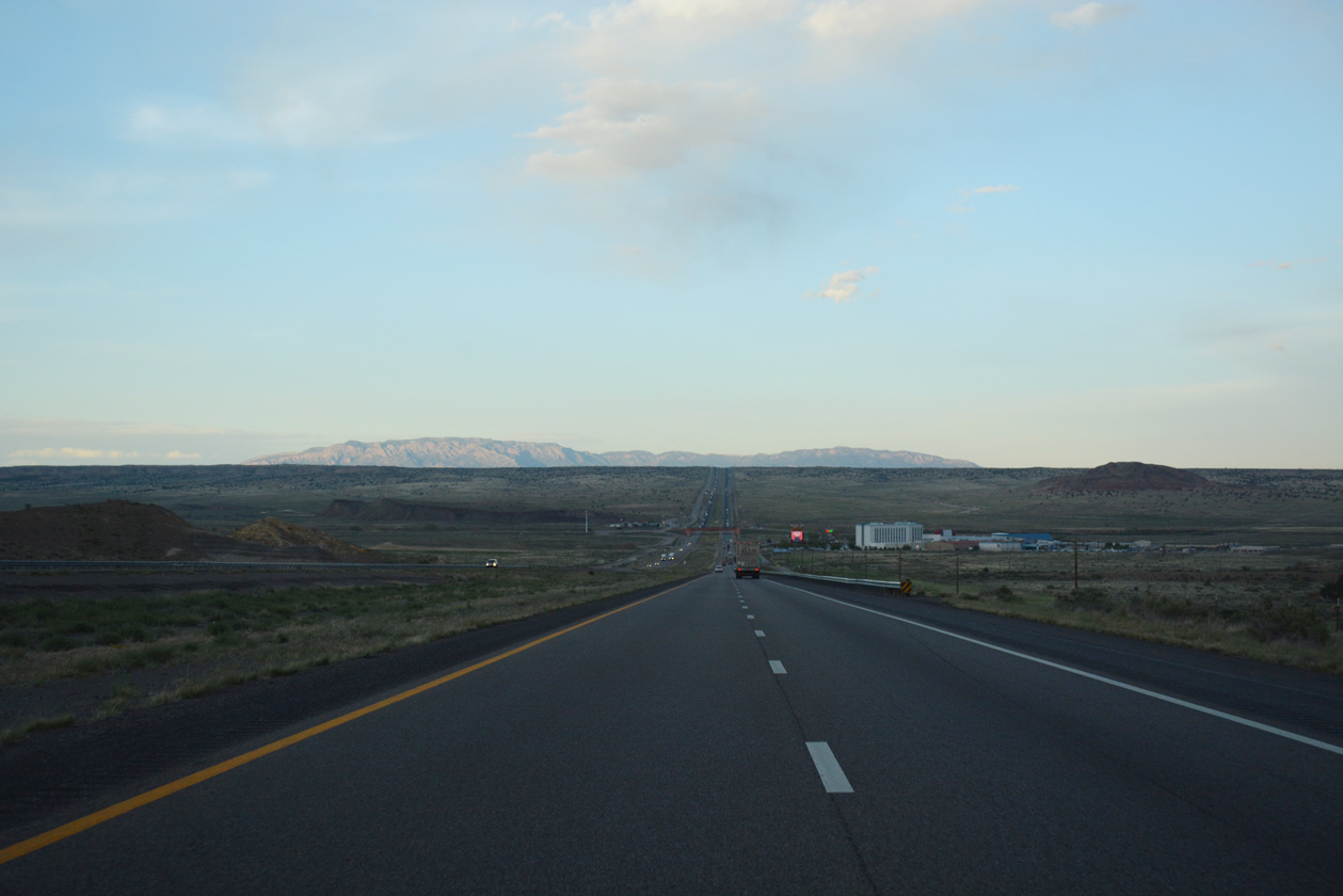
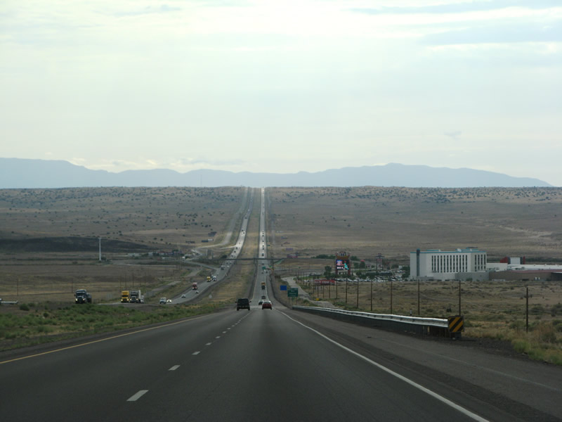
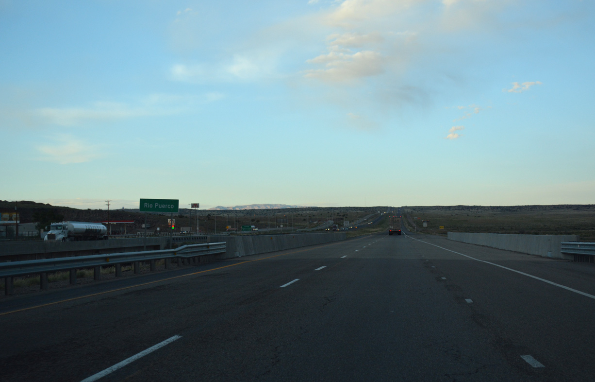
| Descending from a mesa toward the Rio Puerco along Interstate 40 east. An unpaved section of Central Avenue enters the area from the northwest and parallels the freeway along the frontage road system to Exit 140. 04/27/17, 06/29/08 |
|
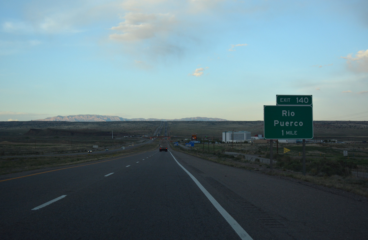
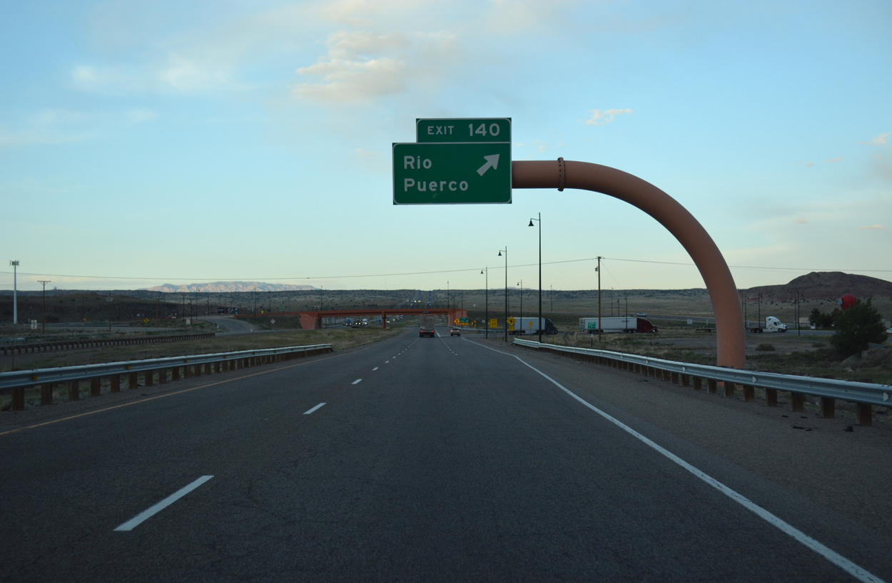
| Exit 140 joins Interstate 40 with the adjacent frontage roads and Rio Puerco Road (Tribal Highway 7070). 04/27/17 |
|
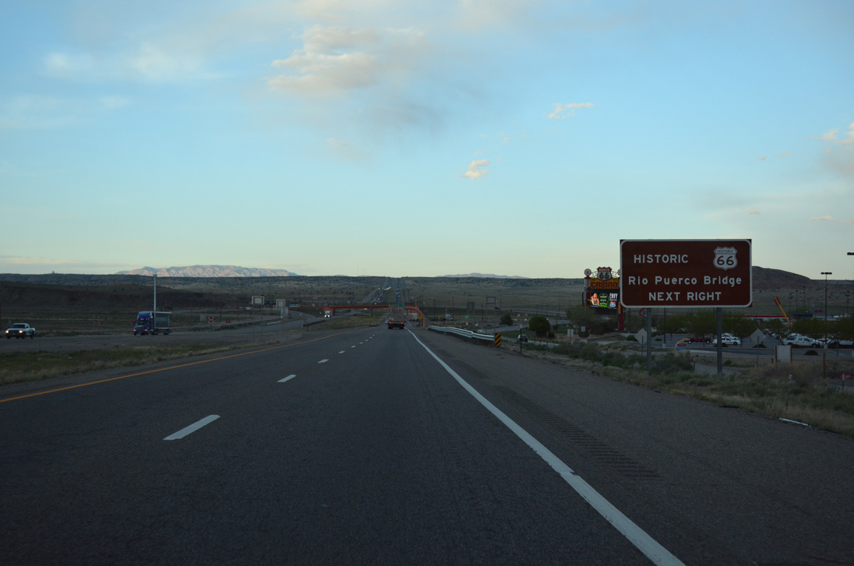
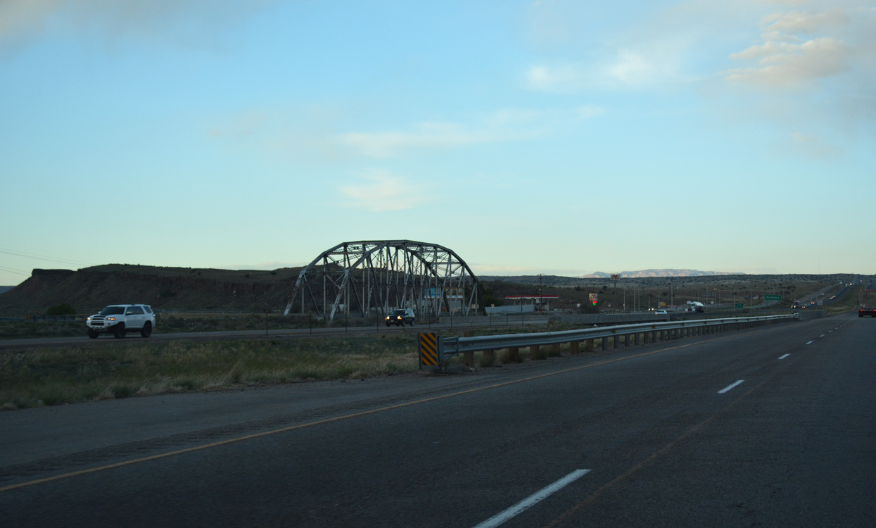
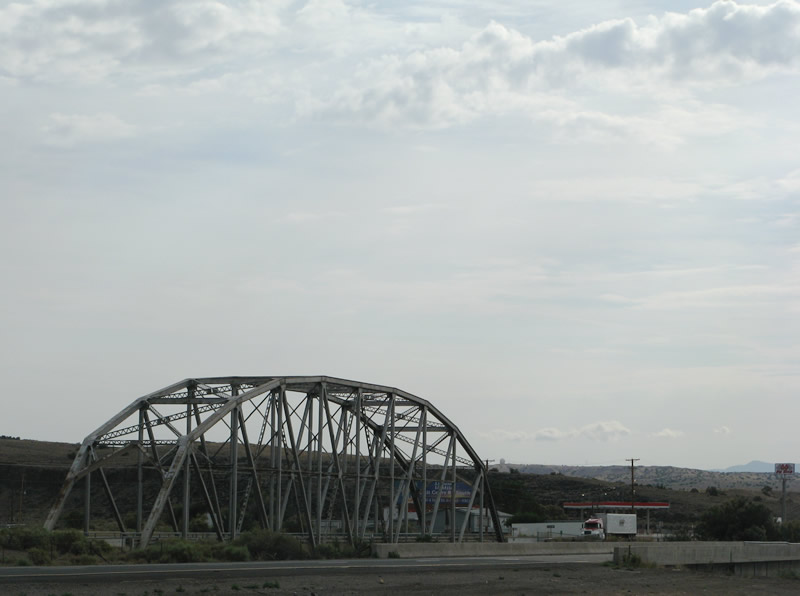
| The Rio Puerco Bridge lies just east of I-40 along Historic U.S. 66 (Central Avenue). Added to the National Register of Historic Places in 1997, the Parker through truss bridge closed to vehicular traffic in 1999 with a new span built nearby. The Rio Puerco Bridge remains open for pedestrians.1 04/27/17 |
|
| Exit 140 departs I-40 east for the Route 66 Casino and the Canoncito Indian Reservation. A roundabout was added along the north side of the parclo interchange (Exit 140) with Rio Puerco Road during construction between August and November 2007. 04/27/17 |
|
| The adjacent Rio Puerco Bridge was constructed in 1933 and incorporated into the alignment of U.S. 66 in 1937. Designed to withstand floodwaters along the Rio Puerco, the U.S. 66 bridge measures 250 feet in length with a 25 foot wide deck. It was rebuilt to increase the vertical clearance in 1957.1 04/27/17, 06/29/08 |
|
| Interstate 40 across the usually dry riverbed of the Rio Puerco was completed by 1970. U.S. 66 was realigned onto the freeway until its decommissioning in 1985. 04/27/17 |
|
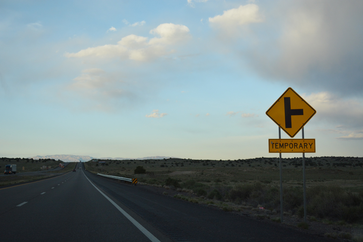
| Distance sign posted 18 miles out from Downtown Albuquerque. This assembly was missing in 2017. 06/29/08 |
|
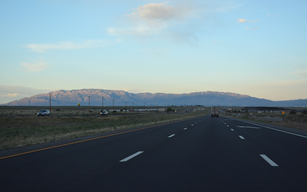
| A truck climbing lane opens along Interstate 40 eastbound from mile marker 143 to 146. The freeway gains 300 feet in elevation on the ascent onto Nine Mile Hill. 04/27/17 |
|
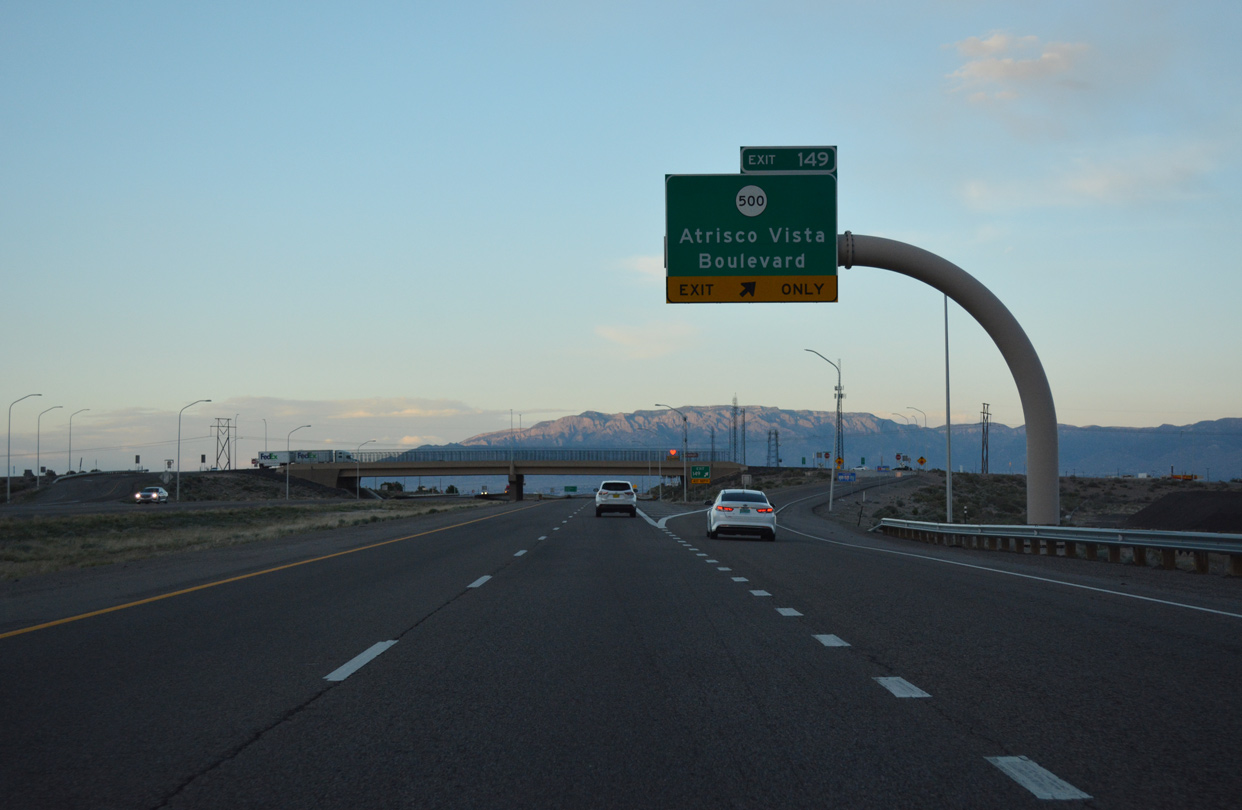
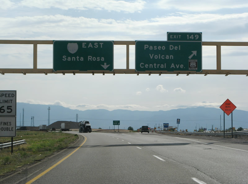
| Interstate 40 finally reaches the western suburbs of Albuquerque at Exit 149 with NM 500 east and Atrisco Vista Boulevard. Comprising a 12.35 mile long loop southeast to I-25 near Albuquerque International Sunport (ABQ), NM 500 begins at the forthcoming diamond interchange. 04/27/17 |
|
| Central Avenue, the post-1937 route of U.S. 66 across the city of Albuquerque, branches east from Interstate 40 ahead of NM 500 (Atrisco Vista Boulevard). 04/27/17 |
|
| Exit 149 departs Interstate 40 east for Atrisco Vista Boulevard (NM 500 south). Atriso Vista Boulevard south connects with Historic U.S. 66 (Central Avenue) by the Tierra West Estates mobile home community. Heading north, Atrisco Vista Boulevard (FL 4007) continues to Double Eagle II Airport (AEG) and the Petroglyph National Monument Volcano day use area for Vulcan, Black, and J A. 04/27/17 |
|
| Previously a wye interchange joined I-40 eastbound with Central Avenue (former Business Loop I-40 / U.S. 66) east ahead of Paseo del Volcan, the former name of Atrisco Vista Boulevard. Separate ramps connected I-40 westbound with Paseo del Volcan. The separate exchanges were consolidated. 06/29/08 |
|
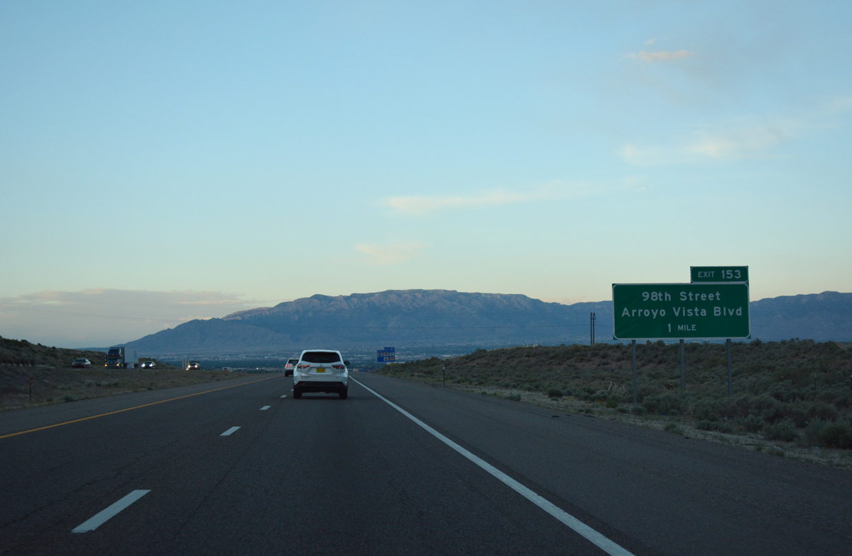
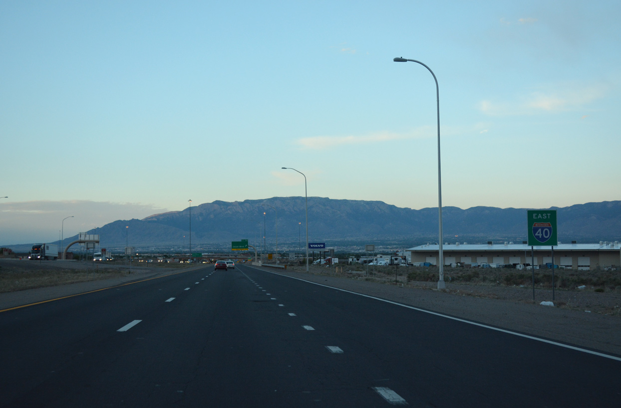
| The first in a series of interchange sequence signs for I-40 east in the city of Albuquerque stands two miles ahead of 98th Street (Exit 153). 04/27/17 |
|
| Interstate 40 lowers 400 feet in elevation to 5,300 feet above sea level between Exits 149 and 153. 04/27/17 |
|
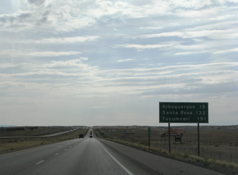
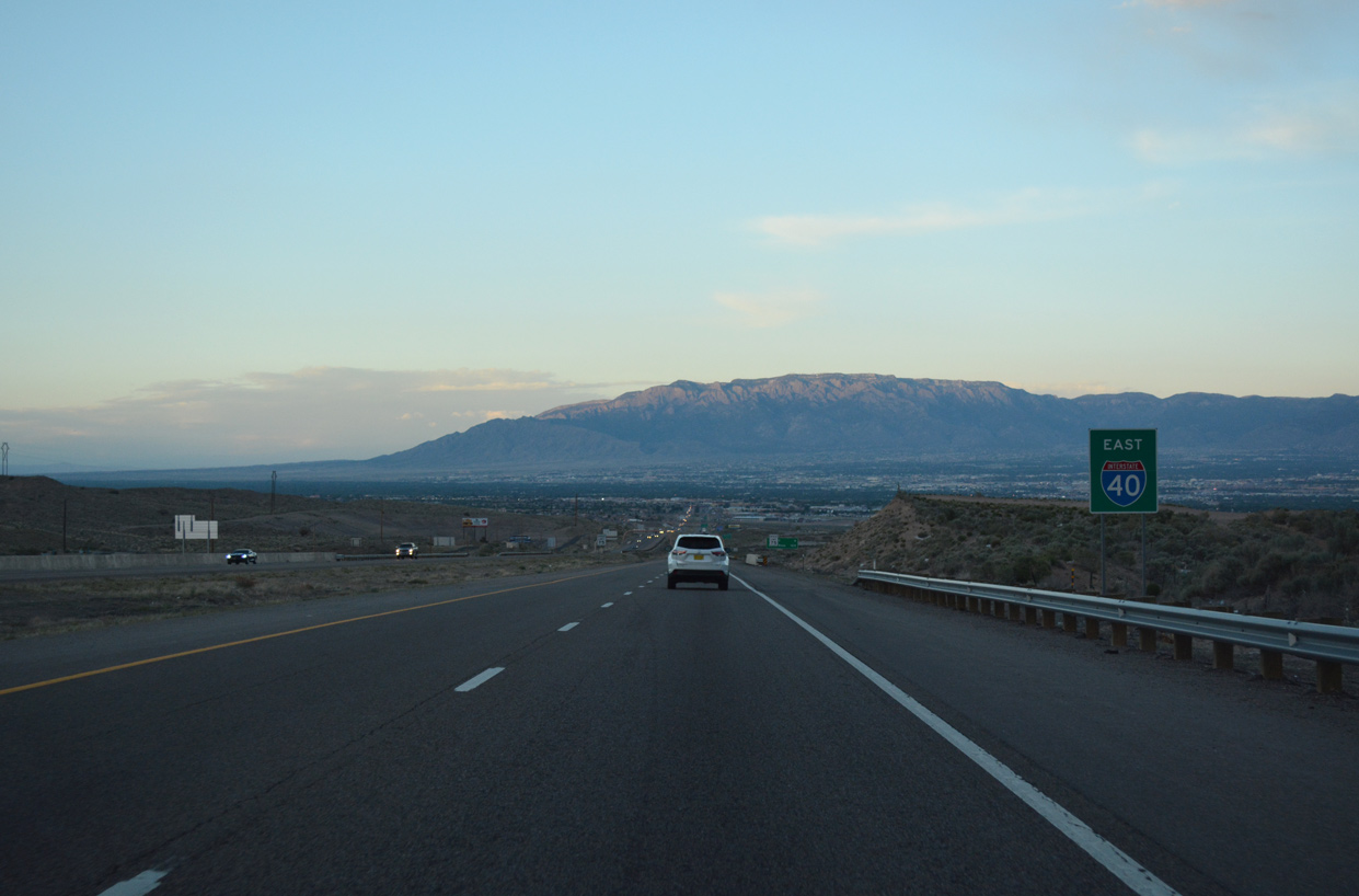
| Interstate 40 converges with I-25 in nine miles to the northeast of Downtown Albuquerque. Santa Rosa lies 116 miles further. 04/27/17 |
|
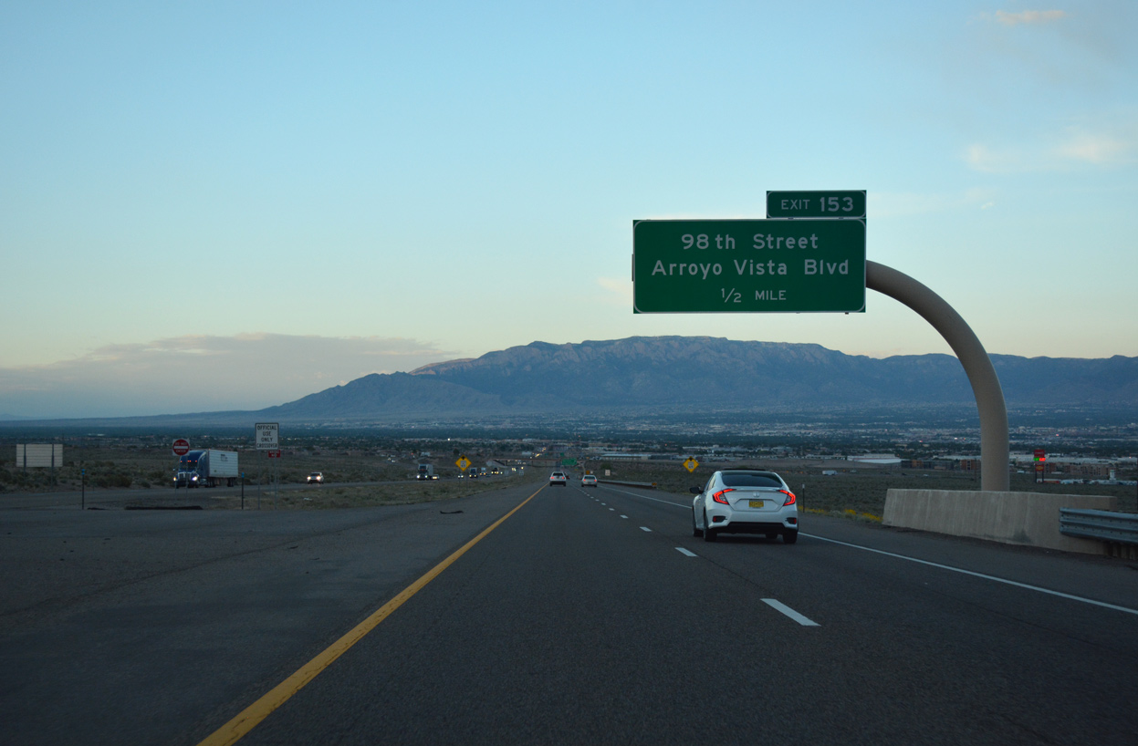
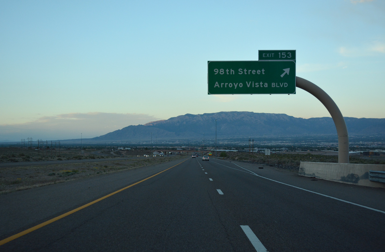
| A parclo interchange (Exit 153) joins Interstate 40 east with 98th Street south and Arroy Vista Boulevard north in one mile. 04/27/17 |
|
| Arroyo Vista Boulevard spurs north from the exchange with I-40 to the Tres Volcanoes neighborhood and Nusenda Community Stadium. 04/27/17 |
|
| Exit 153 leaves I-40 east for 98th Street south to the Avalon, Route 66 West and Westgate Heights suburban neighborhoods of west Albuquerque. 04/27/17 |
|
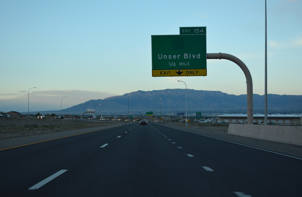
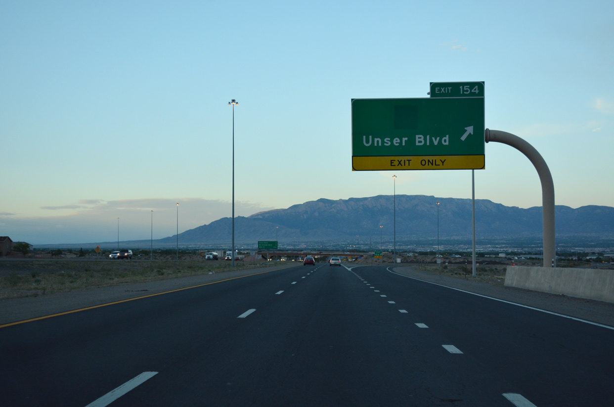
| Visitors headed to Petroglyph National Monument are directed northward from Interstate 40 along Unser Boulevard at forthcoming Exit 154. Unser Boulevard runs along eastern reaches of the park to Rinconada Canyon, the Visitor's Center and Boca Negra Canyon. 04/27/17 |
|
| Prior to 2012, NM 345 followed Unser Boulevard 3.65 miles north from Historic U.S. 66 (Central Avenue) at the Los Volcanes neighborhood to St. Josephs Avenue at the Ladera Heights community. The state resumed jurisdiction over Coors Boulevard (NM 45) in place of the state maintained section of Unser Boulevard.2 04/27/17 |
|
| Auxiliary lanes open along both directions of I-40 between the exchanges at Exits 153 and 154. 04/27/17 |
|
| Entering the parclo interchange (Exit 154) with Unser Boulevard on Interstate 40 east. The suburban arterial is named for Al Unser, an Albuquerque native and International Motorsports Hall of Famer.3 04/27/17 |
|
| Interstate 40 continues east two miles to Coors Boulevard, a major commercial arterial north from Central Avenue (Historic U.S. 66) and the Alamosa neighborhood to Ladera Heights. 04/27/17 |
|
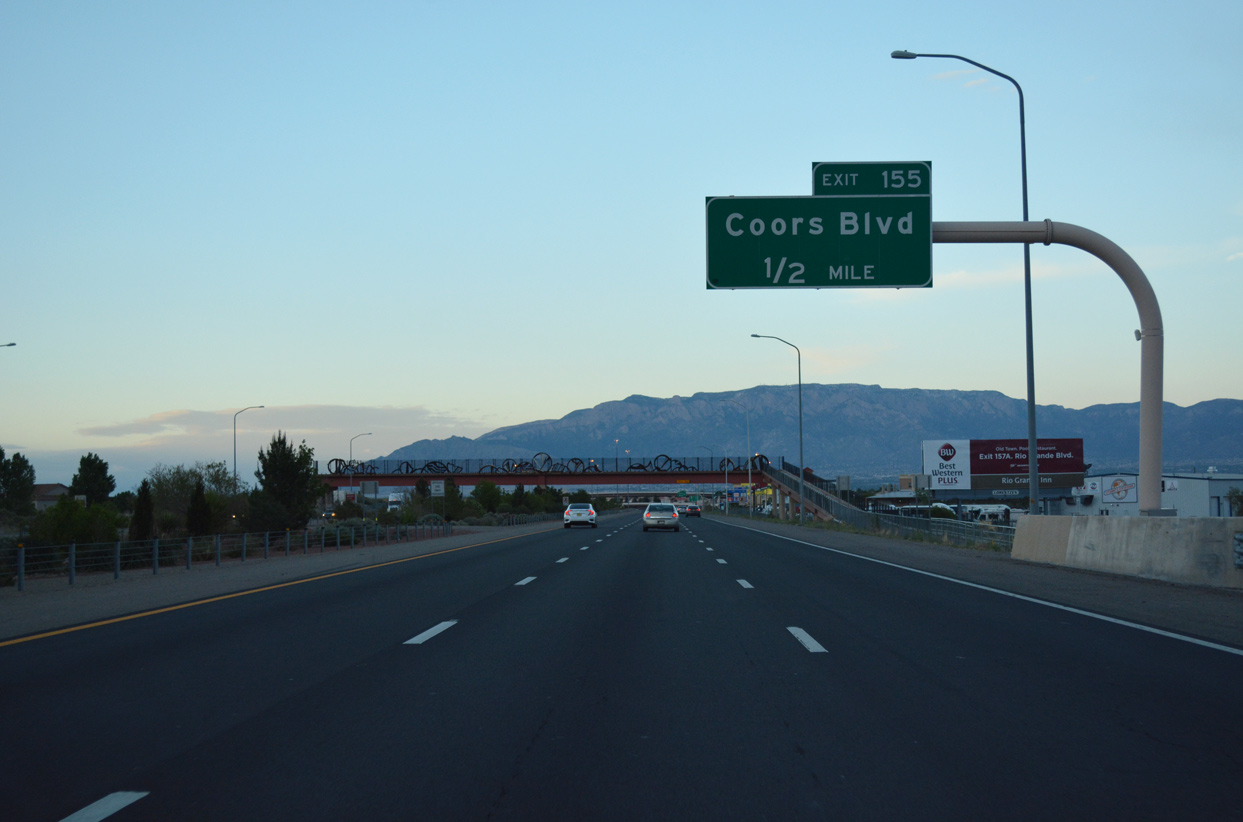
| Construction in 2005-06 upgraded Exit 155 with Coors Boulevard (NM 45) into a multi level interchange with flyover ramps, pedestrian bridges and bicycle paths. NM 45 was established along the arterial by 2012. 04/27/17 |
|
| Interstate 40 expands to a six lane freeway east from Unser Boulevard. 04/27/17 |
|
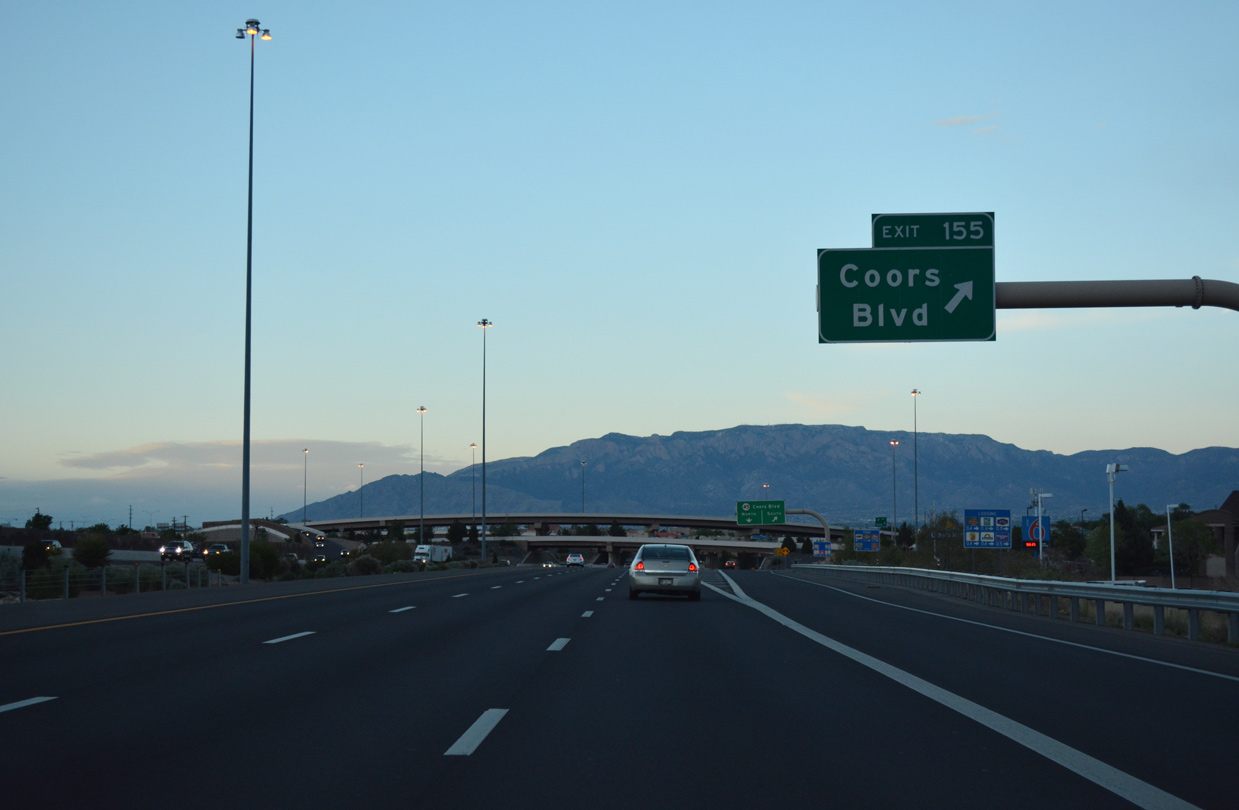
| One half mile ahead of the ramps (Exit 155) for NM 45 (Coors Boulevard) on I-40 east. The state road extends 22.92 miles north from NM 314 in Isleta Pueblo to NM 528 (Alameda Boulevard) near the Paradise Hills community in north Albuquerque. 04/27/17 |
|
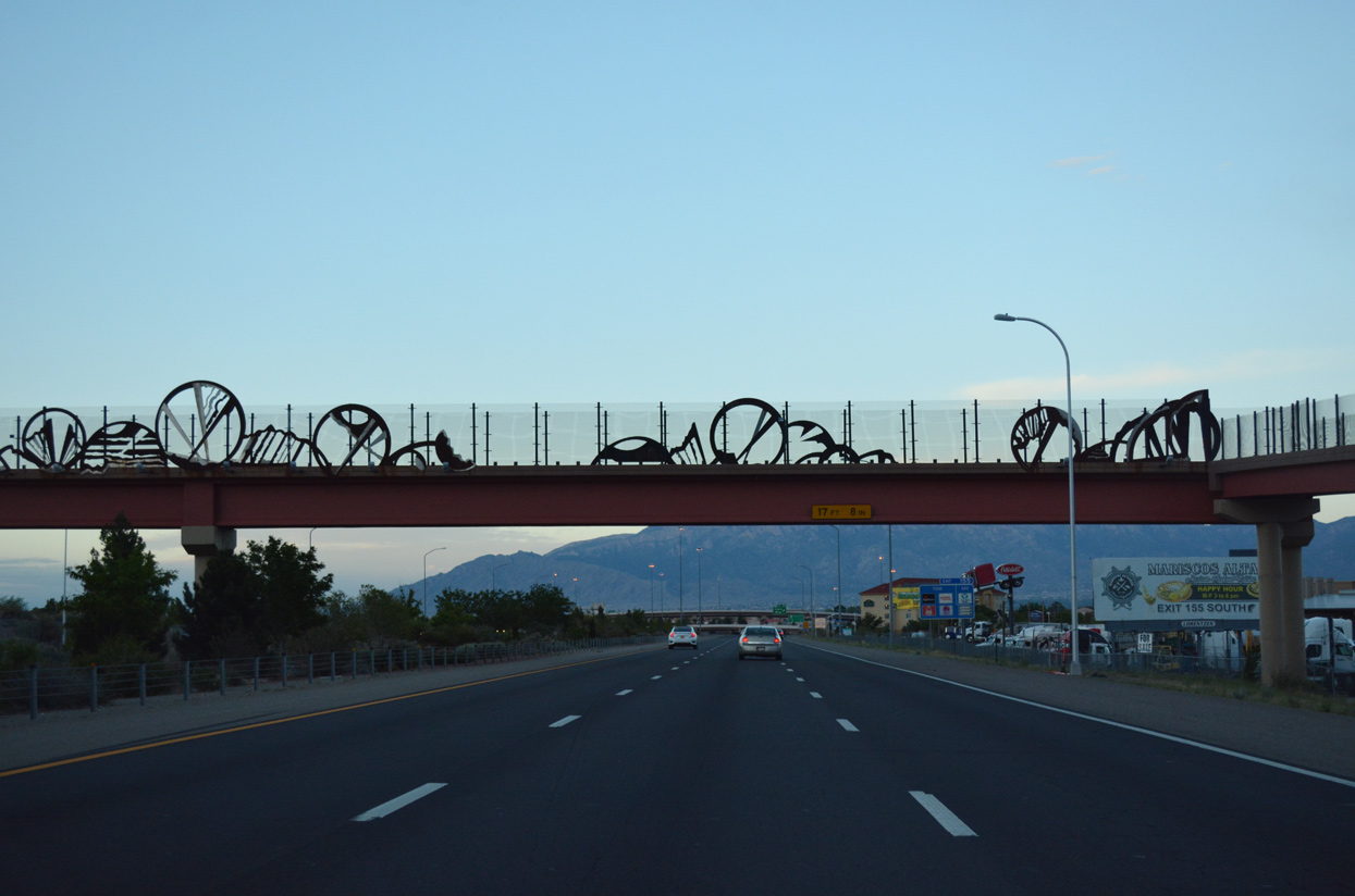
| A pedestrian bridge connecting the S.R. Marmon and Los Volcanes neighborhoods, spans Interstate 40 midway between Exits 154 and 155. 04/27/17 |
|
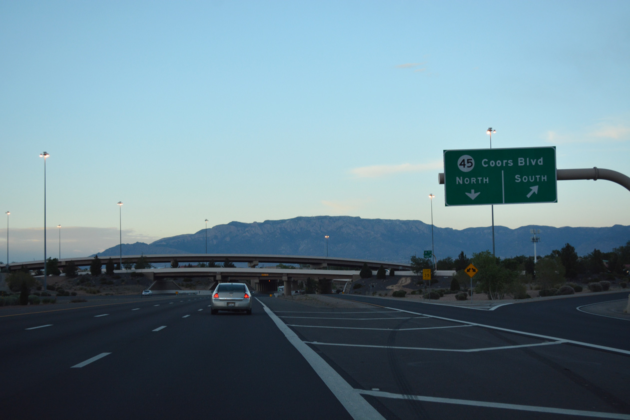
| Exit 155 departs I-40 east for Coors Boulevard (NM 45) at the West Bluff and West Mesa neighborhoods. Coors Boulevard was formerly part of NM 448 north of St. Josephs Drive. 04/27/17 |
|
| Coors Boulevard south continues from Central Avenue to the town of South Valley. Paralleling the Rio Grande northward, NM 45 joins I-40 with the Taylor Ranch community. 04/27/17 |
|
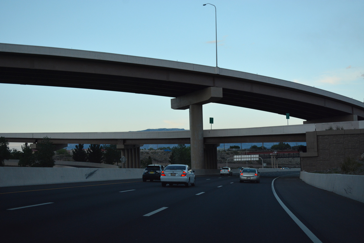
| Selected by residents in an online survey, flyovers spanning Interstate 40 at Coors Boulevard were painted Latte, Portabello, Jute Brown and Spicy Hue. The $91 million reconstruction of Exit 155 was built in conjunction with the GRIP I-40 corridor. Work began in December 2004 and finished in May 2006. 04/27/17 |
|
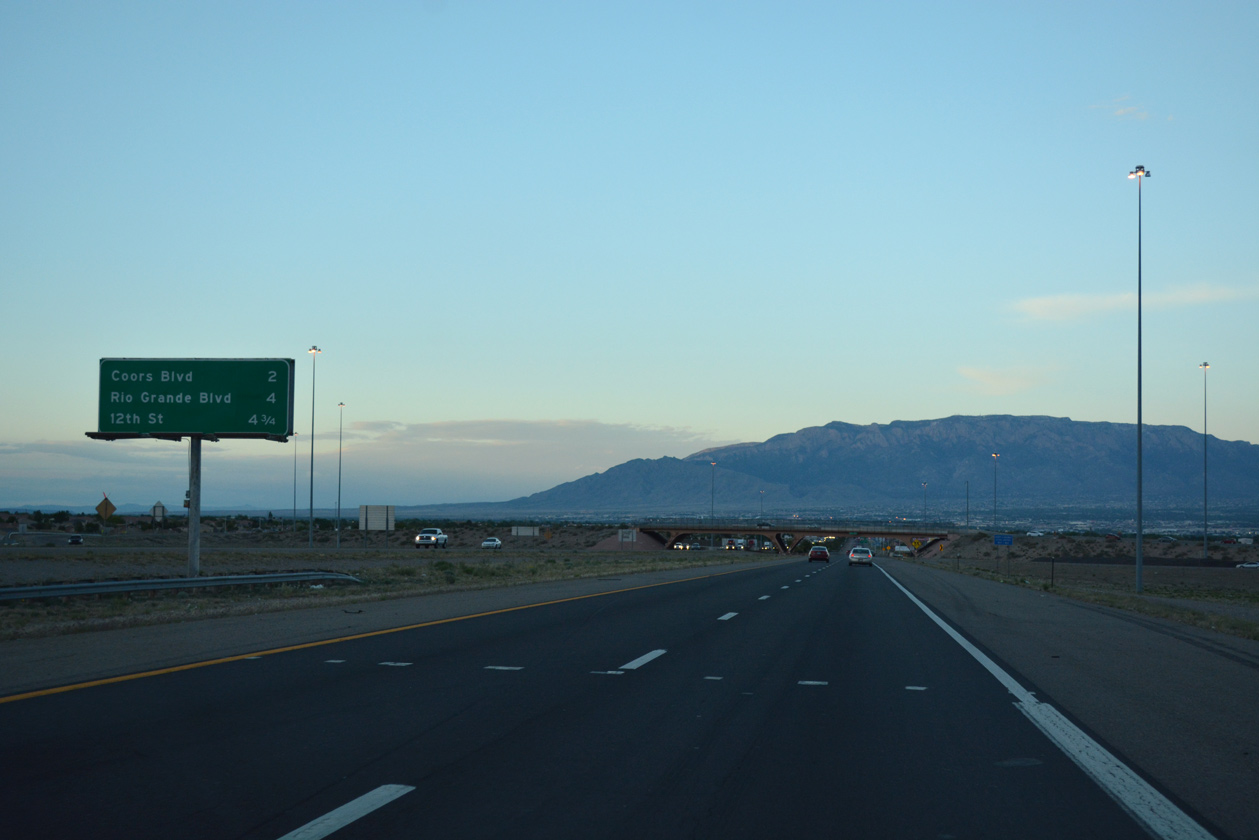
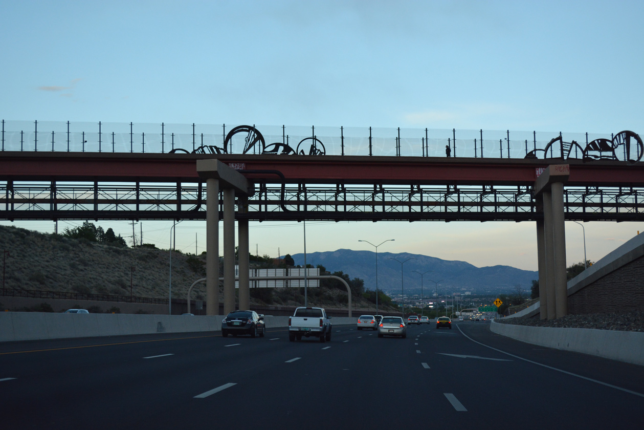
| Advancing east from the West Bluff area along the Rio Grande, I-40 meets Interstate 25 in three miles. Forthcoming Exit 157A with Rio Grande Boulevard serves the Old Town area of Albuquerque. 04/27/17 |
|
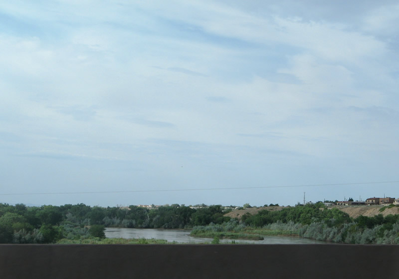
| Spanning the Rio Grande along Interstate 40 east. Levees and nature trails line the river through adjacent ABQ BioPark and Tingley Beach Park. 04/27/17, 06/29/08 |
|
| Including auxiliary lanes, I-40 crosses the Rio Grande with ten overall lanes. The ensuing exit links the freeway with the Near North Valley and Los Duranes neighborhoods to the north. 04/27/17 |
|
| Interchanges beyond Rio Grande Boulevard serve Downtown Albuquerque via the numbered street grid. 04/27/17 |
|
| Historic Old Town lies between I-40 and Historic U.S. 66 (Central Avenue) to the west of Rio Grande Boulevard. Nearby attractions include ABQ BioPark Zoo, Aquarium and Botanical Gardens, and the Albuquerque Museum of Natural History & Science. 04/27/17 |
|
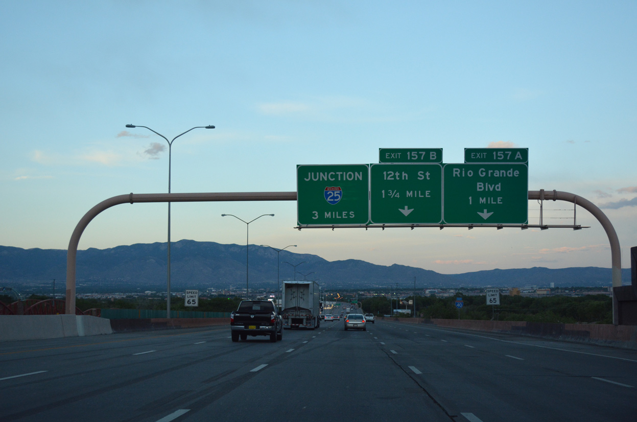
| Interstate 40 east reaches the diamond interchange (Exit 157A) with Rio Grande Boulevard. Historically, NM 194 followed Rio Grande Boulevard northward from Central Avenue (Business Loop I-40) to the village of Los Ranchos de Albuquerque and NM 528 at Alameda in north Albuquerque. 04/27/17 |
|
| Continuing east, I-40 passes between the Near North Valley and Sawmill Area to 12th Street (Exit 157B). 04/27/17 |
|
| An auxiliary lane drops along I-40 eastbound at Exit 157B for 12th Street to Wells Park and Near North Valley. 04/27/17 |
|
| Three successive off-ramps depart over a three quarter mile stretch of Interstate 40 east starting with the split diamond interchange (Exit 157B) between 12th and 6th Streets. 04/27/17 |
|
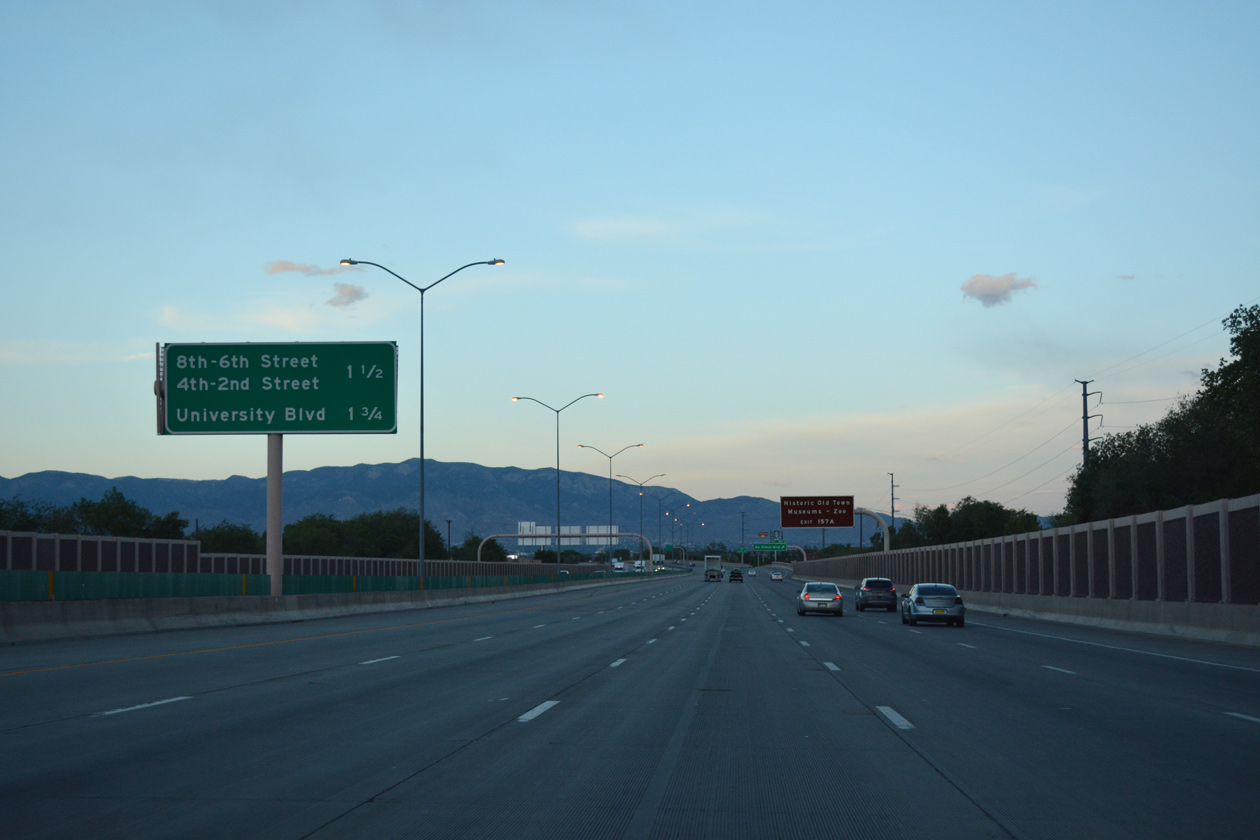
| 8th Street serves an industrial area east of 12th Street. 6th Street forms a one way couplet with 5th Street between I-40 at Near North Valley and Downtown Albuquerque. 04/27/17 |
|
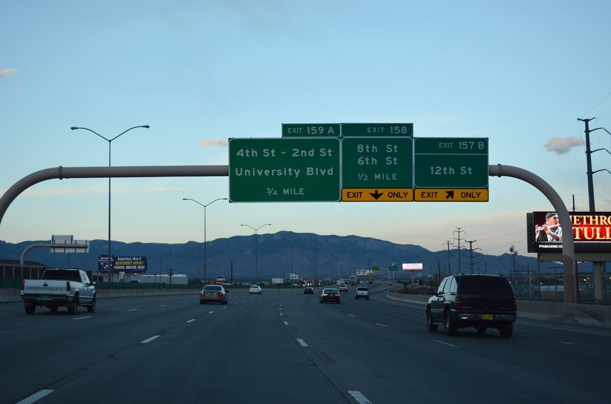
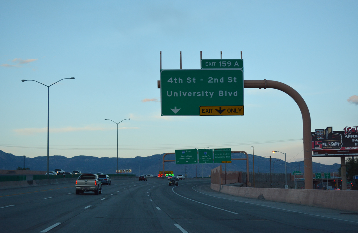
| Exit 159A constitutes a two lane flyover from eastbound I-40 to the intersection of Indian School Road and 4th Street by Coronado Park. 4th Street represents the pre-1937 route of U.S. 66 leading south through Downtown and north through Alameda. 04/27/17 |
|
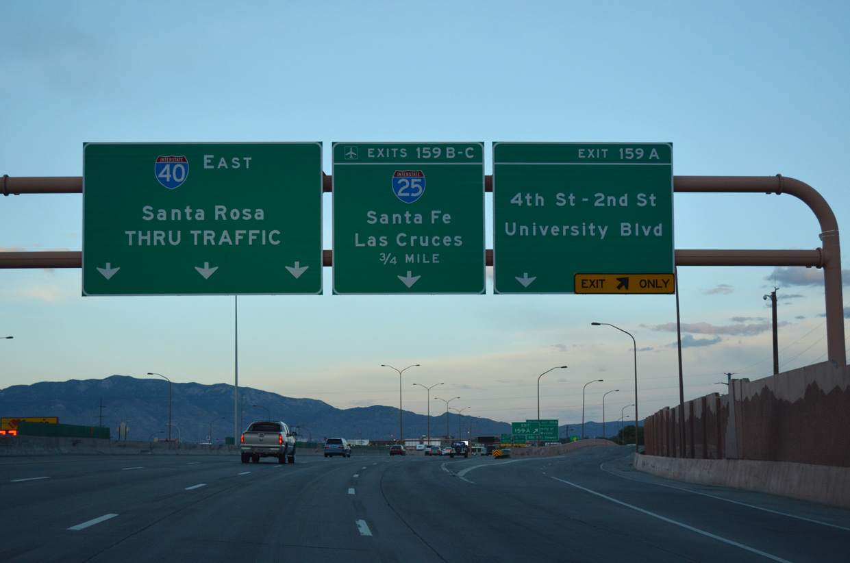
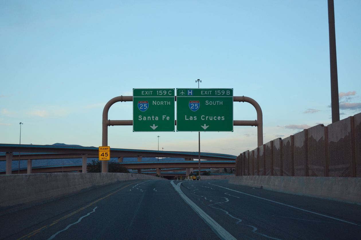
| Exit 159A parts ways with I-40 east for the frontage road system east to 2nd Street, Broadway Boulevard (former NM 47) and University Boulevard south to the University of New Mexico (UNM). Exit 159B follows with two lanes for Interstate 25 (Pan American Freeway). 04/27/17 |
|
| Interstate 25 joins Downtown and UNM with Rio Rancho and the northern suburbs in Sandoval County, Albuquerque International Sunport (ABQ), and South Valley. 04/27/17 |
|
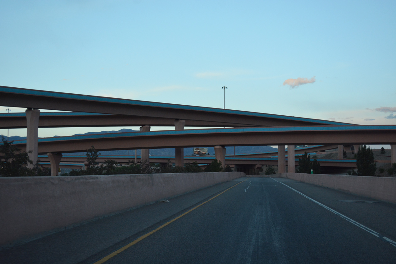
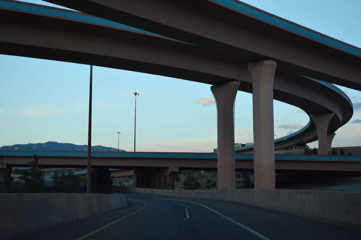
| The eastbound roadway expands to five lanes again leading into the "Big I" interchange (Exits 159B/C). 04/27/17 |
|
| Looking southward from Interstate 40 at the Downtown Albuquerque skyline. 06/29/08 |
|
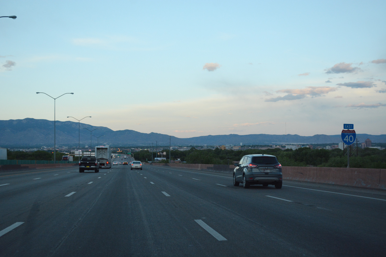
| Exits 159B/C depart in unison from I-40 east for Interstate 25. I-25 wholly replaced U.S. 85 from Las Cruces in southern New Mexico northward to Denver, Colorado. Within the Albuquerque metropolitan area, the Pan American Freeway joins the central business district with North Valley, Coralles and Bernalillo. 04/27/17 |
|
| Traffic separates for I-25 north to Santa Fe, Las Vegas and Pueblo, Colorado and I-25 south to Los Lunas, Belen and El Paso, Texas. Interstate 25 was completed in the state of New Mexico by 1980.4 04/27/17 |
|
| Completed in 1965, the exchange joining I-25/40 was rebuilt from June 30, 2000 to May 25, 2002. The $270 million "Big I" project replaced a low speed interchange with left side ramps into a multi level systems interchange.5 04/27/17 |
Page Updated 04-08-2019.

 East
East