


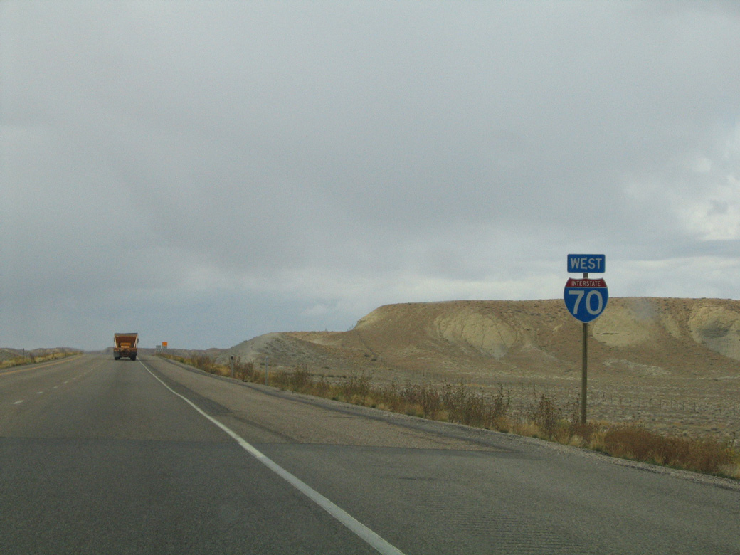
 West
West
I-70/U.S. 6-50 westbound enter Grand County, Utah from Mesa County, Colorado through arid Grand Valley.
08/16/13

Interstate 70 west into Utah is part of the Dinosaur Diamond Scenic Byway.
08/16/13

The Utah Welcome Center lies 40 miles west of the state line at mile marker 190.
08/16/13
08/16/13

U.S. 6 nationally is the Grand Army of the Republic Highway. This is the only sign acknowledging the U.S. 6 overlap along I-70 west in Utah.
08/16/13

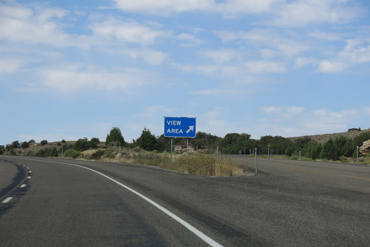
A vista point for the Book Cliffs and Grand Valley is next along I-70/U.S. 6-50 west beyond mile marker 229.
08/16/13

08/16/13

The diamond interchange at Exit 227 is the first of several ranch exits along Interstate 70 within the state of Utah.
08/16/13
08/16/13

Harley Dome Road connects Interstate 70 with parallel Old U.S. 6/50 from Exit 227.
08/16/13

Old Highway 6/50 lead northeast toward the Book Cliff area and Colorado state line while Down Harley Dome Road runs south through Coal Draw to the Westwater area.
08/16/13

Interstate 70 angles southwest across Coal Draw beyond Exit 227 through Grand Valley.
08/16/13

08/16/13

08/16/13
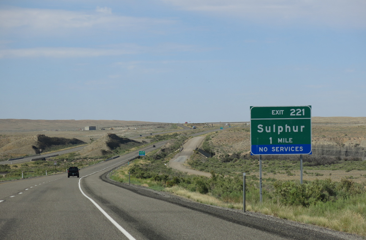
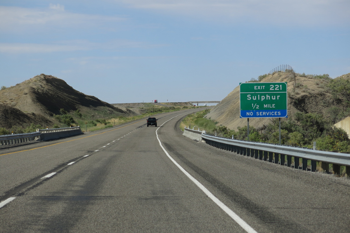
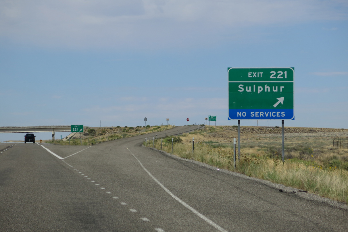
I-70/U.S. 6-50 curve southwest across Westwater Wash to the diamond interchange at Exit 221.
08/16/13
08/16/13
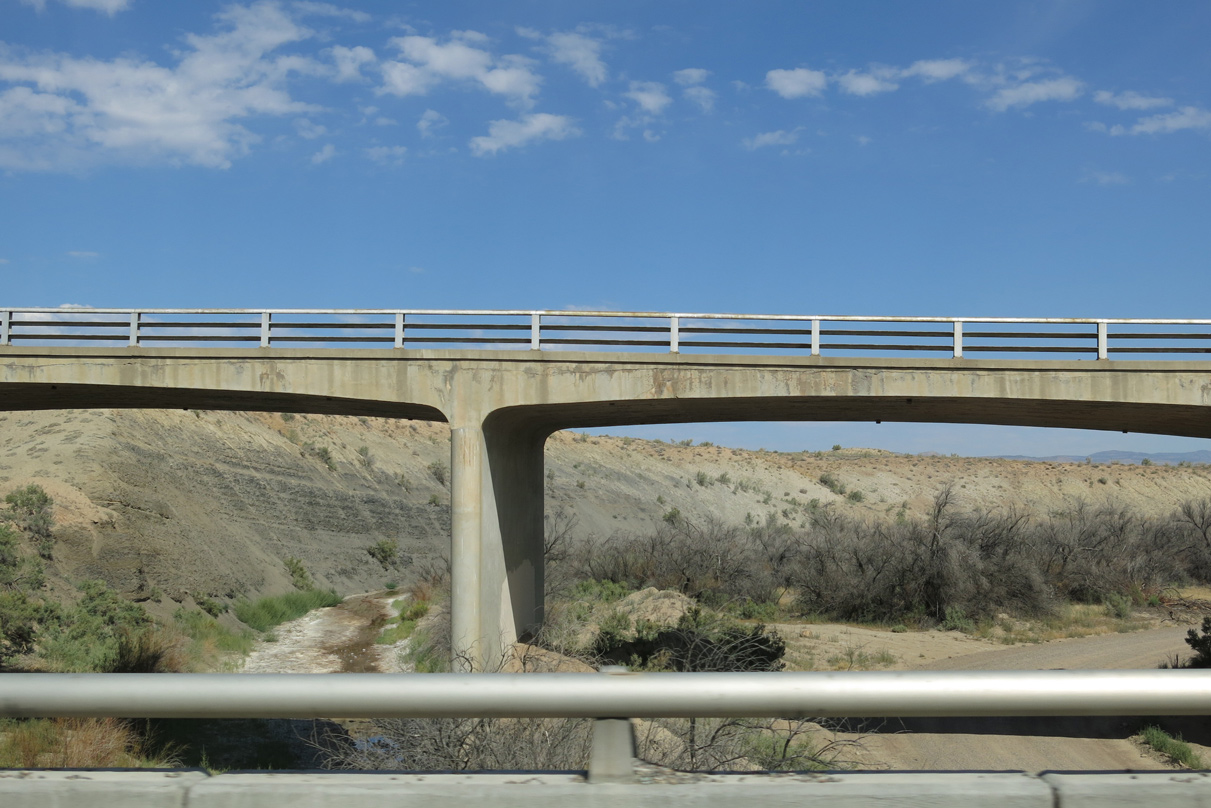
Adjacent to I-70 across Whitewater Wash is a concrete rigid frame bridge along old U.S. 6/50 built in 1952.1
08/16/13
08/16/13

08/16/13

08/16/13

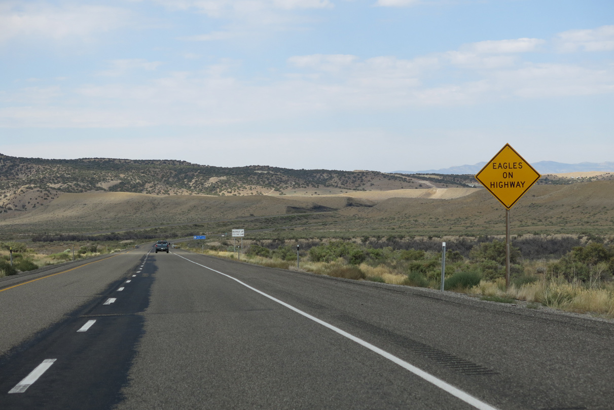
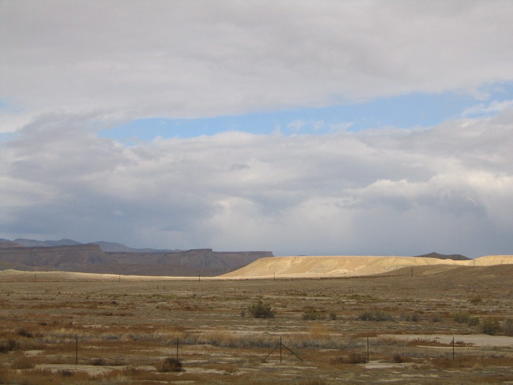
The Book Cliffs rise along the northern horizon beyond Grand Valley. Beyond them are the Roan Cliffs.
08/16/13

Formerly signed for Cisco, the diamond interchange at Exit 214 lies south of Danish Flat.
08/16/13

Old Cisco Road 7.95 miles south from Exit 214 to SR 128 formerly represented the northernmost stretch of that state route.
08/16/13

Old Cisco Highway (old U.S. 6/50) heads south across Danish Wash 5.5 miles to Cisco. Cottonwood Road stems north toward the Book Cliffs.
08/16/13

08/16/13

Cisco Mesa (el. 4,885 feet) rises west of Danish Flat and south of the Book Cliffs.
08/16/13

08/16/13

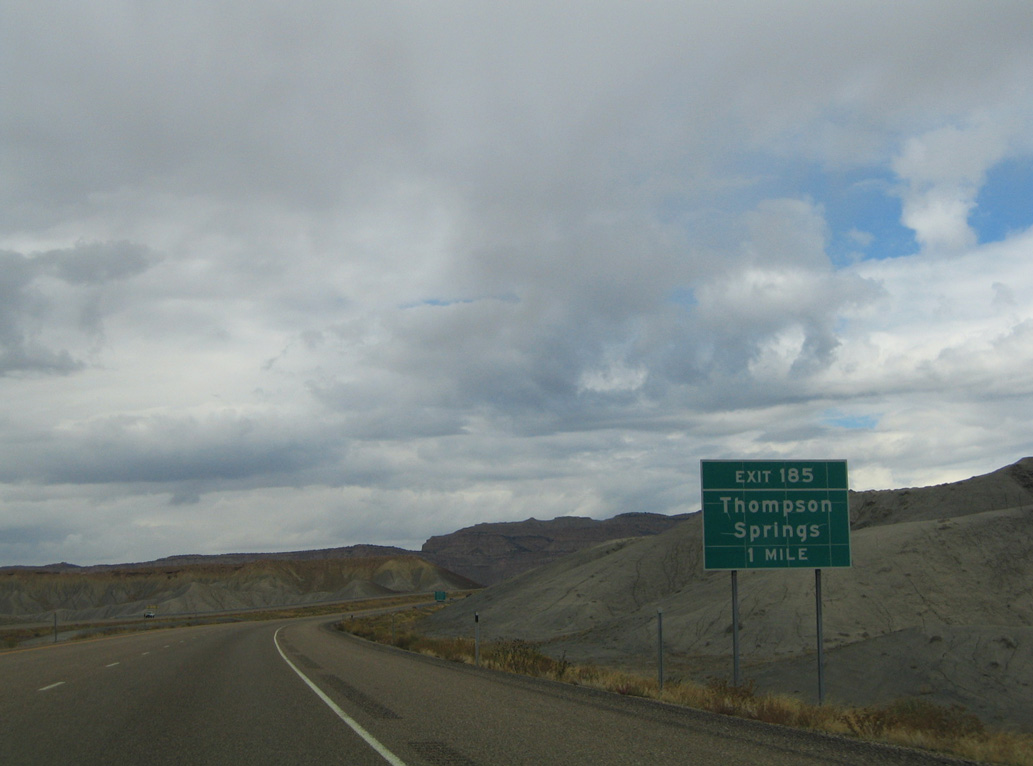
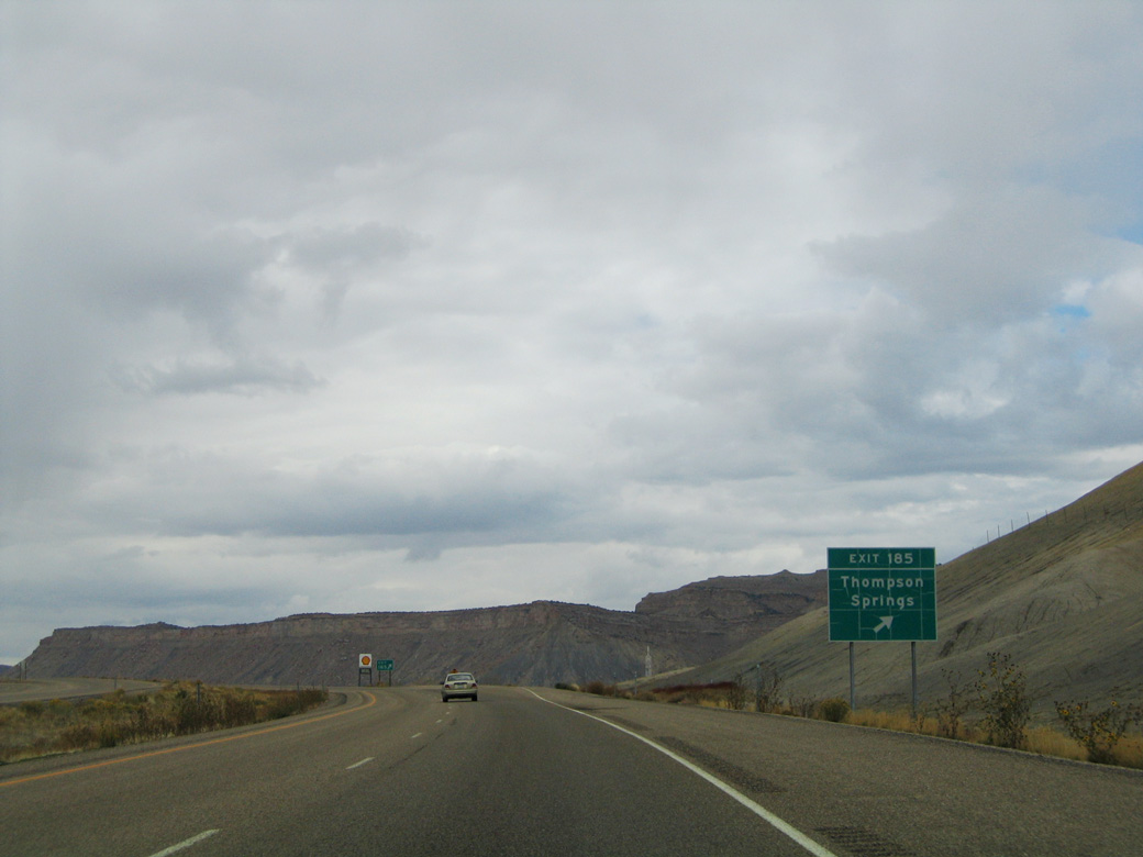
Thompson Springs is 22 miles west of Cisco Wash along Interstate 70.
08/16/13

The bridges across Cisco Wash on Interstate 70 were built in 1971.
08/16/13

Interstate 70 southeast of Windy Mesa.
08/16/13

The diamond interchange (Exit 204) with the north end of SR 128 lies just south of the Union Pacific Railroad siding of White House.
08/16/13

SR 128 runs 3.04 miles east along former U.S. 6-50 toward Cisco before turning south toward the Colorado River valley. SR 128 parallels the river southwest to Dewey and Arches National Park.
08/16/13

SR 128 travels 44.59 miles overall between I-70/U.S. 6-50 at Exit 204 and U.S. 191 near Moab.
08/16/13

SR 128 provides one of two routes from Interstate 70 to Moab, the seat of Grand County.
08/16/13
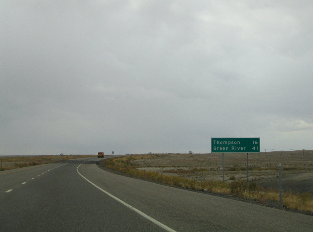
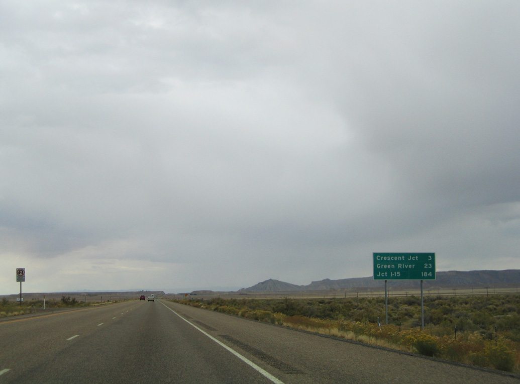
Staying south of old U.S. 6/50 and the Union Pacific Railroad, Interstate 70 advances 16 miles west to Thompson Springs and 41 miles to Green River.
10/18/04

Old Cisco Highway (former U.S. 6) span Pinto Wash along the north side of I-70 across a concrete tee beam bridge built in 1950.2
10/18/04

I-70/U.S. 6-50 bee line across Elba Flat.
10/18/04

The Book Cliffs
10/18/04

10/18/04

Originally numbered Exit 190, the diamond interchange for Yellowcat is a ranch exit.
10/18/04

Exit 193 leaves I-70/U.S. 6-50 west for Yellow Cat Road beyond Sagers Flat and Sagers Wash.
10/18/04
10/18/04

190 miles of I-70 remain to the junction with Interstate 15 at Cove Fort, west of the Pahvant Range.
10/18/04
10/18/04

10/18/04
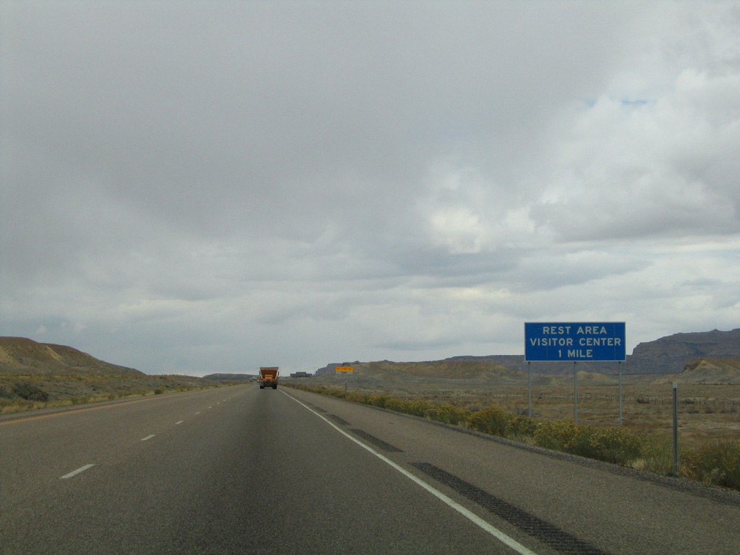
The tourist information at mile marker 190 is the first rest area along Interstate 70 west in Utah.
10/18/04

10/18/04
Unmarked on guide signs for Exit 187, SR 94 (Thompson Canyon Road) stems north from Exit 187 to Old Cisco Highway (old U.S. 6) in the community of Thompson Springs.
10/18/04

SR 94 parallels Thompson Wash to the east along a 0.96 mile long course to Old Cisco Highway.
10/18/04
Salt Valley Gorge Road extends south from the diamond interchange (Exit 187) joining I-70/U.S 6-50 with SR 94 (Thompson Canyon Road).
10/18/04

10/18/04
10/18/04

Ramps at the former weigh stations along Interstate 70 remain in place at mile marker 186.
10/18/04

10/18/04

U.S. 191 ties into I-70/U.S. 6-50 at Crescent Junction. U.S. 191 travels 27 miles south to Arches National Park and 31 miles to Moab.
10/18/04

U.S. 191 north combines with I-70/U.S. 6-50 west for 24.2 miles through Green River. Like U.S. 6/50, U.S. 191 is vastly unsigned along the concurrency.
10/18/04

U.S. 191 serves not only Arches National Park, but also Canyonlands National Park via connections with SR 313 and SR 211.
10/18/04
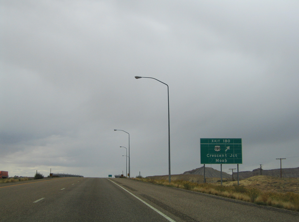
Exit 180 leaves Interstate 70 west for U.S. 191 south to Moab, La Sal Junction and Monticello. U.S. 191 enters Arizona at the Navajo Indian Reservation. 157.29 miles to the south.
10/18/04

Old Cisco Highway (old U.S. 6) connects with the diamond interchange at Exit 182 from Crescent Flat to the northeast.
10/18/04

U.S. 191 shield posted at Exit 182 and Crescent Junction.
10/18/04

Sources:
- Westwater Wash Bridge. BridgeHunter.com.
- Pinto Wash Bridge. BridgeHunter.com.
Photo Credits:
10/18/04, 08/16/13 by AARoads
Connect with:
U.S. 191
Page Updated 02-19-2022.