|
| Interstate 270 constitutes a seven mile long urban loop from Exit 279A north to I-25 and U.S. 36 (Denver-Boulder Turnpike) near Thornton and Westminster. 04/22/17 |
|
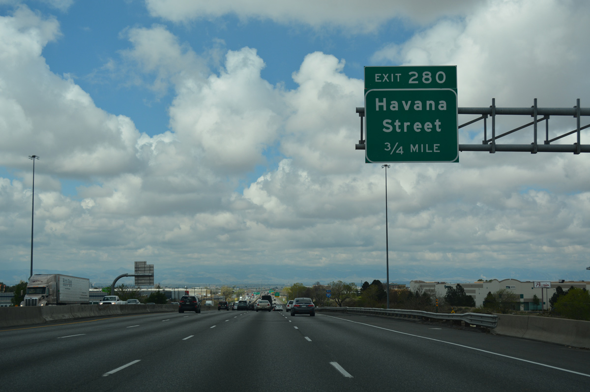
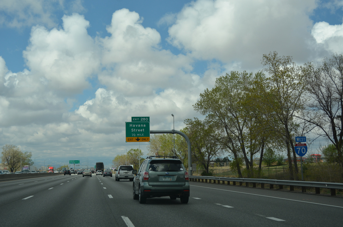
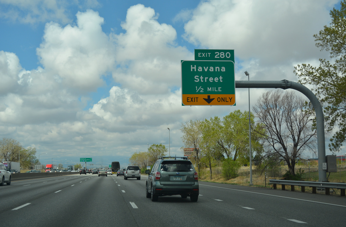
| Forthcoming Havana Street runs through the western edge of the Stapleton industrial area. Back when Stapleton International Airport was in operation, there used to be a runway that crossed over I-70 just west of Exit 280 with Havana Street. That overpass was subsequently demolished after the airport closed. 04/22/17 |
|
| A number of warehouses and distributor centers spread both north and south of Interstate 70 between Peoria and Havana Streets. 04/22/17 |
|
| The Peoria Street entrance ramp from Montbello forms an auxiliary lane west to Exit 280. 04/22/17 |
|
| Havana Street heads south from Exit 280 to Iola Street and North Aurora. A separate section of the street south from Colfax Avenue in Arapahoe County is a part of SH 30. SH 30 lines the commercial boulevard from 6th Avenue south to where Havana Street makes a 90-degree turn west onto Hampden Avenue. 04/22/17 |
|
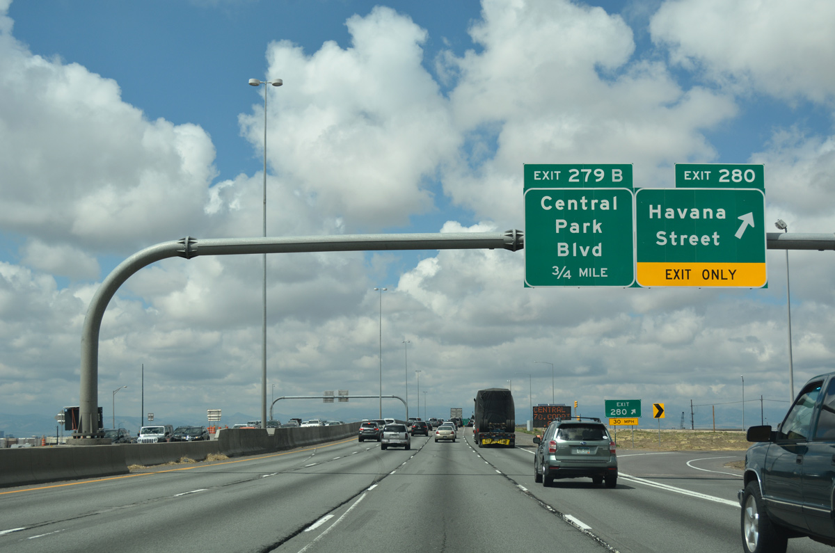
| Back to back off-ramps depart in one mile for Central Park Boulevard to the Northfield commercial area of Stapleton, and Interstate 270 northwest to Commerce City and I-76 at the North Washington industrial area. 04/22/17 |
|
| Westbound I-70 enters the folded diamond interchange (Exit 280) with Havana Street. Havana Street south from Colfax Avenue (Business Loop I-70) to Hampden in Denver, and Hampden Avenue west to I-25 at University Hills represents the northern extension of U.S. 285 designated between 1970-79. 04/22/17 |
|
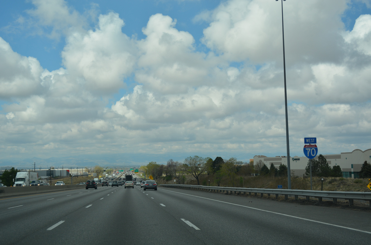
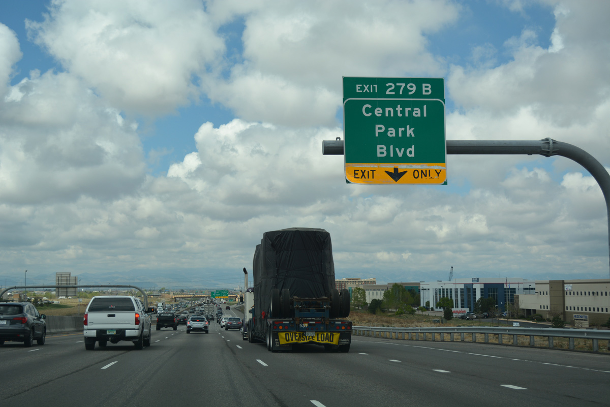
| A fifth westbound lane opens along I-70 west from Havana Street to Exit 279B with Central Park Boulevard. Central Park Boulevard is an arterial serving the Stapleton redevelopment area. 04/22/17 |
|
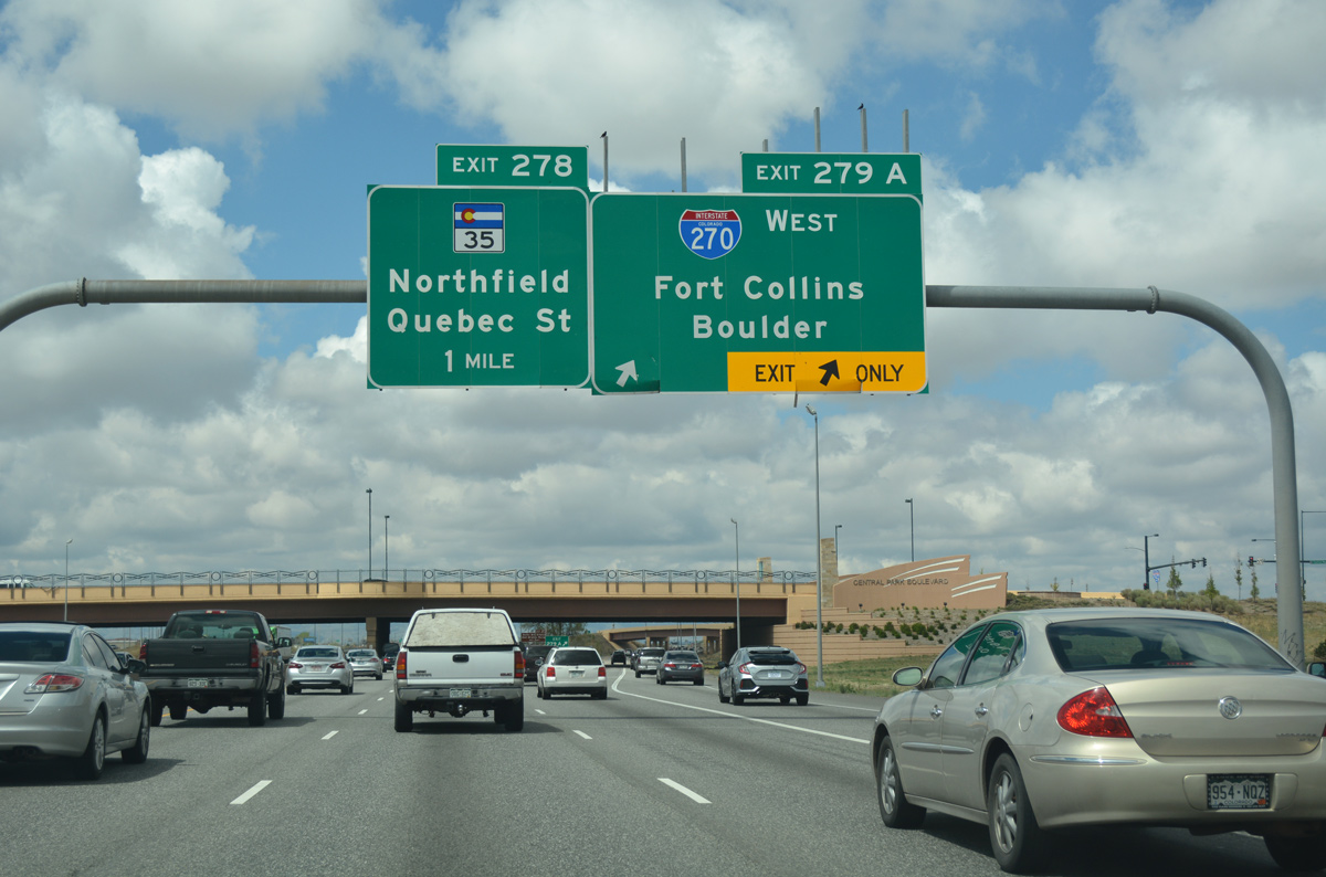
| The diamond interchange (Exit 279B) with Central Park Boulevard opened to traffic in October 2011. Work on the exchange included adding slip ramps to the adjacent wye interchange (Exit 279A) with Interstate 270 west. 04/22/17 |
|
| Interstate 270 serves truck traffic to Commerce City, commuters to Broomfield and the northwest, and airport travelers from the I-25 corridor. Exit 279A represents the westbound split of U.S. 36 from I-70 to Boulder. 04/22/17 |
|
| The Central Park Boulevard overpass accommodates six overall lanes with 12 foot wide sidewalks and bike lanes. The arterial was built along the footprint of the original Stapleton Airport runway over I-70. 04/22/17 |
|
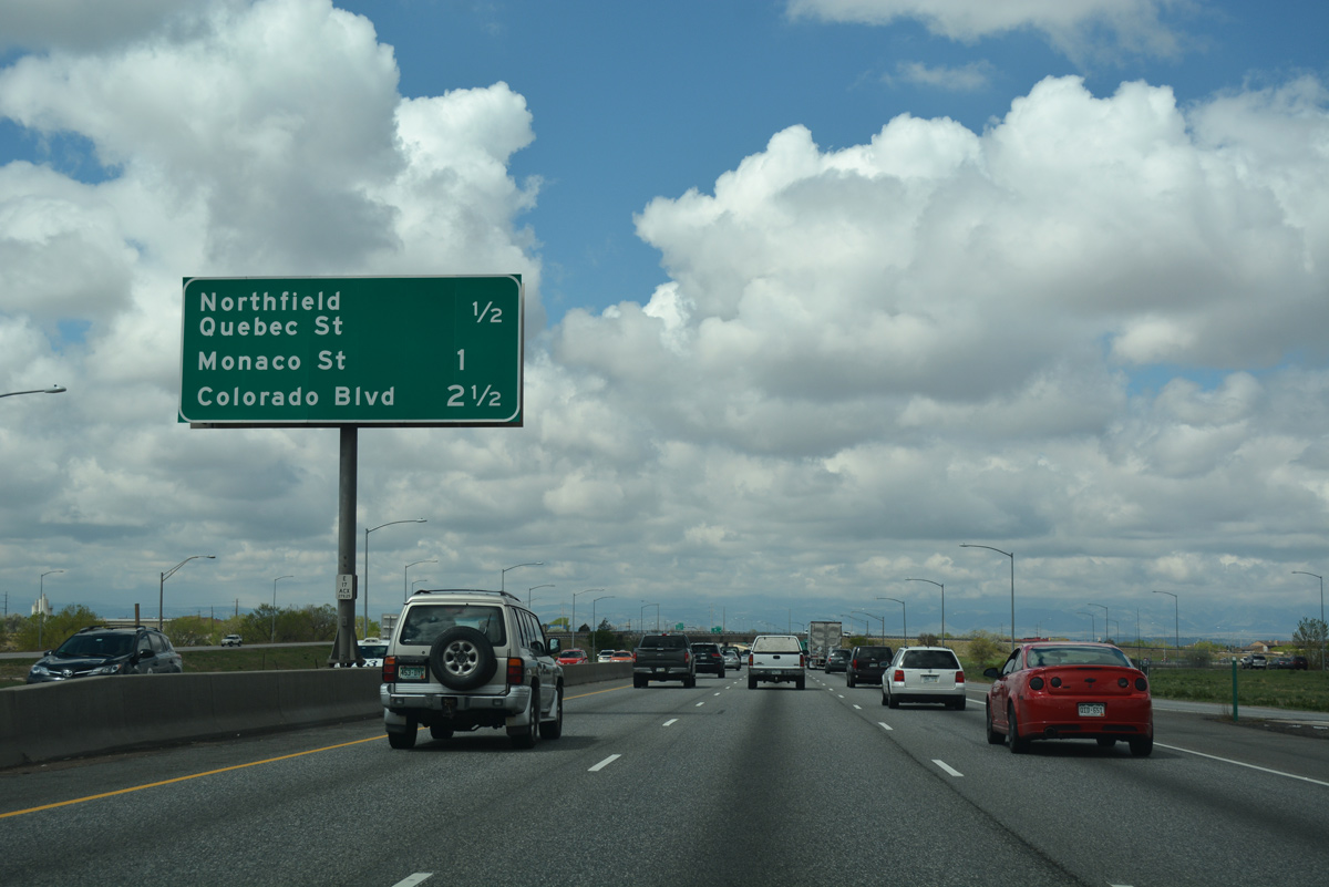
| The succeeding exit connects I-70 with SH 35 (Quebec Street), which used to be the main route for the Stapleton International Airport passenger terminal to the south. Beyond Quebec Street is Exit 277 in the Northeast Park Hill neighborhood of Denver. 04/22/17 |
|
| Quebec Street leads north to Northfield Boulevard and Dick's Sporting Goods (DSG) Park, home of the MLS Colorado Rapids franchise. South from Exit 278, Quebec Street heads to the South Park Hill neighborhood and Johnson & Wales University. 04/22/17 |
|
| Only a 1.269 mile segment of SH 35 remains along Quebec Street north from Exit 278 to E 53rd Place. Formerly SH 35 extended south to Martin Luther King, Jr. Boulevard, the former entrance to Stapleton Airport. That portion was truncated by 2005. 04/22/17 |
|
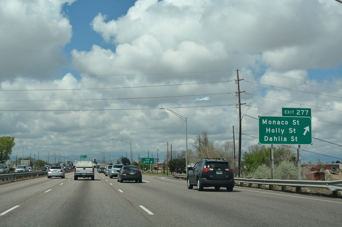
| Interstate 70 elevates to span a Denver Rock Island Railroad (DRIR) line just ahead of the split diamond interchange (Exit 277) with the Stapleton Drive frontage road system. 04/22/17 |
|
| Monaco, Holly and Dahlia Streets intersect Stapleton Drive over the course of 1.1 miles through a warehouse district in Northeast Park Hill. 04/22/17 |
|
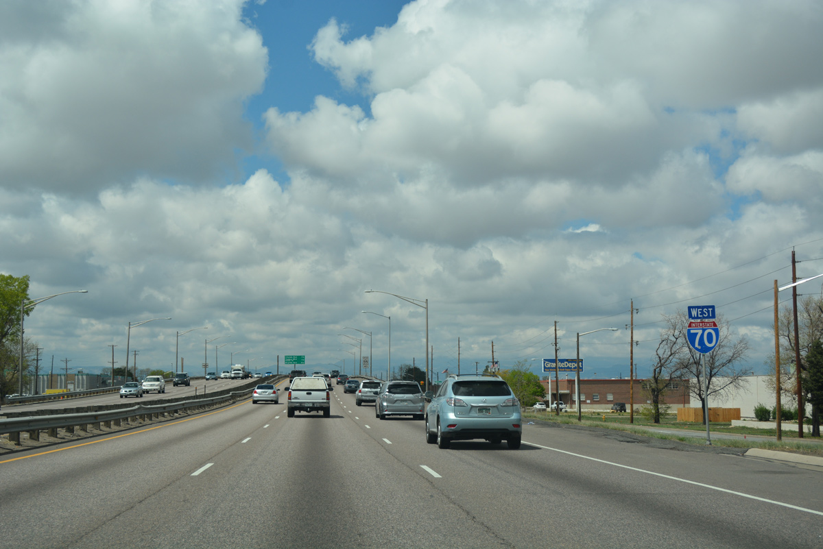
| Interstate 70 continues west with six overall lanes through the Northeast Park Hill area. This stretch was completed in 1964, and being rebuilt as part of the Central 70 Project from 2018 to 2023. 04/22/17 |
|
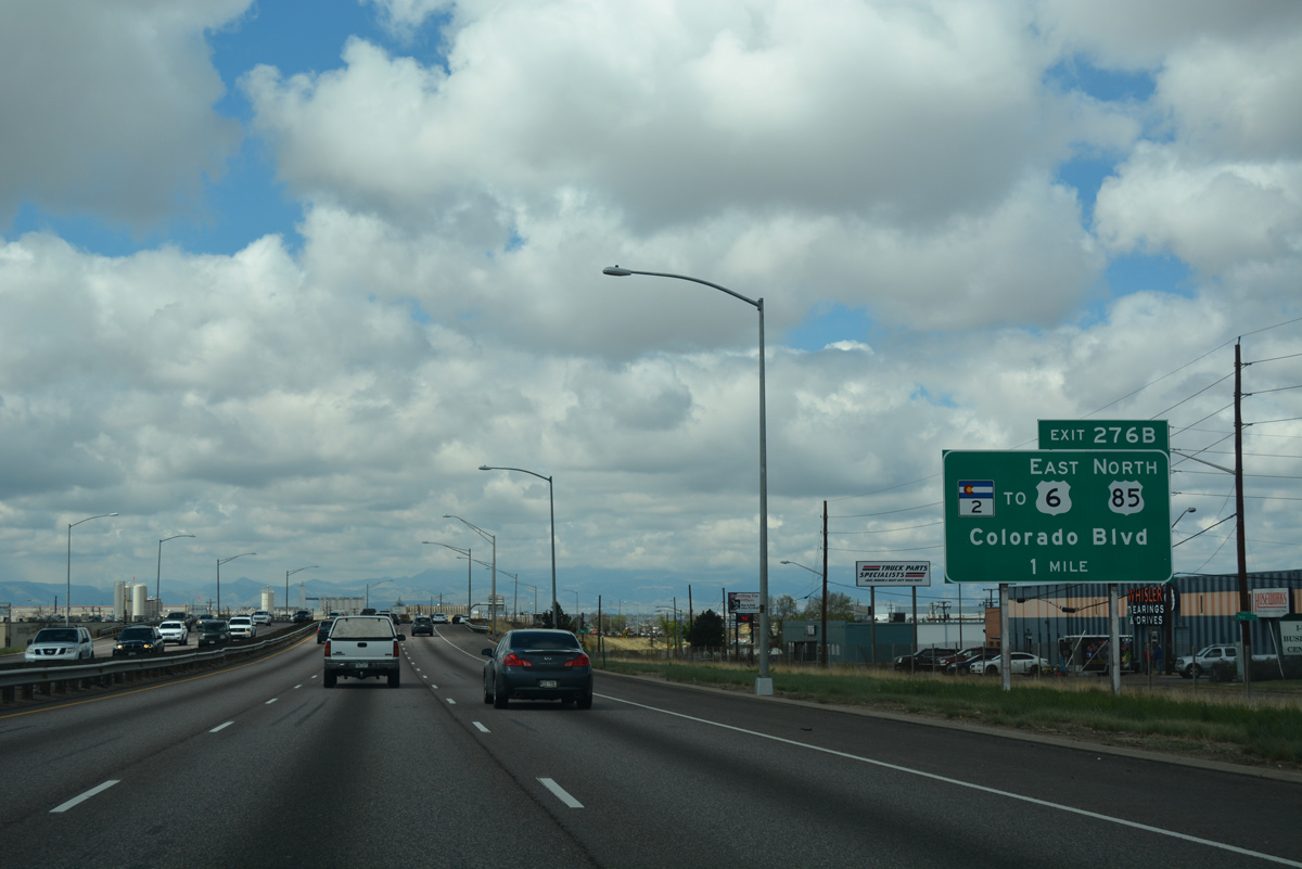
| The Central 70 Project adds tolled Express Lanes along I-70 west from Quebec Street. Work also reconfigured the parclo interchange (Exit 276B) with Colorado Boulevard into a diamond interchange. 04/22/17 |
|
| SH 2 follows a major north to south arterial route (Colorado Boulevard) through Denver, skirting the eastern edge of Denver City Park and serving Glendale before meeting Interstate 25 southeast of Cherry Creek. 04/22/17 |
|
| Colorado Boulevard connects I-70 westbound with U.S. 6-85 (Vasquez Boulevard) just north of Exit 276B. SH 2 combines with U.S. 6-85 for 1.1 miles north to Interstate 270 in Commerce City. 04/22/17 |
|
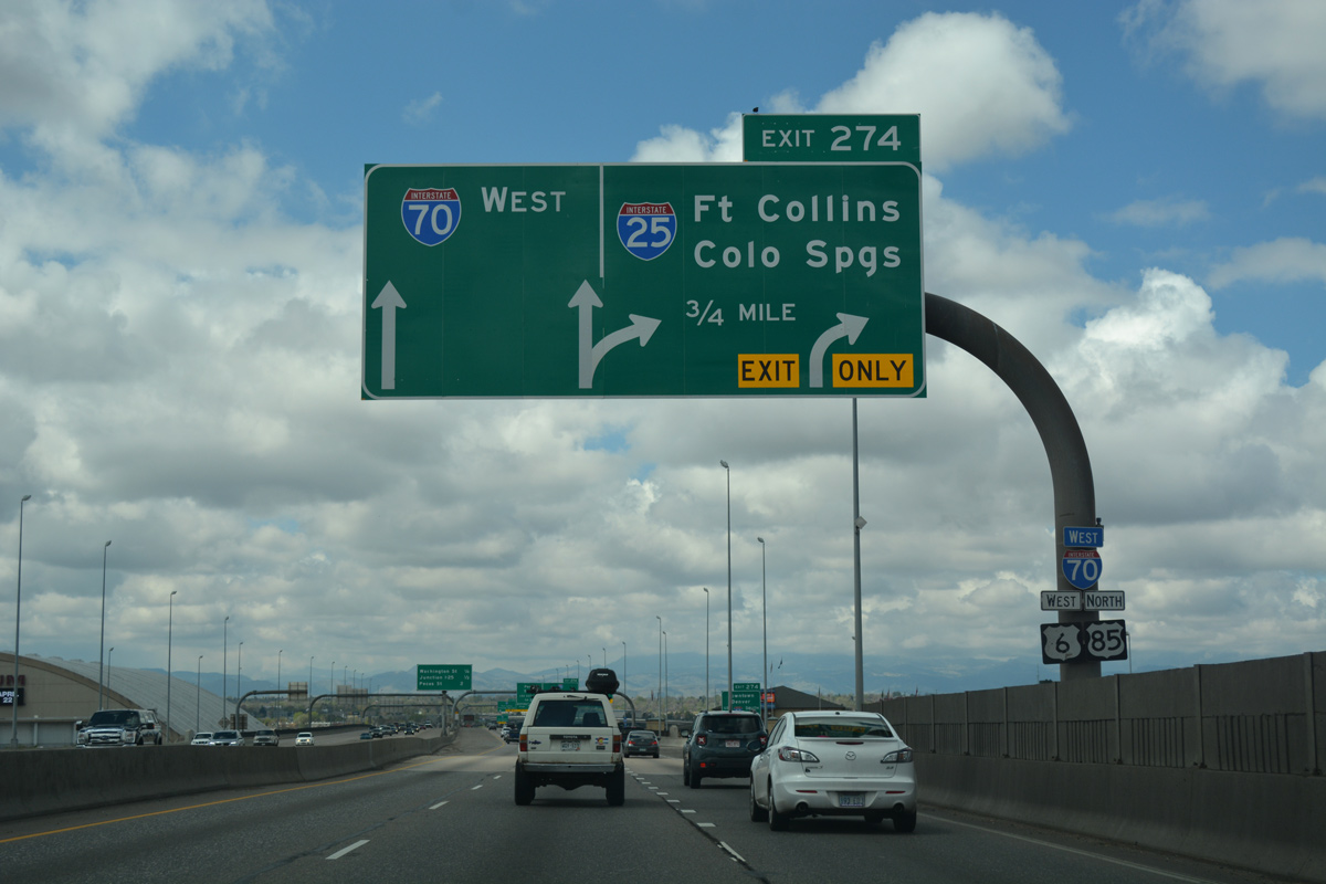
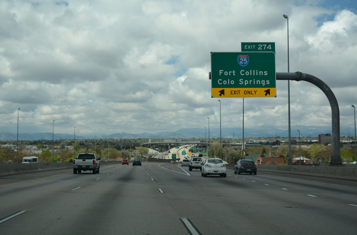
| Advancing west from the SH 2 (Colorado Boulevard) overpass, I-70 meets Interstate 25 at the Mousetrap Interchange (Exit 274) in 2.25 miles. 04/22/17 |
|
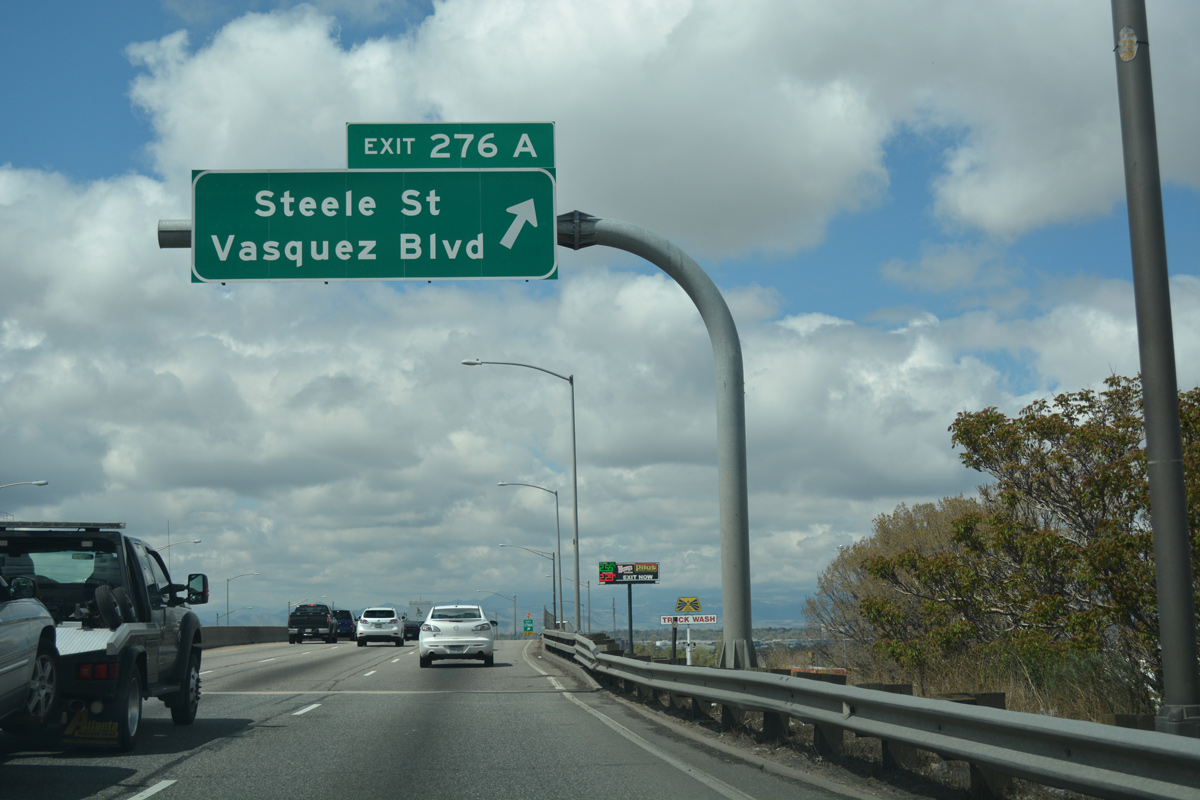
| The Central 70 Project eliminated Exit 276A from I-70 westbound, instead directing traffic to Steele Street onto a rebuilt frontage road. Steele Street ties into U.S. 6/85 (Vasquez Boulevard) just north of I-70 in the Elyria Swansea neighborhood. Steele Street south leads to Clayton and Skyland. 04/22/17 |
|
| An older shield assembly referenced the overlap with U.S. 6 west and U.S. 85 south to Interstate 25 south. CDOT generally does not sign overlaps, and U.S. 6/85 are not acknowledged along I-25. 04/22/17 |
|
| Diamond interchanges at Exit 275B with Brighton Boulevard (SH 265) and Exit 275A with Washington Street precede the junction with Interstate 25 on I-70 west. 04/22/17 |
|
| Built in 1964, the viaduct carrying I-70 through the Elyra Swansea neighborhood was demolished and replaced with below grade roadways as part of the Central 70 project. Including Express toll lanes, a lid was constructed above the freeway between Clayton and Columbine Streets. 04/22/17 |
|
| The elevated lanes of I-70/U.S. 6-85 traveled above 46th Avenue, which served local traffic through Elyria Swansea. Originally designated as SH 72, this viaduct (46th Avenue Expressway) was well known for delays, especially due to poor site distance between the entrance and exit ramps, as well as limited acceleration and deceleration lanes. 04/22/17 |
|
| Brighton Boulevard angles southwest from Exit 275B and Denver Coliseum to Broadway south through Five Points in central Denver. Broadway leads south to connecting streets with Coors Field (home of the Colorado Rockies MLB team) and North Capitol Hill. Both Brighton Boulevard and Broadway were a part of the old U.S. 6-85 alignment before the two routes were transferred onto the freeway system. 04/22/17 |
|
| Vasquez Boulevard is paralleled by Brighton Boulevard (SH 265), which offers an alternate route to U.S. 6-85 between I-70 and I-76. Split into two segments, SH 265 overlays Brighton Boulevard for 2.56 miles north to U.S. 6/85 in Commerce City. 04/22/17 |
|
| Two lanes depart from I-70 west at Exit 274 for Interstate 25 north to Fort Collins and Cheyenne, Wyoming and south to Colorado Springs and Pueblo. Prior to staged reconstruction from 1987 to 2003, the Mousetrap Interchange was substandard with left side ramps. 04/22/17 |
|
| Interstate 25 south parallels the South Platte River as it wraps around Downtown Denver along the Valley Highway (U.S. 85-87). 04/22/17 |
|
| Remaining elevated, I-70/U.S. 6-85 span a junction of the BNSF Railroad line and the South Platte River to Exit 275A for Washington Street. Washington Street turns north from Five Points through the Globeville area east of I-25. 07/04/12 |
|
| Exit 275A lowers from Interstate 70 west to Washington Street, which parallels I-25 north to the Adams County community of North Washington. Interstate 25 constitutes a busy commuter route, serving suburbs from Thornton to Loveland and Greeley. 04/22/17 |
|
| Westbound I-70 enters the turbine interchange (Exit 274) with Interstate 25 north to Fort Collins and south to Downtown and Colorado Springs. U.S. 6/85 depart I-70 west to overlap with I-25 south to the 6th Avenue freeway and Santa Fe Drive respectively. 04/22/17 |
|
| Continuing from the Mousetrap Interchange, I-70 enters the Chaffee Park and Sunnyside communities of Denver at Exit 273. 04/22/17 |
|
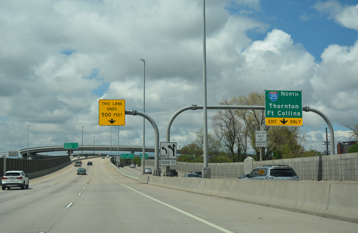
| The I-70 mainline reduces to two through lanes above Interstate 25. The exchange with I-25 (Valley Highway) was built in 1951, and referred to as the Mousetrap Interchange by the locals and the media from the 1960s onward.1 04/22/17 |
|
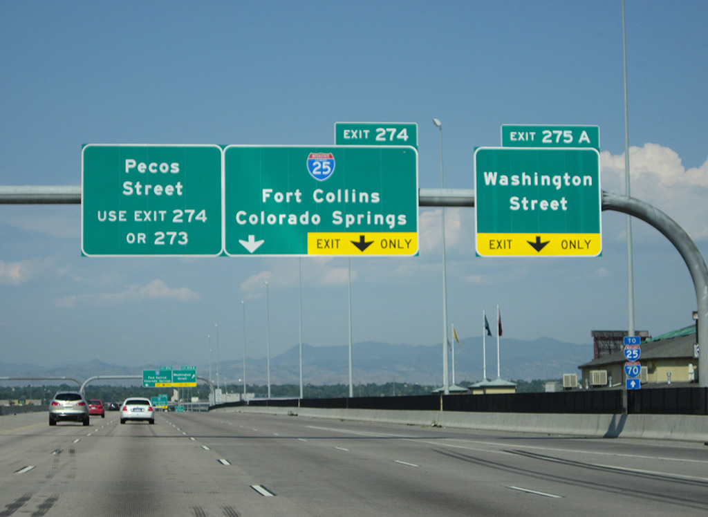
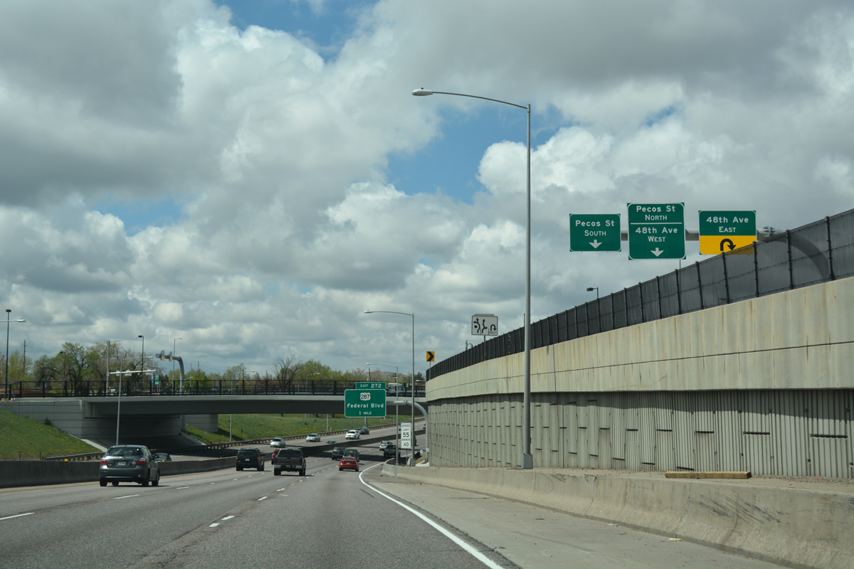
| A dumbbell interchange (Exit 273) connects Interstate 70 with Pecos Street in one mile. U.S. 287 follows at Exit 272 at Berkeley. 04/22/17 |
|
| Ramps from Washington Street and I-25 north form a collector distributor roadway along I-70 westbound to Pecos Street. I-70 was originally intended to end at I-25 per 1956 Interstate Highway plans, but the extension to Utah was authorized in 1958. The freeway west to U.S. 287 was completed in December 1965. 04/23/17 |
|
| Exit 273 leaves Interstate 70 west for both Pecos Street and adjacent 48th Avenue. Pecos Street travels north to unincorporated Adams County and I-76 and south to the Highland community at 32nd Avenue, near I-25. 04/23/17 |
|
| An $18 million CDOT project both replaced the Pecos Street overpass across Interstate 70 and added roundabouts at both the north and south side ramps. Work ran from November 2012 to October 2013.2 04/22/17 |
|
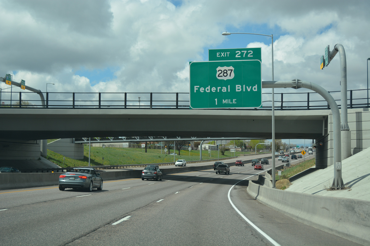
| U.S. 287 (Federal Boulevard) separates the Chaffee Park and Regis communities north from Exit 272 to Interstate 76 (Exit 3) and Berkley in adjacent Adams County. 04/22/17 |
|
| Reassurance marker posted ahead of the Zuni Street underpass. 48th Avenue forms frontage streets along both sides of the six lane freeway here. 04/23/17 |
|
| Interchange sequence sign listing the three exits to the Regis community of north Denver from Interstate 70 westbound. 04/23/17 |
|
| U.S. 287 is a major route, serving most communities on the Front Range between Denver and Fort Collins, including Westminster, Lafayette, Longmont, Berthoud and Loveland. Through Denver, U.S. 287 follows Federal Boulevard south to Sloan Lake, Jefferson Park and Colfax Avenue (U.S. 40) at Sun Valley. U.S. 40/287 overlap east with Business Loop I-70 through central Denver to I-70 at Exit 288 in east Aurora. 04/23/17 |
|
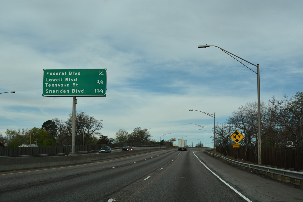
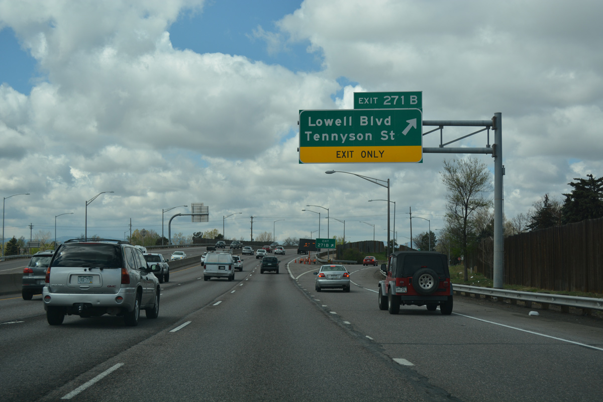
| Interstate 70 lowers below U.S. 287 (Federal Boulevard) ahead of Rocky Mountain Lake Park and the half diamond interchange (Exit 271B) with Lowell Boulevard. 04/22/17 |
|
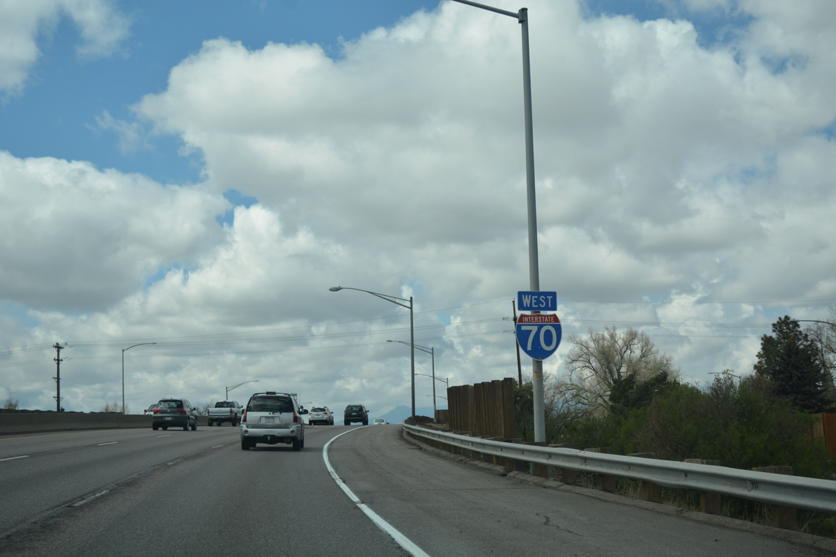
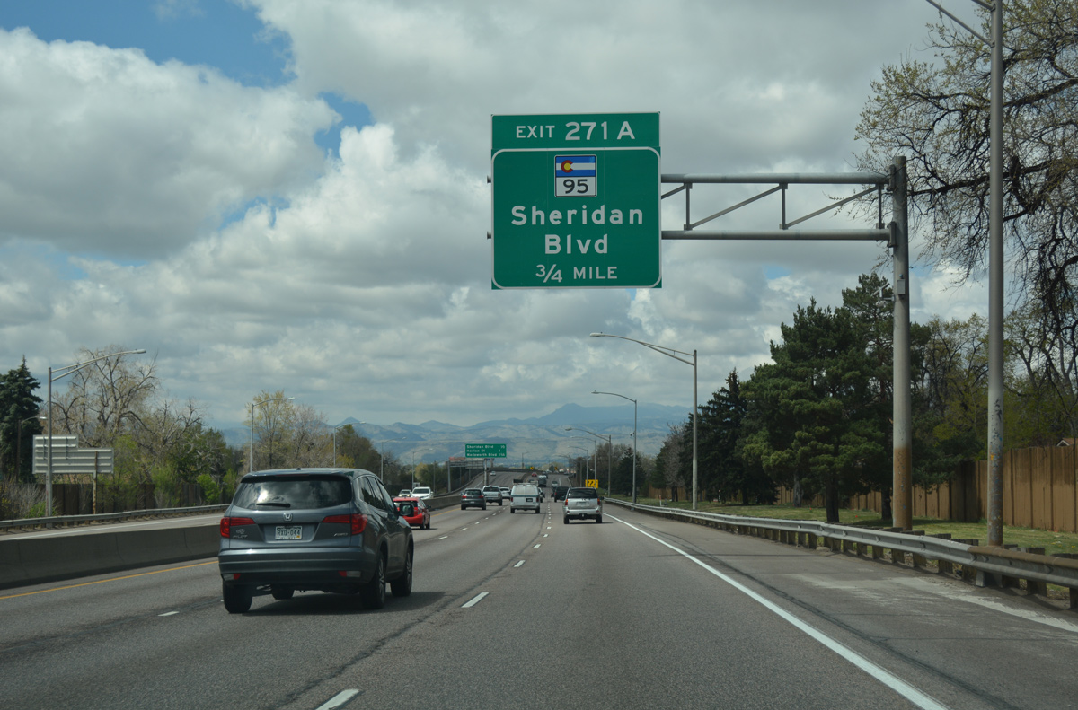
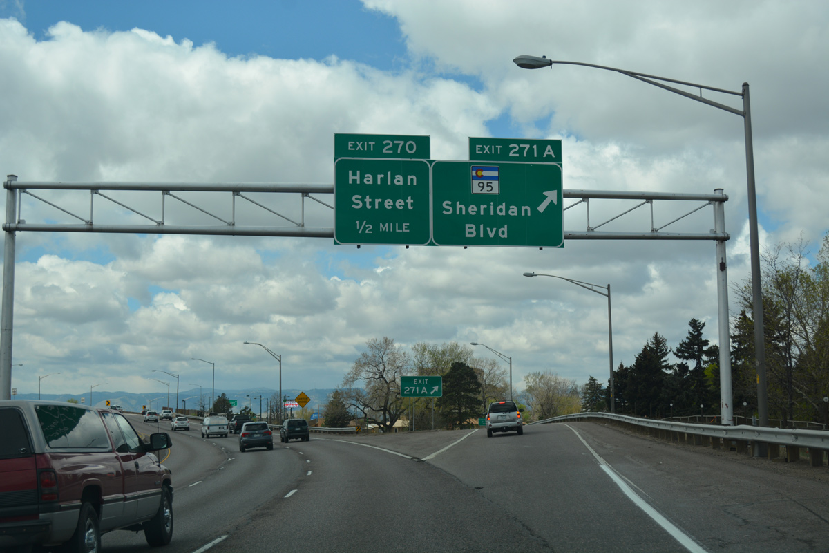
| Westbound I-70 leaves the Denver city limits beyond Harlan Street in two miles. SH 95 (Sheridan Boulevard) meets the freeway at Exit 271A in 1.25 miles at Berkeley Lake Park. 04/22/17 |
|
| Lowell Boulevard heads north to Regis University and Berkley in Adams County and south to Berkeley and West Highland. Tennyson Street parallels to the west by the Willis Case Golf Course. 04/22/17 |
|
| I-70 elevates to span Lowell Boulevard by this shield assembly. CDOT recorded 107,000 vehicles per day (vpd) along this stretch in 2015. 04/22/17 |
|
| Forthcoming SH 95 (Sheridan Boulevard) generally acts as the boundary between the city/county of Denver to the east and Jefferson County to the west. 04/22/17 |
|
| Beyond SH 95 (Sheridan Boulevard), I-70 briefly enters the town of Lakeside to Harlan Street at Exit 270, before entering northeast Wheat Ridge. 04/22/17 |
|
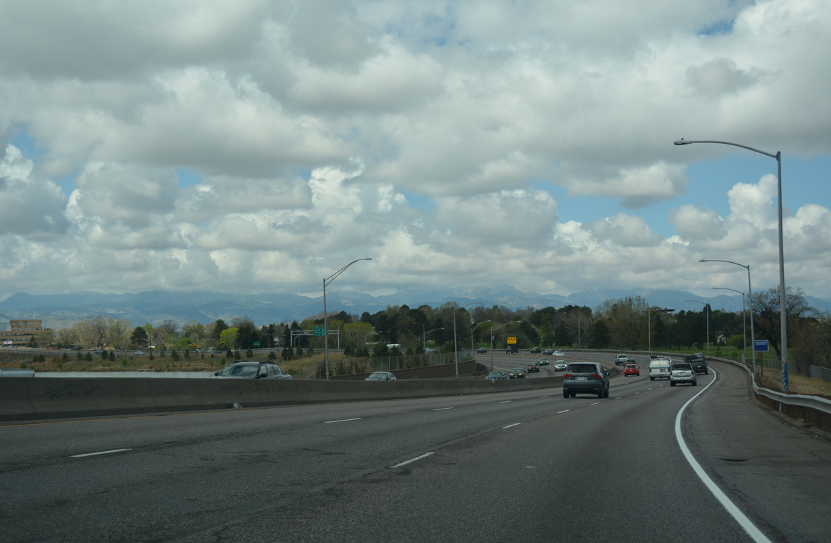
| Succeeding S-curves encircle the north side of Berkeley Lake along Interstate 70 west between Tennyson Street and the parclo interchange (Exit 271A) with Sheridan Boulevard. 04/22/17 |
|
| Westbound Interstate 70 reaches Exit 271A to SH 95 ( Sheridan Boulevard). West of here, former SH 72 used to turn north onto Marshall Street and northwest via Ralston Street into Arvada. SH 72 begins at the Ward Road interchange (Exit 266). 04/22/17 |
Page Updated 02-01-2022.


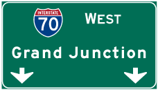
 West
West


 West
West  South
South