|
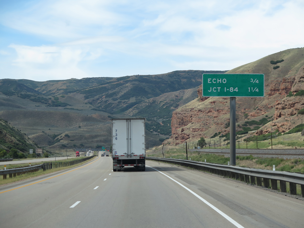
| Descending toward Echo Reservoir and the settlement of Echo (Exit 169) on Interstate 80 westbound after the Echo Canyon Welcome Center. Paralleling the freeway to the north is Echo Canyon Road (old U.S. 30S/189) and the Union Pacific Railroad line. 08/25/14 |
|
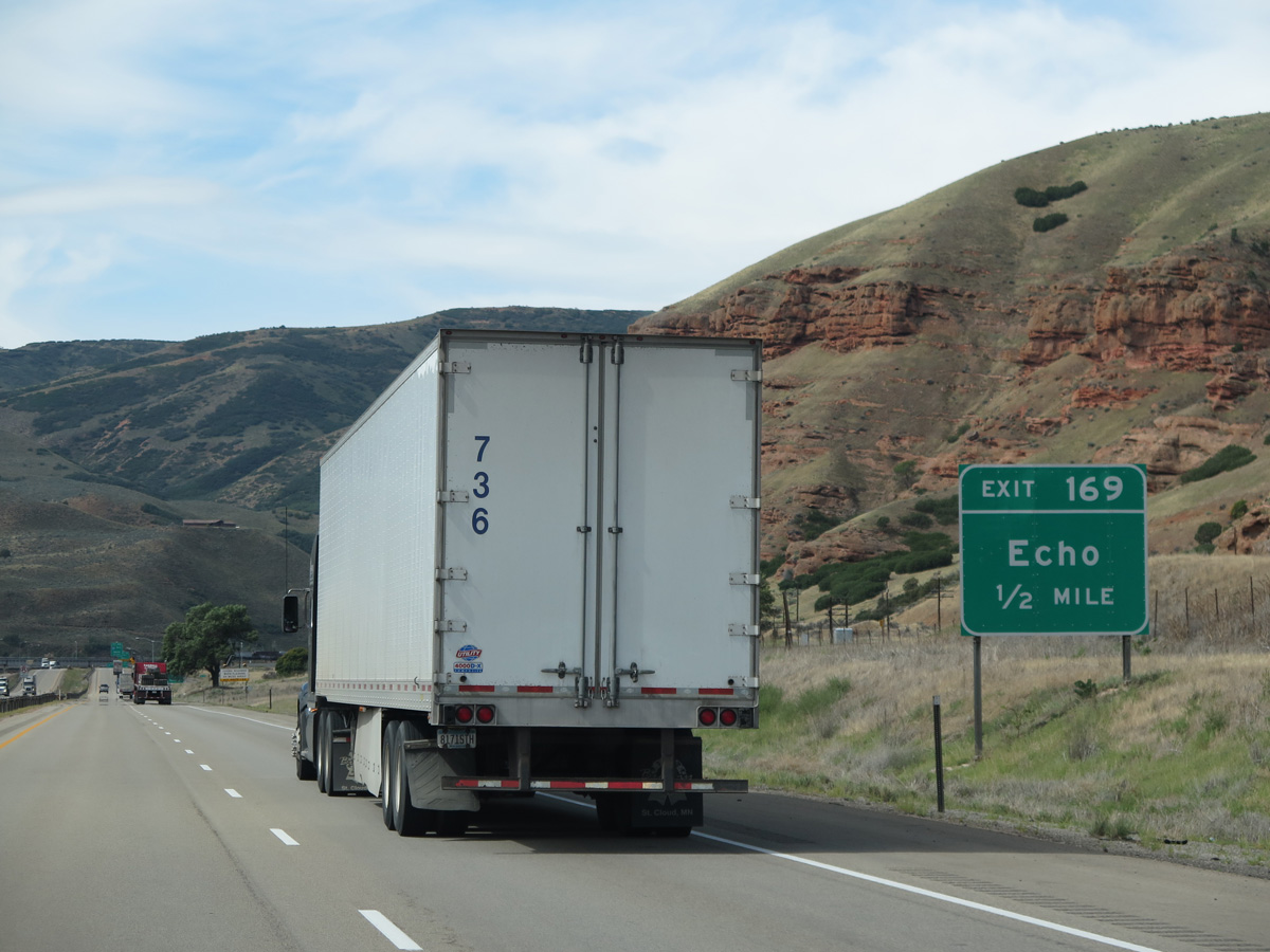
| A diamond interchange (Exit 169) joins I-80 with Echo Dam Road adjacent to both Echo and Echo Canyon Roads in one half mile. 08/25/14 |
|
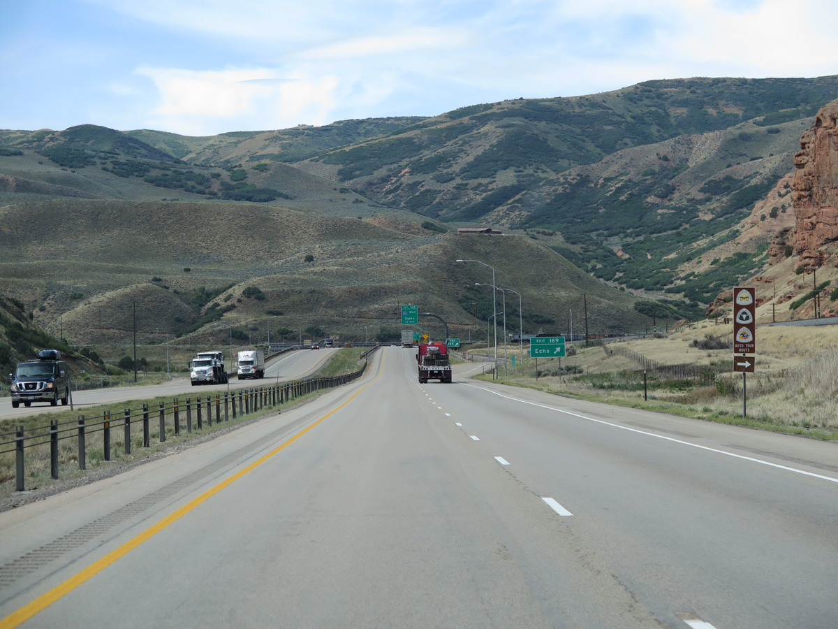
| The California Trail, Mormon Pioneer and Pony Express Historic Auto Trails branch northwest from I-80 along old U.S. 30S to Ogden. The California Trail and Pony Express return to I-80 west across the Great Salt Lake Desert. 08/25/14 |
|
| Interstate 80 westbound at the ramp departure (Exit 169) to Echo Dam Road. Echo Dam Road is the former alignment of U.S. 189 south alongside Echo Reservoir to Main Street in Coalville. Echo Road extends northwest from Echo Canyon Road along I-84 as old U.S. 30S to Echo and Henefer. 08/25/14 |
|
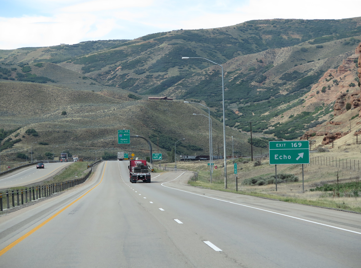
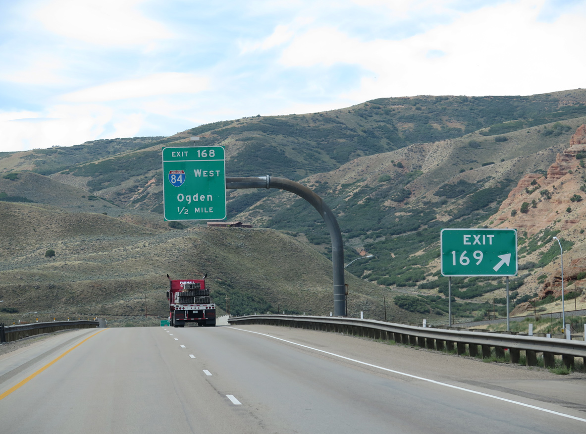
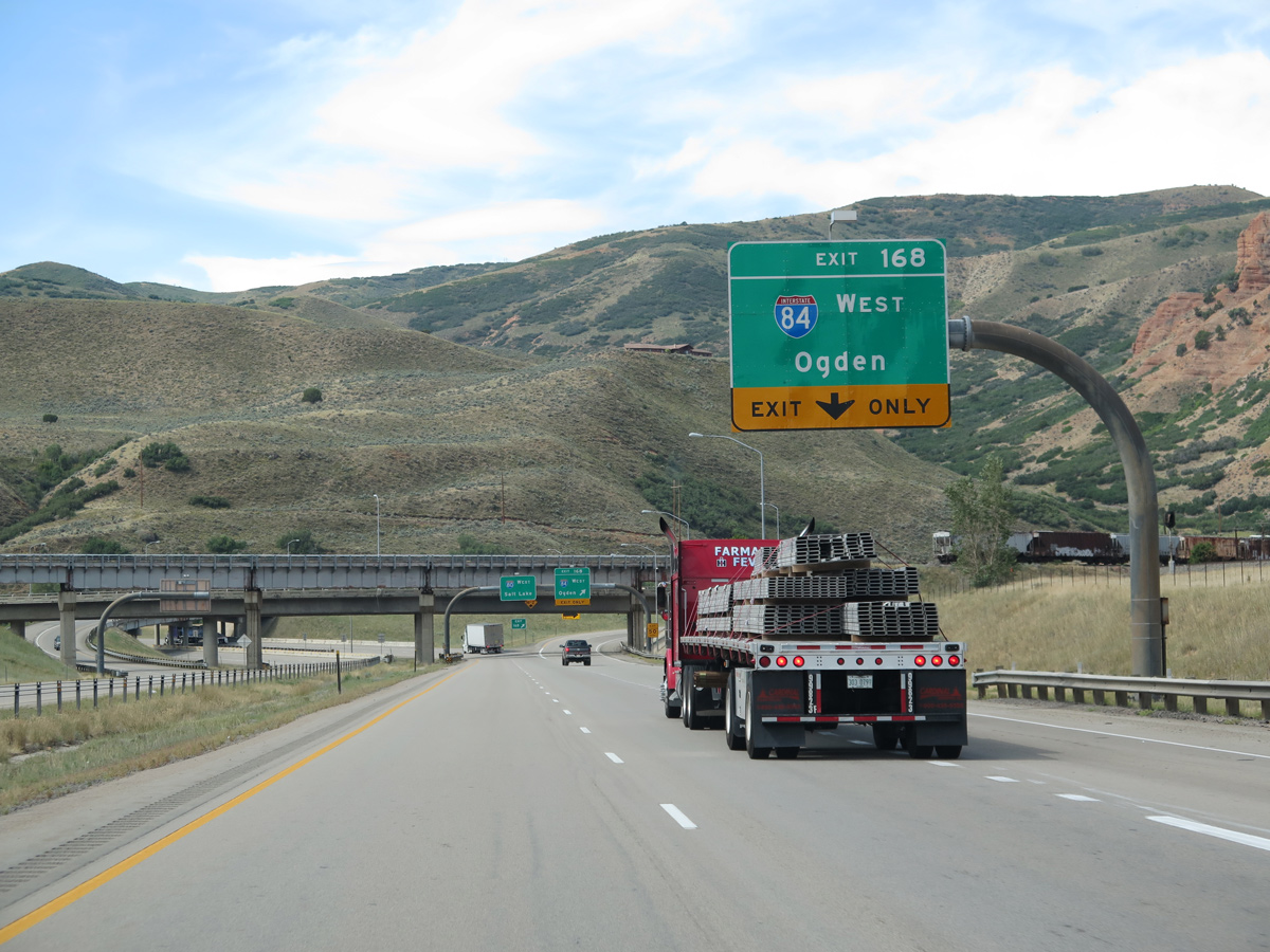
| A semi directional T interchange (Exit 168) immediately follows Exit 169 with the westbound beginning of Interstate 84. I-84 travels northwest from Echo Junction to Ogden, Boise, Idaho and along the Columbia River to Portland, Oregon. 08/25/14 |
|
| An auxiliary lane forms from the Echo Dam Road on-ramp to Interstate 84 west (Exit 168). I-84 overtook the former U.S. 30S northwest through Henefer, Morgan and Ogden to Interstate 15. North from there, I-15/84 run concurrently to Brigham City and Tremonton. 08/25/14 |
|
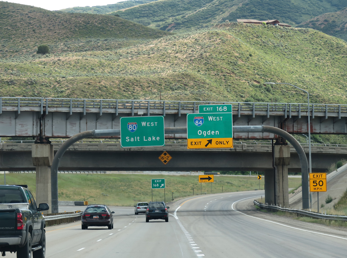
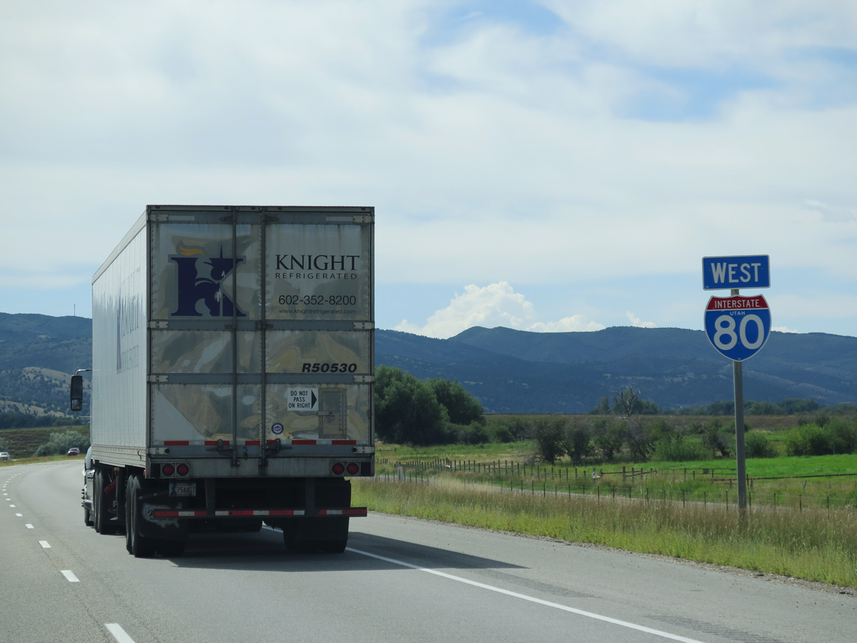
| An abandoned Union Pacific Railroad bridge spans Interstate 80 at the Exit 168 separation with Interstate 84 west. I-80 turns southward toward Coalville and Silver Creek Junction on the 40 mile drive to Salt Lake City. I-84 ventures northwest eight miles through Henefer Valley to reach Ogden in 39 miles. 07/11/15 |
|
| Beyond Echo Junction, Interstate 80 turns southward on the hill side overlooking Echo Reservoir. 07/11/15 |
|
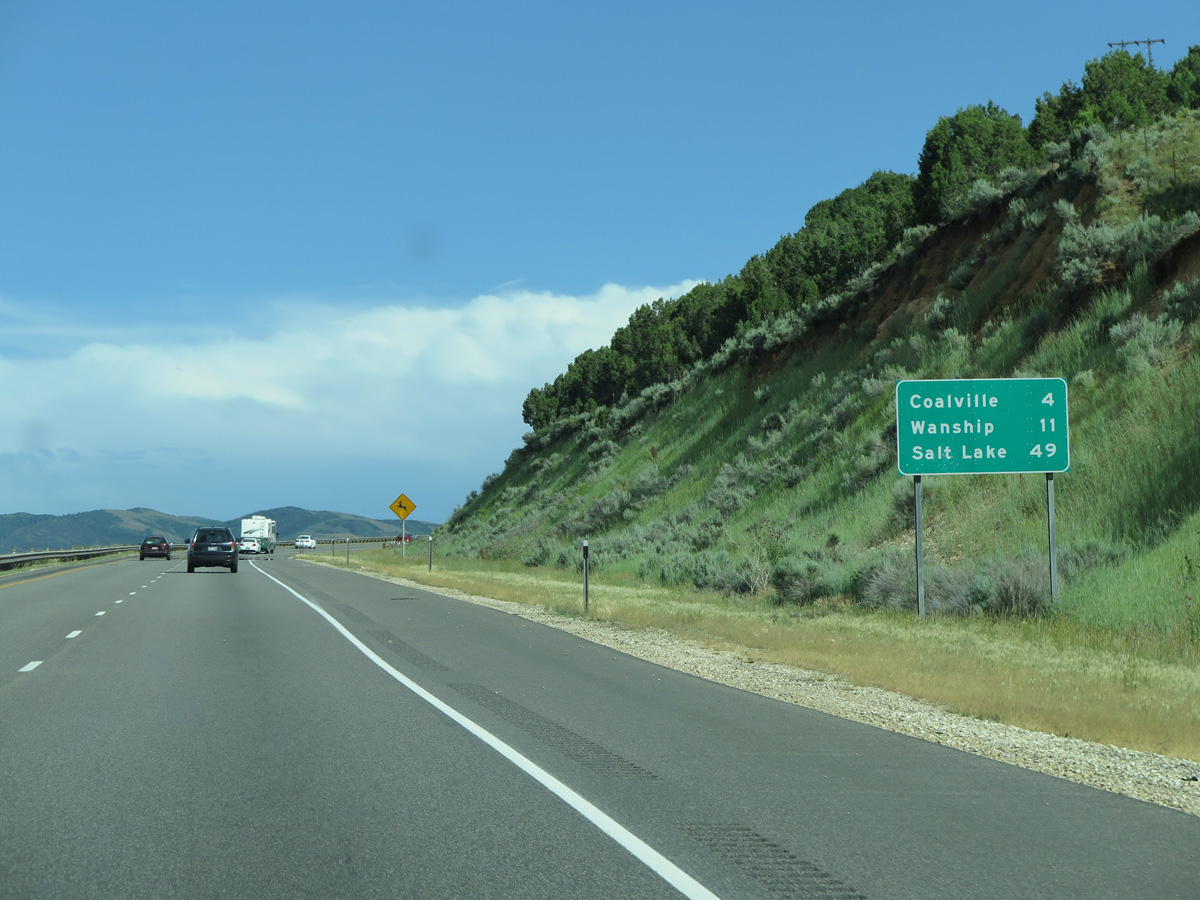
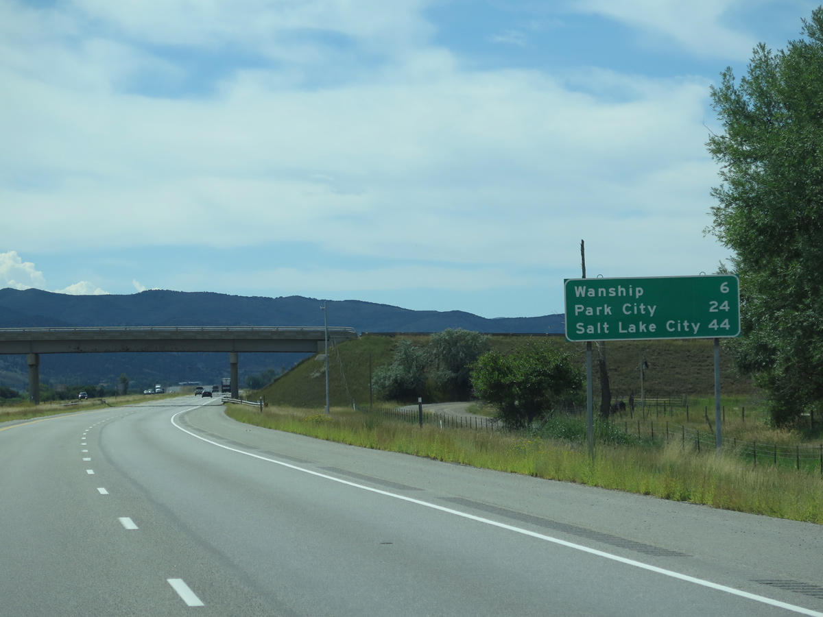
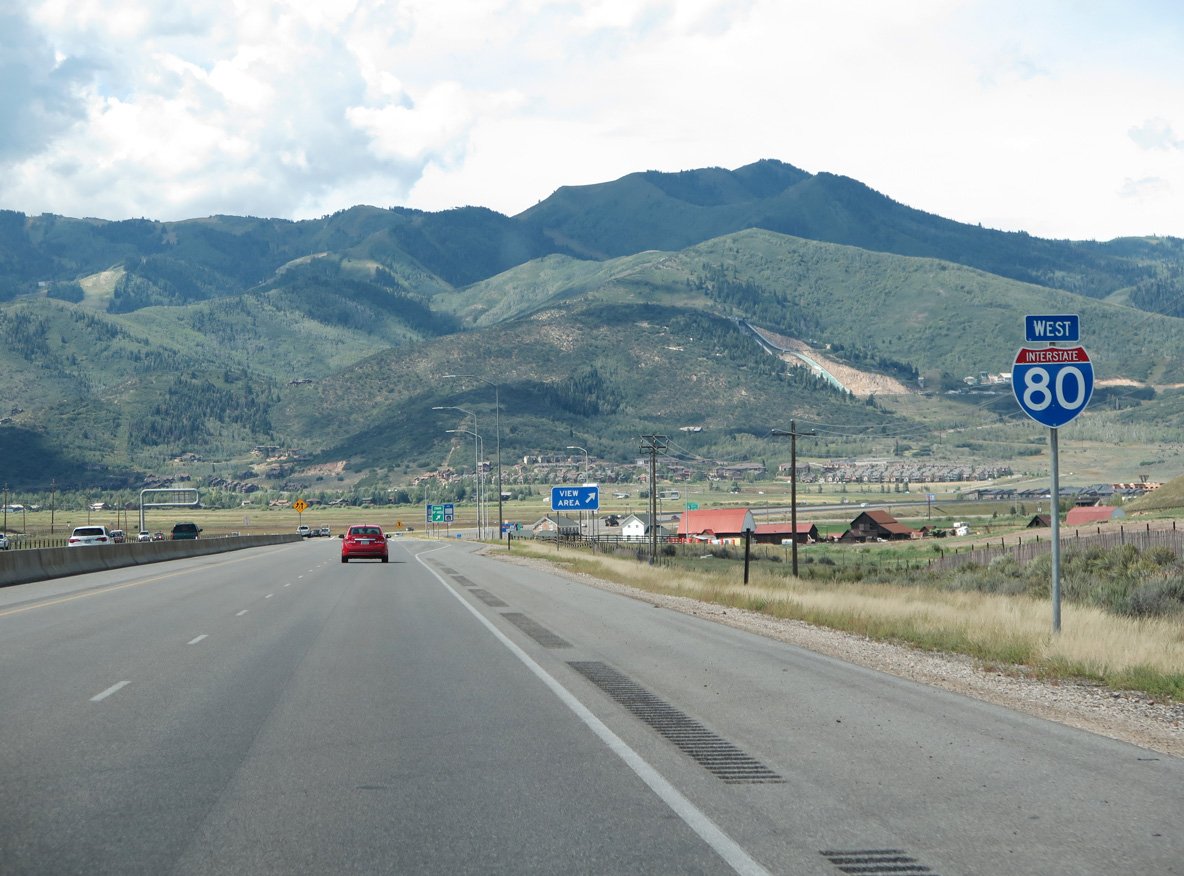
| The city of Coalville lies four miles ahead, followed by Wanship in 11 miles. Downtown Salt Lake City is 48 miles away, but listed at 49 miles. 07/11/15 |
|
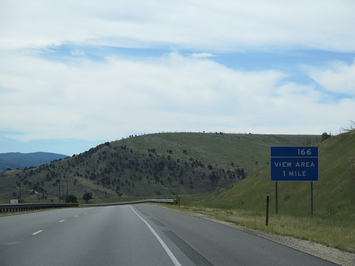
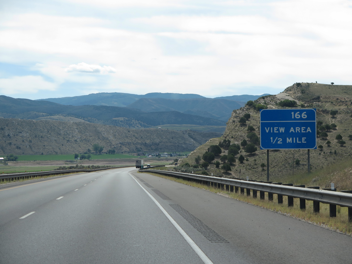
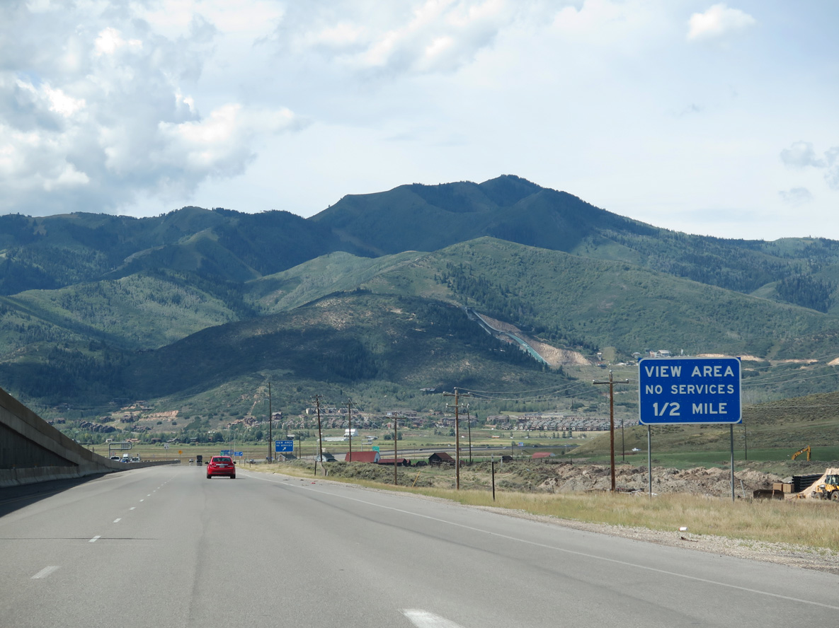
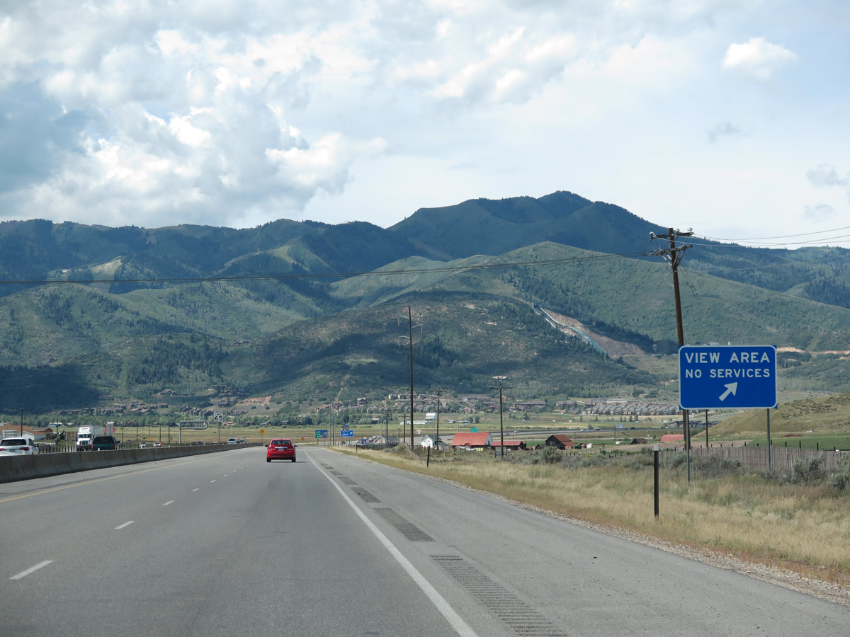
| View areas line both directions of Interstate 80 as it travels above Echo Reservoir. 08/25/14 |
|
| The Elkhorn Divide ridge dominates the southern horizon on the half mile approach to the Exit 166 view area. 08/25/14 |
|
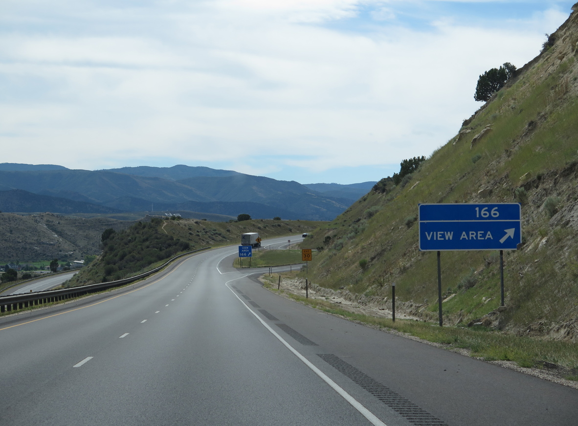
| Westbound Interstate 80 reaches the off-ramp (Exit 166) for the Echo Reservoir View Area. The city of Coalville lies just south of the lake. 08/25/14 |
|
| Confirming marker for Interstate 80 west posted by milepost 164. 08/25/14 |
|
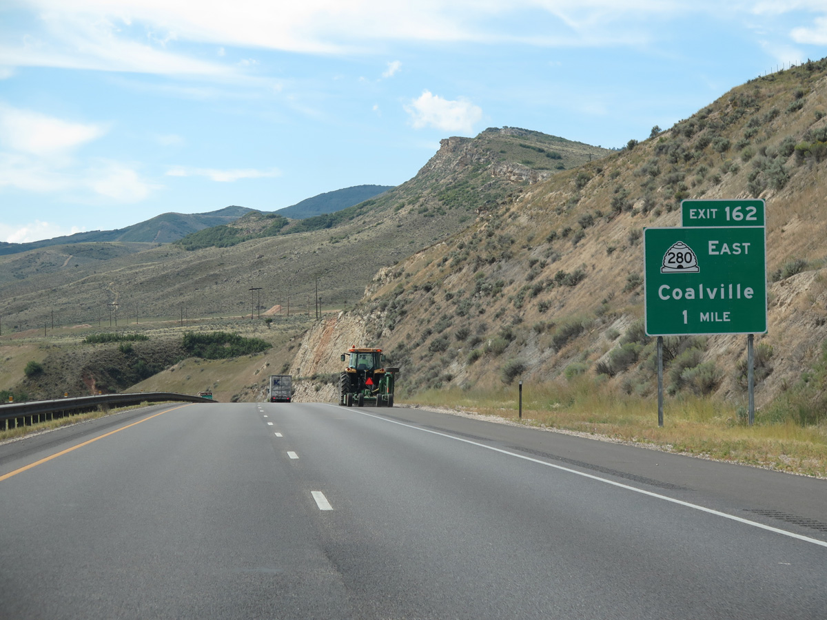
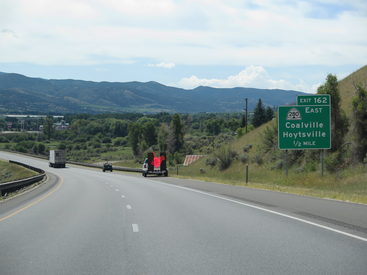
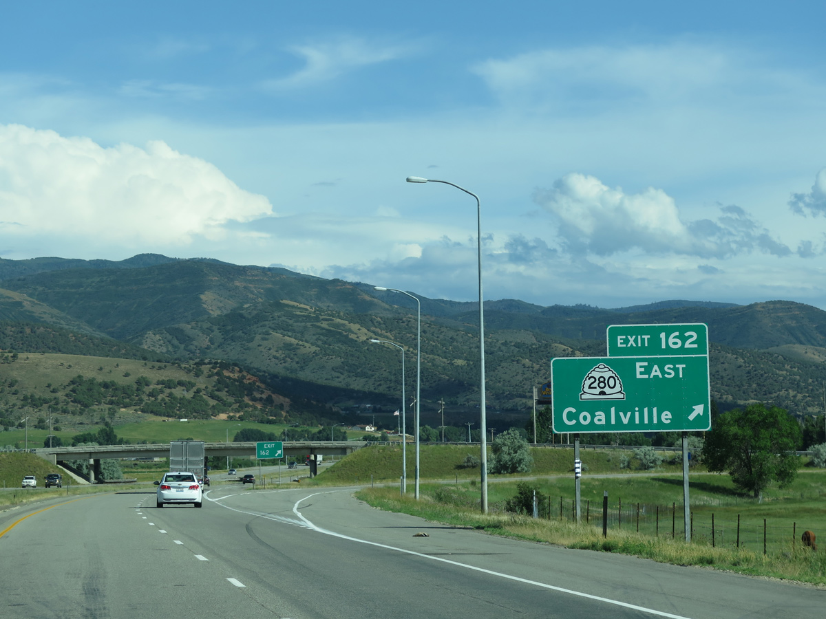
| Exit 162 departs in one mile for SR 280 (100 South), a 0.399 mile connector linking Interstate 80 with Main Street in Coalville. 08/25/14 |
|
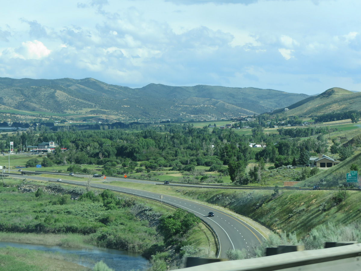
| Interstate 80 lowers into the Coalville city limits across a causeway traversing the southern periphery of Echo Reservoir. 07/11/15 |
|
| Main Street north from SR 280 leads back to Echo Reservoir and south to Hoytsville Road. Hoytsville Road is the former alignment of U.S. 189 and U.S. 530 south to Hoytsville and Wanship. 08/25/14 |
|
| Entering the diamond interchange (Exit 162) with SR 280 (100 South) east and Icy Springs Road west on I-80 westbound. Icy Springs Road meanders west to Lewis Canyon. SR 280 acts as a business spur from Interstate 80 as Coalville offers food and lodging. 07/11/15 |
|
| State named shield posted for Interstate 80 west in Coalville. 08/25/14 |
|
| Interstate 80 parallels the Historic Union Pacific Rail Trail southward on the four mile drive to Wanship. The ski resort area of Park City follows in 20 miles. 08/25/14 |
|
| A wide agricultural valley spreads into view as Interstate 80 leads south from Coalville along the Weber River. 07/11/15 |
|
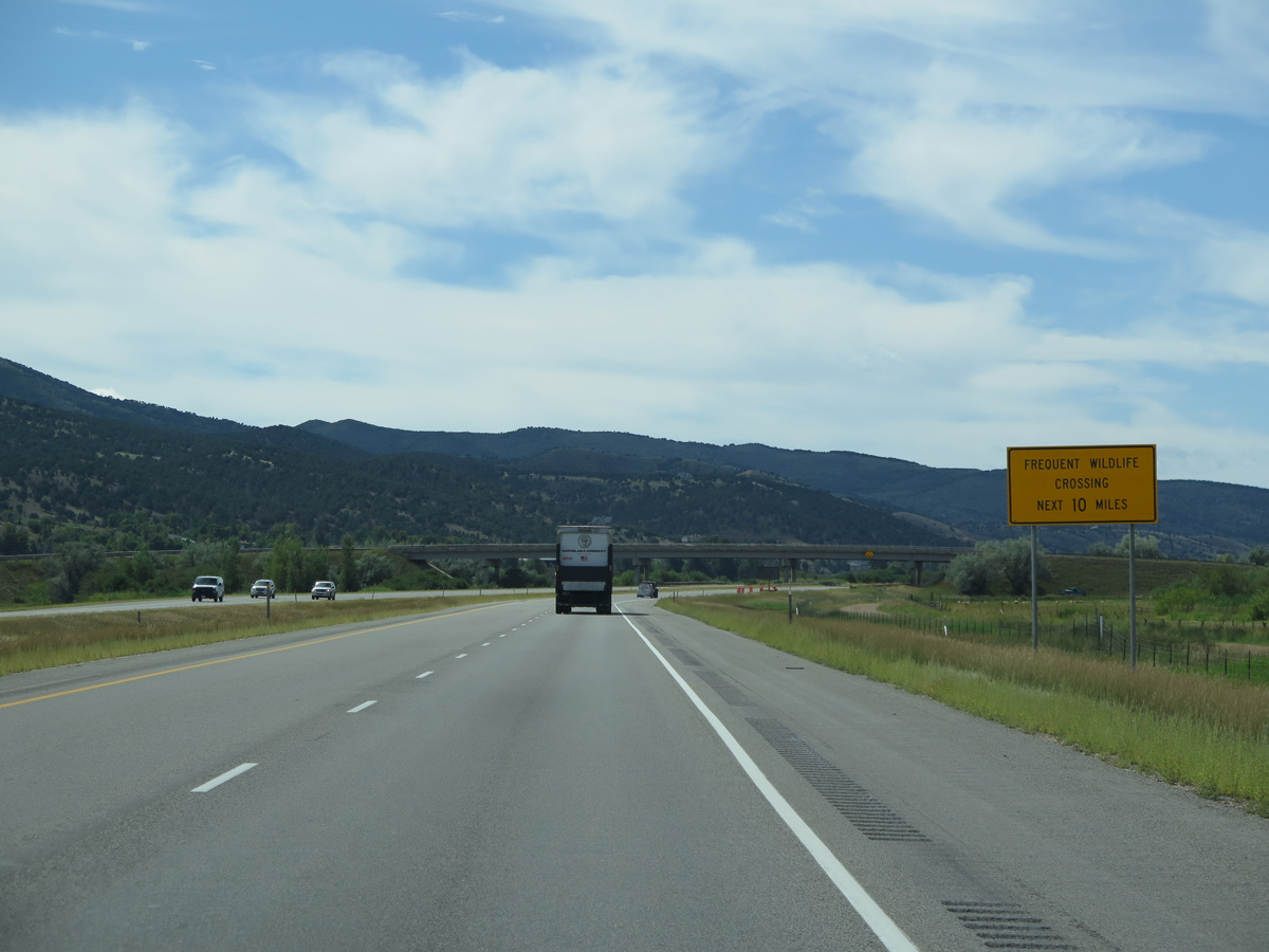
| Judd Lane spans I-80 behind this sign advising motorists to use caution due to frequent wildlife crossings between Wanship and Silver Creek Junction. 08/25/14 |
|
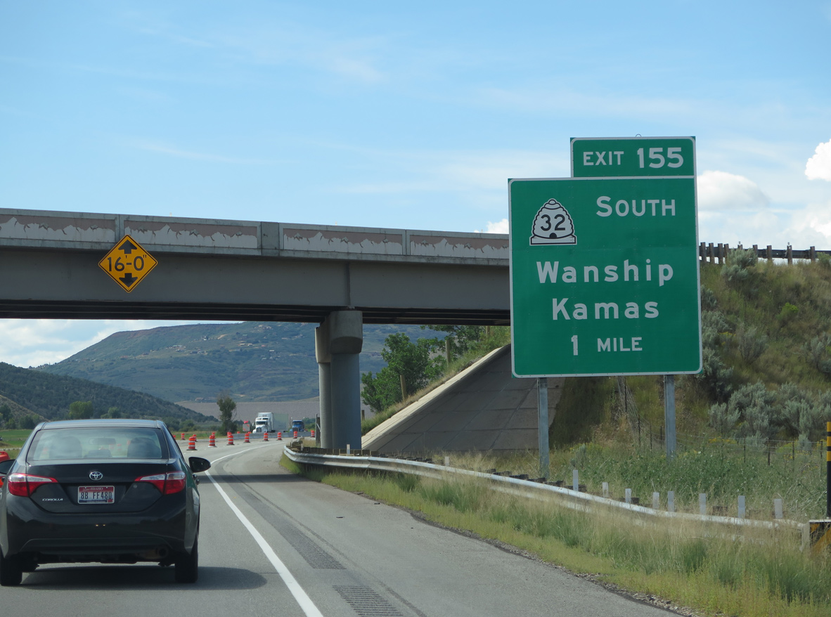
| Hoytsville Road passes over Interstate 80 one mile north of the diamond interchange (Exit 155) with SR 32. 08/25/14 |
|
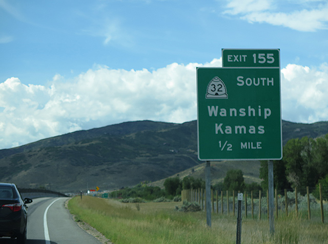
| SR 32 loops west from the off-ramp (Exit 155) to Old Lincoln Highway through Wanship before turning south alongside Rockport Lake and State Park to Kamas. 08/25/14 |
|
| Exit 155 leaves I-80 west for SR 32 south. The state route reaches the Summit County seat of Kamas in 15 miles.
Construction from June 2014 to October 2015 as part of the statewide Renovate I-80 Projects rebuilt the freeway from Wanship south to Silver Creek Junction. Work included a new concrete roadway and drainage improvements. 08/25/14 |
|
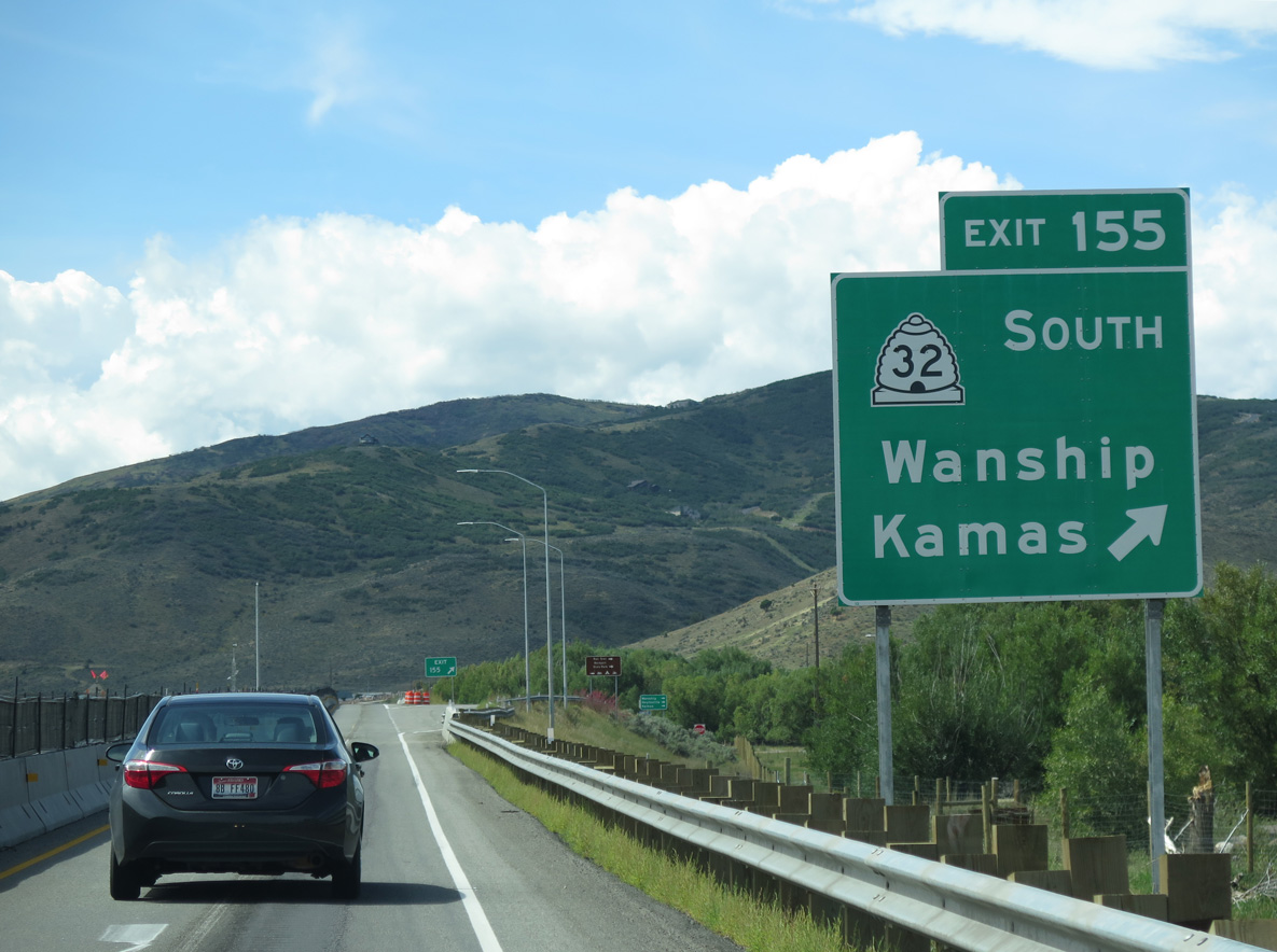
| Interstate 80 curves west around Wanship between Old Lincoln Highway and the three quarter diamond interchange with SR 32 (Exit 155 from I-80 east). 08/25/14 |
|
| A winding stretch takes Interstate 80 alongside Silver Creek southwest on the seven mile trek to U.S. 40 at Silver Creek Junction. Downtown Salt Lake City lies 30 miles further west. 08/25/14 |
|
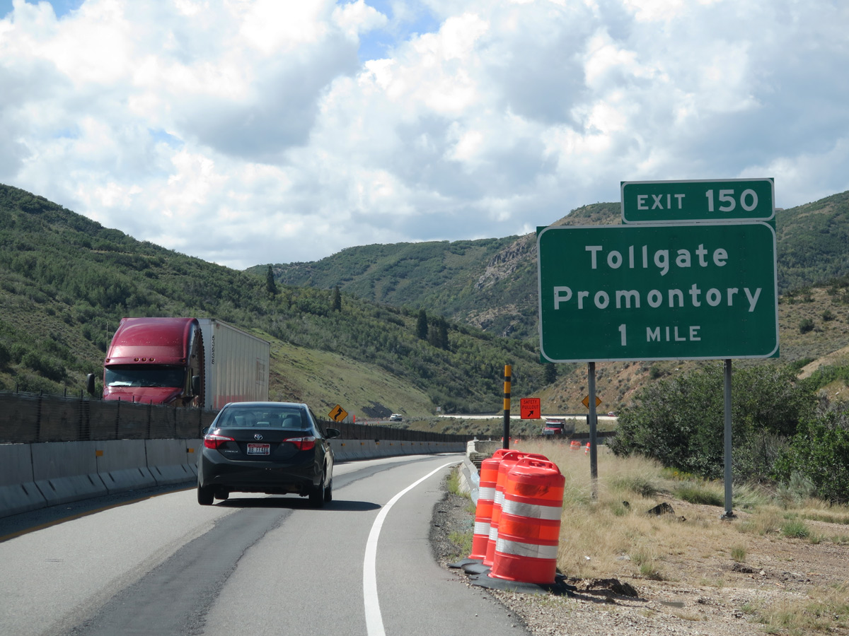
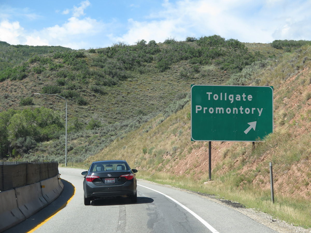
| The roadways of Interstate 80 run on opposite sides of Silver Creek to the diamond interchange (Exit 150) for Tollgate Canyon and the Promontory golf course community. 08/25/14 |
|
| Tollgate Canyon Road east and Promontory Ranch Road west come together at Exit 150 in one mile. Signs for this junction previously referenced just a ranch exit. 08/25/14 |
|
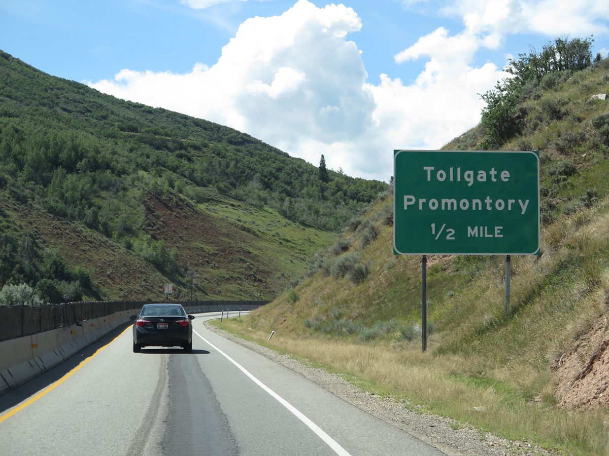
| Westbound I-80 at the off-ramp (Exit 150 for Tollgate and Promontory. Tollgate Canyon Road wraps around northern reaches of the Silver Summit suburban community. 08/25/14 |
|
| The north and southbound lanes of I-80 remain separated with the Historic Union Pacific Rail Trail running between them to milepost 148. 08/25/14 |
|
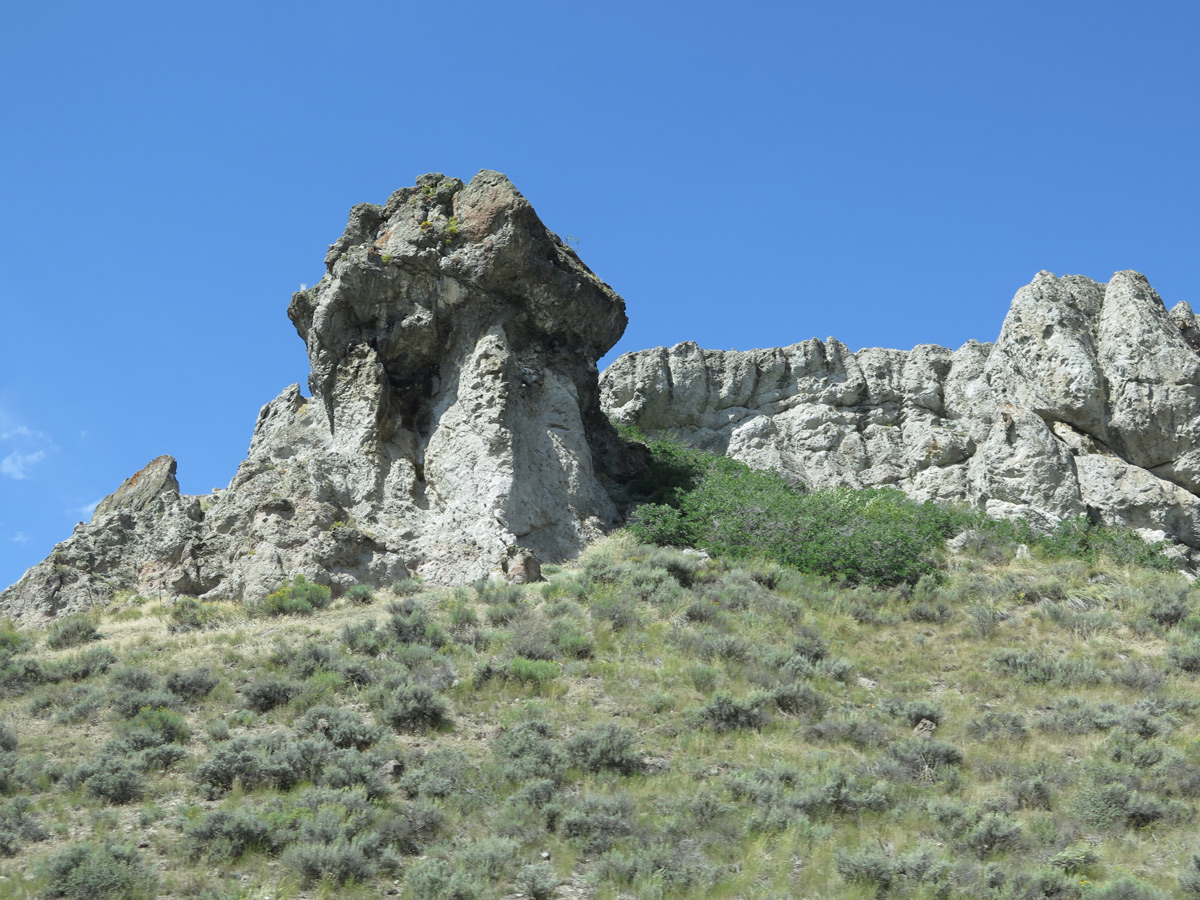
| Craggy formations rise above the westbound lanes of Interstate 80 by milepost 150. 08/25/14 |
|
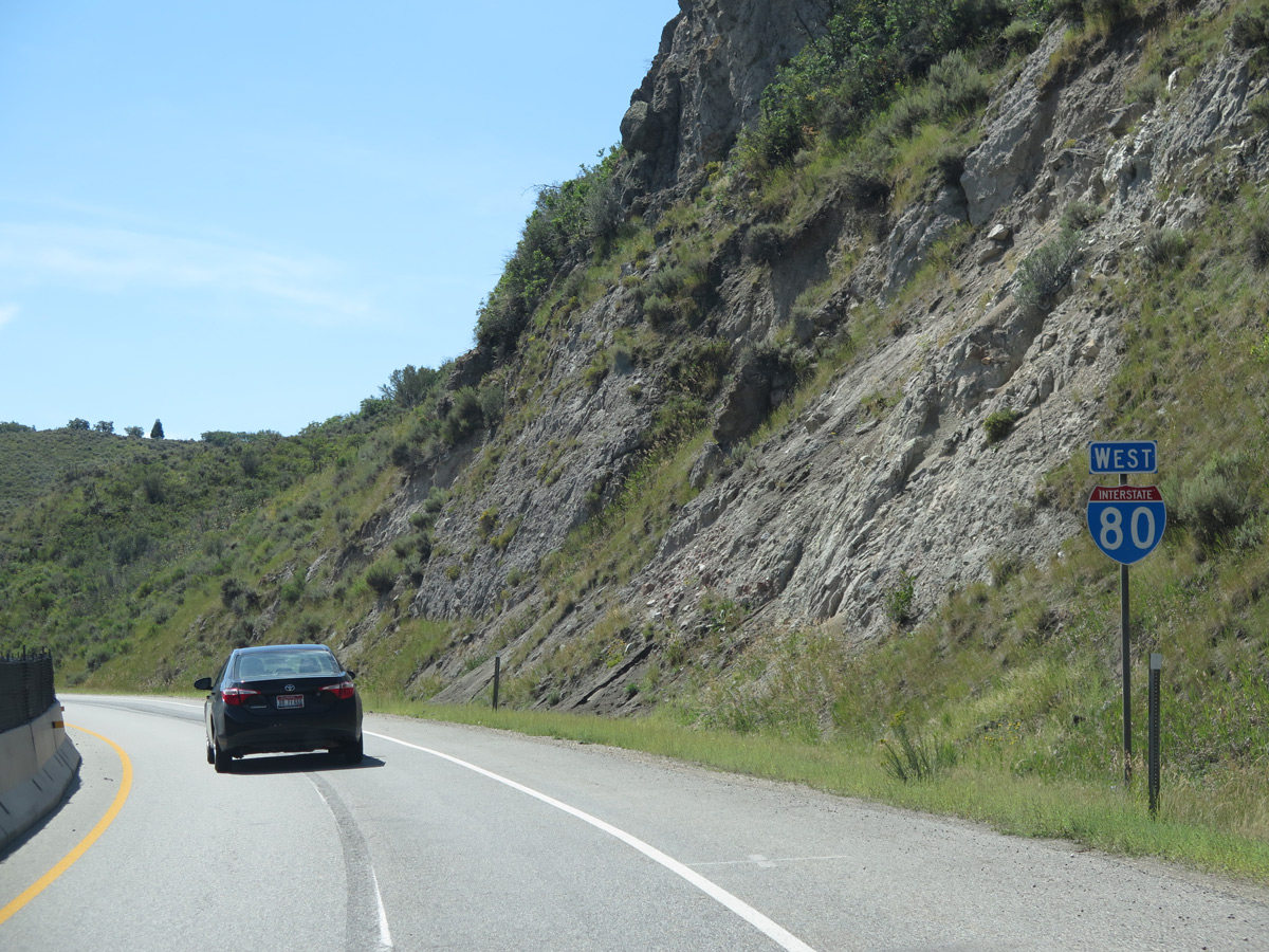
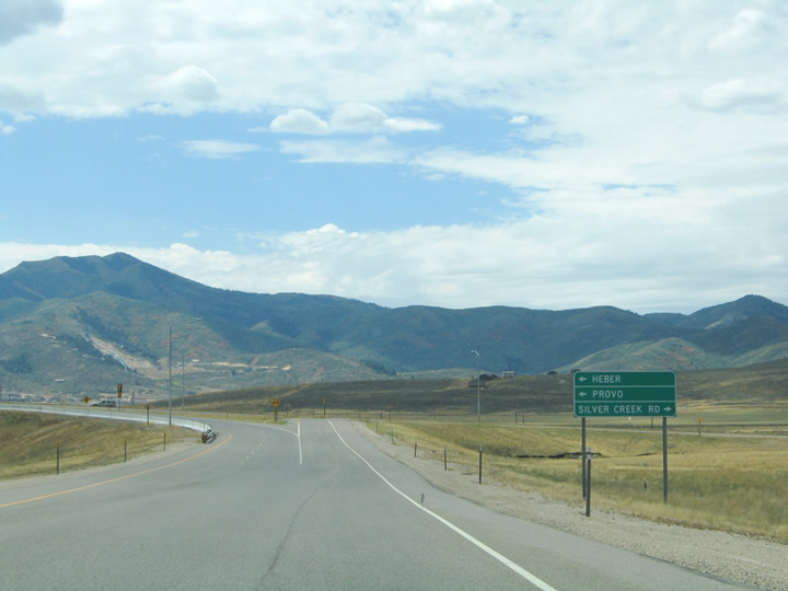
| Next in line for westbound travelers along I-80 is the western terminus of U.S. 40 at Silver Creek Junction. U.S. 40, once part of the Lincoln Highway between San Francisco and Salt Lake City, was replaced by Interstate 80 from Exit 146 westward to San Francisco, California. The forthcoming junction represents the truncated end of U.S. 40 as it enters the scene from Park City and Heber City to the south. 08/25/14 |
|
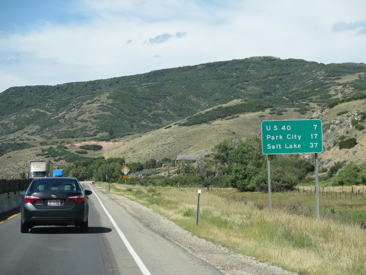
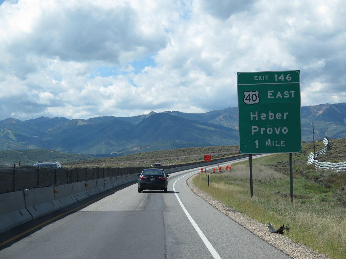
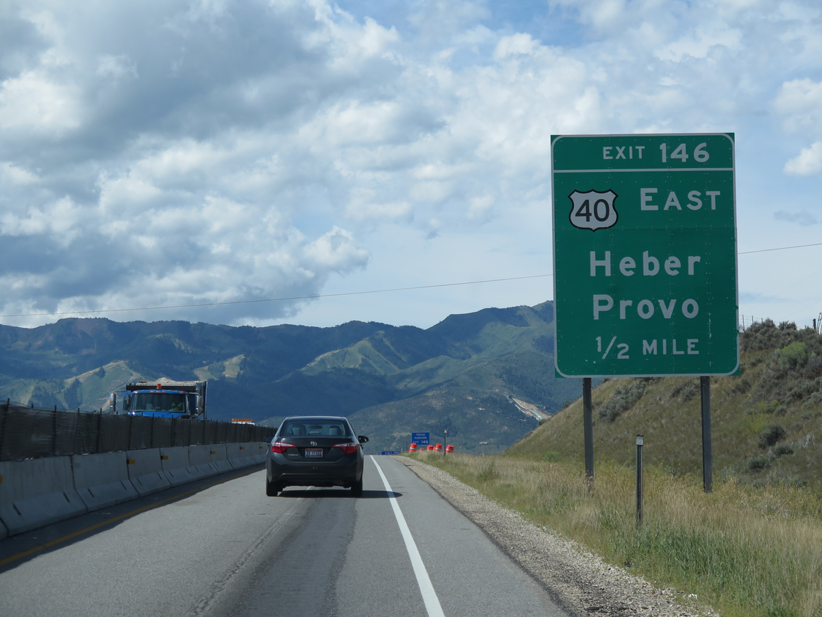
| One half mile ahead of Exit 146 for U.S. 40 west to U.S. 189 at Heber City. U.S. 40 constitutes a freeway from Interstate 80 southward to SR 32 near Heber City. The freeway was initially built in 1990 to bypass Jordanelle Reservoir, which covers portions of old U.S. 40 to the south. An extension of the freeway was completed in 1993 between Park City Junction and I-80. 08/25/14 |
|
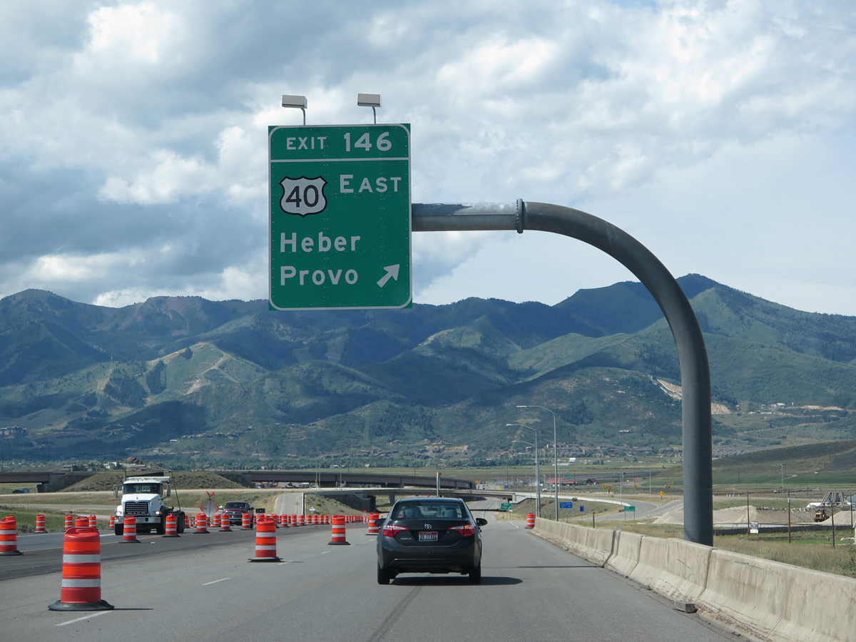
| Exit 146 departs Interstate 80 west for U.S. 40 east to Heber City, U.S. 189 south to Provo and Silver Creek Road north. The U.S. 40 freeway serves nearby Park City, host of the 2002 Winter Olympic Games. 08/25/14 |
|
| Silver Creek Road provides the main access road to the Silver Summit community. 09/08/05 |
|
| A single-point urban interchange (SPUI) facilitates movement between Interstate 80, U.S. 40 and Silver Creek Road. A flyover shuttles drivers from U.S. 40 west to I-80 as well. The exchange was upgraded by summer 2001 to accommodate traffic for the 2002 Winter Olympic Games. 08/25/14 |
|
| View areas line both sides of I-80 as the freeway encircles a mountain through Parleys Park. 08/25/14 |
|
| The view area doubles as a chain up area for Interstate 80 west from Parleys Summit to Salt Lake Valley. 08/25/14 |
|
| Confirming marker posted for Interstate 80 west ahead of Murdock Peak (el. 9,602 ft) of the Wasatch Range. 08/25/14 |
|
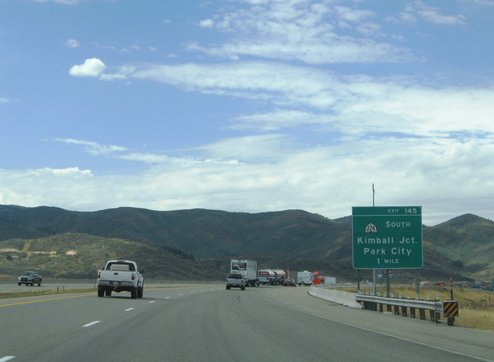
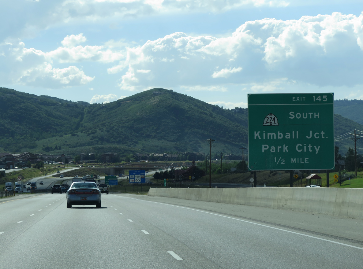
| Expansion of Interstate 80 to six overall lanes between Silver Creek Junction and Kimball Junction claimed the one mile guide sign for SR 224 (Exit 145). The left side ramp from U.S. 40 added the third westbound lane. 09/08/05 |
|
| One half mile ahead of the off-ramp (Exit 145) to SR 224 on Interstate 80 west.
SR 224 was expanded to four lane lanes from Park City north to Interstate 80 during a three year project. Work was to wrap up by Thanksgiving 1993, but delays due to utility relocation and drainage lines pushed completion back to August 1994.1 07/11/15 |
|
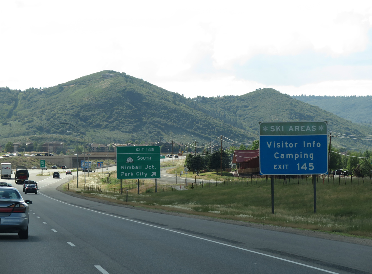
| SR 224 provides a second entry point into the Park City resort area from Interstate 80 at Exit 145.
In preparation for the 2002 Winter Olympic Games, a $10 million reconstruction of the diamond interchange with SR 224 replaced it with a single point urban interchange (SPUI). The new configuration opened in May 2001.2 07/11/15 |
|
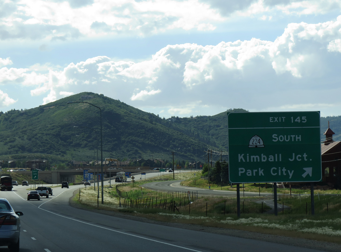
| SR 224 stems south from Exit 145 at Kimball Junction two miles to Snyderville and five miles into Park City. The state route north ends at Rasmussen Road, a north side frontage road. An outlet center mall, big box retail and a business park line the state route to the immediate south. 07/11/15 |
|
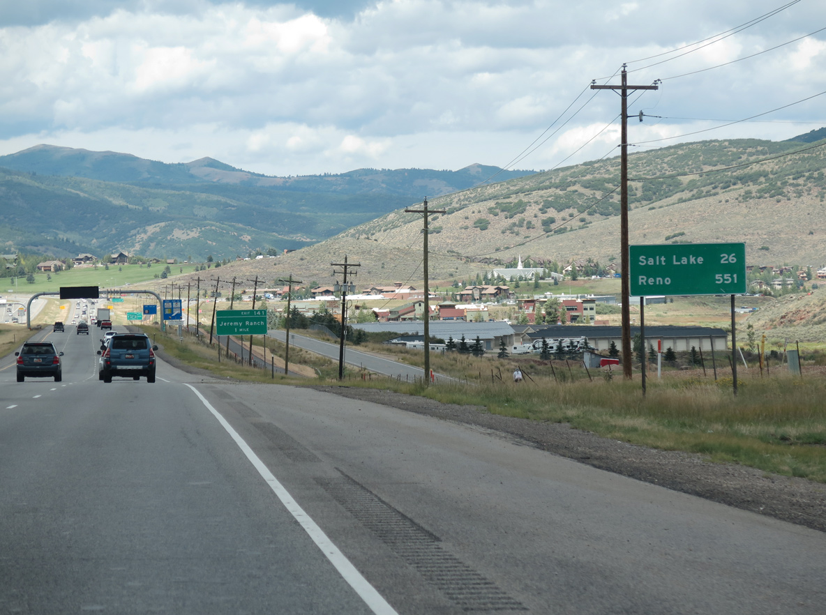
| 26 miles east of Downtown Salt Lake City, Interstate 80 leaves Parleys Park for Toll Canyon and Wasatch-Cache National Forest. Reno debuts to long distance travelers at 551 miles away. 08/25/14 |
|
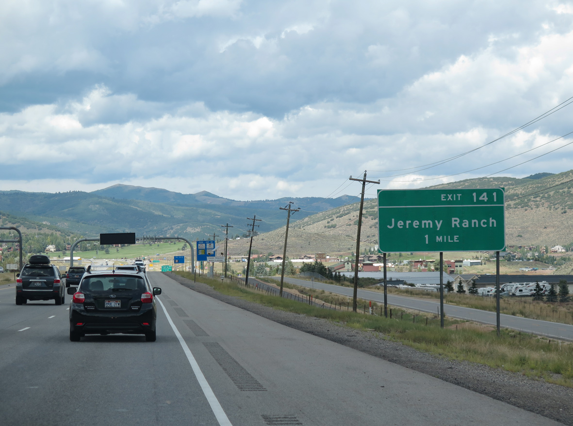
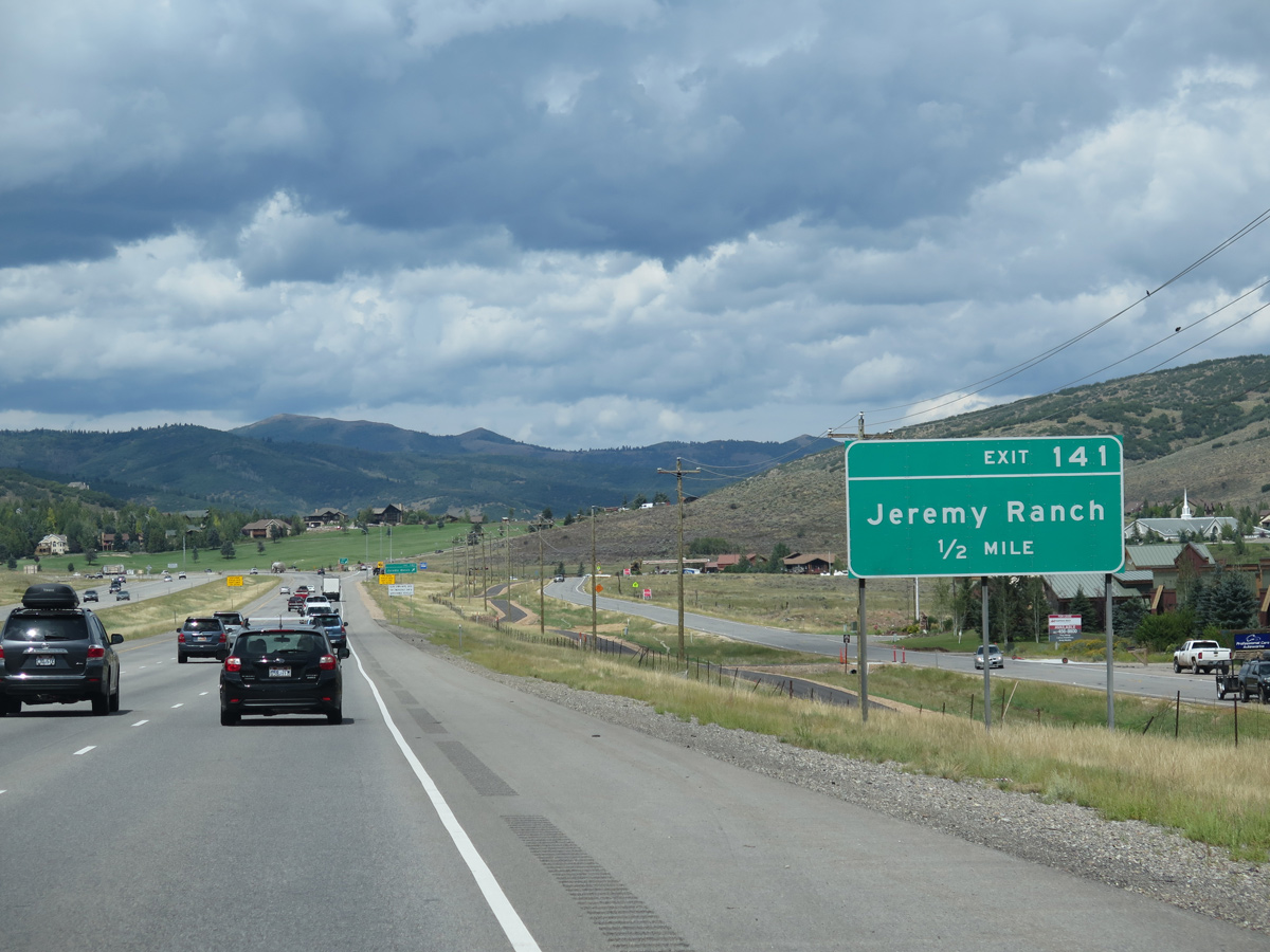
| Interstate 80 veers northwest to the suburban areas of Jeremy Ranch Golf & Country Club and Pinebrook at Exit 141. 08/25/14 |
|
| A diamond interchange (Exit 141) connects Interstate 80 with Pinebrook Boulevard south to Pinebrook and Twomile Canyon and Homestead Road north to Jeremy Ranch. 08/25/14 |
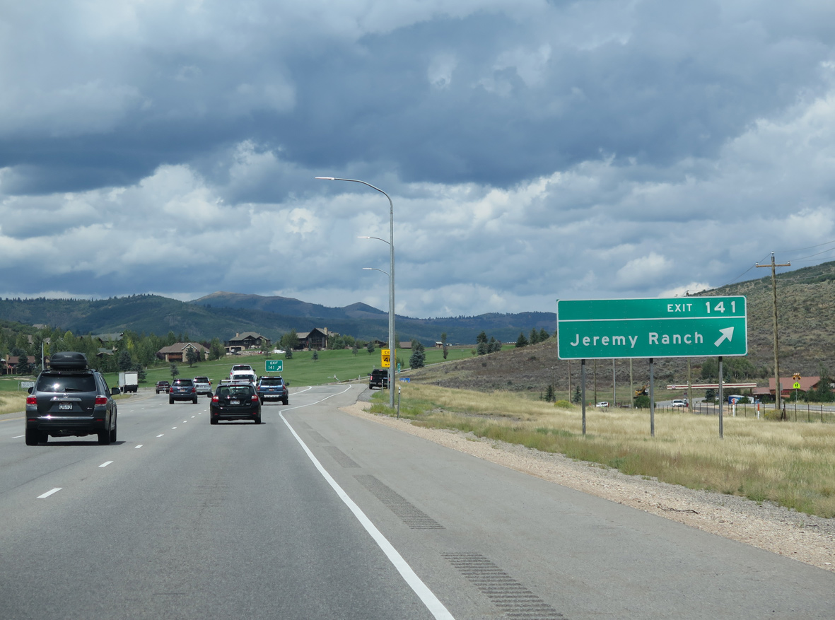
|
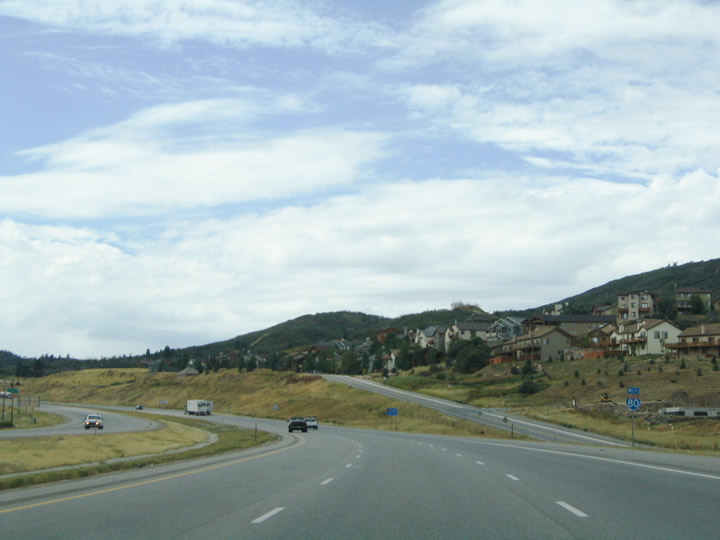
| Drivers bound for Jeremy Ranch leave Interstate 80 west at Exit 141. A frontage road system continues west along the freeway to Exit 140 at Parleys Summit. 08/25/14 |
|
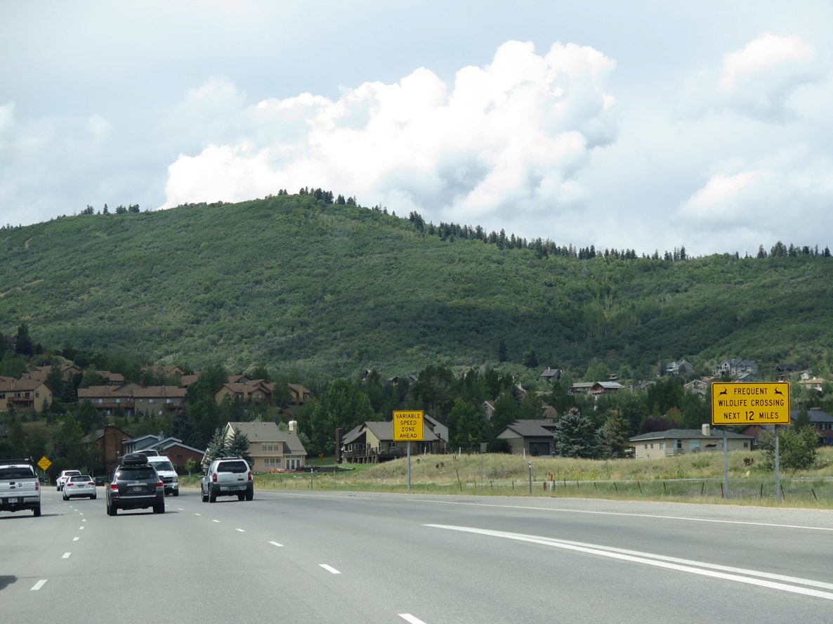
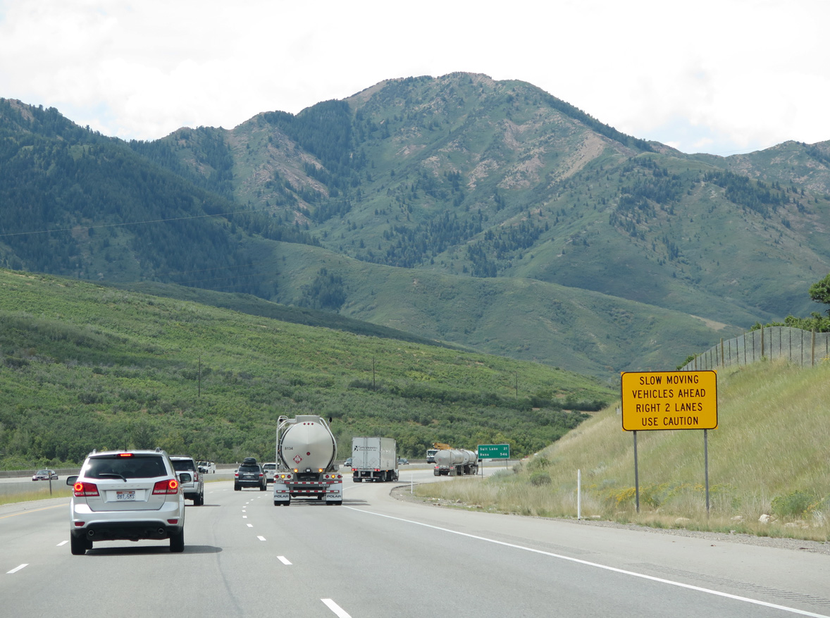
| A left lane restriction for trucks ensues west of Exit 141 as Interstate 80 climbs toward Parleys Summit (el. 7,016 ft). Motorists are urged to use caution for frequent wildlife crossing on the descent through Parleys Canyon. 08/25/14, 09/08/05 |
|
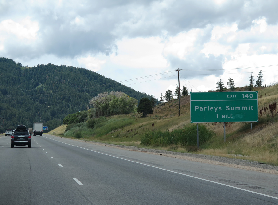
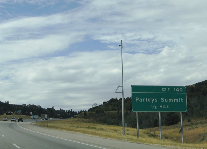
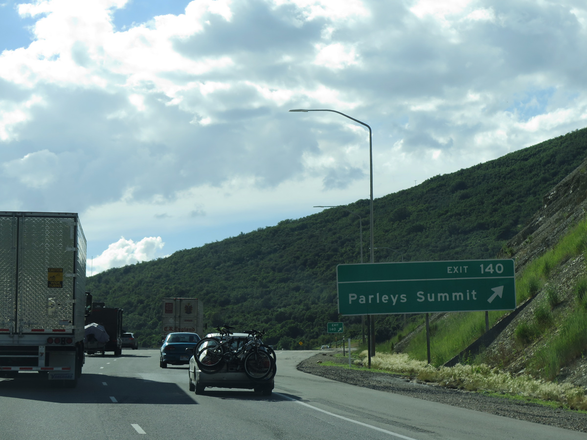
| Interstate 80 winds westward through Toll Canyon to a diamond interchange (Exit 140) at Parleys Summit. 08/25/14 |
|
| Parleys Lane meanders west from Jeremy Ranch to meet Interstate 80 at Exit 140 in one half mile. 09/08/05 |
|
| Exit 140 leaves I-80 west for Parleys Lane south to Aspen Lane and the mountainside community of Summit Park. 07/11/15 |
|
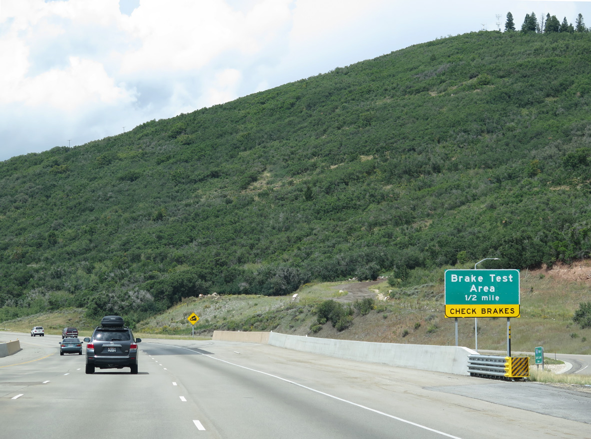
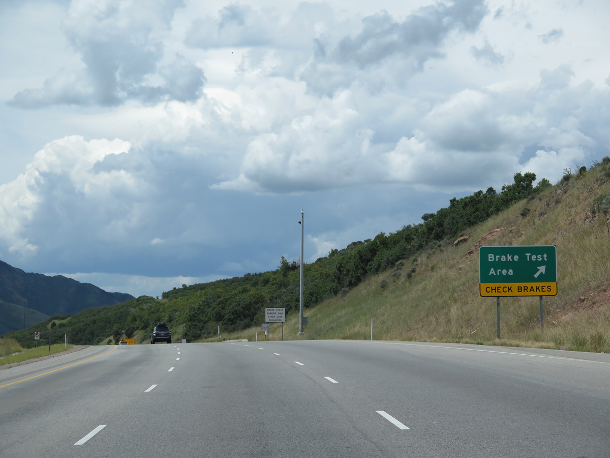
| Truckers see a brake test area at Parleys Summit as the freeway commences a lengthy descent into Salt Lake Valley. 08/25/14 |
|
| Interstate 80 crosses the Salt Lake County line at the brake test area. A county line sign was posted here until 2009. 08/25/14 |
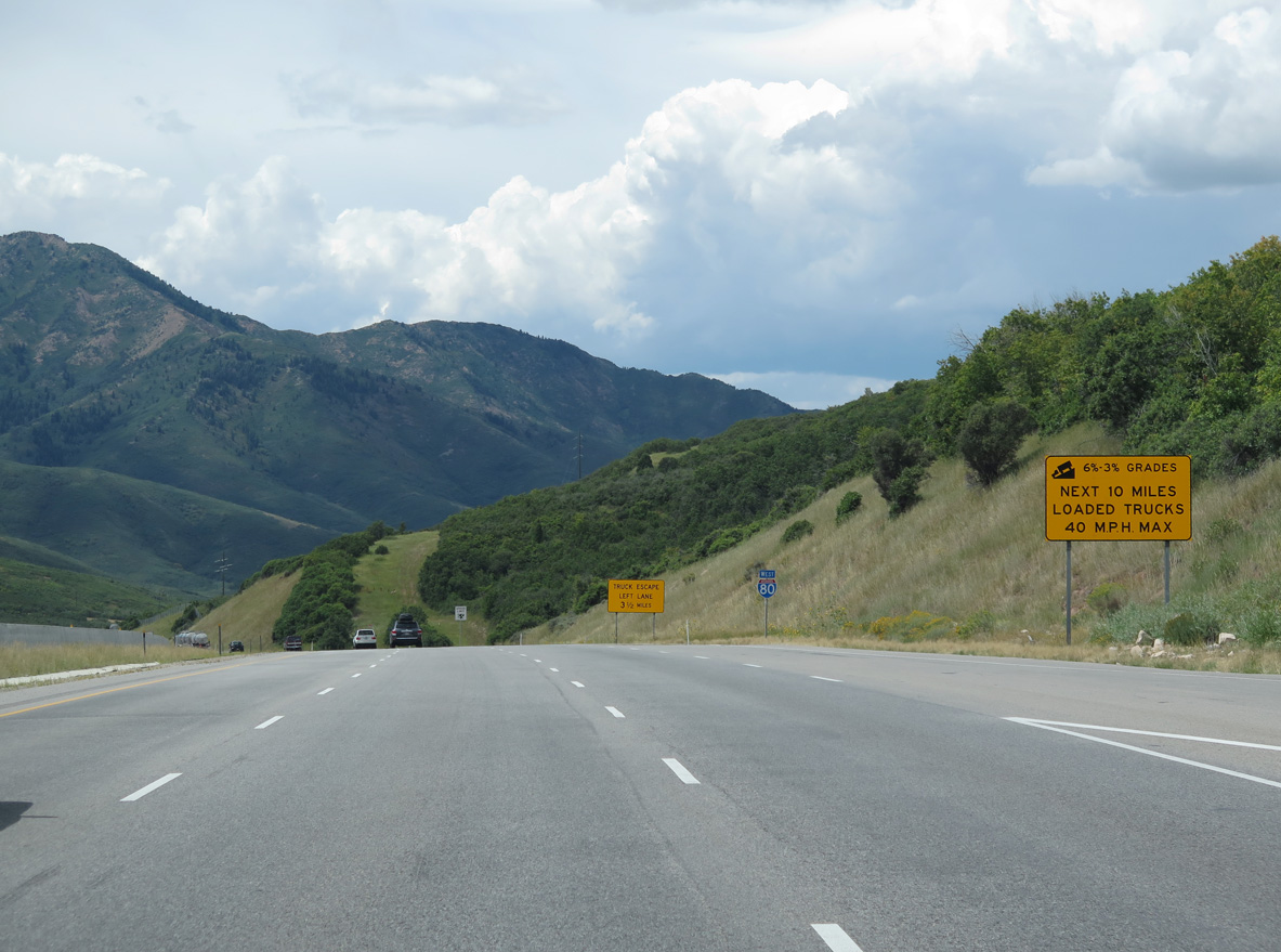
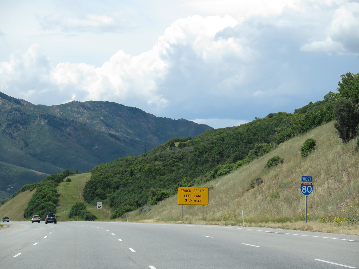
|
| Interstate 80 drops over 2,400 feet in elevation between Parleys Summit and Salt Lake City. Truckers are limited to 40 miles per hour on the 3 to 6 percent grade. 08/25/14 |
|
| Intelligent transportation systems (ITS) operations along I-80 include the use of variable speed limits between Kimball Junction and Parleys Canyon. 08/25/14 |
|
| Mount Aire (el. 8,621 ft) rises to the southwest as Interstate 80 advances west 21 miles to Downtown SLC and 546 miles to Reno, Nevada. 08/25/14 |
|
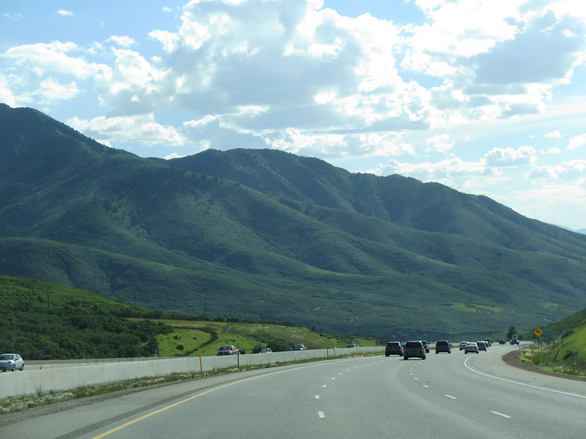
| Interstate 80 travels through portions of Wasatch-Cache National Forest on the trek through Parleys Canyon. 07/11/15 |
|
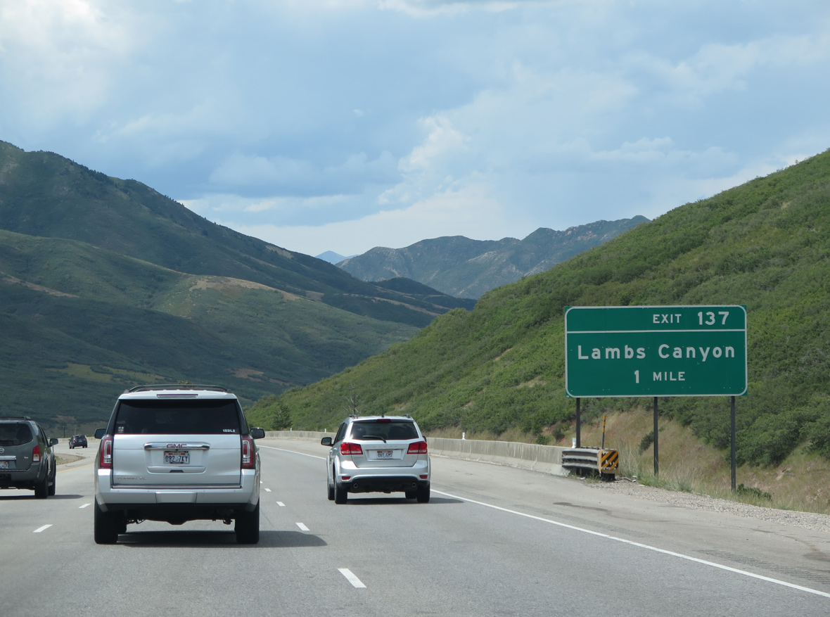
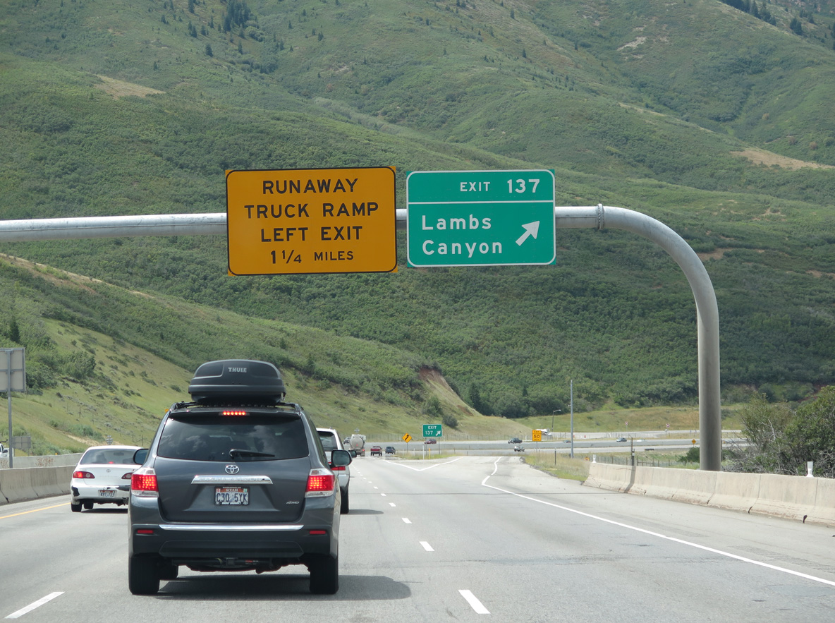
| One mile east of the diamond interchange (Exit 137) at Lambs Canyon on Interstate 80 west. 08/25/14 |
|
| Lambs Canyon Road (National Forest 268) spurs south from upcoming Exit 137 to Lambs Canyon and Lake Salamander. A Frontage Road also ties in from the north. 08/25/14 |
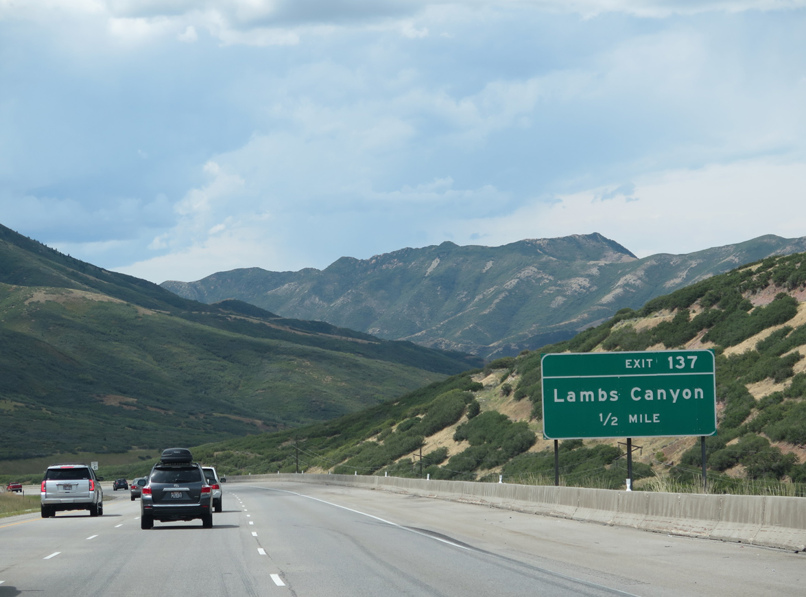
|
| Interstate 80 westbound at the Lambs Canyon off-ramp (Exit 137). A left side runaway truck ramp lies 1.50 miles ahead. 08/25/14 |
|
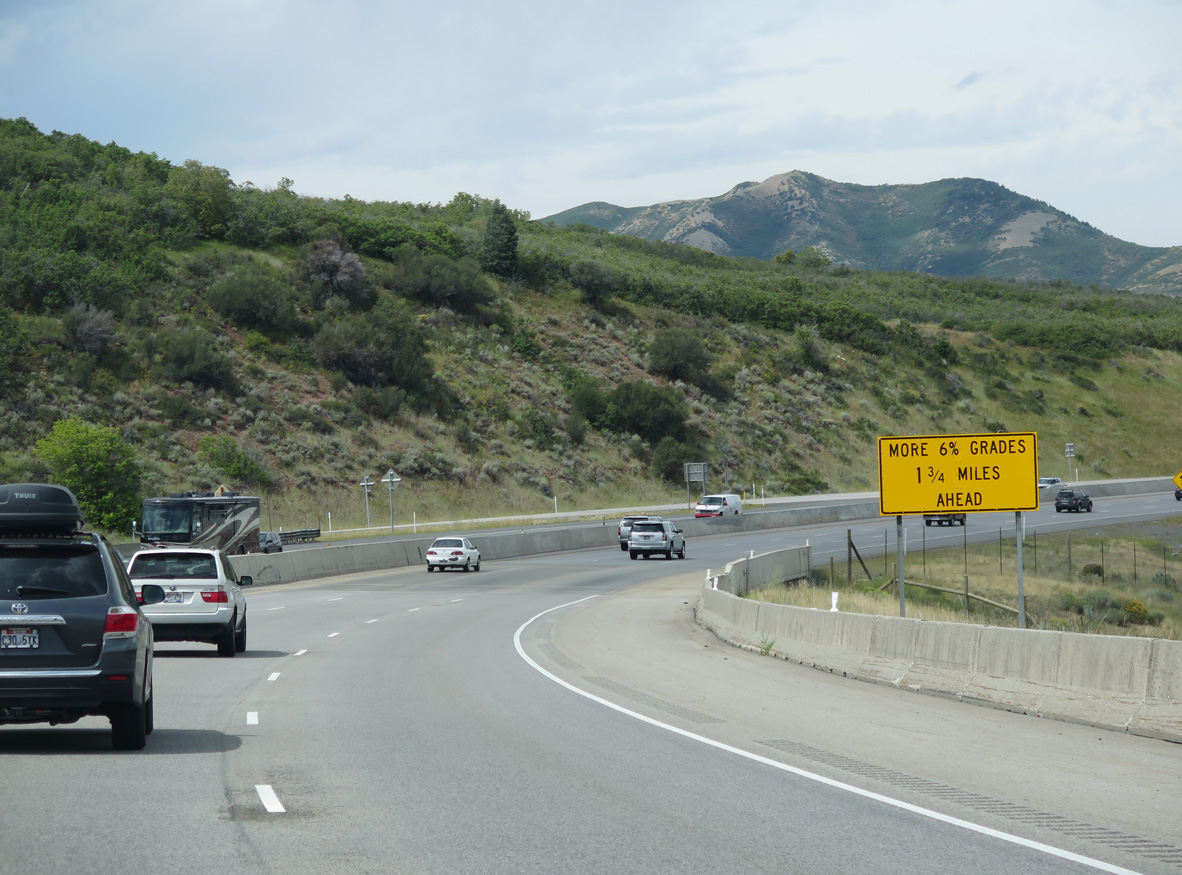
| Additional 6% grades occur along westbound Interstate 80 beyond Mountain Dell Reservoir in 1.75 miles. 08/25/14 |
|
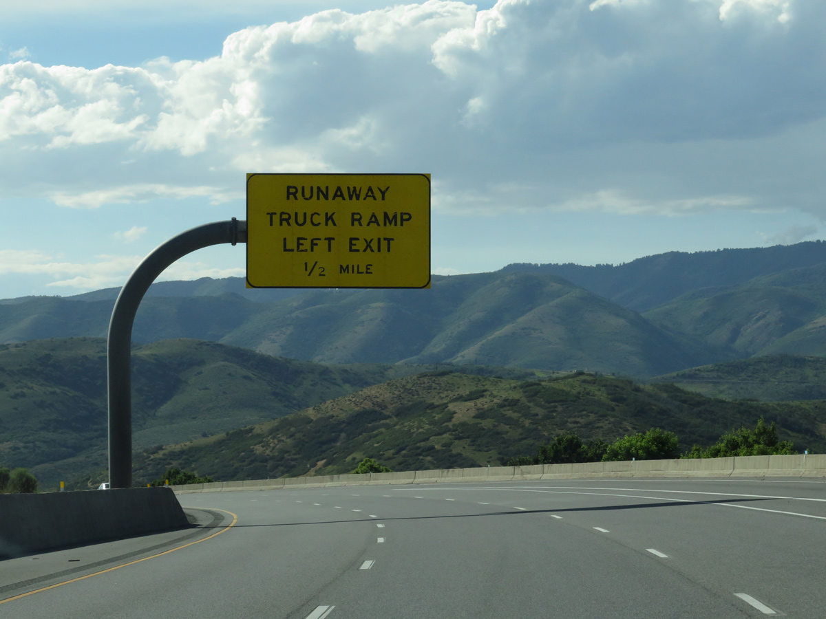
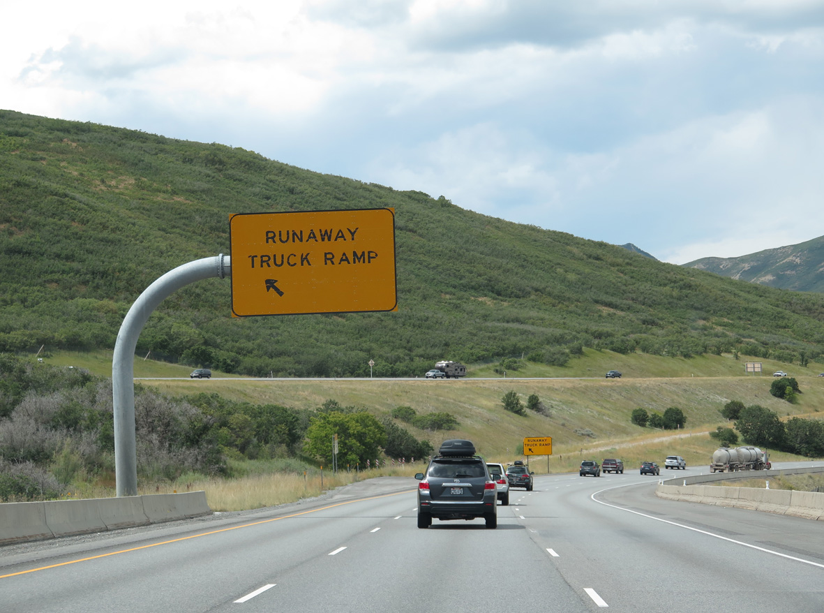
| A roadway separation accommodates the left side runaway truck ramp near milepost 135. 07/11/15, 08/25/14 |
|
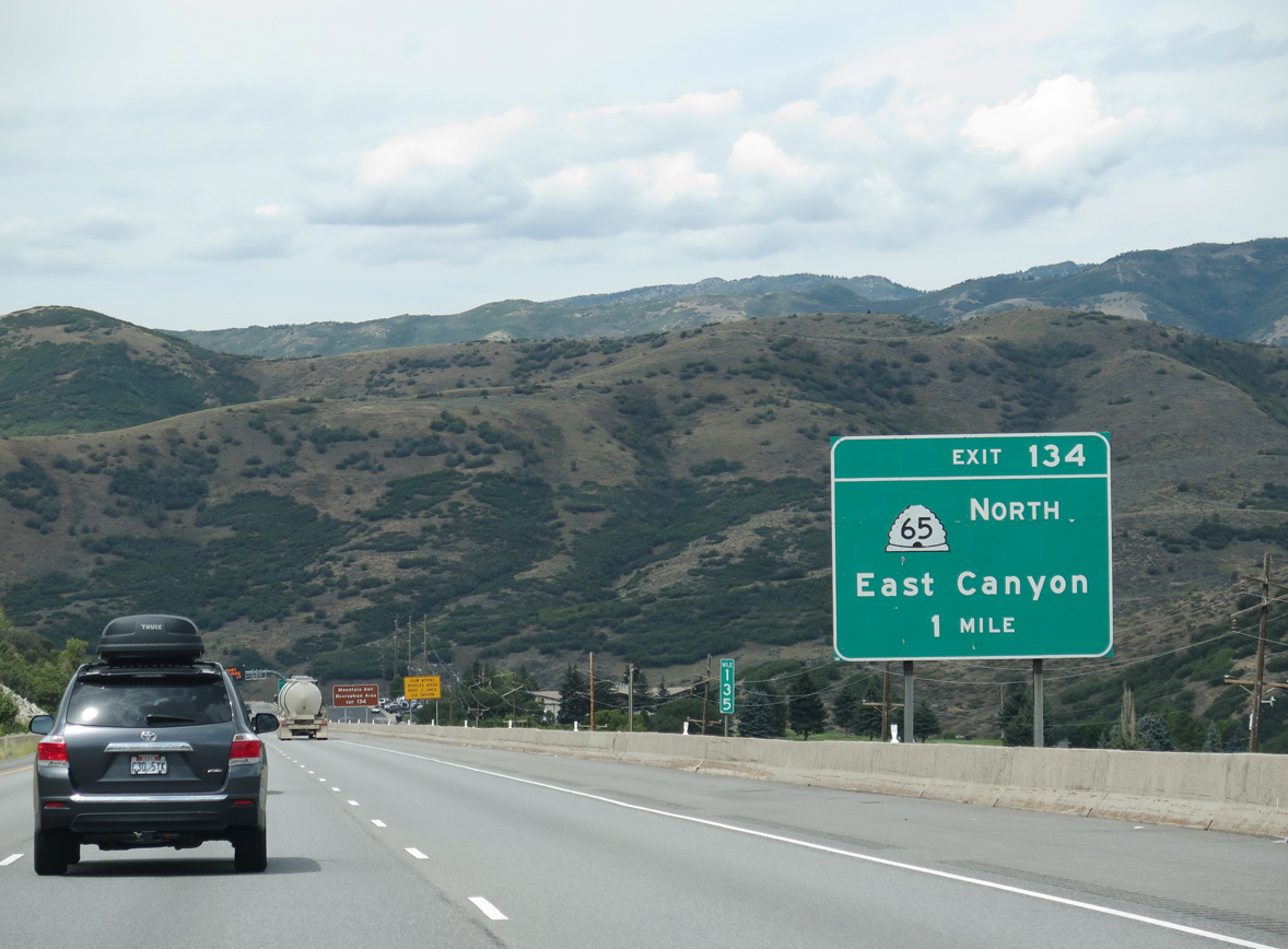
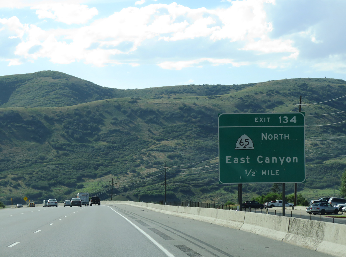
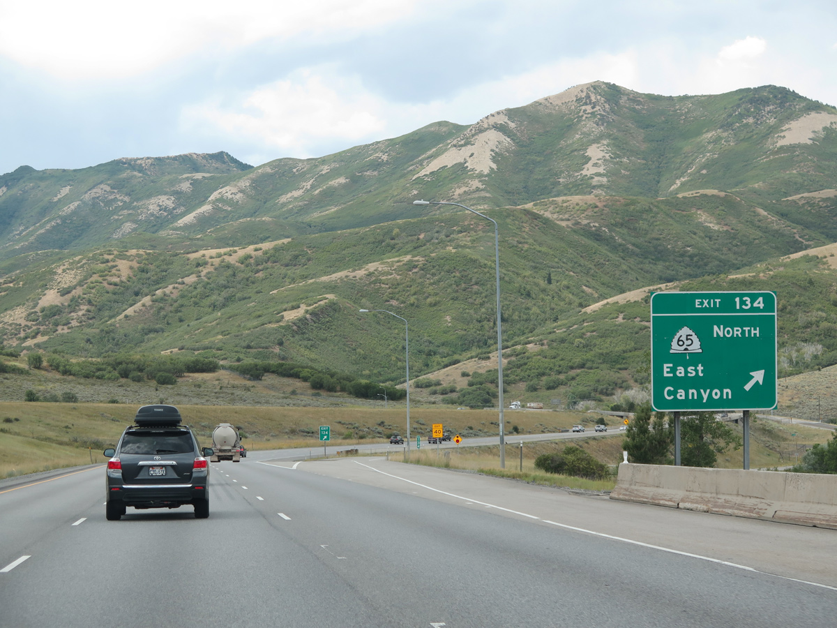
| Interstate 80 runs alongside Mountain Dell Golf Course to the diamond interchange (Exit 134) with SR 65 at Mountain Dell Reservoir. 08/25/14 |
|
| SR 65 begins at Interstate 80 and ventures northward to Mountain Dell Recreation Area and the East Canyon Reservoir in Morgan County. The state route totals 28.32 miles between Exit 134 and I-84 at Henefer. 07/11/15 |
|
| SR 65 travels across several switch backs before and after Big Mountain Pass en route to East Canyon. The state route intersects SR 66 in 19.3 miles at East Canyon State Park and is closed during the winter. 08/25/14 |
|
| A parting shot of SR 65 north to Little Dell Reservoir and Little Mountain Summit. 07/11/15 |
|
| Interstate 80 passes just south of Mountain Dell Dam. The dam is accessible only from an access road and wye interchange (Exit 133 on I-80 east) with the freeway. 08/25/14 |
|
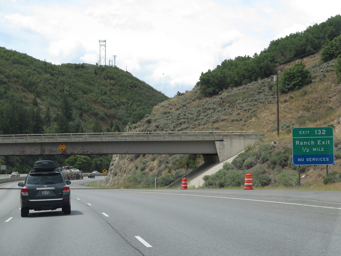
| Utilizing the Montana signing practice for ranch exits, a lone half mile guide sign appears for Exit 132 as I-80 passes under the Mountain Dell Dam access road. 08/25/14 |
|
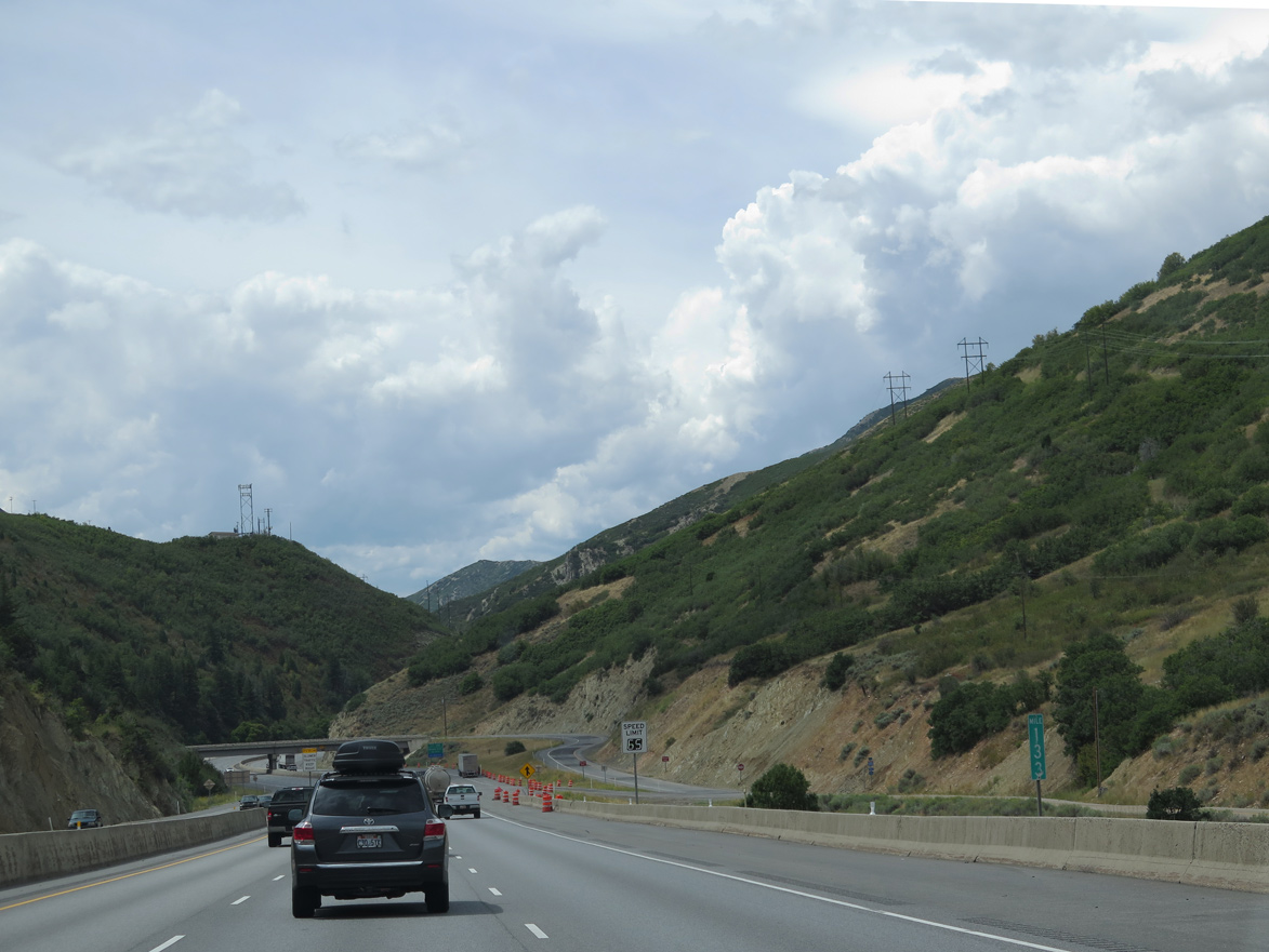
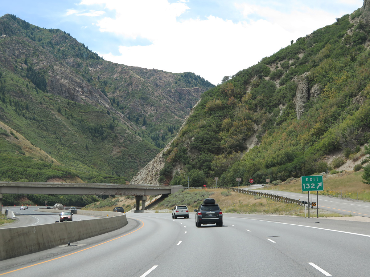
| A sharp curve precedes Exit 132 and Mount Aire Canyon along I-80 west. 08/25/14 |
|
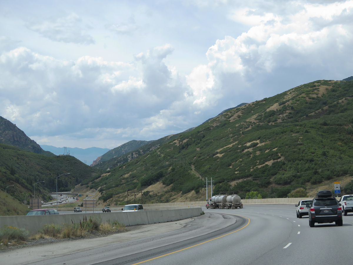
| Mt. Aire Canyon Road travels three miles southeast from a diamond interchange (Exit 132) with Interstate 80 to a dead end near the summit of Mount Aire. 08/25/14 |
|
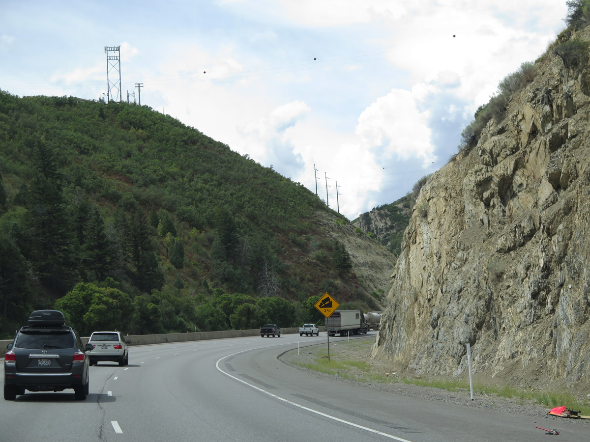
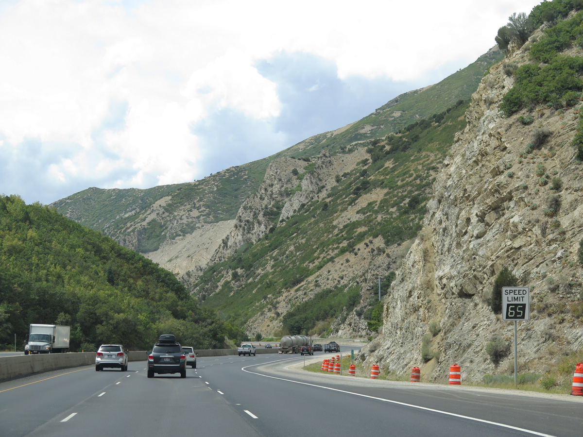
| Progressing downward toward Salt Lake Valley, Interstate 80 makes several additional S-curves ahead of Pharaohs Glen. 08/25/14 |
|
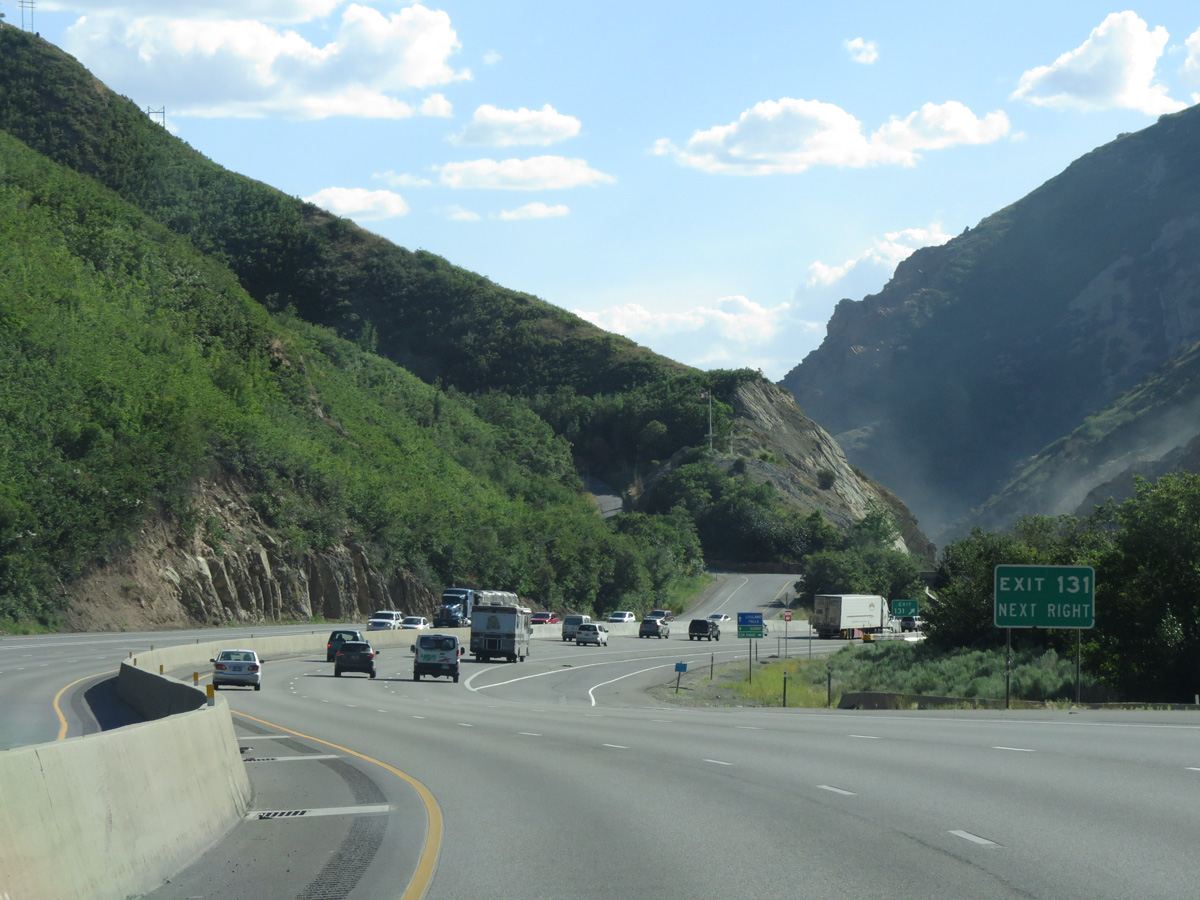
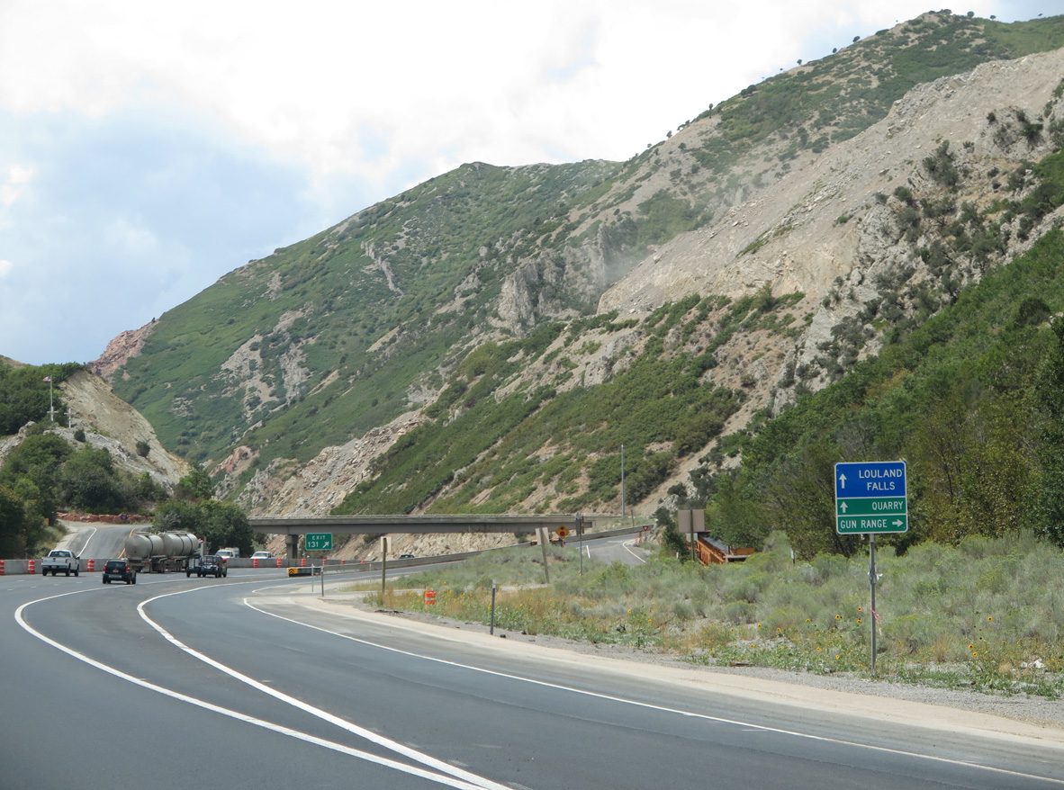
| A three quarter diamond interchange (Exit 131) provides local access to Louland Falls, a quarry and a firearms range. 07/11/15 |
|
| Exit 131 separates with a right turn leading east to the aforementioned gun range and unnamed access roads to the adjacent quarry and Louland Falls on the north facing hillside. 08/25/14 |
|
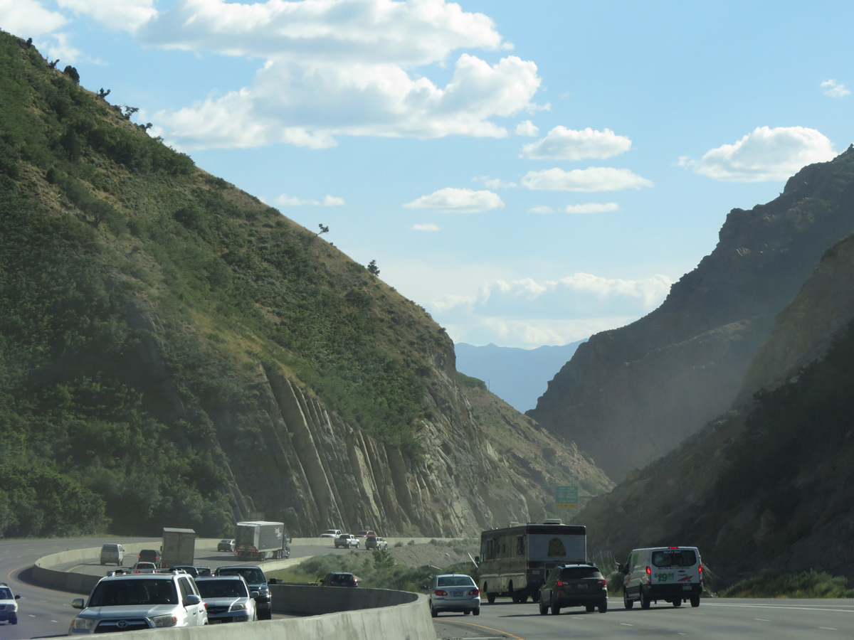
| A half diamond interchange (Exit 131 on I-80 east) succeeds the quarry ahead of the mouth of Parleys Canyon. 07/11/15 |
|
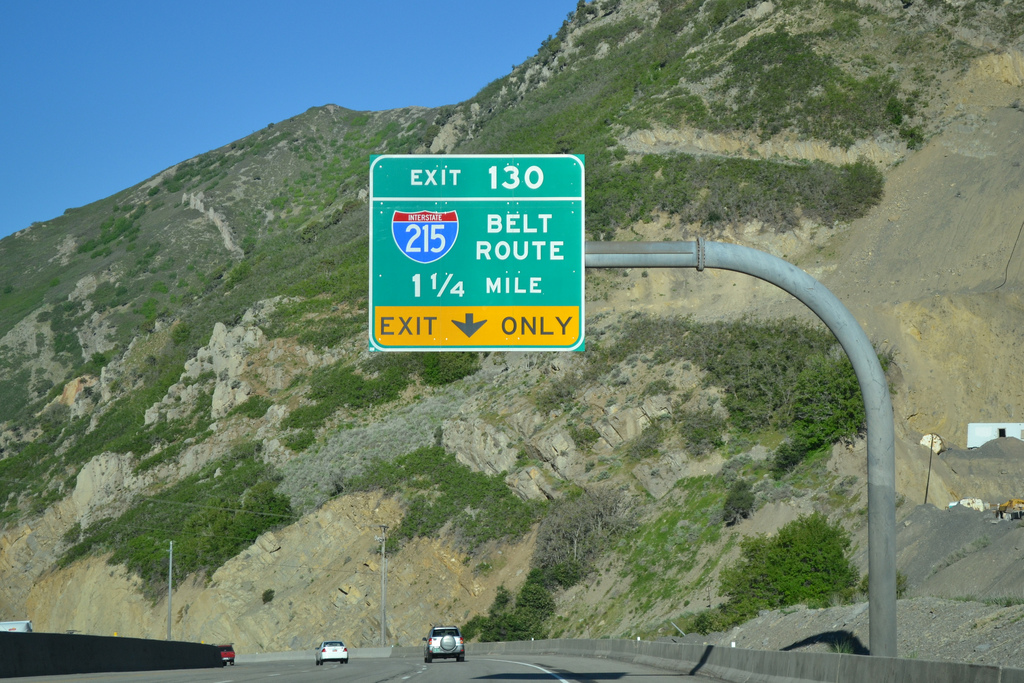
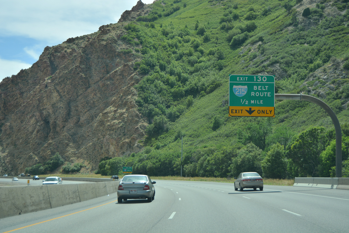
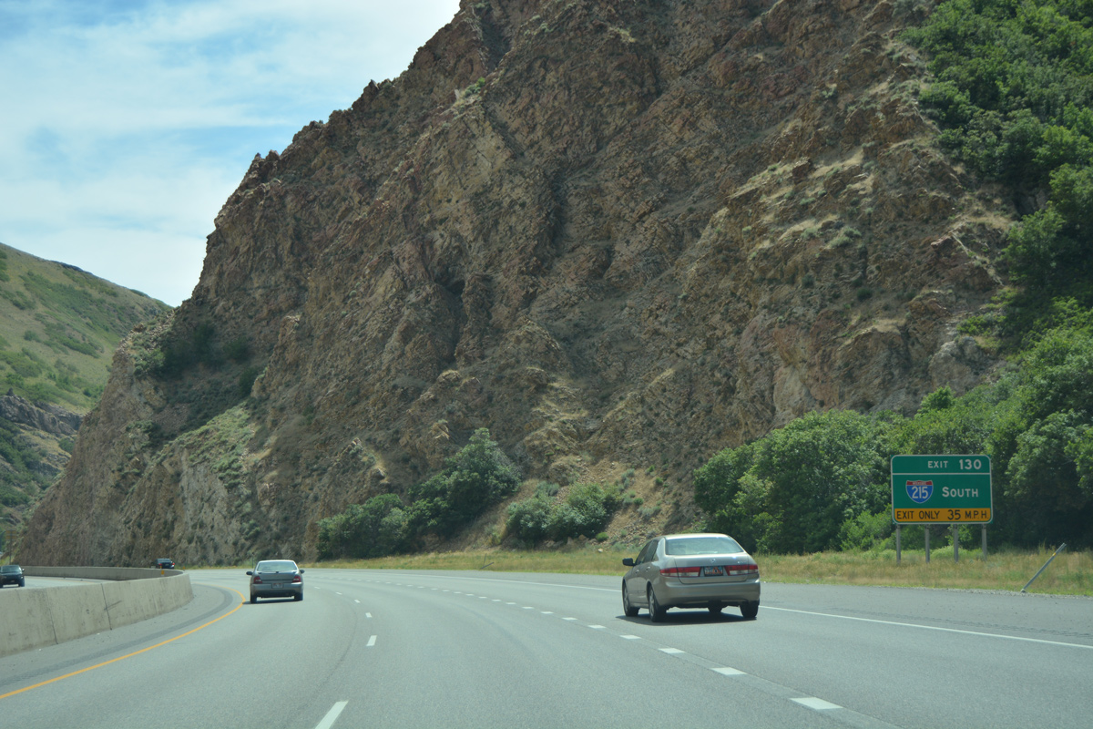
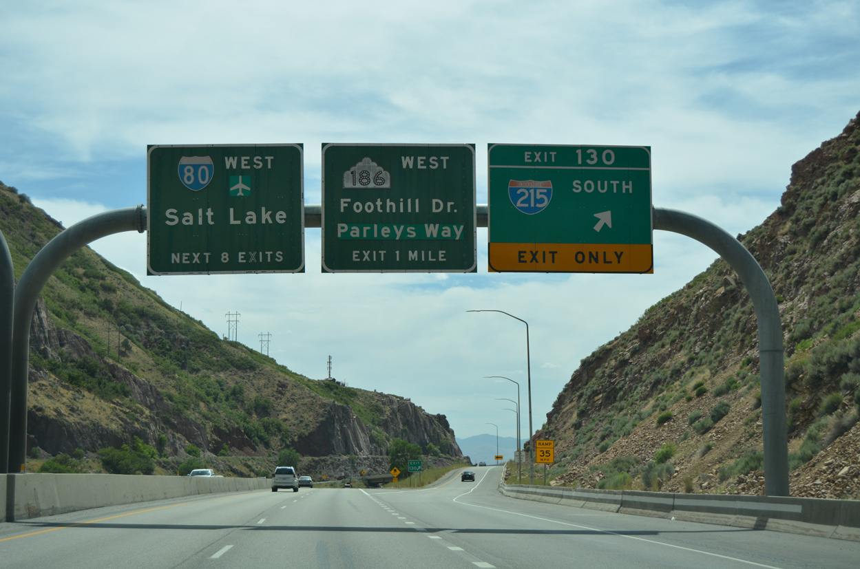
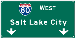
| Interstate 80 proceeds west to split with Interstate 215 south at Exit 130 in 1.25 miles. The belt route forms a 270 degree loop around Salt Lake City. Nicknamed The Crossroads of the West, the city had a population of 191,180 per 2013 Census estimates, sits at an elevation of 4,226 feet above sea level, and was founded in 1847. 06/09/11 |
|
| Interstate 215 travels south to the suburbs of Holladay and Cottonwood Heights and west to Midvale and Murray should use Interstate 215. The commuter freeway provides connections with SR 190 to the Solitude/Brighton ski areas and SR 210 for Snowbird/Alta ski areas. 07/08/16 |
|
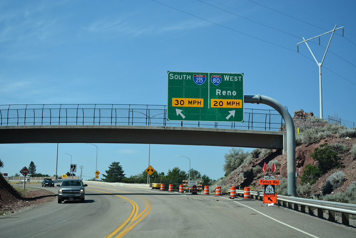
| A 0.4 mile connector takes motorists southwest from Exit 130 to Interstate 215 at Canyon Rim as the mainline bends northwest to merge with I-80 at Sugar House in Salt Lake City. The super two freeway was formerly SR 171. 07/08/16 |
|
| I-215 provides a bypass of Salt Lake City and South Salt Lake for motorists headed south on Interstate 15 to Provo. SR 186 west emerges from the north end of the SLC Belt Route along Foothill Drive. The subsequent exit from I-80 west provides direct access to the state route north for the University of Utah. 07/08/16 |
|
| Westbound at the wye interchange (Exit 130) with the two lane access road linking with Interstate 215. 07/08/16 |
|
| The access road from Exit 130 provides access to both directions of Interstate 215. The belt route travels southwest ten miles to I-15 at Murray and west 1.4 miles to SR 186 (Foothills Drive) and onto I-80. 07/16/17 |
|
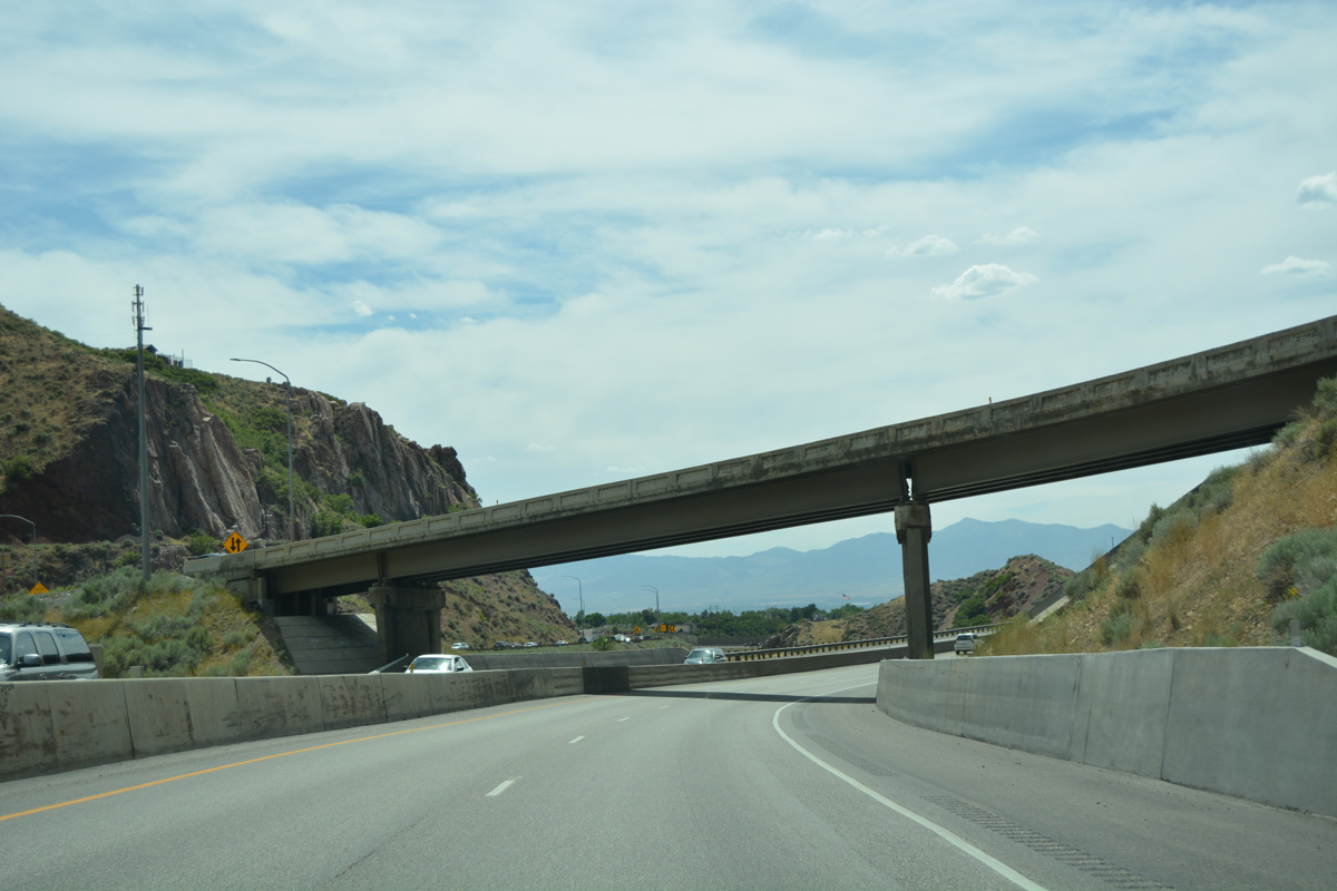
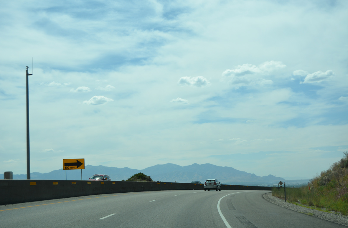
| The local terrain yields the unique two-pronged end of Interstate 215 as I-80 west exits Parleys Canyon. 07/08/16 |
|
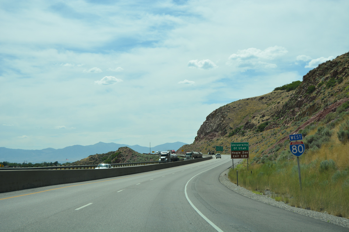
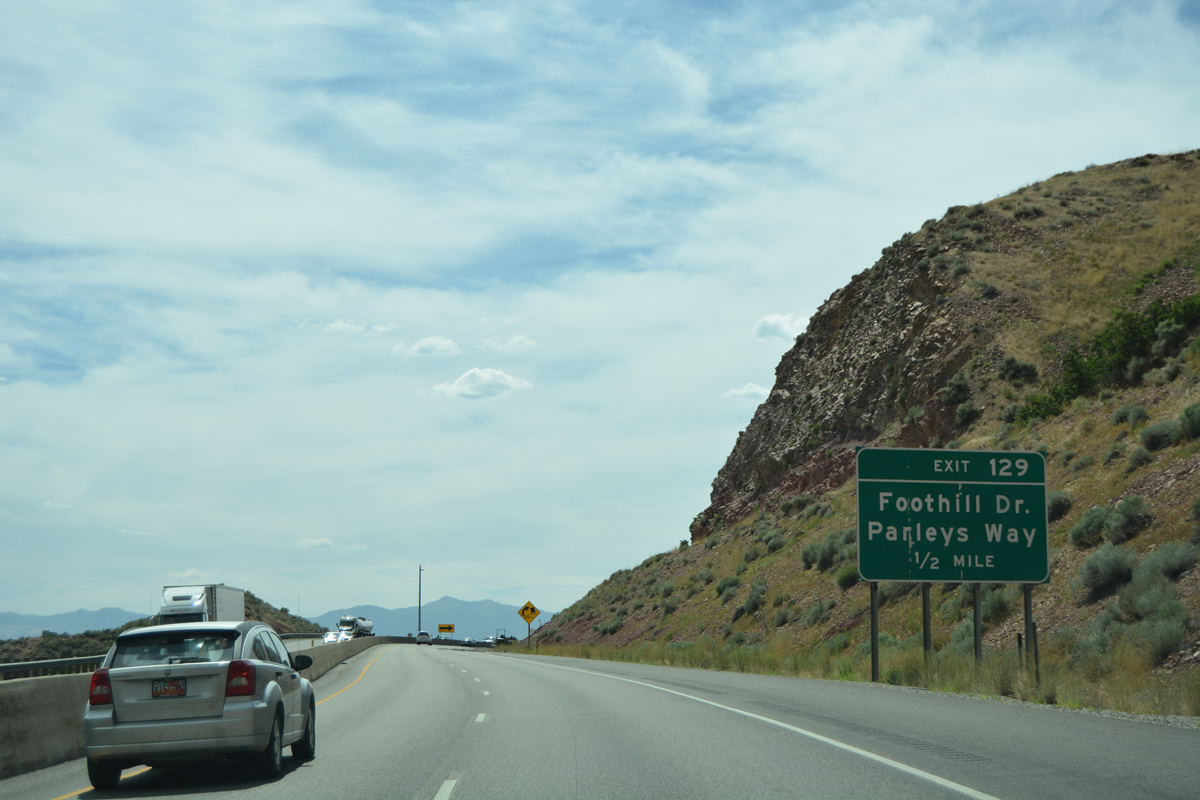
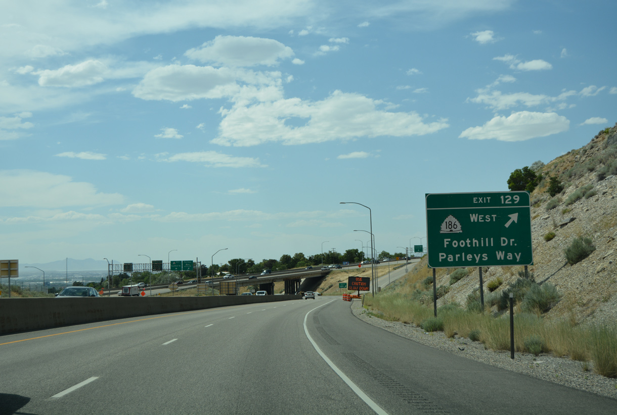
| SR 186 is omitted from the half mile sign for Exit 129. The state route follows the old alignment of U.S. 40 Alternate to U.S. 89 (State Street), where it turns north through Downtown to the state capitol. The 8.55 mile route ends at U.S. 89 (Beck Street) north of Capitol Hill. 07/08/16 |
|
| Interstate 80 wraps around the hills rising above Parleys Creek to the parclo interchange with SR 186 (Foothill Drive). 07/08/16 |
|
| Exit 129 parts ways with Interstate 80 west for SR 186 (Foothill Drive) north to East Bench and Bonneville Hills and Parleys Way (historic U.S. 40) west through Sugar House. 07/08/16 |
|
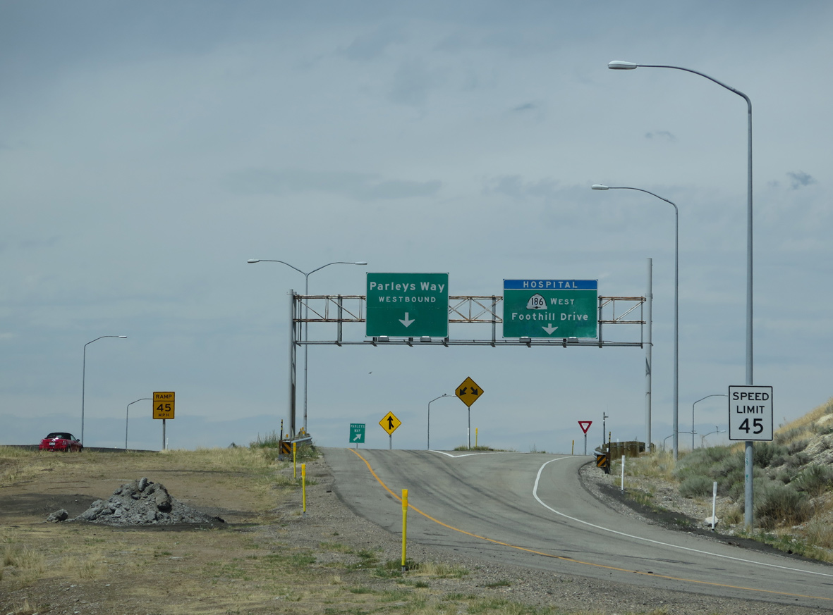
| Foothill Drive branches north from Interstate 215 to split with Parleys Way west just north of I-80. Separate ramps connect Exit 129 with the respective commercial arterials. 08/25/14 |
Page Updated 08-02-2016.

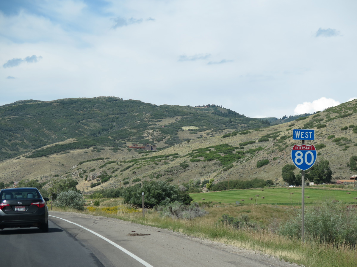
 West
West  South
South