|
| Interstate 215 commences south from a wye interchange with I-15 in the city of North Salt Lake. 08/10/16 |
|
| I-215 initially heads west to a diverging diamond interchange (Exit 28) with SR 68 (Redwood Road). 08/10/16 |
|
| Conversion of the exchange at Exit 28 to a DDI cost $27.69 million with work completed in 2019.1 08/10/16 |
|
| Curving southwest across SR 67 and the Jordan River, Interstate 215 south enters Salt Lake County. 08/10/16, 07/16/17 |
|
| The south end of SR 67 (Legacy Parkway) ties into I-215 at a wye interchange just west of SR 68 (Redwood Road). 07/16/17 |
|
| An auxiliary lane accompanies I-215 south from Legacy Parkway. Legacy Parkway is a freeway paralleling I-15/U.S. 89 south from Farmington. 07/16/17 |
|
| North 2100 stems west from Rose Park Lane to West 4000 in northwest Salt Lake City. 07/16/17 |
|
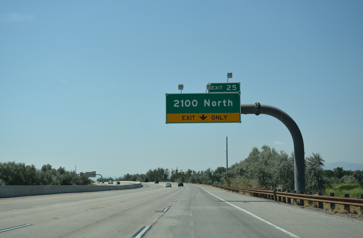
| One half mile ahead of the diamond interchange (Exit 25) with North 2100 on Interstate 215 south. 07/16/17 |
|
| Exit 25 departs I-215 south for North 2100 west to air cargo facilities at Salt Lake City International Airport (SLC) and parallel Rose Park Lane to the Westpointe neighborhood in Salt Lake City. 07/16/17 |
|
| Interstate 215 continues south between Salt Lake City International Airport (SLC) and the Westpointe neighborhood. 08/10/16 |
|
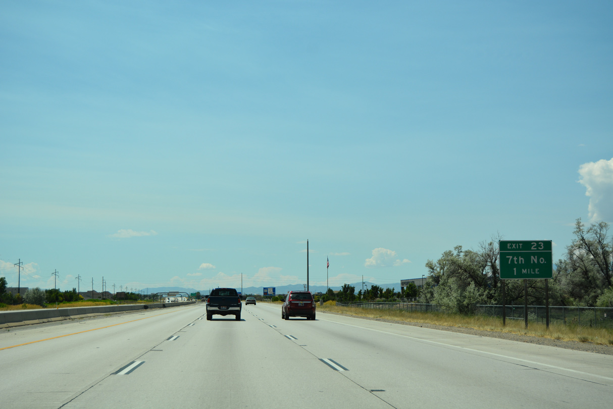
| The succeeding exit joins I-215 with North 700 at the Jordan Meadows neighborhood. 07/08/16 |
|
| West from the diamond interchange at Exit 23, 700 North ties into 2200 West by the General Aviation services area for SLC Airport. 07/08/16 |
|
| 700 North east becomes 600 North at Riverside Park at the Fairpark neighborhood in Salt Lake City. Utah State Fairpark is located to the southeast between the Jordan River and 1000 West. 07/08/16 |
|
| Exit 23 leaves I-215 south for 700 North. 600 North extends the five lane boulevard east to the Rose Park, Jackson and Guadalupe neighborhoods at Interstate 15. 07/08/16 |
|
| I-215 advances south to a systems interchange (Exit 22) with Interstate 80. 07/08/16 |
|
| Interstate 80 travels east to Downtown Salt Lake City and west to Salt Lake City International Airport (SLC) and the Great Salt Lake Desert. Previously the ramps for I-80 were numbered Exit 22A/B instead of B/A. 07/08/16 |
|
| Beyond the Salt Lake Valley, Interstate 80 continues west to Wendover and Elko, Winnemucca and Reno, Nevada. 07/08/16 |
|
| Exit 22B forms a distributor roadway along I-80 west to the exchange with Terminal Drive north to SLC Airport and SR 154 (Bangerter Highway) south to West Valley City. 08/10/16 |
|
| Exit 22A loops onto I-80 east ahead of the Sherwood and Riverside neighborhoods. I-80 combines with I-15 south from Downtown before turning east between Gateway and Ball Park toward Millcreek and Parleys Canyon out of the Salt Lake Valley. 07/08/16 |
|
| A high flyover connects Interstate 215 north with I-80 west. 07/08/16 |
|
| A reassurance marker stands along the entrance ramp from I-80 to I-215 south. The ramps and freeway mainline span SLGW and Union Pacific Railroad tracks here. 08/10/16 |
|
| The Salt Lake City Beltline proceeds south to Exit 21 between the Westside Industrial area and the Poplar Grove neighborhood. 07/08/16 |
|
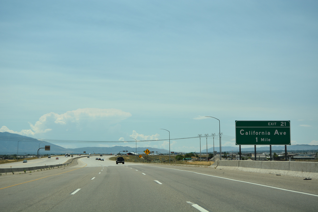
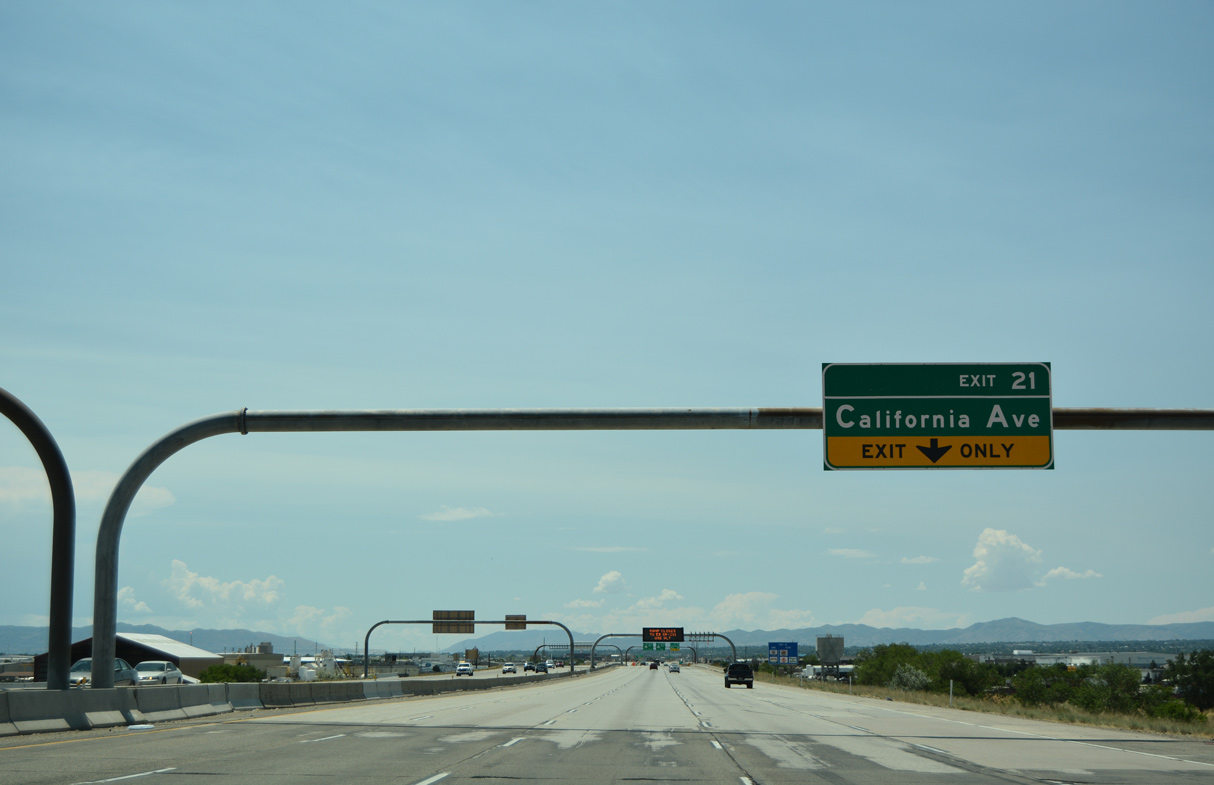
| Interstate 215 expands to eight overall lanes from I-80 to the south junction with I-15. California Avenue meets the freway at a single point urban interchange (SPUI). 07/08/16 |
|
| California Avenue constitutes an arterial west to SR 85 (Mountain View Highway) and east to 1300 South at the Cannon neighborhood. 07/08/16 |
|
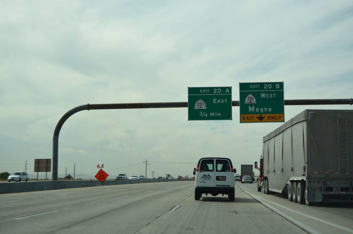
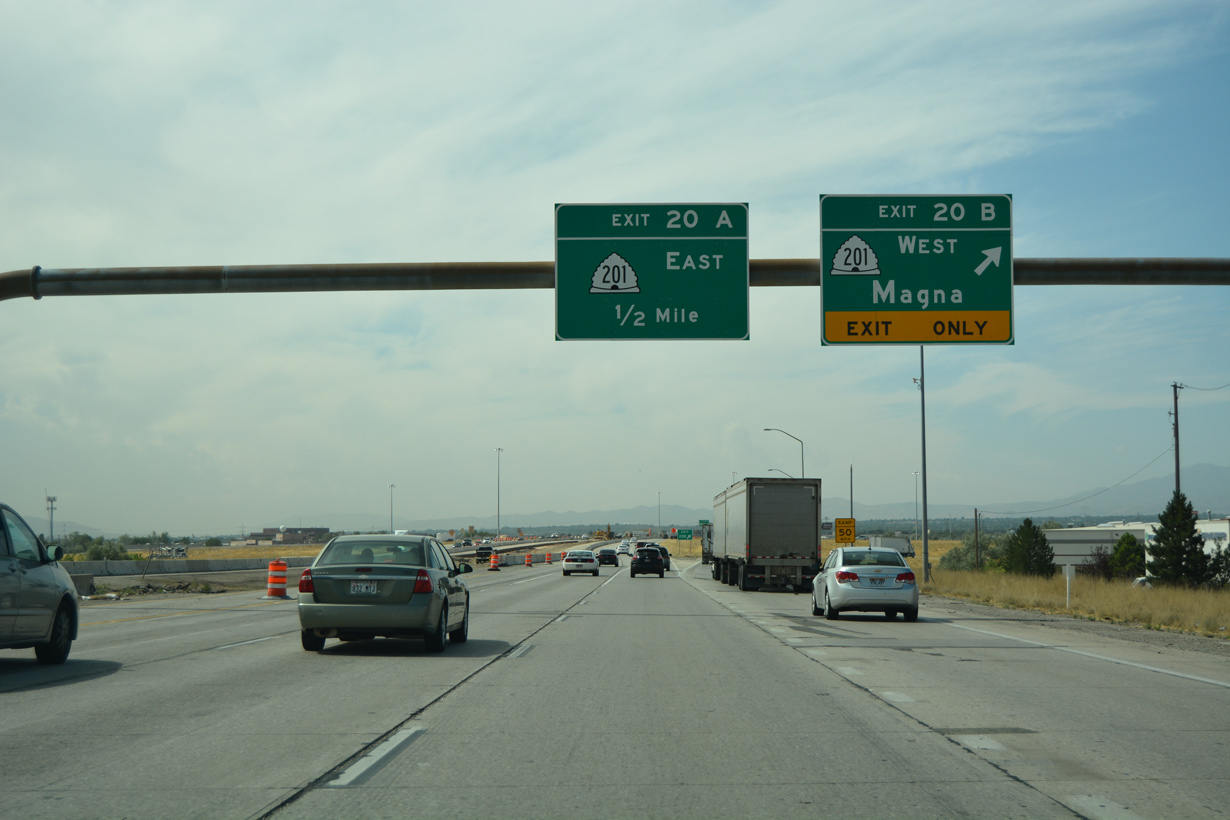
| SR 201 is the 2100 South Freeway extending west from I-15/80 at Ball Park in Salt Lake City to 7200 West at Magna. 08/10/16 |
|
| A cloverleaf interchange links Interstate 215 and SR 201 (2100 South Freeway) at Exit 20. SR 201 extends 15 miles west to I-80 at Lake Point Junction. 08/10/16 |
|
| The 2100 South Freeway east ties into the south split of I-15/80. SR 201 shifts off the freeway via 900 West onto 2100 South to U.S. 89 (State Street) by the Liberty-Wells neighborhood in Salt Lake City. 08/10/16 |
|
| Interstate 215 enters West Valley City south ahead of the directional cloverleaf interchange (Exit 18) with SR 171 (3500 South). 07/08/16 |
|
| SR 171 runs across West Valley City between SR 111 and the South Salt Lake city line at the Jordan River. 07/08/16 |
|
| The exchange with SR 171 (3500 South) lies between Valley Fair Mall along adjacent 2400 West and the Maverick Center, an entertainment venue hosting concerts and Utah Grizzlies ice hockey to the northeast. 07/08/16 |
|
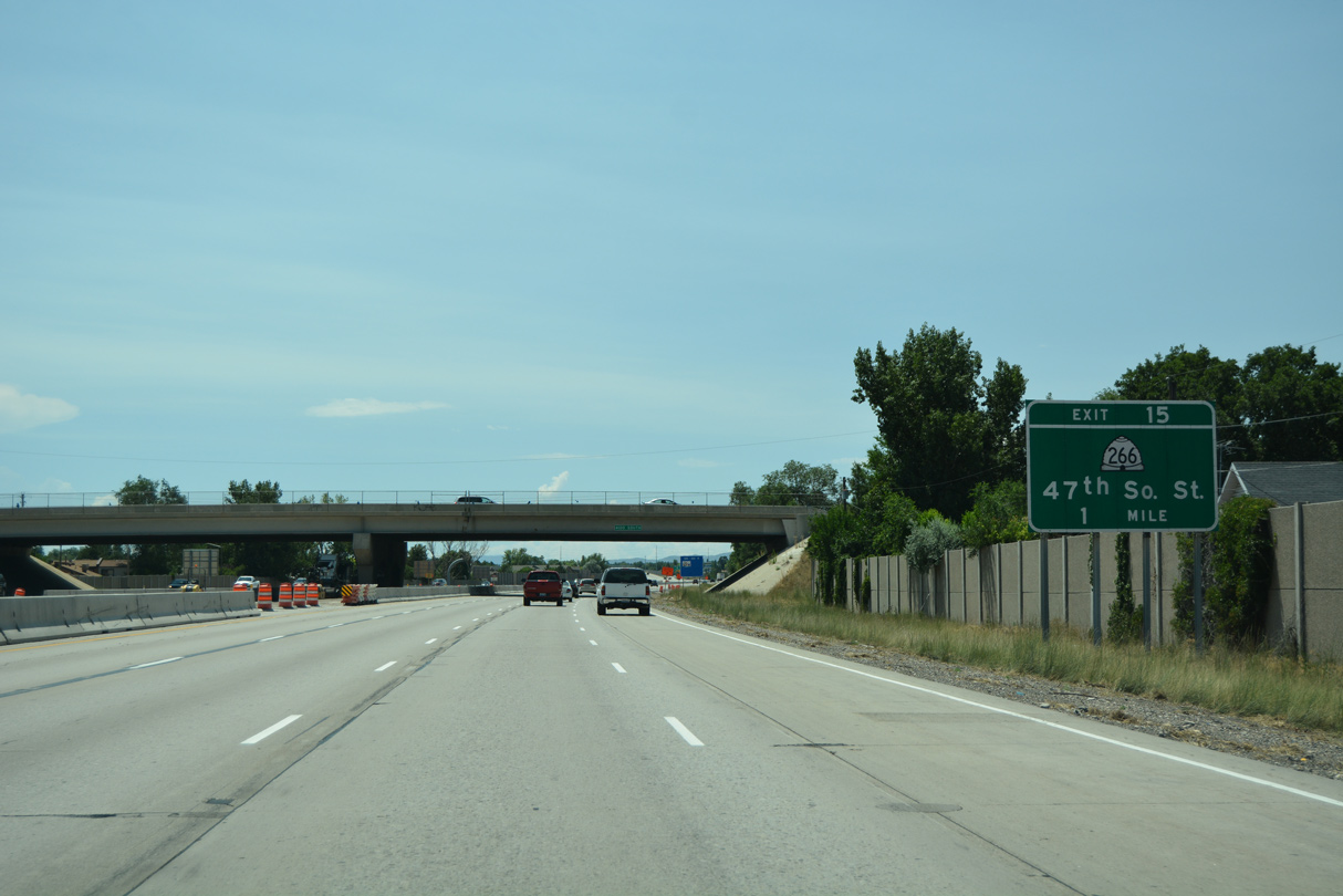
| The ensuing exit from I-215 south is with SR 266 (4700 South) in the city of Taylorsville. 07/08/16 |
|
| SR 266 travels 8.13 miles east from Interstate 215 along 4700 South, Taylorsville Expressway, and 4300 South through Taylorsville, Murray and Holladay. 07/08/16 |
|
| Taylorsville city hall lies just west of Exit 15. Salt Lake Community College is to the northeast. 07/08/16 |
|
| An auxiliary lane opens south from SR 266 (4700 South) to SR 68 (Redwood Road). 07/08/16 |
|
| Interstate 215 curves southeast from the SR 173 (5400 South) underpass to the six-ramp parclo interchange with SR 68 (Redwood Road) at Exit 13. 07/08/16 |
|
| A 70.80 mile long highway, SR 68 (Redwood Road) originates from U.S. 89 at Woods Cross to the north and concludes to the south at U.S. 6 and Elberta. 07/08/16 |
|
| Exit 13 departs Interstate 215 south for SR 68 (Redwood Road) north through Taylorsville and south to West Jordan. 07/08/16 |
Page Updated 02-07-2022.

 South
South