SR 360 provides a cutoff north from U.S. 6 at Basalt across Little Summit to U.S. 95 at Tonopah Junction. Following Mina/Basalt Cutoff Road, SR 360 navigates along a 23.23 mile course between the Excelsior Mountains and Candelaria Hills wholly within Mineral County.
|
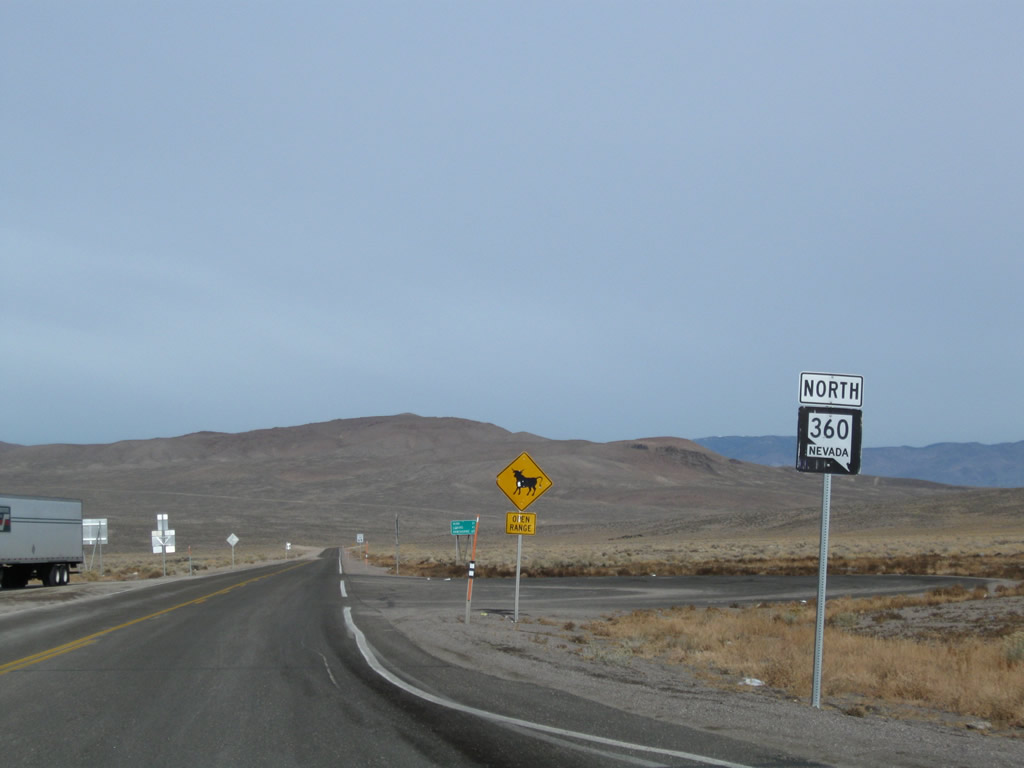
| SR 360 leads north from U.S. 6 at Basalt to connect with northbound U.S. 95. toward Walker Lake, Hawthorne, and Yerington (via U.S. 95 Alternate). 11/11/08 |
|
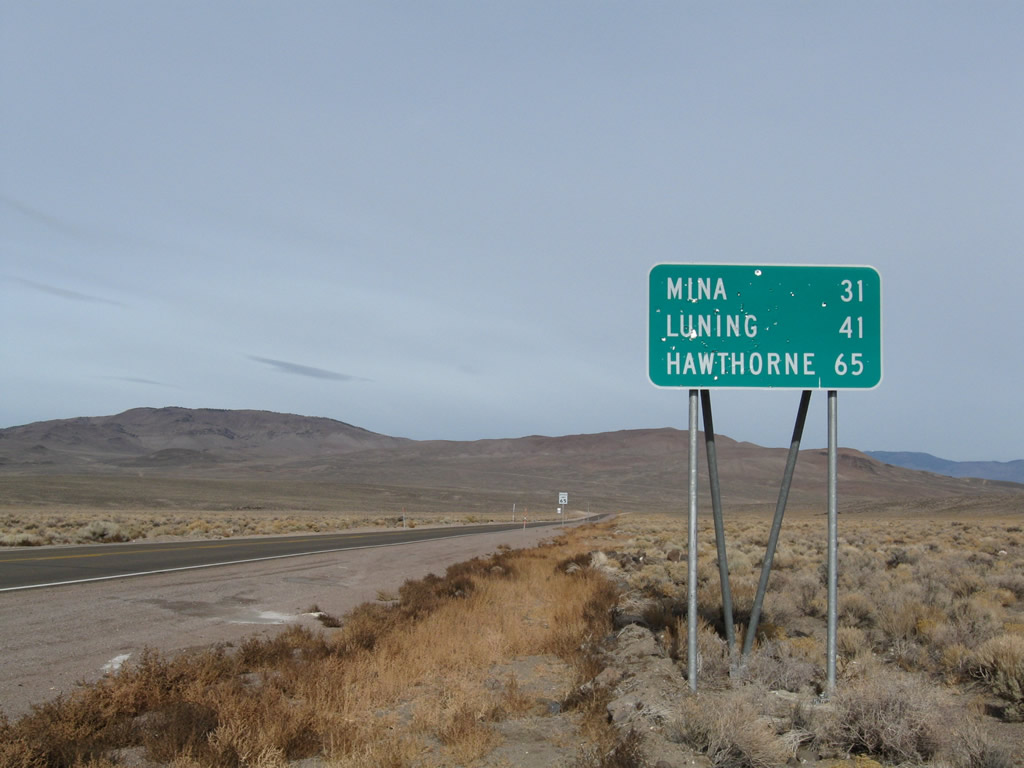
| The rural community of Mina lies 31 miles to the north along U.S. 95 beyond the end of SR 360. Unincorporated Luna and Hawthorne follow. 11/11/08 |
|
| A rural highway, SR 360 sees little traffic between U.S. 6 and U.S. 95. NDOT traffic counts between 2008 and 2017 varied between 380 and 550 vehicles per day (vpd). 11/11/08 |
|
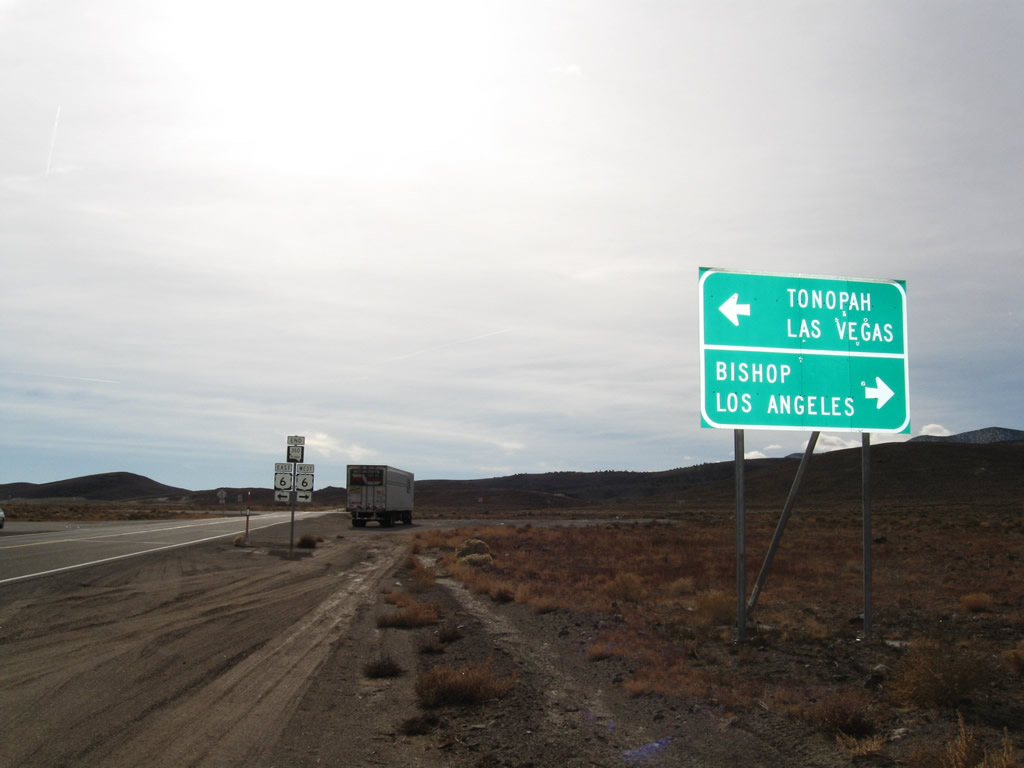
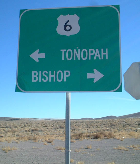
| Approaching U.S. 6 (Grand Army of the Republic Highway) on SR 360 south. U.S. 6 travels south to Bishop, California, where it ends at U.S. 395. U.S. 6 formerly extended to Los Angeles along U.S. 395 and SR 14. 11/11/08 |
|
| An end shield for SR 360 appears at U.S. 6 ahead of the dirt road spurring to the site of Basalt. 11/11/08 |
|
| U.S. 6 east leads to Coaldale, where it combines with U.S. 95 southbound to Tonopah. 11/11/08 |
|
| Westbound U.S. 6 crosses Montgomery Pass into Queen Valley ahead of the California state line. East from SR 360, U.S. 6 passes north of the Volcanic Hills, meeting both SR 264 and SR 773 south to Fish Lake Valley. 01/20/02 |
Page Updated 04-19-2019.