
U.S. 40 travels 486.92 miles in Colorado, entering the state at Dinosaur and departing into Kansas east of Arapahoe. Through northwestern reaches of the state, U.S. 40 joins the county seats of Craig, Steamboat Springs and Hot Sulphur Springs to the Rocky Mountains. South from Granby, U.S. 40 ascends across Berthoud Pass at an elevation of 11,315 feet to Empire and Interstate 70.
Interstate 70 overlays U.S. 40 east through Idaho Springs. East into Jefferson County, the US highway emerges as a frontage road for the freeway to El Rancho, and again from Genesee Park to Mount Vernon Canyon. Through Golden, Lakewood, Denver and Aurora, U.S. 40 combines with Business Loop I-70 along Colfax Avenue.
Colfax Avenue and Interstate 70 converge in east Aurora, with U.S. 40 and U.S. 287 joining the freeway on an unmarked concurrency to Limon. U.S. 40/287 branch southeast from I-70 and U.S. 24 at Limon to Kit Carson. U.S. 287 heads south to Eads while U.S. 40 continues to Cheyenne Wells and Wallace County, Kansas.
U.S. 40 Colorado Guides
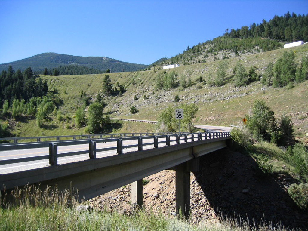
U.S. 40 branches southeast from U.S. 6 and I-70 in eastern Clear Creek County, Colorado across Clear Creek on a bridge built in 1973. 09/01/04
 West West |
 | U.S. 385 overlaps with U.S. 40 west for 0.55 miles to E 5th Street S at the town of Cheyenne Wells. 04/23/17 |
 | U.S. 40 westbound merges onto Interstate 70 at Genesee Park. Section B of U.S. 40 begins 2.4 miles to the west from SH 74 at El Dorado. 02/02/02 |
   | U.S. 40 west and U.S. 6 converge at the west end of Clear Creek Canyon. U.S. 40 (Route 040B) ends, with U.S. 6 merging onto I-70 west through Idaho Springs. SH 119 ties into U.S. 6, 2.8 miles to the east. 09/01/04 |
Photo Credits:
02/02/02, 09/01/04, 04/23/17 by AARoads
Connect with:
Interstate 25
Interstate 70
U.S. 6
U.S. 24
Page Updated 01-31-2022.