
U.S. 40 (The Victory Highway) used to run from San Francisco, California, east to Atlantic City, New Jersey. Like many transcontinental U.S. highways, U.S. 40 was truncated well before reaching the Pacific Ocean. It ends at Silver Creek Junction, Utah.
U.S. 40 is one of the original 1926 U.S. Highways. With the construction of Interstate 80 in the 1960s and 1970s, U.S. 40 dwindled in importance. California decommissioned U.S. 40 in 1964, and Nevada followed suit in 1975. Although most of the road was absorbed by Interstate 80, many old alignments remain today. All of the I-80 business loops; Nevada State Routes 230, 396, and 427; and several locally maintained frontage roads are remnants of the old road. Some towns, such as Wendover, have street signs that designate the business loop as "Old Highway 40."
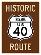
U.S. 40 was the Victory Highway, which follows Interstate 80 across Northern Nevada. Following the Humboldt River for much of its length, the Victory Highway served Reno, Winnemucca, and Elko on its approximately 410 mile length. Starting in the 1820s, the most pioneers crossed Nevada along the approximate U.S. 40 alignment, including the famous '49ers on their way to California's famed Mother Lode of gold. This pioneer trail came to be known as the Emigrant or Humboldt Trail.
Looking back, U.S. 40 can be considered a victim of its own success. However, its success was not always assured. In the early 1920's, the Victory Highway Association competed against the Lincoln Highway Association for east-west travelers across Nevada. In 1926, the Victory Highway across Northern Nevada was designated U.S. 40, and the Lincoln Highway across Central Nevada was designated U.S. 50. U.S. 6, which follows the Midland Trail across Central Nevada, was not established as a U.S. route until 1938, and unlike the other two routes, it does not lead travelers to Northern California.
The Northern Nevada route of the Victory Highway had the competitive advantage over the Lincoln Highway in that the Victory Highway followed the original pioneer trails and had been used extensively throughout the 1800s. On the other hand, most pioneers avoided the U.S. 50 route across Central Nevada, as it was not surveyed until 1855 and not mapped until 1859. As such, most travelers preferred the northern route through the 1850s, although the central route's shorter length enticed the Pony Express, Overland Stage, and transcontinental telegraph to use it in the 1860s. However, by 1870, the Central Pacific Railroad decided to follow the northern alignment, which all but killed the central route until the advent of the automobile in the early 1900s.
After these two highways were designated as U.S. 40 and U.S. 50, the highway associations competed for travelers. And the Lincoln Highway Association was able to attract more travelers at times. For example, in 1931, a traffic count at Fernley indicated that 181 cars took U.S. 50 and 141 cars took U.S. 40. However, this added fuel to the fire of competition. The Victory Highway Association put up advertisements that designated U.S. 40 as the "Main Line" across Nevada, while the Lincoln Highway Association used a gas station in Wendover to attract travelers to take the central route.
Unfortunately for the Lincoln Highway proponents, by 1939 three out of every four cars traveling westbound through Wendover were taking U.S. 40. Moreover, in 1940 U.S. 40 was designated a national defense highway, which gave it priority in terms of federal expenditures. With this action, the Lincoln Highway Association realized that U.S. 50 would not carry more traffic than U.S. 40, so they reduced their efforts to advertise U.S. 50 and increased their efforts to attract travelers into Nevada, as opposed to other east-west routes through other states. The central route proponents advertised the route as the '49er Trail.
With the increased traffic along U.S. 40, improvements were in the offing. The 1956 National Defense and Interstate Highway Act sealed the fate of U.S. 40 as a major national transportation corridor. The last section of Interstate was completed in 1983 to bypass Lovelock. U.S. 40 was decommissioned in Nevada, with its new terminus pushed back to Utah.
Between 1954 and 1964, Alternate U.S. 40 followed what is now California 70 and U.S. 395 between Sacramento and Reno. This alternate route, while not faster than U.S. 40, provided an all-weather route between these two cities. California 70 crosses the Feather River Canyon en route to Nevada.
The state of Utah decommissioned its segment of U.S. 40 concurrently with Nevada in 1975, so today U.S. 40 is truncated just northeast of Park City, Utah, at Silver Creek Junction. At the interchange of Interstate 80 and U.S. 40 lies a large, black sign that indicates the end of U.S. 40.
Page Updated 06-18-2002.