|
| U.S. 395 drops from Upper Long Valley in Sierra County, California into Cold Spring Valley at Bordertown, Nevada. 07/17/17 |
|
| Signs depicting the lone prospector welcomed motorists entering Nevada for around 25 years. New welcome signs were unveiled across the state starting on March 15, 2017. The replacement signs use the winning entry of a contest organized by three state entities where Nevada high school students submitted designs.1 2000 |
|
| The diamond interchange (Exit 83) with Village Parkway lies just beyond the California border along U.S. 395 south. Village Parkway travels east from the adjacent Frontage Road (old U.S. 395) at Bordertown to the community of Cold Springs, a bedroom community in northwest Reno. 07/17/17 |
|
| Continuing southeast from Bordertown, U.S. 395 straddles the western edge of the dry bed of White Lake to a truck check station. 07/17/17 |
|
| No longer posted, this reassurance marker for U.S. 395 at Bordertown was the first in Nevada southbound. 09/09/05 |
|
| Granite Peak rises prominently to the south within unincorporated Washoe County as truckers on U.S. 395 reach the check station by dry White Lake. 07/17/17 |
|
| U.S. 395 begins its southward climb out of Cold Springs Valley ahead of Exit 80 with White Lake Parkway. The north-south roadway links U.S. 395 and the parallel Frontage Road (old US 395) with Village Parkway in Cold Springs. 07/17/17 |
|
| One half mile ahead of the diamond interchange (Exit 80) with White Lake Parkway on U.S. 395 southbound. Old US 395 parallels the freeway along the southbound side from the state line to north Reno. 07/17/17 |
|
| Exit 80 leaves U.S. 395 south for White Lake Parkway. White Lake Parkway encircles the east side of White Lake to Village Parkway. 07/17/17 |
|
| A chain installation area, for periods of snowy or icy weather, lies just beyond the entrance ramp from White Lake Parkway. U.S. 395 ascends 300 feet in elevation from Cold Spring Valley across the Granite Hills. 09/09/05 |
|
| The second confirming marker for U.S. 395 south in Nevada was this assembly posted at Dry Lake Summit. 09/09/05 |
|
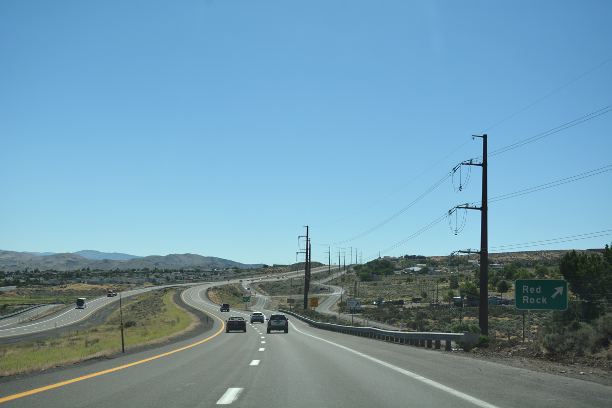
| Turning eastward from Dry Lake Summit, the U.S. 395 freeway lowers three hundred feet in elevation along the south side of Granite Peak to Red Rock Road (Exit 78). 07/17/17 |
|
| U.S. 395 sinks another one half mile toward the diamond interchange (Exit 78) with Red Rock Road. Red Rock Road stems north from old US 395 (Virginia Street) to the Silver Shores development. 07/17/17 |
|
| Continuing the descent into Lemmon Valley on U.S. 395 south. The freeway runs along the Reno city line east from Exit 78 alongside the Turtle Creek subdivision. 07/17/17 |
|
| Southbound U.S. 395 at Exit 78 for Red Rock. Red Rock Road wraps around the west side of the dry Silver Lake to Silver Knolls, and ranch areas in northern Lemmon Valley. 07/17/17 |
|
| Stead Boulevard meets U.S. 395 south at the succeeding exit in one mile. Steed Boulevard comprises a four lane suburban boulevard north to an array of subdivisions at the Stead area of north Reno. 07/17/17 |
|
| Stead Boulevard provides a direct route to Reno/Stead Airport (RTS), located on a plateau west of Swan Lake. Reno/Tahoe International (RNO) lies 11 miles south along U.S. 395 & Interstate 580. 07/17/17 |
|
| Entering the diamond interchange (Exit 76) with Stead Boulevard on U.S. 395 south. Stead Boulevard ends at parallel North Virginia Street (old US 395) to the south. Silver Lake Road intersects the boulevard to the north by the Sierra Sage Golf Course and Silver Lake development. 07/17/17 |
|
| U.S. 395 gradually turns southward across Lemmon Valley and next meets Lemmon Drive at a diamond interchange (Exit 74). 07/17/17 |
|
| A half mile ahead of Exit 74 to Lemmon Drive on U.S. 395 south. Lemmon Drive travels 3.5 miles north to the community of Lemmon Valley, located on the east side of the dry Swan Lake. 07/17/17 |
|
| U.S. 395 southbound reaches the off-ramp (Exit 74) to Lemmon Drive. Military Road splits with Lemmon Drive, 0.9 miles to the north and branches northwest to the Silver Vista Village and The Crest at Stonefield suburban developments and Reno-Stead Airport (RTS). 07/17/17 |
|
| Advancing southeast, U.S. 395 passes by warehouses and a mobile home park to Exit 73 with Golden Valley Road. 07/17/17 |
|
| The first reassurance marker for U.S. 395 south in Nevada stands beyond the Lemmon Drive on-ramp. 07/17/17 |
|
| A half mile ahead of the diamond interchange (Exit 73) with Golden Valley Road on U.S. 395 south. Golden Valley Road originates in the Peavine Heights subdivision west of the Raleigh Heights community. 07/17/17 |
|
| East from Exit 73, Golden Valley arcs through the Golden Valley community to O'Brien Pass and 7th Avenue east to Sun Valley. 07/17/17 |
|
| U.S. 395 spans a Union Pacific Railroad line below this reassurance marker. 06/28/14 |
|
| U.S. 395 enters Panther Valley and splits with U.S. 395 Business (Virginia Street) at Exit 72. Virginia Street (SR 430) carries the business loop southward to the University of Nevada at Reno and Downtown Reno. U.S. 395 bypasses Downtown to the east along Martin Luther King Jr. Memorial Highway. 07/17/17 |
|
| Entering the trumpet interchange (Exit 72) with U.S. 395 Business (Virginia Street) south in Panther Valley. Virginia Street passes through central Reno and meets U.S. 395 again in 8.7 miles at Exit 63. The business route south 3.16 miles to SR 659 (McCarran Boulevard) is SR 430. The remainder of the route is city-maintained and poorly signed as U.S. 395 Business. 07/17/17 |
|
| Parr Boulevard east and Dandini Boulevard west come together at a diamond interchange (Exit 71) with U.S. 395 south in one mile. 07/17/17 |
|
| The distant Virginia and Pah Pah Ranges rise along the east side of Truckee Meadows beyond this confirming marker preceding Exit 71. 06/28/14 |
|
| Exit 71 departs from U.S. 395 south. Parr Boulevard extends 1.1 miles west to intersect with U.S. 395 Business (Virginia Street) at Vista Rafael Parkway. Dandini Boulevard takes a winding course east by the Desert Research Institute and Truckee Meadows Community College 1.8 miles to Sun Valley Boulevard (SR 443). 07/17/17 |
|
| The final push toward Truckee Meadows takes U.S. 395 southeast through a split diamond interchange (Exit 70) with SR 443 (Clear Acre Lane) and SR 659 McCarran Boulevard). 07/17/17 |
|
| Exit 70 links U.S. 395 south with SR 443 (Clear Acre Lane) just north of its terminus at SR 659 (McCarran Boulevard). A service road extends south from Clear Acre Lane to McCarran Boulevard directly. 07/17/17 |
|
| SR 443 (Clear Acre Lane) spurs 3.20 miles north from SR 659 to 7th Avenue and Sun Valley Boulevard in the community of Sun Valley. 06/28/14 |
|
| Exit 70 partitions from U.S. 395 (Martin Luther King, Jr. Memorial Highway) southbound. Adjacent McCarran Boulevard comprises a 23 mile long arterial beltway encircling central Reno and Sparks. The route is wholly maintained by NDOT and designated as SR 659. 07/17/17 |
|
| The service road from SR 443 (Clear Acre Lane) partitions with an on-ramp for U.S. 395 south ahead of the McCarran Boulevard overpass. Prior to 2004-05 construction, a diamond interchange joined U.S. 395 with McCarran Boulevard directly. 07/17/17 |
|
| U.S. 395 turns due south from SR 659 (McCarran Boulevard) to exit 69 with Oddie Boulevard and the Spaghetti Bowl interchange (Exit 68) with Interstate 80. 07/17/17 |
|
| Interchange sequence sign posted a quarter mile ahead of the parclo interchange (Exit 69) with Oddie Boulevard. I-580 accompanies U.S. 395 south ahead of Glendale Avenue (Exit 67). 07/17/17 |
|
| The McCarran Boulevard entrance ramp for U.S. 395 joins the freeway south above the Wedekind Road underpass. Sound walls separate the west side from the North Valley neighborhood. 07/17/17 |
|
| Exit 69 departs U.S. 395 south for Oddie Boulevard, the former route of SR 663 between Sutro Street (old SR 666) in Reno and SR 445 (Pyramid Way) in Sparks. SR 663 was transferred to local maintenance in 2010.
Three lanes otherwise continue southward to the Spaghetti Bowl interchange (Exit 68) with Interstate 80. 07/17/17 |
|
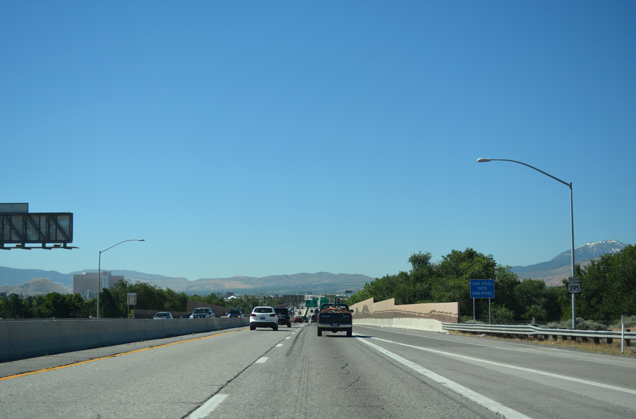
| Interstate 80 generally mirrors the course of the Truckee River across Truckee Meadows. The urban freeway travels along the north side of Reno and just south of Downtown Sparks nearby. 06/28/14 |
|
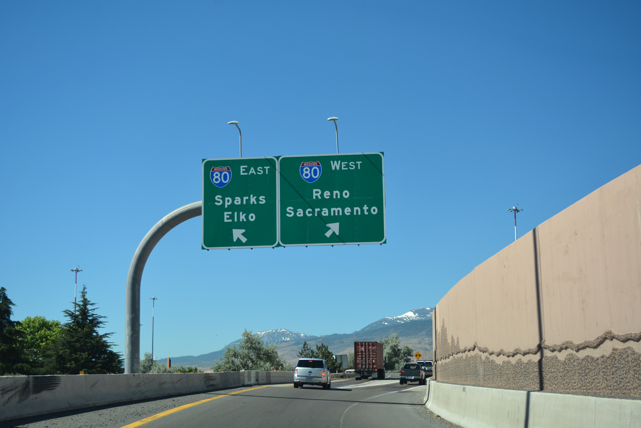
| Interstate 580 begins and accompanies all of U.S. 395 south to Washoe Valley and Carson City. Exit 68 separates from the freeway, carrying traffic bound for I-80 east to Elko and west to Sacramento, California in unison. 07/17/17 |
|
| Exit 68 partitions fro Interstate 80 east to Winnemucca, Elko (286 miles) and Salt Lake City, Utah (509 miles) and west to Verdi, Truckee and Sacramento (127 miles). The Spaghetti Bowl is a turbine interchange, with a pair of loop ramps from I-580 to I-80. 07/17/17 |
Page Updated 07-04-2018.

 South
South