Looking west from the previous east end of SR 7 at Airport Parkway. Photo by Garrett Smith (07/07/11).
Utah State Route 7 is Southern Parkway, a partially completed freeway that loops east of St. George, providing access to St. George Regional Airport (SGU) and developing areas to southwestern reaches of Hurricane. The state route starts at a single point urban interchange (SPUI) with Interstate 15, opposite Sun River Parkway west to the Sun River community. The initial 5.91 miles are built out with four overall lanes. The remainder of the 18.30 mile route carries just two lanes.
Southern Parkway curves northeast from Airport Parkway to run alongside Warner Ridge to Punchbowl Dome (el. 3,533 feet). The state route navigates northeast, from a point 1.3 miles north of the Warner Valley Road underpass, through a valley east of Washington Dome (el. 3,261 ft) to a diamond interchange connecting with Washington Dam Road at milepost 15. The eastern extent of SR 7 continues into the city of Hurricane by Sand Hollow Resort Golf Course. It ends by Sand Hollow Reservoir.
Following nearly two years of construction, Segment 1 of the Southern Parkway, stretching 3.4 miles between Interstate 15 and River Road (Exit 3), opened on July 7, 2009. Succeeding 3.9 mile freeway (Segment 2), from River Road east to Airport Parkway, opened by September 2010.1 Airport Parkway was also built as a new terrain route northwest from Exit 7 to the new St. George Regional Airport (SGU).
Work on two additional portions of SR 7 continued through January 2014. Opening then was Segment 3A, an extension of Southern Parkway north from Airport Parkway to Warner Valley Road in the city of Washington, and Segment 4A, a separate two lane highway leading east from Washington Dam Road to Sand Hollow Road in the city of Hurricane. The 4.5 mile link (Segment 3A) between those sections was built at a cost of $21 million.1 Bringing the total cost of Southern Parkway to $175 million at that point, it opened to traffic on January 12, 2016.2
Future road work includes $80 million in construction to build the parkway north from 3000 South to SR 9 in Hurricane (Segment 5), and another $85 million by 2035 for expansion project.1 Segment 6 will upgrade SR 9 to a limited access road, completing the 32 mile loop back to Interstate 15 in north Washington.2
|
| SR 7 curves southward from Interstate 15 to quickly meet Astragalus Drive at a folded diamond interchange (Exit 1). 08/12/11 |
|
| Exit 1 loops away from SR 7 (Southern Parkway) east to Astragalus Drive at Black Mountain Drive west. The rural exchange at the north end of Big Valley is slated for future development. Photo taken 08/12/11. 08/12/11 |
|
| Proceeding southeast from Astragalus Drive, SR 7 continues through largely undeveloped areas alongside Atkinville Wash. 08/12/11 |
|
| The ensuing exit joins SR 7 (Southern Parkway) with River Road north and Mohave County 5 south into Arizona. 08/12/11 |
|
| The diamond interchange (Exit 5) with River Road straddles the Arizona state line in one half mile. 08/12/11 |
|
| River Road winds northward from Exit 3 by White Dome (el. 2,861 feet) to Fort Pierce Industrial Park. County Road 5 is an unpaved road south to BLM Land through Big Valley. 08/12/11 |
|
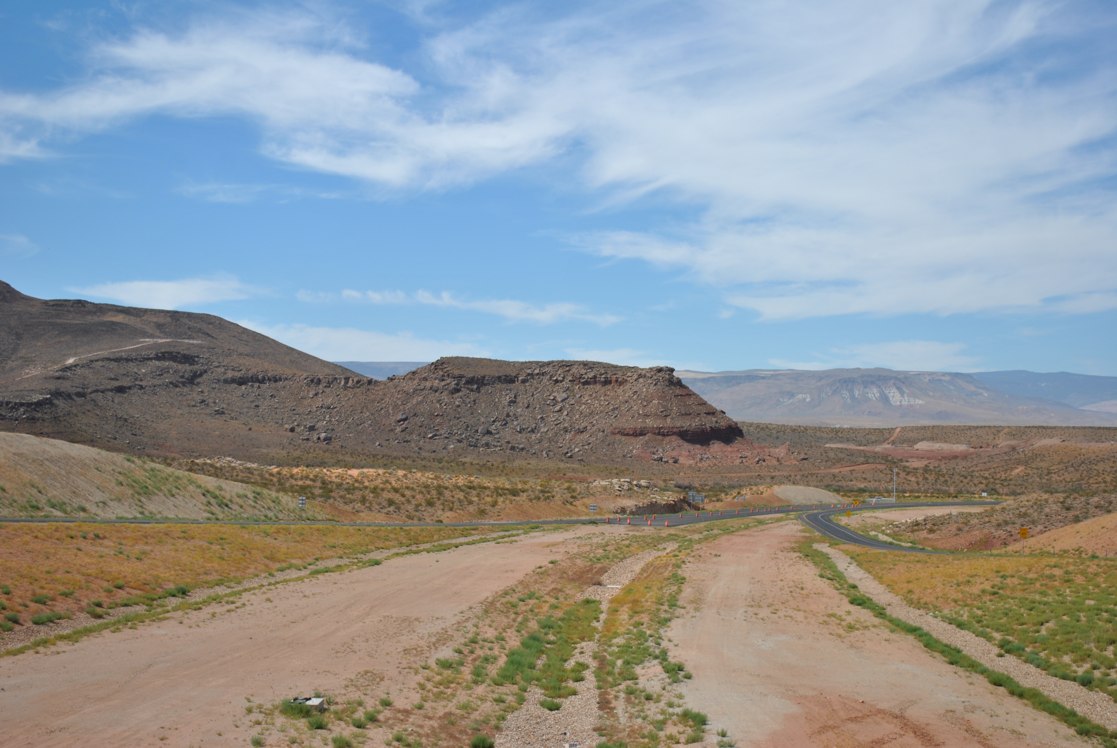
| Continuing east, Southern Parkway makes a pair of gradual S-curves through undeveloped lane south of White Dome. Development appears further east at Exit 7. 08/12/11 |
|
| A diamond interchange, unnumbered as of 2016, connects SR 7 (Southern Parkway) with Desert Canyons Parkway. The parkway serves development both north and south of the freeway. 08/12/11 |
|
| Southern Parkway narrows to two lanes ahead of the Desert Canyons Parkway underpass. The expressway advances east across Fort Pierce Wash to meet Airport Parkway in one mile. 08/12/11 |
|
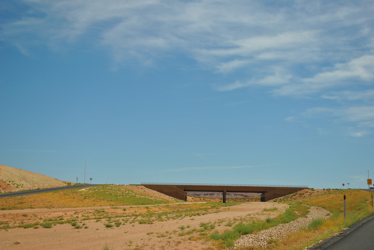
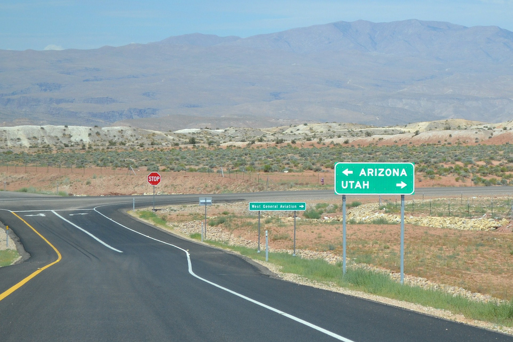
| A yellow caution sign preceded the temporary end of Southern Parkway at the diamond interchange (Exit 7) with Airport Parkway. The parkway was completed with two lanes northward to Warner Valley Road in January 2014. 08/12/11 |
|
| Airport Parkway angles northwest from forthcoming Exit 7 to a roundabout with Desert Canyons Parkway. The parkway turns northeast from there to the St. George Regional Airport (SGU) passenger terminal. SGU Airport opened in January 2011. 08/12/11 |
|
| All traffic defaulted onto Airport Parkway prior to the 3.2 mile extension of Southern Parkway north to Warner Valley Road. Areas surrounding this exchange are a part of the 8,000 acres of proposed new development.2 08/12/11 |
|
| Little Black Mountain rises to the south in this view from the Airport Parkway overpass at the east end of Southern Parkway Segment 2. 08/12/11 |
|
| Traveling west at the then-beginning of SR 7 from Airport Parkway. The two lane freeway crosses over Fort Pierce Wash on the succeeding stretch. 07/07/11 |
|
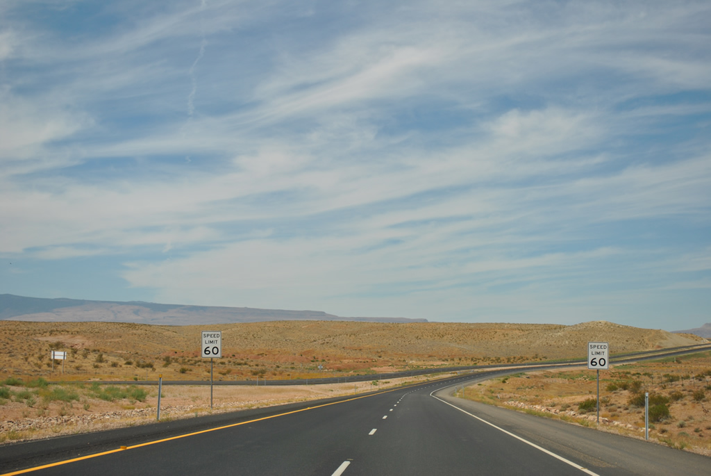
| Speed limits along SR 7 (Southern Parkway) west over Fort Pierce Wash were initially set at 60 miles per hour (mph). They have since increased to 65 mph. 07/07/11 |
|
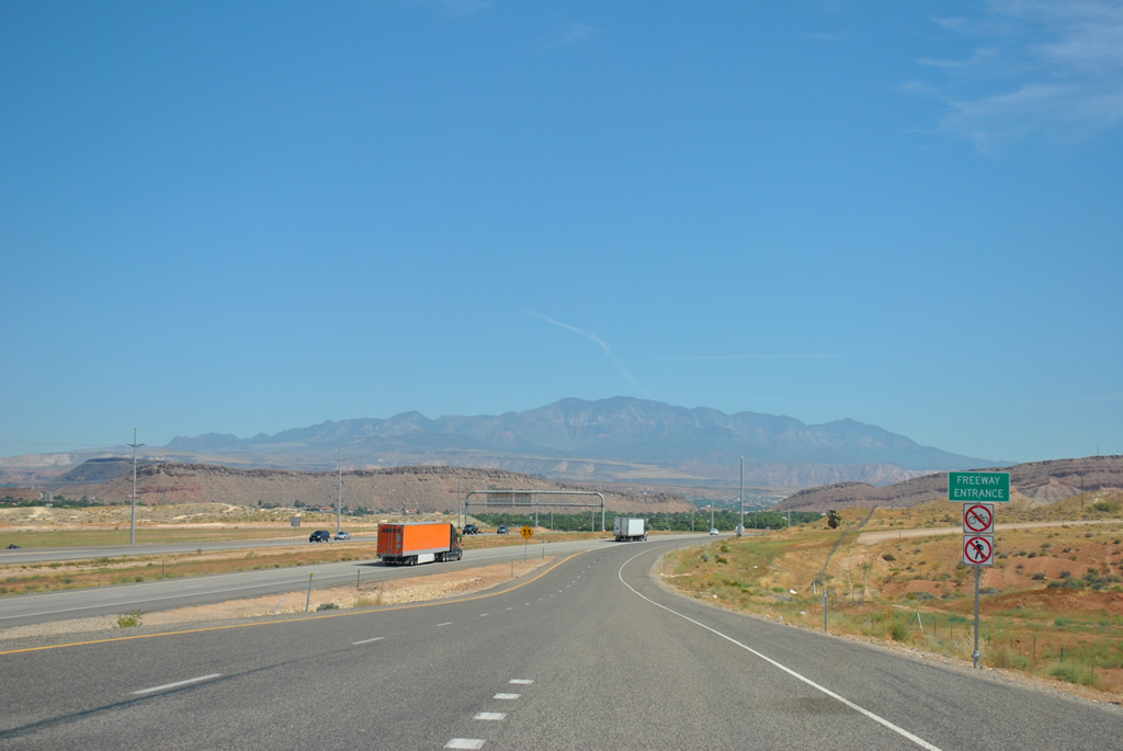
| SR 7 west enters a diamond interchange with Desert Canyons Parkway to the immediate west of Fort Pierce Wash. The exit opened up adjacent land for development, including the Deserts Edge At Desert Canyons subdivision just to the south. 07/07/11 |
|
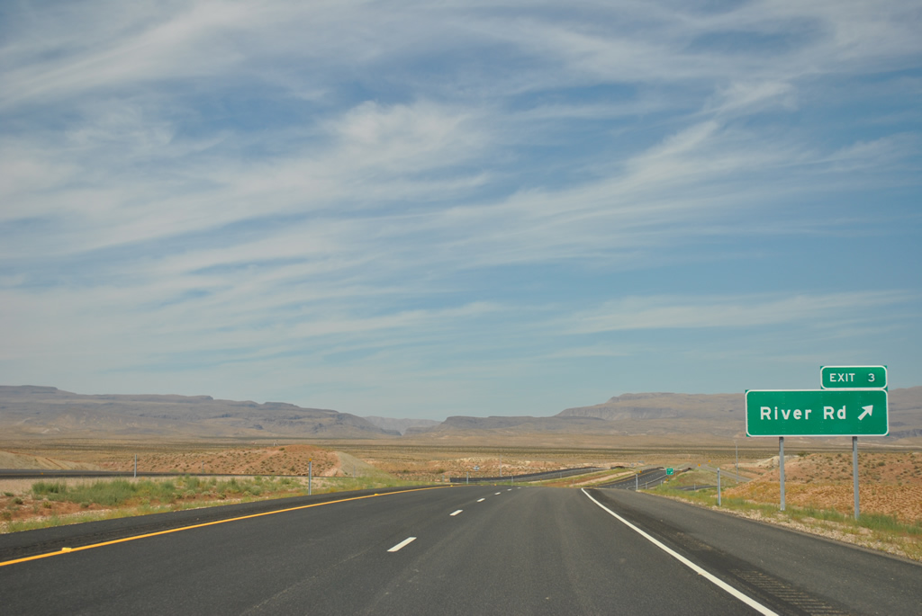
| Southern Parkway gradually curves southward to run alongside the Arizona border to a diamond interchange (Exit 3) with River Road north and Mojave County Route 5 south. 08/12/11 |
|
| Forthcoming River Road leads north to Fort Pierce Industrial Park. Linking roads lead motorists east to the west general aviation facilities of St. George Regional Airport (SGU). 07/07/11 |
|
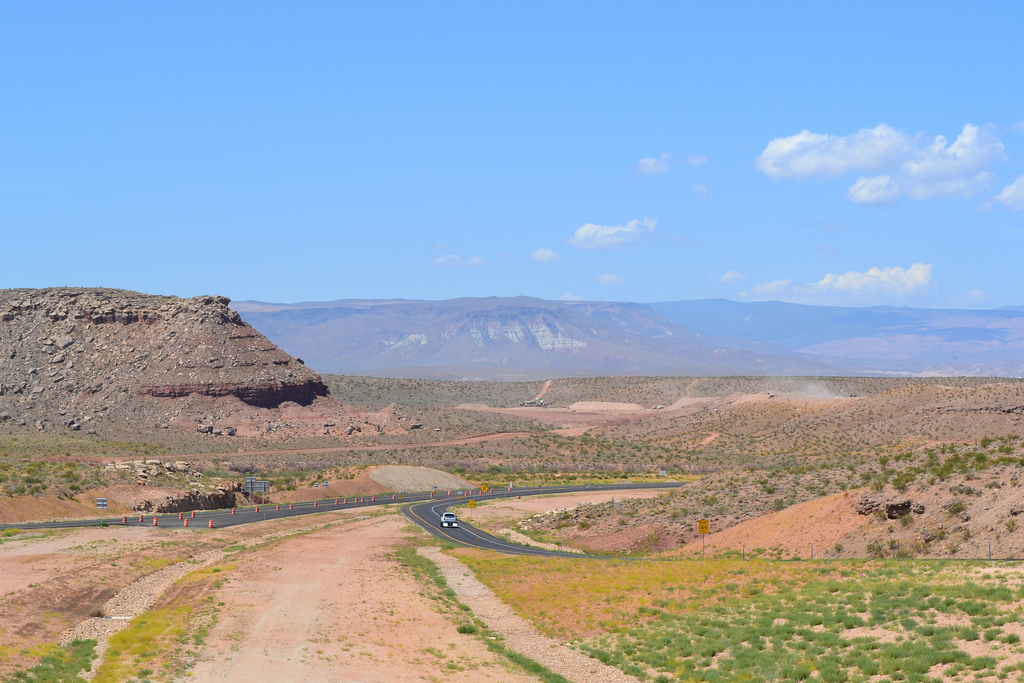
| Southern Parkway passes just south of White Dome (el. 2,861 feet) on the half mile approach to River Road north and County Road 5 south. 07/07/11 |
|
| Exit 3 departs from SR 7 west. River Road extends 8.2 miles north from CR 5 to 100 North in the city of St. George. CR 5 is an unpaved route spurring south to BLM areas of northern Arizona. 08/12/11, 07/07/11 |
|
| The distant Beaver Dam Mountains spread along the western horizon as Southern Parkway advances west and north toward Interstate 15 and Downtown St. George. 07/07/11 |
|
| A folded diamond interchange (Exit 1) joins SR 7 with Astragalus Drive north. Astragalus Drive was constructed for future development along the east side of Interstate 15. 08/12/11 |
|
| The single point urban interchange (SPUI) with Interstate 15 lies just west of the Astragalus Drive underpass on SR 7. 08/12/11 |
|
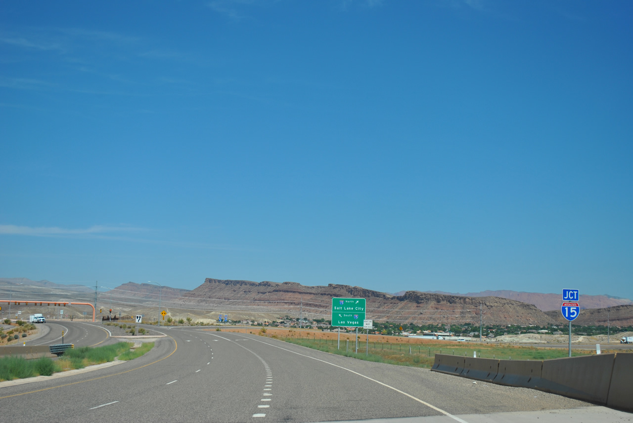
| Interstate 15 and SR 7 come together on the south side of St. George by the Sun River community. The freeway leads southwest through Virgin River Gorge to Mesquite and Las Vegas, Nevada. 08/12/11 |
|
| The northbound on-ramp to central St. George, Cedar City, Provo and Salt Lake City leaves Southern Parkway west as the freeway ends. 08/12/11 |
Sources:
- "New Southern Parkway segment opens." The Independent (UT), January 12, 2016.
- "Long-awaited link made on Southern Parkway." The Spectrum (UT), January 12, 2016.
07/07/11 by Garrett Smith. 08/12/11 by AARoads.
Connect with:
Interstate 15
Page Updated 07-17-2017.


 East
East