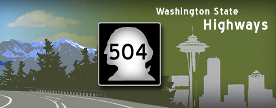
Washington State Route 504 once carried summer travelers to Spirit Lake, esteemed as one of the most beautiful spots in the Cascade Range. After Mount Saint Helens erupted violently on May 18, 1980, forests were flattened and the once jewel-like lake was filled with ash and logs. In the aftermath, a huge wall of mud, ash, and debris, known as a lahar, raced down the North Fork Toutle River Valley - burying over 30 miles of the original alignment of SR 504 along with it.
Between 1987 and 1994, the state of Washington rebuilt the highway, this time positioning the roadbed well above the valley floor to guard against future damage from debris and lahars. To cross the many creeks that empty into the North Fork Toutle River along the route, 14 new bridges were built. The first section of the new highway opened in 1992.
Renaming the route "Spirit Lake Memorial Highway," the State of Washington dedicated the highway to the memory of the 57 people who died as a result of the 1980 eruption. In 1998, The Association of Engineering Geologists honored the highway as an outstanding environmental and engineering geologic project.1
|
| Eastbound SR 504 (Spirit Lake Memorial Highway) officially begins at the Interstate 5 exit 49 interchange in Castle Rock. Almost immediately upon leaving town, motorists encounter this distance sign for Seaquest State Park, Silver Lake, and Toutle (second image). 07/31/05 |
|
| The first major attraction along eastbound SR 504 is the Mount Saint Helens Visitor Center near milepost 5. Although about 47 miles from Johnston Ridge, the center features the most exhibits of all the volcano-related visitor centers along the route. The center lies outside the national monument and is operated by the Washington State Parks and Recreation Commission under a partnership agreement with the U.S. Forest Service. Passes to the Coldwater Ridge and Johnston Ridge visitors centers may be purchased here. 07/31/05 |
|
| Eastbound SR 504 passes along the northern shore of Silver Lake a short way east of the visitor center. Motorists now get their first good view of the volcano, seen here across the lake in the second image. 07/31/05 |
|
| Ten miles east of Castle Rock, SR 504 enters the community of Toutle (pop. about 700). 07/31/05 |
|
| SR 504 crosses the Toutle River just east of the town. The river and its north fork were inundated with mud flows as a result of the 1980 eruption; the aftermath of the flows is still very visible. The flows extended as far west as Interstate 5- almost 60 miles (as the river flows) away. 07/31/05 |
|
| The only major junction along the Spirit Lake Memorial Highway is with SR 505 east of Toutle. SR 505 heads northwest to Toledo before meeting Interstate 5 at exit 63. 07/31/05 |
|
| East of the small settlement of Kid Valley, SR 504 is routed down the newer section of highway that begins to climb the ridges above the North Fork Toutle River. Tall bridges carry the highway over numerous creeks that empty out of narrow canyons into the Toutle. 07/31/05 |
|
| The volcano looms larger in these views approaching (first image) and leaving the Hoffstadt Bluffs Visitors Center, a Cowlitz County-run facility open to the public. For those seeking a truly unique view of the mountain, the center offers helicopter rides in season. 07/31/05 |
|
| SR 504 travels east across the Hoffstadt Creek bridge, the longest of the many spans encountered along the new section of highway. Motorists traveling across may be unaware of the height of this span, as it gives little clue of its 370-ft. height when approaching from straight on. (See bottom of page for other views of the bridge) 07/31/05 |
|
| The Spirit Lake Memorial Highway officially enters the "blast zone" once across the Hoffstadt Creek bridge. This boundary marks the furthest extent of downed and damaged timber resulting from the 1980 eruption. Notice the small size of the trees- some have been replanted, others sprouted on their own. Elevation markers, like this 2,000-ft. sign, are periodically provided along the entire length of SR 504. 07/31/05 |
|
| SR 504 continues to climb once inside the blast zone; here a passing lane is provided. 07/31/05 |
|
| The dramatic impact of the 1980 mud flows in the North Fork Toutle River Valley is easy to see from the south shoulder of the highway. The flows buried much of the original alignment of SR 504. 07/31/05 |
|
| The Spirit Lake Memorial Highway builds the excitement, revealing ever-closer views of the volcano around each bend. These views were taken before and after the 3,000-ft. elevation marker. 07/31/05 |
|
| SR 504 crests at 3,800 feet above sea level. Now traveling through Weyerhaeuser Company timber lands, tidy rows of young, even-aged noble firs march up the slopes beyond the highway. These trees are part of a massive reforestation effort undertaken by Weyerhaeuser in which 18 million seedlings were hand-planted in parts of the devastated area.2 The effects of the eruption are not as obvious here, as the trees have grown rapidly in the mild, wet climate of western Washington. 07/31/05 |
|
| The bridge over Elk Creek is typical of the many bridges that span creeks along the highway. 07/31/05 |
|
| A 25-m.p.h. speed zone is posted as SR 504 approaches the Coldwater Ridge Visitor Center. Travelers bypassing the center and continuing directly to Johnston Ridge must take a right side "shortcut" exit; the main direction of travel defaults to the visitor center and loops back to rejoin SR 504. 07/31/05 |
|
| SR 504 enters the 110,000-acre Mount Saint Helens National Volcanic Monument at Coldwater Ridge near the Coldwater Ridge Visitor Center. The highway temporarily drops in elevation as it descends the ridge, bearing for South Coldwater Creek. 07/31/05 |
|
| Now running alongside South Coldwater creek, eastbound SR 504 prepares to cross the Skamania County Line. No tree salvage or planting is permitted inside the monument, so the surrounding landscape bears testimony of the natural succession of vegetation following the eruption. Most of the trees are red alder- a "pioneer" species that establishes itself quickly following a major disturbance. 07/31/05 |
|
| Looking across the south shoulder of SR 504 at a preview of the upcoming steep climb to the top of Johnston Ridge. 07/31/05 |
|
| After negotiating a 180-degree turn, the climb along SR 504 begins. Near-barren hillsides surrounding the drive up might make drivers feel more like they are in southern California and not rain-soaked southwestern Washington. 07/31/05 |
|
| The Spirit Lake Memorial Highway makes its final winding climb toward Johnston Ridge. Elevation at the top is a little over 4,200 feet above sea level. 07/31/05 |
|
| An end shield is posted at the top of the ridge and SR 504 terminates at the sprawling parking lot below the visitor center. 07/31/05 |
|
| Open from May 1 - September 30, the Johnston Ridge site features the Johnston Ridge Volcanic Observatory, with exhibits, daily tours, gifts, and a dramatic video that makes for memorable viewing. A trail winds its way along the ridge top; another leads down into the scarred landscape below the crater, giving visitors the opportunity for a leisurely stroll along the base of an active volcano. The ridge is named for David Johnston, a USGS vulcanologist who perished in the 1980 eruption. 07/31/05 |
|
| Open from May 1 - September 30, the Johnston Ridge site features the Johnston Ridge Volcanic Observatory, with exhibits, daily tours, gifts, and a dramatic video that makes for memorable viewing. A trail (right image) winds its way along the ridge top; another leads down into the scarred landscape below the crater, giving visitors the opportunity for a leisurely stroll along the base of an active volcano. The ridge is named for David Johnston, a USGS vulcanologist who perished in the 1980 eruption. 07/31/05 |
|
| Scenes of devastation and renewal make lasting impressions when visiting Johnston Ridge. A mere five miles from the crater's core, the site offers unparalleled viewing of the volcano and the surrounding blast zone. 07/31/05 |
|
| First westbound confirming marker for SR 504 stands immediately upon departing Johnston Ridge. The first leg to South Coldwater Creek is steep and winding. 07/31/05 |
|
| A caution sign warns motorists (especially trucks) of the grade, though no percentage of downgrade is provided. 07/31/05 |
|
| Directly in front of SR 504 as it descends toward South Coldwater Creek is Harry's Ridge, named after the cantankerous but colorful Harry Truman, owner of the Spirit Lake Lodge prior to the 1980 eruption. The 83-year old Truman gained folk-hero status locally when he refused to evacuate his lodge, despite repeated pleas from officials to leave. 07/31/05 |
|
| At the bottom of the ridge, SR 504 crosses South Coldwater Creek and soon enters Cowlitz County. South Coldwater Creek flows into Coldwater Creek proper, which in turn flows into the North Fork Toutle River. 07/31/05 |
|
| The highway crosses Coldwater Creek shortly after crossing the county line. 07/31/05 |
|
| There are still some awesome views of the volcano on the way back, especially when the winding highway turns south and faces the mountain. 07/31/05 |
|
| Now outside the National Monument, a runaway truck ramp is provided for westbound traffic. The truck traffic on the highway mostly consists of rigs that deliver supplies to the visitors' centers. 07/31/05 |
|
| These views show the rapid regeneration of the forests outside the National Monument, thanks to replanting efforts by the Weyerhaeuser Timber Company. It is hard to believe that the original forests on these hillsides were destroyed only 25 years ago. It is not unusual for young fir trees to add two to three feet in height during a single season; some of new trees are already over 70 feet tall. 07/31/05 |
|
| Westbound SR 504 leaves the blast zone behind at the Hoffstadt Creek crossing. 07/31/05 |
|
| Fast forward to Castle Rock: the Spirit Lake Memorial Highway nears its western terminus at Interstate 5. 07/31/05 |
|
| SR 504 meets Interstate 5 at exit 49 in Castle Rock; the route continues as SR 411 on the west side of I-5. 07/31/05 |
|
| On clear days, another volcano can be seen distantly from parts of SR-504: 12,276-foot Mount Adams. This dormant peak is situated due east of its more famous neighbor, in adjacent Yakima County. 07/31/05 |
|
| A view of Mt. St. Helens behind Coldwater Lake at the Coldwater Ridge Visitor Center. 07/31/05 |
|
| Views of the Hoffstadt Creek bridge, looking east. At 2,340-feet long, it is the longest of the 14 new bridges along SR 504. A series of piers support three sections of steel truss (clearly seen in these views), as well as four sections of steel plate girders at the bridge's eastern end. 07/31/05 |
|
| These interpretive signs, highlighting bridge construction and the eruption's effect Weyerhaeuser forest lands, are posted at a viewpoint at the western end of the Hoffstadt span. 07/31/05 |
Sources:
- Washington State Department of Transportation (WSDOT) and The Association of Engineering Geologists (AEG).
- Weyerhaeuser Corporation.
07/31/05 by Matt Strieby
Connect with:
Interstate 5
Page Updated 04-05-2006.


