|
| I-74/U.S. 52 enter the state of Ohio near the city of Harrison. I-74 remains in Hamilton County along its 19.47 mile course southeast to I-75 near Northside. 07/20/11 |
|
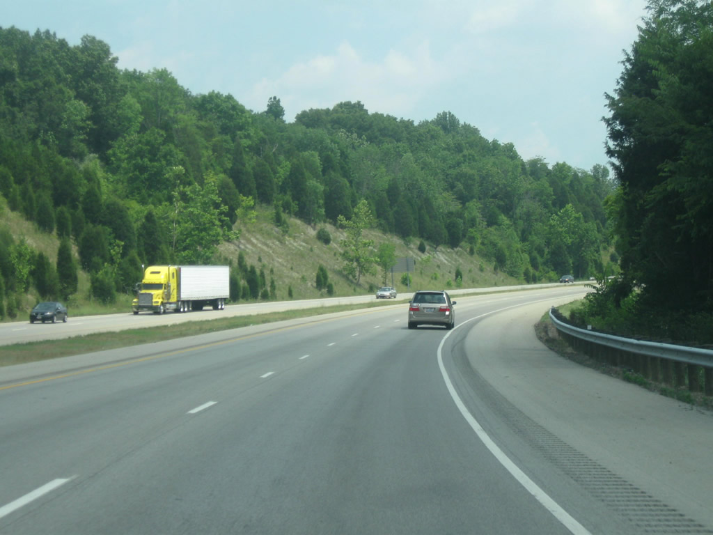
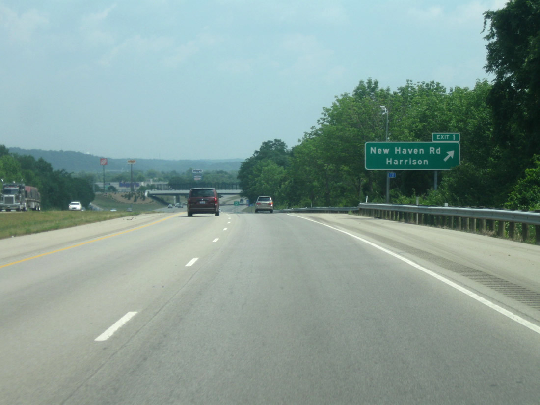
| I-74/U.S. 52 angles southeast, passing over Kolb Creek ahead of New Haven Road (Exit 1). 07/20/11 |
|
| A diamond interchange (Exit 1) joins I-74/U.S. 52 with New Haven Road in Harrison. New Haven Road extends west to end at Harrison Avenue (old U.S. 52) opposite Biddle Avenue. Harrison Avenue parallels the freeway to Miamitown. 07/20/11 |
|
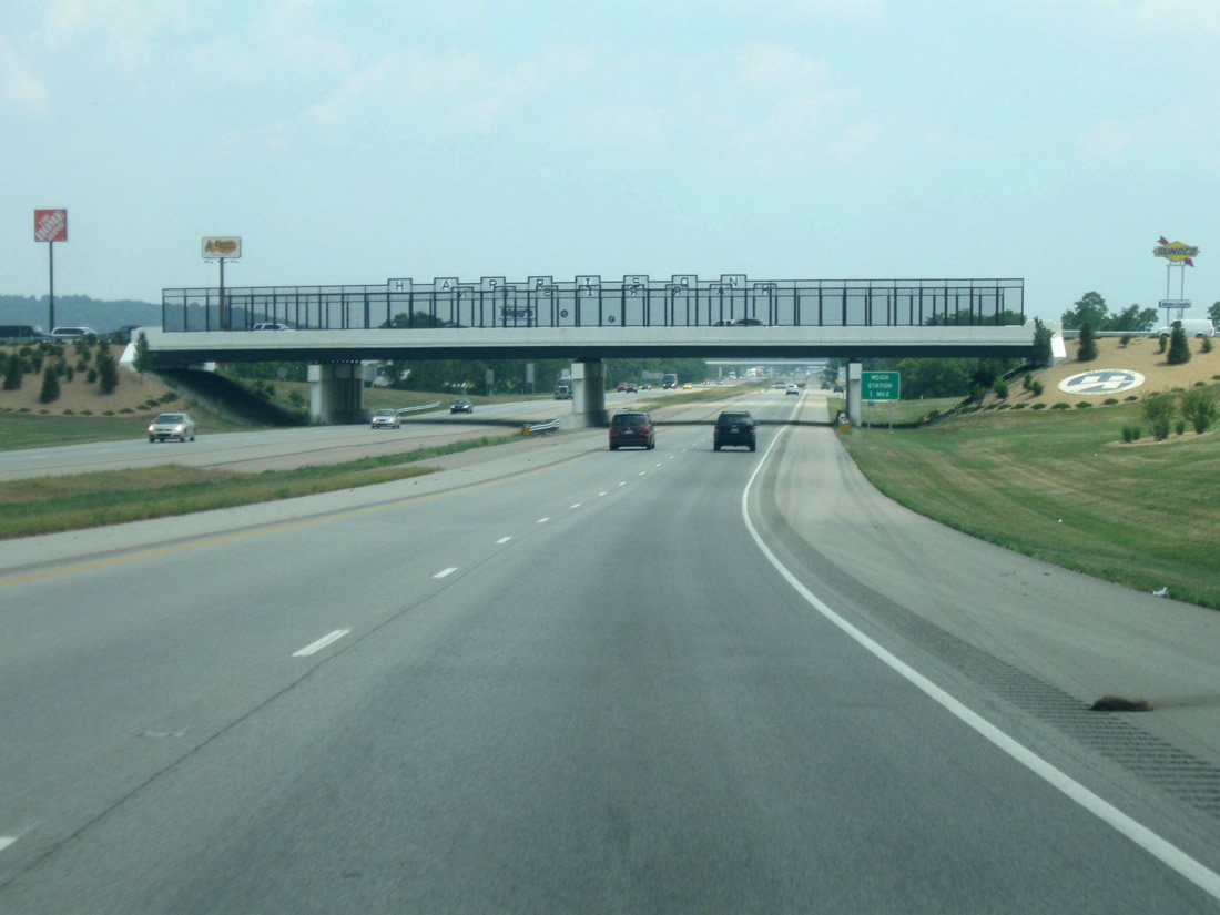
| Passing underneath New Haven Road. The city of Harrison was named after President William Henry Harrison, and was incorporated in 1850. 07/20/11 |
|
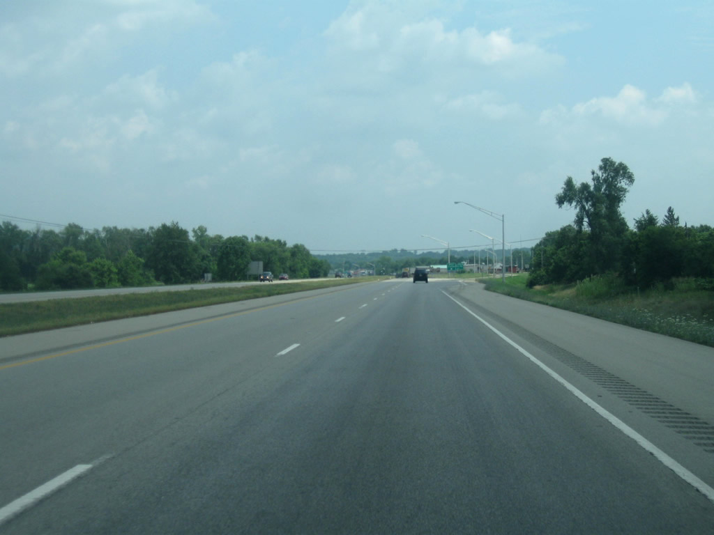
| A weigh station lines eastbound Interstate 74 between New Haven Road (Exit 1) and Dry Fork Road (Exit 3). 07/20/11 |
|
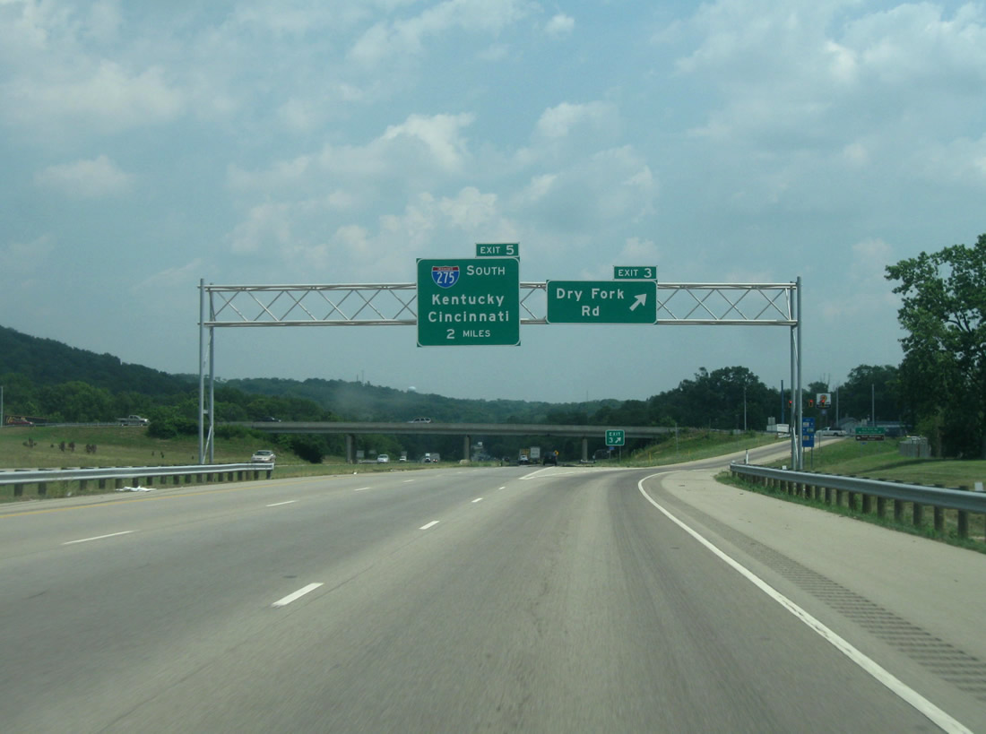
| A diamond interchange (Exit 3) joins I-74/U.S. 52 with Dry Fork Road two miles ahead of I-275. Dry Fork Road parallels the Dry Fork River north from Harrison Avenue to New Haven. 07/20/11 |
|
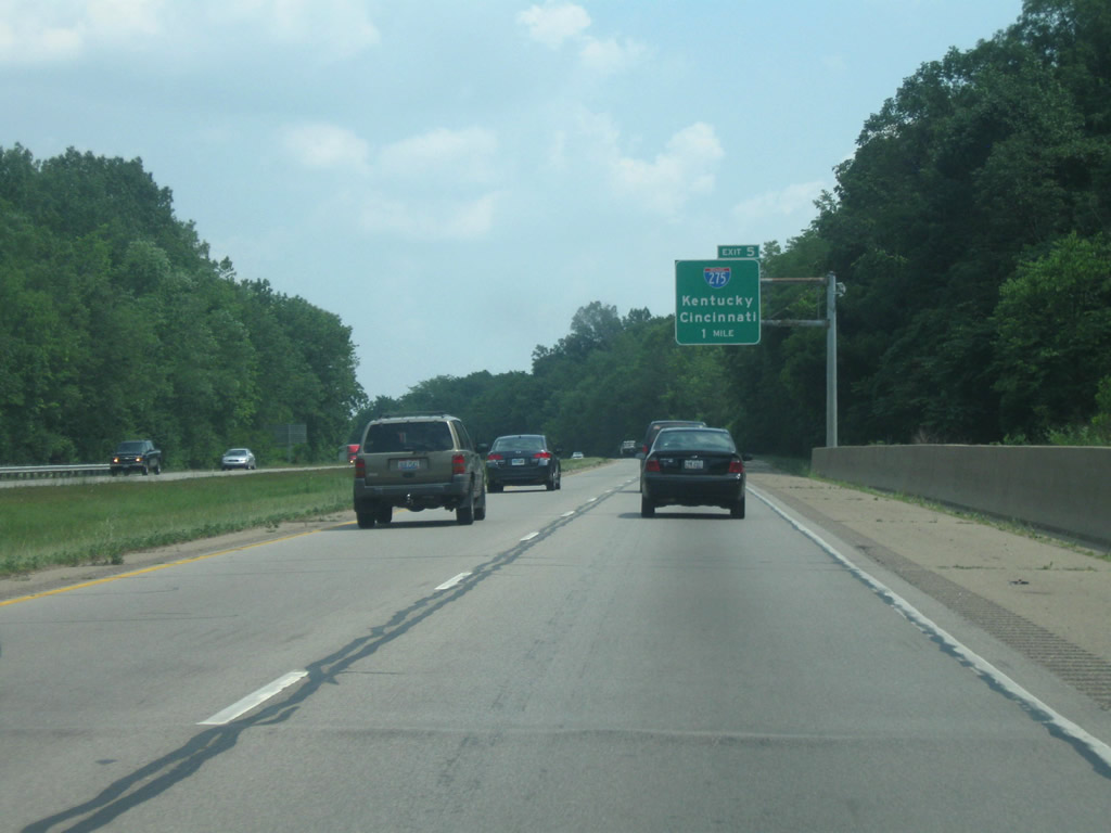
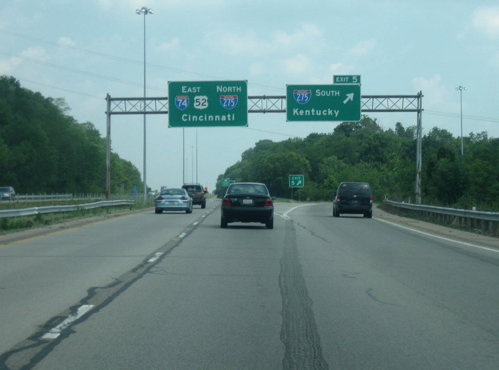
| One mile out from the trumpet interchange (Exit 5) with Interstate 275. I-275 encircles the greater Cincinnati area along an 83.71 mile loop. I-74/U.S. 52 east join I-275 north along a 3.74 mile overlap. 07/20/11 |
|
| I-275 travels southwest from I-74/U.S. 52 to Elizabethtown before crossing into Indiana. The freeway enters northern Kentucky ahead of Idlewild, traveling along an eastern course to Cincinnati/Northern Kentucky International Airport (CVG) and I-71/75 at Erlanger. 07/20/11 |
|
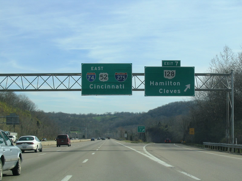
| I-74/275 and U.S. 52 advance one half mile to SR 128 (Exit 5) next. SR 128 connects the freeway with Cleves to the south (via U.S. 50) and with Hamilton, seat of Butler County, to the north. 11/14/04 |
|
| This assembly ahead of Exit 7 (SR 128) was replaced by Summer 2011. 11/14/04 |
|
| Following the Great Miami River, SR 128 (Hamilton Cleves Pike Road) winds southward 4.9 miles to conclude at U.S. 50 ahead of Cleves. Traveling northeast, SR 128 stays west of the river to Pershing Avenue in Hamilton. 11/14/04 |
|
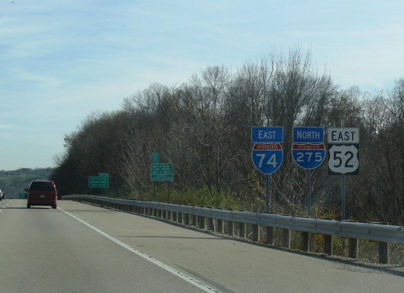
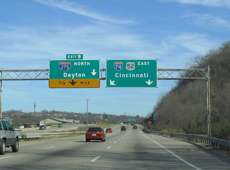
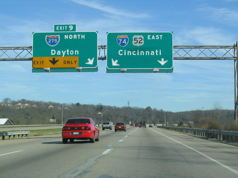
| I-74/275 and U.S. 52 turn northeast to cross the Great Miami River 0.75 miles out from the split at Exit 9. A diagrammatic overhead replaced these panels by 2011. 11/14/04 |
|
| Interstate 275 arcs northeast to northern Cincinnati suburbs, connecting with I-75 to Dayton and I-71 to Columbus. 11/14/04 |
|
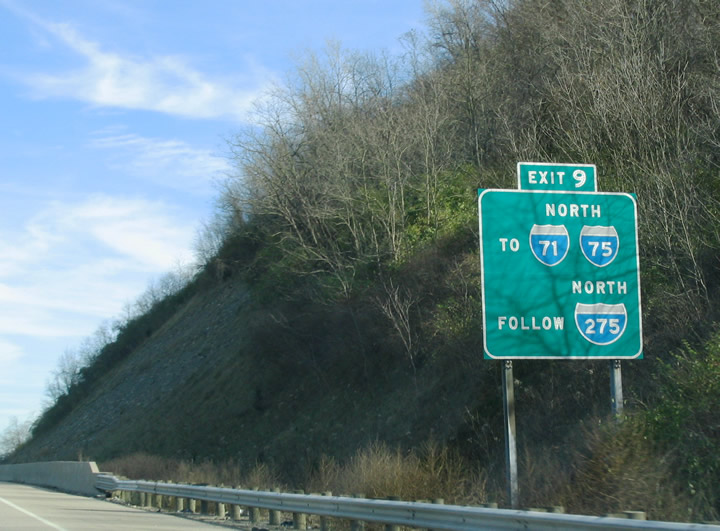
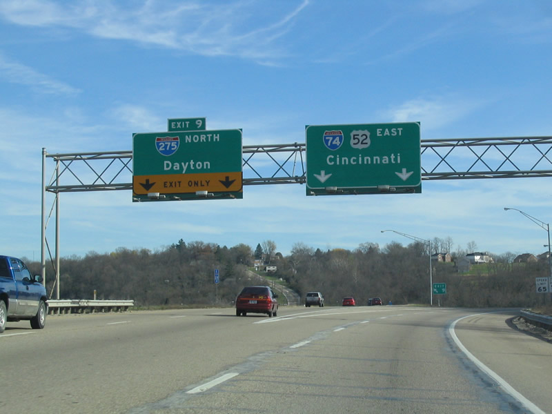
| Interstate 275 continues north from the upcoming three wye interchange (Left Exit 9) to SR 126 (Ronald Reagan Highway) while I-74/U.S. 52 turns south to meet Harrison Avenue (Exit 11). 11/14/04 |
|
| Two lanes depart for I-275 north at Left Exit 9. I-275 continues 15.2 miles to an exchange with I-75 at Springdale and 20.3 miles to I-71 at Blue Ash. 11/14/04 |
|
| Harrison Avenue joins I-74/U.S. 52 east at a parclo interchange (Exit 11) 0.75 miles ahead. 07/20/11 |
|
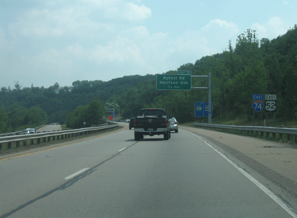
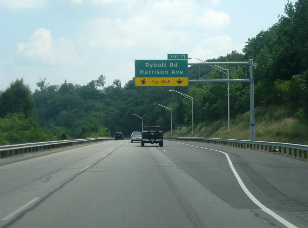
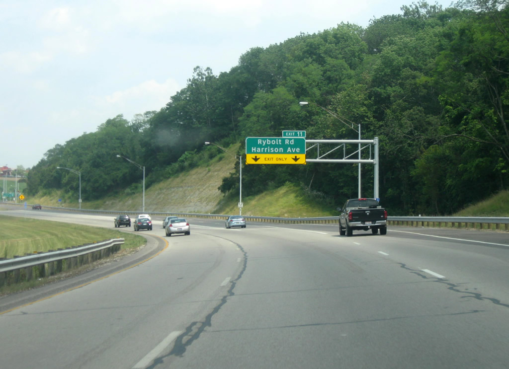
| Rybolt Road extends north from Taylor Road in Mack North to Harrison Avenue south of the upcoming interchange (Exit 11). 07/20/11 |
|
| The off ramp from I-74/U.S. 52 east ties into Old Rybolt Road, with connections to Harrison Avenue and Rybolt Road. Harrison Avenue continues southeast from Exit 11 to Dent. 07/20/11 |
|
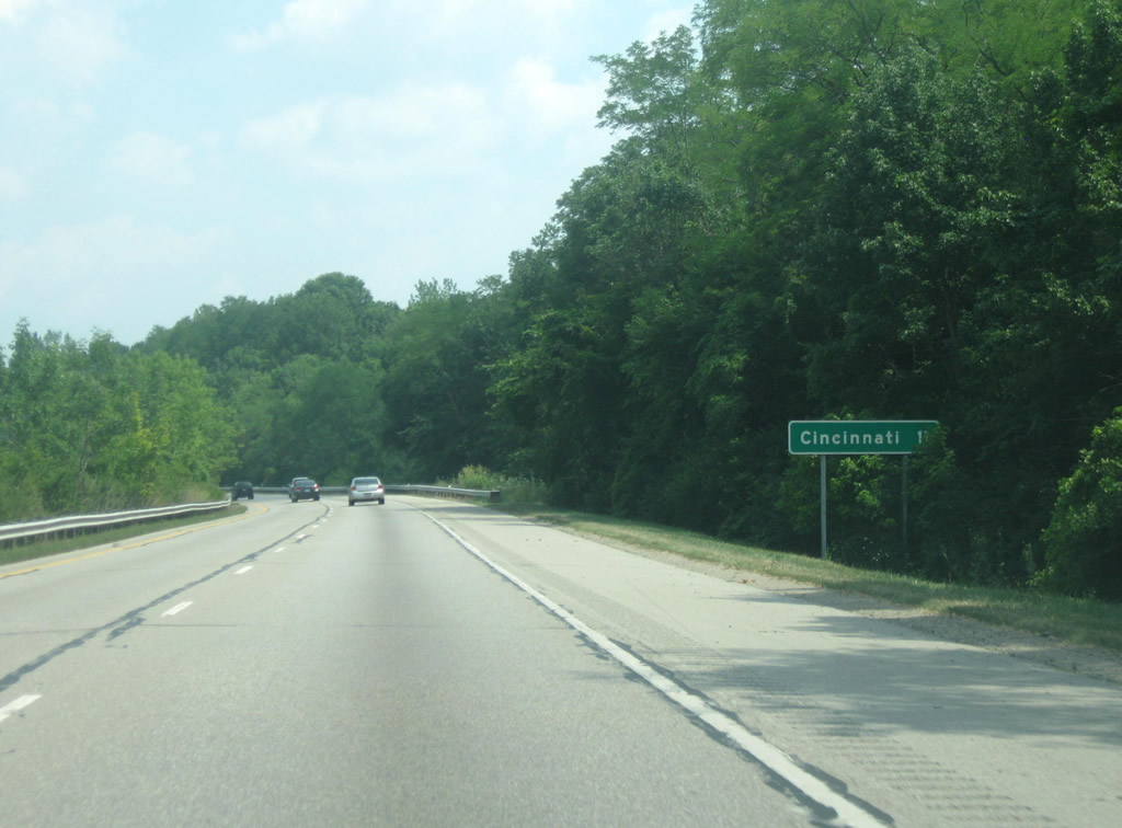
| Downtown Cincinnati is located 11 miles to the southeast along the Ohio River. 07/20/11 |
|
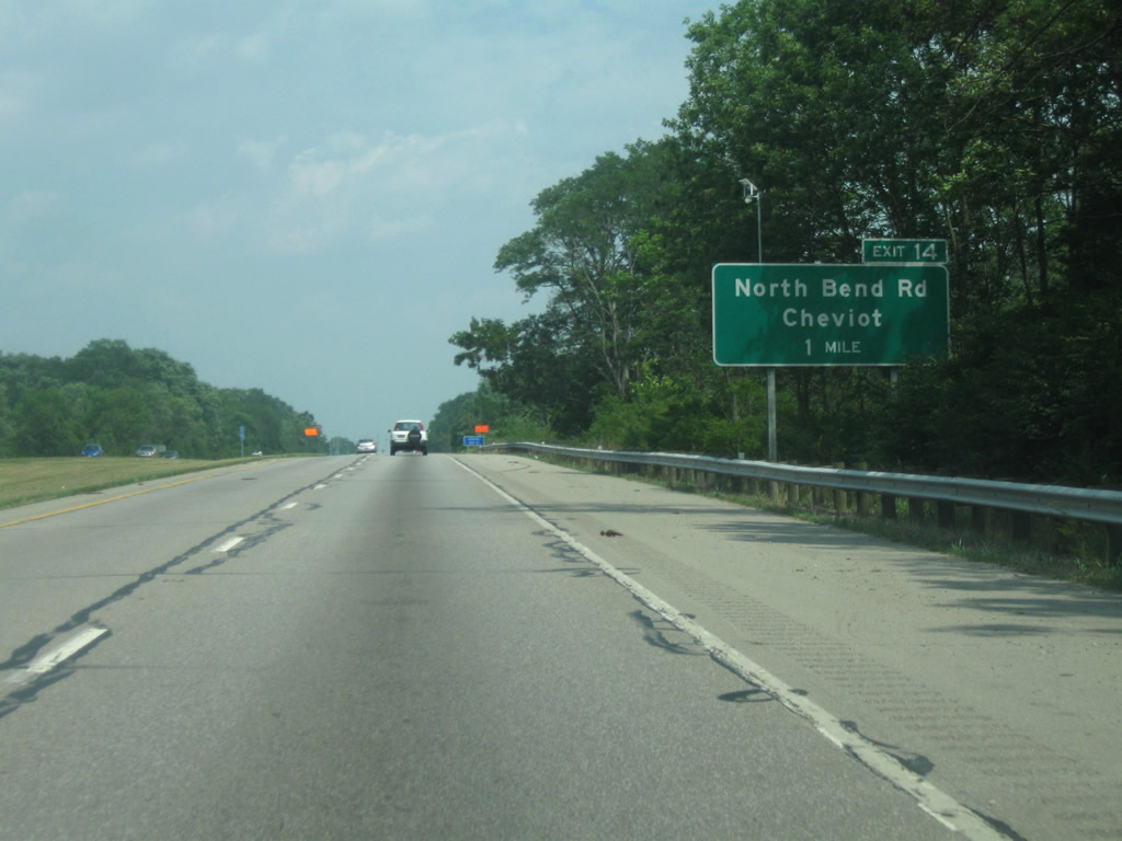
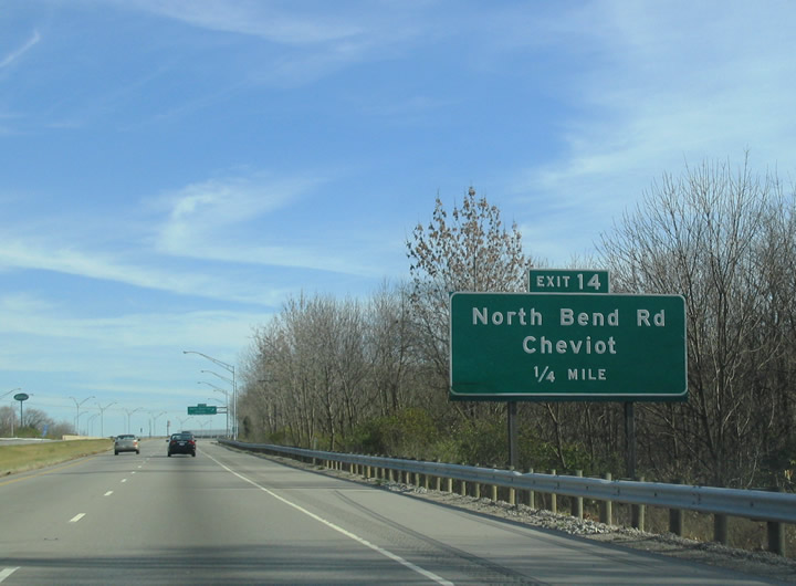
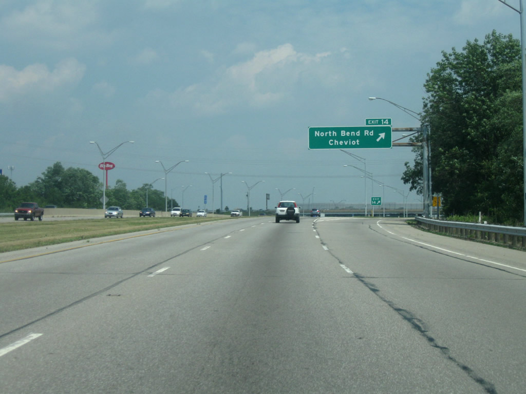
| North Bend Road meets Interstate 74 at a six-ramp parclo interchange (Exit 14) in one mile. 07/20/11 |
|
| North Bend Road comprises a commercial arterial from Exit 14 north to Cheviot Road, where it turns east to Mount Airy. 11/14/04 |
|
| Exit 14 departs for North Bend Road. North Bend Road travels 2.6 miles south to Harrison Avenue near central Cheviot. 07/20/11 |
|
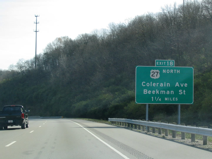
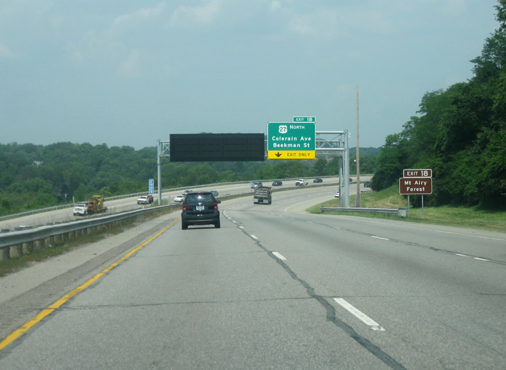
| Leaving Mt. Airy Forest, a 1,459 acre park within Cincinnati city limits, I-74/U.S. 52 east next meet U.S. 27 (Colerain Avenue) north and Beekman Street. 11/14/04 |
|
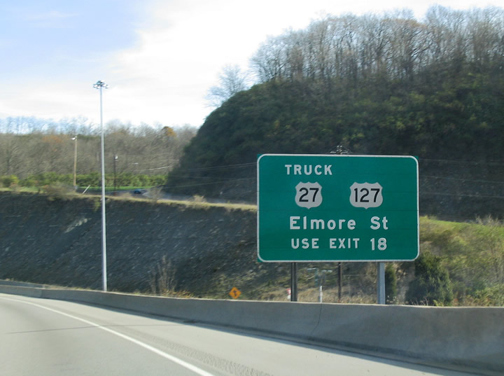
| I-74/U.S. 52 passes over the half diamond interchange (Exit 17) with Montana Avenue ahead of Exit 18 for U.S. 27 north. Elmore Street (U.S. 27 Truck) travels east from Beekman Street to connect with U.S. 127 south. 11/14/04 |
|
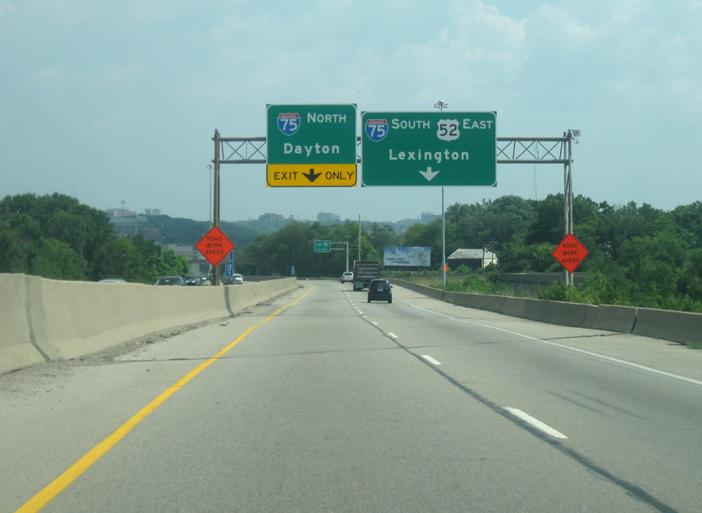
| I-74 concludes 1.75 miles ahead at a systems interchange with I-75. Interstate 75 joins Cincinnati with Dayton to the north and Lexington, Kentucky to the south. 07/20/11 |
|
| The on ramp from Montana Avenue forms an auxiliary lane east to Exit 18. U.S. 27 overlays Colerain Avenue northwest through the Mount Airy neighborhood while Beekman Street lines Mill Creek south into the Millvale and English Woods areas.
This sign bridge was removed by a 2007 construction project. 11/14/04 |
|
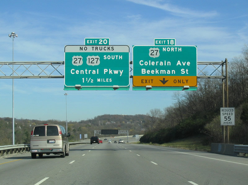
| I-74/U.S. 52 arc back southeast as a single ramp leaves at Exit 18 to U.S. 27. The once proposed Colerain Expressway would have tied into I-74 at Exit 18 from the northwest suburbs. 07/20/11 |
|
| Colerain Avenue extends southeast from the north end of the exchange to Blue Rock Avenue in the Cumminsville neighborhood. U.S. 27 Truck overlays Beekman Street south to Elmore Street east.
U.S. 27 joins I-74/U.S. 52 southeast to I-75 (Mills Creek Expressway) en route to Downtown. 07/20/11 |
|
| Spanning Beekman Street (Exit 18), lanes partition for I-75 north to Dayton and Lima and I-75/U.S. 27-52 south to downtown Cincinnati. U.S. 27 continues south with I-75/U.S. 52 to Hopple Street in the Camp Washington neighborhood. 07/20/11 |
|
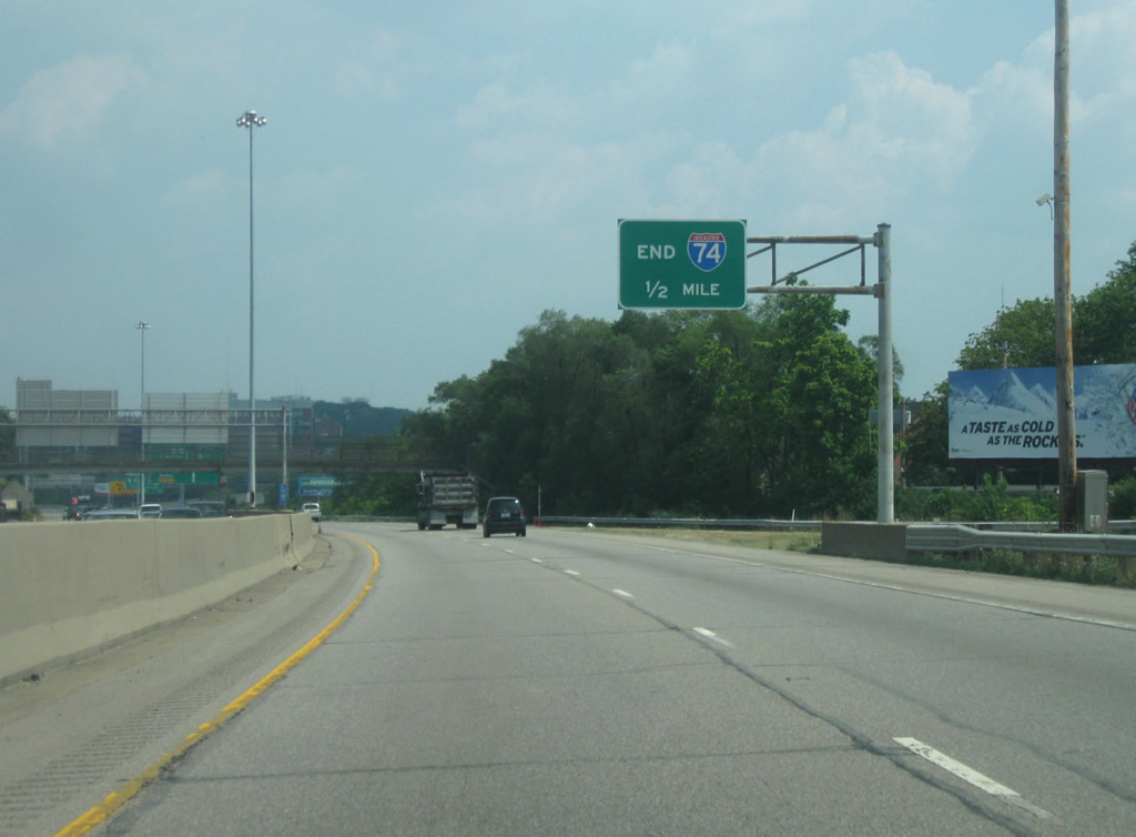
| Interstate 74 concludes its 19.47 mile run in the Buckeye State one half mile ahead. 07/20/11 |
|
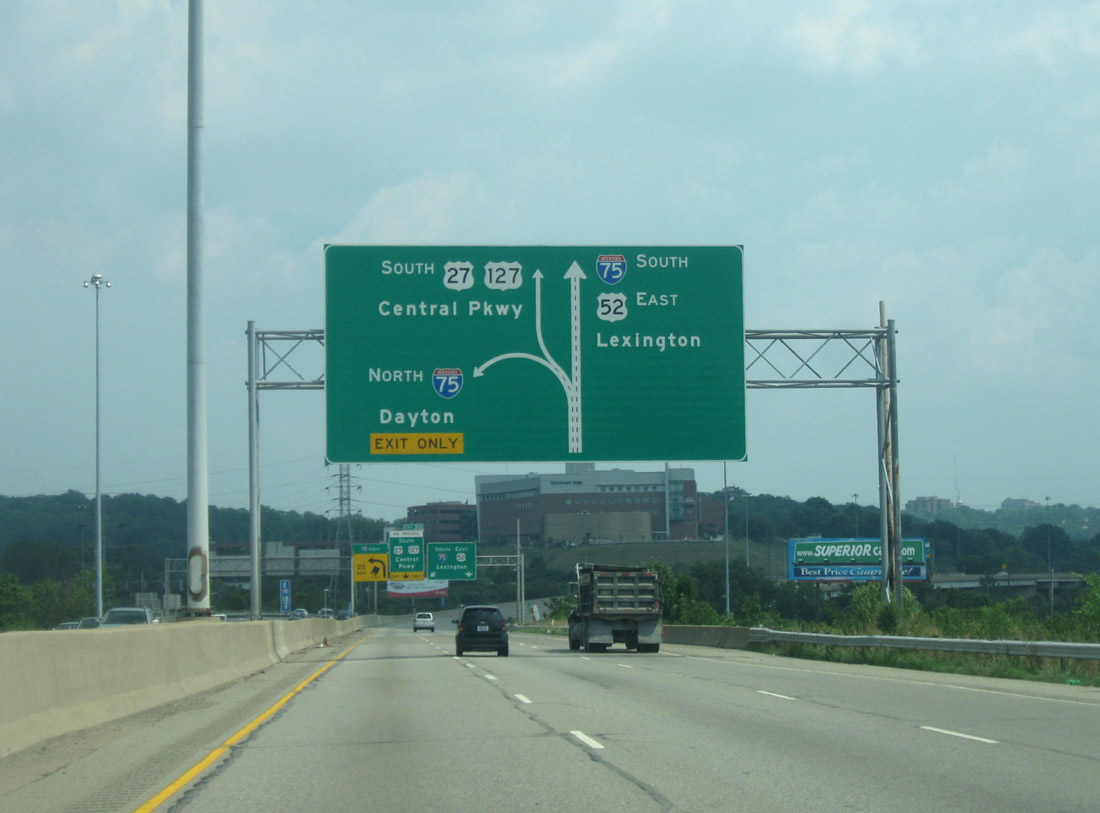
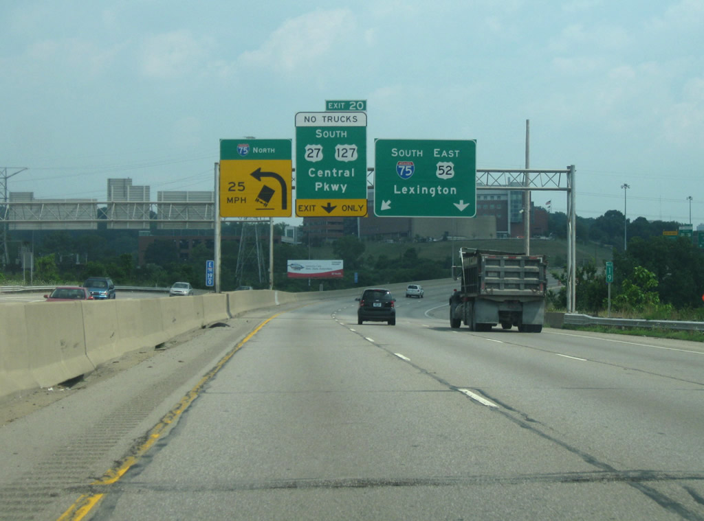
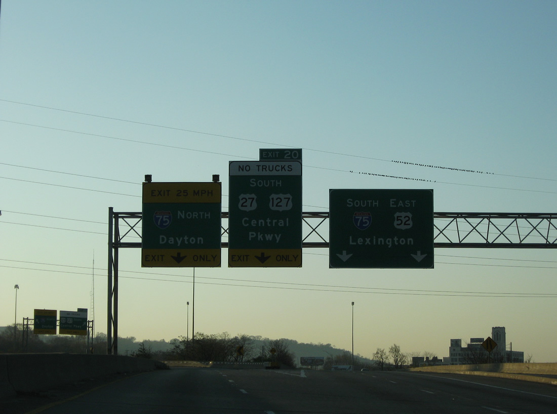
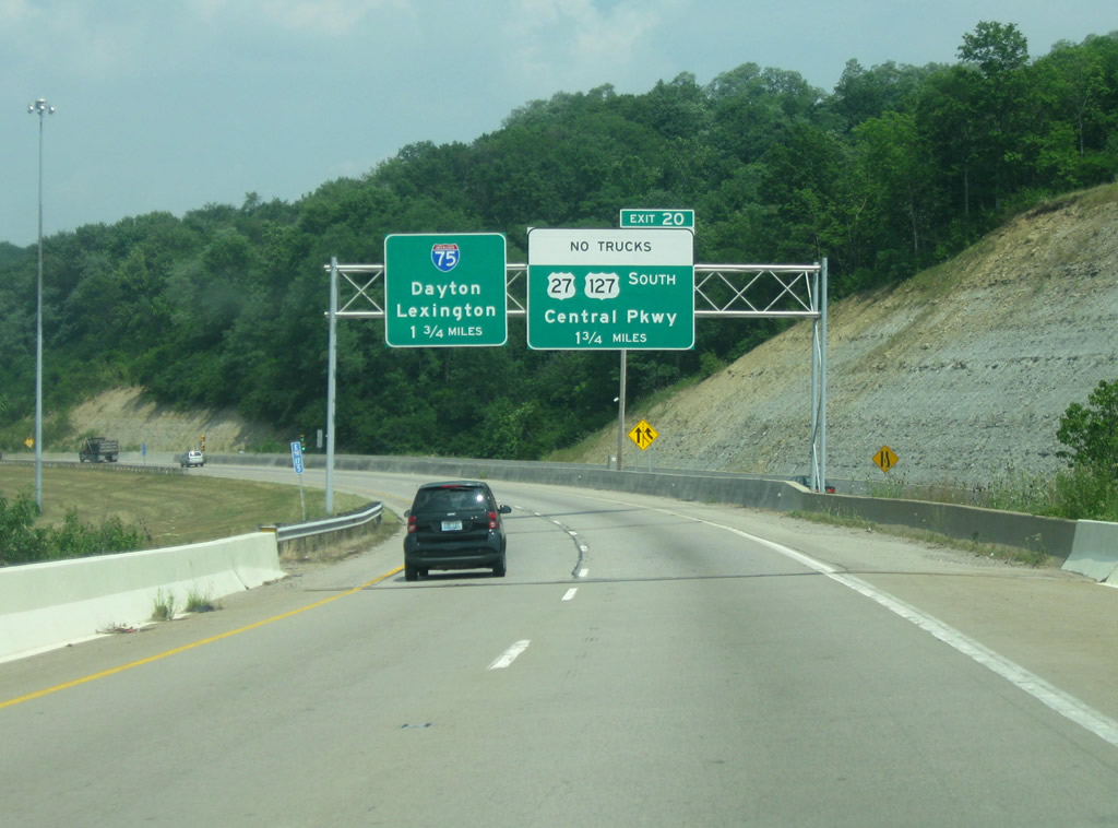
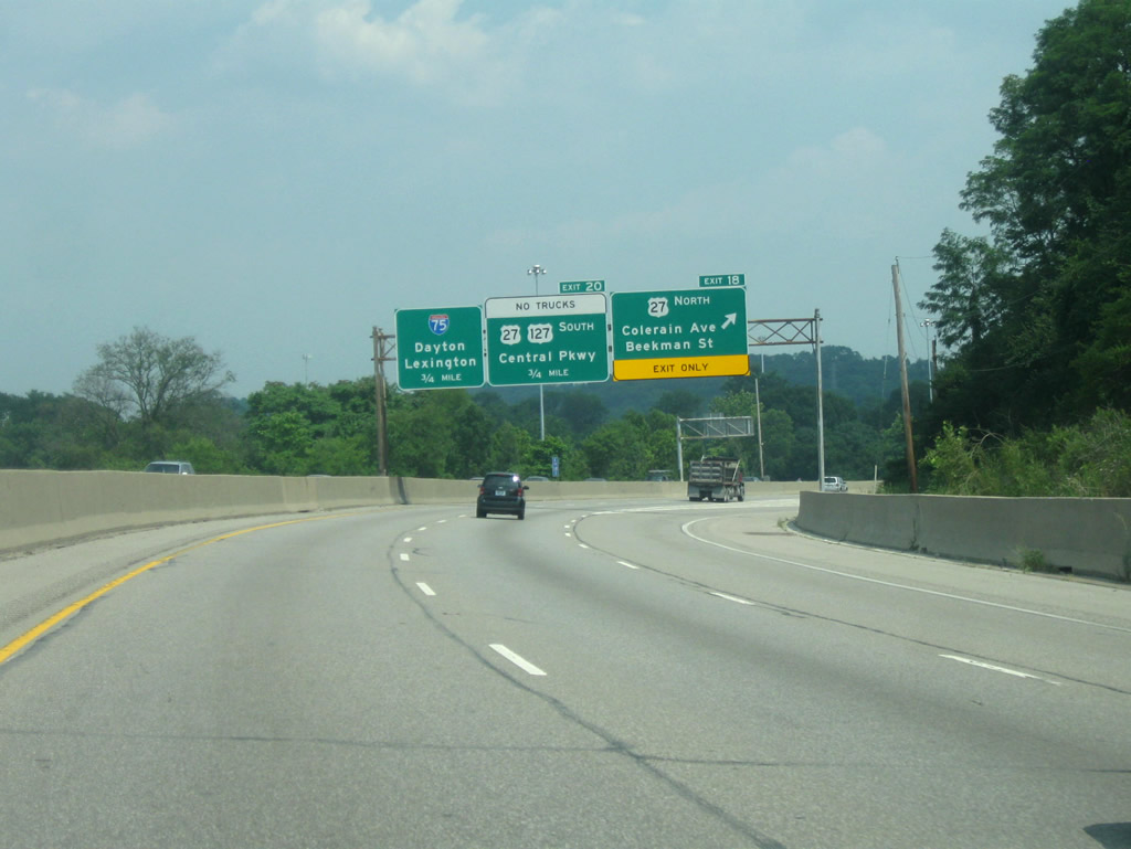
| Previous overhead assembly along I-74 east referenced the former direct ramp (Exit 20) to U.S. 127 (Central Parkway), where U.S. 27 joined for an overlap to Downtown. This ramp was closed by 2016 as part of rehabilitation of I-75 (Mill Creek Expressway) through the exchange.
Updated signs indicate the continuation of U.S. 27 south along I-75 to Exit 3 (Hopple Street). 07/20/11 |
|
| A loop ramp previously joined I-74/U.S. 27-52 from Spring Grove Avenue (U.S. 27-127 Truck) at the Mill Creek viaduct. The freeway mainline defaults onto I-75 south four miles north of downtown Cincinnati. I-75 follows the Mill Creek Expressway northeast 3.5 miles to SR 562 (Norwood Lateral Expressway) and 49 miles to downtown Dayton. 07/20/11 |
|
| I-74 ends as U.S. 27/52 continue along I-75 south to Hopple Street. A single lane ramp takes drivers onto northbound I-75 to the villages of St. Bernard, Elmwood Place and Arlington Heights. 11/08/09 |
|
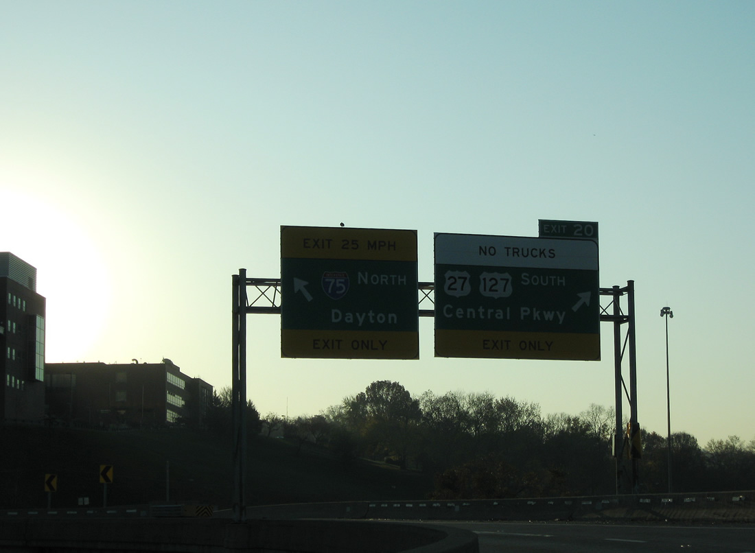
| U.S. 27 previously departed along a dedicated ramp (Exit 20) directly to Central Parkway (U.S. 127) south. This ramp was severed to make room for a c/d roadway along northbound I-75 from Hopple Street. 11/08/09 |
Page Updated 03-05-2013.


 East
East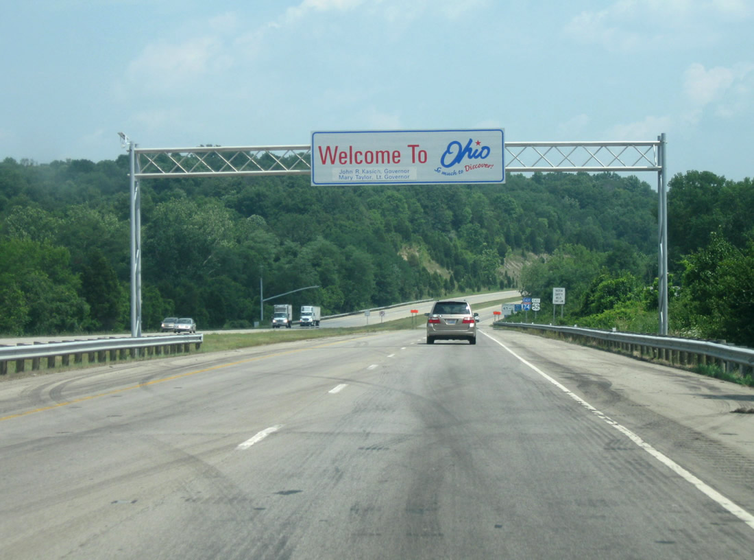
 North
North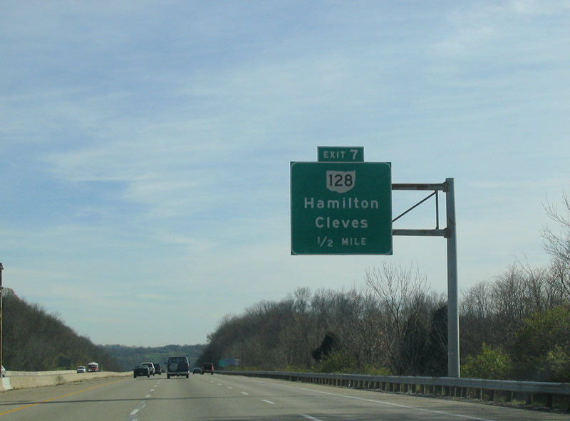
 South
South