|
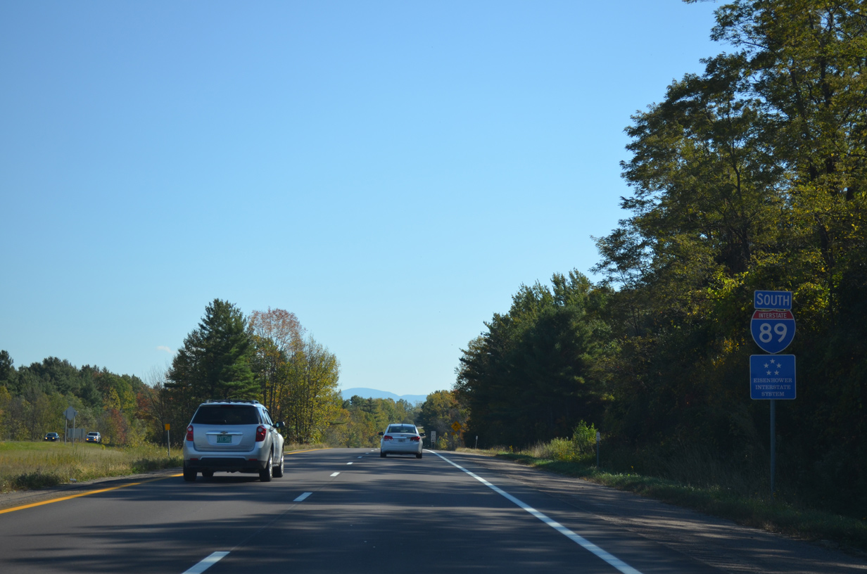
| Interstate 89 turns east from South Burlington to Montpelier. The freeway passes through a mixture of agricultural and suburban areas to the town of Williston. 10/06/14 |
|
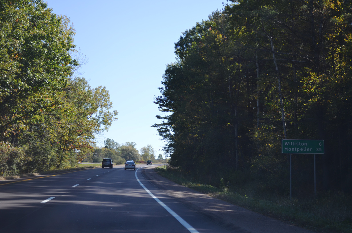
| The Williston town center lies six miles to the east along parallel U.S. 2. Montpelier is a half hour drive. 10/06/14 |
|
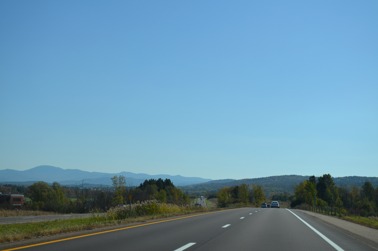
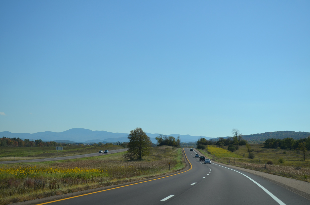
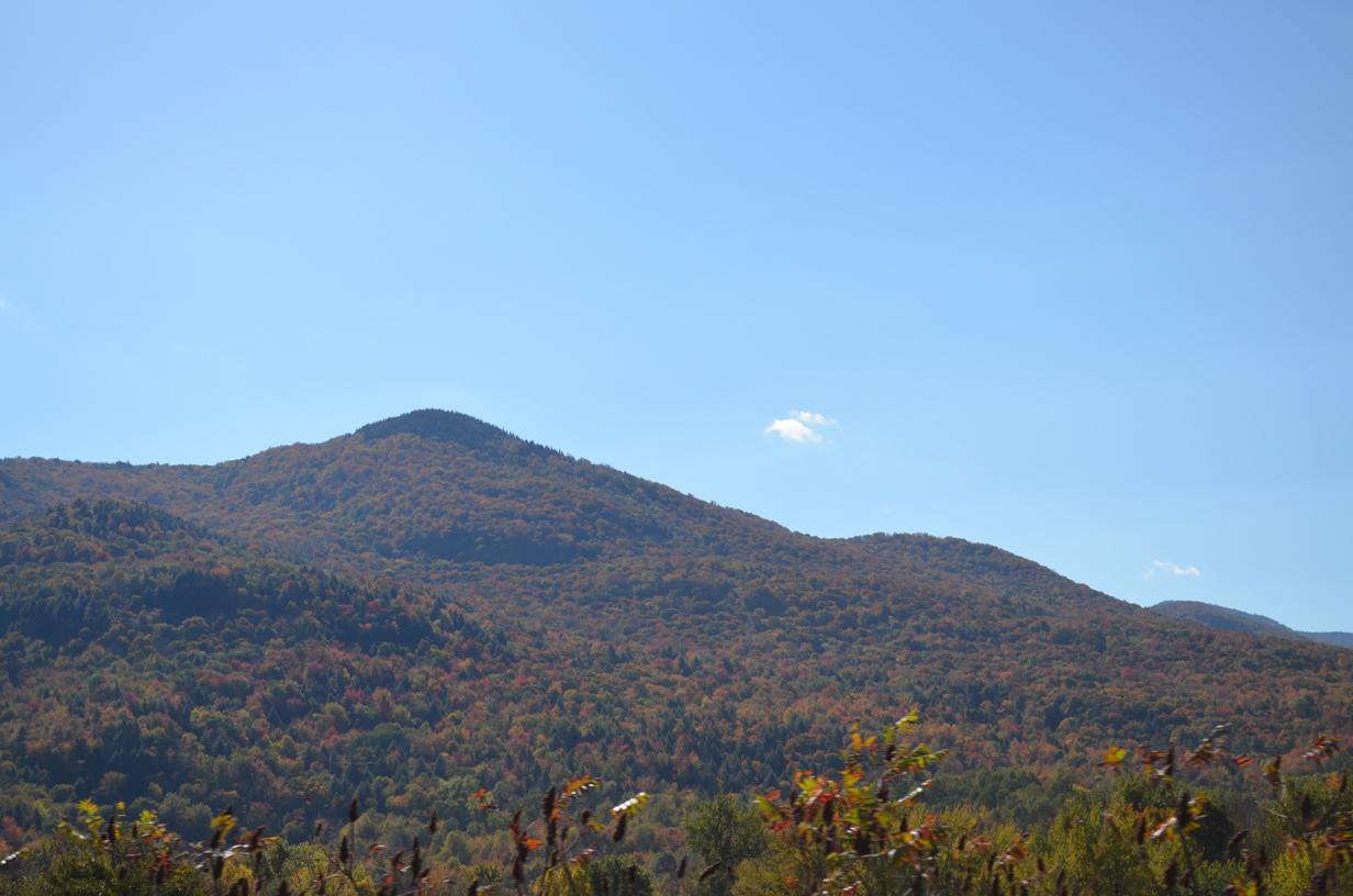
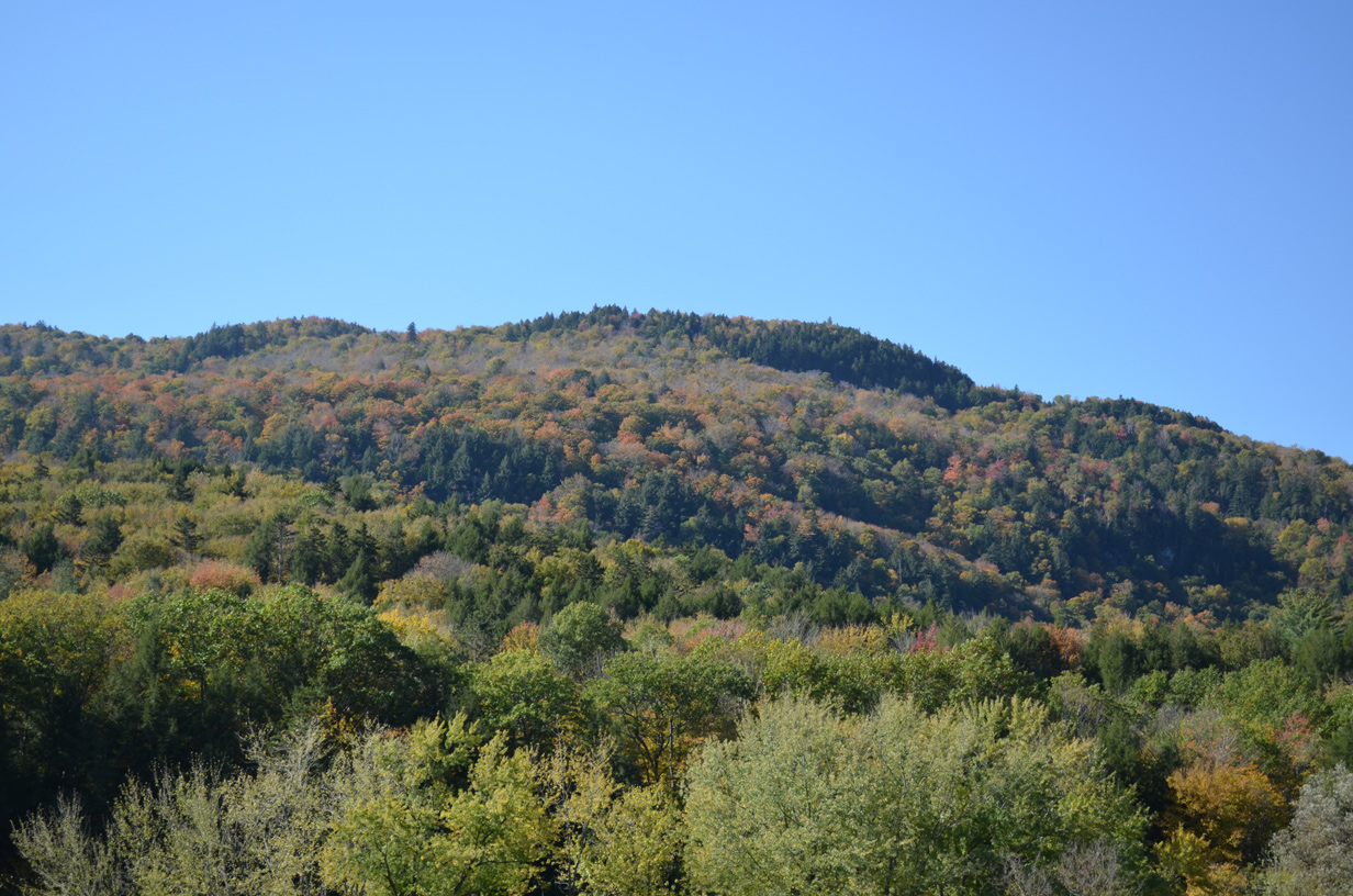
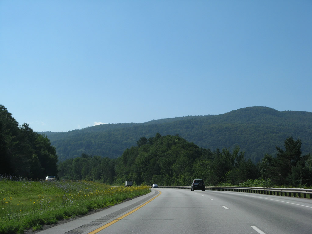
| The Green Mountains rise prominently to the east. 10/06/14 |
|
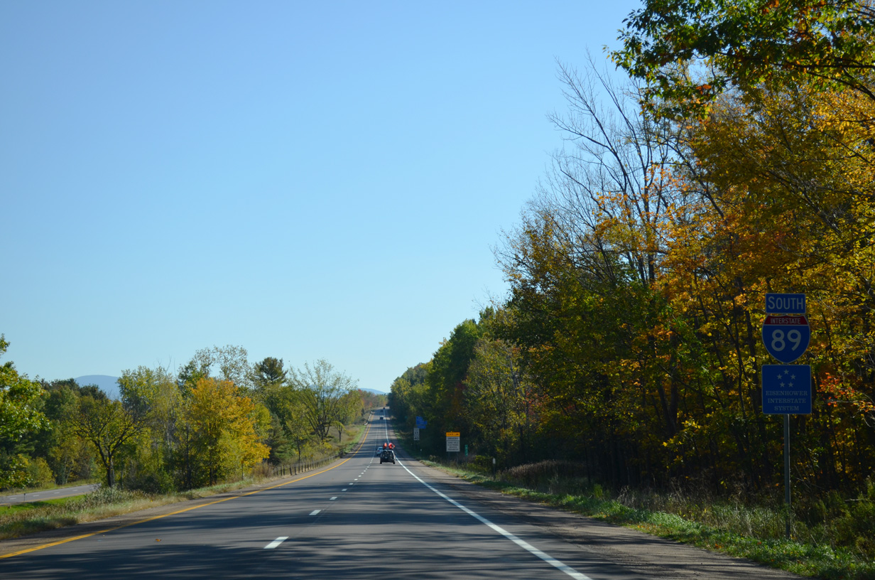
| Interstate 89 retains a wide median to Muddy Brook, which marks the South Burlington city and Williston town line. 10/06/14 |
|
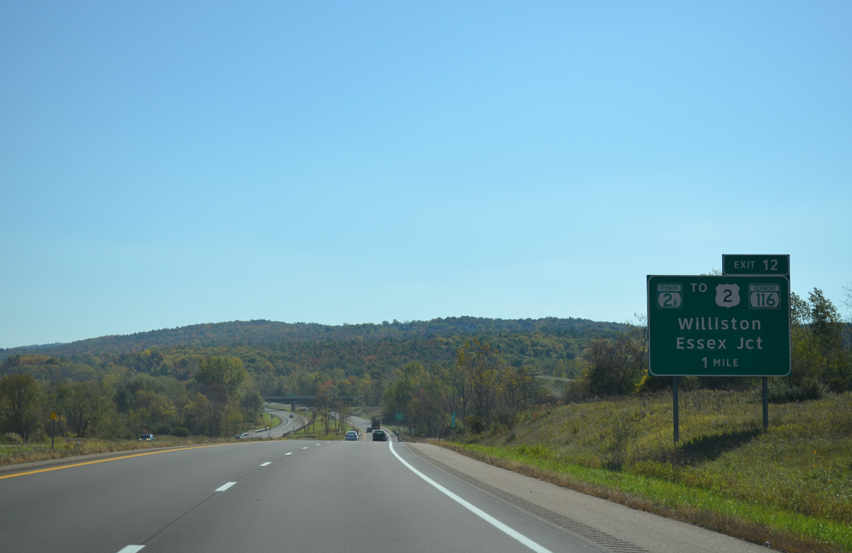
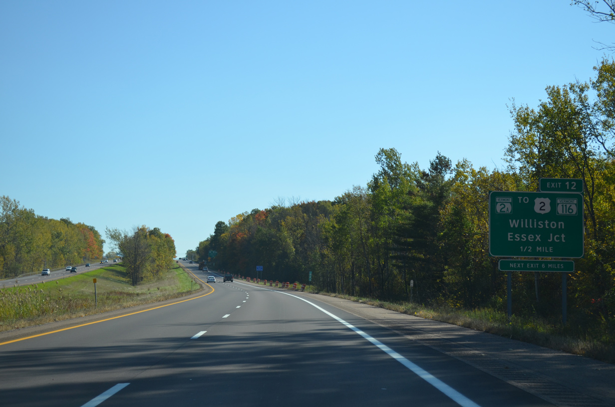
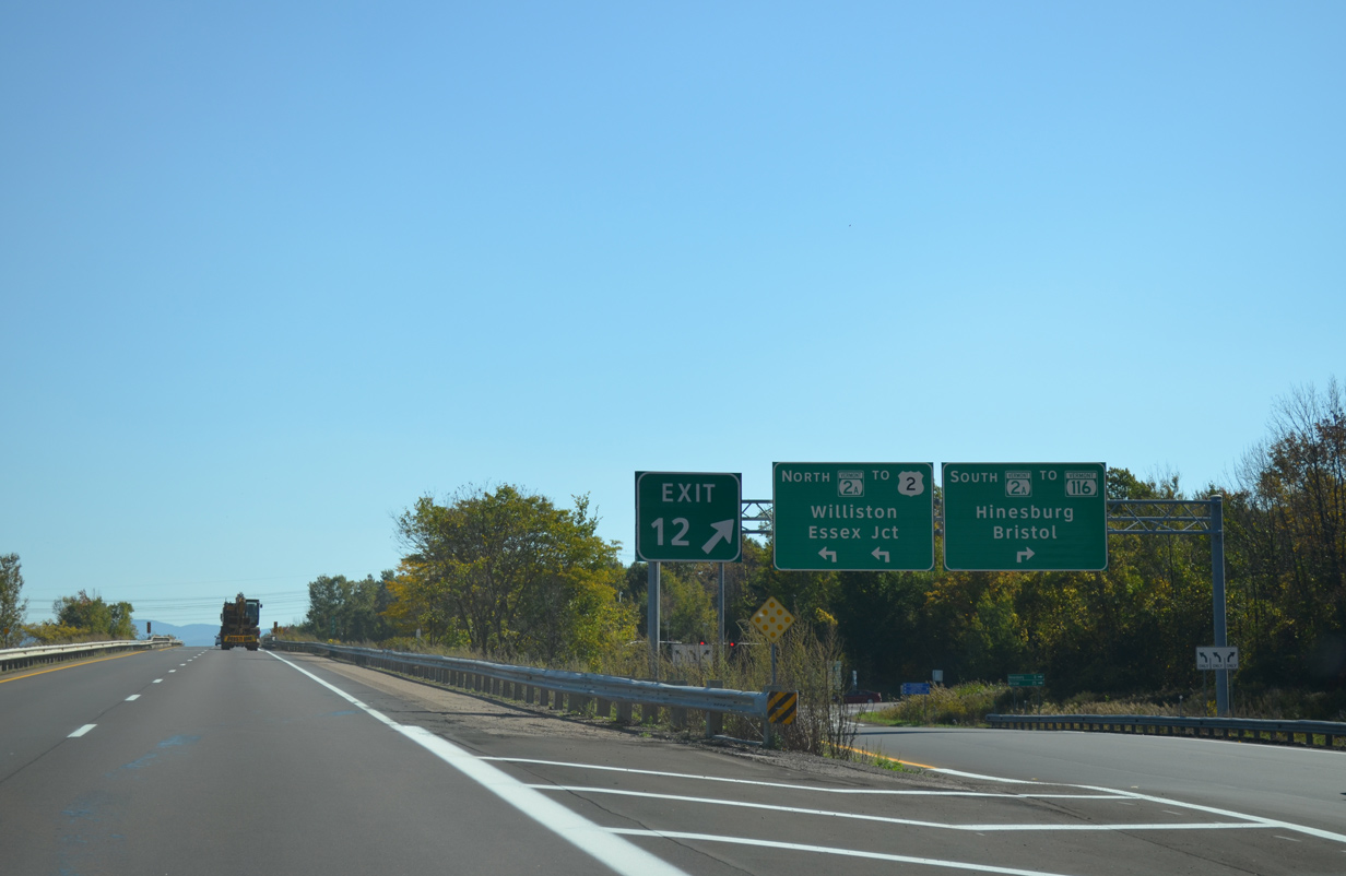
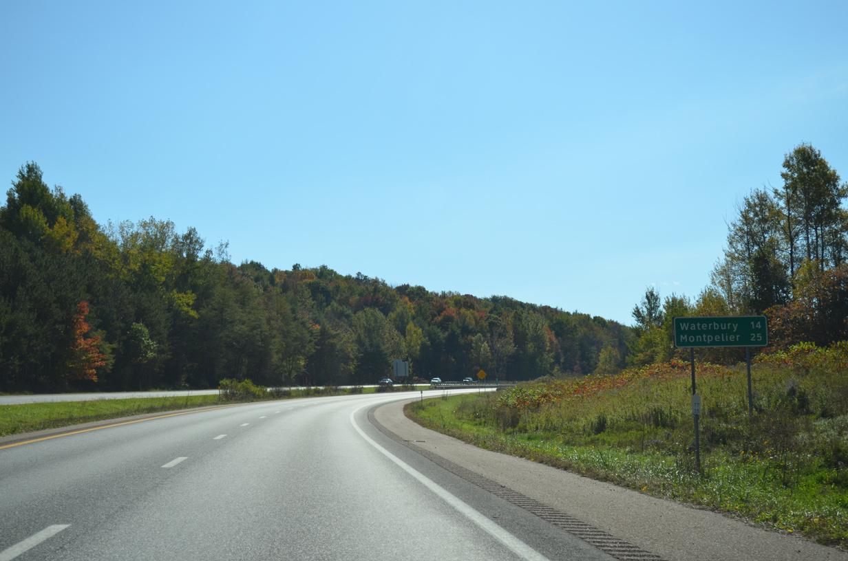
| A diamond interchange (Exit 12) joins Interstate 89 with VT 2A (St. George Road), a 13.85 mile long route between St. George and Colchester, in one mile. 10/06/14 |
|
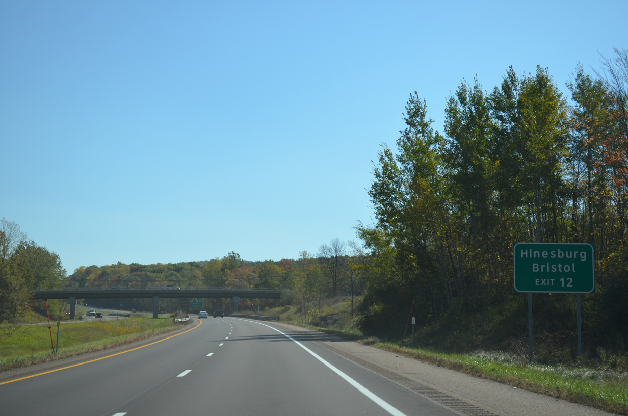
| VT 116 passes over I-89 in South Burlington without direct access to the freeway. Connections with VT 2A south lead motorists to the state route for Hinesburg and Bristol. 10/06/14 |
|
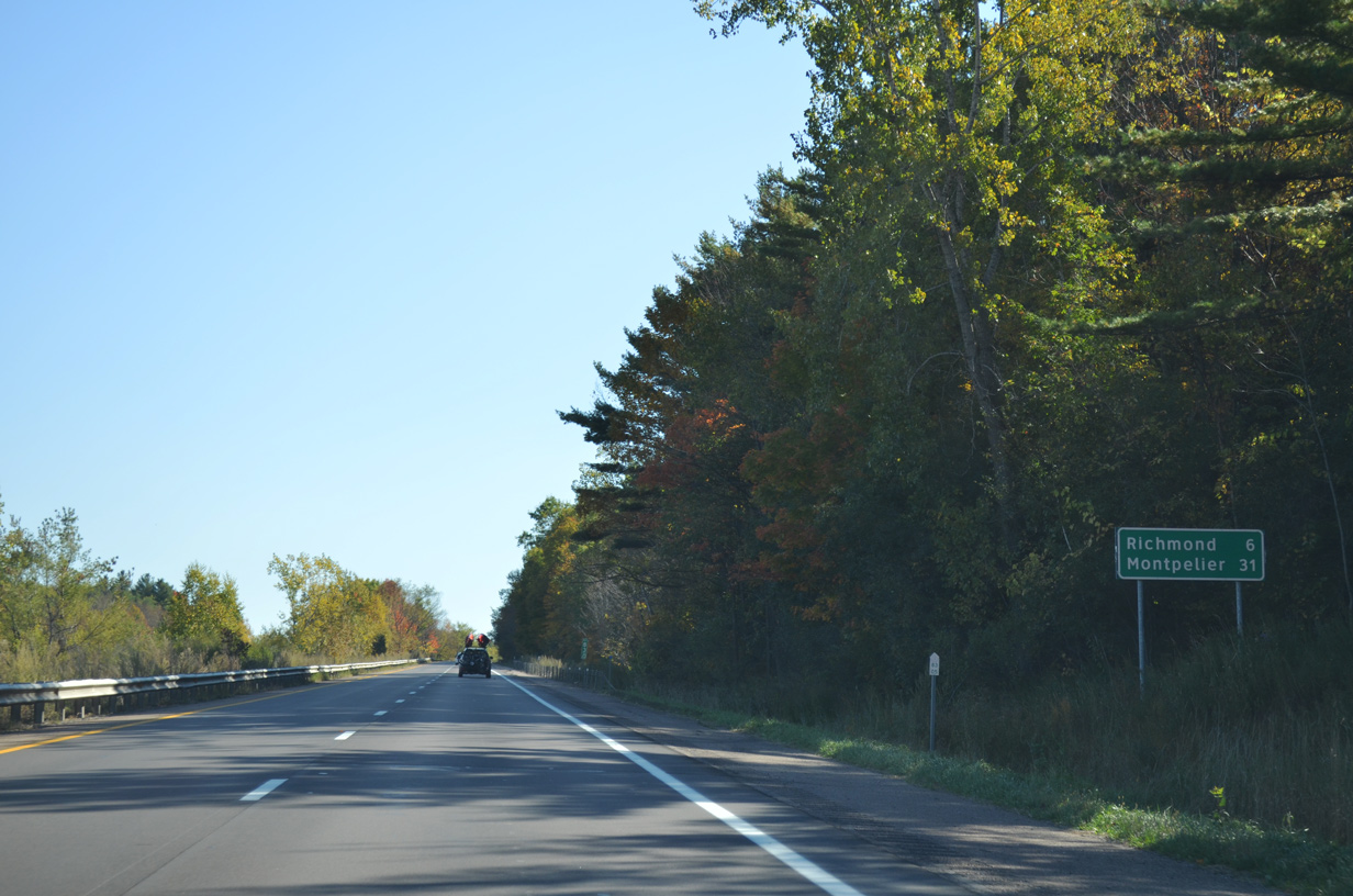
| VT 2A (St. George Road) bisects a sprawling retail area (Tafts Corner Park) northward from Exit 12 to U.S. 2 (Williston Road). U.S. 2 leads back west into South Burlington and east to suburban areas to the Richmond town line. 10/06/14 |
|
| Exit 12 departs Interstate 89 south for VT 2A (St. Georges Road) in Williston. The state route extends northward from U.S. 2 to cross the Winooski River into the Essex Junction town center. 10/06/14 |
|
| A sign bridge directs traffic onto VT 2A along the Exit 12 off-ramp. VT 2A ends five miles to the south, with VT 116 advancing three miles south to the Hinesburg town center. St. George Road north comprises a four lane arterial by a number of big box retail stores. 10/06/14 |
|
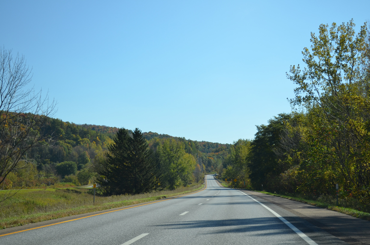
| Interstate 89 runs east along the north slopes of adjacent hills. U.S. 2 parallels the freeway just to the north. 10/06/14 |
|
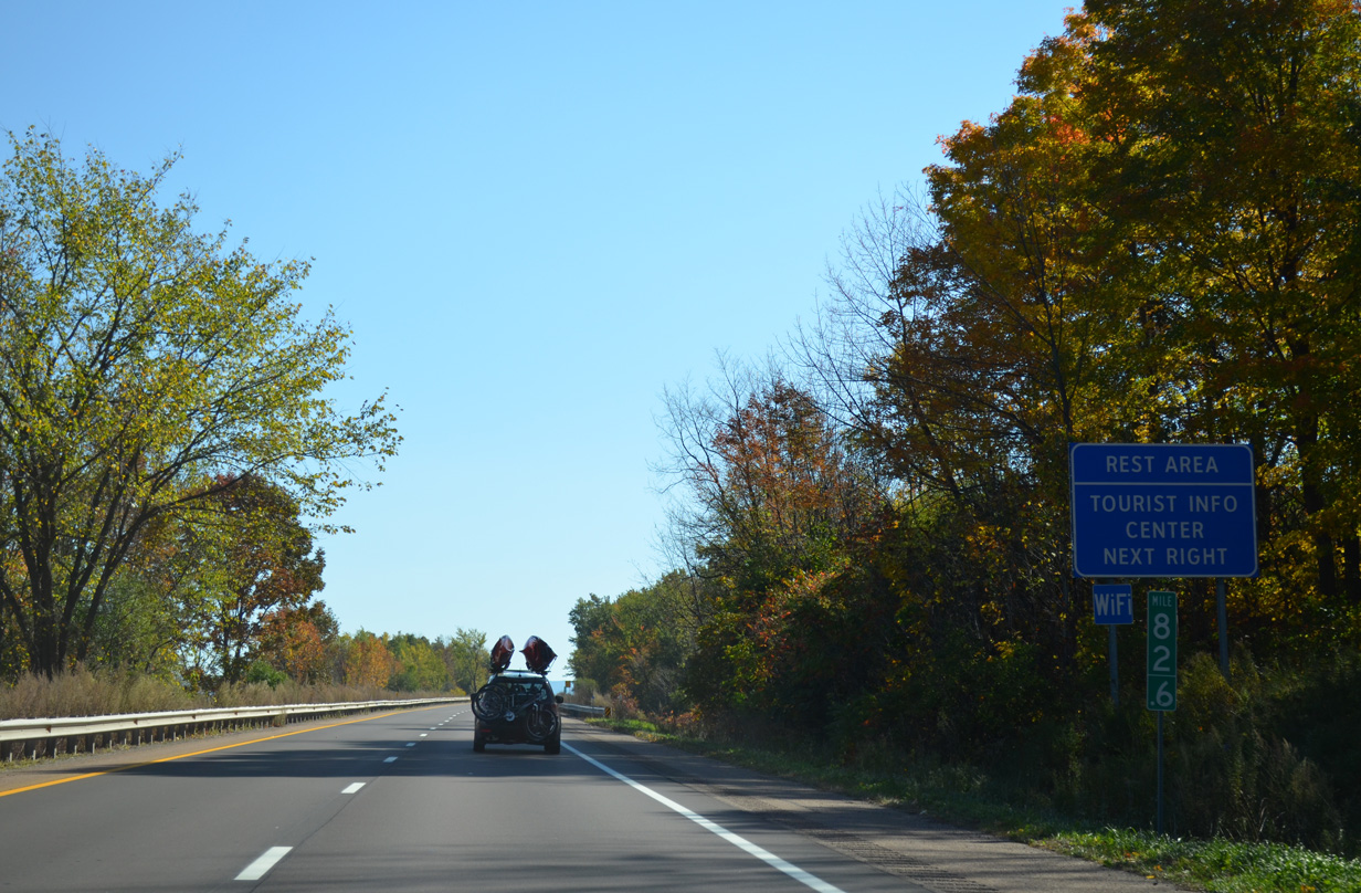
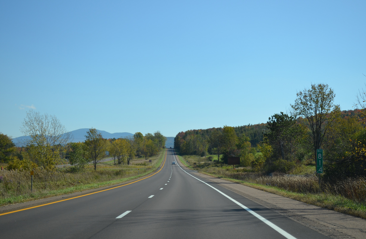
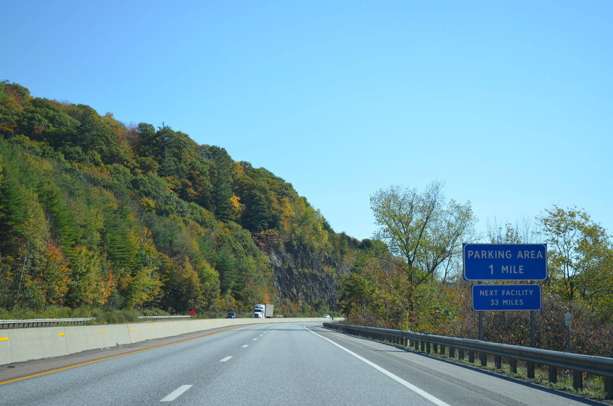
| A set of rest areas offer drivers a respite along Interstate 89 in Williston. 10/06/14 |
|
| Continuing east, Interstate 89 travels 31 miles to Montpelier.
A trumpet interchange was proposed at this location with the unconstructed Chittenden Circumferential Highway (VT 289). 10/06/14 |
|
| The Williston rest area houses a tourist information center where travelers can pick up a Vermont attractions map. 10/06/14 |
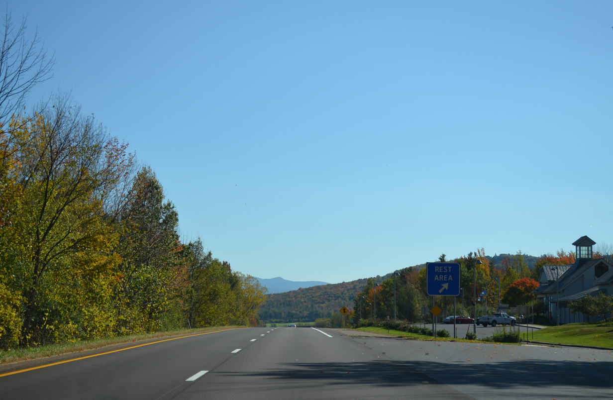
|
| Interstate 89 at the Williston Southbound Information Center. The Williston town center lies just northeast of here. 10/06/14 |
|
| Interstate 89 and U.S. 2 pass just north of Yantz Hill (el. 1,158 ft). 10/06/14 |
|
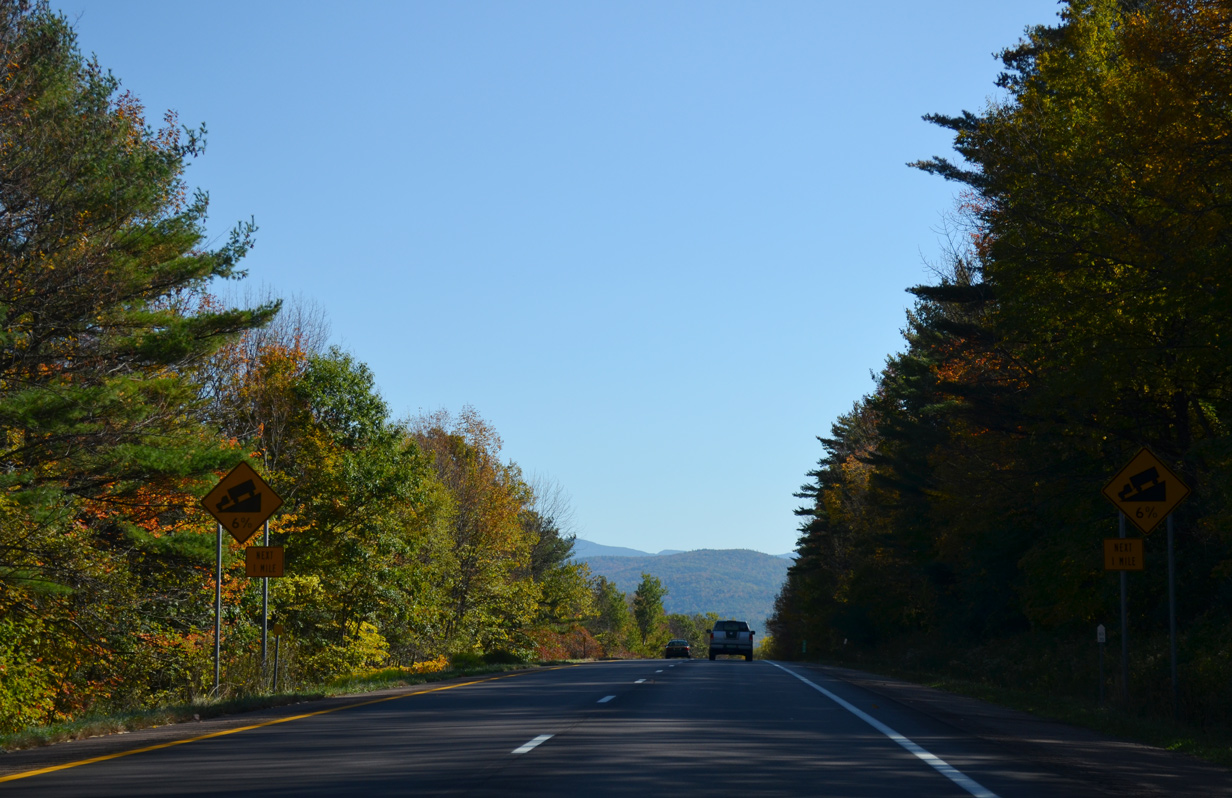
| Truckers are advised of the 6% grade I-89 encounters as the freeway drops from 620 to below 320 feet in elevation. 10/06/14 |
|
| I-89 makes an S-curve around an agricultural plain spreading south from the Winooski River. 10/06/14 |
|
| Robbins Mountain (el. 2,047 ft) anchors the Green Mountain chain in this scene looking southeast near the Richmond town line. 10/06/14 |
|
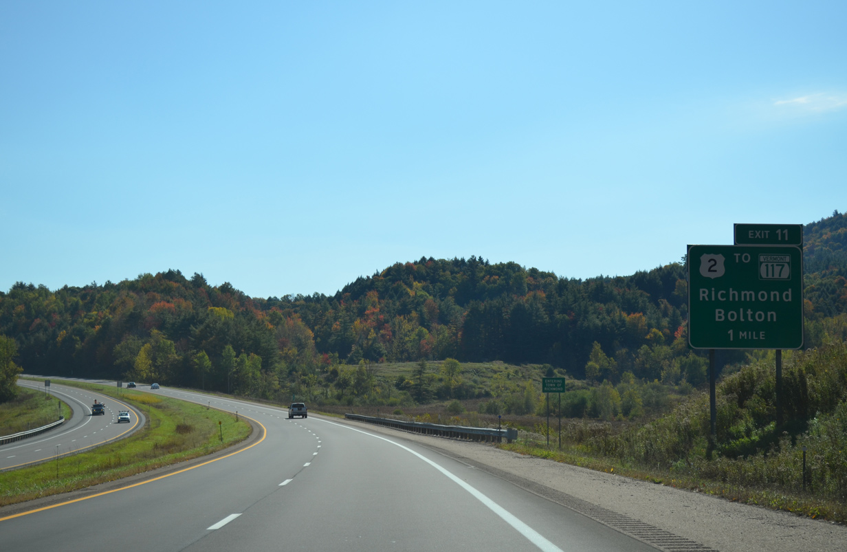
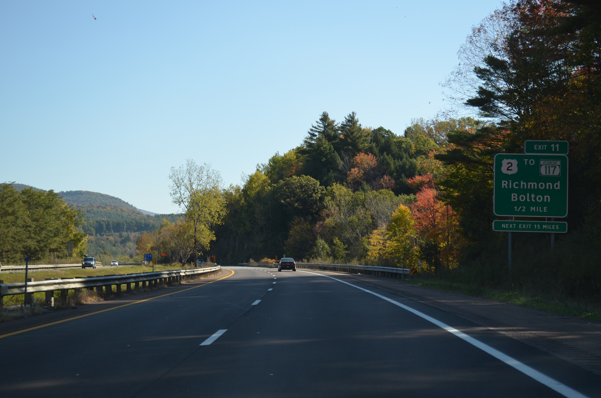
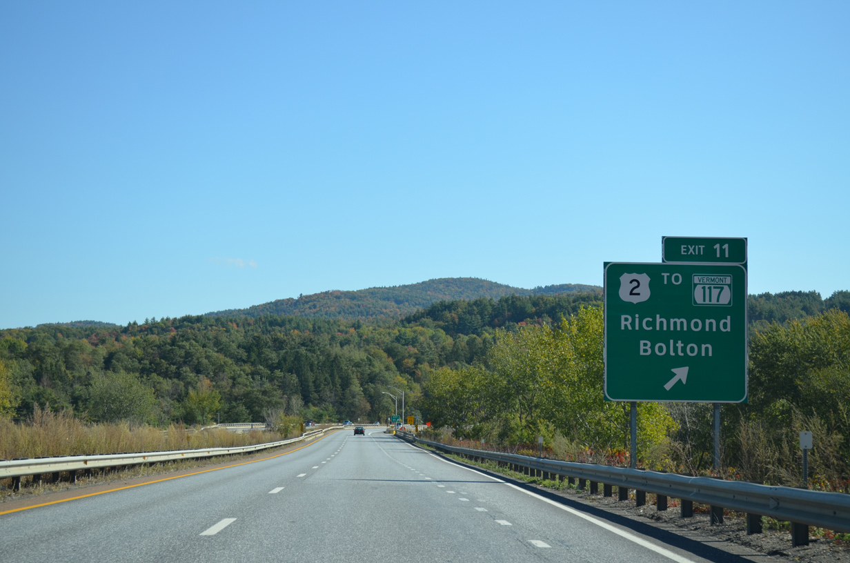
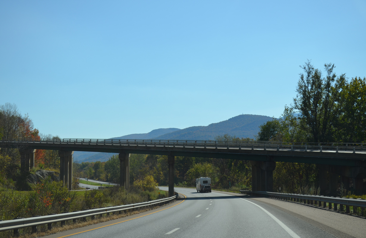
| U.S. 2 (West Main Street) and Interstate 89 come together again just north of the Richmond town center at a parclo interchange (Exit 11). 10/06/14 |
|
| VT 117 concludes an 8.0 mile route southeast from Essex Junction at U.S. 2 adjacent to Exit 11. 10/06/14 |
|
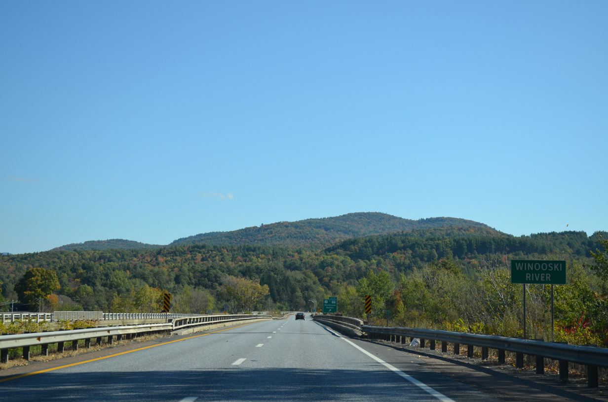
| Interstate 89 southbound crosses the Winooski River for the second time. The waterway parallels the freeway for the remaining miles east to Montpelier. 10/06/14 |
|
| U.S. 2 (W Main Street) remains close by to the freeway from Exit 11 in Richmond to Jonesville, the town of Bolton and North Duxbury. 10/06/14 |
|
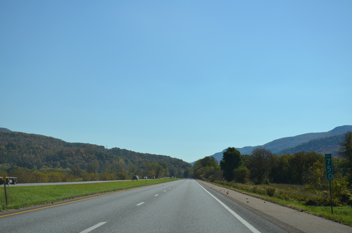
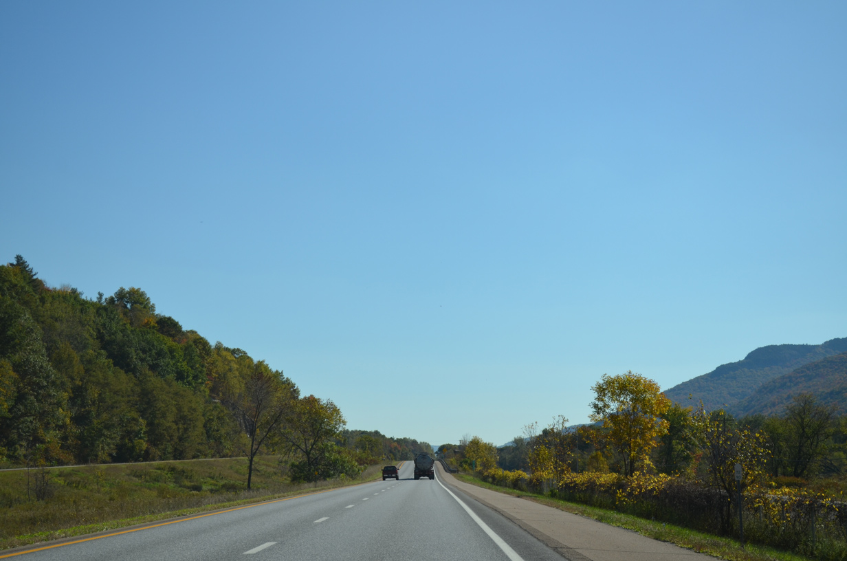
| The 14.4 mile exit less stretch between Richmond and Waterbury is the longest along the entire length of Interstate 89. 10/06/14 |
|
| Montpelier is another 11 miles east beyond Waterbury. Motorists are advised to be wary of Moose for the next 15 miles as well. 10/06/14 |
|
| Interstate 89 passes by the Richmond town center and switches sides with U.S. 2. 10/06/14 |
|
| U.S. 2 shifts north and straddles the south slopes of the adjacent hills before passing under I-89 again at milepost 74. 10/06/14 |
|
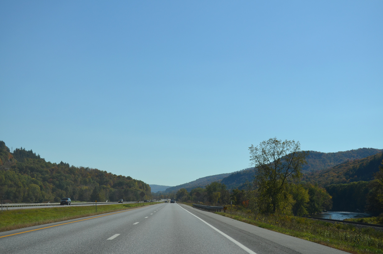
| The freeway plies across an agricultural plain alongside a New England Central Railroad line. The Winooski River flows just to the south. 10/06/14 |
|
| A roadway separation takes place as U.S. 2 shifts to the south through Jonesville. 10/06/14 |
|
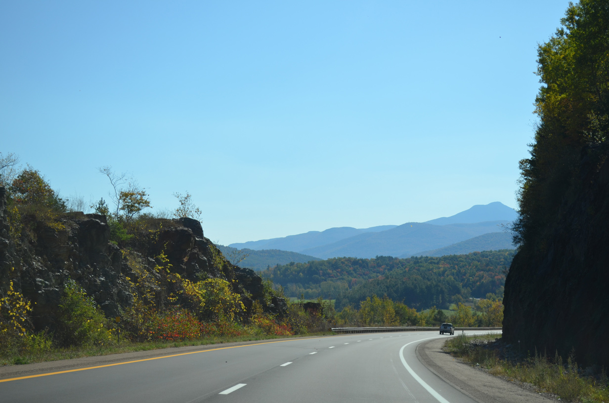
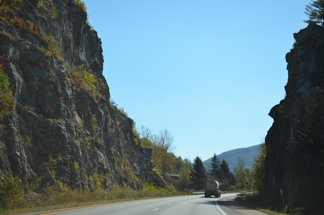
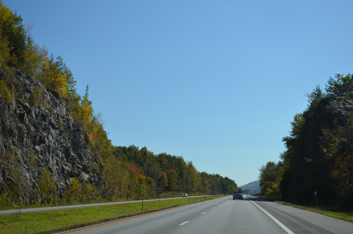
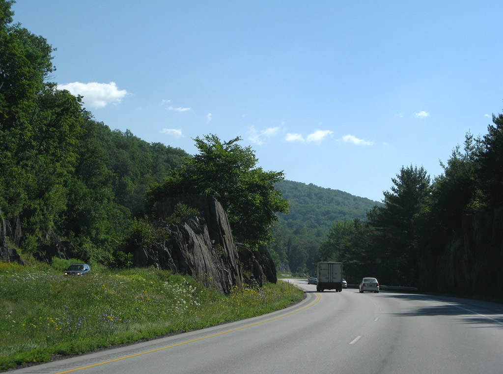
| Jagged rock cuts appear as I-89 makes an S-curve across the Bolton town line. 10/06/14 |
|
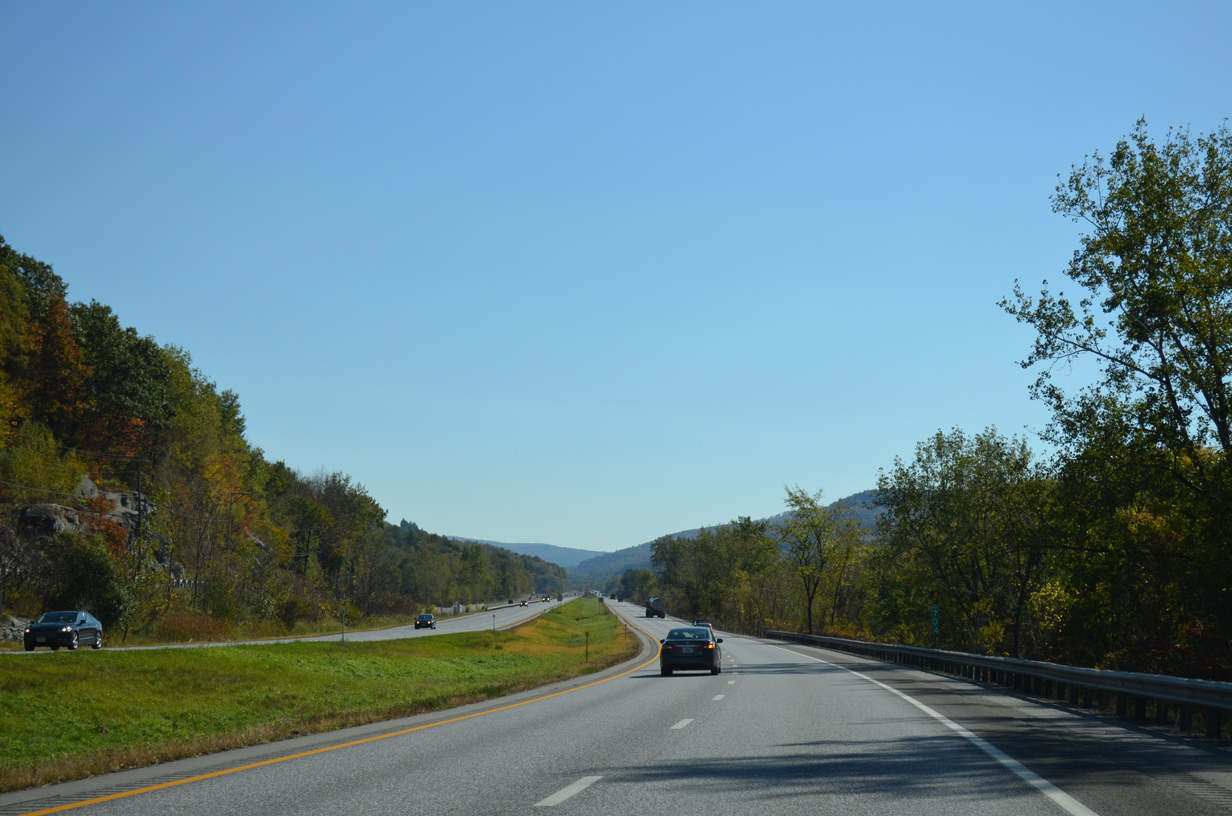
| Interstate 89 emerges from the S-curve to parallel U.S. 2 (Theodore Roosevelt Highway) directly as the route advances to the Bolton town center. 10/06/14 |
|
| Straddling the south slopes of Stimson Mountain (el. 1,995 ft) along Interstate 89. 10/06/14 |
|
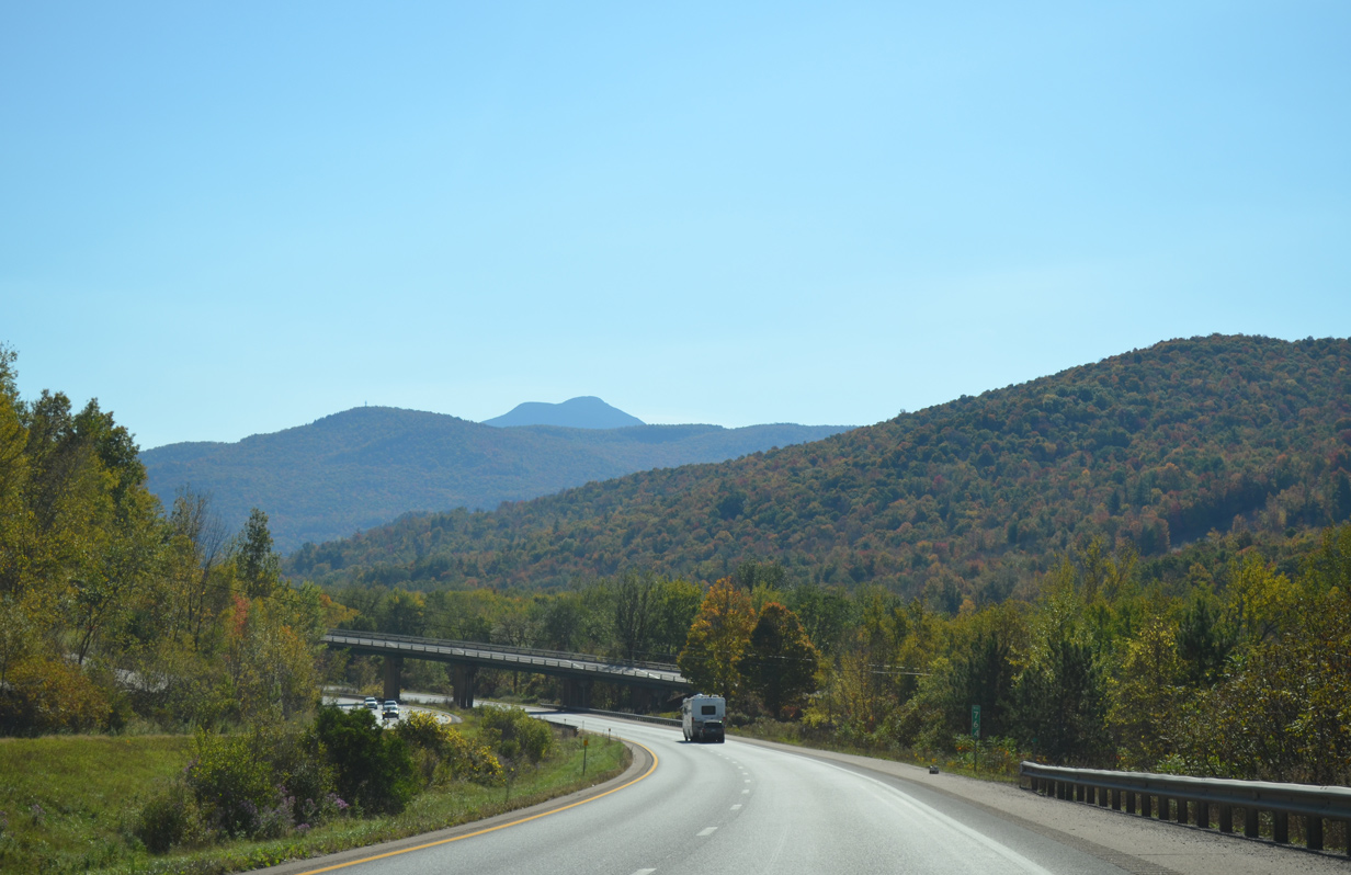
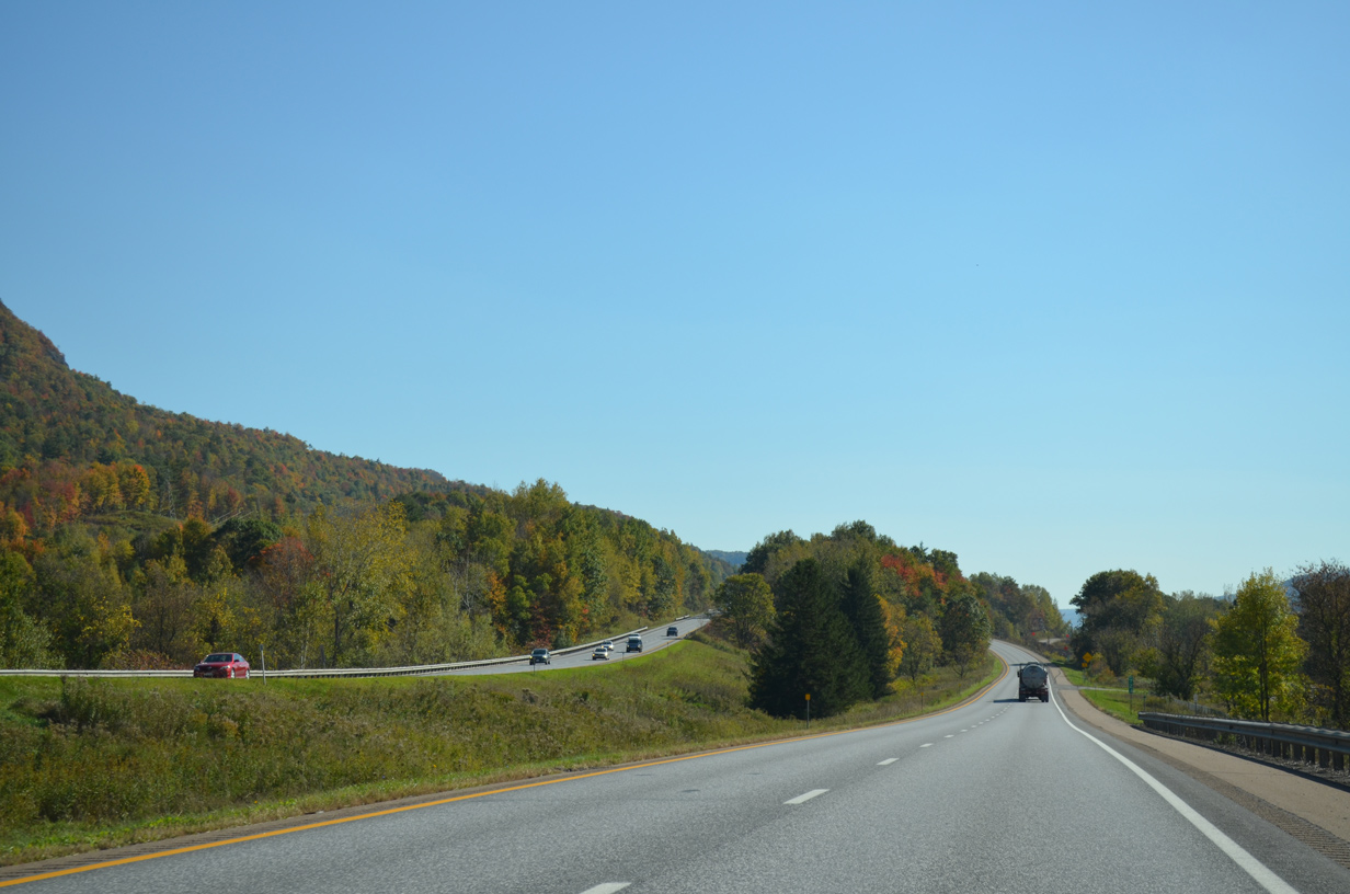
| Fall foliage nears its peak on Robbins Mountain to the south of the adjacent Winooski River. 10/06/14 |
|
| U.S. 2 again switches places with Interstate 89 from Bolton east to west Waterbury. 10/06/14 |
|
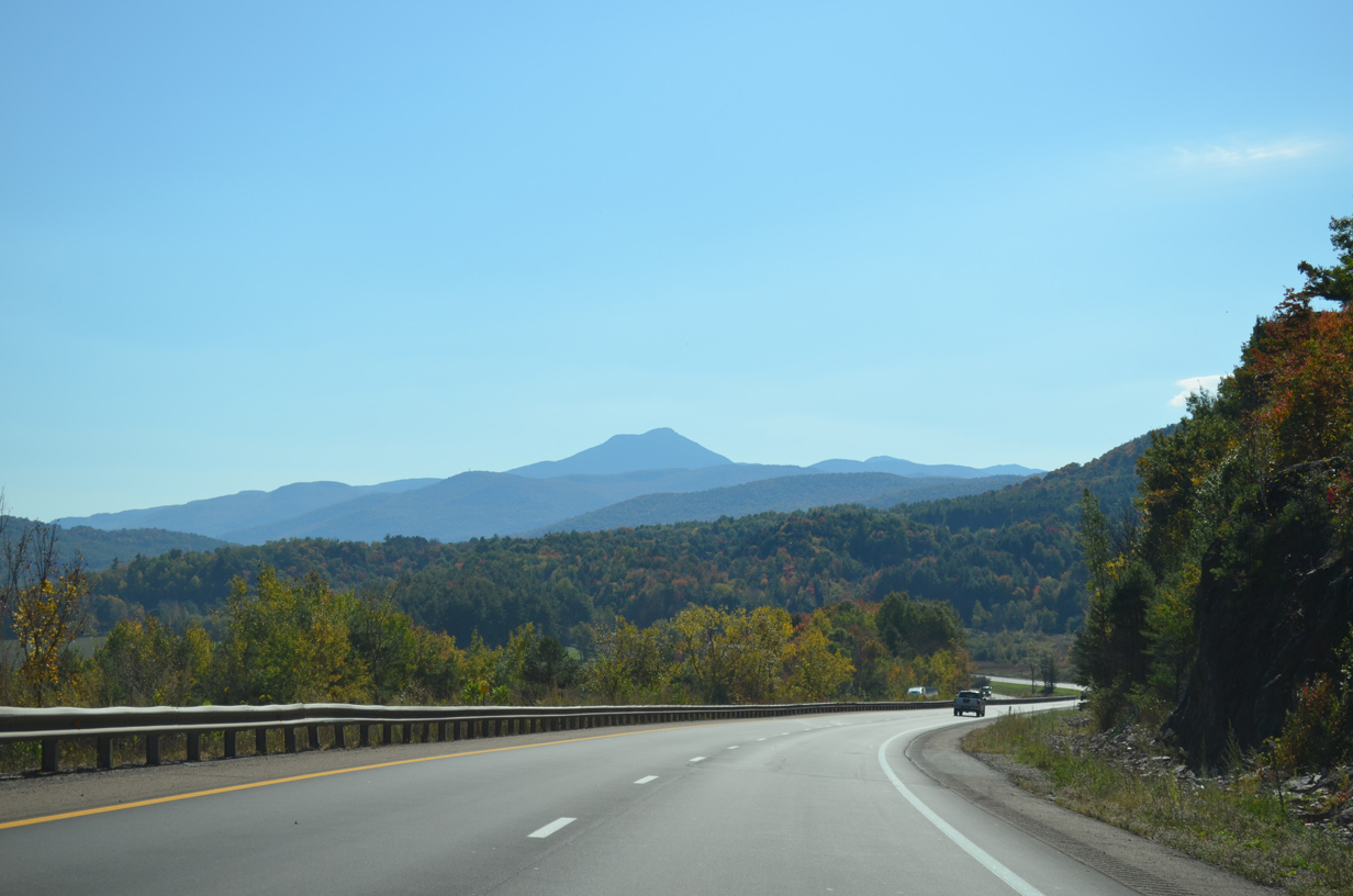
| This straight away takes Interstate 89 and adjacent U.S. 2 south of Bone Mountain (el. 2,917 ft). 10/06/14 |
|
| Looking south at the Green Mountains beyond the Winooski River. 10/06/14 |
|
| A southbound side parking area lies one mile ahead near Bolton Falls. Sign changes made by 2012 rebranded this from a rest area with no facilities. 10/06/14 |
|
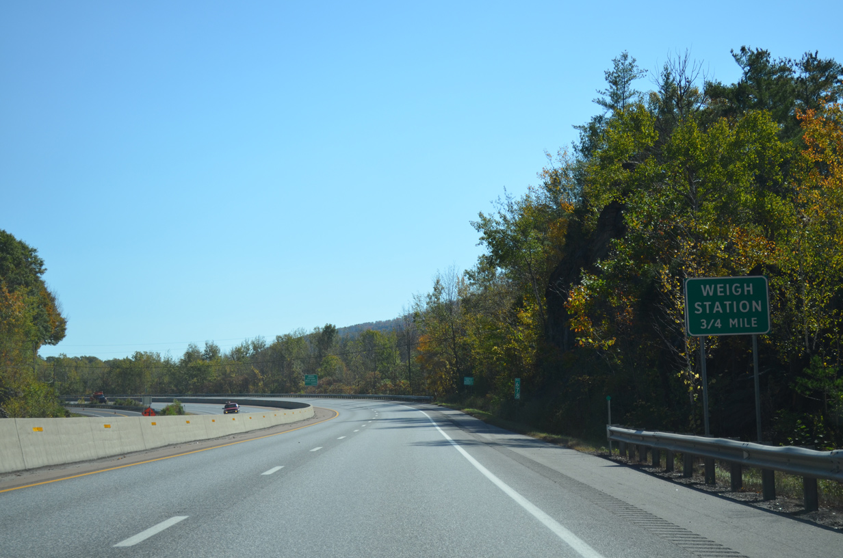
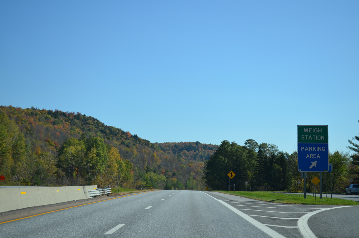
| The forthcoming parking area doubles as a truck weigh station. Motorists cross the Washington County line just beyond this sign. 10/06/14 |
|
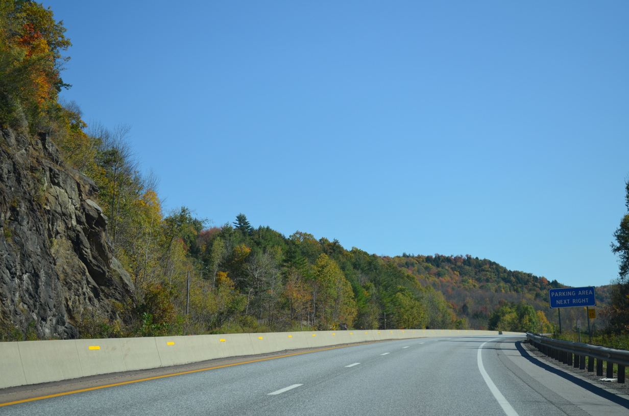
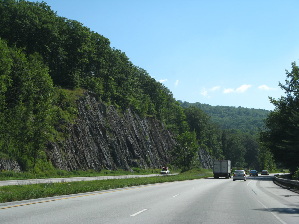
| Making another S-curve south of Woodward Mountain (el. 3,084 ft), I-89 south reaches the rest area and weigh station. 10/06/14 |
|
| Another under crossing takes U.S. 2 on the south side of Interstate 89 to the Waterbury town center. 10/06/14 |
|
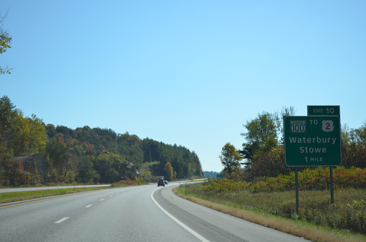
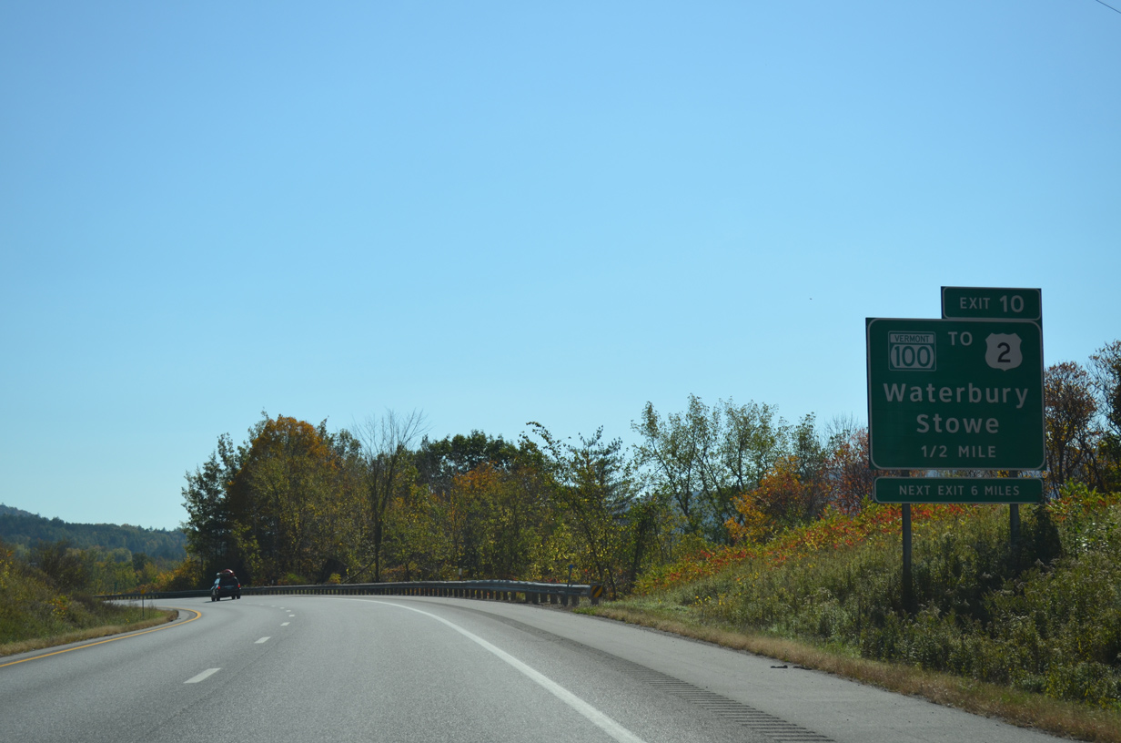
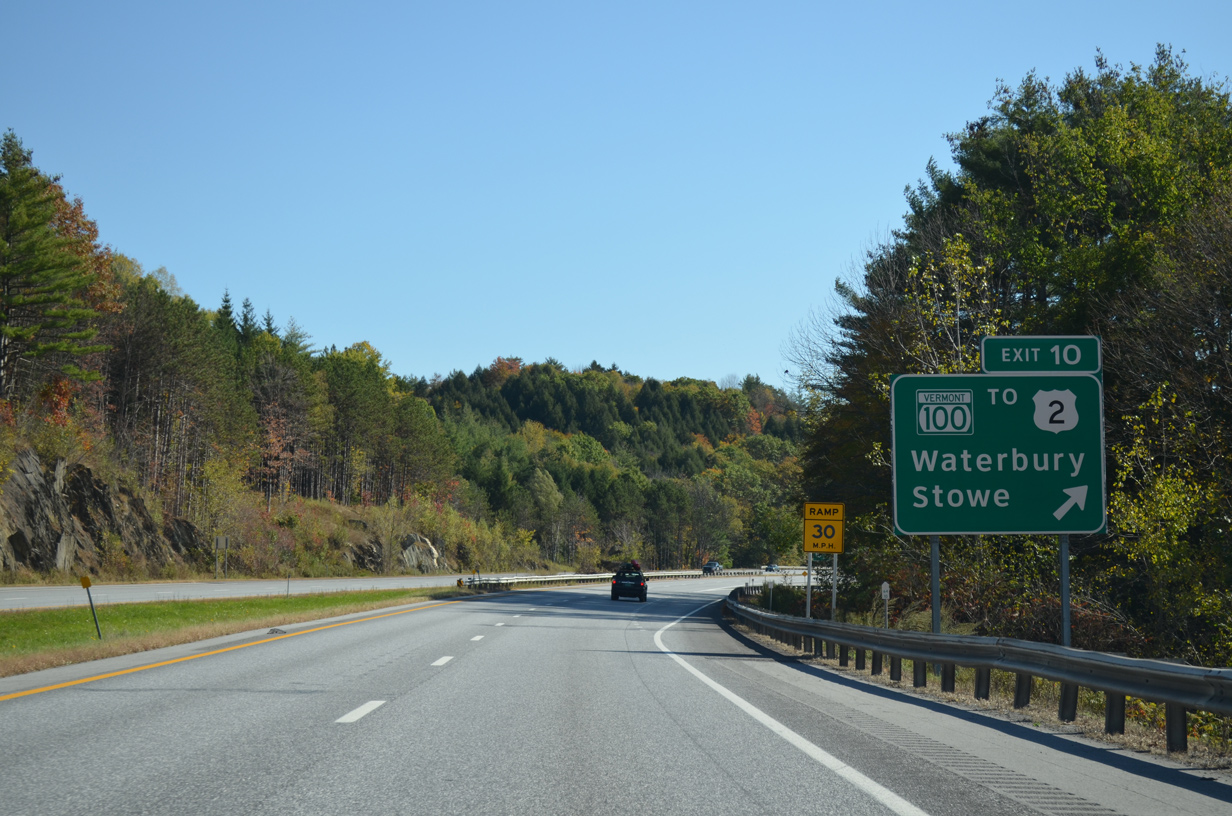
| Vermont Route 100, the famed scenic highway that travels across the Green Mountains in the central part of the state, crosses paths with Interstate 89 at Waterbury in one mile. 10/06/14 |
|
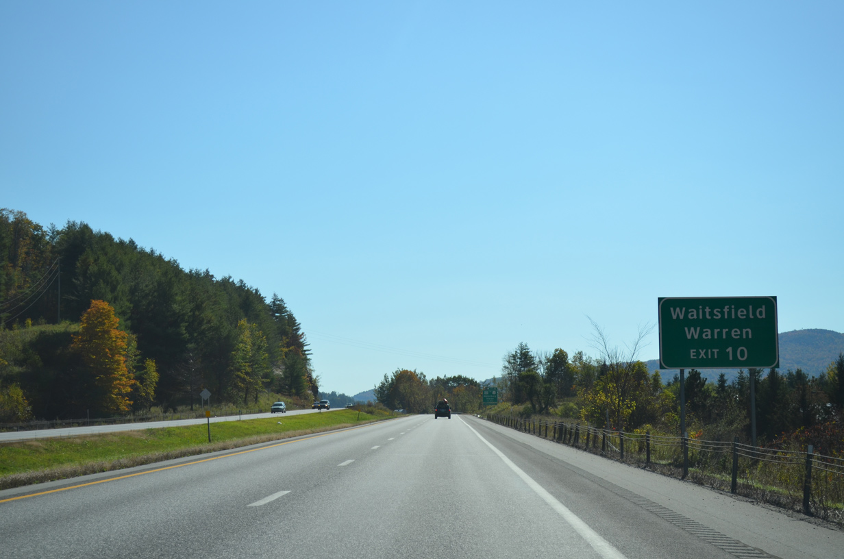
| A 1.4 mile overlap takes VT 100 south along U.S. 2 (Main Street) east through Waterbury. The state route resumes a southward course from town through Duxbury to Waitsfield and Warren in southwest Washington County. 10/06/14 |
|
| Vermont Route 100 leads north ten miles from Waterbury to Stowe. One mile north of Exit 10 is Ben and Jerry's Ice Cream Factory. 10/06/14 |
|
| Entering the parclo A2 interchange (Exit 10) with VT 100 on Interstate 89 south. VT 100 runs nearly the height of the state for 216.8 miles from Massachusetts 8 at Stamford to VT 105 in Newport. 10/06/14 |
|
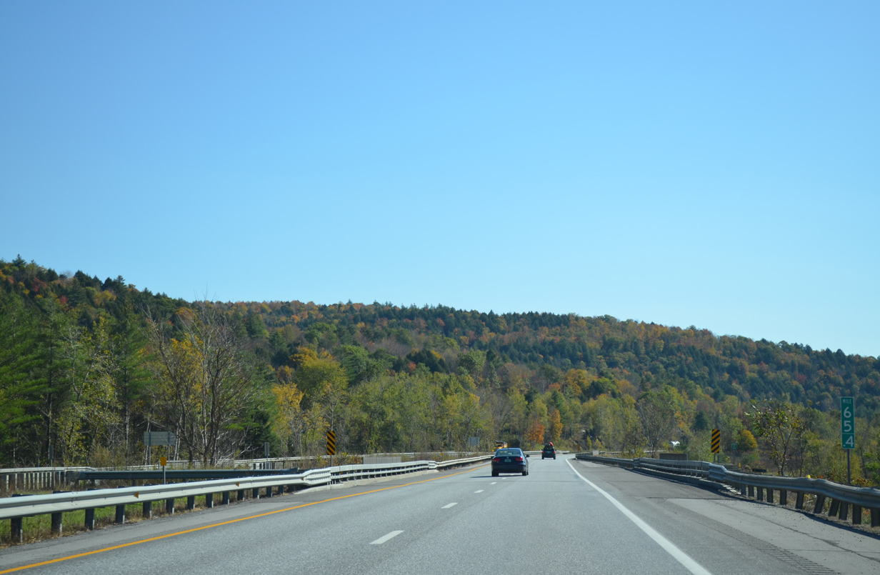
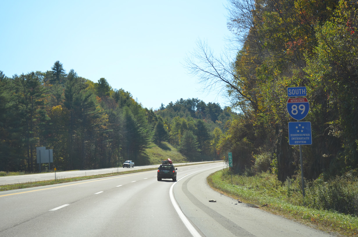
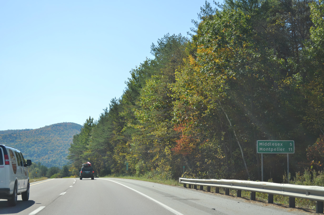
| Interstate 89 stays north of the Winooski River alongside the New England Central Railroad to Exit 9 at Middlesex in five miles. Montpelier is just 11 miles away. 10/06/14 |
|
| Mount Cobb (el. 1,588 ft) rises south of the Winooski River in the town of Moretown as I-89 leads away from Waterbury. 08/04/07 |
|
| Beyond the Middlesex town line, Interstate 89 arcs away from the Worcester Mountains toward the confluence of the Mad and Winooski Rivers. 08/04/07 |
|
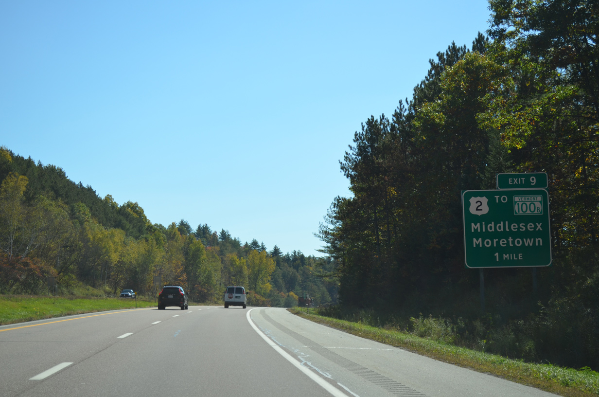
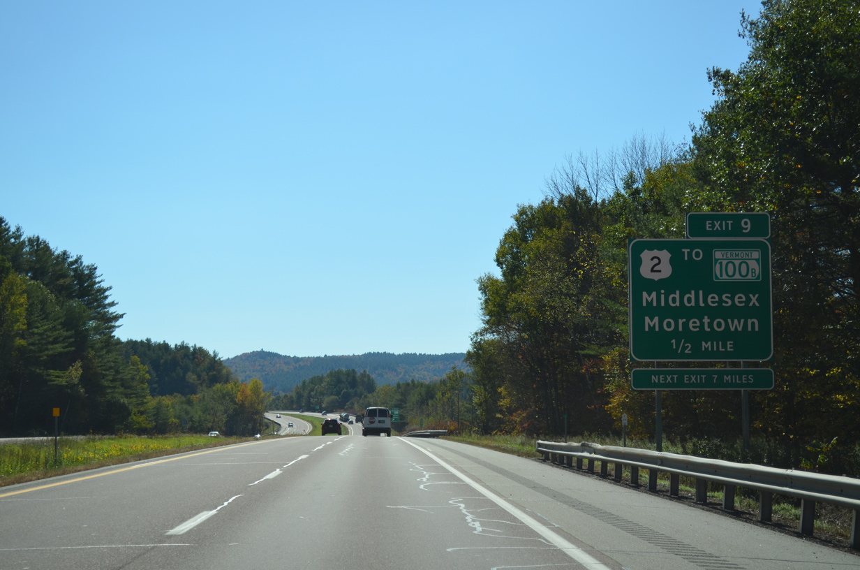
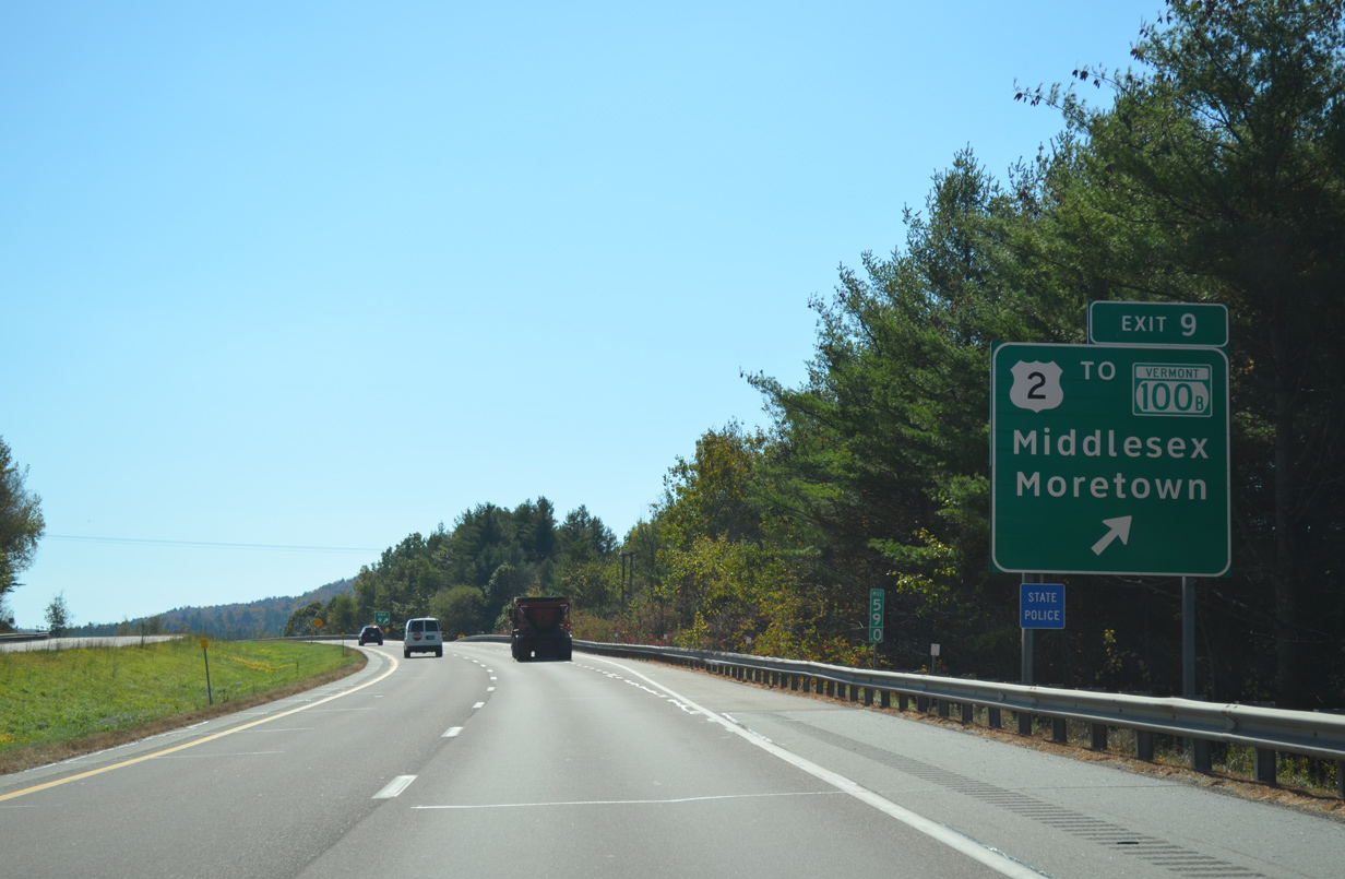
| Center Road links Interstate 89 with parallel U.S. 2 via a diamond interchange (Exit 9) in one mile. 10/06/14 |
|
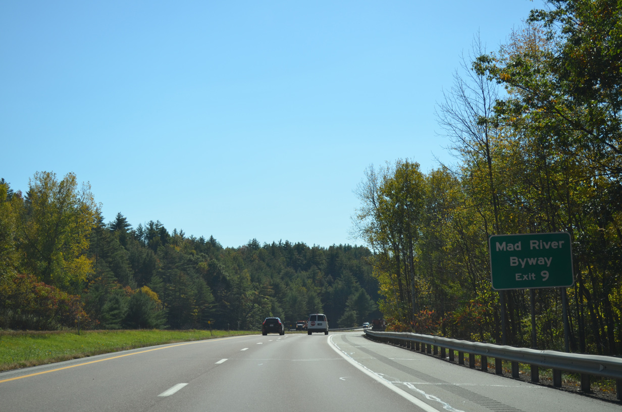
| Beginning in Middlesex, VT 100B runs 7.9 miles southwest along the Mad River to Moretown and VT 100. TV 100B doubles as the northernmost segment of the Mad River Byway, which also includes VT 100 south to Waitsfield and VT 17. 10/06/14 |
|
| U.S. 2 enters the Middlesex town center just east of Center Road and Exit 9. 10/06/14 |
|
| Exit 9 departs I-89 south for Center Road south to U.S. 2 and north to Middlesex Center. U.S. 2 intertwines with the freeway three more times to Montpelier without direct access. 10/06/14 |
|
| Interstate 89 crosses Great Brook by this reassurance marker. 10/06/14 |
|
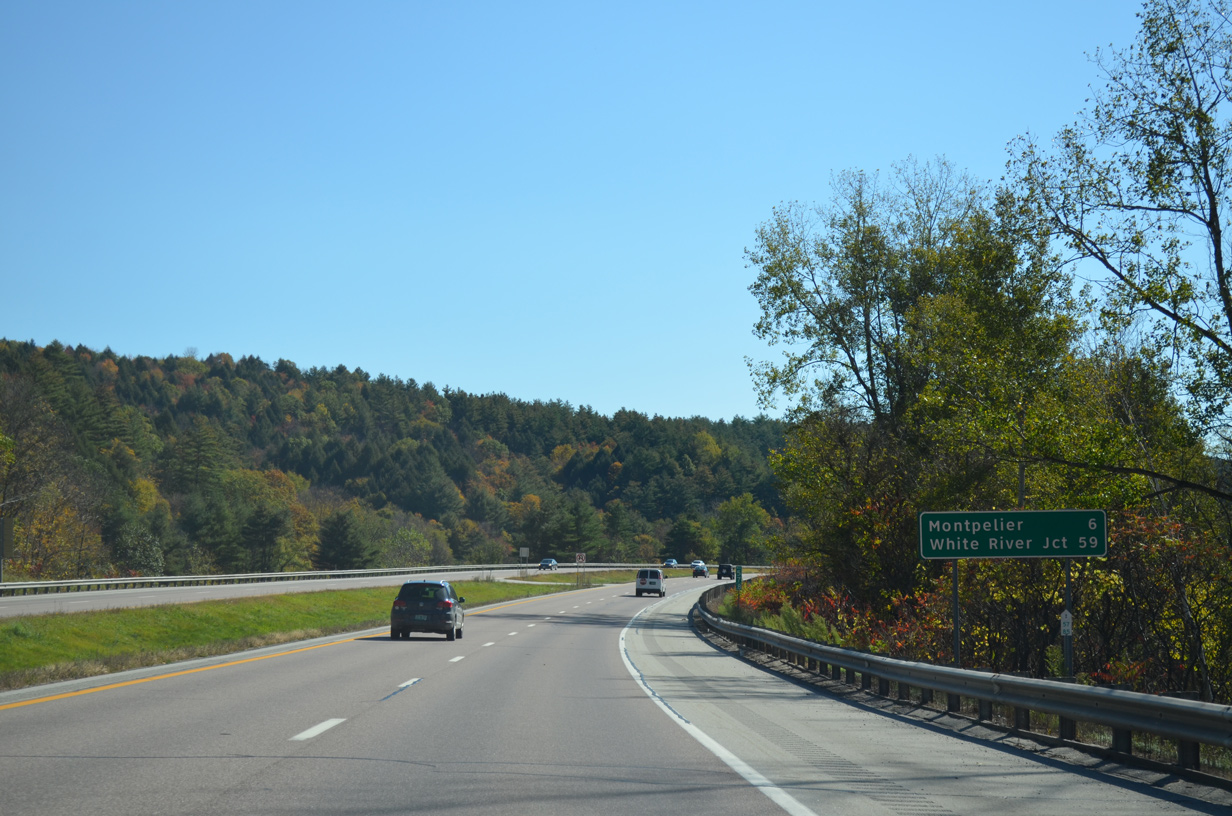
| White River Junction appears as the final control city for Interstate 89 south in Vermont at 59 miles out. 10/06/14 |
|
| U.S. 2 spans both I-89 and the New England Central Railroad in this scene. 10/06/14 |
|
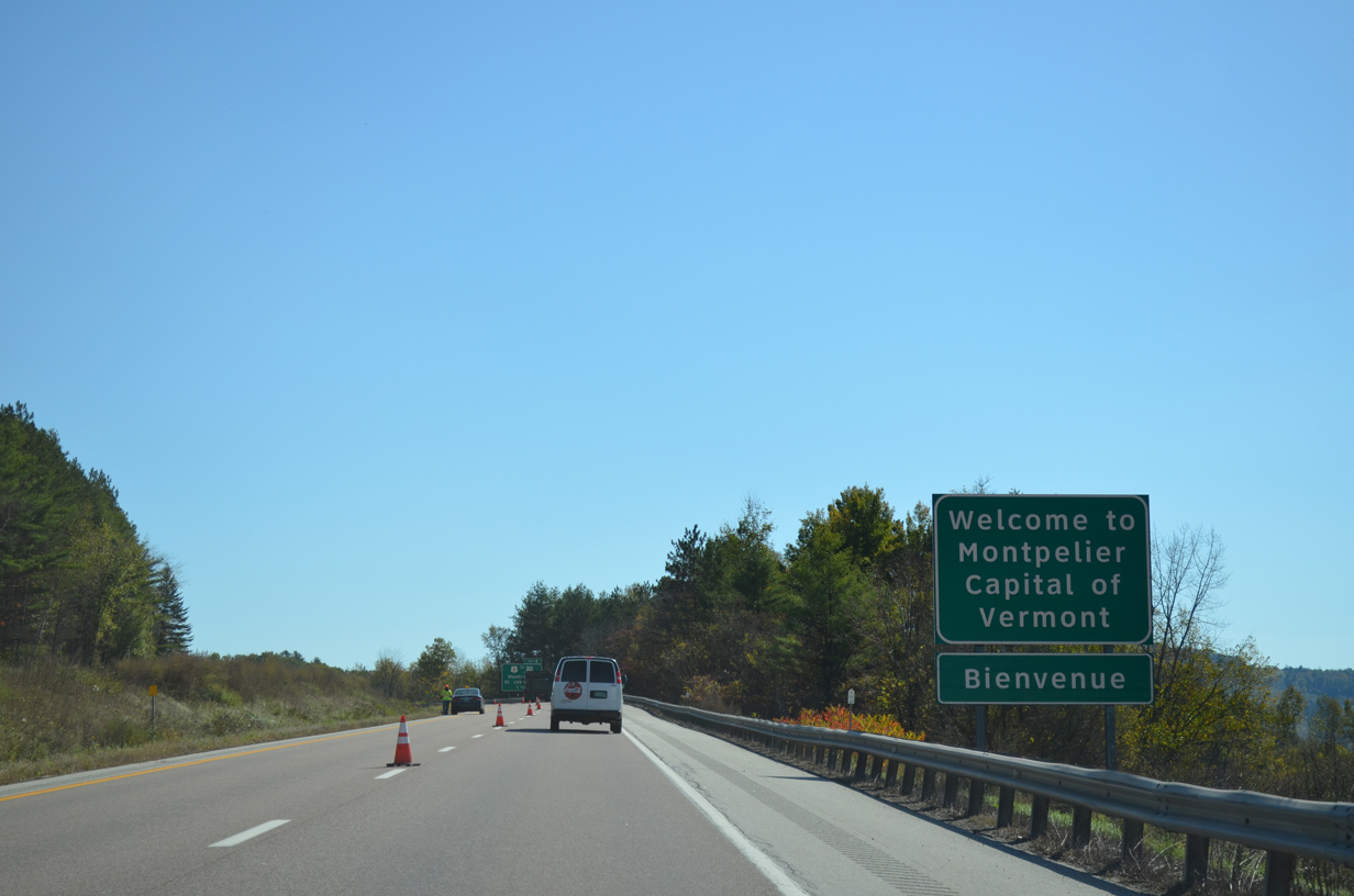
| With around 8,000 residents, Montpelier is the smallest capital city in the United States. 10/06/14 |
|
| U.S. 2 diverges from the I-89 at Montpelier. U.S. 2 follows State Street east to Bailey Avenue at U.S. 2 Business and Downtown. U.S. 2 crosses the Winooski River and overtakes Memorial Drive east en route to U.S. 302 on the 37 mile drive to St. Johnsbury. 10/06/14 |
|
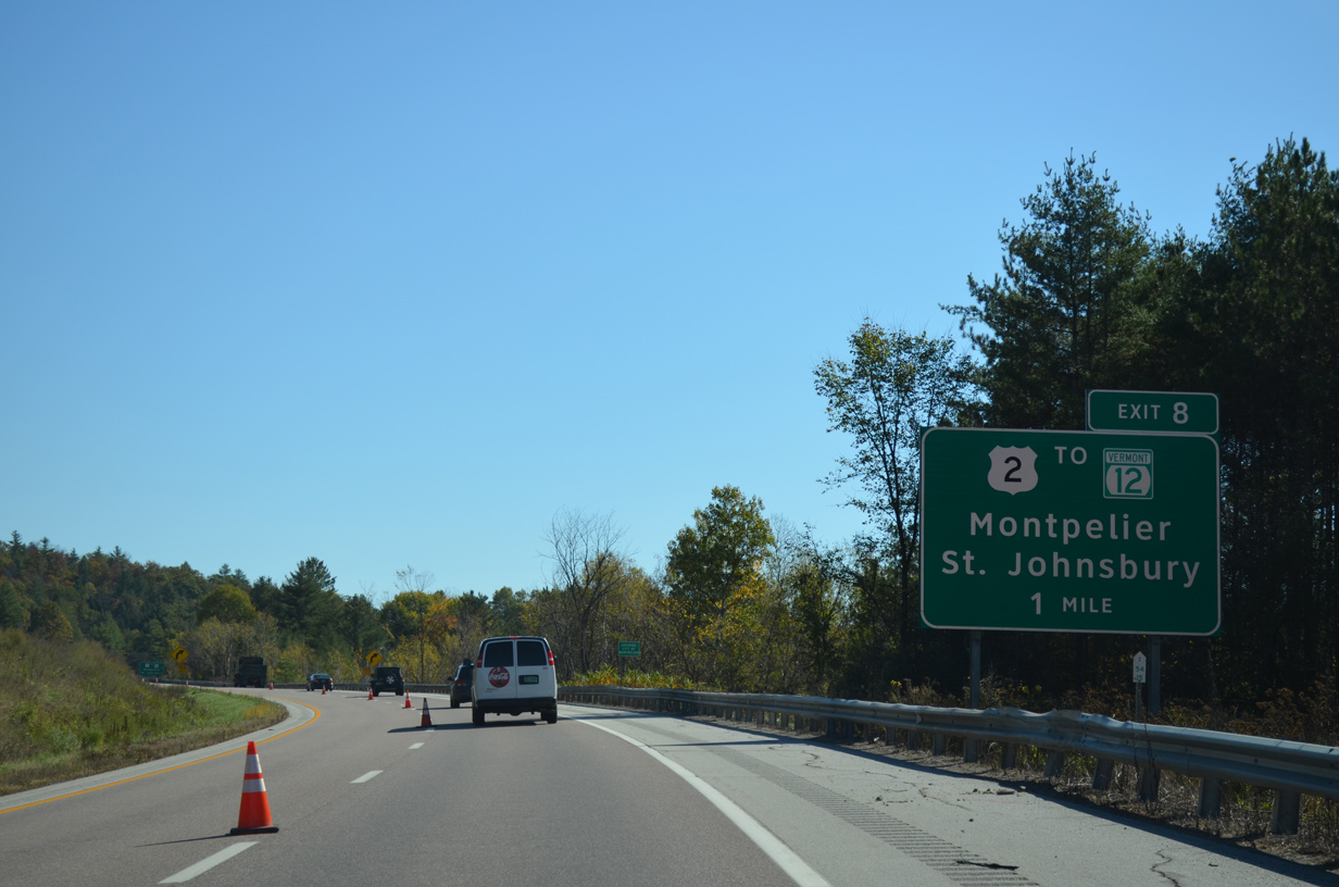
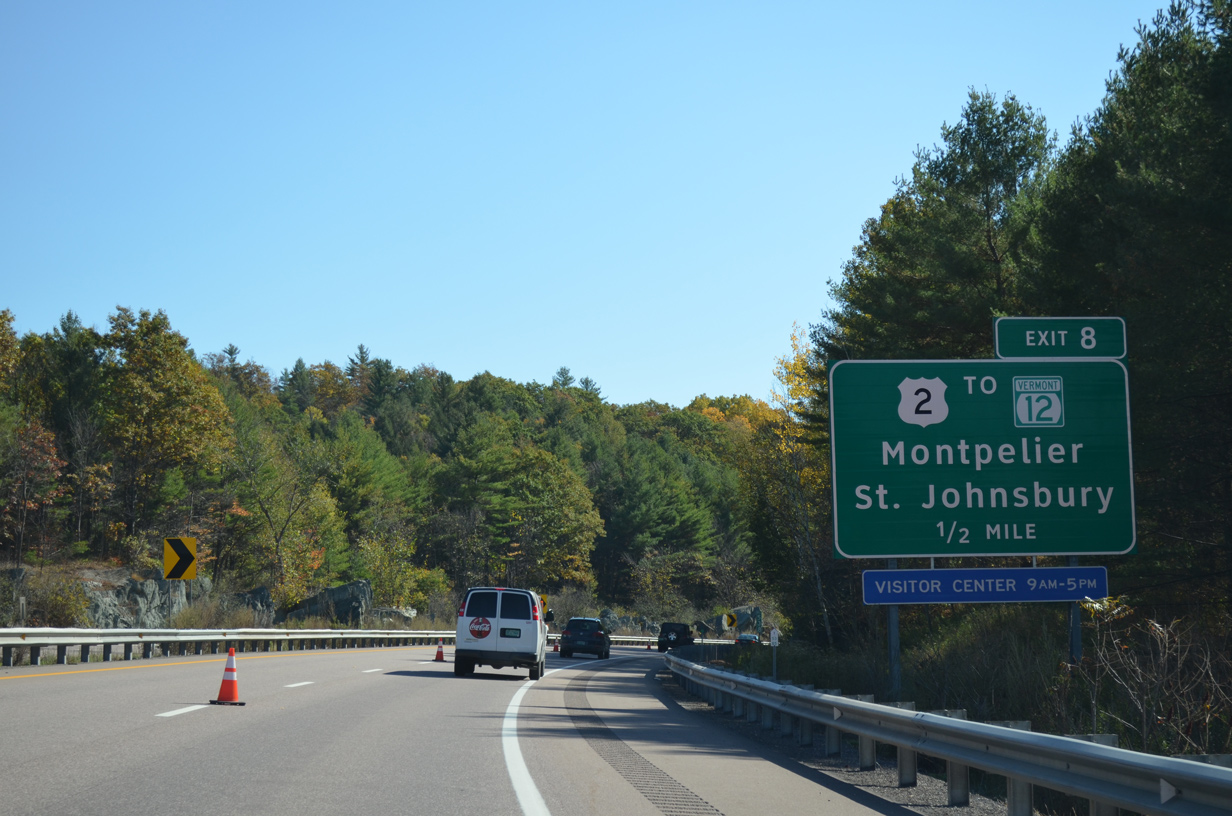
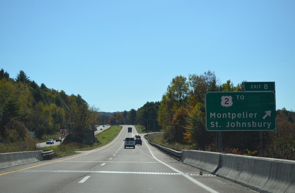
| A trumpet interchange (Exit 8) joins Interstate 89 with Memorial Drive in one half mile. Memorial Drive spurs 0.89 miles northeast with four lanes to U.S. 2 at Bailey Avenue Extension. Memorial Drive follows U.S. 2 to VT 12 (Northfield Street) and U.S. 2 Business (Main Street). 10/06/14 |
|
| Interstate 89 finally turns southward at Montpelier to cross the Winooski River for the final time. The freeway crosses over VT 12 (Northfield Street) just south of Exit 8. VT 12 goes for 97.5 miles from VT 15A at Morrisville to become New Hampshire Route 12 in Weathersfield. 10/06/14 |
Page Updated 03-06-2015.

 South
South