This north-south state trunk highway begins in the extreme southwest corner of the state east of Dubuque, Iowa and extends 412.15 miles to end in Downtown Superior at Interstate 535 and U.S. 53. Wis 35 has the distinction of being the longest state maintained roadway in Wisconsin. The route often parallels the Mississippi and St. Croix rivers on its trek northward through the western part of the state. This guide covers the first few miles within the limits of Grant County.
|
| Wis 35 emerges from IL 35 at the state line in southeast Grant County. 12/21/09 |
|
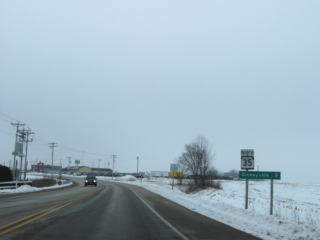
| The state highway is also part of the Wisconsin Great River Road, which follows the route from the Illinois state line north 230 miles to the town of Prescott, located along the east shores of the Mississippi River. The Wisconsin Great River Road is part of a much larger network of highways, byways, and local roads which follow the Mississippi River from the deltas of Louisiana to its headwaters in north-central Minnesota at Lake Itasca. Reassurance markers such as this one are placed periodically along the Great River Road network. 12/21/09 |
|
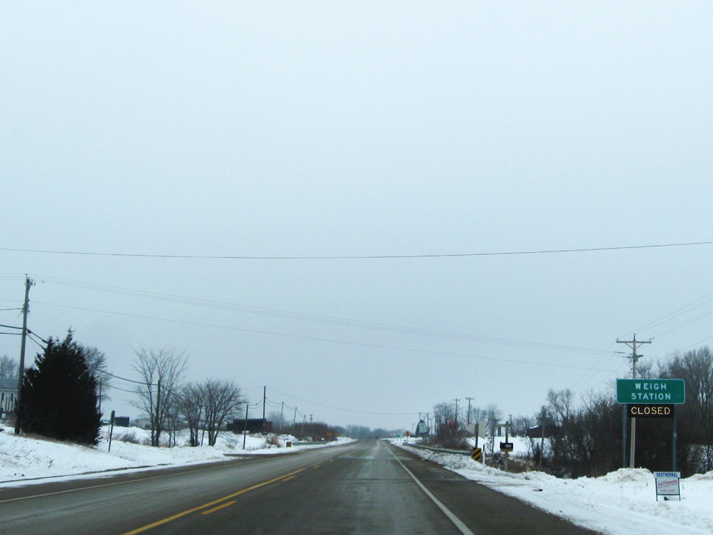
| Guide sign for the weigh station that is situated immediately north of the intersection with Wis 11. The weigh station is one of 16 facilities operated throughout the state for commercial truckers. 12/21/09 |
|
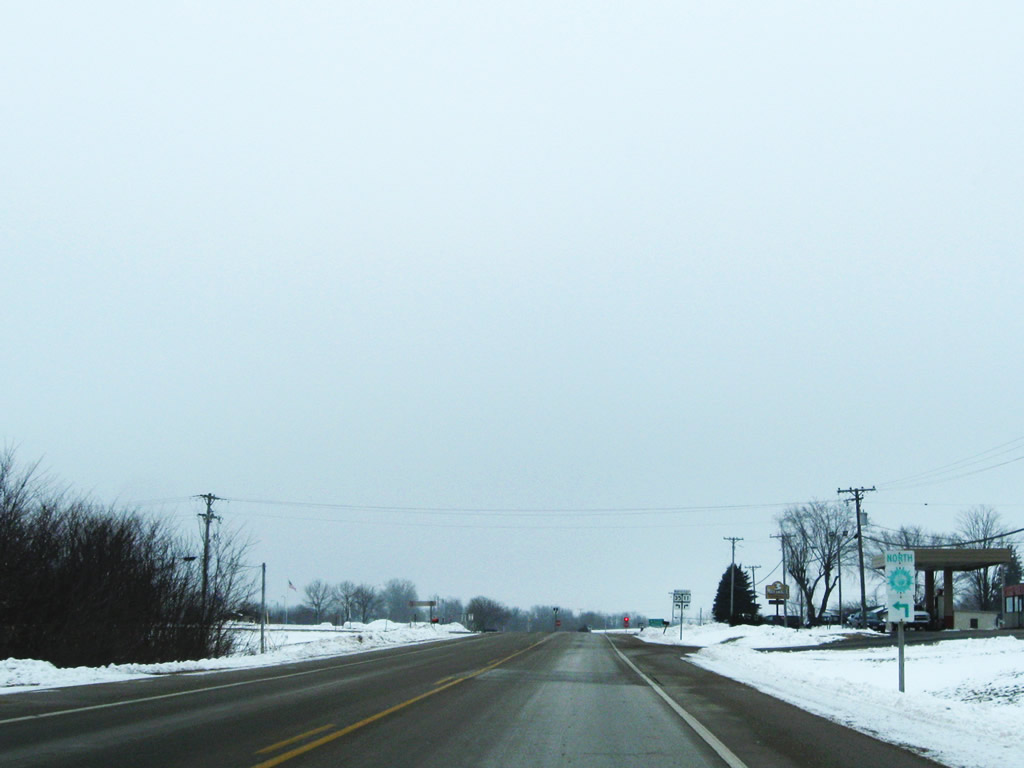
| The Great River Road will continue to follow Wis 35 another 248 miles to the town of Prescott, situated along the Mississippi River at its intersection with the St. Croix River. Prescott resides on the Wisconsin side of both rivers and lies 22.9 miles southeast of downtown St. Paul, Minnesota. 12/21/09 |
|
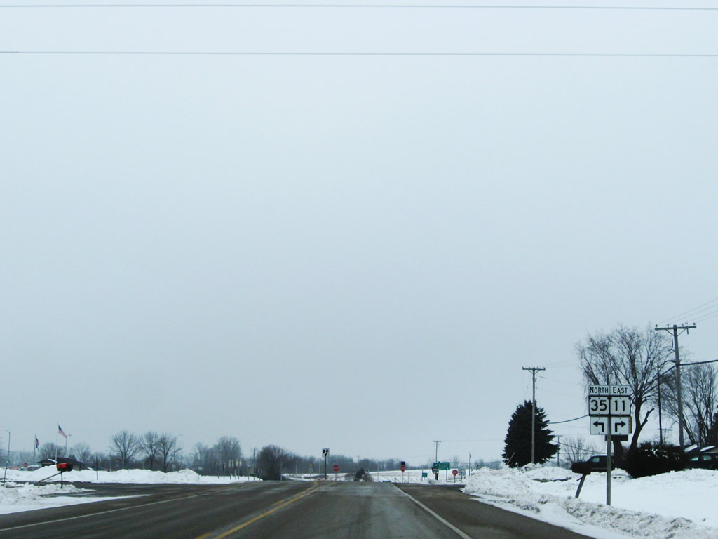
| Wis 35 approaches the intersection with Wis 11. Wis 11 is an east-west route that travels 157.56 miles, linking U.S. Highway 61 and U.S. Highway 151 with the south central cities of Monroe and Janesville, and also links with the city of Racine, which lies along the west shores of Lake Michigan. 12/21/09 |
|
| Wis 35 and the Great River Road turn west 0.3 miles alongside Wis 11 to U.S. 61/151. The city of Monroe lies 55.1 miles east along Wis 11 followed by the city of Janesville, along the I-39/90 corridor in 90.3 miles. 12/21/09 |
Page Updated 02-27-2011.