
Cataloged below are state routes covered at AARoads. Hidden state routes such as SR 3 (U.S. 31), SR 13 (U.S. 43), and SR 57 (U.S. 45) are covered on their respective U.S. Highway guides.
| Highway | South/West End | North/East End | Mileage |
|---|---|---|---|
| 5 | Thomasville | Natural Bridge | 197.775 |
| 8 | Cuba | Georgia state line | 217.887 |
| 14 | Mississippi state line | Opelika | 218.289 |
| 17 | Mobile | Tennessee state line | 346.562 |
| 21 | Florida state line | Piedmont | 279.296 |
| 22 | Safford | Georgia state line | 168.543 |
| 41 | Florida state line | Selma | 127.484 |
| 47 | Awin | Mexia | 43.063 |
| 49 | Franklin | Talladega National Forest | 82.684 |
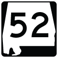
| 52 | Opp | Geneva | 26.455 |
| 56 | Mississippi state line | Wagerville | 27.696 |
| 59 | SR 182 - Gulf Shores | SR 21 - Uriah | 93.670 |
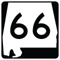
| 66 | Linden | Safford | 4.959 |
| 69 | Jackson | Guntersville | 280.599 |
| 77 | LaFayette | Att-al/la | 112.334 |
| 81 | Notasulga | Tuskegee | 10.432 |
| 83 | Evergreen | Midway | 24.274 |
| 86 | Mississippi state line | Gordo | 27.396 |
| 100* | SR 15 - Andalusia | U.S. 84 - Andalusia | 1.6 |
| 104 | Robertsdale | Montrose | 10.769 |
| 112* | Bay Minette | Florida state line | 30.2 |
| 113 | Florida state line | Barnett Crossroads | 15.457 |
| 115 | SR 9 | U.S. 280 | 3.250 |
| 124 | Townley | Jasper | 10.896 |
| 129 | U.S. 43 - north of Fayette | SR 13 - Haleyville | 41.191 |
| 134 | Opp | Columbia | 76.795 |
| 135 | SR 182 - Gulf Shores | SR 180 - Gulf Shores | 2.138 |
| 136 | Monroeville | Excel | 6.151 |
| 137 | Florida state line | U.S. 29 | 13.997 |
| 149 | U.S. 280 - Mountain Brook | U.S. 31 - Birmingham | 8.145 |
| 152 | Interstate 65 - Montgomery | U.S. 231/SR 21 - Montgomery | 6.605 |
| 154 | Coffeeville | Thomasville | 29.480 |
| 156 | Jachin | Pennington | 7.186 |
| 158 | U.S. 45 - Kushla | Sarland | 9.280 |
| 159 | Gordo | Fayette | 29.626 |
| 161 | SR 182 - Orange Beach | SR 180 - Orange Beach | 1.716 |
| 163 | SR 193 | U.S. 90 - Mobile | 11.104 |
| 175 | Sprott | Heiberger | 5.382 |
| 177 | U.S. 43 - Jackson | U.S. 43 - Jackson | 5.160 |
| 180 | Fort Morgan | Orange Beach | 32.184 |
| 181 | Weeks Bay | Spanish Fort | 18.235 |
| 182 | Pine Beach | Florida state line (SR 292) | 17.046 |
| 185 | Greenville | Letohatchee | 23.129 |
| 188 | Grand Bay | Heron Bay | 19.686 |
| 193 | Dauphin Island | Tillman's Corner | 26.012 |
| 195 | SR 13 - Haleyville | SR 5 - Jasper | 41.179 |
| 199 | Tuskegee | Notasulga | 10.218 |
| 213 | Eight Mile | Saraland | 5.753 |
| 215 | Tuscaloosa | Cottondale | 12.100 |
| 217 | Eight Mile | Mobile County 96 | 26.119 |
| 225 | Spanish Fort | Stockton | 23.910 |
| 229 | Millstead | Tallassee | 21.020 |
| 233 | SR 129 - Glen Allen | U.S. 278 - near Sunny Home | 14.561 |
| 255 | Redstone Arsenal | Huntsville | 10.052 |
| 263 | Greenville | Braggs | 8.480 |
| 275 | Bemiston (Talladega) | northwest Talladega | 3.495 |
| 281 | Talladega National Forest | U.S. 78 | 26.334 |
| 287 | Bay Minette | I-65 | 6.370 |
* - decommissioned
Source: ALDOT Milepost Maps
SR 52 originates in southeastern Alabama to the southwest of the Geneva County seat of Geneva. The highway extends north from CR 185 (former SR 185) to the northeast of De Funiak Springs, Florida. Traveling five miles, SR 52 meets SR 196 at Geneva.
Continuing east from Geneva, SR 52 heads to Hartford, Slocomb and Malvern before reaching the Dothan belt line. A four mile stretch, from near the Geneva/Houston County line to U.S. 231, was four-laned. Within Dothan, the state route travels through Downtown, emerging from the city en route to Webb and the Georgia state line near Columbia.
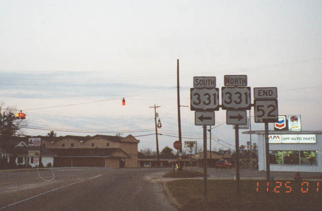 | Prior to completion of the Opp bypass for U.S. 331, SR 52 extended northwest to Florala Highway (old U.S. 331) south of Downtown Opp. 11/25/01 |
SR 66 acts as a connector between SR 28 and SR 5 between Consul and Safford. Totaling just nine miles, the highway comprises part of a longer route between Linden and Selma.
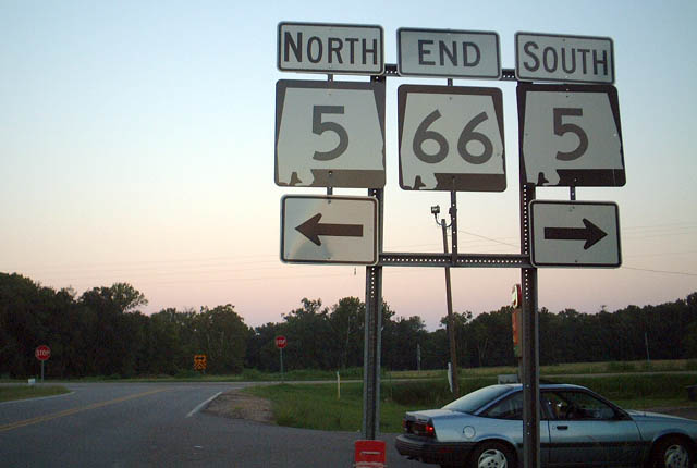 | SR 66 eastbound concludes at SR 5 in rural Dallas County. SR 5 connects with SR 22 east at Safford in 1.25 miles. 08/10/02 |
A lengthy state route, SR 69 originates at SR 177 in the Clark County seat of Jackson. Following a northerly course, SR 69 traverses rurals areas of the Black Belt region to Tuscaloosa, where it combines with I-359 and a U.S. 43. Northern reaches of the route extend to U.S. 431 at Guntersville.
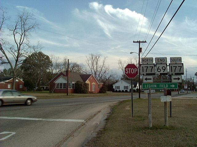 | SR 69 (Coffeeville Road) spurs 0.6 mile south from the grade separated intersection with U.S. 43 to SR 177 (College Avenue) north of Downtown Jackson. SR 177 represents the former alignment of U.S. 43 through Jackson. 02/10/02 |
SR 84 runs 24 miles north from the Conecuh County seat of Evergreen to SR 47 at Midway. Beyond an interchange with I-65, the state route is rural.
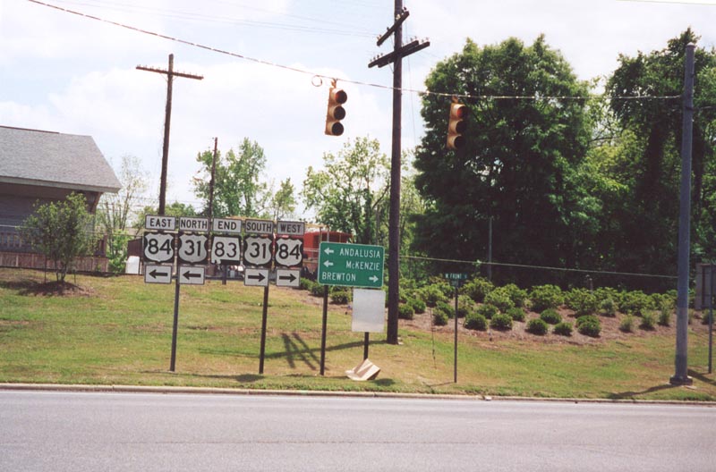 | Southbound SR 83 concludes at U.S. 31/84 in Evergreen. 04/21/01 |

Alabama State Route 124 travels 11 miles between U.S. 78 and SR 69 in Walker County. The east end of SR 102 ties into the route at Towney.
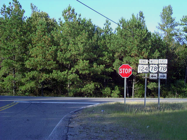 | Alabama State Route 124 concludes at SR 118 (signed here still as part of U.S. 78), near I-22 east of Carbon Hill. The state route parallels I-22 eastward to SR 69, just south of Exit 61. 09/25/03 |
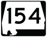
SR 154 constitutes a rural route traveling 32 miles from Coffeeville and U.S. 84 northeastward to U.S. 43 at Thomasville in Clark County.
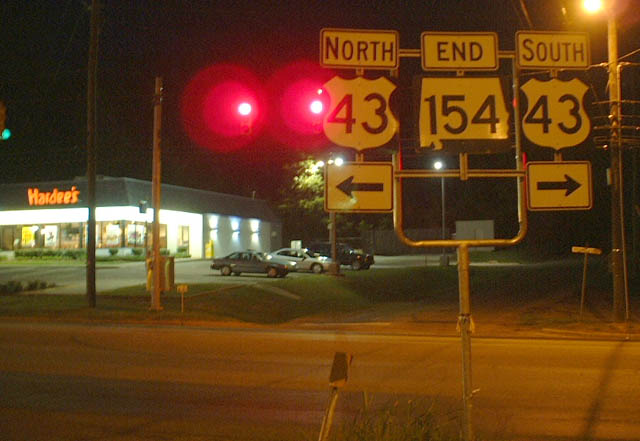 | Eastbound SR 154 (Tallahatta Springs Road) ends at a commercialized stretch of U.S. 43 in Thomasville. 08/10/02 |
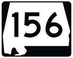
SR 156 travels seven miles east from SR 17 at Jachin to SR 14 miles at Pennington. Staying within Choctaw County, the route traverses mostly pine forest land.
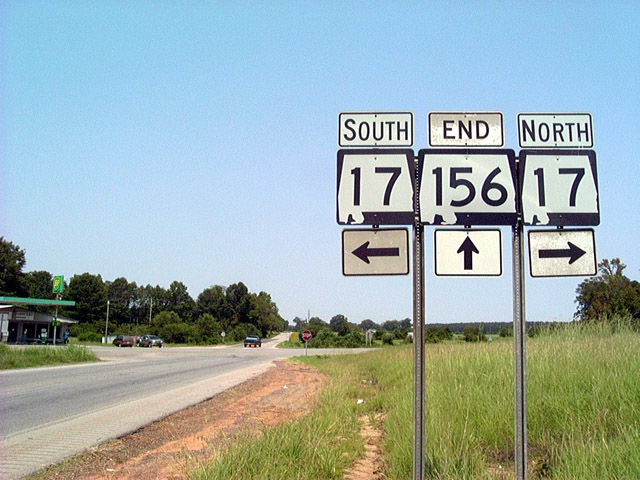 | SR 156 west ends at a rural intersection with SR 17 at the community of Jachin. 08/10/02 |

SR 175 is a five mile connector in Perry County between SR 5 and SR 183 outside of Marion and near Talladega National Forest.
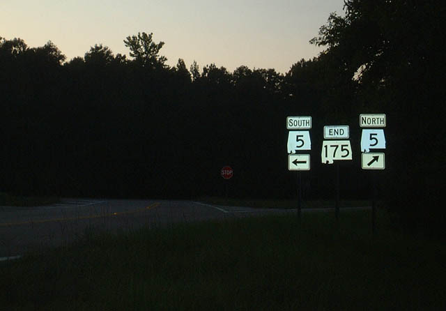 | SR 175 ends at SR 5, which travels out of the Marion area to the community of Heilberger and Talladega National Forest. 08/10/02 |

A ten mile route, SR 199 heads north from SR 81 and Tuskegee to SR 14 near Liberty City. Remaining wholly within Macon County, SR 199 crosses over Interstate 85 without an interchange.
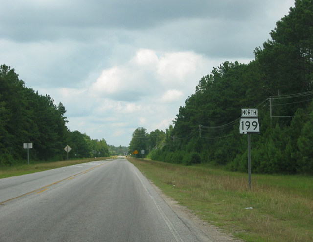 | The first SR 199 shield stands just west of SR 81, and three miles north of the Macon County seat of Tuskegee. 08/22/03 |

Alabama State Route 229 begins at Interstate 85 near Milsted and travels 21 miles north to SR 63. The state route serves the communities of Tallassee, Burlington, Kent, and Red Hill in Elmore County.
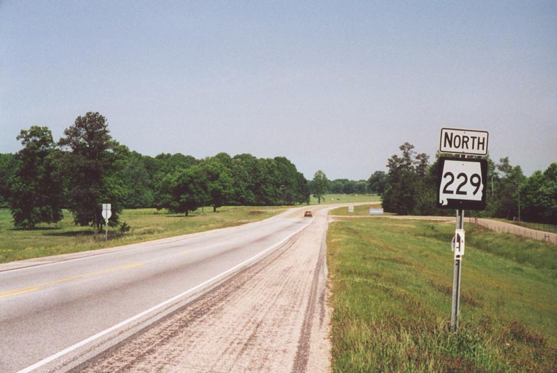 | The first confirming marker for SR 229 north appears just beyond the interchange (Exit 26) with Interstate 85. 04/21/01 |
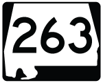
SR 263 runs 15 miles north from SR 185 at north Greenville to SR 21 at the rural settlement of Braggs.
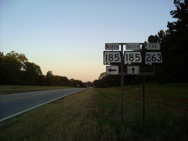 | SR 185 turns from Fort Deposit to the northeast to overtake the south end of SR 263 en route to I-65 and the Butler County seat of Greenville. 10/01/03 |
Page Updated 11-07-2012.