The Sky Harbor Expressway is an orphaned piece of expressway serving traffic on the east side of Sky Harbor Airport. The freeway begins at University Avenue, and travels north across the Salt River before reaching Washington Street, where it ends to become 44th Street.
As part of the 1985 Freeway system, the Hohokam Expressway (Arizona 143) was programmed for redesign and reroute. Before this point, the Hohokam traveled from Interstate 10 at 48th Street north and west to 44th Street. In the final plans, the Hohokam Expressway was redesigned to travel between Loop 202 and Interstate 10 (paralleling 48th Street) and was not designed to serve Sky Harbor Airport. To provide airport access, a new expressway was designed which would take over the northern half of the former Hohokam Expressway.
Construction timeline:
- September 1996: University Drive to Sky Harbor Blvd
- March 1992: Sky Harbor Blvd to Washington Street
The corridor was planned to be extended west to 40th Street, with a conversion of 40th Street to a limited access corridor. An at-grade intersection with Superior Avenue was planned, as well as an overpass of University Avenue.
While Arizona 143 has peak hour traffic issues, it is still adequately handling its share of Sky Harbor Airport traffic, and Arizona 153 has been consistently under-utilized. Plans to finish the expressway to Interstate 10 were consistently delayed.
In 2007, the City of Phoenix released their updated Peoplemover plans. One of the elements of the Peoplemover plan is to convert Arizona 153 back to a city street, and run the Peoplemover along the route.
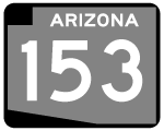
In August 2007, ADOT removed Arizona 153 from the State Highway system. Signs were removed from the road in April 2008. Former Arizona 153 is now known as 44th Street.
|
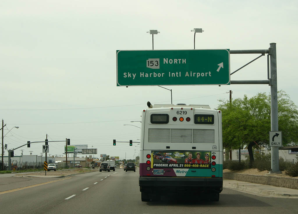
| Looking westbound on University Drive, this overhead sign marks the beginning of Former SR 153 northbound. 04/08/07 |
|
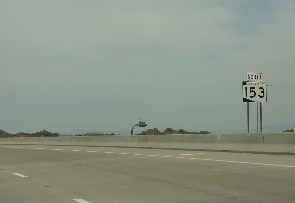
| This reassurance marker was one of the few on SR 153. Former SR 153 is a six lane expressway throughout its length. 04/08/07 |
|
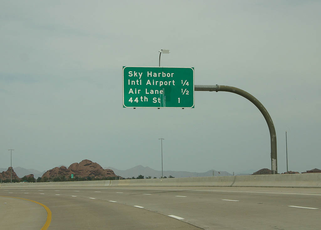
| Distance sign for the next three exits - Sky Harbor Airport, Air Lane and 44th Street/Washington Street. 04/08/07 |
|
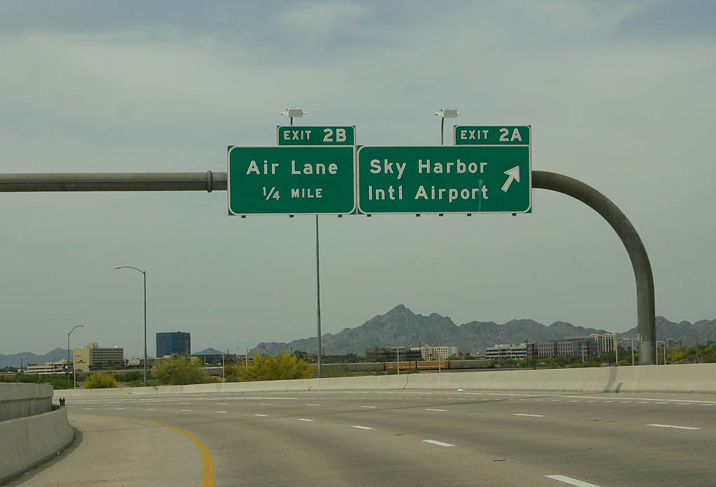
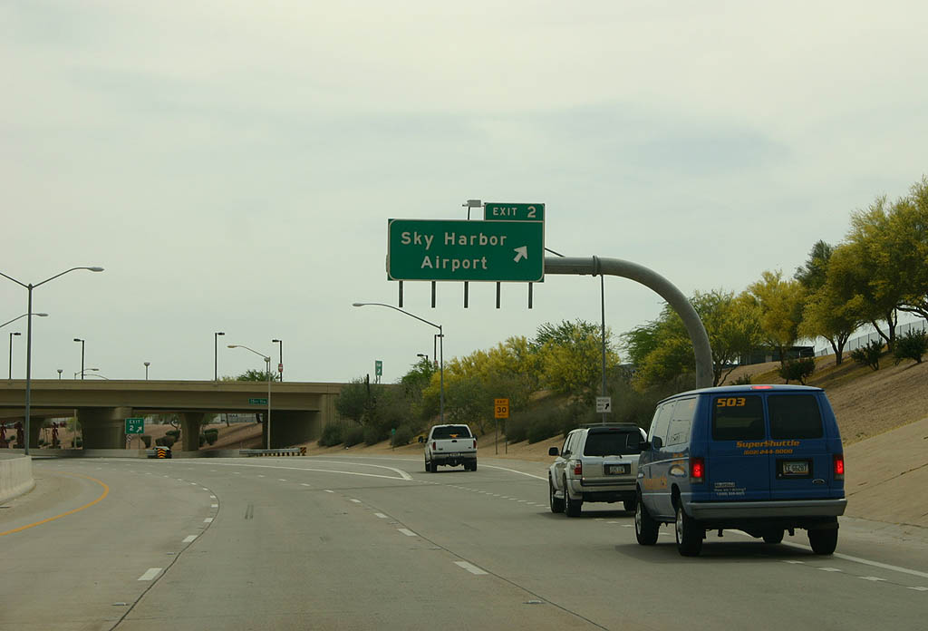
| Exit 2A departs here to reach Sky Harbor airport. The next exit is Air Lane, exit 2B. 04/08/07 |
|
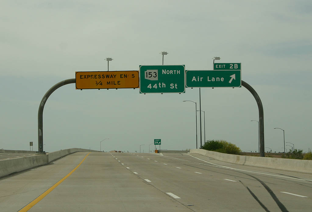
| Exit 2B departs here for Air Lane. This exit does not access the airport itself, but the industrial areas that border Sky Harbor Airport. 04/08/07 |
|
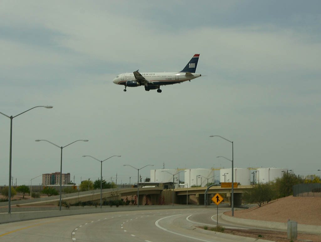
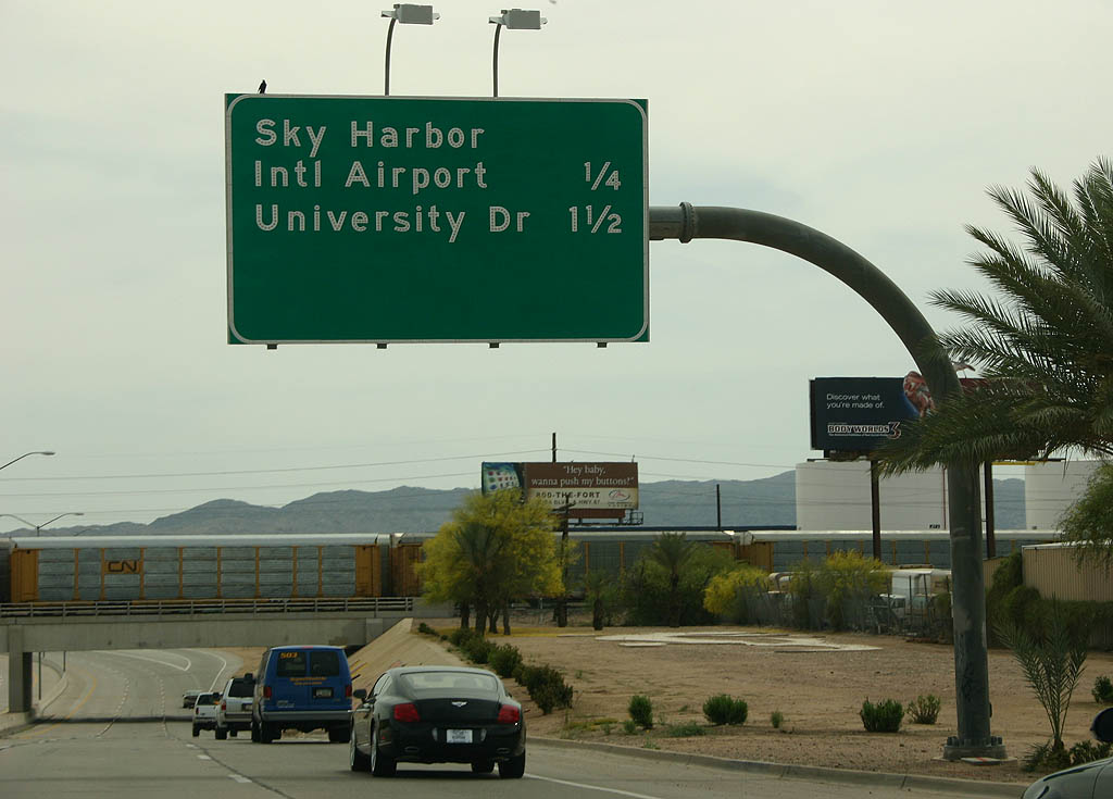
| As former SR 153 turns northbound, we see the airport fuel farm and an US Airways A319 on final approach to the north runway. Former SR 153 is mostly at grade or below grade to comply with clear zone requirements around Sky Harbor. 04/08/07 |
|
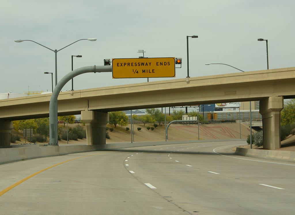
| Passing under the Air Lane bridge, we see another warning that the expressway is about to end. 04/08/07 |
|
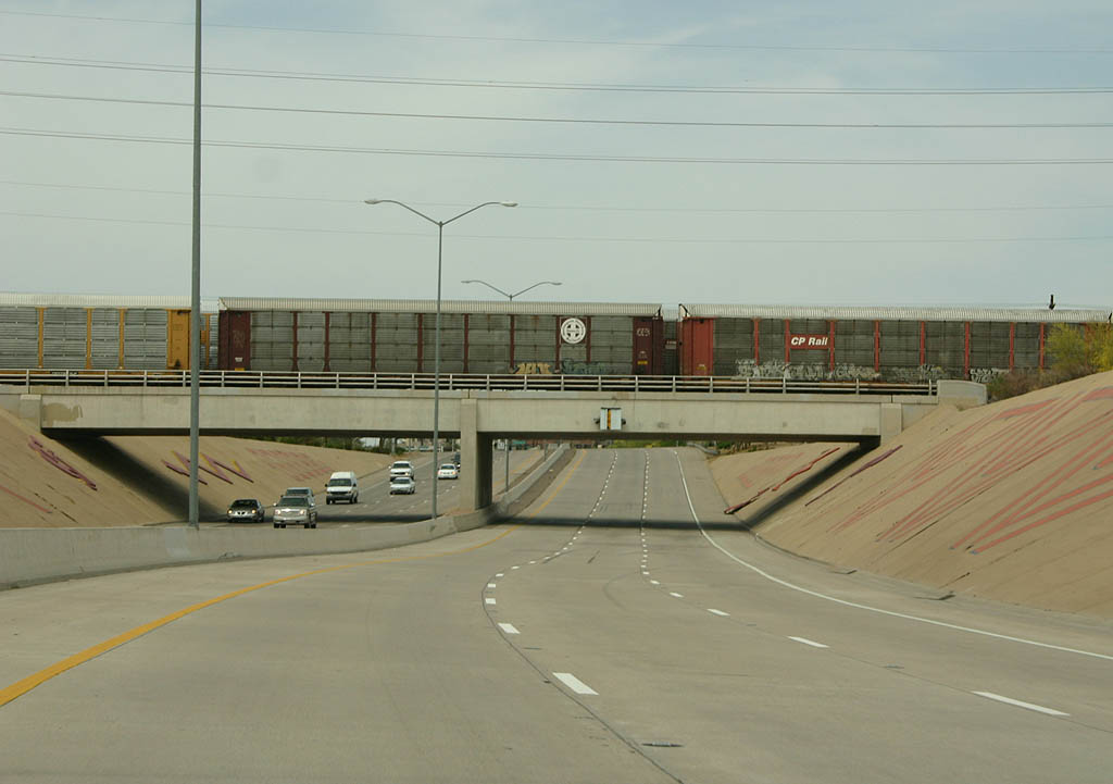
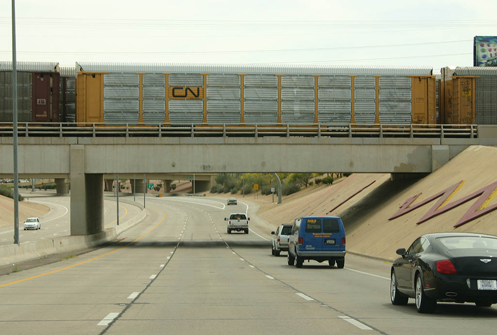
| Former SR 153 is now travelling along the old alignment of the Hohokam Expressway (from 1979 to 1991). This railroad bridge dates back to the construction of the original Hohokam Expressway in 1980, and carries the Union Pacific Railroad. 04/08/07 |
|
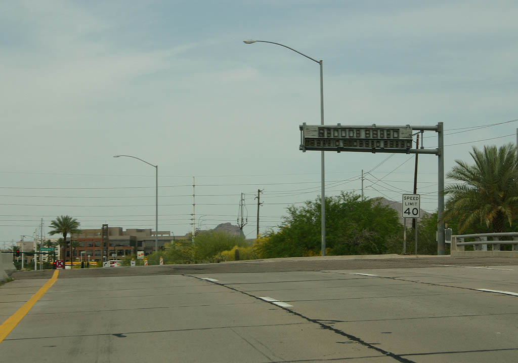
| This warning sign used to light up to warn traffic that a stoplight was ahead. It has not worked in many years, and possibly dates back to when this section of road was the Hohokam Expressway. Just beyond this sign, Former SR 153 becomes 44th Street and ends. 04/08/07 |
|
| Facing southbound on 44th Street, this overhead sign advises travellers to take Washington Street to reach Interstate 10 via SR 143, or continue on Former SR 153 to reach Sky Harbor Airport. This sign was placed due to the original alignment of SR 143 beginning ahead, at Washington Street and 44th Street. 04/08/07 |
|
| Now on Former SR 153, the first overhead is a distance sign to the only two exits - Sky Harbor Airport and University Drive. 04/08/07 |
|
| Former SR 153 passes under the Union Pacific railroad tracks just south of Washington Street. This bridge crosses the former alignment of SR 143, also signed as Business Loop 10. 04/08/07 |
|
| Exit 2 departs here for Sky Harbor Airport. 04/08/07 |
|
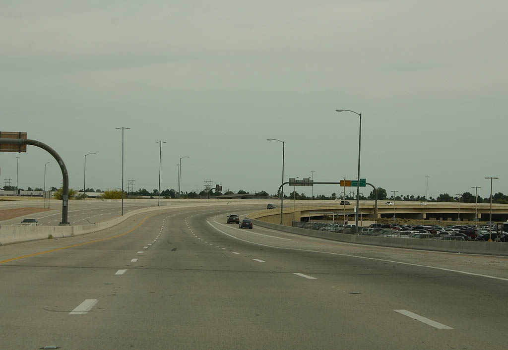
| This is a typical view of the almost always empty expressway south of exit 2. In the distance, SR 143 can be seen. 04/08/07 |
|
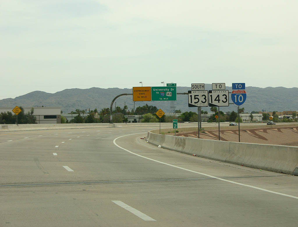
| Distance sign to University Drive. Use University Drive to reach SR 143 and Interstate 10. 04/08/07 |
|
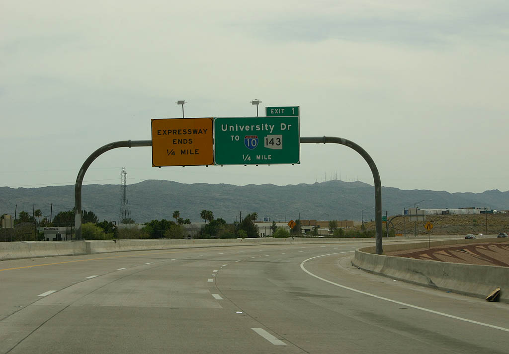
| This shield assembly is interesting, as it shows Former SR 153 to SR 143 to Interstate 10. This is designed for travelers taking the east exit from Sky Harbor to reach Interstate 10. 04/08/07 |
|
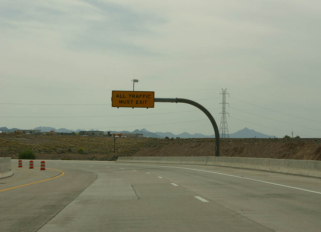
| All traffic must exit the stub expressway at University Drive. 04/08/07 |
|
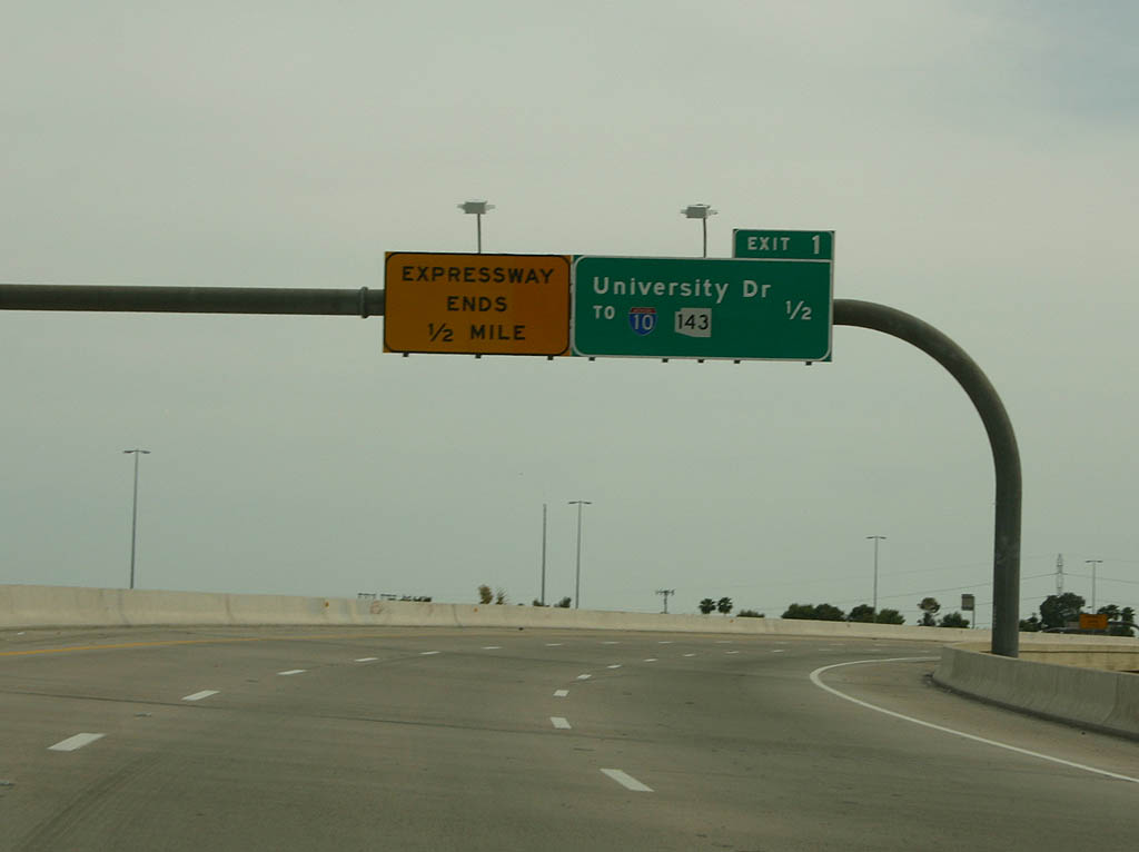
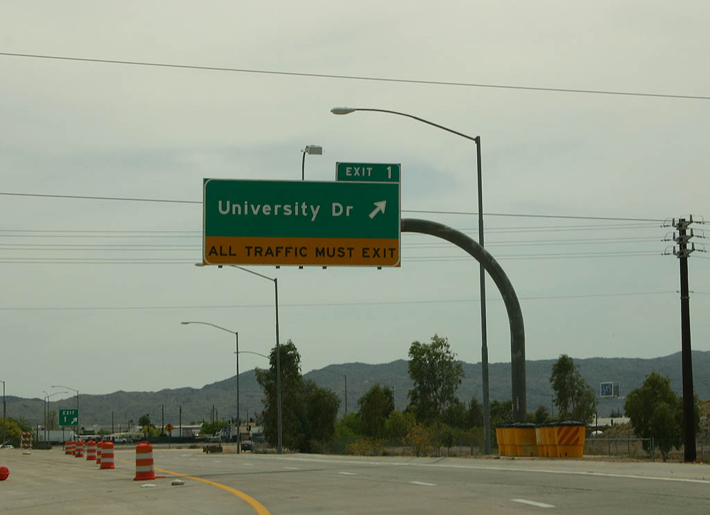
| Exit 1 departs here for University Drive. While the freeway was planned to continue south to Interstate 10 at 40th Street, these plans were abandoned. 04/08/07 |
Photo Credits:04/08/07 by Kevin Trinkle
Page Updated 03-16-2008.