|
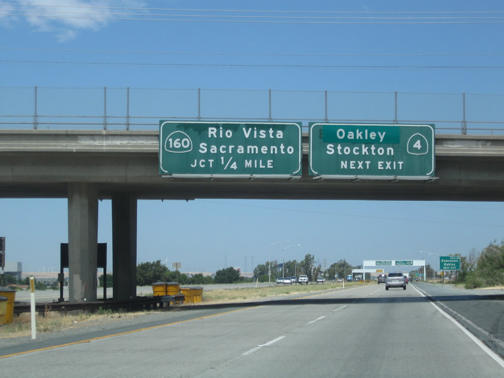
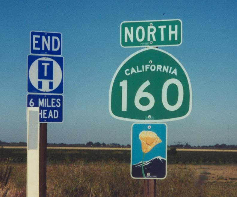
| SR 160 begins at a directional T interchange with SR 4 (California Delta Highway) and heads north along a freeway to Oakley and the Antioch Bridge. Construction completed in 2016 added the missing ramps between the two state routes, coinciding with a realignment of SR 4 south onto a bypass freeway of Brentwood. 07/18/09 |
|
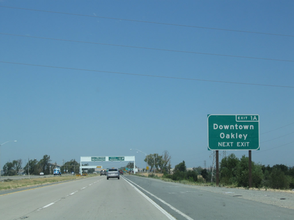
| Oakley Road spans SR 160 beyond this guide sign preceding the folded diamond interchange (Exit 1A) with 18th Street west and Main Street east at Bridgehead. Main Street connects with Cypress Road to Bethel Island on the east side of Oakley. 07/18/09 |
|
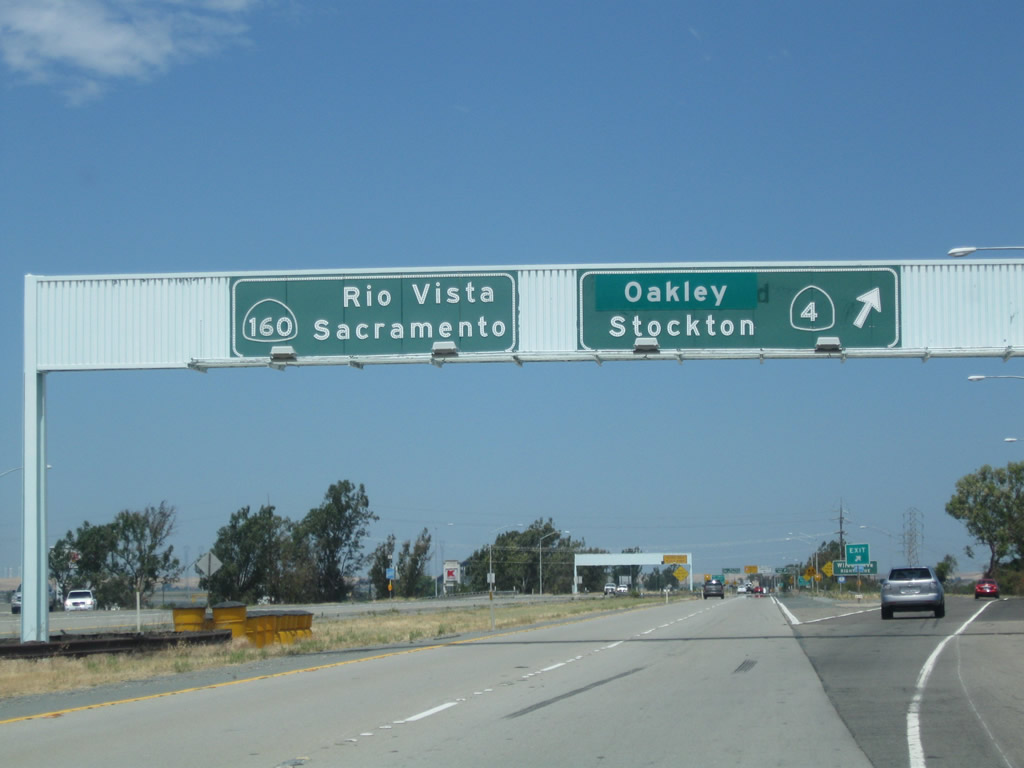
| SR 4 previously overlapped with SR 160 north to Main Street and a surface route leading southeast from Oakley to Brentwood. The route shifted onto the freeway/expressway south from Antioch in 2016. 07/18/09 |
|
| Downtown Oakley is a 2.5 mile drive along Main Street (former SR 4) east from Exit 1A. The city of Oakley "A Place for Families in the Heart of the Delta" was incorporated on July 1, 1999. Sitting an elevation of 20 feet, the city boasts over 40,000. 07/18/09 |
|
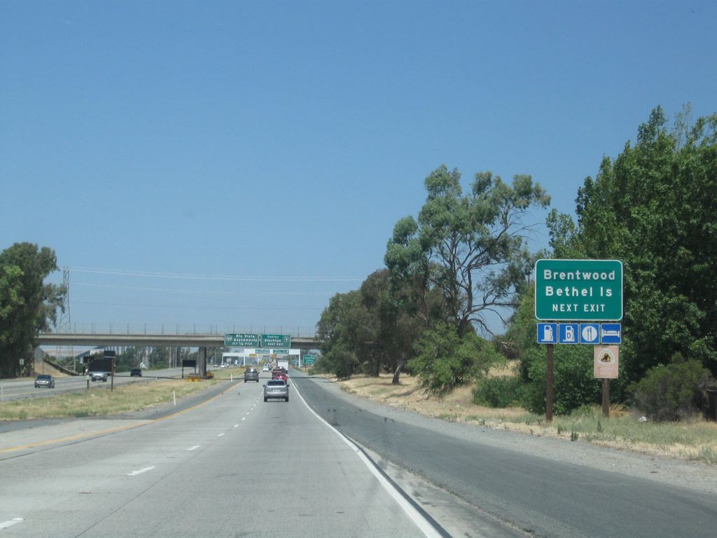
| Exit 1A departs SR 160 north for Main Street east and 18th Street west into the city of Antioch. This sign bridge was removed in 2015 during road work to add an auxiliary lane north from SR 4. 07/18/09 |
|
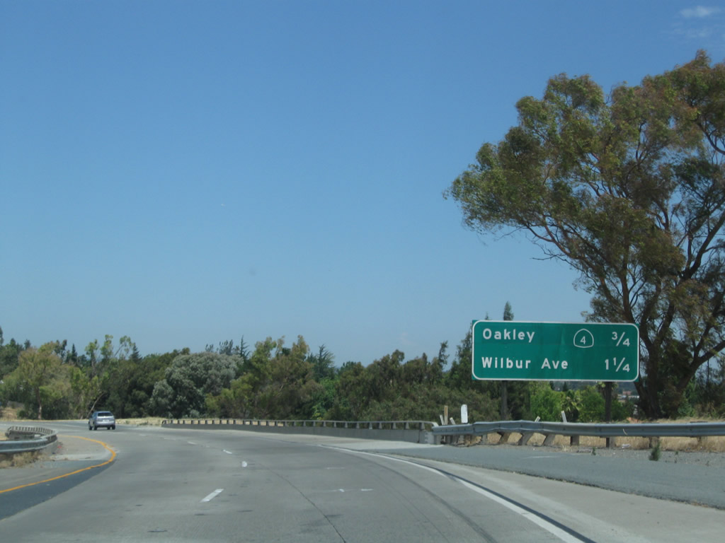
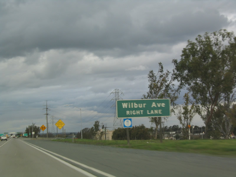
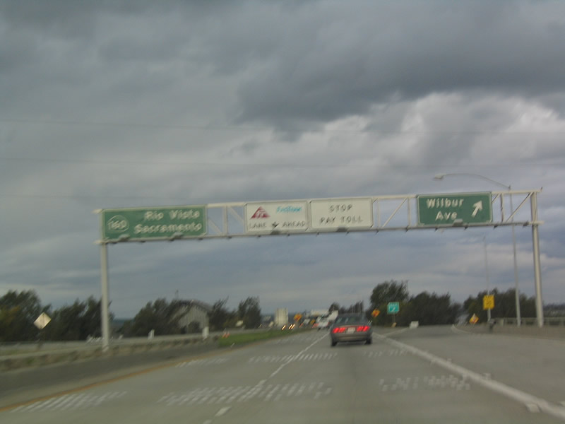
| A diamond interchange (Exit 1B) with Wilbur Avenue lies just north of the Main Street entrance ramp along SR 160. 12/31/04 |
|
| The freeway portion of SR 160 concludes at the exchange with Wilbur Avenue. 12/31/04 |
|
| Exit 1B leaves SR 160 north for Wilbur Avenue to marines and industrial areas along the south banks of the San Joaquin River. 12/31/04 |
|
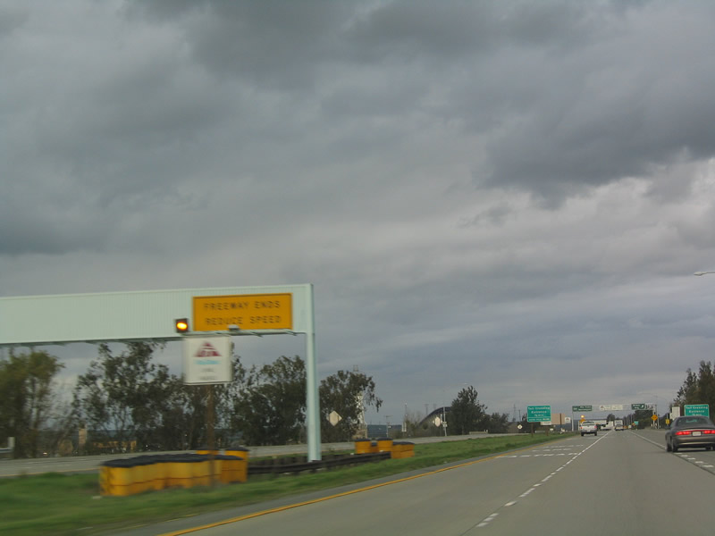
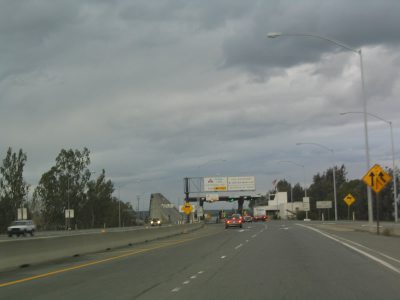
| Tolls are collected from motorists crossing the Antioch Bridge northbound. A three lane plaza lies just beyond the on-ramp from Wilbur Avenue. 12/31/04 |
|
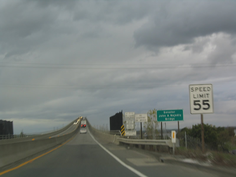
| SR 160 reduces to two lanes and ascends onto the Antioch Bridge. Opened in 1978, the steel plate girder bridge is officially designated the Senator John A. Nejedly Bridge. 12/31/04 |
|
| With a length of 9,504 feet, the Antioch Bridge replaced an older lift bridge that had been in service at this location since January 1926, and was previously purchased by the state in 1940. The San Joaquin doubles as the Sacramento County line across SR 160. 12/31/04 |
|
| According to usage statistics posted on the official Antioch Bridge site for fiscal year 2010-2011, over two million vehicles paid the toll to cross the span. Leading northward, SR 160 touches down on Sherman Island, which is wedged between the San Joaquin River to the south and the Sacramento River to the northwest. 12/31/04 |
|
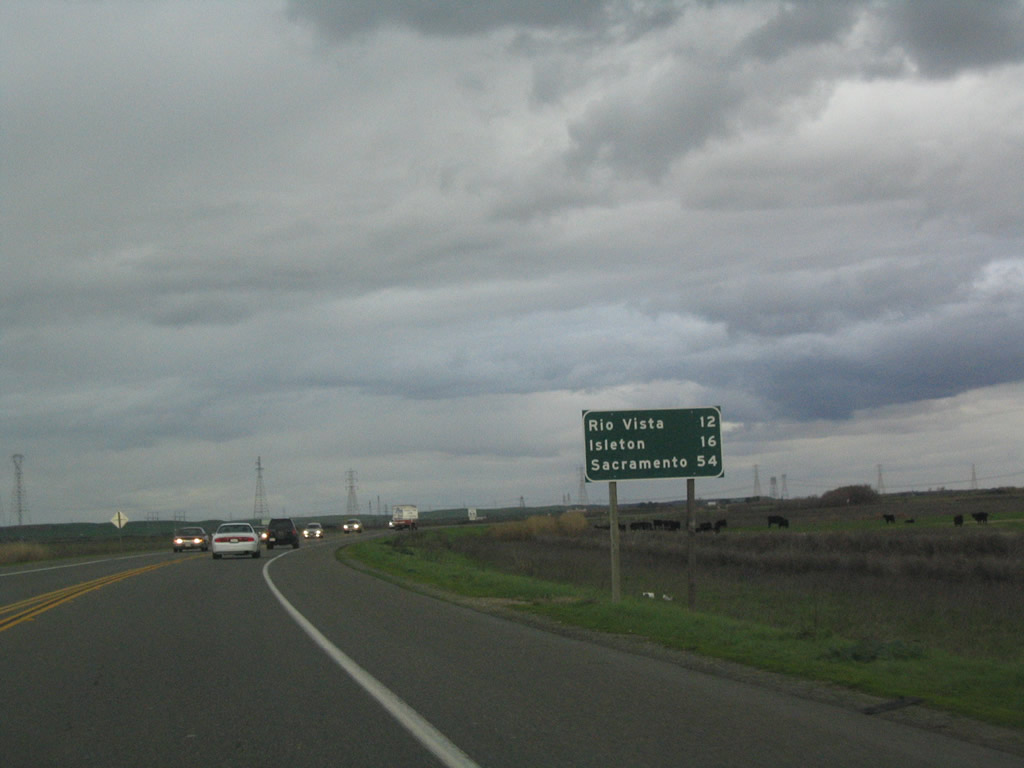
| SR 160 continues 12 miles north from the Antioch Bridge to Rio Vista and 16 miles to Isleton. 12/31/04 |
|
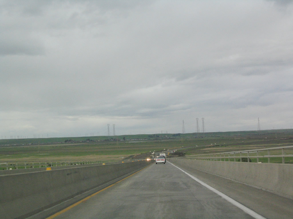
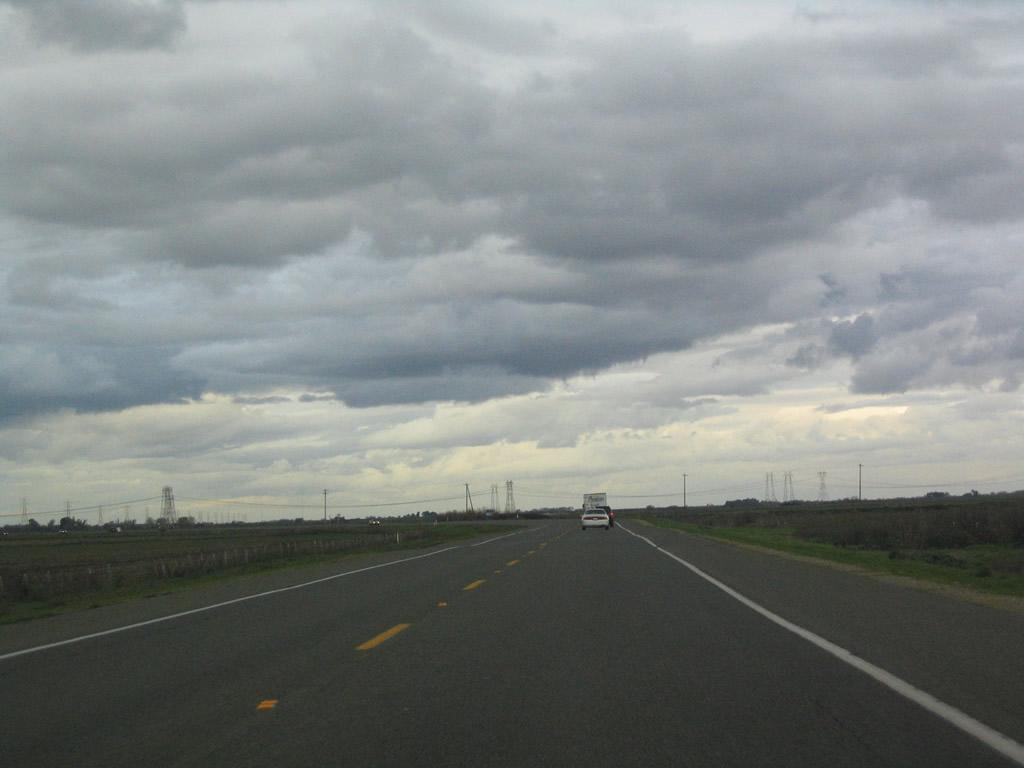
| SR 160 maintains just two lanes but sees significant traffic as part of the major trans-delta route across Sherman Island. 12/31/04 |
|
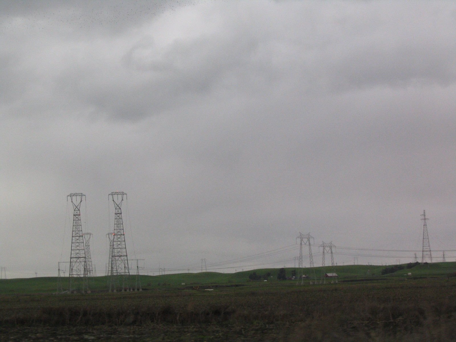
| Three 500kV power lines span Sherman Island and SR 160. The electricity corridors connect to both Path 15 and Path 66, two major north-south 500kV transmission systems. 12/31/04 |
|
| SR 160 parallels Horseshoe Bend northeast from Emmaton to the north end of Sherman Island. 12/31/04 |
|
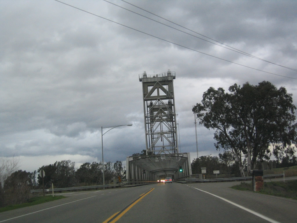
| The Three Mile Slough Bridge carries SR 160 north from Sherman Island onto Brannan Island. A 749 foot long vertical lift bridge, the movable span was built in 1949.1 12/31/04 |
|
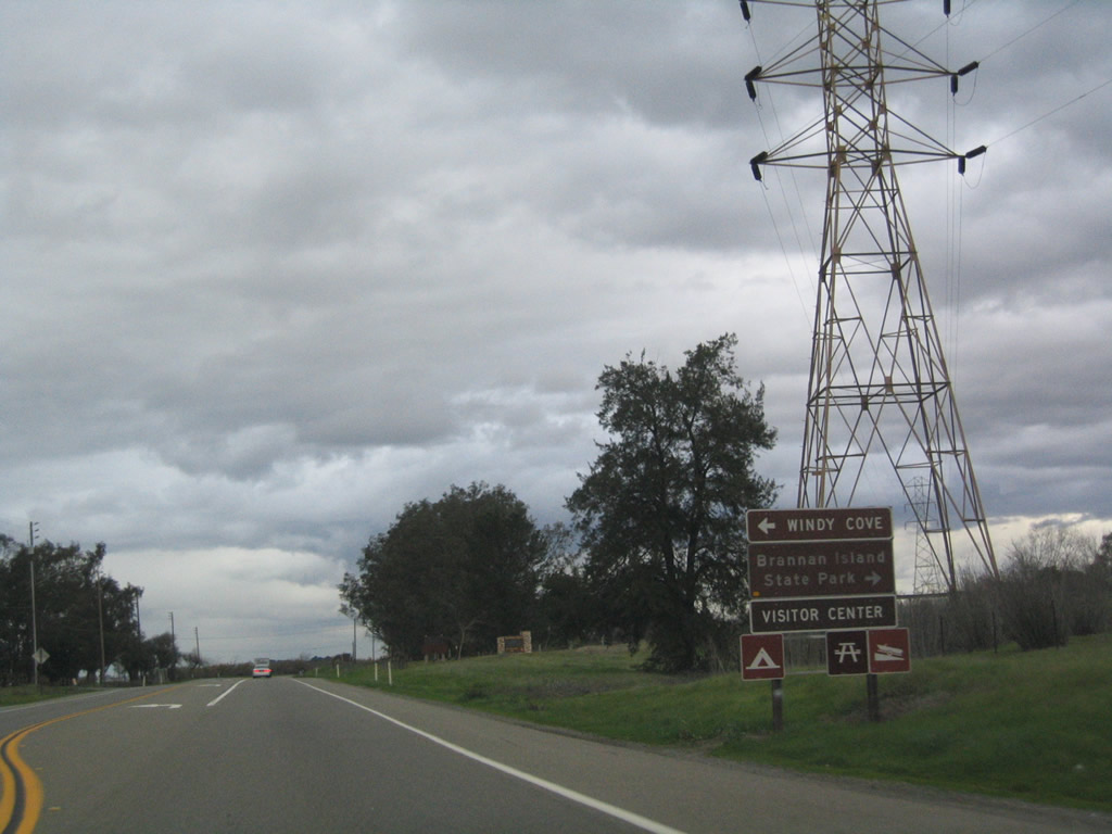
| Northbound SR 160 approaches the turnoff to Brannan Island State Recreation Area. 12/31/04 |
|
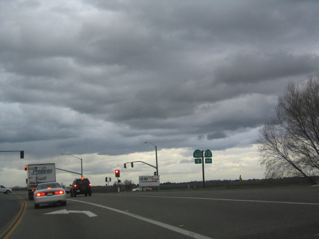
| SR 160 lines the east banks of the Sacramento River to SR 12. SR 12 spans the Rio Vista Bridge west into the city of Rio Vista en route to Fairfield, Napa, Sonoma and Santa Rosa. East from Brannan Island, the state route continues to I-5 and Lodi. 12/31/04 |
|
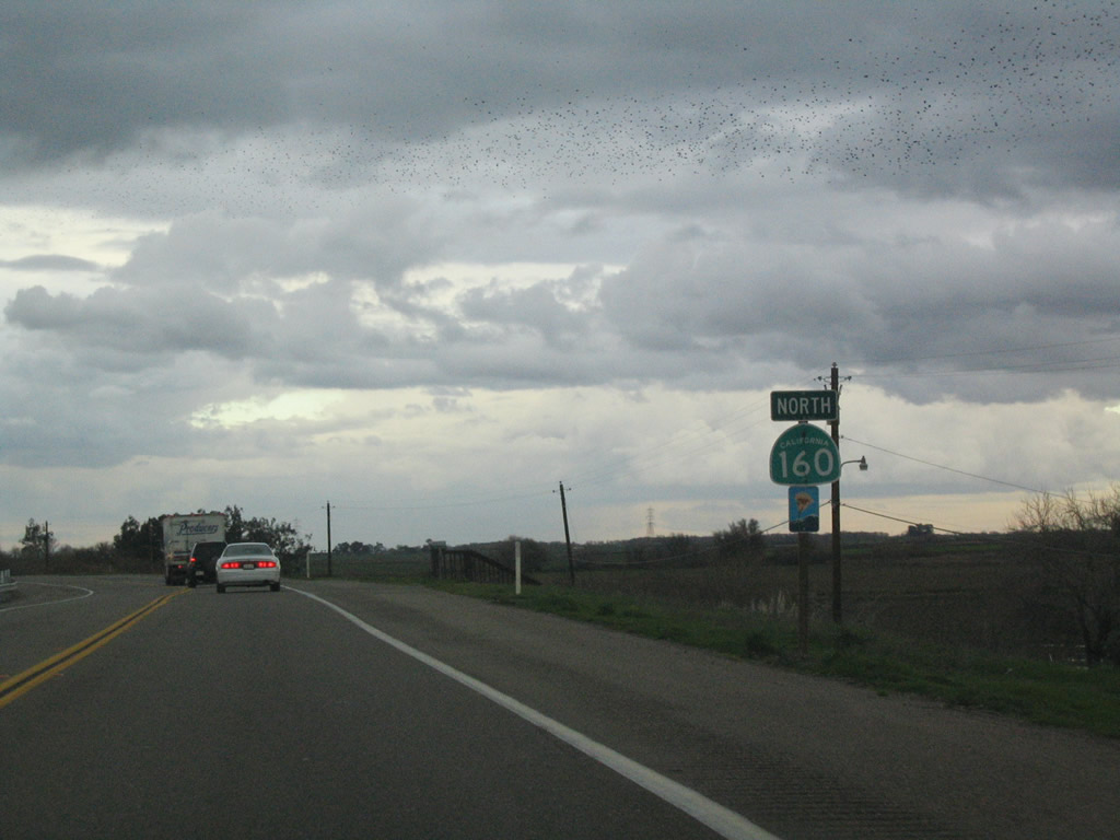
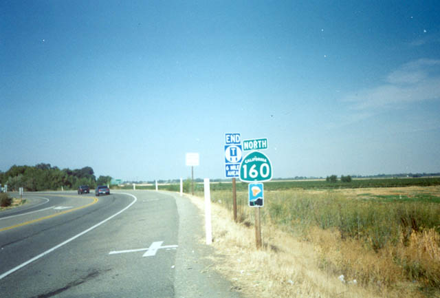
| Confirming marker for SR 160 posted after SR 12. The state route curves northeast toward Isleton. 2002, 03/29/01 |
|
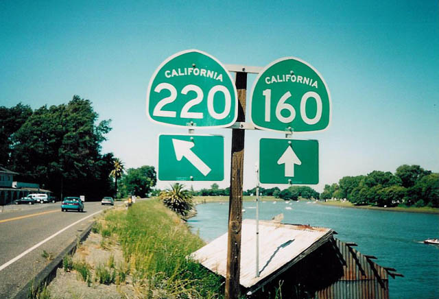
| Northbound SR 160 meets the east end of SR 220 at Ryde on Grand Island. SR 220 travels west to Howard Landing and a ferry across Steamboat Slough to SR 84 on Ryer Island. 2002 |
Page Updated 07-20-2018.