
State Route 299
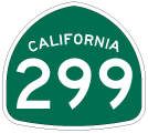
California 299 is a major east-west corridor from the Arcata-Eureka area in Humboldt County on the Pacific Coast to the Nevada state line east of Alturas. The state route connects Weaverville, Redding, Blue Lake and Willow Creek. California 299 also serves Trinity County, a remote area between the coast and the well-traveled Interstate 5 corridor. It also links with California 3, a scenic route north through Trinity County to Yreka.
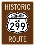
From 1934 through 1964, California 299 was signed as U.S. 299 from Arcata to Redding and U.S. 395 at Alturas. The section of California 299 east of U.S. 395 was never part of U.S. 299. When most U.S. highways in California were eliminated, U.S. 299 was removed because it was less than 300 miles and wholly located within the state. Even today, when California 299 reaches the Nevada border, it reverts to an unpaved road (Nevada 8A).
 East
East
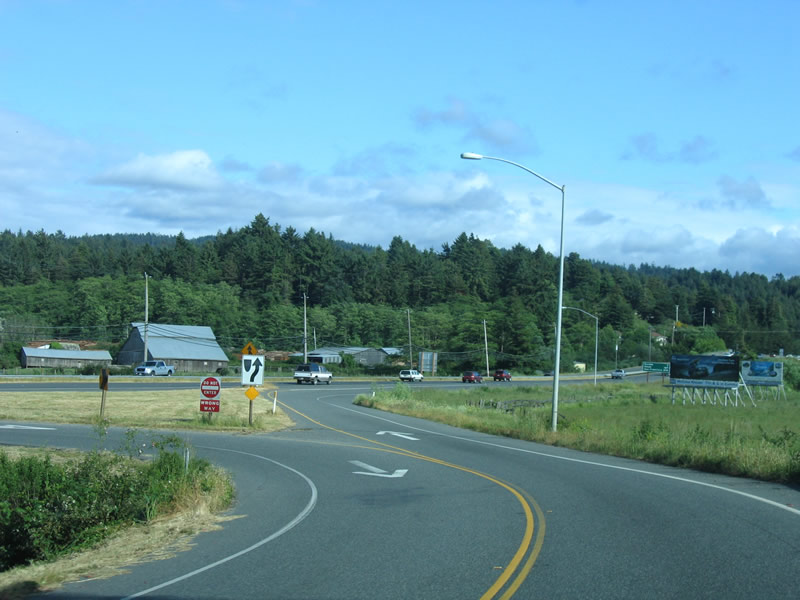
The view of the nascent SR 299 freeway from the ramp connecting from U.S. 101 south at their trumpet interchange.
05/28/06
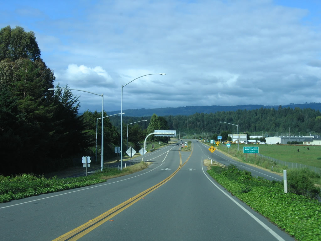
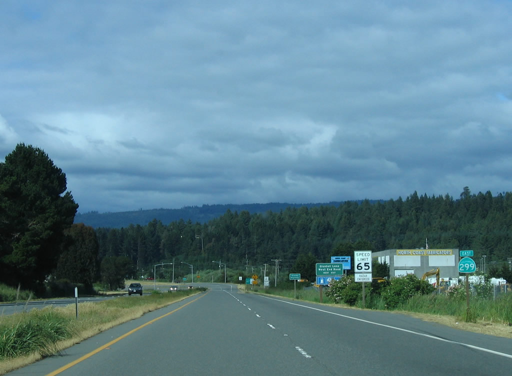
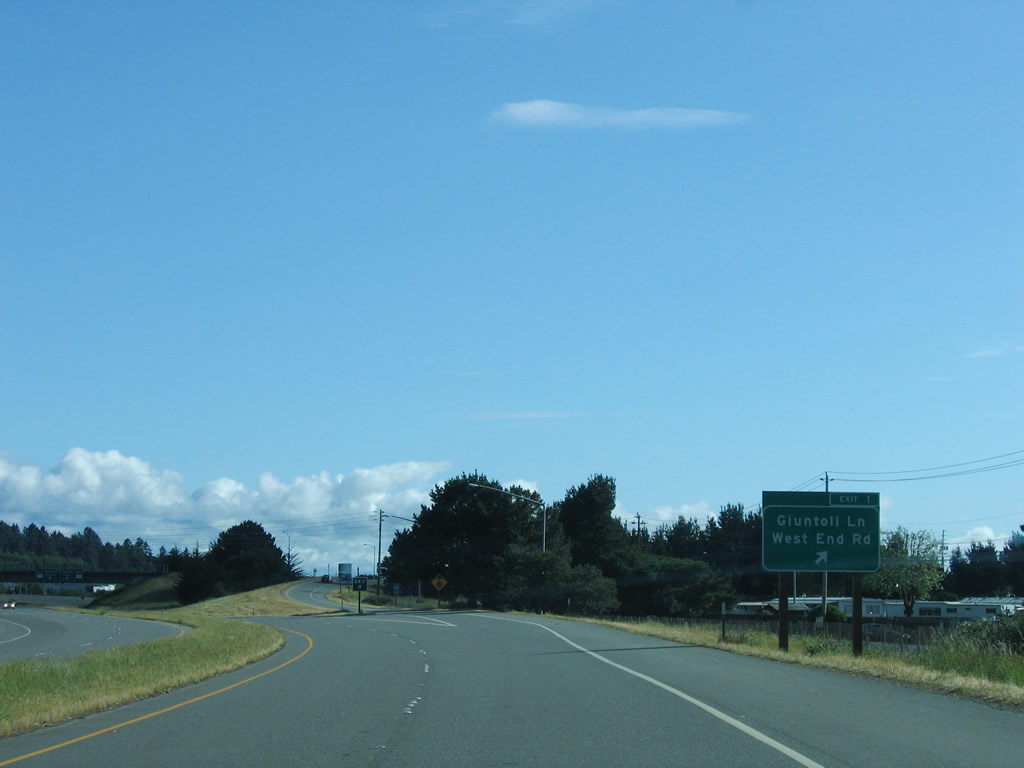
The first exit on eastbound SR 299 (Trinity Highway) departs in a half mile for Giuntoli Lane and West End Road. The freeway from U.S. 101 to Exit 5 was largely constructed in 1965. It incorporates some older bridges and structures.
05/28/06
This is the first SR 299 east reassurance shield.
05/28/06
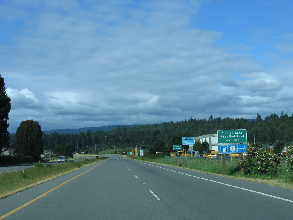
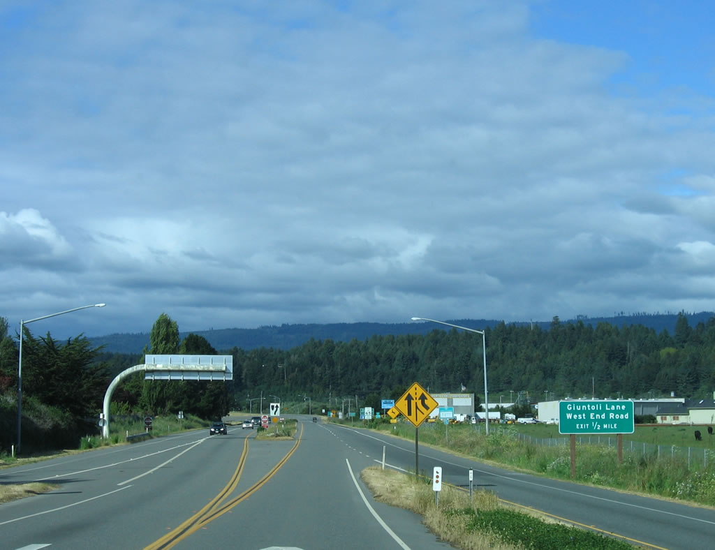
All motorist services can be found at Exit 1, Giuntoli Lane and West End Road. Giuntoli Lane also meets U.S. 101 at an interchange just west of here.
05/28/06
Exit 1 leaves SR 299 (Trinity Highway) east for Giuntoli Lane and West End Road.
05/28/06
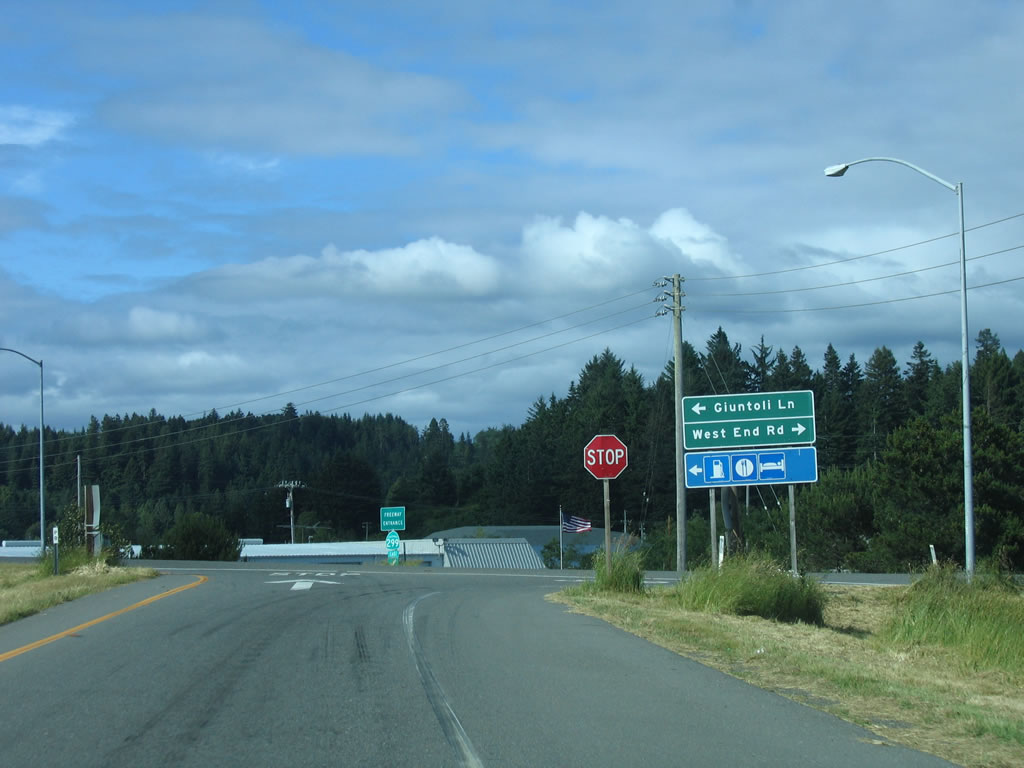
Giuntoli Lane heads west from SR 299 back to U.S. 101. Giuntoli Lane east ends nearby at West End Road.
05/28/06
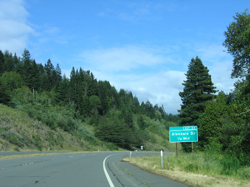
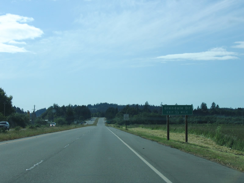
Continuing from SR 200 / North Bank Road (Exit 2), the succeeding exit along SR 299 east is with Glendale Drive.
05/28/06
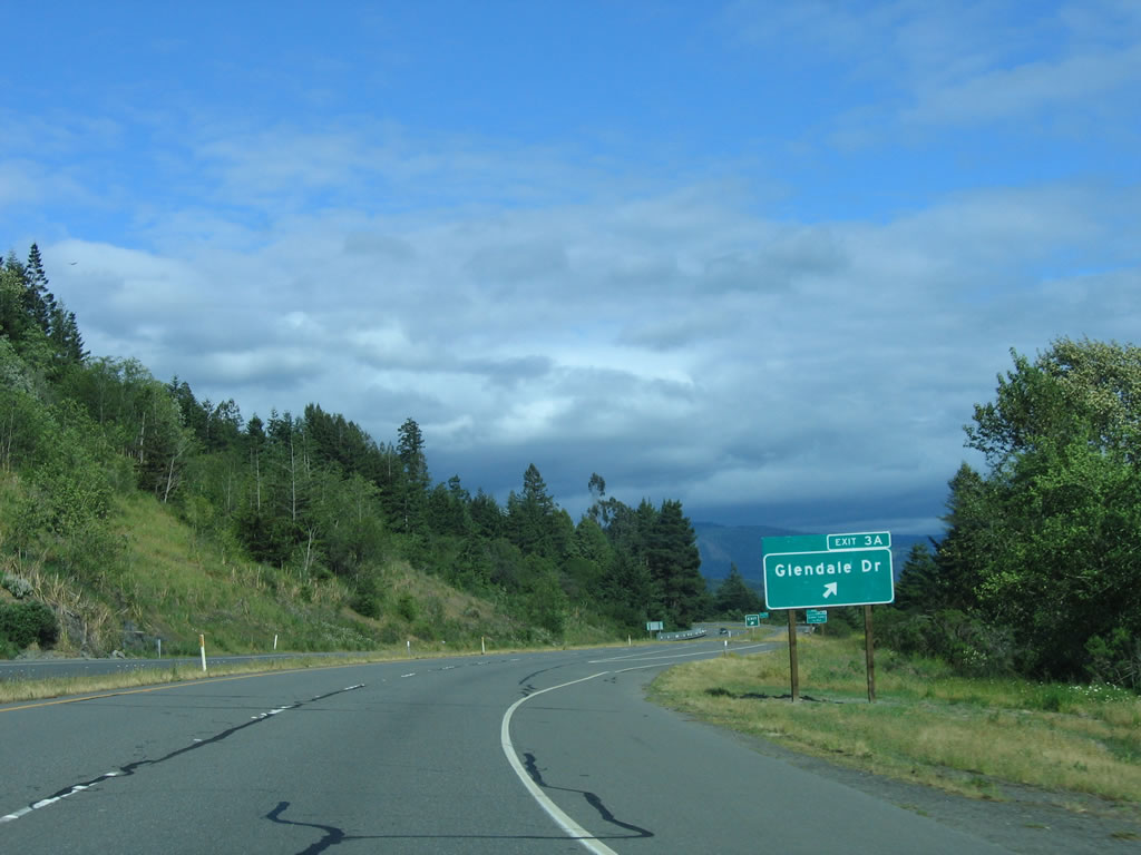
Eastbound SR 299 (Trinity Highway) reaches the off-ramp (Exit 3A) for Glendale Drive.
05/28/06
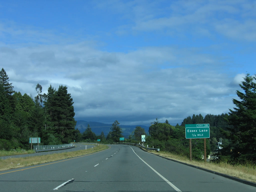
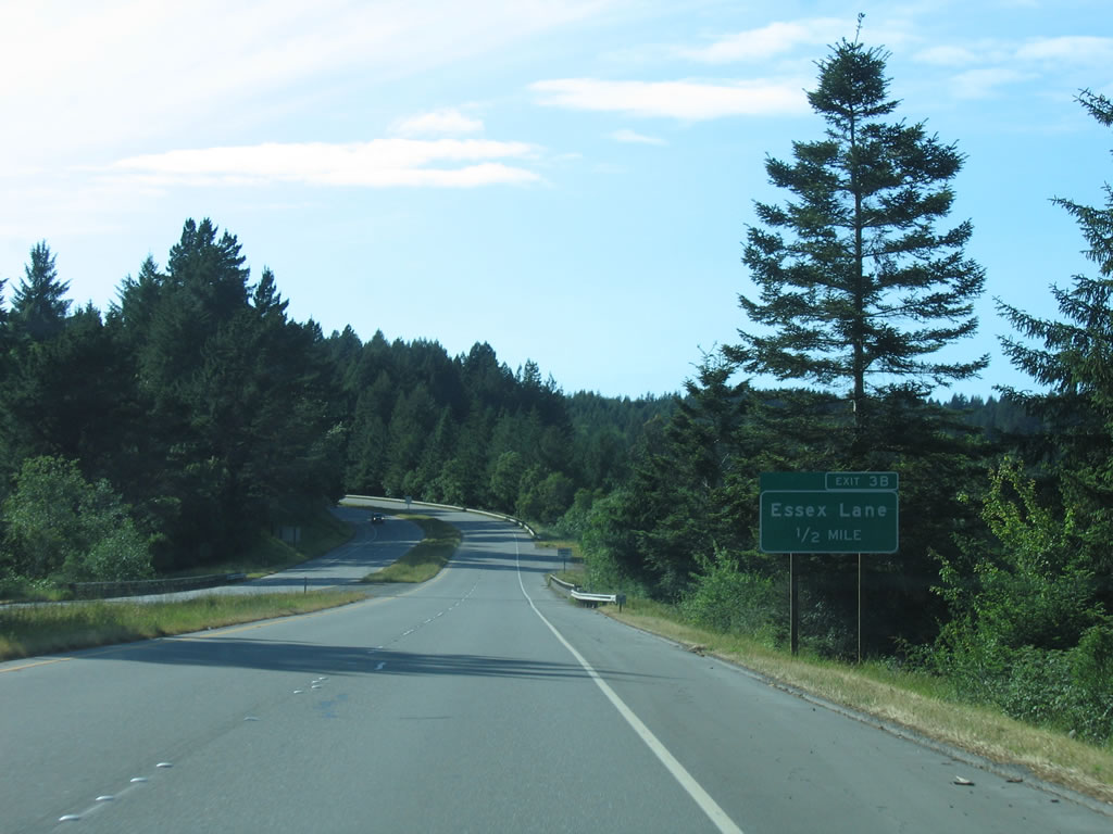
SR 299 (Trinity Highway) advances one quarter mile east to Exit 3B with Essex Lane.
05/28/06
Fieldbrook Road stems north from Essex Lane near Exit 3B to the unincorporated community of Fieldbrook.
05/28/06
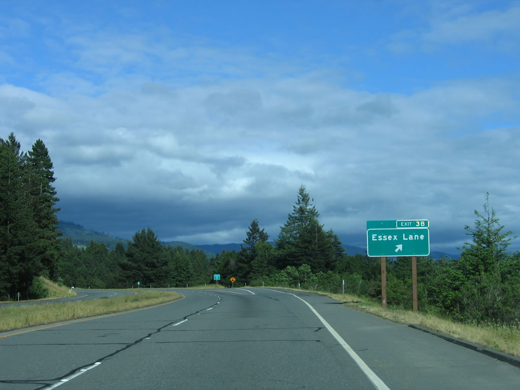
Entering the diamond interchange (Exit 3B) with Essex Lane on SR 299 east.
05/28/06

Reassurance shield for SR 299 posted after Exit 3B on Trinity Highway east.
05/28/06
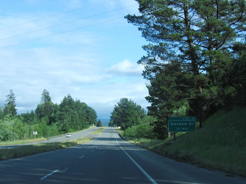
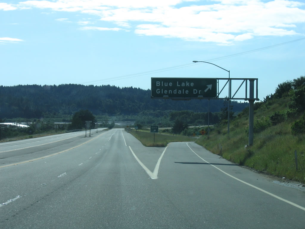
Glendale Drive ties into SR 299 (Trinity Highway) again at Exit 4. The parallel road is the historic alignment of U.S. 299 east from Exit 3A to the city of Blue Lake.
05/28/06
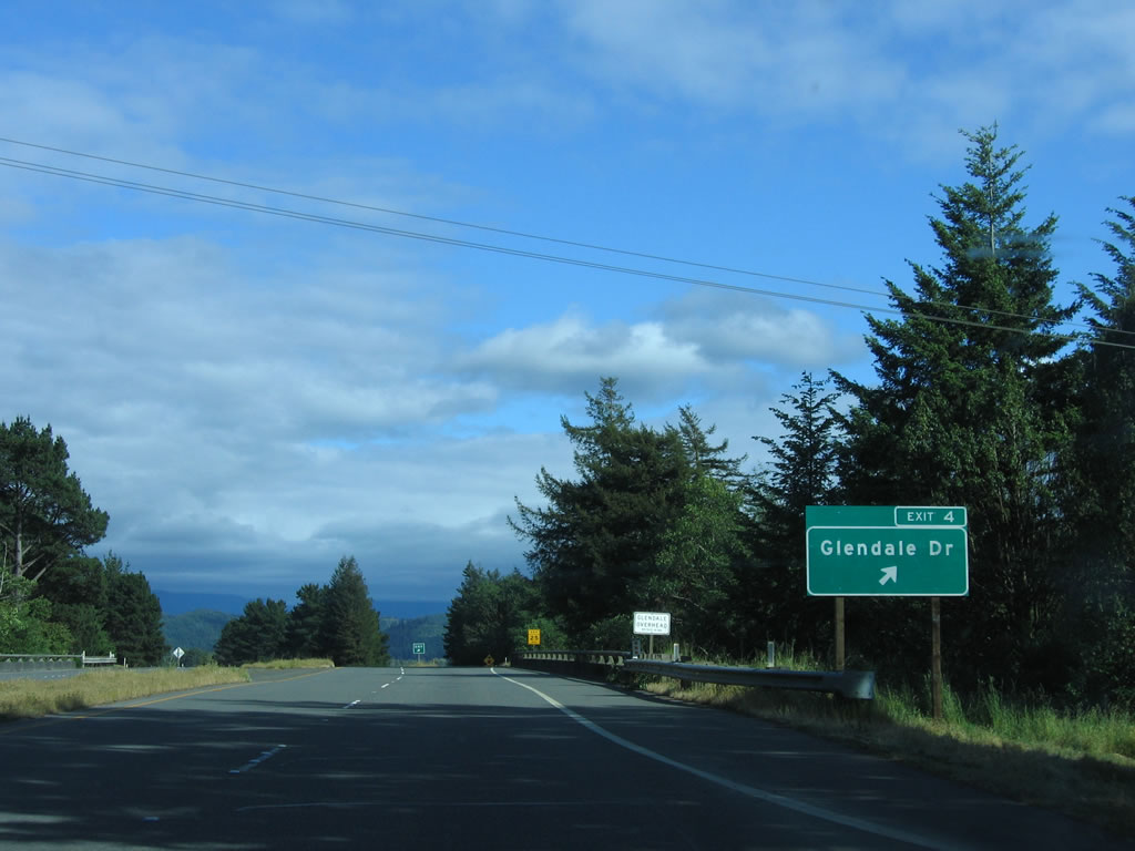
A short access road links the diamond interchange (Exit 4) to Glendale Drive (old U.S. 299) at the unincorporated community of Glendale.
05/28/06
SR 299 angles southeast, parallel to the Mud River, to Blue Lake.
05/28/06
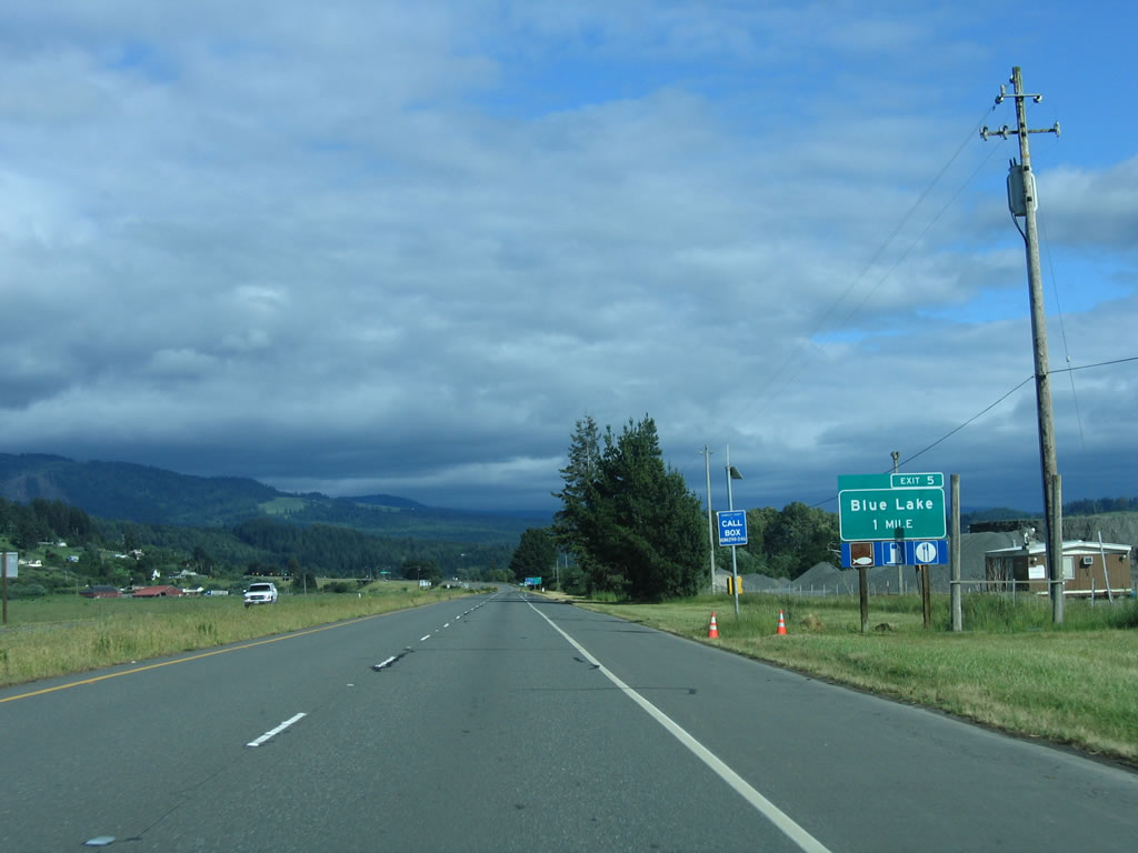
Glendale Drive and the SR 299 freeway converge once more at forthcoming Exit 5 with Blue Lake Boulevard in one mile.
05/28/06
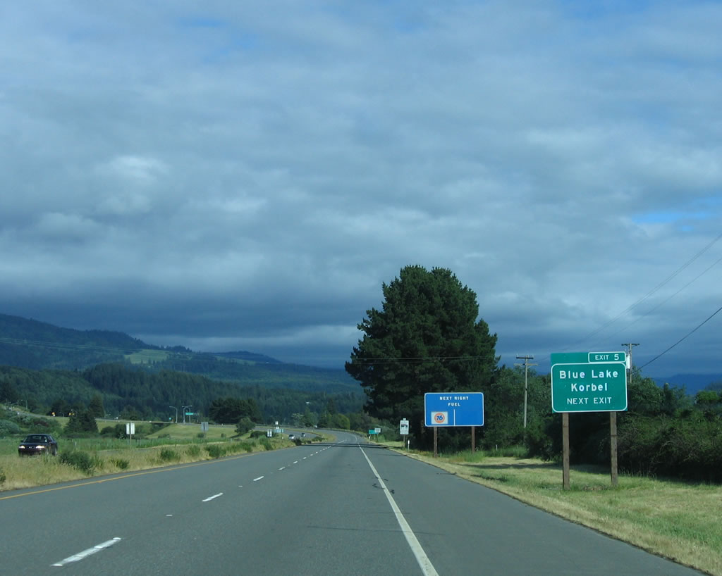
Blue Lake Boulevard (old U.S. 299) bypasses the Blue Lake city center along the north side of town. Maple Creek Road branches south from the route to the community of Korbel.
05/28/06
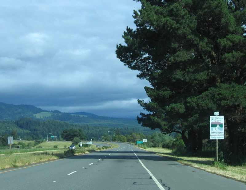
SR 299 follows the Trinity Highway Scenic Byway into the Trinity National Forest.
05/28/06
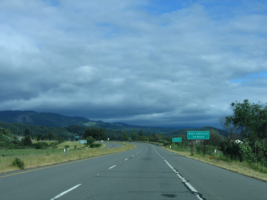
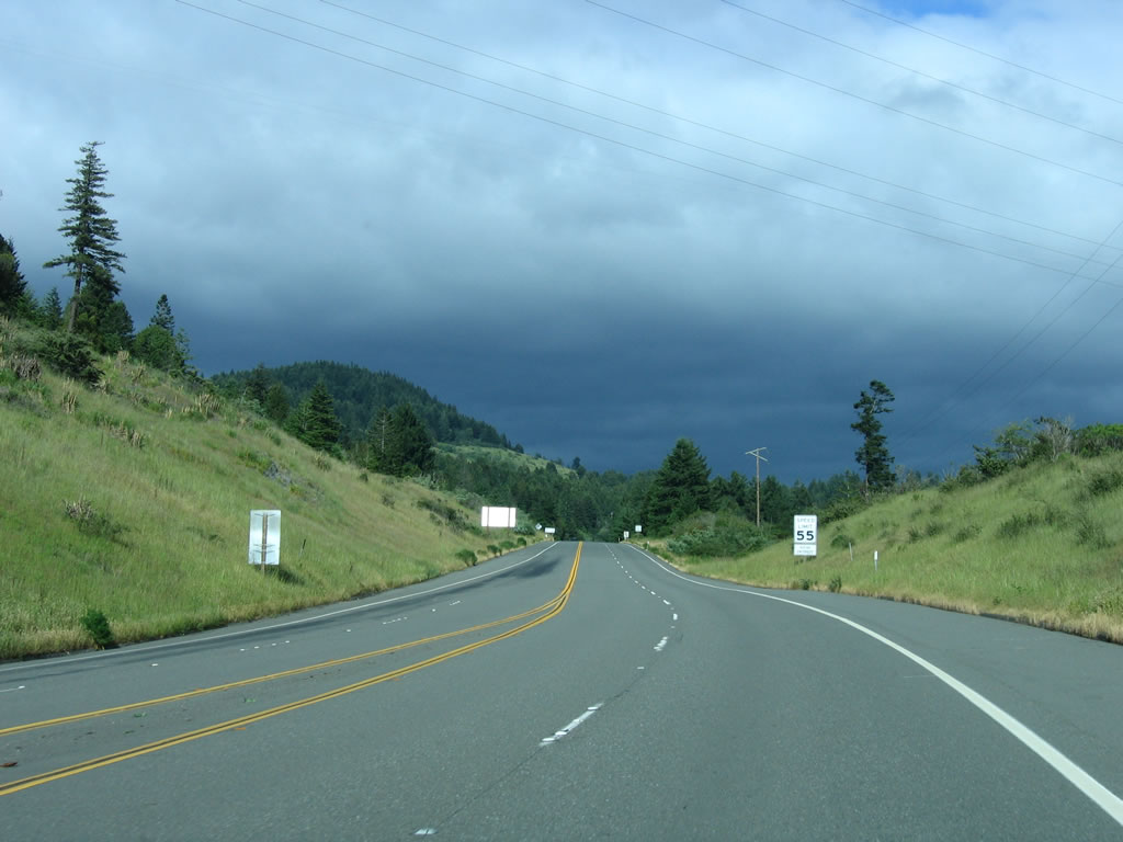
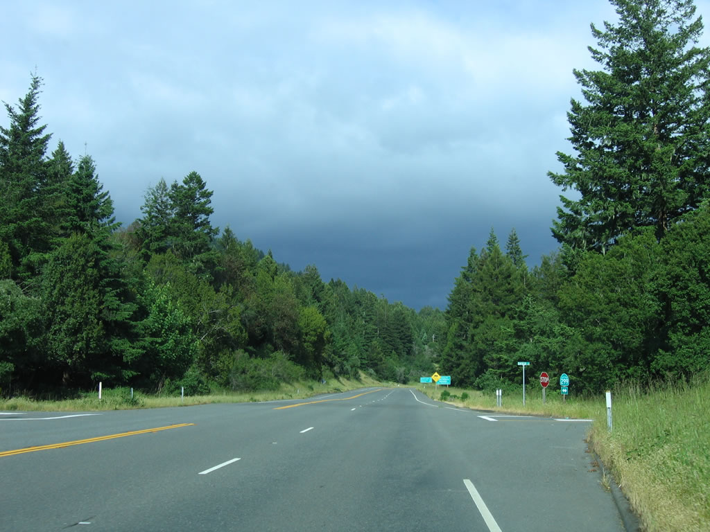
Beyond Blue Lake, SR 299 (Trinity Highway) traverses a remote stretch with no services for the next 34 miles.
05/28/06
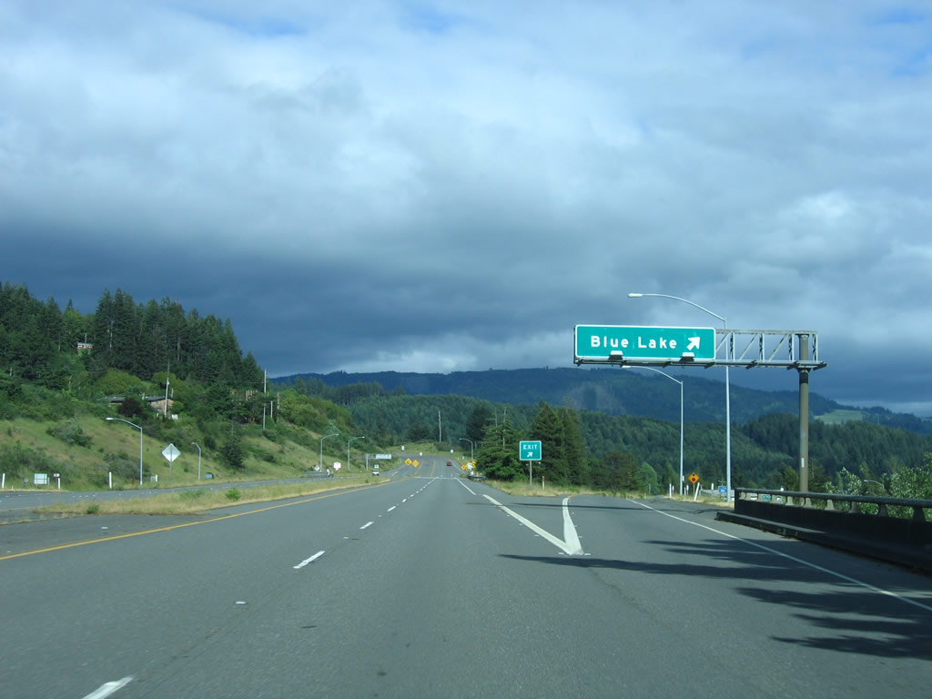
SR 299 (Trinity Highway) eastbound reaches the diamond interchange (Exit 5) with Glendale Drive west and Blue Lake Boulevard east.
05/28/06
The SR 299 freeway ends ahead of the at-grade intersection with Davis Street south into Blue Lake.
05/28/06
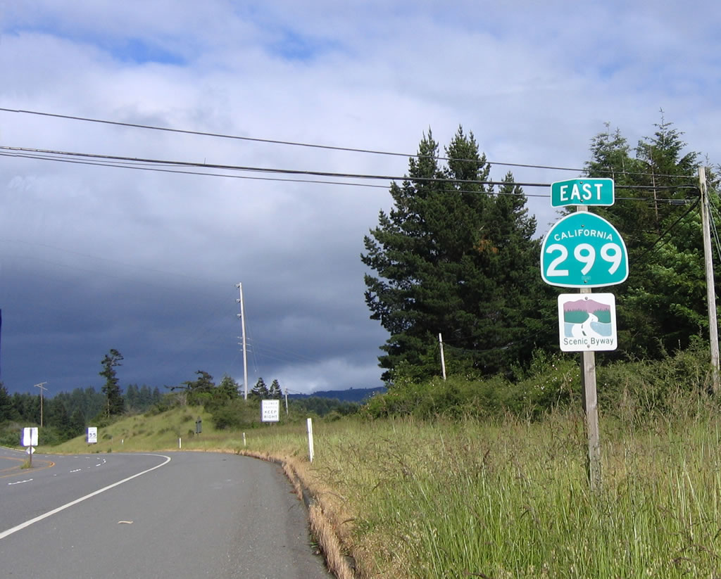
Confirming marker for SR 299 and Trinity Highway Scenic Byway trailblazer posted after Exit 5.
05/28/06
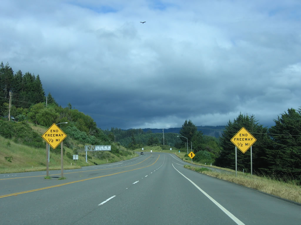
As the SR 299 freeway ends, the eastbound direction retains two lanes for climbing as the highway begins to gain elevation.
05/28/06
Elgar Road ties into SR 299 (Trinity Highway) at Davis Street from as a residential street to the north.
05/28/06
West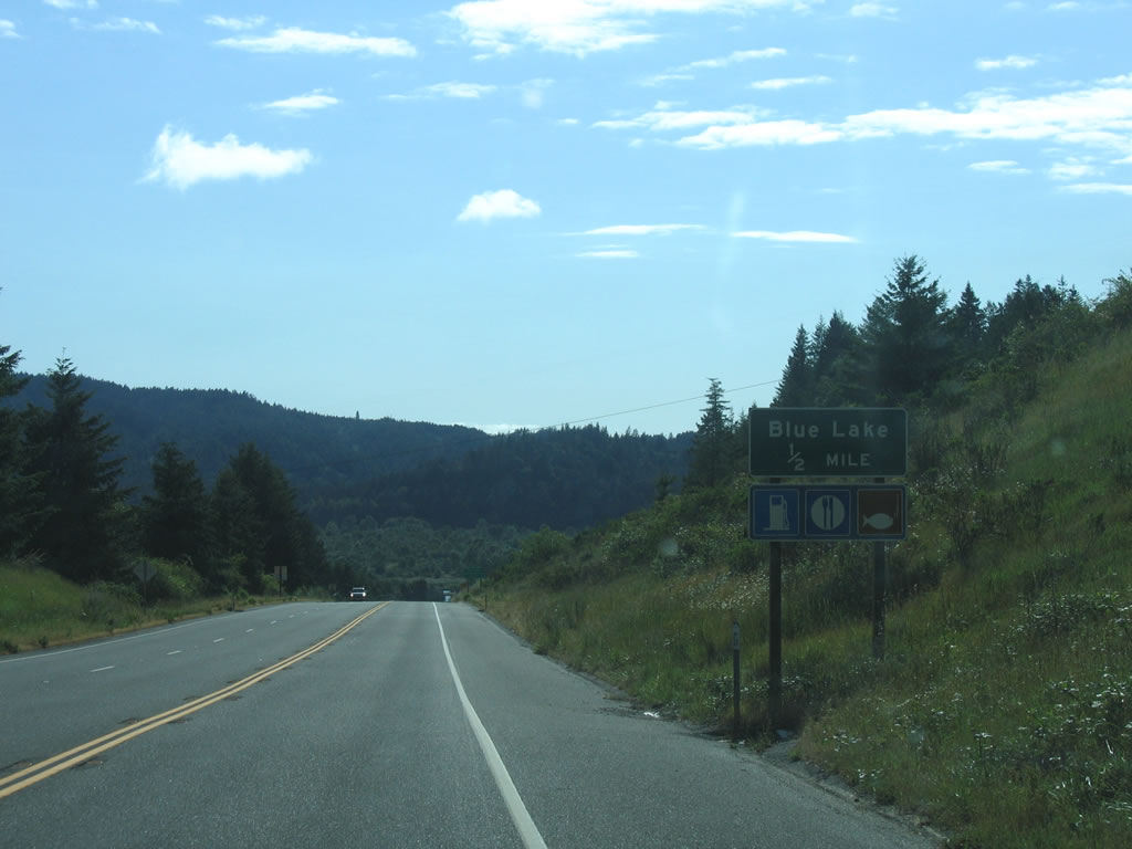
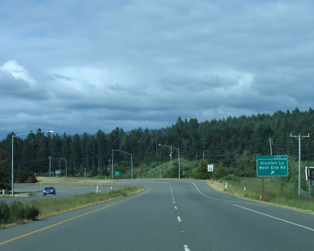
SR 299 (Trinity Highway) upgrades to a four lane freeway on the north side of Blue Lake. The first exit connects Trinity Highway with Blue Lake Boulevard and Glendale Drive, collectively Historic U.S. 299.
05/28/06
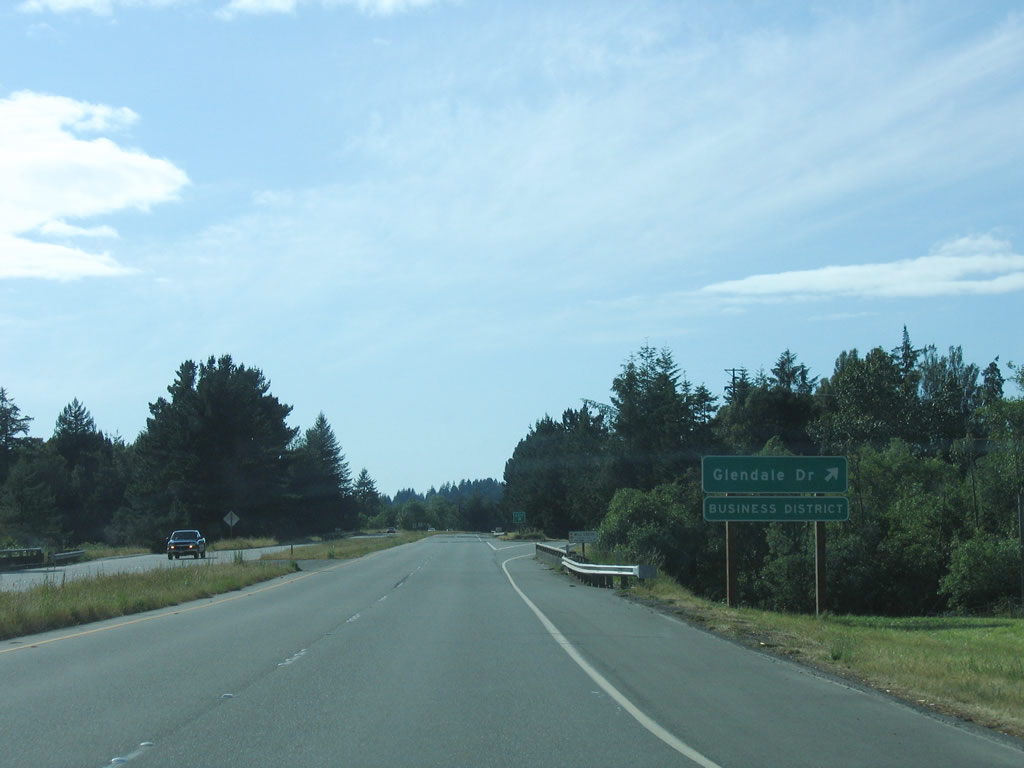
Blue Lake Boulevard wraps around the north side of Blue Lake, tying into SR 299 at a diamond interchange (Exit 5). Glendale Drive continues old U.S. 299 northwest toward Glendale.
05/28/06
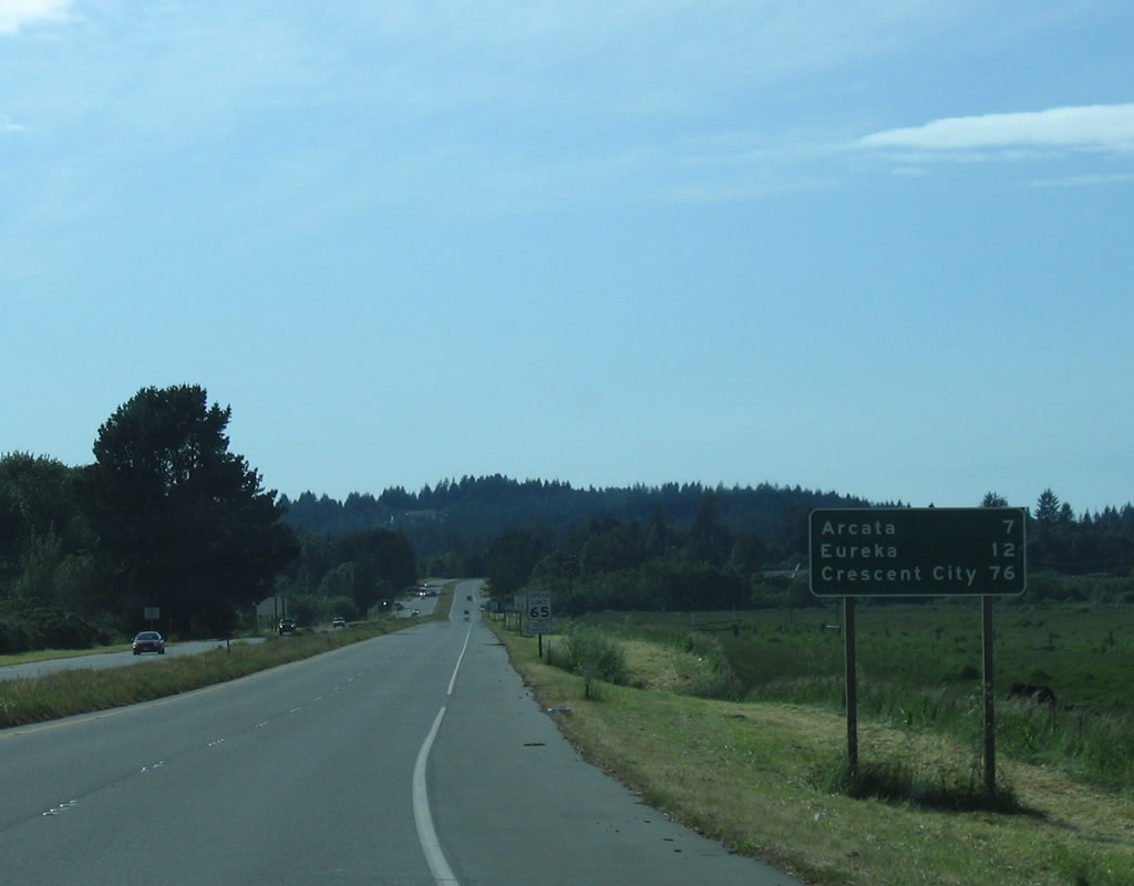
SR 299 west ends in the city of Arcata. The city center lies seven miles ahead via U.S. 101 south. U.S. 101 otherwise heads south to Eureka (12 miles) and north to Crescent City (76 miles).
05/28/06
Leaving the city of Blue Lake, SR 299 (Trinity Highway) turns northwest alongside the Mad River to the unincorporated community of Glendale.
05/28/06
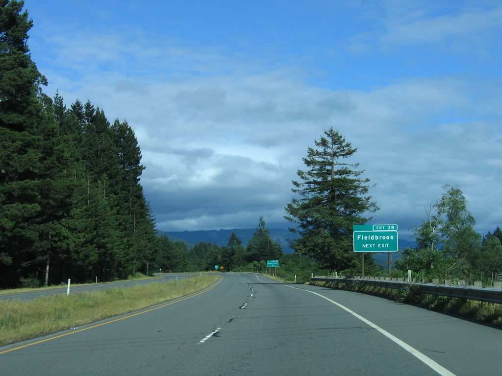
A diamond interchange (Exit 4) joins SR 299 with an access road leading north to adjacent Glendale Drive. Fieldbrook Road heads north to Fieldbrook from nearby.
05/28/06
A diamond interchange (Exit 3B) at Essex Gulch follows on SR 299 west. Essex Lane links the freeway with parallel Glendale Drive to the south and Timmons Road to the north.
05/28/06
SR 299 (Trinity Highway) overtakes former U.S. 299 (Glendale Drive) from Exit 3 A (eastbound only off-ramp) to Exit 2 with SR 200 (North Bank Road) to McKinleyville.
05/28/06
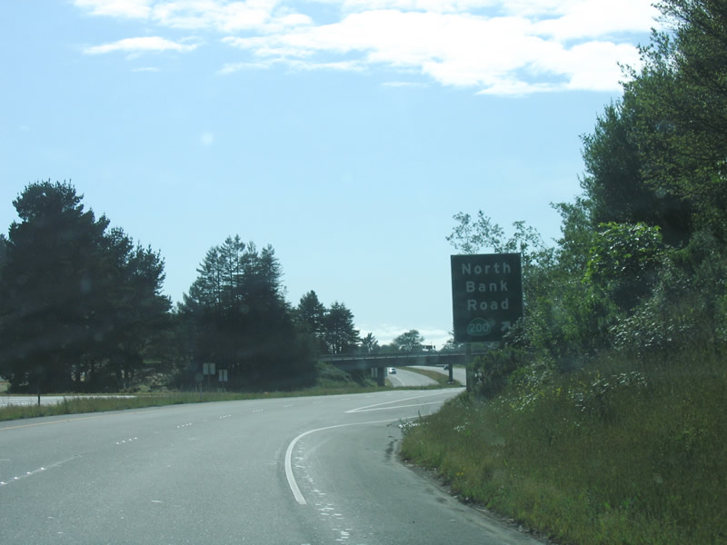
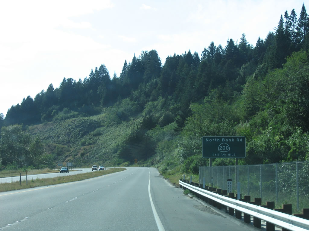
Entering the trumpet interchange (Exit 2) with SR 200 (North Bank Road) into McKinleyville.
05/28/06
SR 299 (Trinity Highway) spans the Mad River into the city of Arcata. The ensuing exit connects the freeway with Guintoli Lane and West End Road.
05/28/06
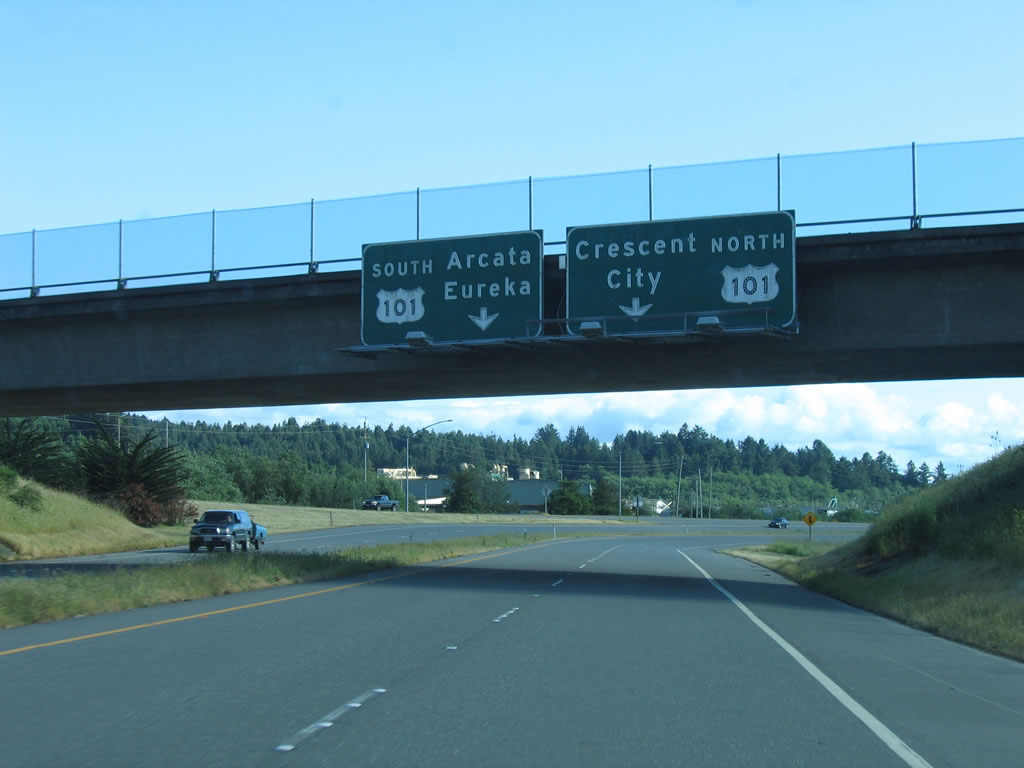
Passing below the Guintoli Lane overpass, overhead guide signs precede the trumpet interchange joining SR 299 with U.S. 101.
05/28/06
Single lane ramps lead drivers onto U.S. 101 (Redwood Highway) north to McKinleyville and south toward Downtown Arcata.
05/28/06
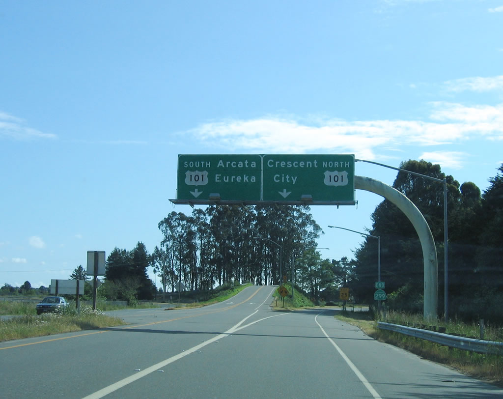
U.S. 101 travels southward through Arcata as a freeway and as an expressway around the east side of Arcata Bay into Eureka. The freeway north hugs the coast from Arcata-Eureka Airport (ACV) to Clam Beach.
05/28/06
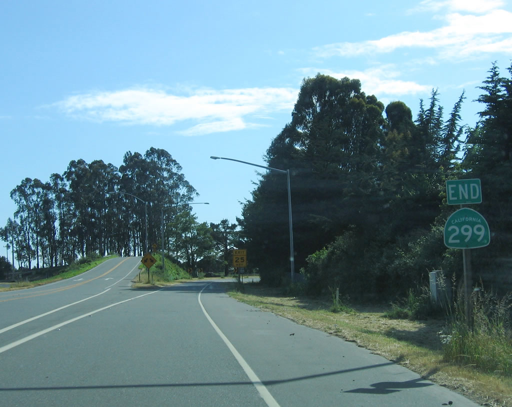
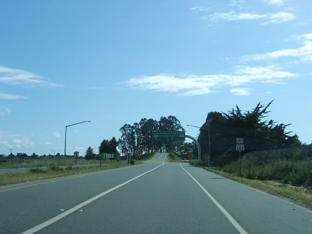
An end shield for SR 299 stands at the exchange with U.S. 101 (Redwood Highway). The expressway west from the Mad River to U.S. 101 dates to at least 1959.
05/28/06
A trailblazer for U.S. 101 accompanies the ramp to Redwood Highway south to Eureka.
05/28/06
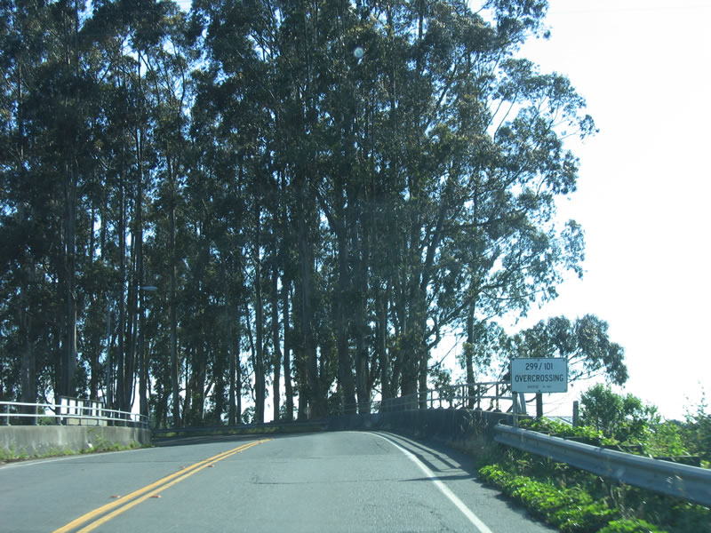
The bridge sign lists span over U.S. 101 as the "299/101 Overcrossing." Normally this would display "299/101 Separation."
05/28/06
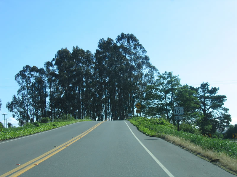
Traffic from SR 299 west to U.S. 101 south merges onto the Redwood Highway by the community of Alliance.
05/28/06
scenes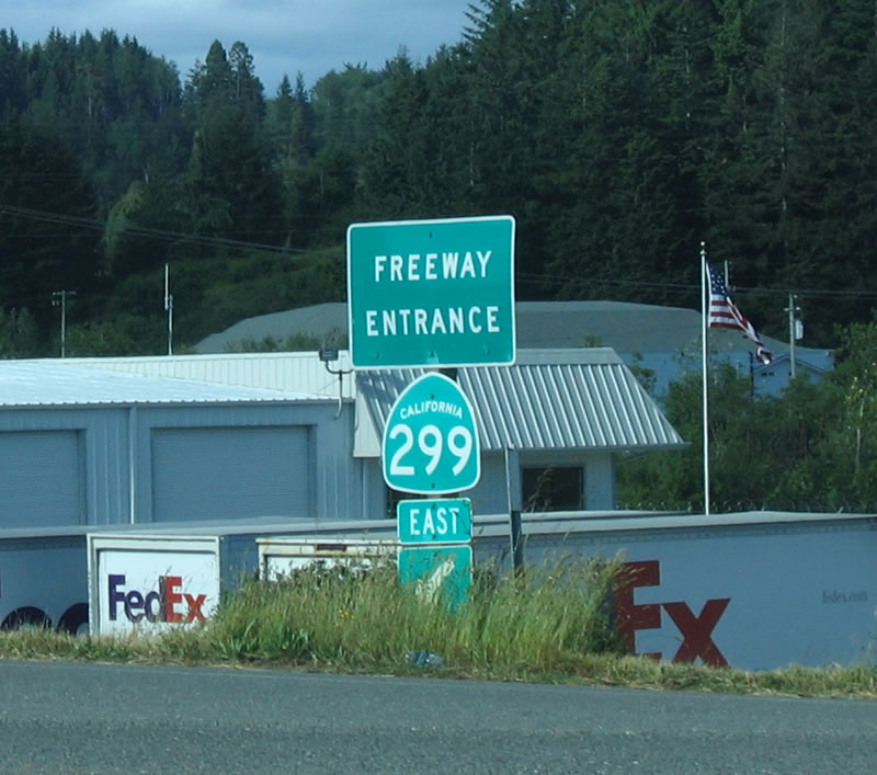
This SR 299 freeway entrance shield assembly is located on Giuntoli Road at Exit 1.
05/28/06
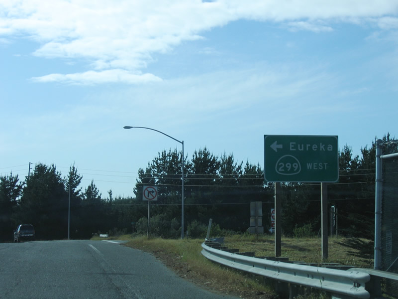
The final on-ramp for SR 299 west references Eureka for U.S. 101 south. This sign appears along Giuntoli Lane west.
05/28/06
Photo Credits:
- Andy Field: 05/28/06
Page Updated Tuesday June 06, 2017.