|
| IH 10 west and IH 35 north combine for 2.1 miles northbound to western reaches of Downtown San Antonio. Exit 154A departs just beyond the SL 353 (Nogalitos Street) overpass for Powell and San Marco Streets. 12/31/02 |
|
| Exit 154A connects IH 10 / 35 north with Powell Street east to adjacent Nogalitos Street (old U.S. 81) and San Marcos Street north to industrial areas west of Apache Creek. 12/31/02 |
|
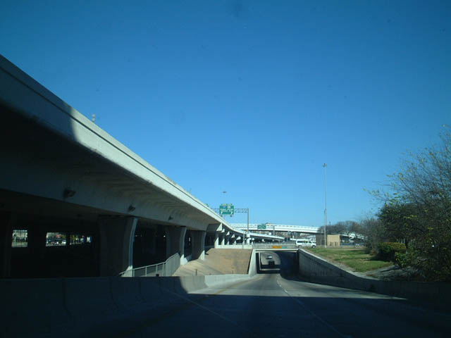
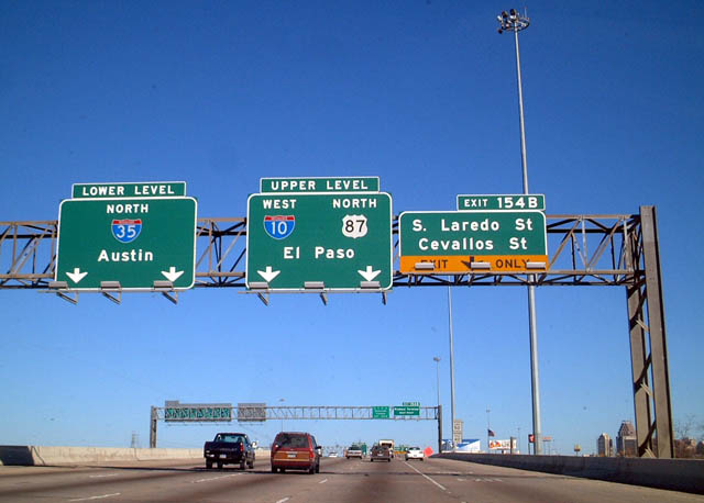
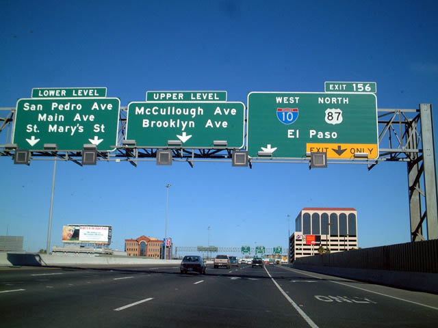
| Traffic partitions into a upper and lower level configuration between Laredo and El Paso Streets. The lower level branches away from the mainline to the left, connecting IH 10 / 35 with SS 536 (South Alamo Street). 12/31/02 |
|
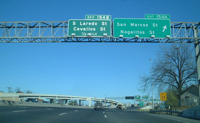
| Motorists headed west along IH 10 & U.S. 87 from IH 35 are directed to use the upper level of the freeway, as those travel lanes stay to the right. Exit 154B departs next for South Laredo Street and Cevalios Street. 12/31/02 |
|
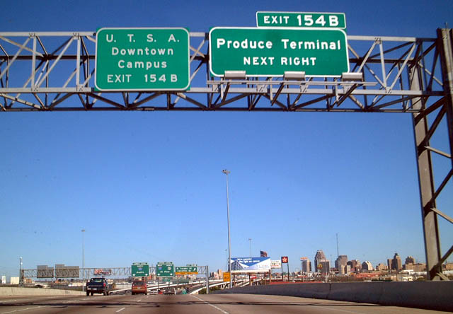
| Points of interest for Exit 154B and South Laredo Street include the Produce Terminal and the University of Texas at San Antonio. 12/31/02 |
|
| Exit 154B leaves IH 10 west & IH 35 north as the freeway partitions into lower and upper levels. 12/31/02 |
|
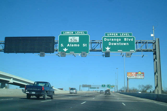
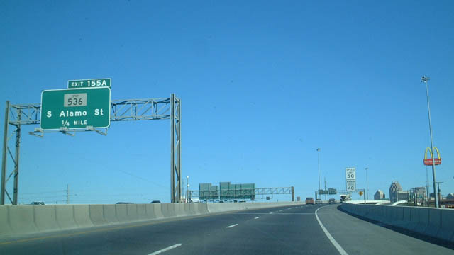
| Advance signage for Exit 155A from the IH 10 / 35 lower level for SS 536 (South Alamo Street). SS 536 represents the former surface route of U.S. 281 leading south from Downtown. 12/31/02 |
|
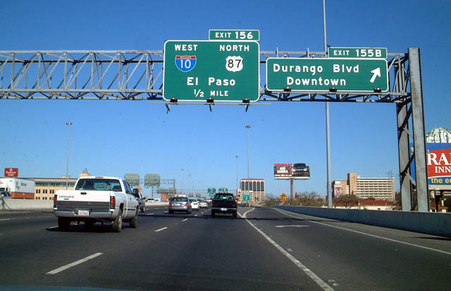
| The split roadways of IH 10 / 35 northbound converge less than a half mile ahead of Exit 155B for Cesar E. Chavez Boulevard (former Durango Boulevard). 12/31/02 |
|
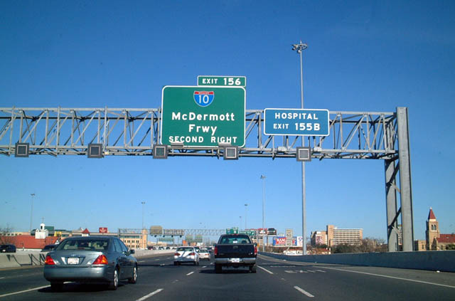
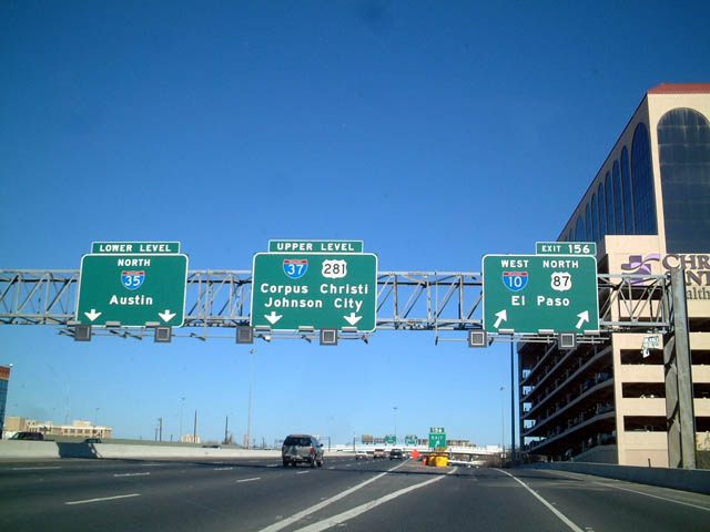
| IH 10 leading northwest from IH 35 (Exit 156) is the McDermott Freeway. 12/31/02 |
|
| Exit 155B to Cesar E. Chavez Boulevard is the main exit into Downtown San Antonio from Interstate 35. Area attractions include The Alamo, the Tower of the Americas, and the Arneson River Theatre. 12/31/02 |
|
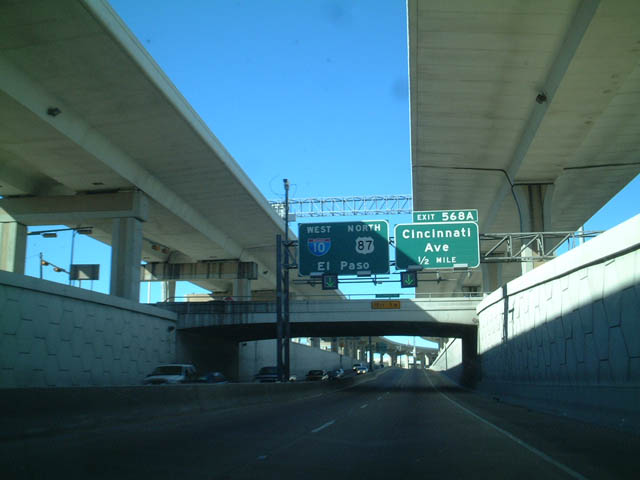
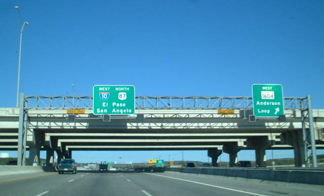
| IH 10 west & U.S. 87 north separate from IH 35 north along a two lane ramp (Exit 156) through a directional T interchange. 12/31/02 |
|
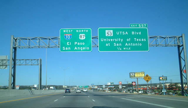
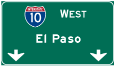
| Interstate 10 west & U.S. 87 continue northwest from Exit 156 to Boerne and western Kendall County, where they split for Kerrville and Fredericksburg respectively. 12/31/02 |
|
| The IH 10 westbound mainline descends below Martin Street and the adjacent IH 35 (PanAm Expressway) viaduct with two lanes and partial shoulders. 12/31/02 |
|
| IH 10 westbound emerges alongside an entrance ramp from San Saba and Martin Street. Additional lanes join from IH 35 southbound ahead. 12/31/02 |
|
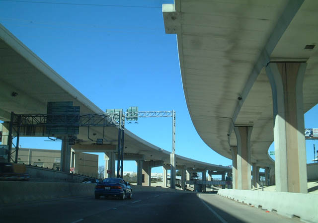
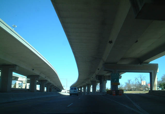
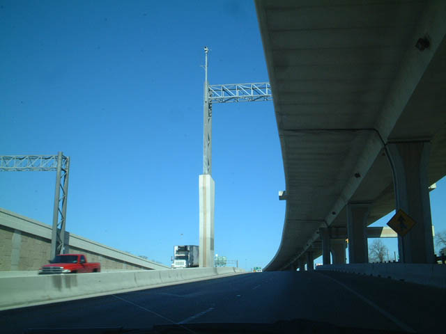
| Winding northwest between Midtown and Near Northwest San Antonio, IH 10 partitions into a dual freeway configuration with upper and lower roadways. 12/31/02 |
|
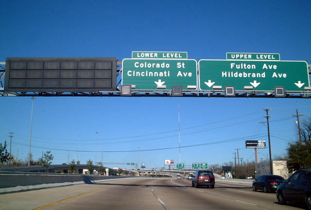
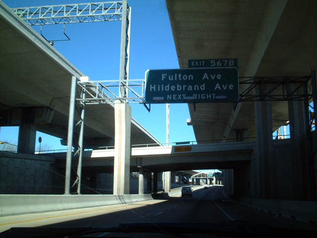
| The IH 10 upper roadway connects with ramps to Spur 421 (Culebra Avenue / Bandera Road) west, Fulton Avenue at Beacon Hill and Hildebrand Avenue for the Los Angeles Heights and Edison neighborhoods. 12/31/02 |
|
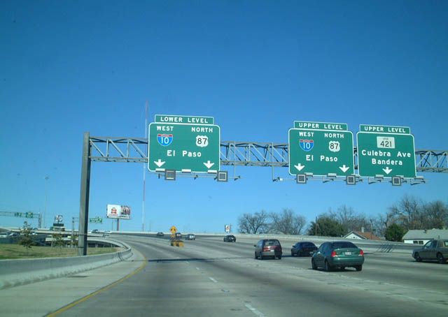
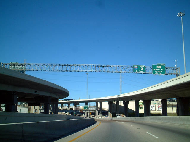
| Two lanes partition for both the lower and upper roadways of IH 10 west/U.S. 87 north. Exit 568B follows from the upper deck to Loop 421, a 5.95 mile long urban boulevard northwest to IH 410 at SH 16 in Leon Valley. 12/31/02 |
|
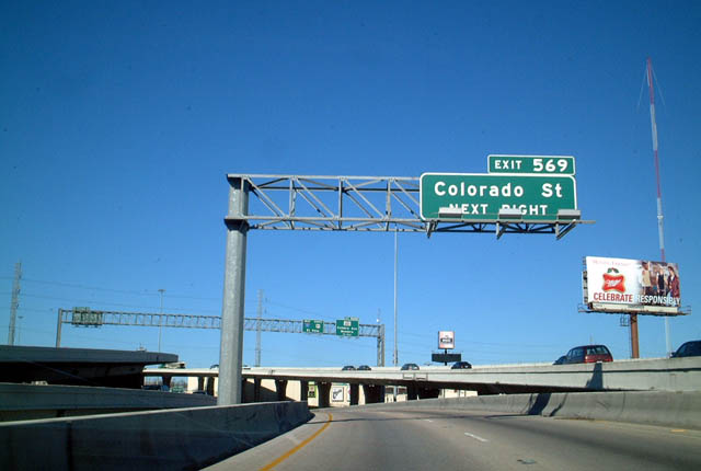
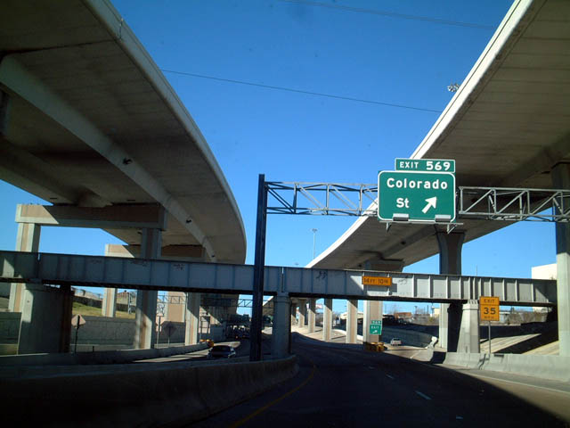
| The ensuing exit from the IH 10/U.S. 87 lower roadway is for Colorado Street to the Uptown and West End neighborhoods. 12/31/02 |
|
| A sign bridge spans the width of the dual freeway segment of IH 10 beyond Frio Street. Exit 569 departs to Colorado Street from below while Exit 568B leaves the upper roadway in a half mile. 12/31/02 |
|
| Colorado Street extends north from Brazos Street and the Historic Westside of San Antonio to Fredericksburg Road (old U.S. 87) as it leads northwest from Five Points toward Keystone. 12/31/02 |
|
| The lower roadway of IH 10 curves northward one half mile from the Colorado Street overpass to Exit 568A for Cincinnati Avenue. 12/31/02 |
|
| A second Union Pacific Railroad line passes between the lower and upper roadways of IH 10 on the section between Midtown and the West End neighborhoods. 12/31/02 |
|
| Cincinnati Avenue provides a cutoff from IH 10 west to Fredericksburg Road south to Five Points. SL 345 was removed from Fredericksburg Road 2.7 miles north from IH 10 to the Balcones Heights city limit in 2015. Maintenance was transferred to the city of San Antonio. 12/31/02 |
|
| IH 10 west/U.S. 87 north at Exit 568A for Cincinnati Avenue. Westward, Cincinnati Avenue parallels Spur 421 (Culebra Road) four blocks to the north to Woodlawn Lake. 12/31/02 |
|
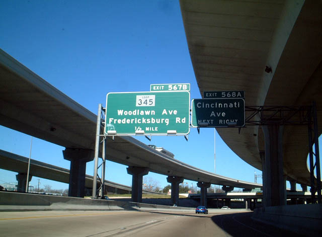
| Progressing north between the Keystone and Beacon Hill communities, IH 10/U.S. 87 cross paths with Fredericksburg Road (old SL 345) at the succeeding off-ramp. The IH 10 frontage road extends north from Exit 567B to Fulton and Hildebrand Avenues. 12/31/02 |
|
| Exit 567B parts ways with the lower roadway of IH 10/U.S. 87 below a pedestrian bridge at French Place. Fredericksburg Road represents the pre-freeway alignment of U.S. 87 through Near Northwest San Antonio and the city of Balcone Heights. SL 345 follows the northernmost 5.10 miles of the arterial to Exit 560A. 12/31/02 |
|
| The upper and lower roadways along IH 10 westbound combine at Martinez Creek. 12/31/02 |
|
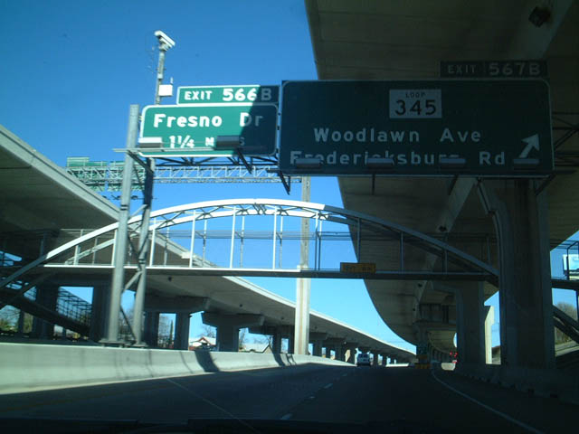
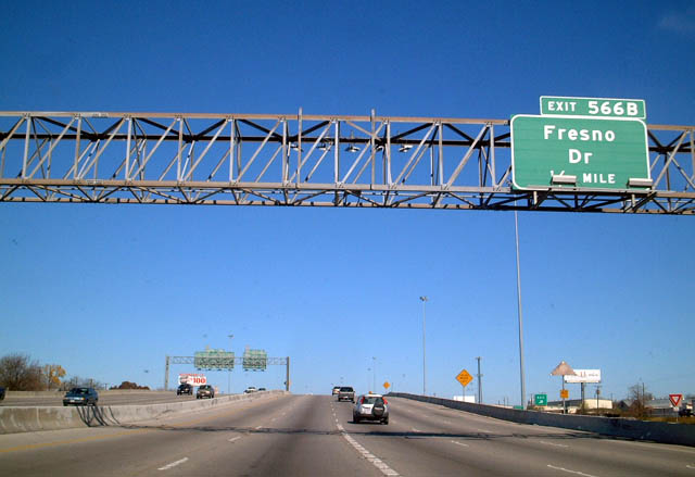
| Continuing north in a traditional TxDOT freeway configuration with companion frontage roads, IH 10/U.S. 87 advance to Exit 566 with Fresno Drive. 12/31/02 |
|
| Fresno Drive joins IH 10/U.S. 87 with the Los Angeles Heights and Edison neighborhoods in San Antonio and the city of Olmos Park. 12/31/02 |
|
| Turning northwest, IH 10/U.S. 87 (McDermott Freeway) next meet West Avenue at Exit 566A and the Dellview Area. 12/31/02 |
|
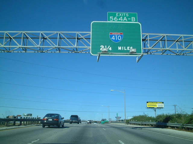
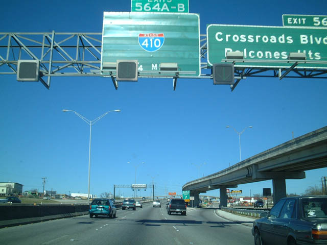
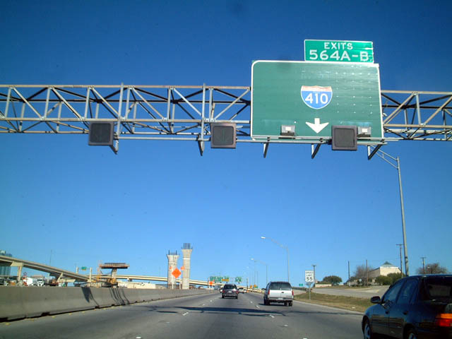
| IH 10 makes a sweeping curve northwest into the Balcones Heights city limits to IH 410. The McDermott Freeway north from Midtown was reconstructed from six lanes to a ten lane freeway. 12/31/02 |
|
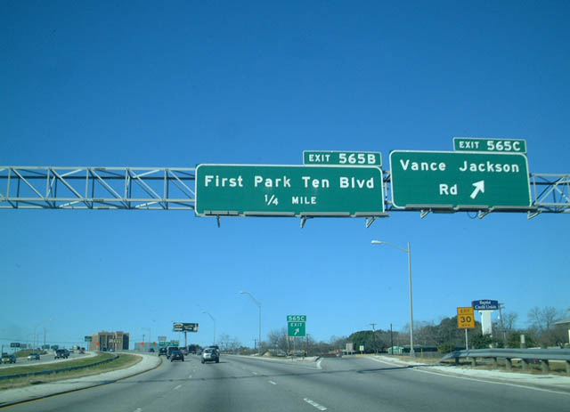
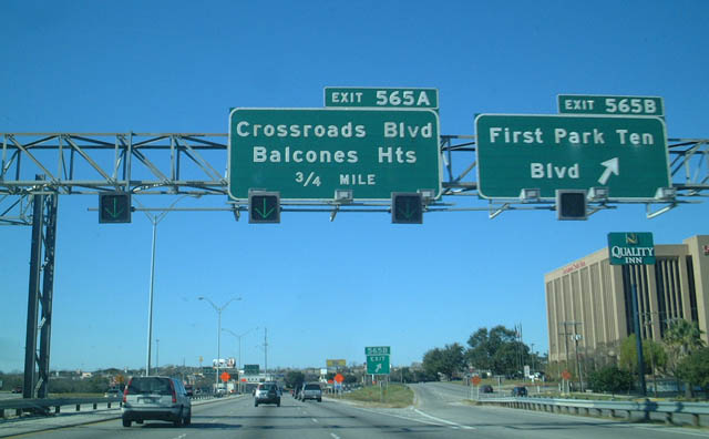
| Exit 565B (old Exit 565C) separates from IH 10 westbound above West Avenue for Vance Jackson Road, a commercial arterial through the Dellview Area. 12/31/02 |
|
| Exit 565B for First Park Ten Boulevard was renamed Exit 565A for Crossroads Boulevard during mid-2000s reconstruction of IH 10. First Park Ten Boulevard is a local loop serving an array of office buildings. Crossroads Boulevard links IH 10 with Wonderland of The Americas mall in Balcone Heights. 12/31/02 |
|
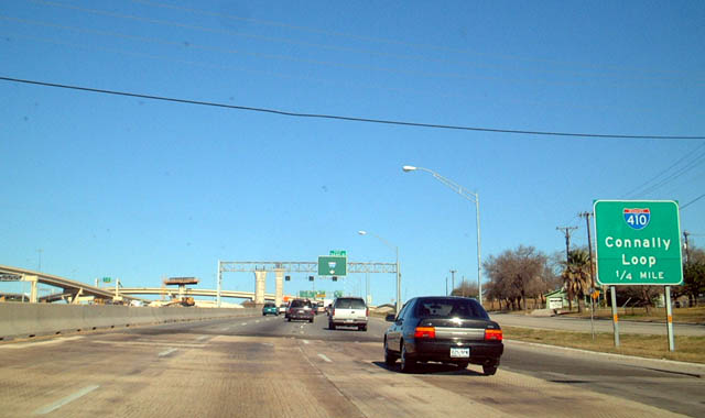
| $132 million in construction from 2000 to 2006 rebuilt the exchange joining IH 10/U.S. 87 (McDermott Freeway) with IH 410 (Connally Loop) into a multi-level systems interchange. Associated expansion of IH 10 eliminated the original ramp for Exit 565A. 12/31/02 |
|
| The 49.5 mile long route of IH 410 honors former Texas Governor John Connally. The northwestern half comprises a heavily traveled commuter freeway while Loop 410 to the southeast remains somewhat rural. 12/31/02 |
|
| The previous directional cloverleaf interchange joining IH 10 and IH 410 was completed in 1960. 12/31/02 |
|
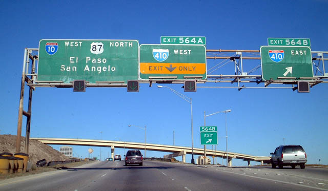
| High speed flyovers replaced grade level ramps for IH 410 at Exit 564. The San Antonio beltway heads east to Castle Hills, San Antonio International Airport (SAT) and IH 35 at Windcrest. 12/31/02 |
|
| IH 410 westbound leads to Leon Valley, Lackland A.F.B. and IH 35 at Southwest San Antonio. 12/31/02 |
|
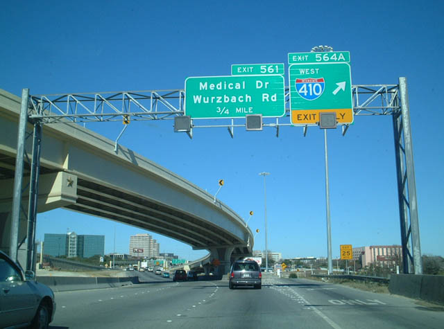
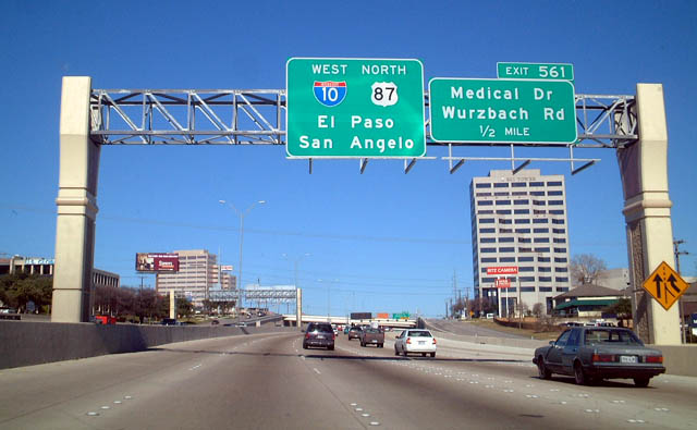
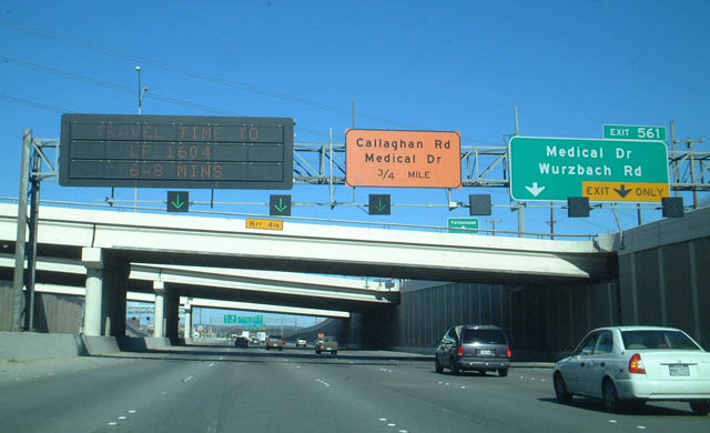
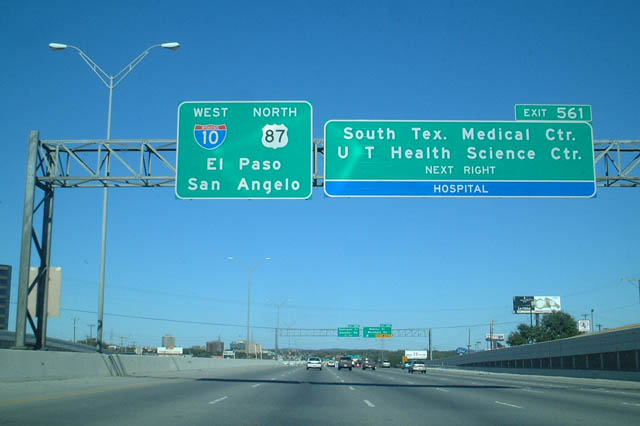
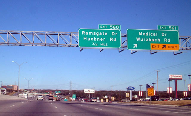
| Exit 563 departs from within the stack at IH 410 for Callaghan Road to the Colonial Hills and Mockingbird Hill neighborhoods. Exit 561 follows for Medical Drive west and Wurzbach Road. 12/31/02 |
|
| Medical Drive links IH 10/U.S. 87 with the University of Texas Health Science Center at San Antonio. Wurzbach Road comprises an arterial to the Laurel Hills and Vance Jackson communities. 12/31/02 |
|
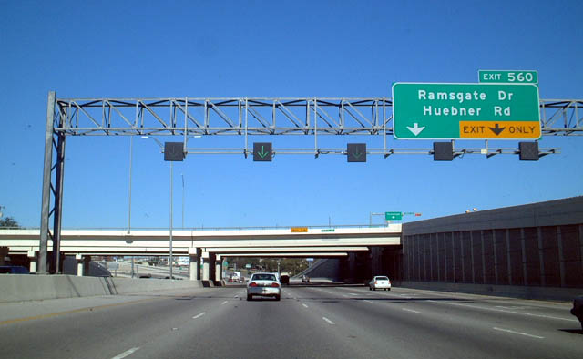
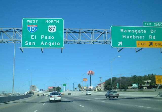
| Exit 560 rises from a below grade section of IH 10/U.S. 87 (McDermott Freeway) to the Frontage Road, 1.2 miles ahead of Huebner Road. 12/31/02 |
|
| Two lanes part ways from IH 10 west & U.S. 87 north at Exit 560. Ramsgate Drive is a neighborhood street northeast to Shenandoah/Vance Jackson. Huebner Road is a commercial arterial southwest to Loop 345 (Fredericksburg Road) and Oakland Estates and northeast to the city of Shavano Park. 12/31/02 |
|
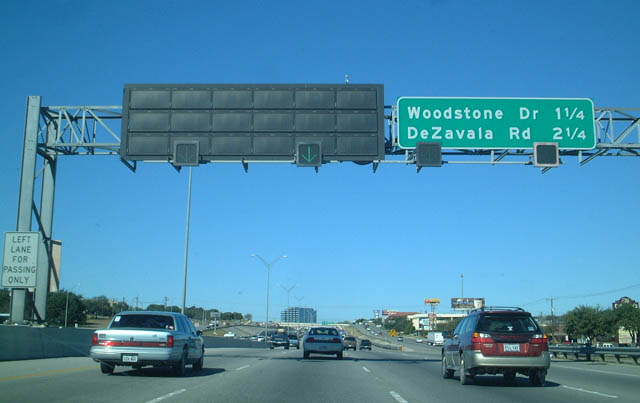
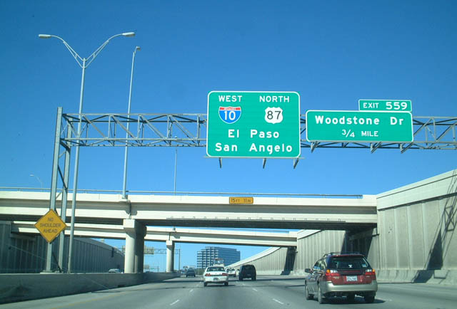
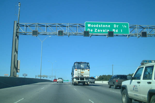
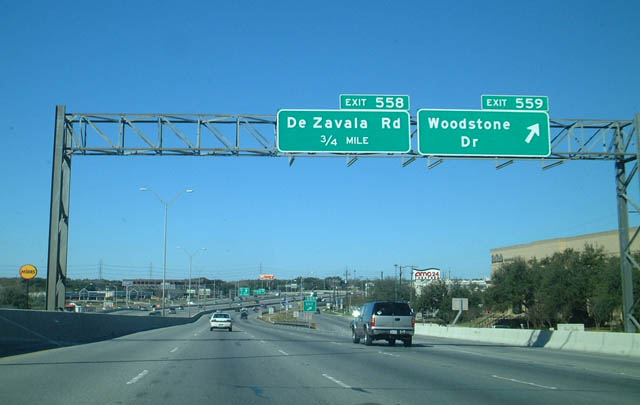
| The succeeding exit departs just beyond the Huebner Road underpass for Woodstone Drive east and DeZavala Road. 12/31/02 |
|
| Separate ramps for Woodstone Drive (Exit 559) and DeZavala Road (Exit 558) were consolidated into a single exit during reconstruction of IH 10 at the north end of SL 345 (Fredericksburg Road) in 2013-14. 12/31/02 |
|
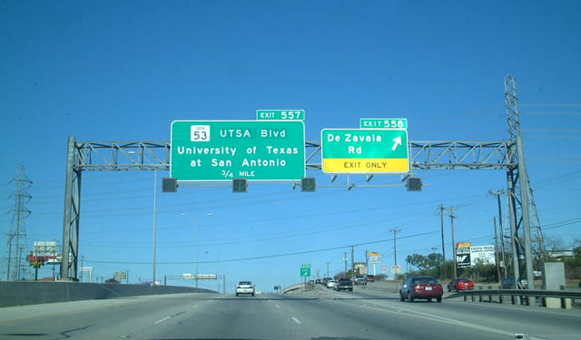
| Progressing north from Loop 345 (Fredericksburg Road), IH 10 west & U.S. 87 north continue 0.75 miles to Exit 557 for the University of Texas at San Antonio (UTSA). 12/31/02 |
|
| Spur 53 was decommissioned with maintenance of UTSA Boulevard transferred to the city of San Antonio in 2015. The 1.576 mile route followed UTSA Boulevard west from IH 10 to Ximenes Avenue. 12/31/02 |
|
| UTSA Boulevard represents the main route to the UTSA campus, located west of IH 10/U.S. 87 and south of SL 1604 (C.W. Anderson Loop). 12/31/02 |
|
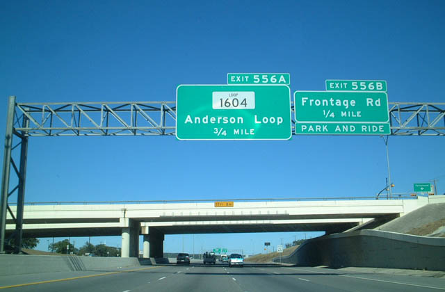
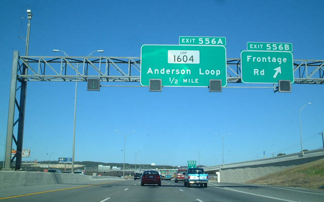
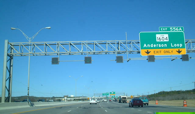
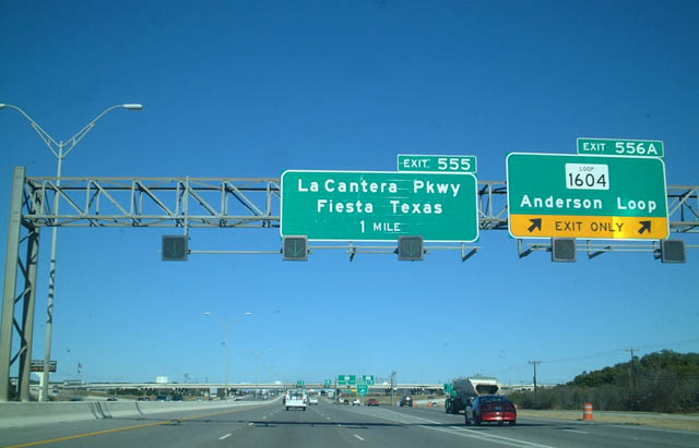
| The ensuing off-ramp connects IH 10 west/U.S. 87 north with the commercialized frontage road preceding the cloverleaf interchange (Exit 556A) with Loop 1604. 12/31/02 |
|
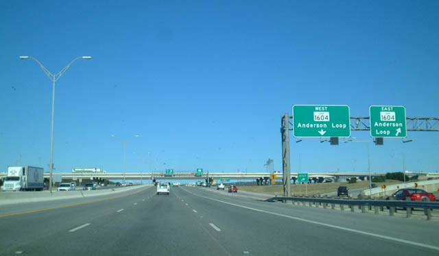
| A two lane collector distributor roadway separates from IH 10/U.S. 87 for Exit 556A to SL 1604. C.W. Anderson Loop constitutes a 94.22 mile long belt route encircling the San Antonio metropolitan area south to IH 35 near Somerset. 12/31/02 |
|
| Loop 1604 east travels to Shavano Park, Hollywood Park and IH 35 at Live Oak. 12/31/02 |
|
| The Loop 1604 freeway arcs southwest from IH 10/U.S. 87 to Helotes, Northwest San Antonio and U.S. 90 by the Lackland AFB Annex. 12/31/02 |
|
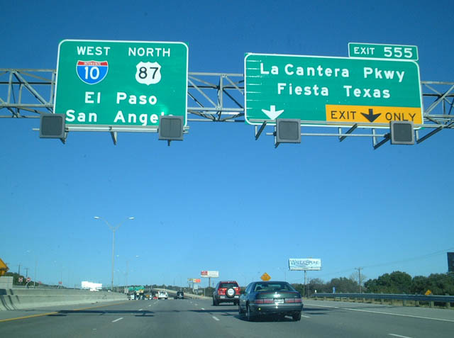
| LaCantera Parkway arcs northeast from UTSA to The Shops at La Cantera Mall, Six Flags Fiesta Texas and IH 10/U.S. 87 at forthcoming Exit 555. 12/31/02 |
|
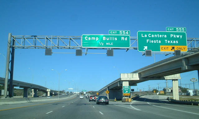
| Exit 555 departs for La Cantera Parkway west to Six Flags Fiesta Texas theme park and The Rim big box retail center. 12/31/02 |
|
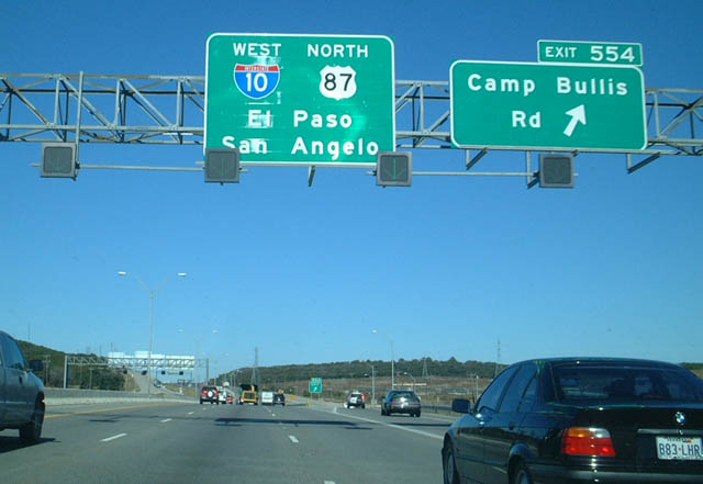
| Exit 554 joins the east side Frontage Road 1.1 mile ahead of Camp Bullis Road, the main access road to Camp Bullis Military Reservation. The I-10 West Expansion Project through December 2019 expands the freeway with six general purpose lanes and two HOV lanes from La Cantera Parkay north 5.9 miles to FM 3351 (Ralph Fair Road). 12/31/02 |
Page Updated 07-17-2019.

 West
West  North
North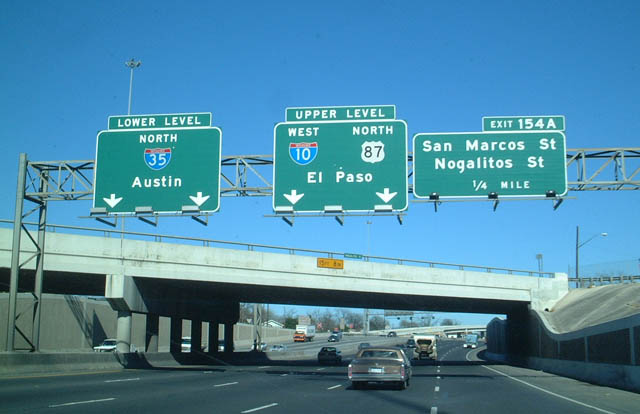


 North
North