|
| Exit 102 joins IH 45 north with FM 1375 at a dumbbell interchange within the city of New Waverly. The freeway feeder roads link the exchange with SH 150 east and FM 1374 north. FM 1375 runs west to reach FM 149 inside Sam Houston National Forest. 03/20/05 |
|
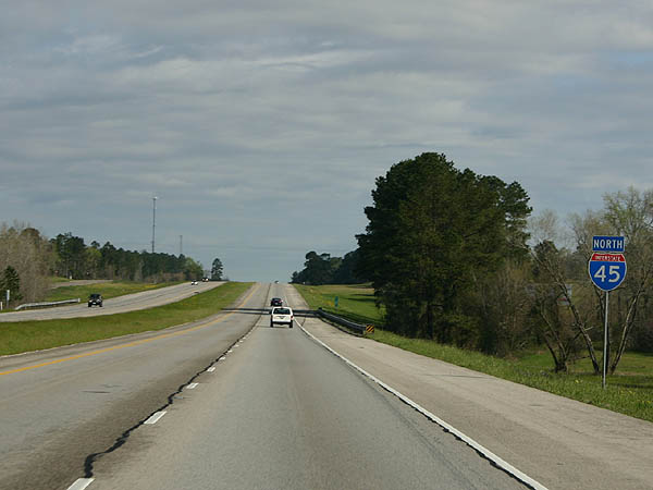
| IH 45 travels through the Piney Woods in Sam Houston National Forest between New Waverly and Huntsville. 03/20/05 |
|
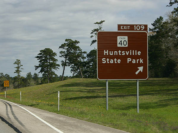
| Park Road 40 connects with IH 45 at a diamond interchange (Exit 109). The 3.55 mile route links the freeway with SH 75 near the Sam Houston State Visitor Center in south Huntsville. 03/20/05 |
|
| PR 40 spurs southwest from Exit 109 to Huntsville State Park. PR 40A branches south from the state highway with both leading toward Lake Raven within the park. 03/20/05 |
|
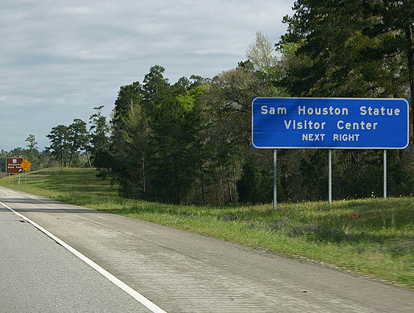
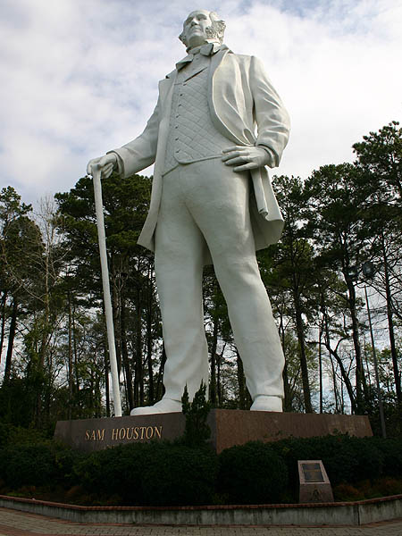
| Facing IH 45 from adjacent SH 75, the Sam Houston Statue is 67 feet tall. 03/20/05 |
|
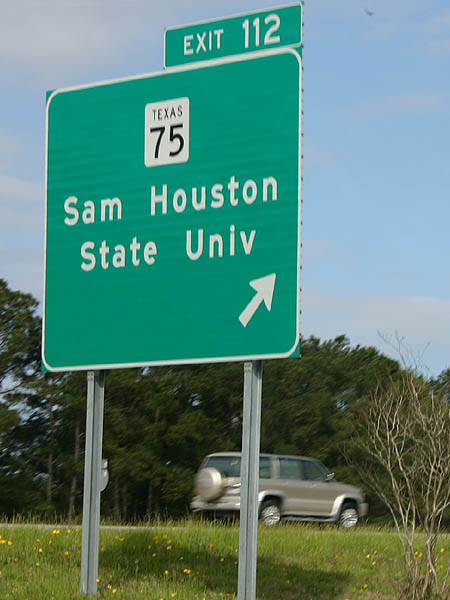
| Continuing into the city of Huntsville, Exit 112 departs IH 45 north onto adjacent SH 75. SH 75 runs through Huntsville to Sam Houston State University. 03/20/05 |
|
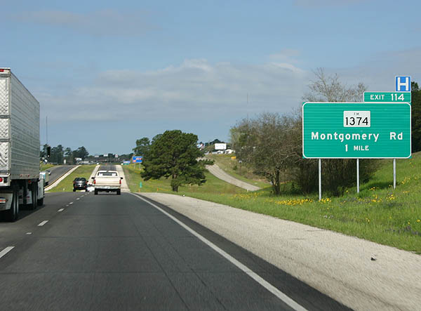
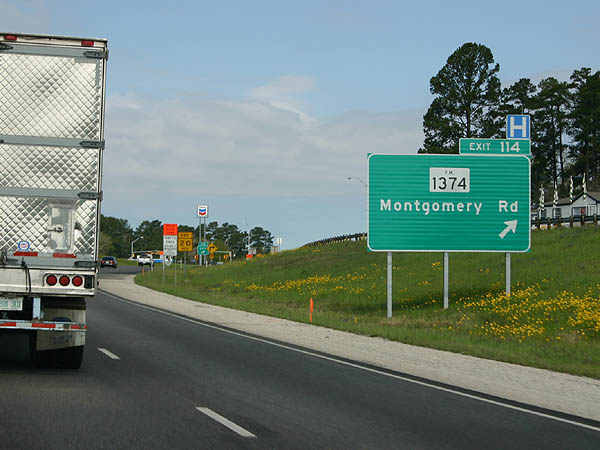
| Exit 113 follows along IH 45 northbound to parallel SH 75 (Sam Houston Avenue) from a wye interchange. SH 19 forms a freeway bypass along te east side of Huntsville. FM 1374 returns to IH 45 at the ensuing exit with Montgomery Road. 03/20/05 |
|
| An 18.00 mile loop north from New Waverly, FM 1374 (Montgomery Road) concludes less than a mile north of IH 45 at SH 75 by Sam Houston State University. 03/20/05 |
|
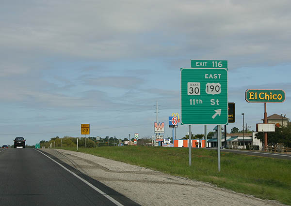
| Passing west of Downtown Huntsville, Interstate 45 advances north to Exit 116 with U.S. 190 east and SH 30. U.S. 190 extends east to the Louisiana border. SH 30 runs west from Huntsville to College Station, home of Texas A&M University. 03/20/05 |
|
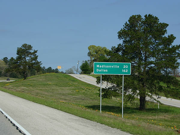
| IH 45 and U.S. 190 are quite scenic north of Huntsville as the road transitions into the Oak Woodlands north of Huntsville. The Madison County seat of Madisonville lies 20 miles to the northwest. 03/20/05 |
|
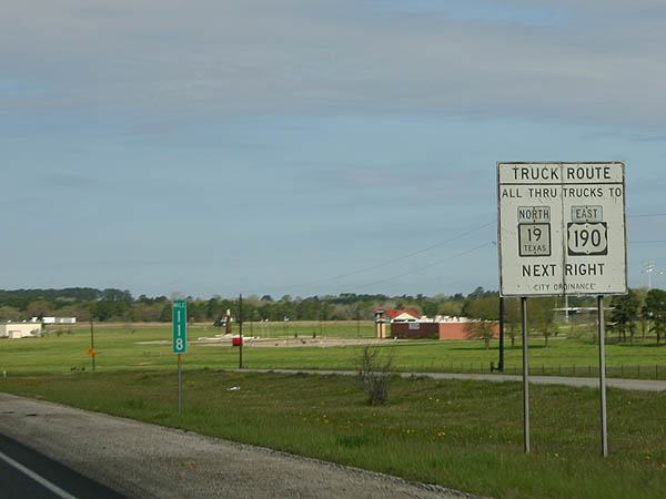
| Trucks are restricted through Huntsville by city ordinance. Truck traffic headed east to U.S. 190 or SH 19 are directed to use SH 75 south and FM 2821 east, which bypass the city center to the north. 03/20/05 |
|
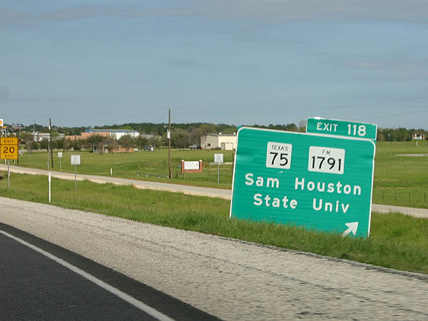
| SH 75 and FM 1791 meet adjacent to IH 45/U.S. 190 at Huntsville Municipal Airport (UTS). FM 1791 angles southwest 18.09 miles to reach FM 149 in northern Montgomery County. 03/20/05 |
|
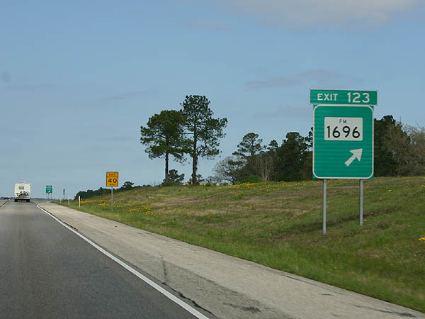
| The east end of FM 1696 ties into IH 45 and U.S. 190 at a rural diamond interchange (Exit 123). FM 1696 dog legs west from a short overlap with SH 75 nearby to Bedia at SH 90. The 31.23 mile long highway continues to SH 39 at Cross. 03/20/05 |
|
| Continuing past the Walker County Rest Areas on IH 45/U.S. 90, the freeway progresses 11 miles north to Madisonville. 03/20/05 |
|
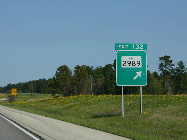
| A diamond interchange (Exit 132) joins IH 45/U.S. 90 with FM 2989 beyond South Bedia Creek in one mile. 03/20/05 |
|
| FM 2989 constitutes a 6.04 mile long connector from IH 45/U.S. 90 west to parallel SH 75 (old U.S. 75/190) and east to FM 247. 03/20/05 |
|
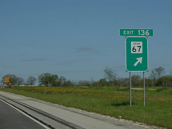
| Entering Madison County across Bedias Creek, IH 45 north & U.S. 190 west meet Spur 67 west at Rocky Ridge Lane and Exit 136. Spur 67 is a 0.344 mile link to adjacent SH 75. 03/20/05 |
|
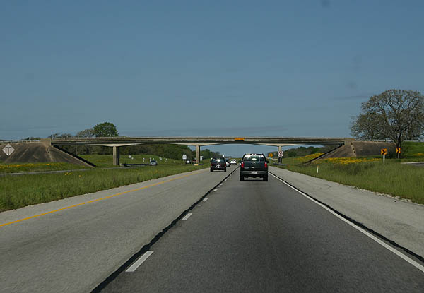
| IH 45 north at the diamond interchange (Exit 136) with SS 67. his section of freeway was completed in 1965. Outside of Huntsville, all roads crossing IH 45 northward to Madisonville are elevated over the freeway. 03/20/05 |
|
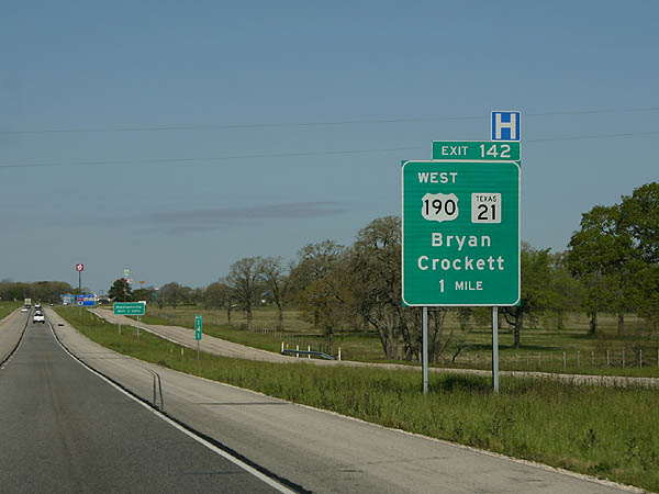
| U.S. 190 west splits with Interstate 45 north on the east side of Madisonville at SH 21 and Exit 142. U.S. 190 and SH 21 run concurrently west to Bryan, while SH 21 continues east to the Louisiana state line via Nagodoches. SH 21 starts in San Marcos at IH 35. 03/20/05 |
|
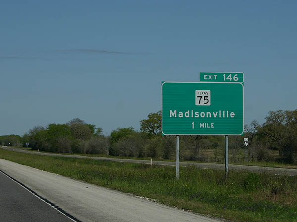
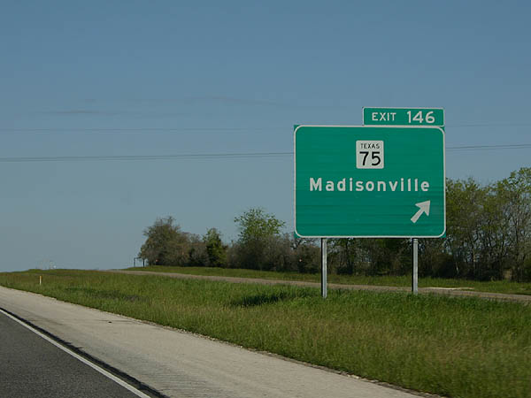
| SH 75 returns to IH 45 north Madisonville at Exit 146. Centered on agriculture and ranching like most of rural Texas, Madisonville is a city of over 4,500. 03/20/05 |
|
| SH 75 shifts to the east of IH 45 from Exit 146 northward to Leona and Centerville. 03/20/05 |
|
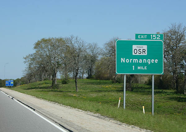
| Interstate 45 traverses agricultural areas and ranch land north to the Leon County line, where the freeway meets Old San Antonio Road (OSR). OSR arcs west from Exit 152 to Normangee and east to SH 21 at Midway. OSR is the only state highway without a corresponding number. 03/20/05 |
|
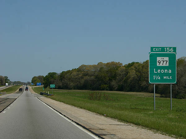
| One mile south of Exit 156 with FM 977 at the rural city of Leona. 03/20/05 |
|
| A picnic area lines the northbound roadway along IH 45 midway between Mustang Creek and Exit 156. Most of the travel amenities in this area are located in Madisonville off SH 75. 03/20/05 |
|
| Exit 156 leaves IH 45 north for FM 977 at Leona. FM 977 measures 27.08 miles east to FM 1119 and west to Flynn and FM 3 near Venetia. 03/20/05 |
|
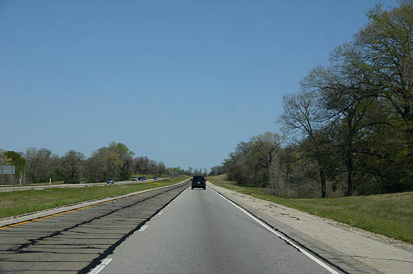
| North of Madisonville, the road leaves the Piney Woods and enters an Oak forest. This section of Texas is drier than the near-swamp conditions that prevail around Houston and to the north. IH 45 retains a four lane configuration to Ennis. 03/20/05 |
|
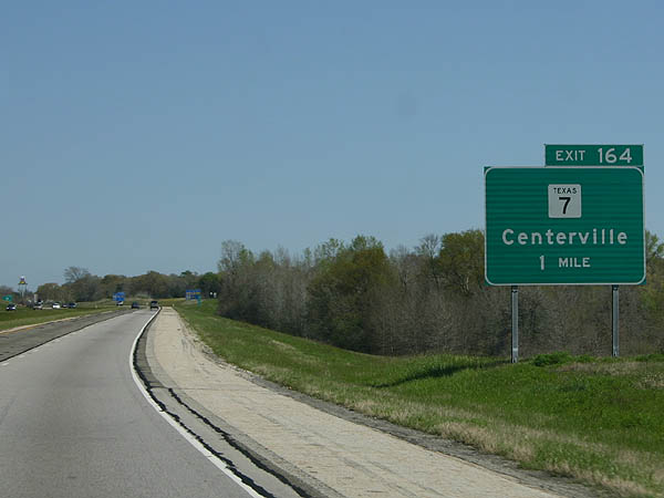
| A diamond interchange joins IH 45 with SH 7 along the west side of Centerville at Exit 164. SH 7 goes for 212 miles from IH 35 south through Centerville to U.S. 84. 03/20/05 |
|
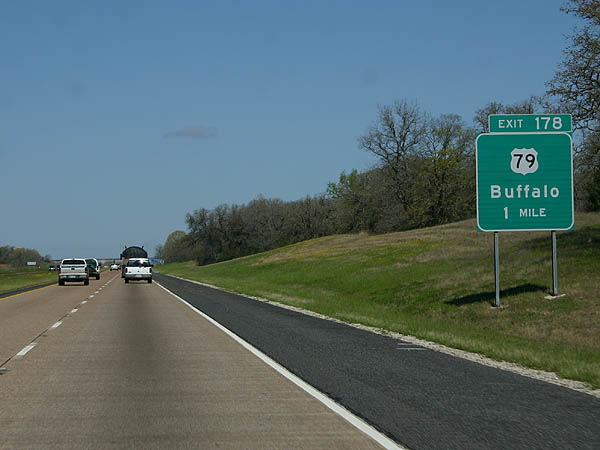
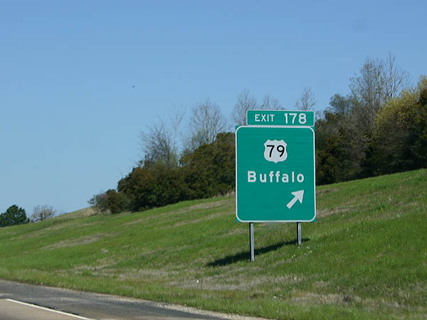
| Advancing into northern Leon County, IH 45 meets U.S. 79 at the city of Buffalo in one mile. U.S. 79 travels southwest to IH 35 in Round Rock, near Austin, from this point. 03/20/05 |
|
| U.S. 79 follows Commerce Street northeast to the Buffalo business district. Beyond the city, the US highway ventures to Palestine, Jacksonville and the Louisiana state line at Bethany. 03/20/05 |
|
| SH 180 (Donie Road) stems west from SH 75 (Buffalo Avenue) at Buffalo to a diamond interchange (Exit 180) with IH 45. 03/20/05 |
|
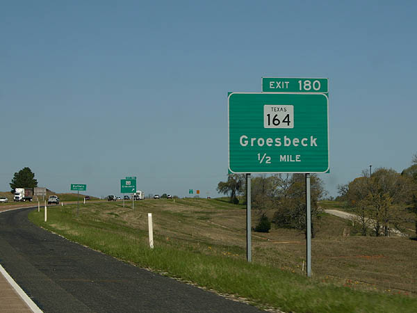
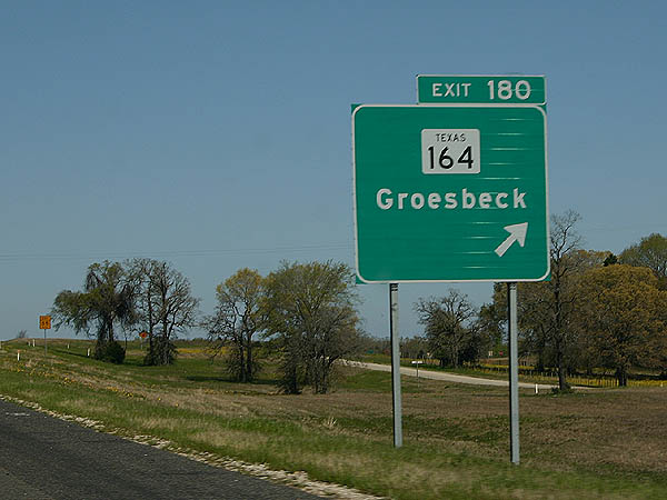
| SH 164 runs 53.92 miles west from Buffalo to Donie, Groesbeck, Mart and SH 6 near Waco. 03/20/05 |
Page Updated 07-15-2019.

 North
North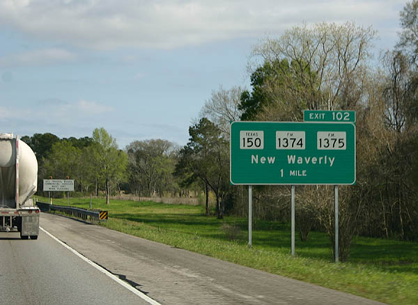
 West
West