A 4.66 mile route, Business Loop I-75 at St. Ignace follows the former route of U.S. 2 (State Street) between Exits 344 and 348 east of Interstate 75. The route was designated in 1960 when Interstate 75 from the north end of the Mackinac Bridge to Evergreen Shores (Exit 348) opened to traffic. U.S. 2 was truncated from Sault Ste. Marie southward in 1983 to end opposite the southern terminus of Business Loop I-75 on Point St. Ignace.1
|
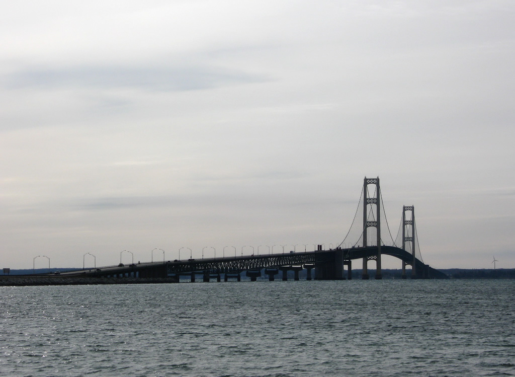
| U.S. 2 concludes its journey at the three-quarter cloverleaf interchange with Interstate 75 at the city of St. Ignace. I-75 spans the Straits of Mackinac southward along the tolled Mackinac Bridge from the U.S. highway end. 11/06/09 |
|
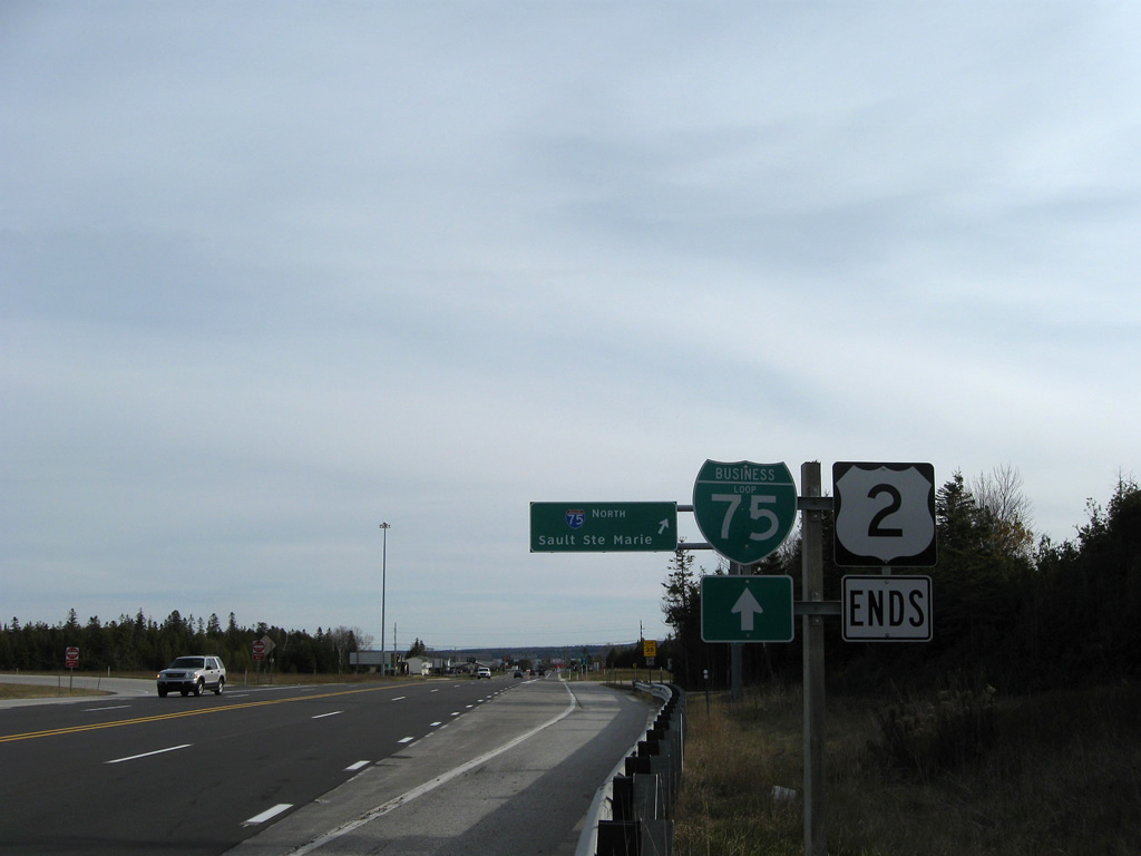
| An end shield for U.S. 2 stands beyond the I-75 underpass. The route originally ended in Sault Ste. Marie, but that portion was later relocated onto I-75 and then truncated in 1984. U.S. 2 resumes in Rouses Point, New York along a 460 mile eastern segment to Houlton, Maine.
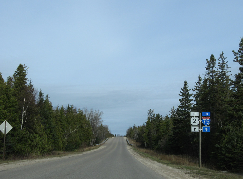
Business Loop I-75 north follows the old surface alignment of U.S. 2 through St. Ignace to Castle Rock. 11/06/09 |
|
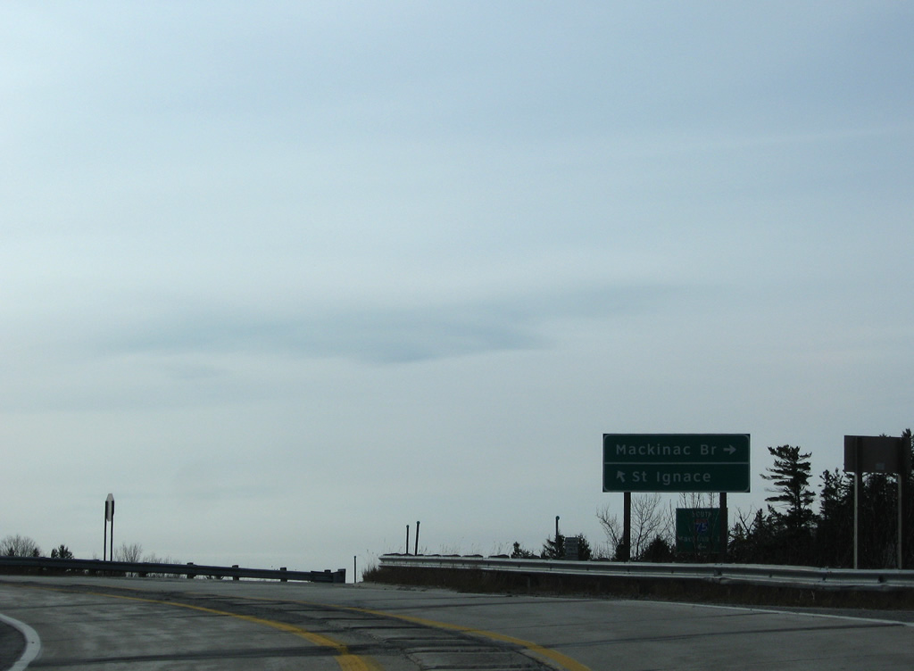
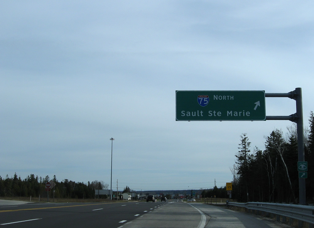
| A loop ramp joins Interstate 75 north from U.S. 2 and the beginning of Business Loop I-75 north to Rudyard and Sault Ste. Marie. I-75 ends at the International Bridge to Ontario. 11/06/09 |
|
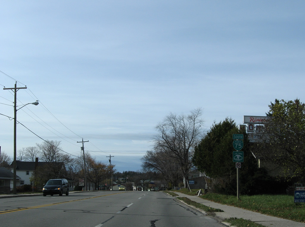
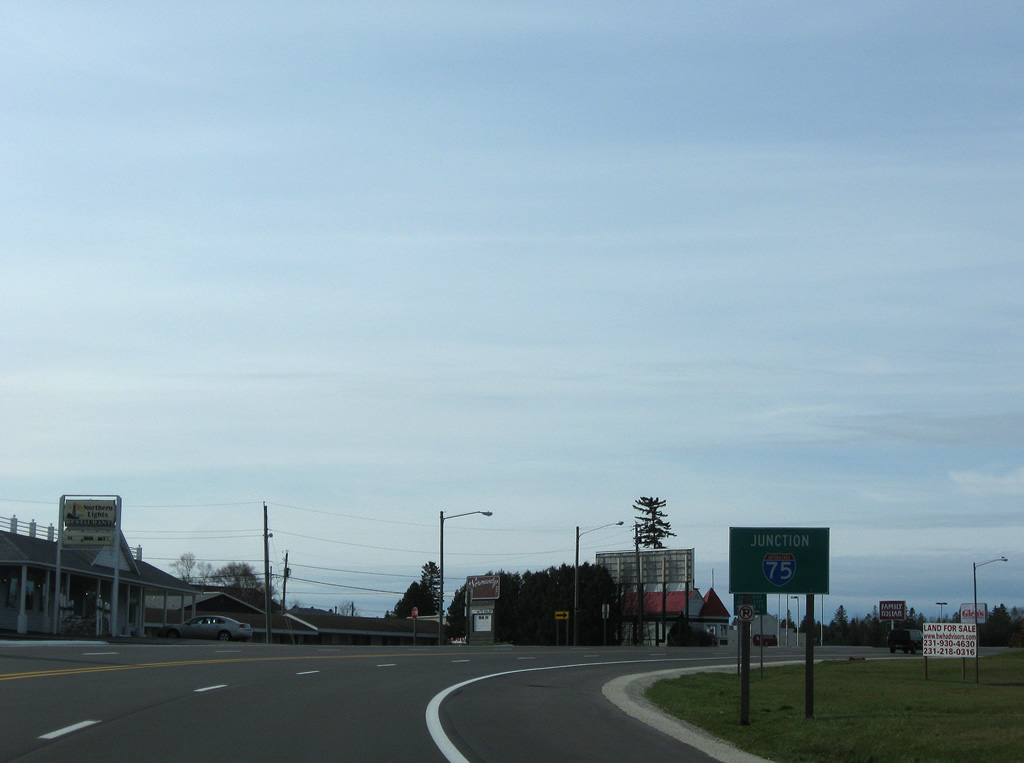
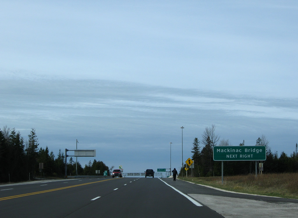
| Business Loop I-75 begins at a modified diamond interchange with Interstate 75 at Castle Rock and West Lant Road. Exit 348 combines with an access road to the Castle Rock tourist attraction ahead of West Lant Road, a west side frontage road. 11/06/09 |
|
| West Lant Road leads south alongside I-75 to Gamble Lake The frontage road provides return access to Interstate 75 south from an adjacent on-ramp. 11/06/09 |
|
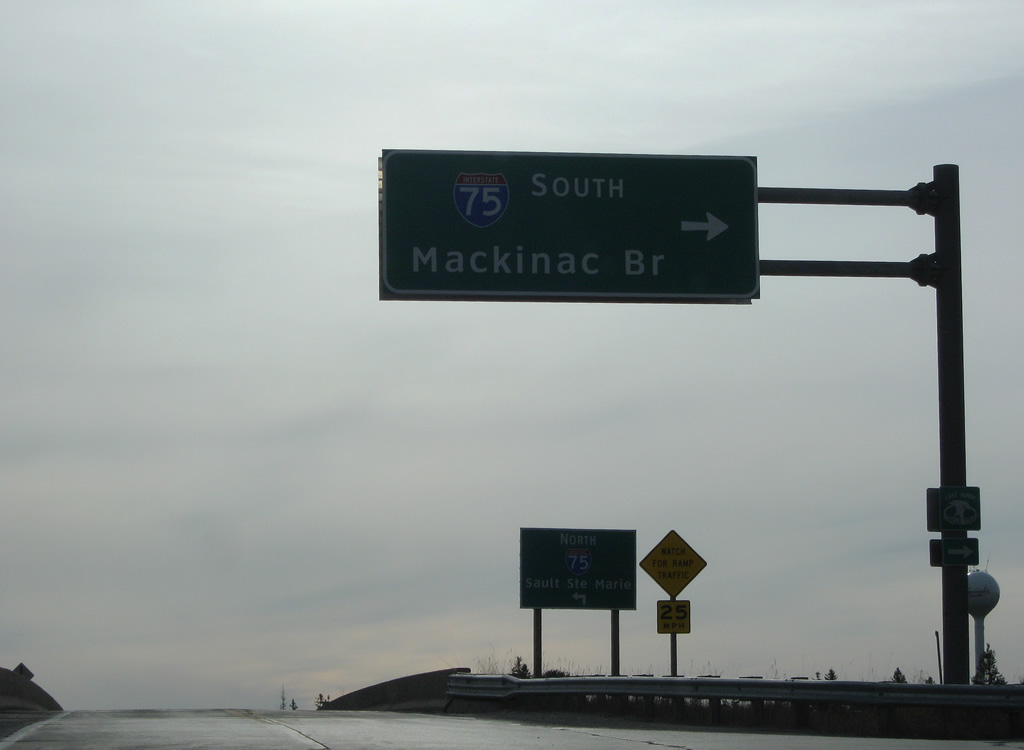
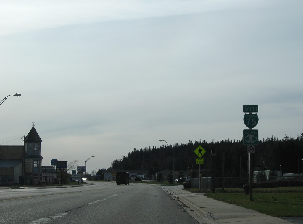
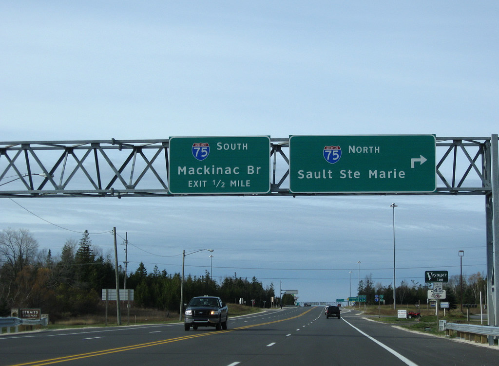
| The first shield for Business Loop I-75 south resides at the northbound on-ramp to Sault Ste. Marie. I-75 replaced U.S. 2 on the 48 mile drive north to the International Bridge across the Saint Marys River. 11/06/09 |
|
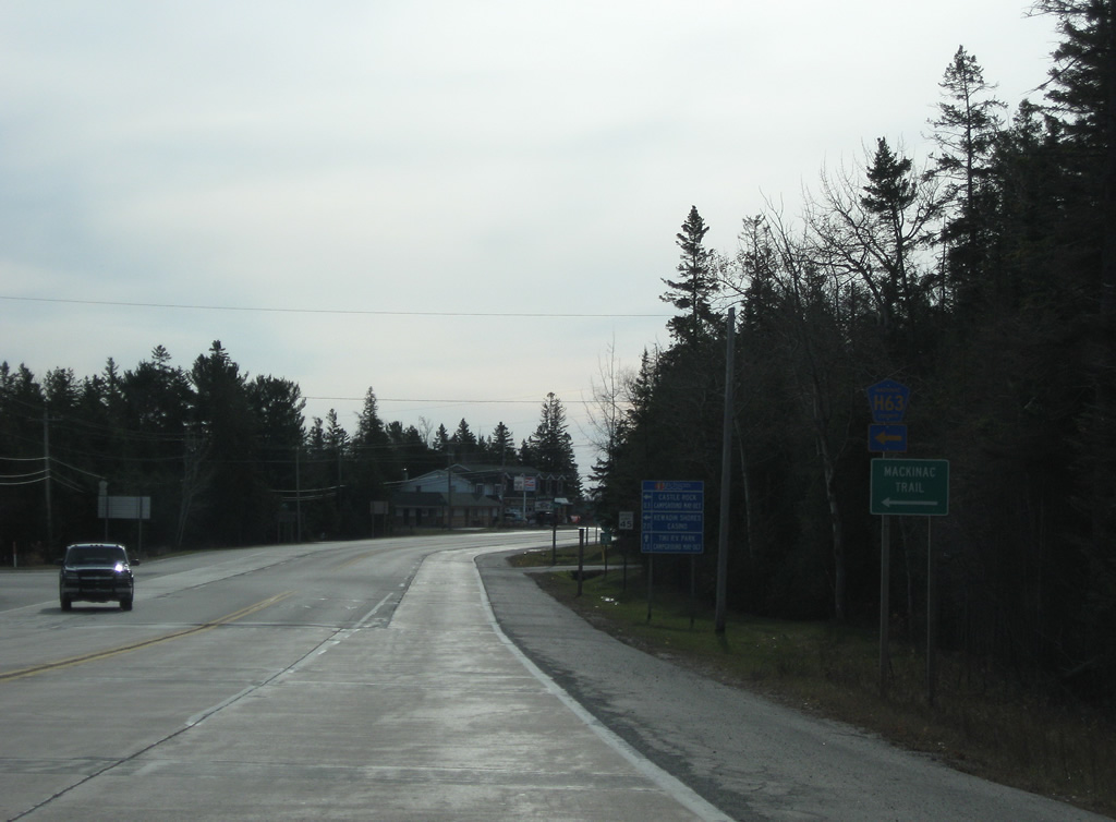
| County Road H63 (Mackinac Trail) ties into Business Loop I-75 just south of Interstate 75. Mackinac Trail was the pre-freeway route of U.S. 2 north from St. Ignace to Sault Ste. Marie. 11/06/09 |
|
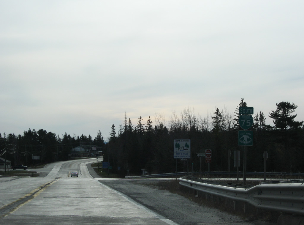
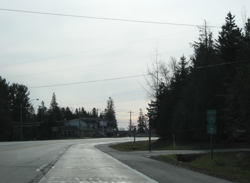
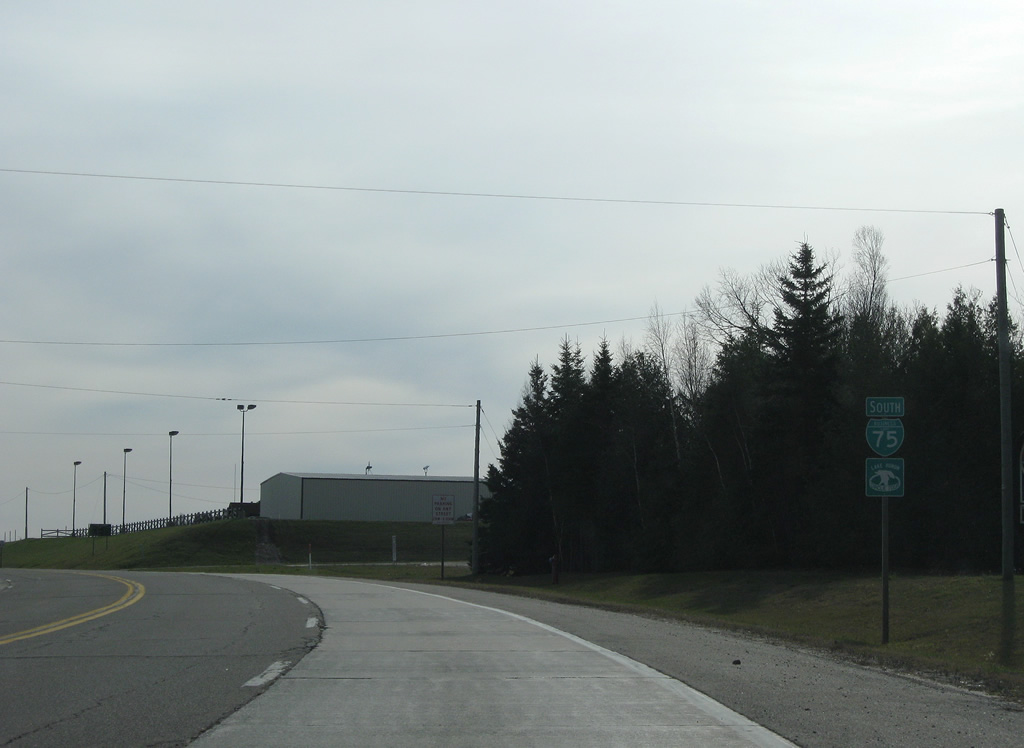
| Business Loop I-75 expands to four lanes through the community of Evergreen Shores. The route overtakes former U.S. 2 southward to St. Ignace. 11/06/09 |
|
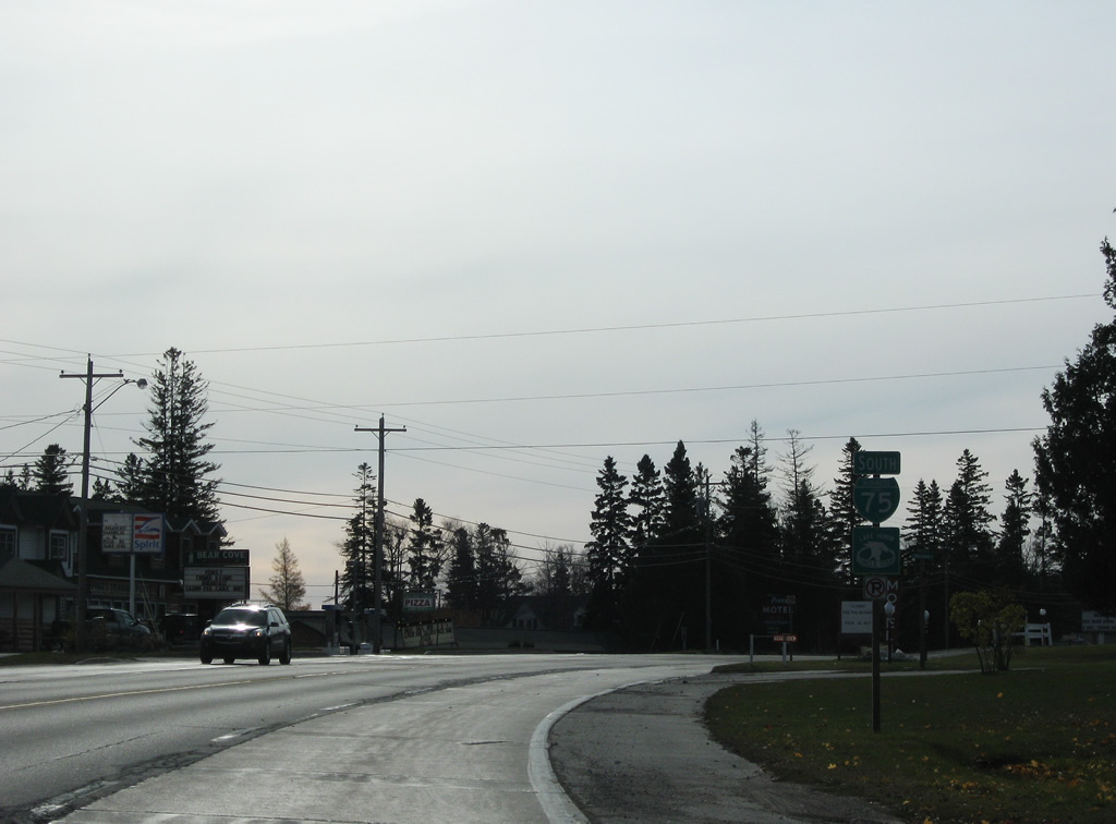
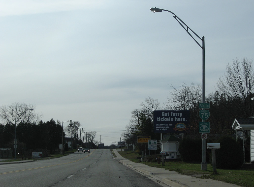
| A second shield for Business Loop I-75 south is posted at Mackinac Lane. 11/06/09 |
|
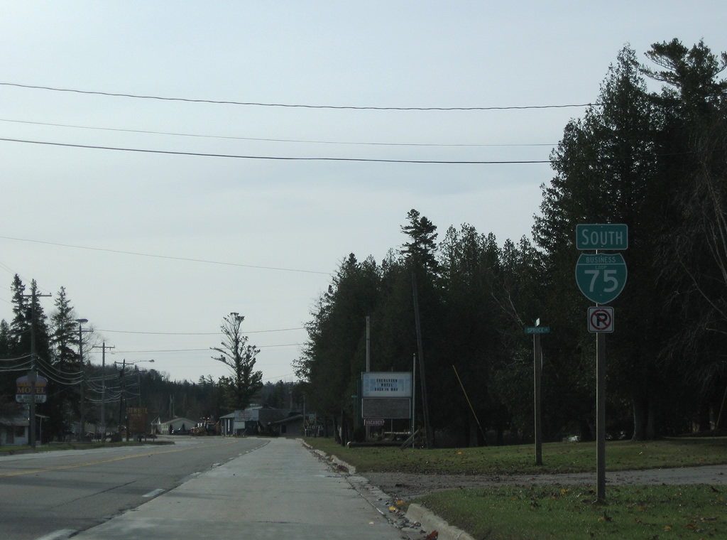
| Three blocks further south, a third shield for Business Loop I-75 appears at Spruce Lane. 11/06/09 |
|
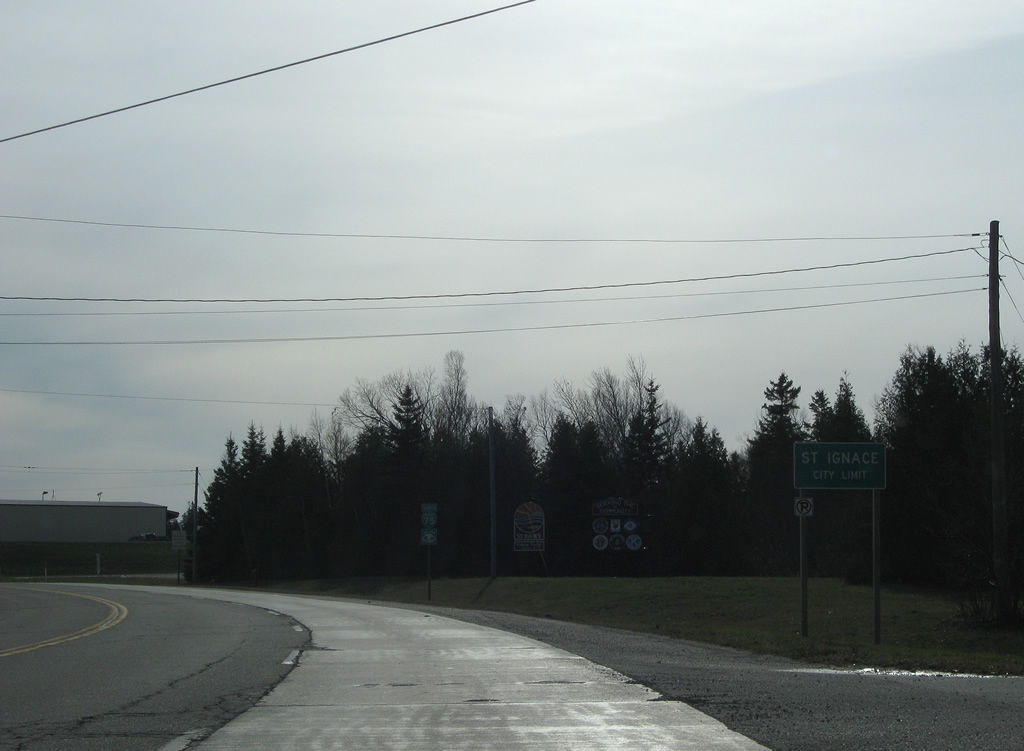
| Business Loop I-75 formally enters the city of St. Ignace at Town Line Road. 11/06/09 |
|
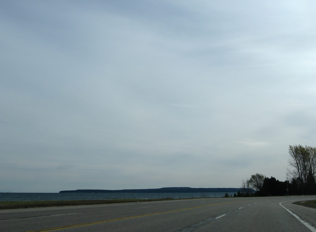
| Following State Street, Business Loop I-75 angles southeast by Mackinac County Airport as Lake Huron comes into view. 11/06/09 |
|
| A number of motels line the east side of State Street as Business Loop I-75 passes by Mackinac Straits Hospital south of North Airport Road. 11/06/09 |
|
| Continuing south between Alpine Street and South Airport Road along Business Loop I-75 (State Street). 11/06/09 |
|
| South Airport Road leads east from Boundary Road to Business Loop I-75 ahead of this reassurance marker. 11/06/09 |
|
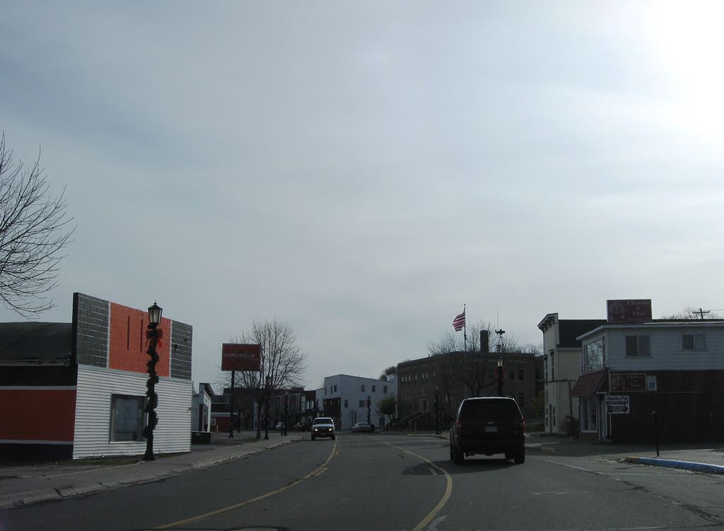
| Business Loop I-75 encircles East Moran Bay from Hazelton Street to Truckey Street through the St. Ignace business district. 11/06/09 |
|
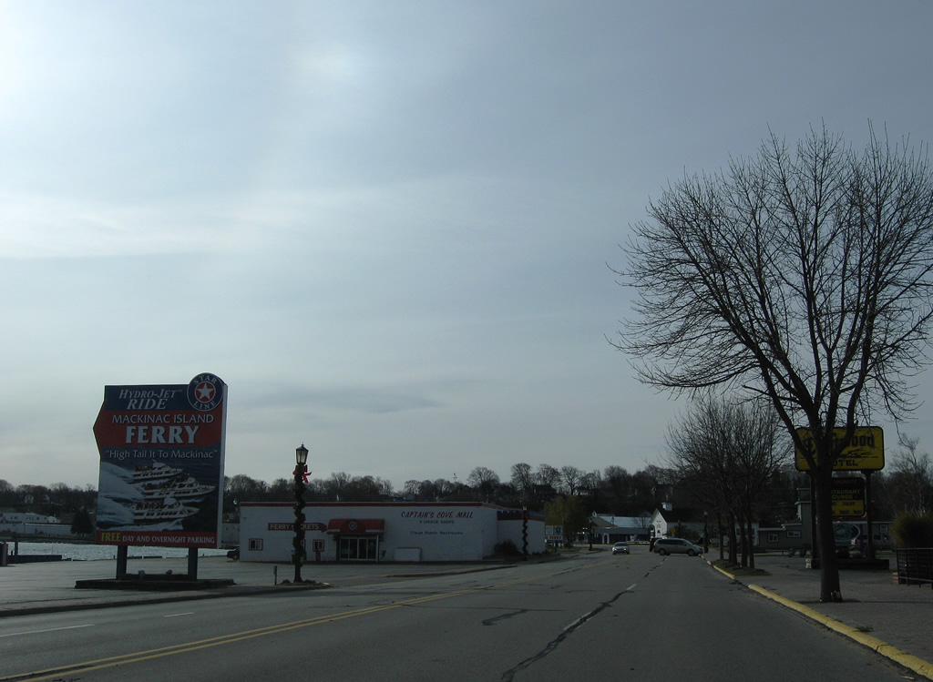
| Several ferry companies operate between St. Ignace and Mackinac Island. The Lake Huron island includes a state park, airport and several golf courses. M-185, an 8.00 mile route encircling the island, is unique because motor vehicles are not allowed on the island. 11/06/09 |
|
| Approaching the St. Ignace Municipal Building along State Street south at Goudreau Street. 11/06/09 |
|
| South State Street splits with Business Loop I-75 to continue alongside Lake Huron to the former ferry landing to Mackinaw City and Graham Point. 11/06/09 |
|
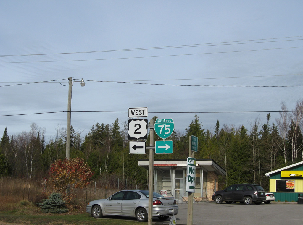
| Business Loop I-75 veers westward from the lake shore to Interstate 75 and U.S. 2 west. 11/06/09 |
|
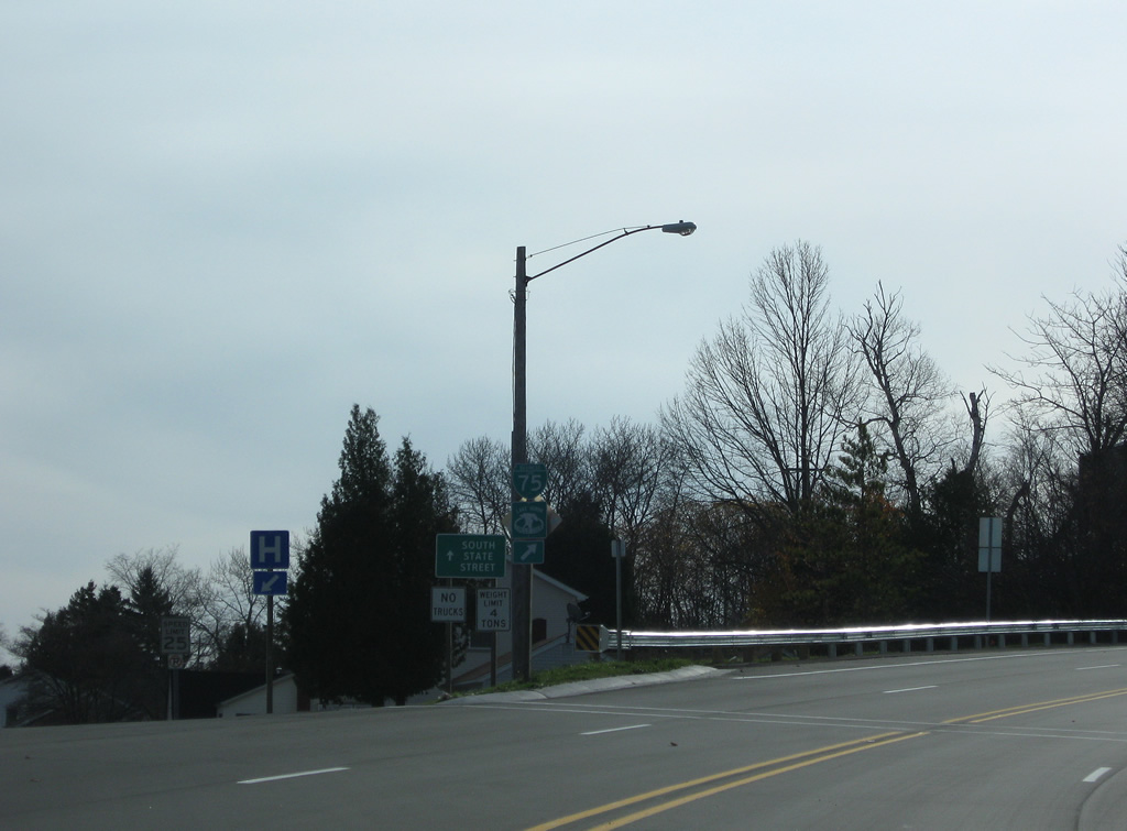
| A small guide sign alerts motorists to the forthcoming three-quarter cloverleaf interchange with Interstate 75 on Business Loop I-75 south. 11/06/09 |
|
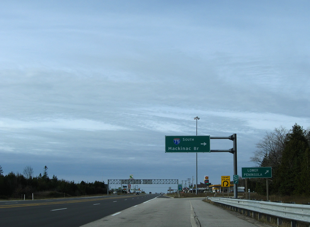
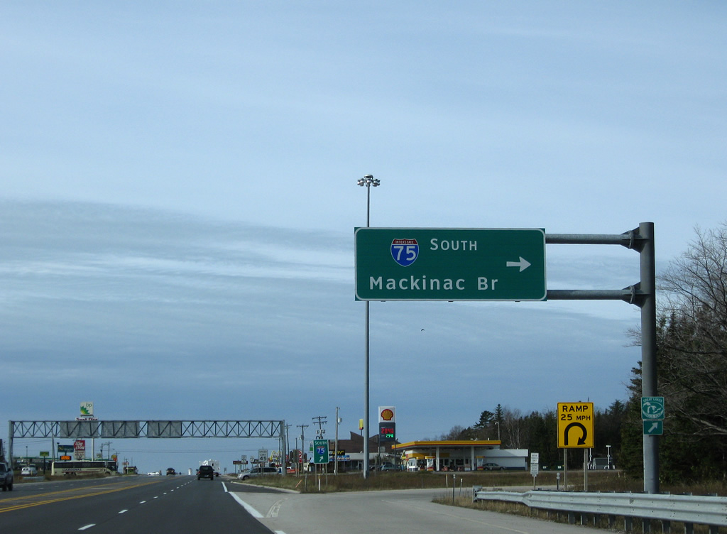
| Nearing the northbound on-ramp for Interstate 75 to Sault Ste. Marie on Business Loop I-75 south. 11/06/09 |
|
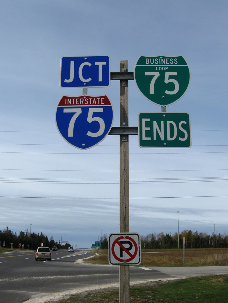
| An end shield assembly for Business Loop I-75 south resides at Chambers Street. 11/06/09 |
|
| A right turn takes drivers onto Interstate 75 north for its final 50.5 miles to the International Bridge linking Michigan with Sault Ste. Marie, Ontario. 11/06/09 |
|
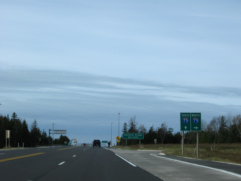
| A loop ramp follows from Business Loop I-75 south onto Interstate 75 south across the Mackinac Bridge. 11/06/09 |
|
| Leading south across the tolled Mackinac Bridge, Interstate 75 travels 64 miles to Gaylord and 194 miles to Saginaw on the Lower Peninsula. 11/06/09 |
|
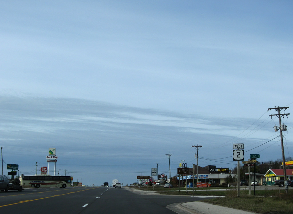
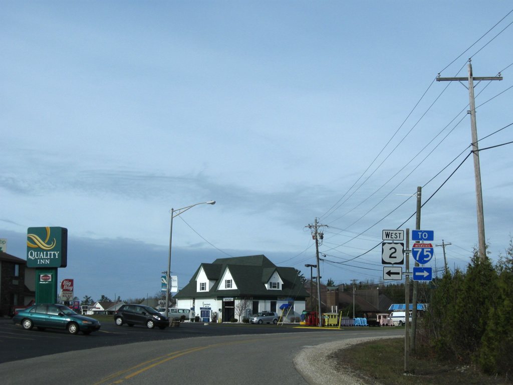
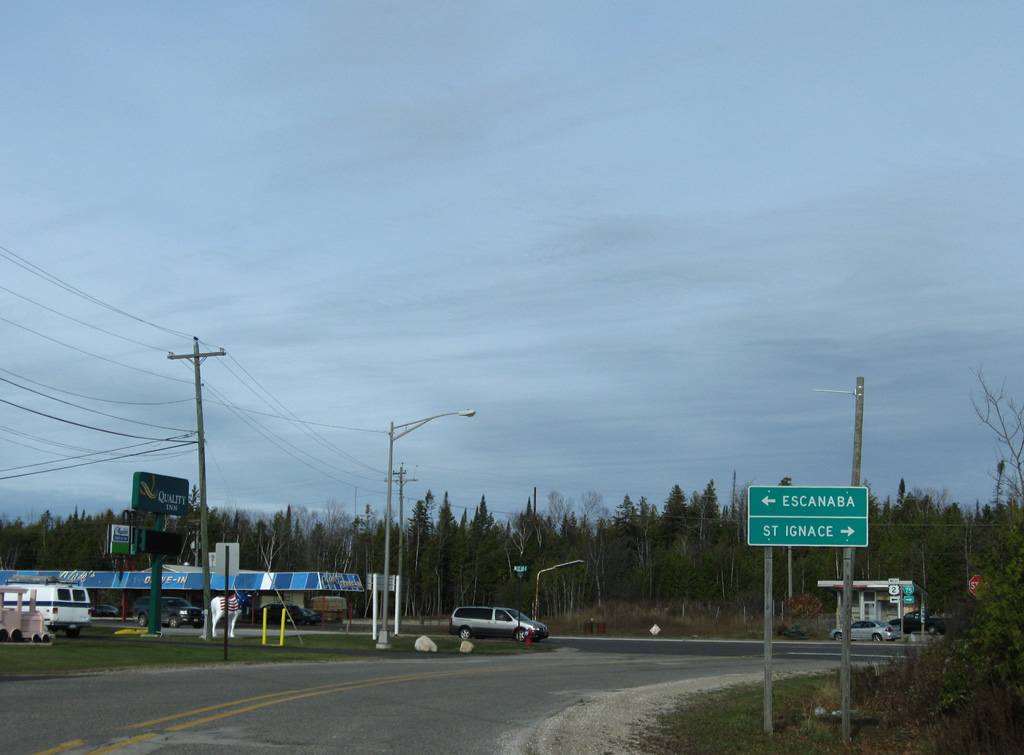
| The western segment of U.S. 2 takes over the four lane arterial of Business Loop I-75 west from I-75 to Manistique and Escanaba. 11/06/09 |
|
| The first reassurance marker for U.S. 2 west follows I-75 at First Street. Next is Boulevard Drive, which leads south to Bridge View Park. 11/06/09 |
|
| Boulevard Drive lowers 100 feet in elevation from U.S. 2 to Bridge View Park. 11/06/09 |
|
| Bridge View Park provides unobstructed, and chilly at times, views of the Mackinac Bridge. The suspension bridge stretches 26,372 feet across the Straits of Mackinac to join the Upper and Lower Peninsulas of Michigan. The five mile span opened to traffic on November 1, 1957.2 11/06/09 |
|
| Mc Gulpin Point spreads into view south of the Straits of Mackinac and west of Mackinaw City. Green Island protrudes from the cold waters just west of Bridge View Park. 11/06/09 |
|
| Boulevard Drive exits Bridge View Park and ascends toward Father Marquette National Memorial and U.S. 2. 11/06/09 |
|
| Angling northwest, Boulevard Drive leaves the entrance road to Father Marquette National Memorial to end at U.S. 2. U.S. 2 enters St. Ignace from Naubinway along the north shore of Lake Michigan to end at Interstate 75. 11/06/09 |
|
| The western segment of U.S. 2 stretches 2,112 miles from St. Ignace west to Everett, Washington. The route combines with U.S. 41 south from Rapid River to Escanaba in 125 miles. 11/06/09 |
|
| U.S. 2 ends at I-75 with Business Loop I-75 overtaking the former route through St. Ignace. 11/06/09 |
Page Updated 10-24-2013.


 East
East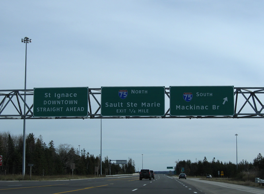

 South
South