|
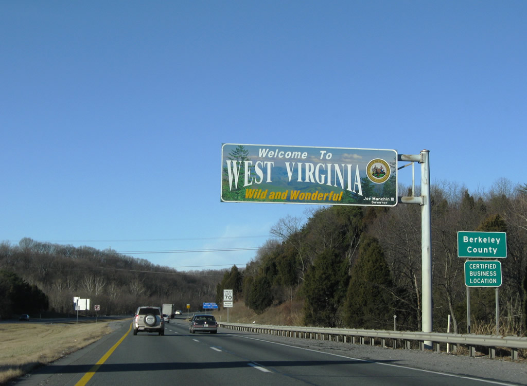
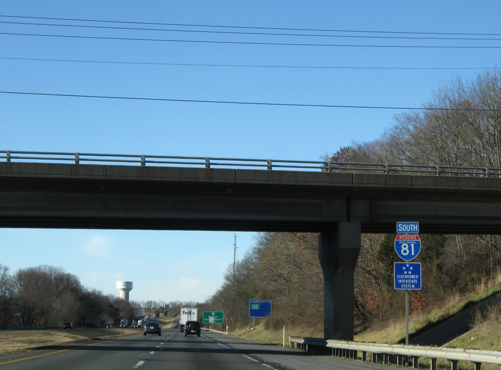
| Interstate 81 enters Berkeley County south across the Potomac River. 12/30/08 |
|
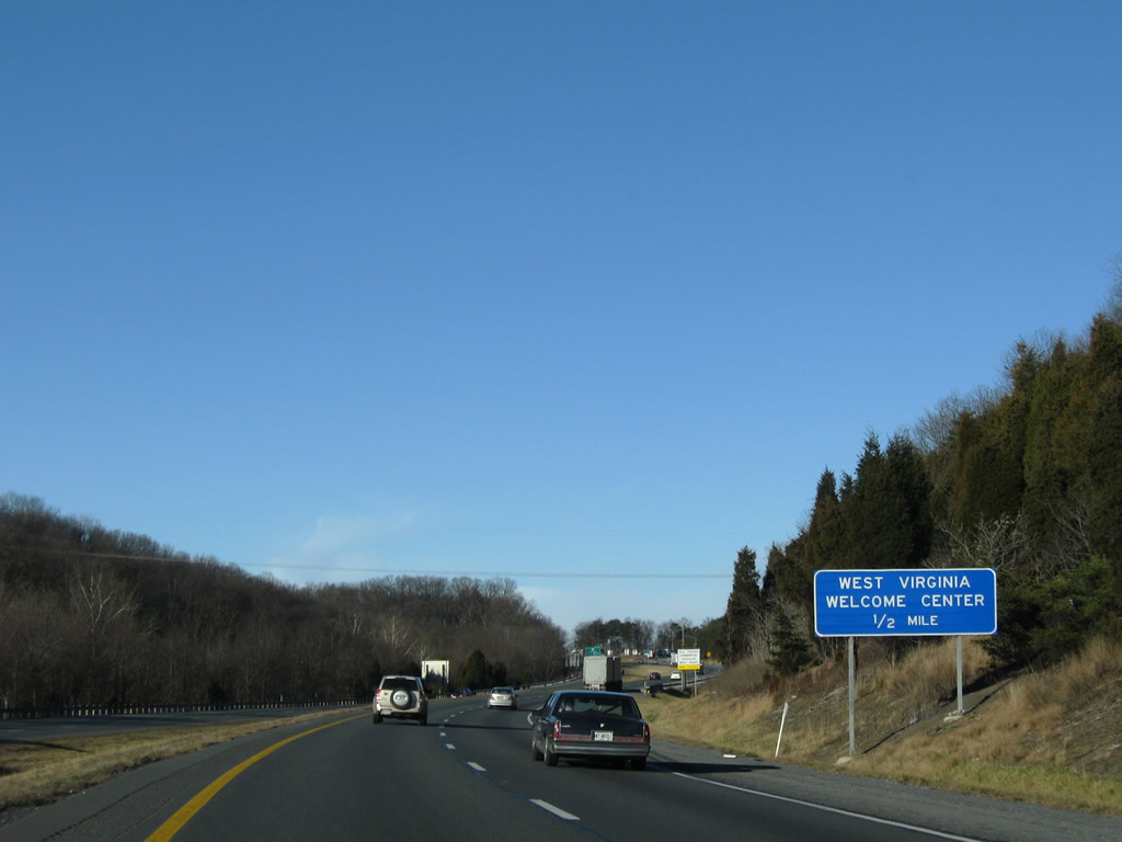
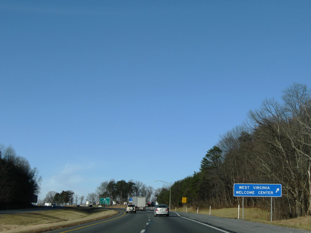
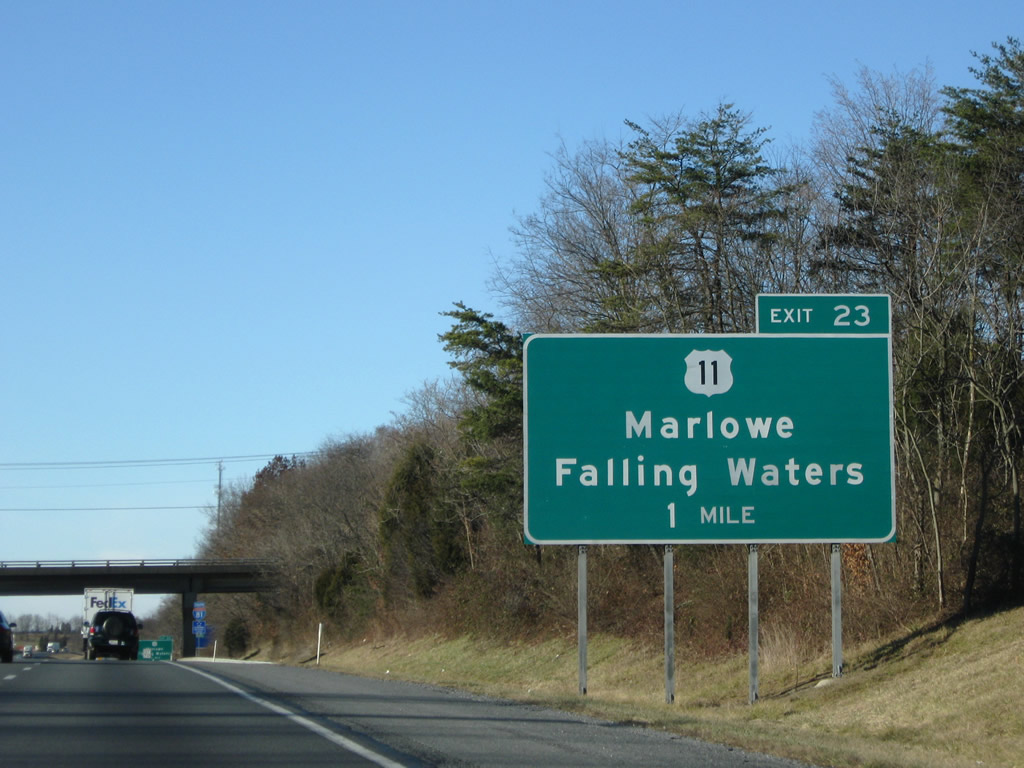
| A tourist information center and rest area lie one half mile ahead along Interstate 81 south (west) near Marlowe. 12/30/08 |
|
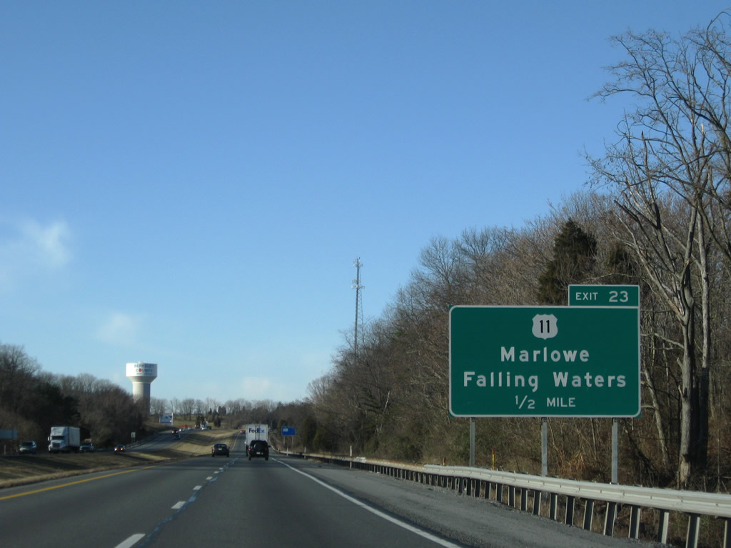
| Southbound Interstate 81 at the West Virginia welcome center. U.S. 11 parallels the freeway to the north from Williamsport, Maryland through Marlowe. 12/30/08 |
|
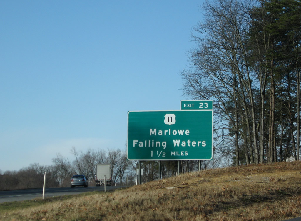
| I-81 converges with U.S. 11, 1.5 miles south of the welcome center at Exit 23. U.S. 11 follows Williamsport Pike through Marlowe. 12/30/08 |
|
| A diamond interchange joins Interstate 81 with U.S. 11 (Williamsport Pike) one mile west of the Broad Lane overpass. 12/30/08 |
|
| The first state named shield for Interstate 81 posted in quite some distance appears below the Broad Lane overpass. 12/30/08 |
|
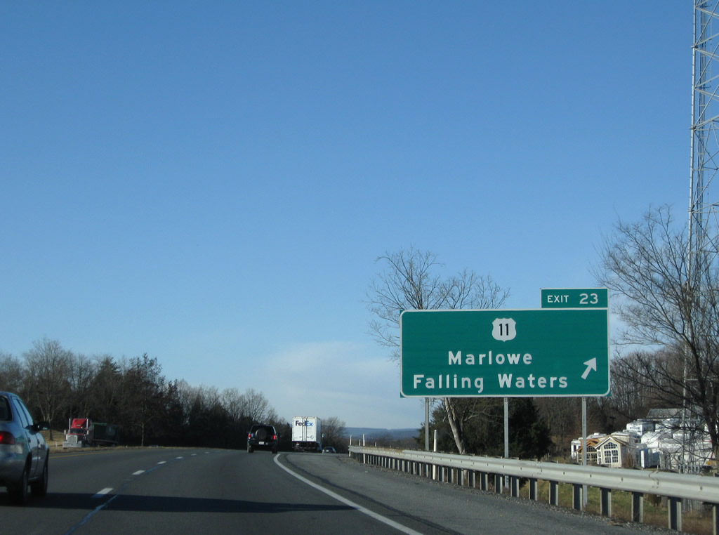
| U.S. 11 switches sides from north of Interstate 81 to southeast at Exit 23. U.S. 11 continues southwest to the Potomac Riverside community of Falling Waters. 12/30/08 |
|
| Exit 23 departs Interstate 81 south for U.S. 11 (Williamsport Pike). U.S. 11 does not meet the freeway again directly until Winchester, Virginia. 12/30/08 |
|
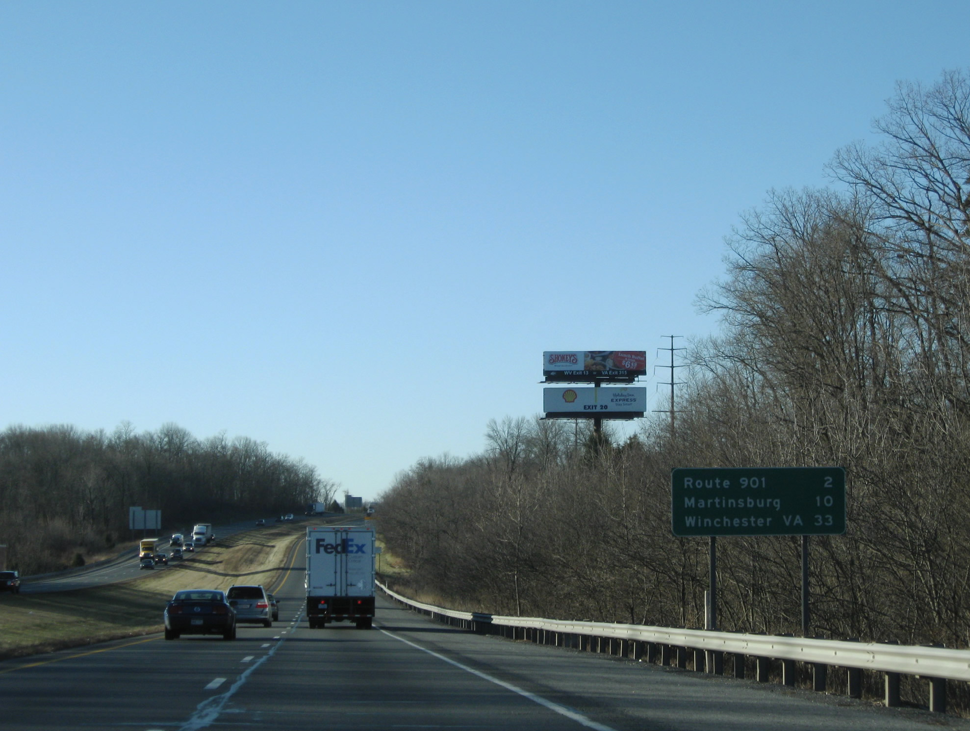
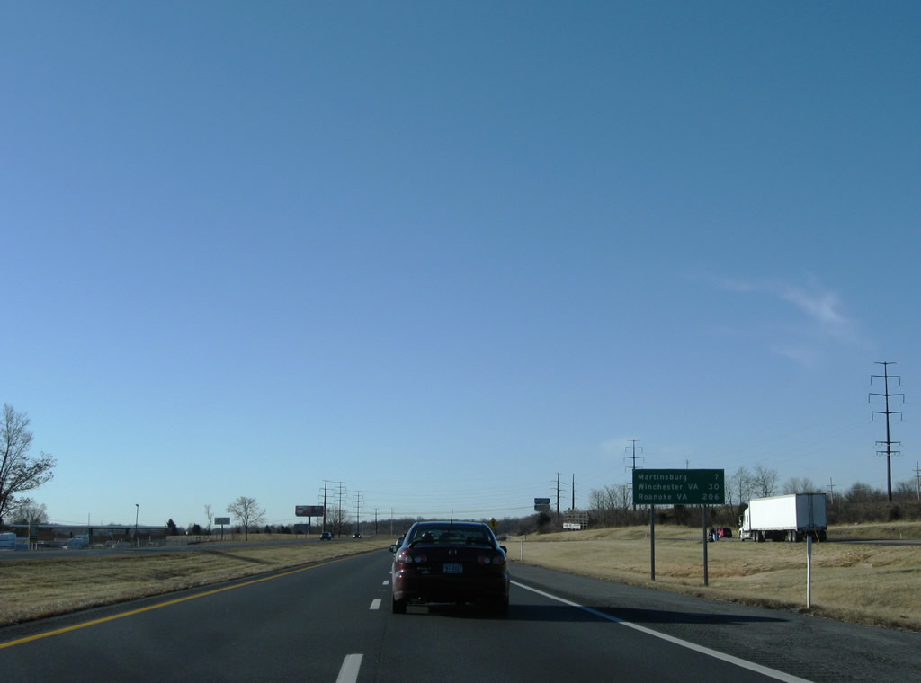
| Martinsburg, the main city in the eastern arm of West Virginia, lies ten miles to the south. Route 901 (Hammonds Mill Road) crosses paths with Interstate 81 in two miles. 12/30/08 |
|
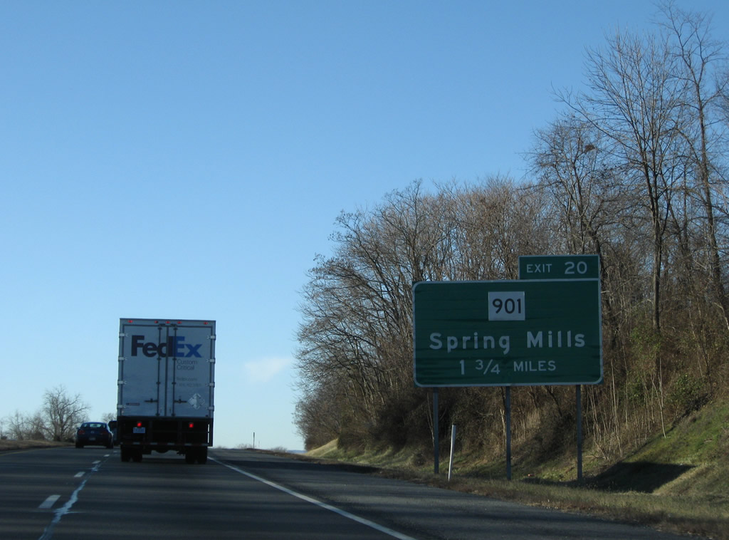
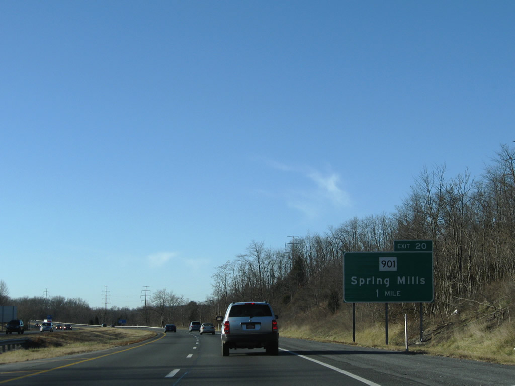
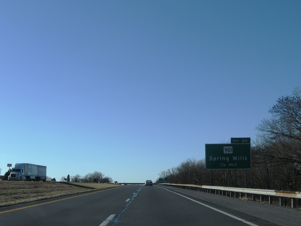
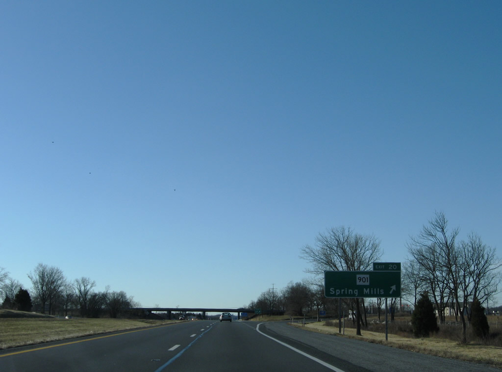
| West Virginia Route 901 connects U.S. 11 (Williamsport Pike) to the east with Spring Mills to the west. 12/30/08 |
|
| A diamond interchange joins Interstate 81 with Route 901 (Hammonds Mills Road) at Exit 20. 12/30/08 |
|
| Route 901 derives its number from Route 9 at Hedgesville. The state route travels six miles between Route 9 and U.S. 11. 12/30/08 |
|
| Development at the previously rural interchange with Route 901 (Hamonds Mills Road) added big box retail, strip malls and residential subdivisions. 12/30/08 |
|
| A parking area follows the entrance ramp from Route 901 adjacent to this distance sign listing Roanoke, Virginia for the first time. 12/30/08 |
|
| WVDOT typically posts Community Interchanges Identificaton Signs in urban areas. This assembly references the first three of four Martinsburg exits from Interstate 81 south. 12/30/08 |
|
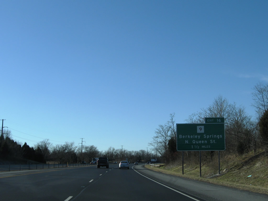
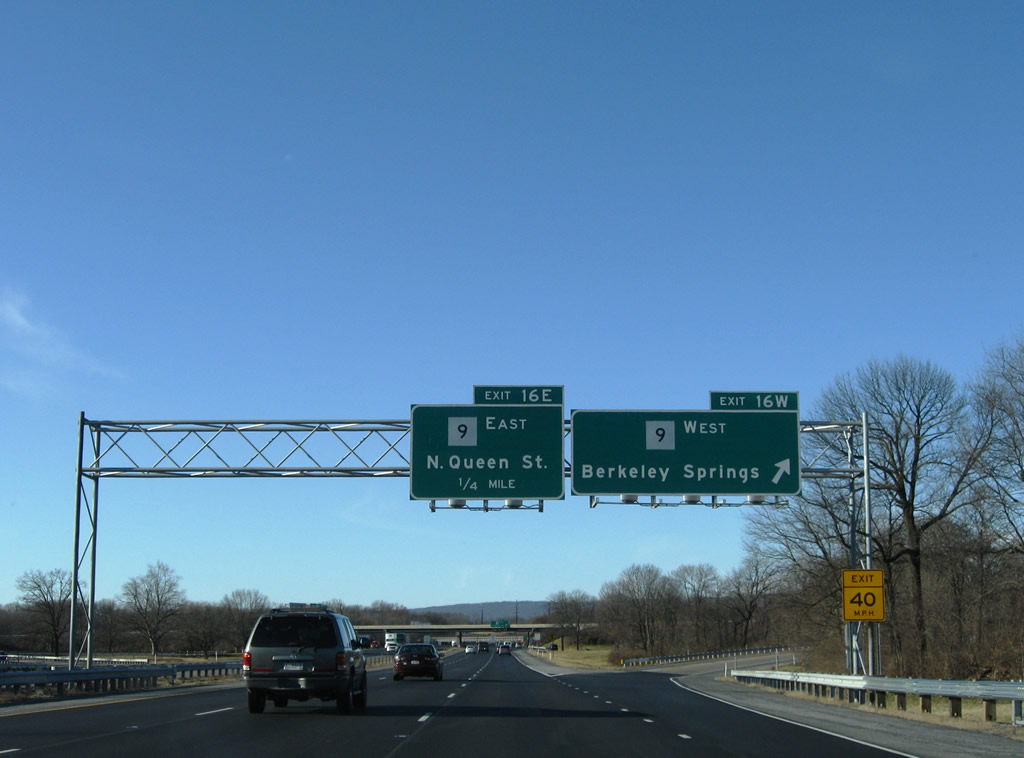
| Route 9 (Hedgesville Road) leads five miles south from Hedgesville and Route 901 to a cloverleaf interchange (Exits 16W/E) with Interstate 81. 12/30/08 |
|
| Route 9 forms a multi state highway with Virginia State Route 9 east to Leesburg. Westward, the state route becomes MD 51 across the Potomac River near Paw Paw. 12/30/08 |
|
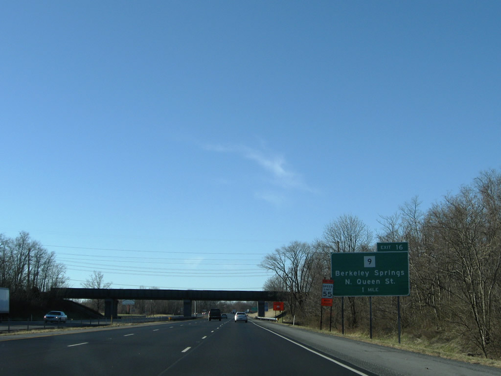
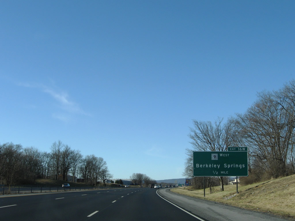
| Exit 16W departs Interstate 81 south in one half mile for Route 9 (Hedgesville Road) west to Berkeley Springs and U.S. 522. 12/30/08 |
|
| Surburbanization of Route 9 leading to North Mountain converted rural farm land to housing tracts on the drive to Hedgesville. Route 9 is part of a growing commuter corridor leading into Northern Virginia. Because of increasing traffic, an expressway was built from Martinsburg southeast to the Charles Town bypass and eastward to Loudon County, Virginia. 12/30/08 |
|
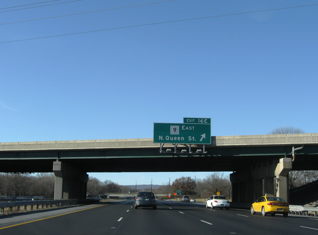
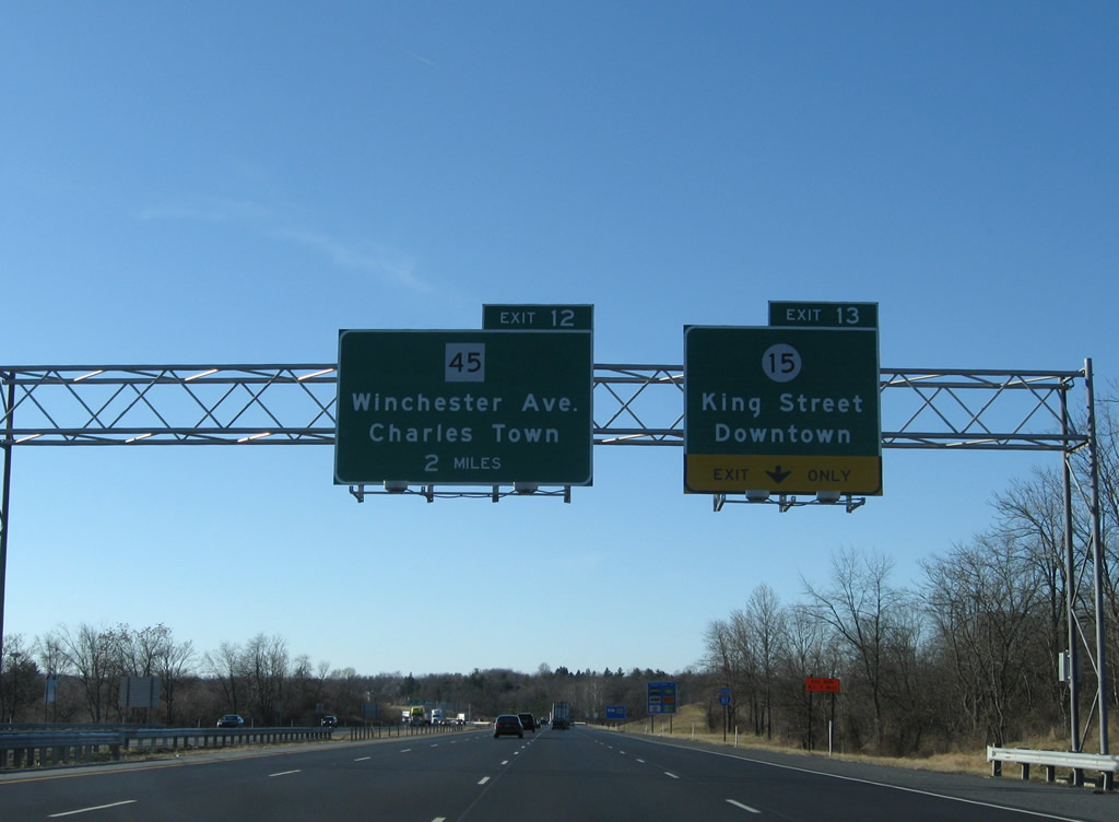
| Route 9 follows Edwin Miller Boulevard south to become N Queen Street in Martinsburg. The state route joins U.S. 11 through the central business district. Shepherd University lies east of N Queen Street via Route 45 east to Shephardstown. 12/30/08 |
|
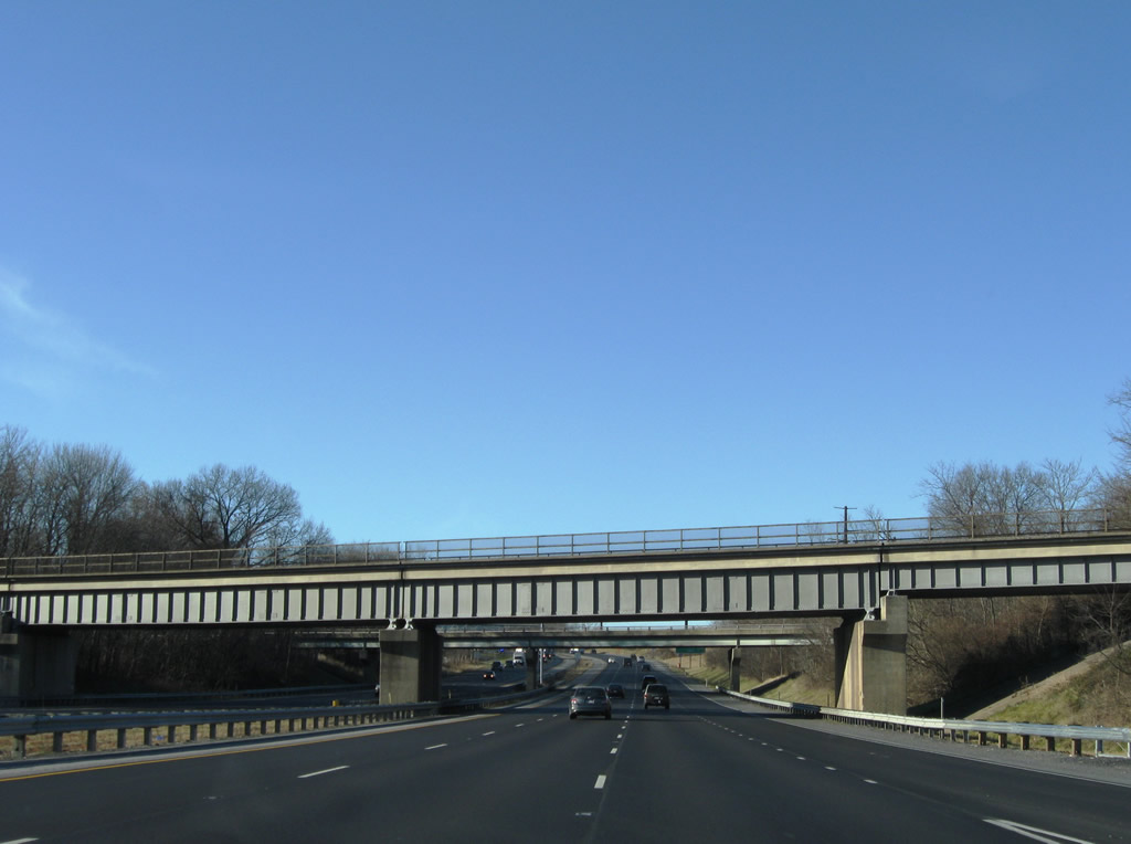
| Interstate 81 maintains six overall lanes through Martinsburg. A CSX Railroad bridge and Rock Cliff Drive (CR 10) pass over the freeway in this scene. 12/30/08 |
|
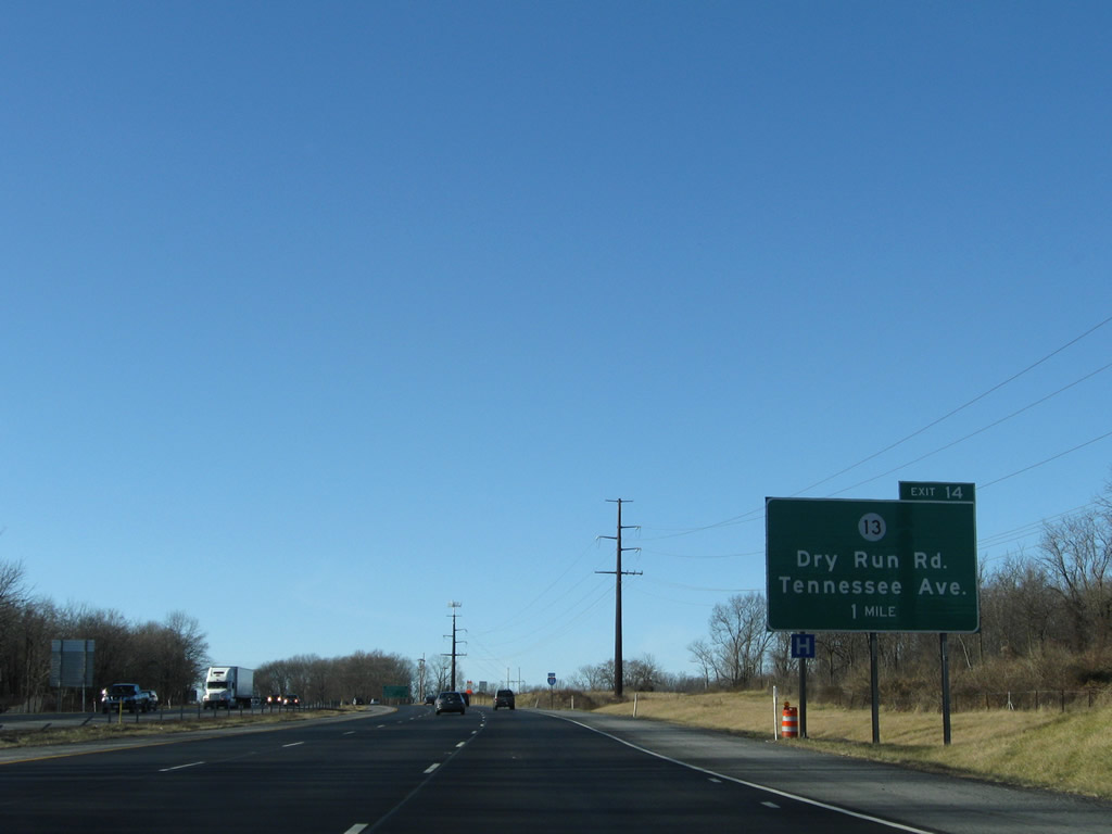
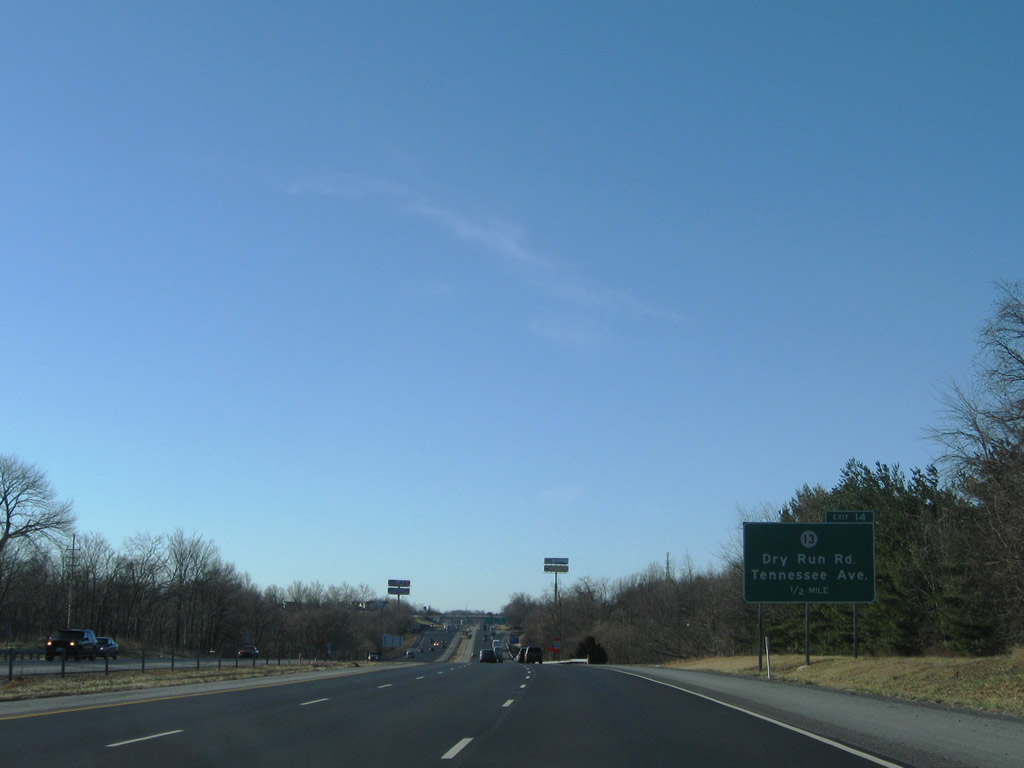
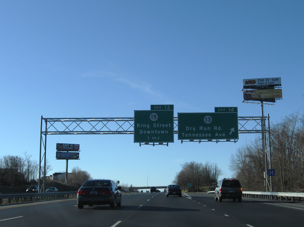
| A diamond interchange links Interstate 81 with CR 13 (Dry Run Road) at forthcoming Exit 14. 12/30/08 |
|
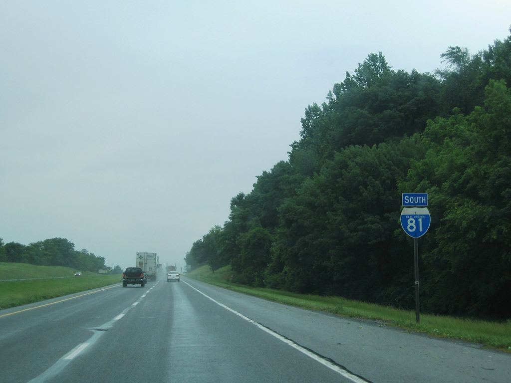
| Reassurance shield posted for Interstate 81 south ahead of Martinsburg. 12/30/08 |
|
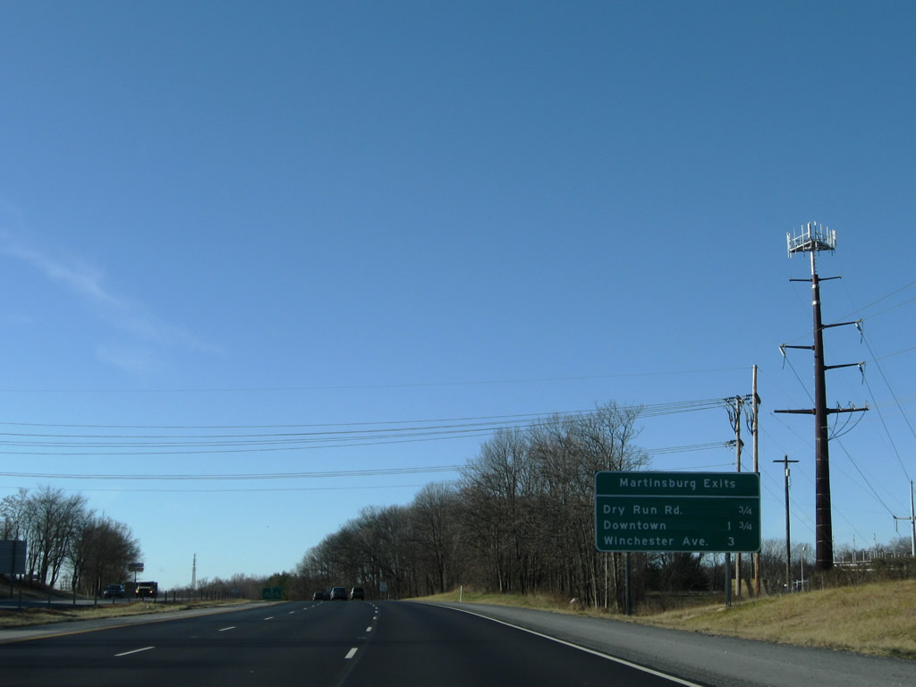
| Exits 14-13-12 all provide access to the Berkeley County seat of Martinsburg to the east. Interstate 81 straddles the western city limits between Dry Run Road and Winchester Avenue. 12/30/08 |
|
| CR 13 follows Dry Run Road northwest from Tavern Road in Martinsburg toward North Mountain and Tomahawk. Exit 14 opened after the initial completion of Interstate 81. 12/30/08 |
|
| Tavern Road meanders through north Martinsburg to Moler Avenue and Route 45 at U.S. 11/Route 9 (N Queen Street). Tennessee Avenue stems southward to the Rosemont section of the city. 12/30/08 |
|
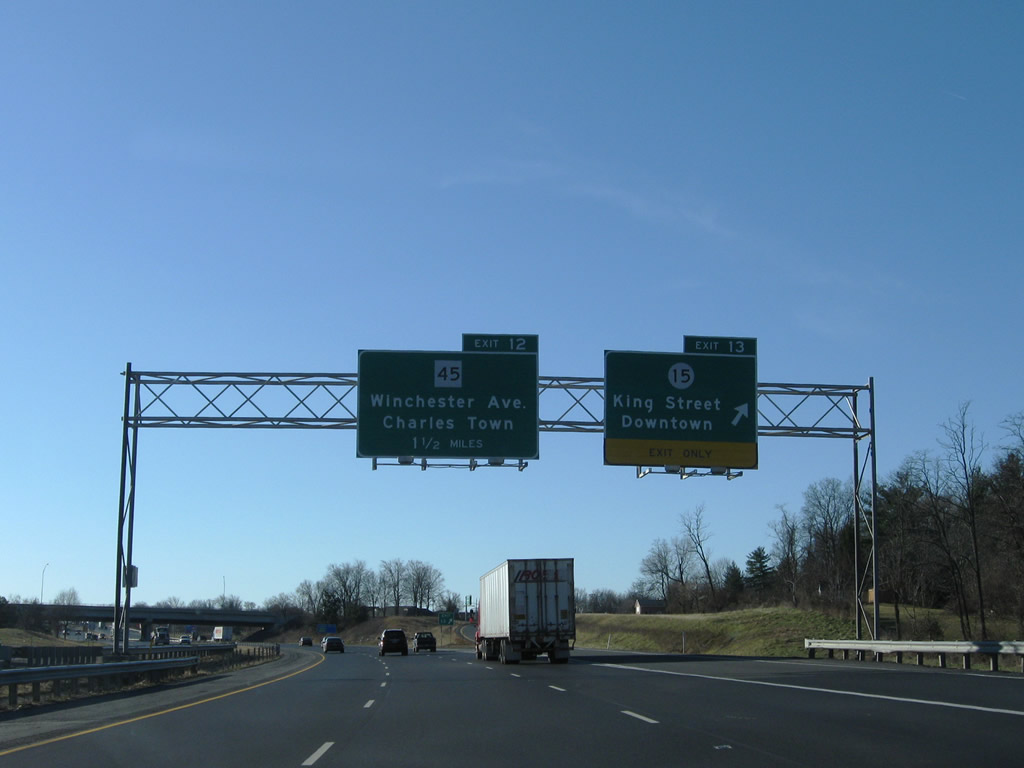
| A diamond interchange (Exit 13) follows with CR 15 (King Street east / Tuscarorar Pike west) on Interstate 81 south. King Street provides a direct route to Downtown. 12/30/08 |
|
| Interstate 81 crosses Tuscarora Creek south beyond this confirming marker. 12/30/08 |
|
| U.S. 11 follows King Street west from Route 9/45 (S Queen Street) to Winchester Avenue south. CR 15 extends west to the Rosemont neighborhood and Interstate 81 at Exit 13. Tuscarora Pike continues CR 15 west to Nollville. 12/30/08 |
|
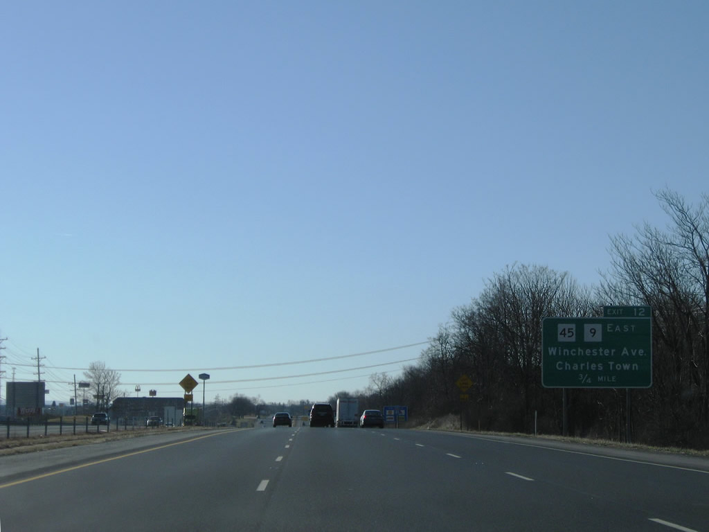
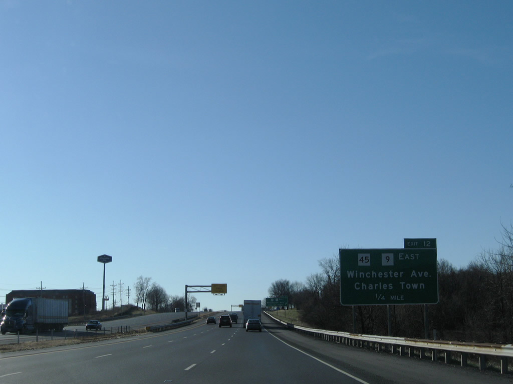
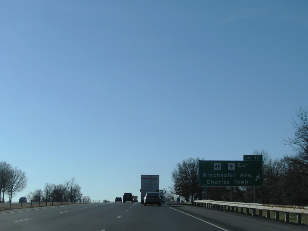
| West Virginia Route 45 (Apple Harvest Drive) meets Interstate 81 at a diamond interchange (Exit 12) west of U.S. 11 (Winchester Avenue). 12/30/08 |
|
| Route 45 provides a direct route to the Route 9 expressway leading southeast to Kearneysville and Charles Town (U.S. 340). Westward, Route 9 continues to Glengary and SR 681 at the Virginia state line near Little Mountain. 12/30/08 |
|
| Exit 12 leaves I-81 south for Route 45 (Apple Harvest Drive). U.S. 11 (Winchester Avenue) parallels I-81 nearby to Downtown Martinsburg, Pikeside and Eastern Virginia Regional Airport (MRB). 12/30/08 |
|
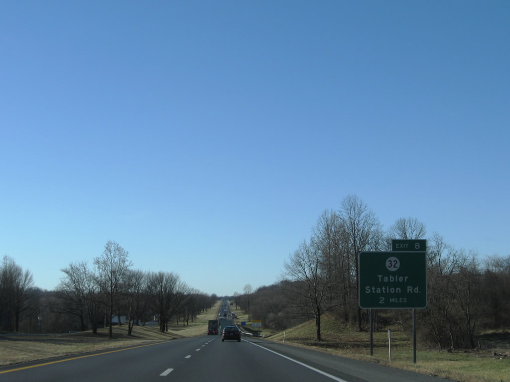
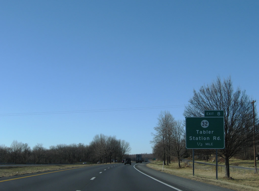
| Interstate 81 reduces to four lanes ahead of Exit 8 with County Route 32. 12/30/08 |
|
| A frontage road (CR 81/3) accompanies I-81 south to the diamond interchange with CR 32 (Tabler Station Road). Tabler Station Road heads east to U.S. 11 (Winchester Avenue) near the airport. 12/30/08 |
|
| Exit 8 departs I-81 south for CR 32 (Tabler Station Road) west to Arden and east to Tablers Station. Exit 8 was added sometime after the initial completion of the freeway. 12/30/08 |
|
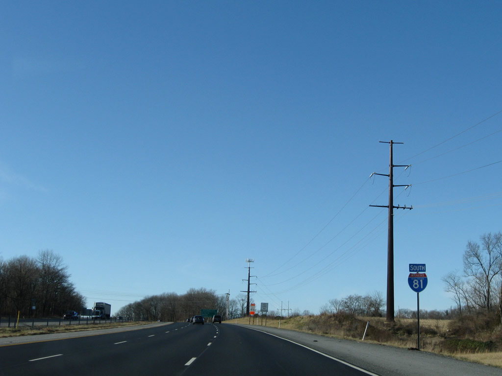
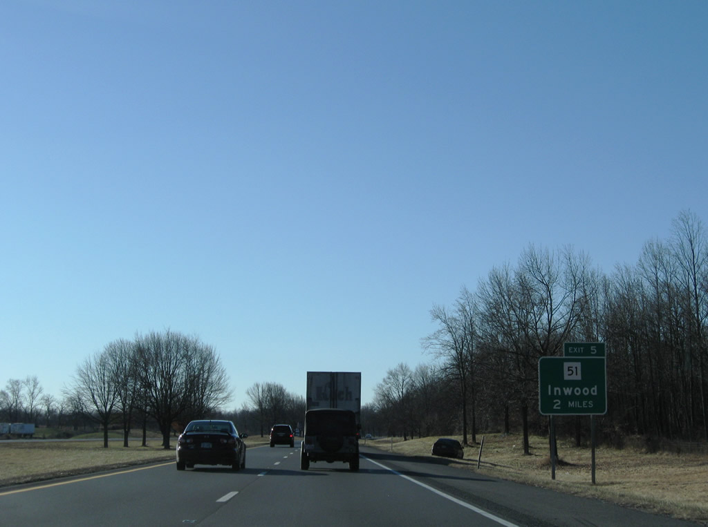
| Advancing south, Interstate 81 continues to the community of Inwood at Exit 5 and Winchester, Virginia. 06/01/04, 12/30/08 |
|
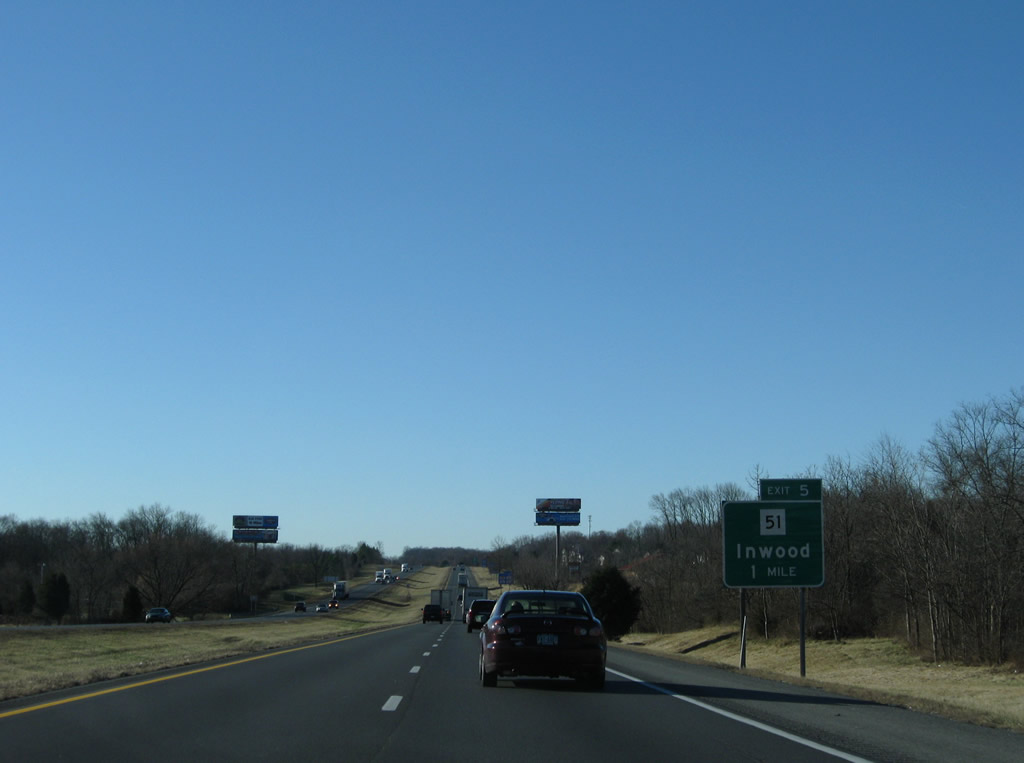
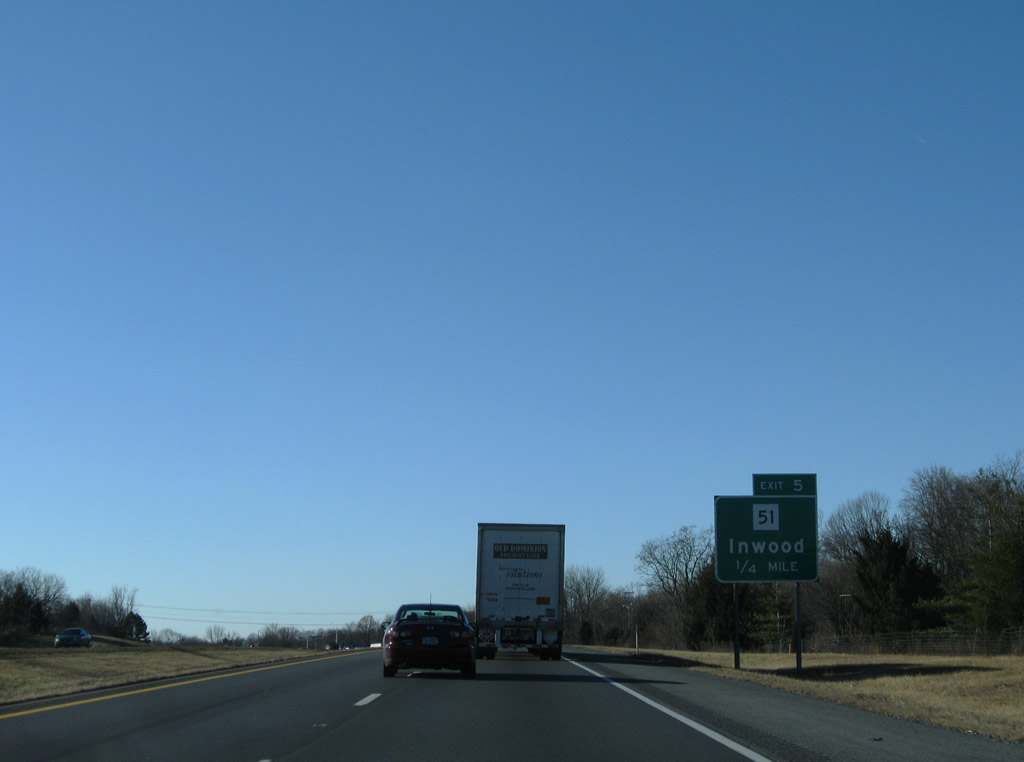
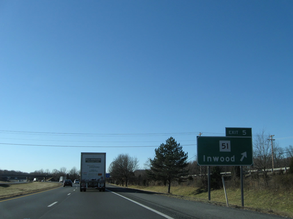
| Route 51 (Gerrardstown Road) meets Interstate 81 at Inwood and the diamond interchange at Exit 5. 12/30/08 |
|
| Route 51 (Gerrardstown Road) travels east 12 miles to Charles Town and west five miles to conclude at Route 45. 12/30/08 |
|
| Route 51 heads a short distance west to Gerrardstown. Leading east from Exit 5, Route 51 combines with U.S. 11 (Winchester Avenue) south within Inwood. 12/30/08 |
|
| Inwood, like areas of Martinsburg to the north, is suburban. A number of subdivisions lie adjacent to Interstate 81 on this stretch. 06/01/04, 12/30/08 |
|
| Approaching the Sam Mason Road overpass, I-81 advances to within two miles of Virginia State Route 669 (Rest Church Road). 12/30/08 |
|
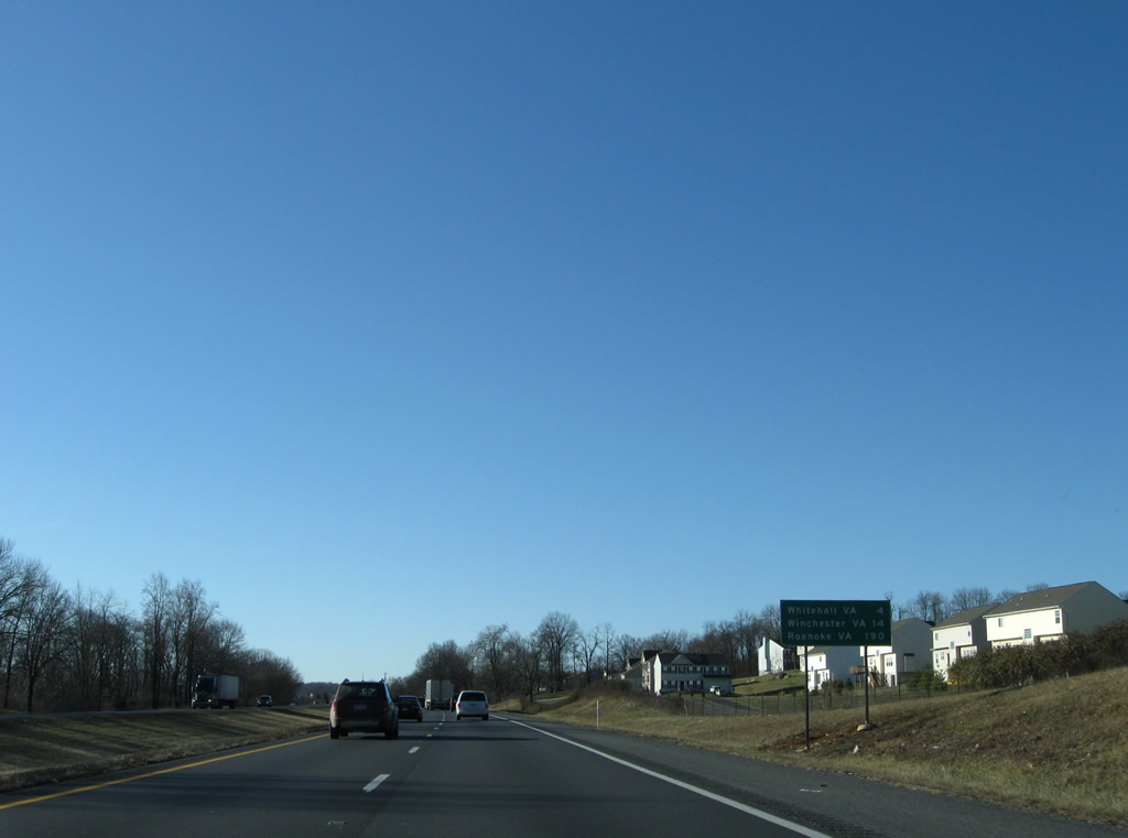
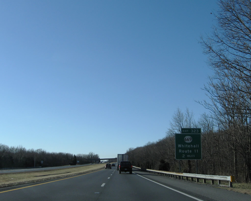
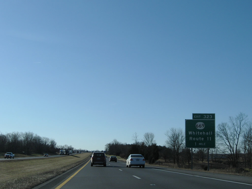
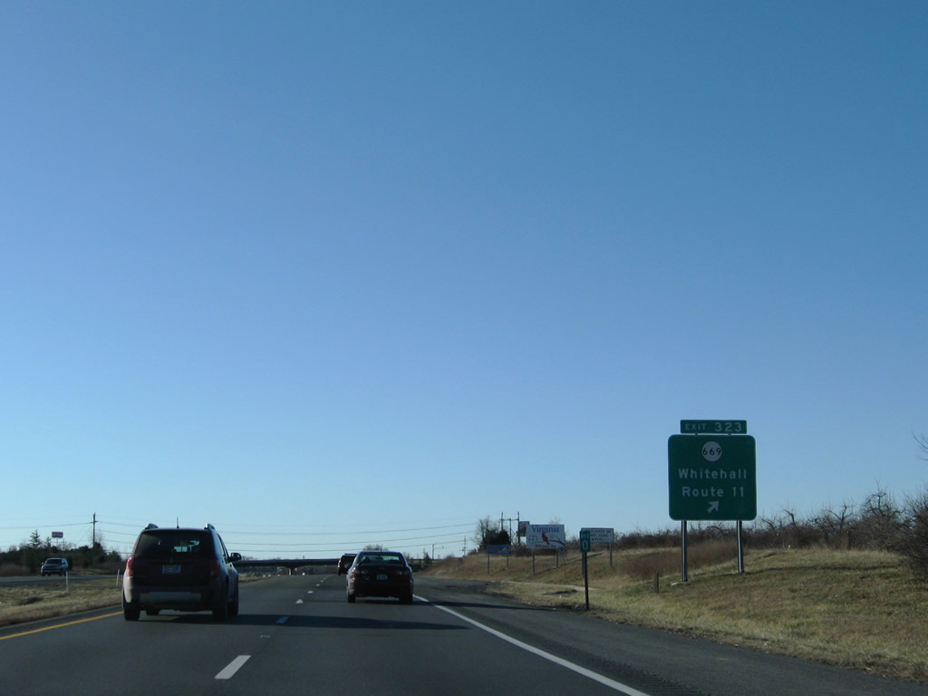
| SR 669 (Rest Church Road) runs west from U.S. 11 (Martinsburg Pike) at Rest to SR 661 south to Grimes and SR 671 west to Whitehall. 12/30/08 |
|
| Milepost zero for Interstate 81 in West Virginia precedes the diamond interchange (Exit 323) with SR 669. U.S. 11 (Martinsburg Pike) enters Virginia nearby from Bunker Hill and Ridgeway and remains close to I-81 through Clear Brook. 12/30/08 |
Page Updated 04-17-2010.

 South
South