Exit 11 constitutes a directional T interchange with a short freeway spur leading south to adjacent Route 34 (Berkshire Road). The exchange was built for the unconstructed Route 25 freeway, a 1960s-80s proposal for a high speed route between Danbury and Bridgeport. Route 25 is a freeway from I-95 northward to Route 111 in Trumbull, but funding issues curtailed the building of the highway northward to I-84 at Exit 11. Plans to upgrade Route 25 were dropped in 1993, and later plans called for replacing the ramps at Exit 11 with a diamond interchange and a new at-grade route south to Route 25 beyond Newtown.1
|
| Interstate 84 east enters the Constitution State and the city of Danbury within the diamond interchange (Exit 1) for Saw Mill Road. Saw Mill Road leads 1.14 miles south into the town of Ridgefield. 08/19/21 |
|
| U.S. 6/202 parallel Interstate 84 to the north from Brewster, New York east into Danbury along Mill Plain Road. 08/19/21 |
|
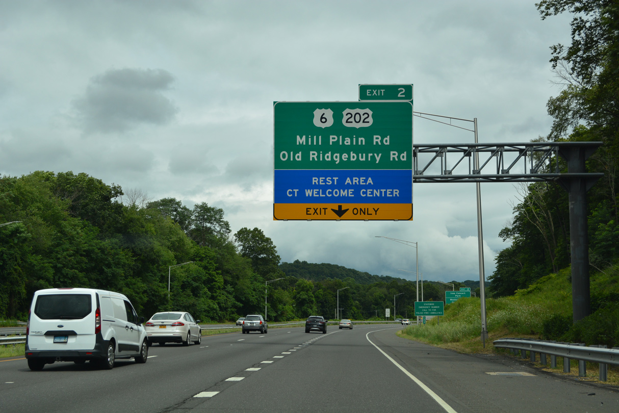
| A diamond interchange joins Interstate 84 with Milestone Road north to adjacent U.S. 6/202 (Mill Plain Road) and the former Union Carbide campus. With two additional freeway ramps, Old Ridgebury Road spans I-84 nearby. 08/19/21 |
|
| Ives Concert Park lies northeast of U.S. 6/202 along Driftway Road. Boehringer Ingelheim, a pharmaceutical company based out of Germany, has a large campus to the southeast off Old Ridgebury Road. 08/19/21 |
|
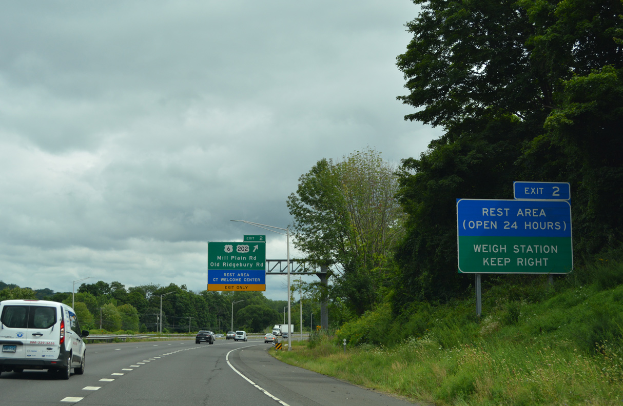
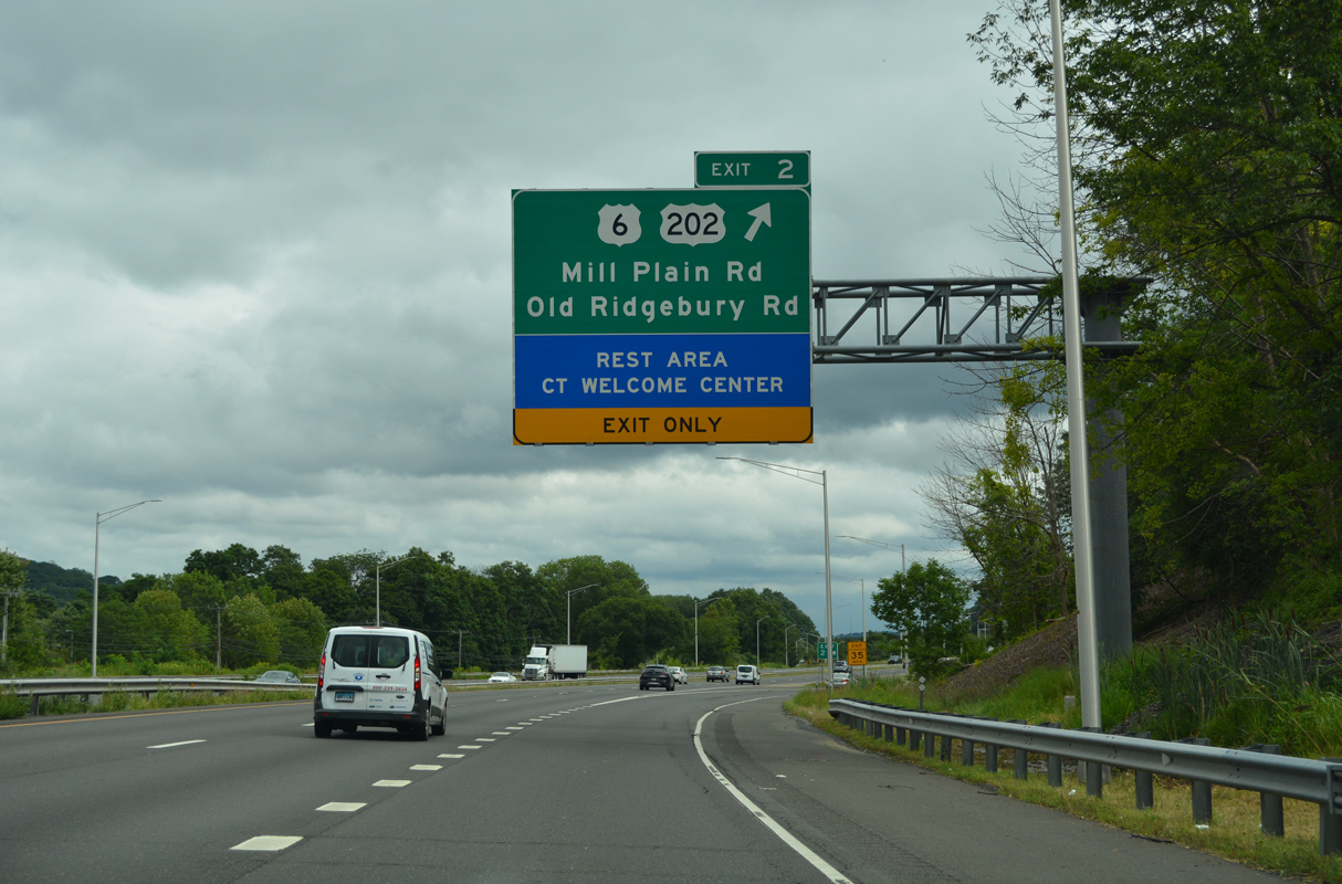
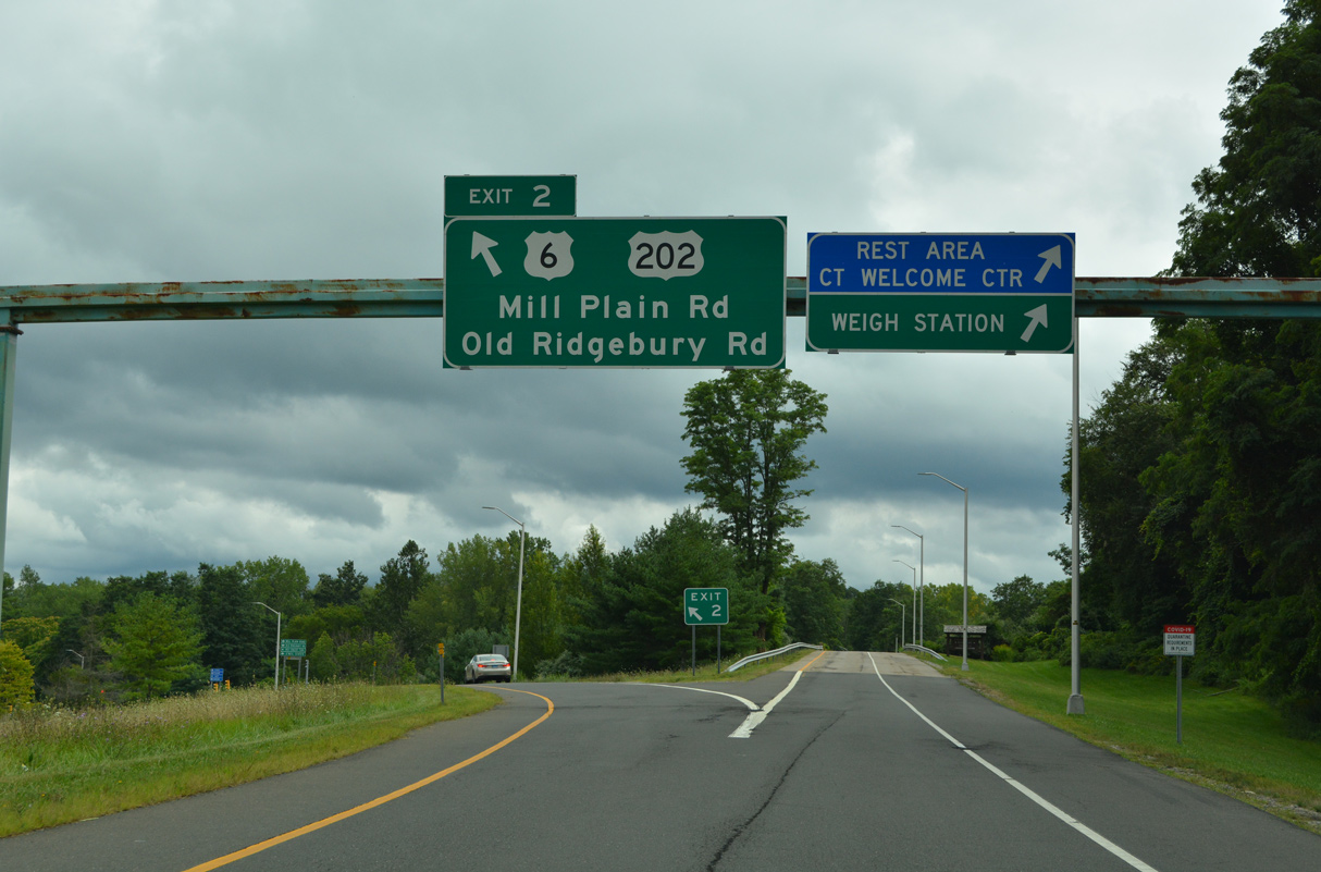
| A Connecticut welcome center, rest area and weigh station are located off of Exit 2. Rest areas are not as common on I-84 as they are on I-95 or the Merritt Parkway because it was never a toll road. 08/19/21 |
|
| Old Ridgebury Road stems 1.55 miles south from U.S. 6/202 into the town of Ridgefield ahead of Saw Mill Road. 08/19/21 |
|
| Exit 2 partitions into an access road for the CT welcome center/rest area and weigh station and off-ramp to Milestone Road for U.S. 6/202 (Mill Plain Road) at Mill Plain. 08/19/21 |
|
| Passing north of Lake Kenosia and Lake Kenosia Park, eastbound Interstate 84 expands with an auxiliary lane from the the Old Ridgebury Road entrance ramp to Exit 3. 08/19/21 |
|
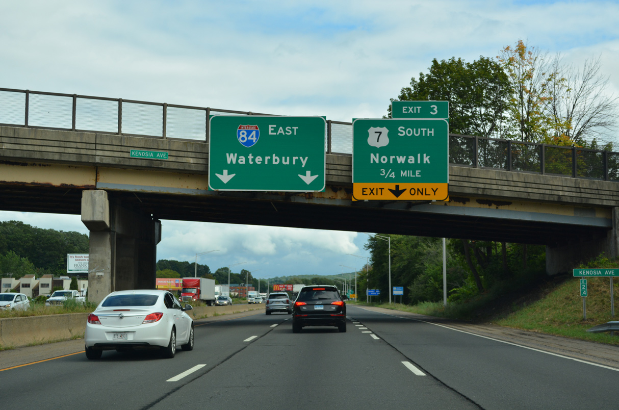
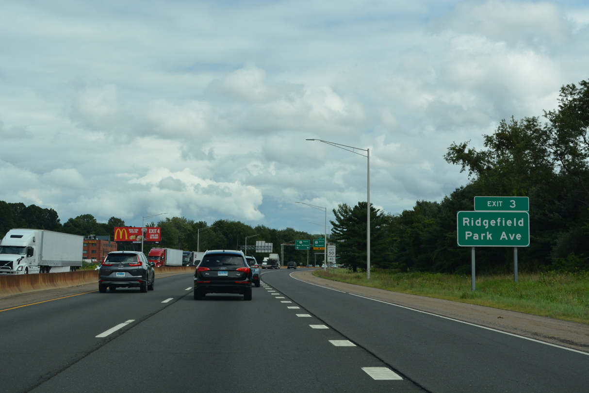
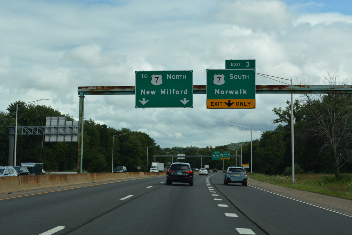
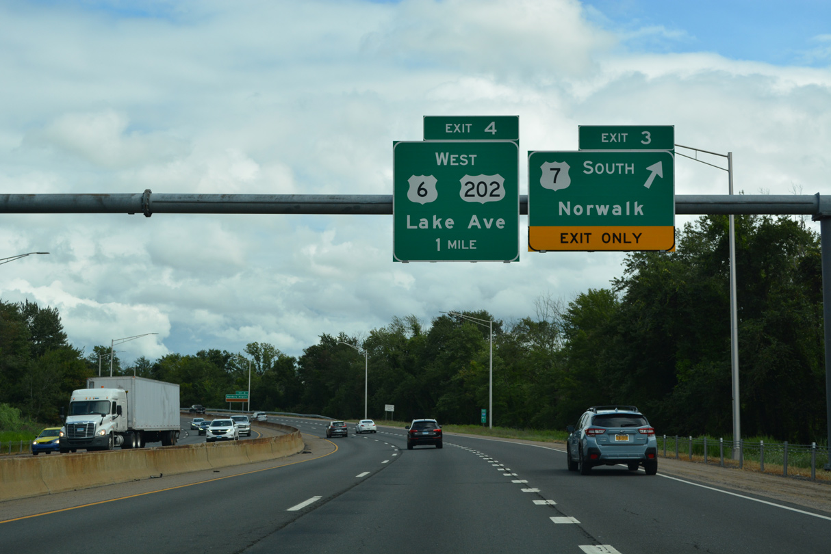
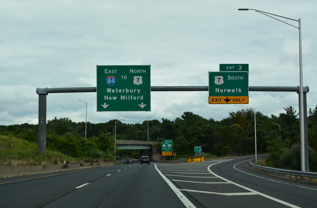
| A three-wye interchange at Exit 3 joins Interstate 84 with U.S. 7 south to Ridgefield, Wilton and the city of Norwalk. 08/19/21 |
|
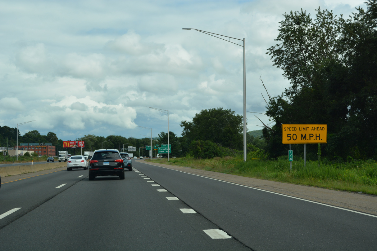
| Rural expressways in Connecticut generally have a 65 mph speed limit, but Interstate 84 across the Danbury metro area reduces to a 50 mph limit. 08/19/21 |
|
| Park Avenue, which leads northeast to Downtown Danbury and west to Danbury Fair mall, connects with the expressway along U.S. 7 just south of Exit 3. 08/19/21 |
|
| U.S. 7 branches south from I-84 west along a freeway 1.5 miles to Wooster Heights Road, Danbury Municipal Airport (DXR) and Wooster Mountain State Park. 08/19/21 |
|
| U.S. 7 between Danbury and I-95 was originally planned as a freeway that was cancelled due to community opposition. The bulk of the route is a two lane highway or four lane boulevard. 08/19/21 |
|
| U.S. 7 travels 21.6 miles south from I-84 at Exit 3 to Interstate 95 at Exit 15 in Norwalk. 08/19/21 |
|
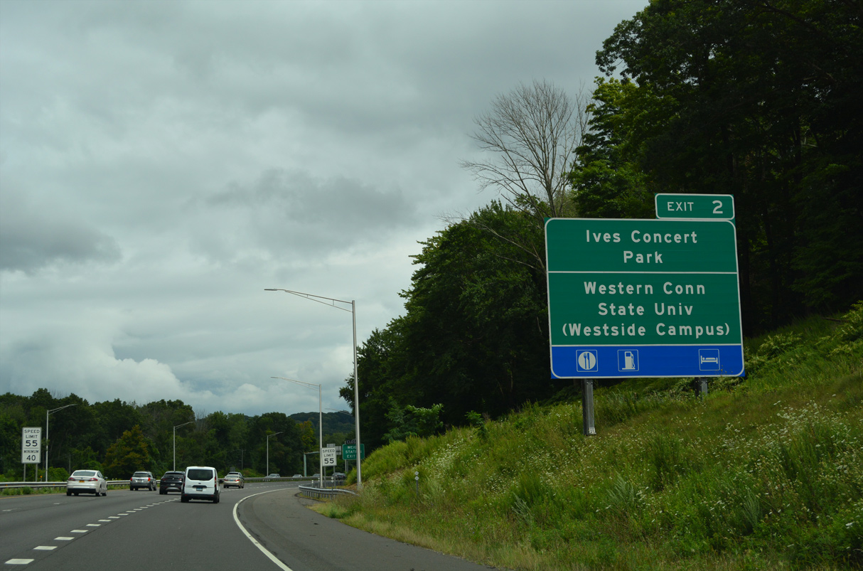
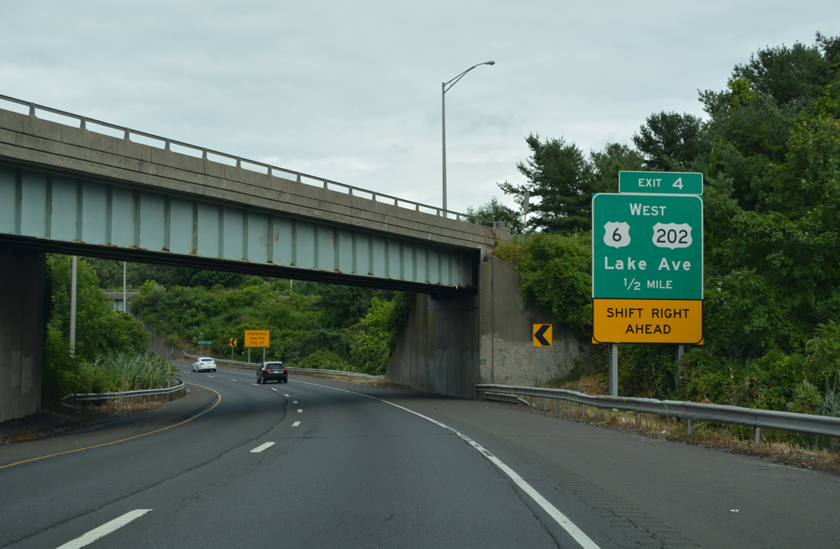
| Curving north, I-84 east combines with U.S. 7 ahead of a folded diamond interchange (Exit 4) with U.S. 6/202 (Lake Avenue). Lake Avenue leads U.S. 6/202 west to University Boulevard (Route 235) to the Western Connecticut State University - Westside Campus. 08/19/21 |
|
| Lake Avenue extends east from U.S. 6/202 and Exit 4 to West Street and Downtown Danbury. Bypassing Downtown to the north, U.S. 6/202 combine with I-84/U.S. 7. 08/19/21 |
|
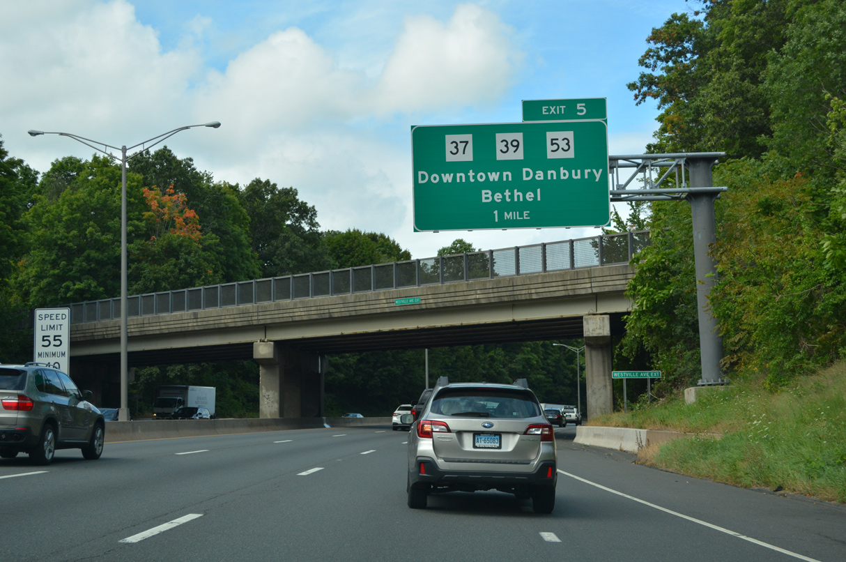
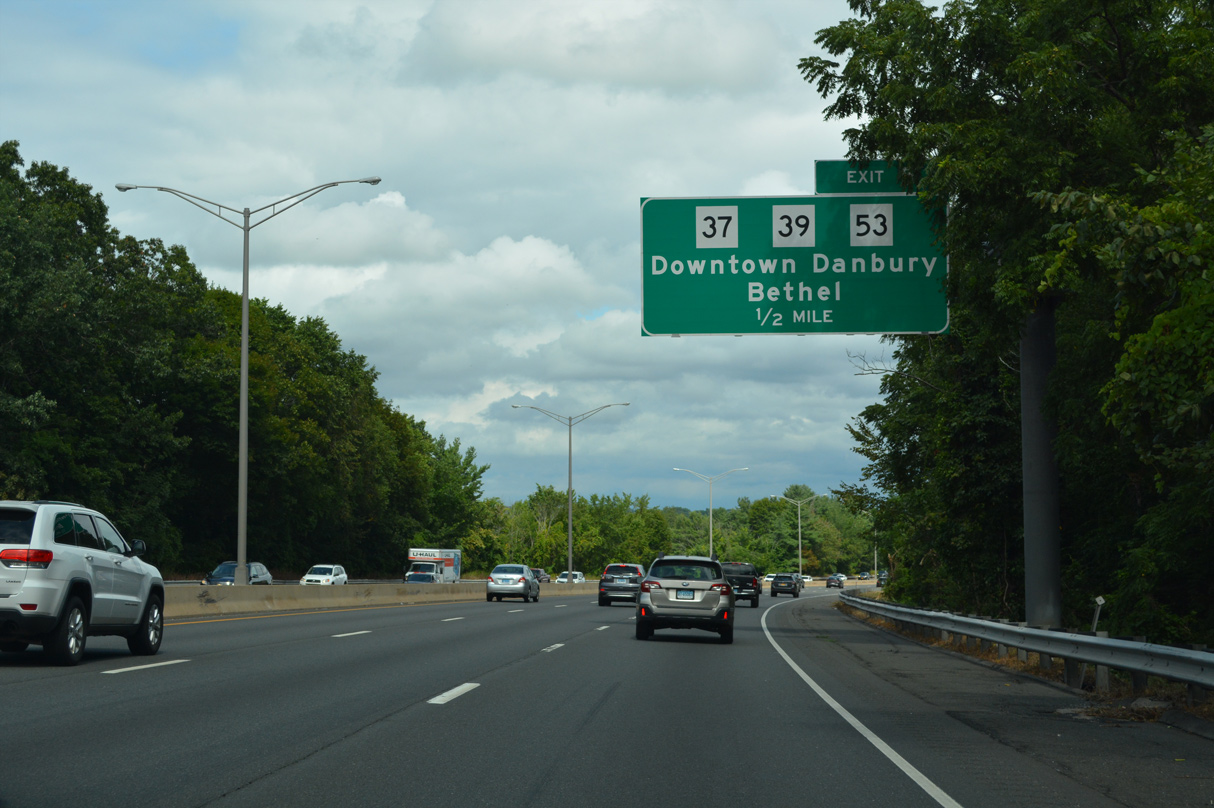
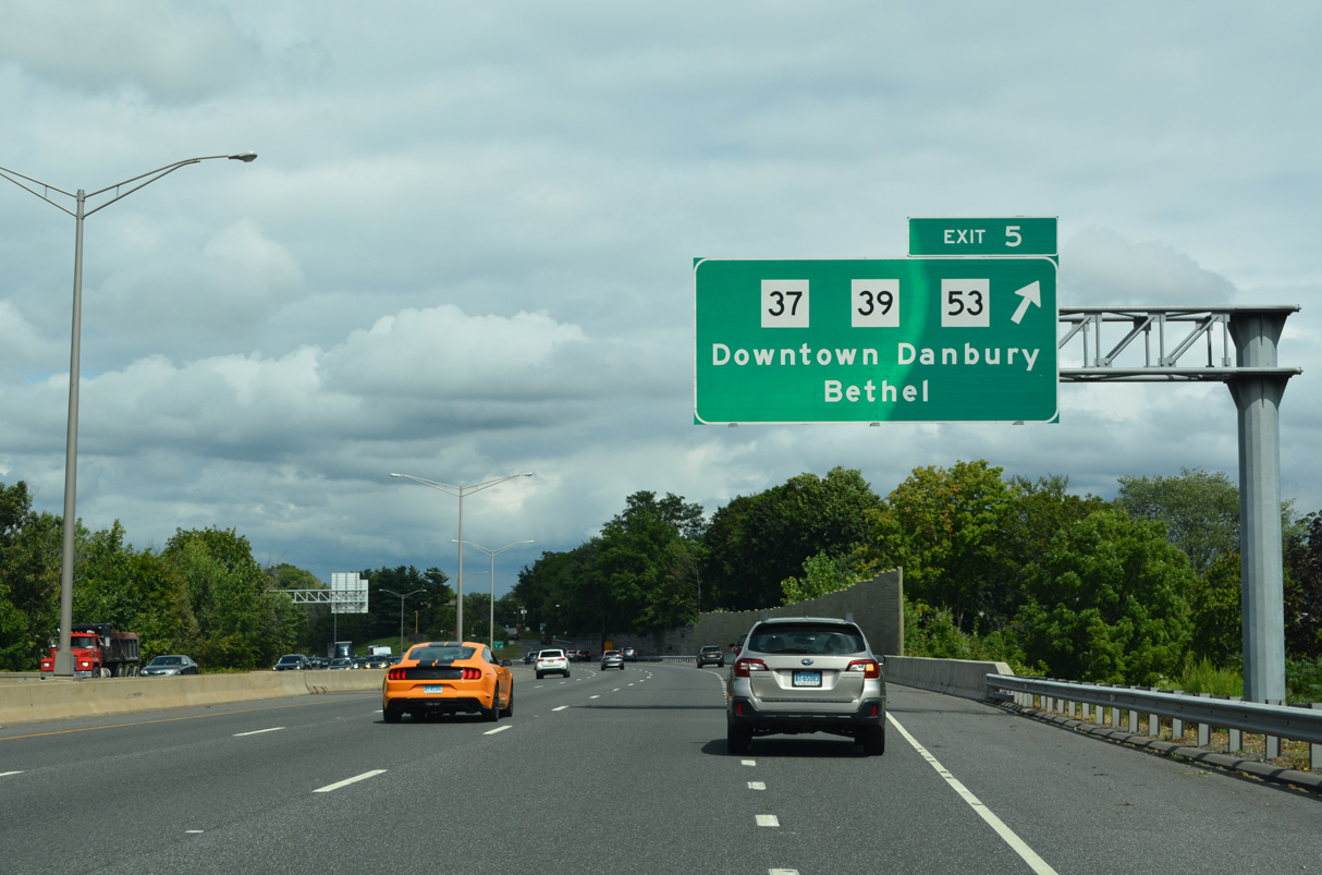
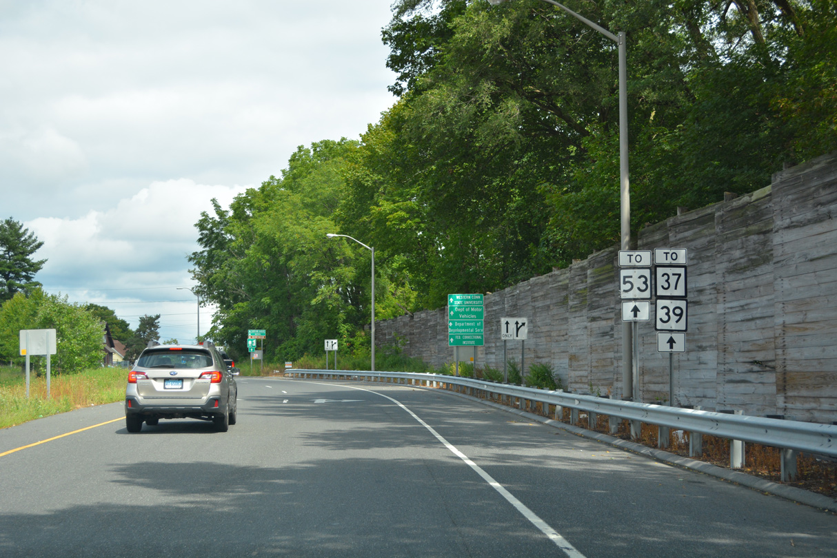
| The parclo interchange at Exit 5 joins I-84/U.S. 6-7-202 with Downs Street (Route 841) east to Route 37 (North Street) north, Route 39 north and Route 53 south on Main Street. Route 53 leads 23.57 miles south from Danbury to Norwalk. 08/19/21 |
|
| Exit 5 serves the Metro North Danbury station, which serves many New York bound commuters that live in Danbury because of its relatively low cost of living, and the Western Connecticut State University Midtown Campus. 08/19/21 |
|
| There are many outdoor recreation areas near Danbury and the most well known is Candlewood Lake which lies north of Exit 5. The largest in the state, Candlewood Lake is man-made. Its purpose is to store water during periods of low electrical power demand to be used when electrical power demand is high. 08/19/21 |
|
| Located south of Danbury along Route 53 at Route 302, the town of Bethel is the corporate headquarters of Cannondale Bicycle Corporation. 08/19/21 |
|
| Route 37 (north Street / Padanaram Road) travels 18.66 miles north Downw Street (Route 841) and Route 53 in Danbury to U.S. 7 in New Milford. Route 39 (Clapboard Ridge Road) meanders 22.76 miles northward near the New York state line to Route 55 in north Sherman. 08/19/21 |
|
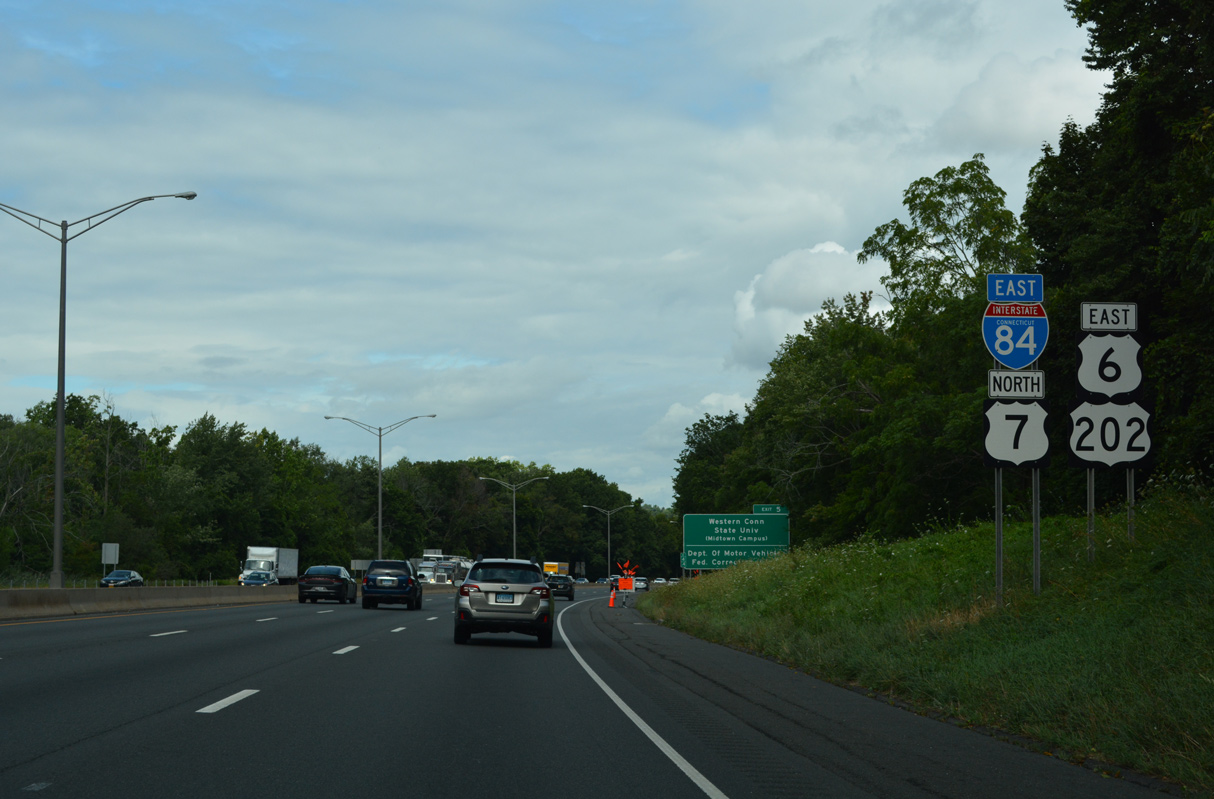
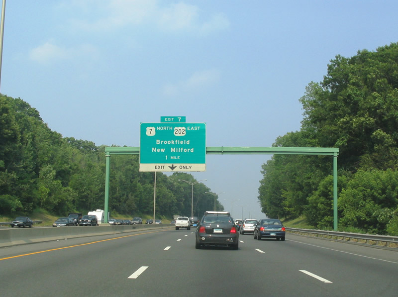
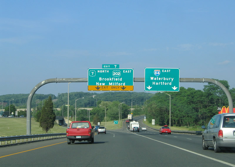
| U.S. 7/202 part ways with I-84/U.S. 6 east to Brookfield at Left Exit 7 in one mile. This overhead was replaced by 2012 and now includes a Left Exit tab. 06/26/05 |
|
| U.S. 7 continues north from I-84/U.S. 6 along an expressway for 6.6 miles to U.S. 202 near the New Milford town line. U.S. 202 parallels U.S. 7 along Federal Road. Replaced with an APL by 2012, these button copy signs for U.S. 7-202 and I-84 included Hartford as a control city for Interstate 84 eastbound. 06/13/05 |
|
| Dropped due to opposition, original plans outlined upgrading U.S. 7 into an undivided freeway northward all the way through Massachusetts to Vermont However because of anticipated traffic needs, the expressway was extended three miles north to the New Milford town line in November 2009. 06/13/05 |
|
| I-84/U.S. 6 angle southeast from the three-wye interchange at Exit 7 to the Still River. 06/26/05 |
|
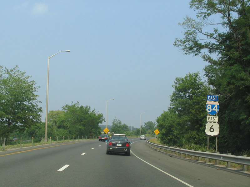
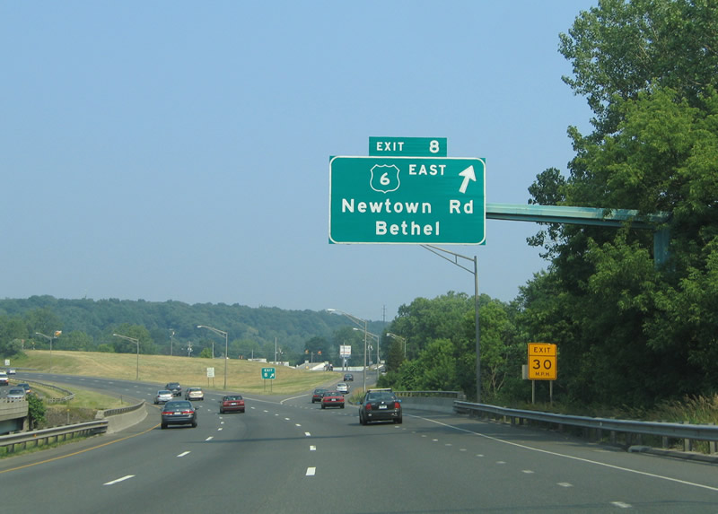
| Separating from I-84 at Exit 8, U.S. 6 shifts onto parallel Newtown Road east across north Bethel. Old U.S. 6 followed Newtown Road (Route 806) west 1.54 miles onto White Street in Danbury. 06/26/05 |
|
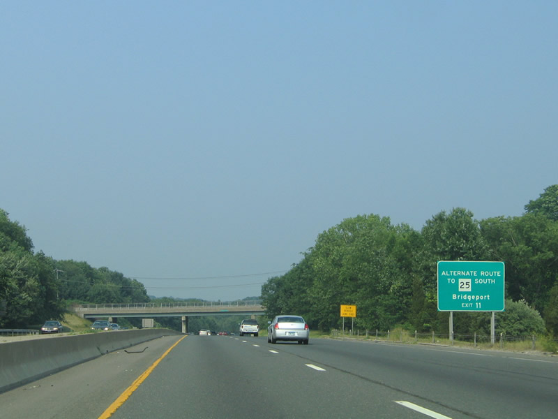
| While Exit 9 links I-84 with Route 25 directly, it is actually faster to stay on Interstate 84 east to Exit 11 as an alternate way of connecting with Route 25 south to Bridgeport. I-84 west to Wasserman Way west bypasses the Newtown town center. 06/26/05 |
|
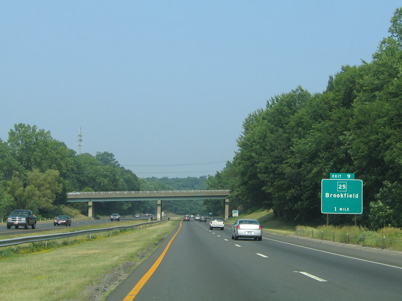
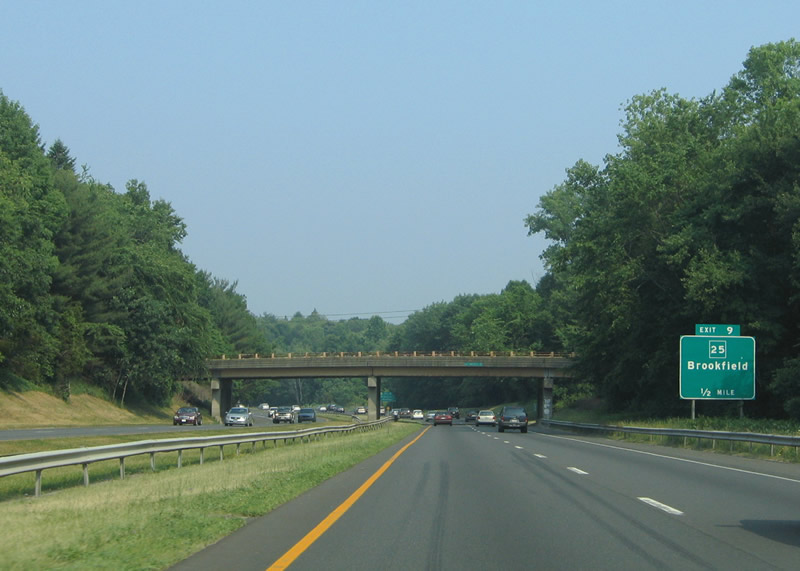
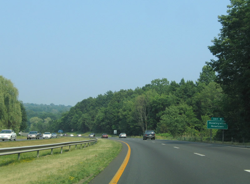
| Secor Road passes over Interstate 84 one mile west of the parclo interchange (Exit 9) with Route 25 (Hawleyville Road). Route 25 meets the freeway at Hawleyville, 0.4 miles north of the overlap with U.S. 6 (Mt. Pleasant Road) in north Newtown. 06/26/05 |
|
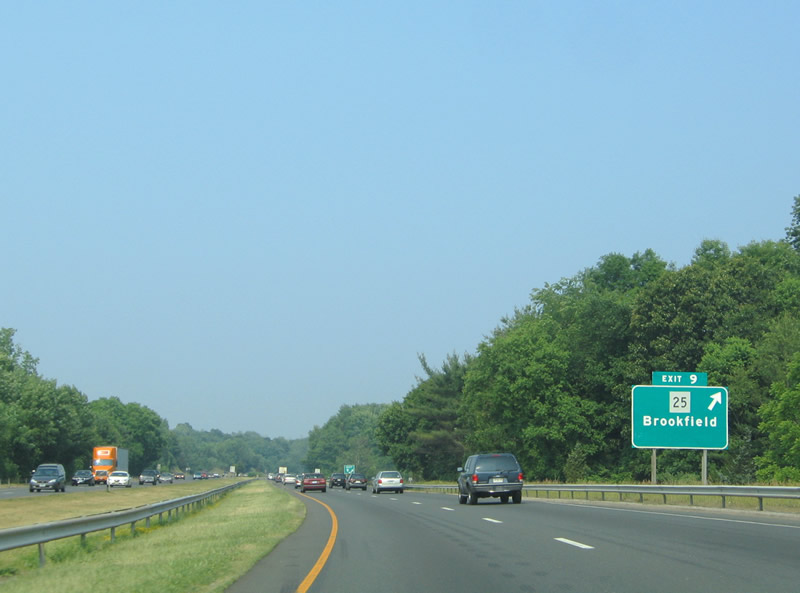
| Old Hawleyville Road spans I-84 a half mile from Exit 9 to Route 25 (Hawleyville Road). Route 25 runs 5.73 miles northwest from U.S. 6 to U.S. 202 at Brookfield Center. Bridgeport was removed as the second control city for Exit 9 in late 2001.1 06/26/05 |
|
| U.S. 6/Route 25 (Main Street) overlap 2.70 miles east to Church Hill Road and the Newtown town center. 06/26/05 |
|
| Route 25 travels 28.59 miles overall from Brookfield south to Interstate 95 in Bridgeport. 06/26/05 |
|
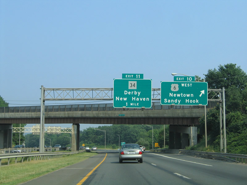
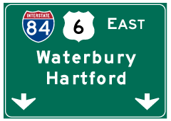
| U.S. 6 rejoins I-84 at Exit 10 from Church Hill Road and the Newtown town center. Church Hill Road (Route 816) extends east to the intersection of Glen Road north, Riverside Road east and Washington Avenue south in Sandy Hook near Rocky Glen State Park.
This sign bridge was taken down and replaced with a new side mounted assembly by 2012. 06/26/05 |
|
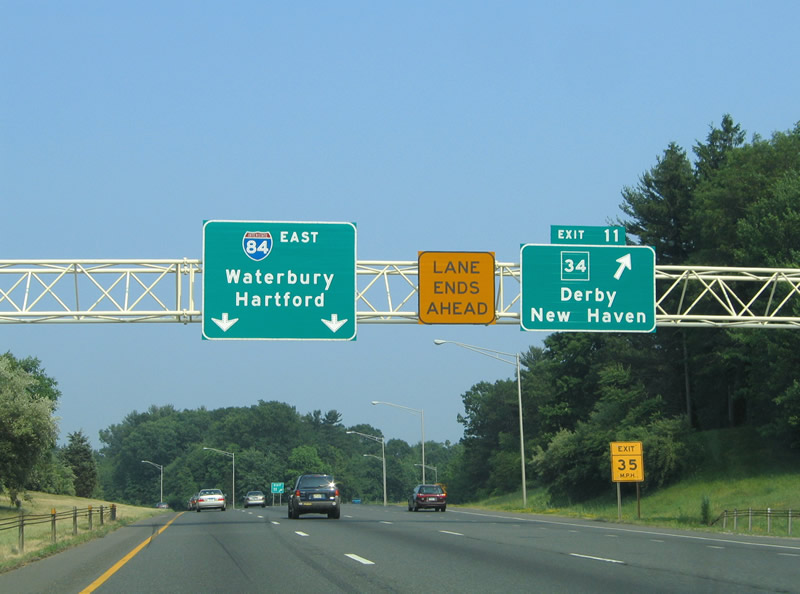
| The short freeway spur from Exit 11 connects I-84 with Wasserman Way (Route 490) north to Route 34 (Berkshire Road) east to Berkshire, Stevenson and Derby. 06/26/05 |
|
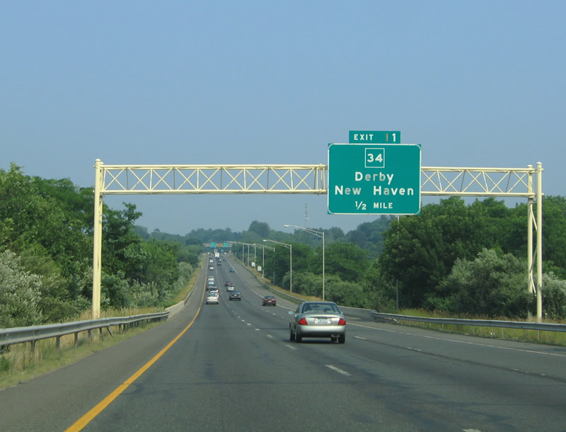
| Route 34 travels 24.37 miles miles southeast from Pearl Street at Sandy Hook to I-91/95 in New Haven. The directional T interchange at Exit 11 was originally built for an extension of the freeway along Route 25 in Trumbull. 06/26/05 |
|
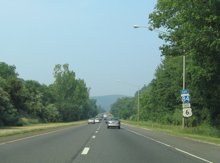
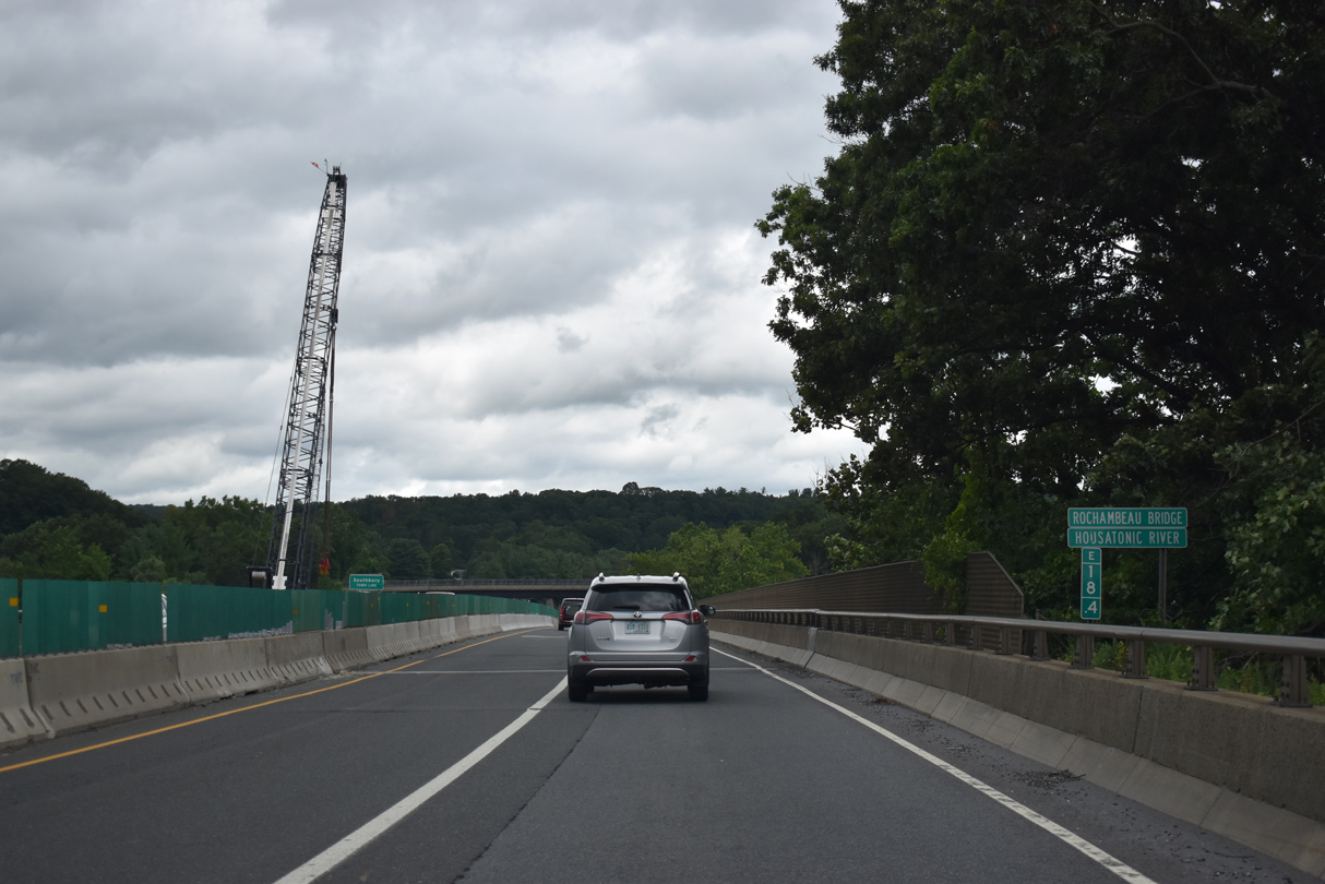
| The landscape along I-84/U.S. 6, which includes a crossing over Lake Zoar of the Housatonic River, is rural northeast to Waterbury. 06/26/05 |
|
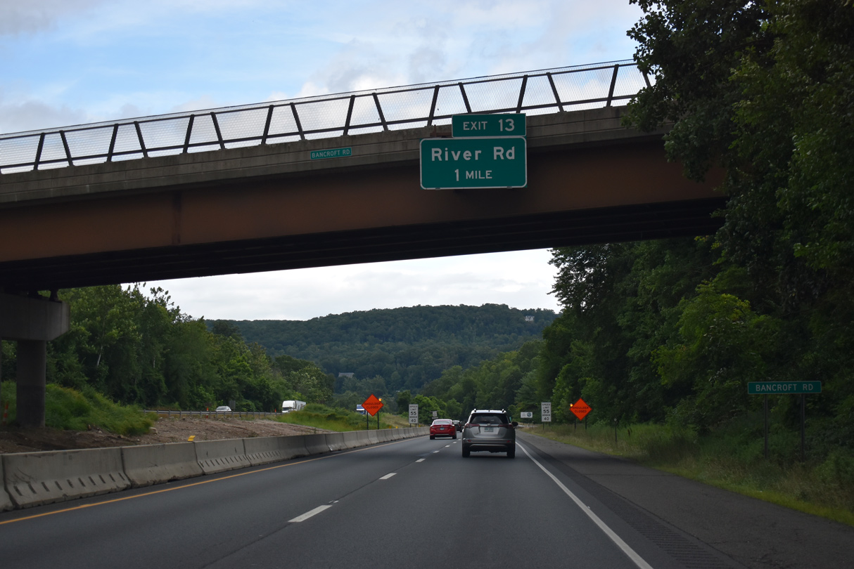
| There is no Exit 12, instead Exit 13 from I-84/U.S. 6 east follows beyond the Housatonic River to Fish Rock Road north of River Road (old U.S. 6). 08/19/21 |
|
| This bridges taking I-84/U.S. 6 over the Housatonic River were previously built to accommodate six overall lanes. Exits 13 through 16 serve the town of Southbury. 08/19/21 |
Page Updated 03-08-2023.

 East
East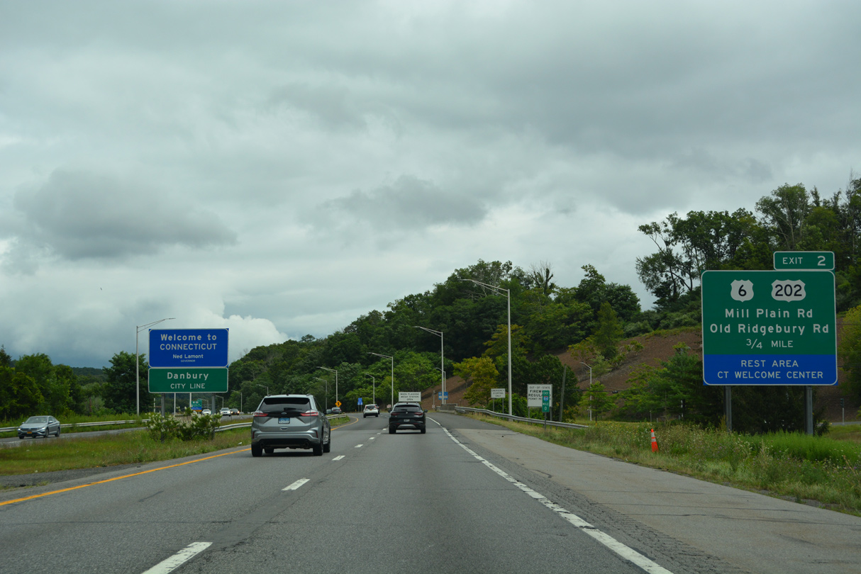

 North
North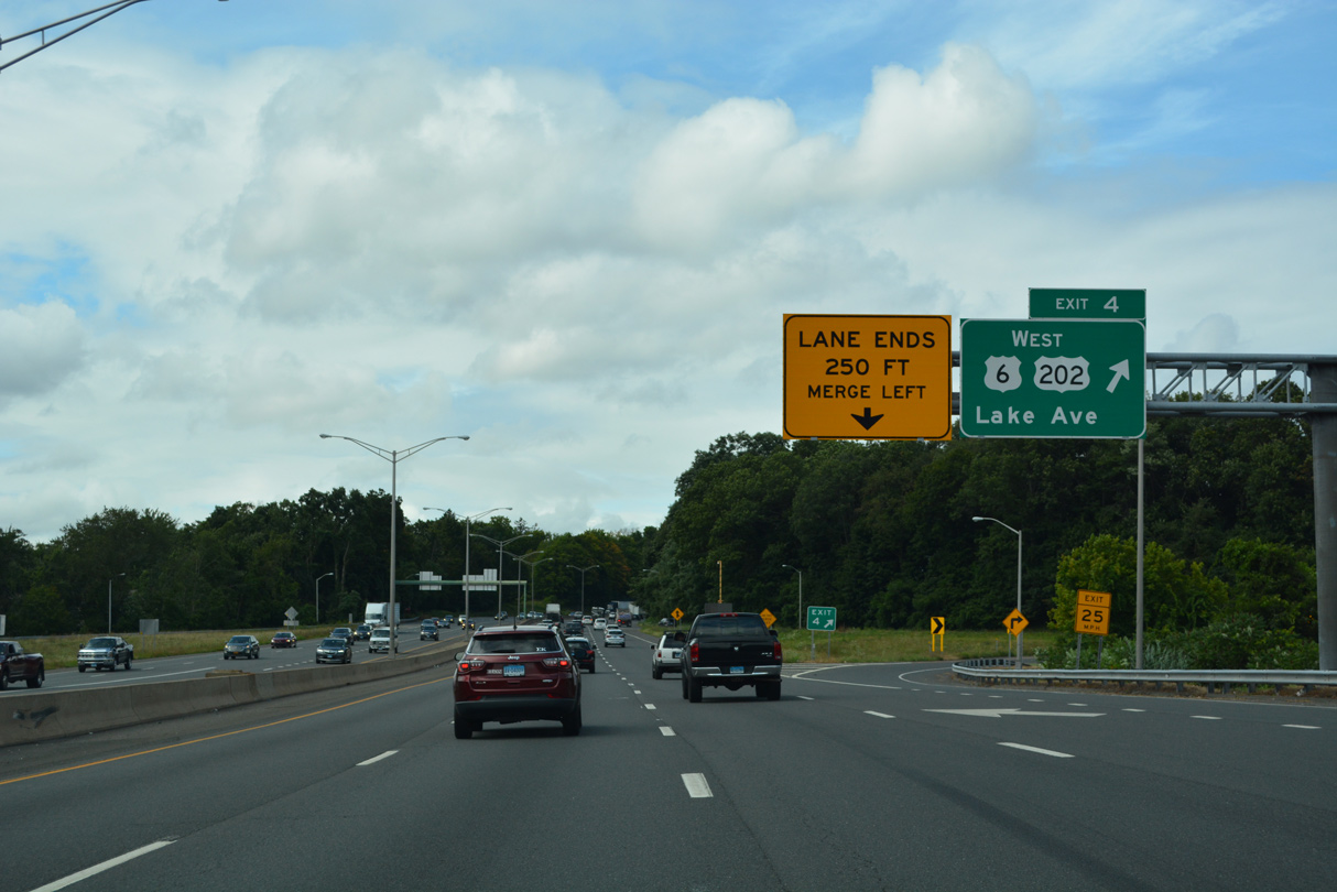

 East
East