|
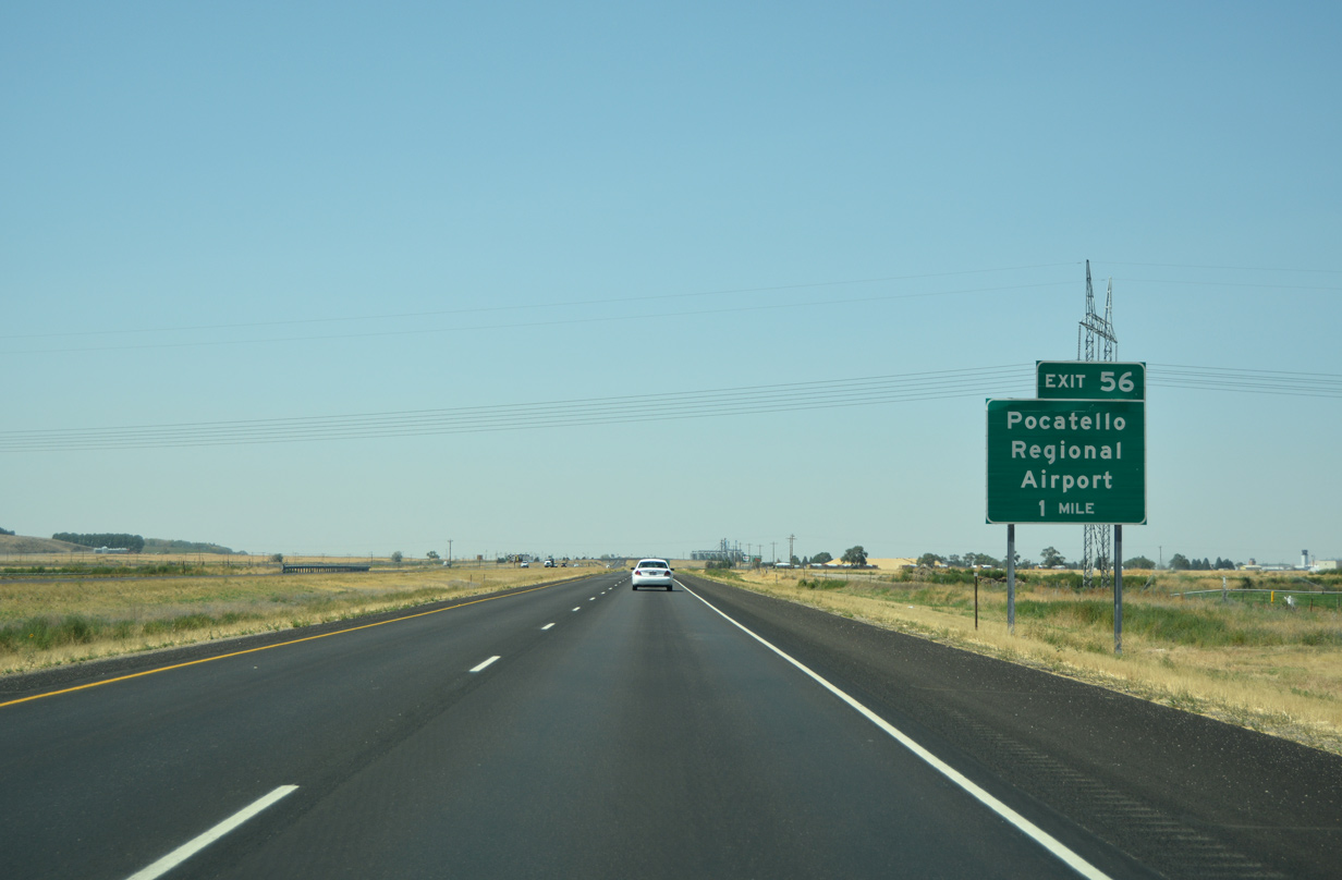
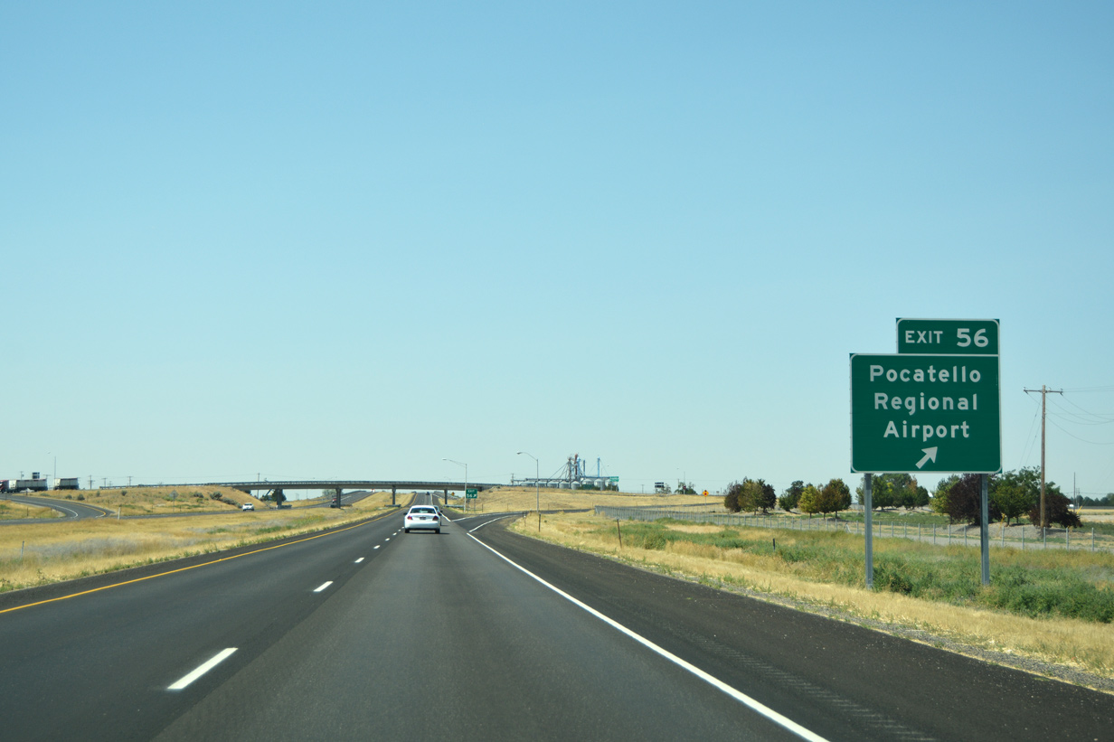
| Leaving the semi-directional-T interchange with Interstate 15, I86 begins its 62.85 mile route west as it passes over Hiline Road. Pocatello Regional Airport (PIH) lies seven miles ahead (Exit 56) along the north side of the freeway. 08/09/16 |
|
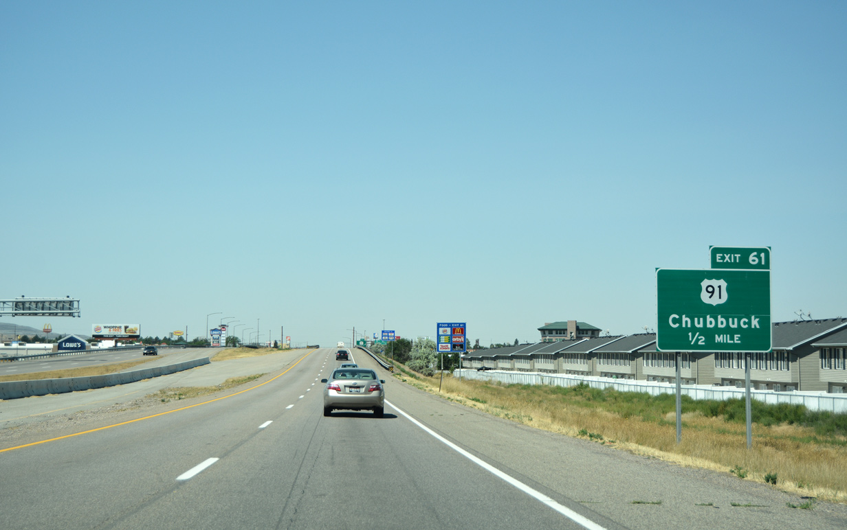
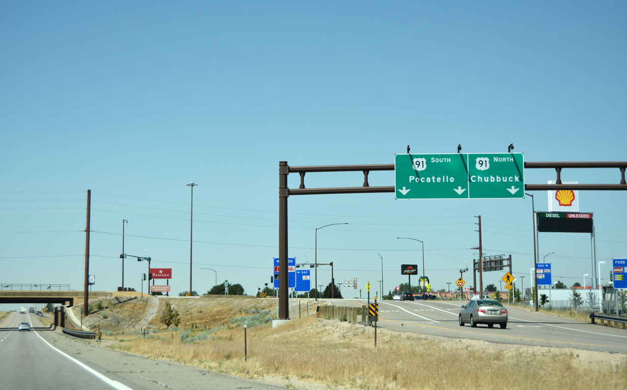
| Motorists reach the first exit along I-86 west in one half mile (Exit 61). U.S. 91 (Yellowstone Avenue) links the freeway with Chubbuck directly to the north and Pocatello to the south. 08/09/16 |
|
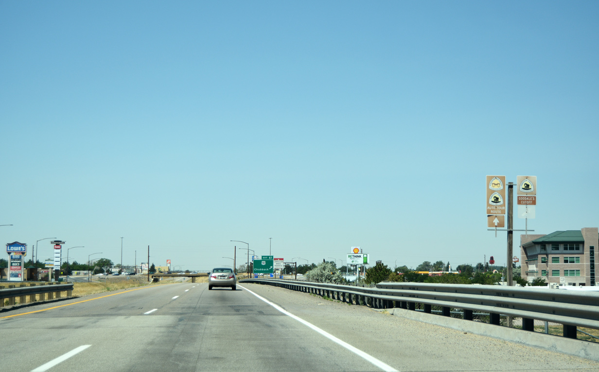
| I-86 generally follows close to the footprints of the original California and Oregon Trails its entire stretch to I-84 near Heyburn. Both trails extended over 2,000 miles from Kansas (Oregon) and Nebraska (California), passing through present day Pocatello en route to the Snake River. Goodale's Cutoff represents a 230 mile spur of the Oregon Trail that branched off near Fort Hall, arcing north and west for a return between Mountain Home and Boise. Today, portions of U.S. 20, 26, 91 and 93 follow along the spur trail. 08/09/16 |
|
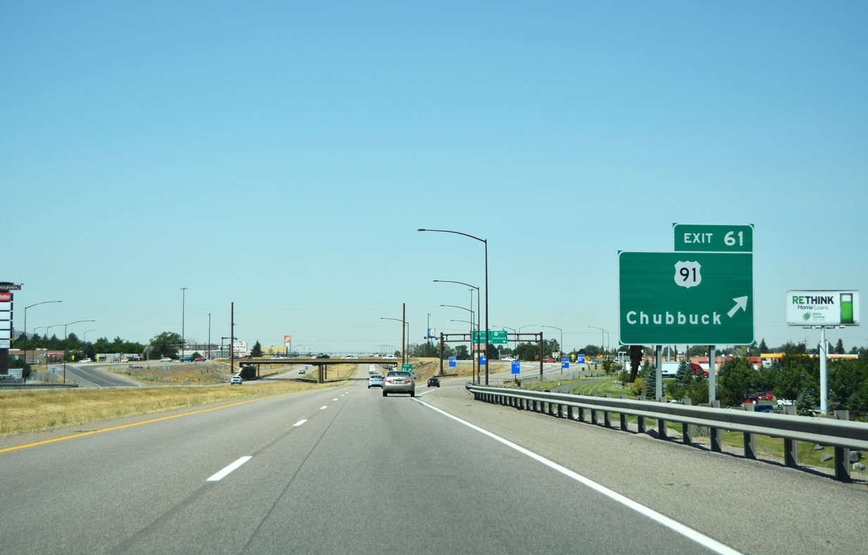
| Traffic departs for U.S. 91 (Exit 61) to Chubbuck and Pocatello. The interchange was converted from a traditional diamond to a diverging diamond between March and November 2013, at a cost of $10.8 million.1 Exit 61 currently represents the only instance of a diverging diamond type of interchange (DDI) within Idaho. 08/09/16 |
|
| U.S. 91 follows Yellowstone Avenue north through Chubbuck as the US highway parallels nearby I-15 to Blackfoot and Idaho Falls. Otherwise, to the south of I-86, U.S. 91 continues along Yellowstone Avenue toward Downtown Pocatello. 08/09/16 |
|
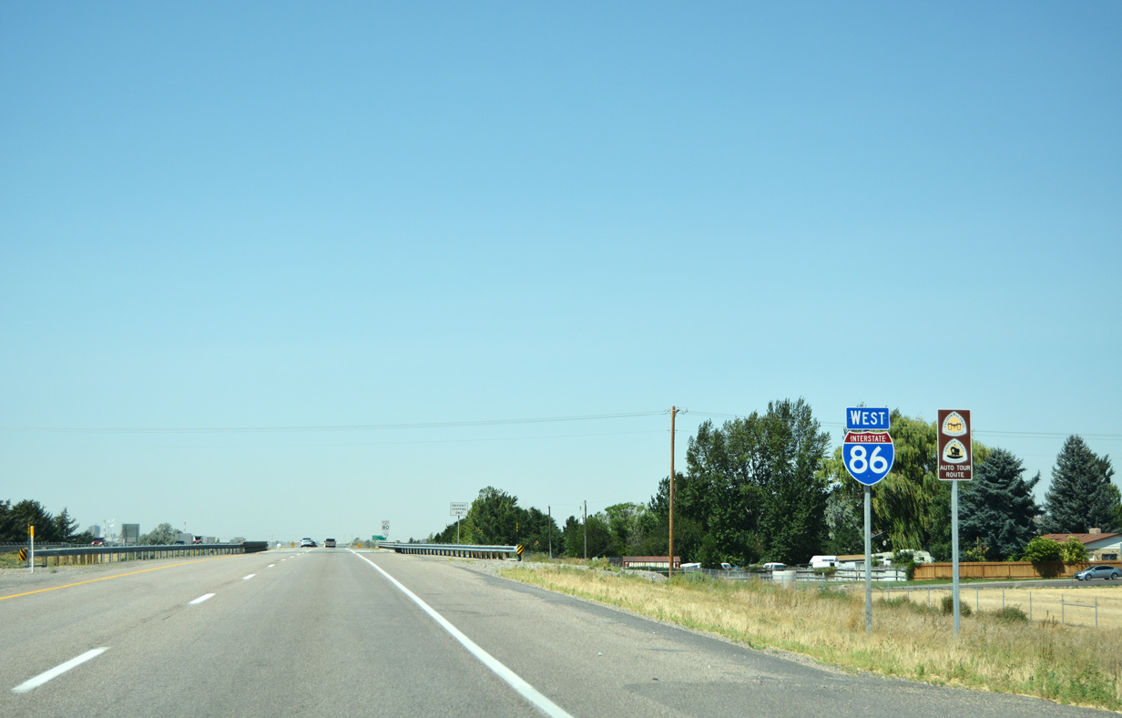
| The first confirming marker for I-86 west is seen beyond the entrance ramp from U.S. 91 (Exit 61). The California and Oregon Trail Auto Tour route continues along the freeway as it passes over Hawthorne Road. 08/09/16 |
|
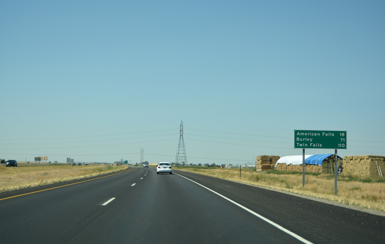
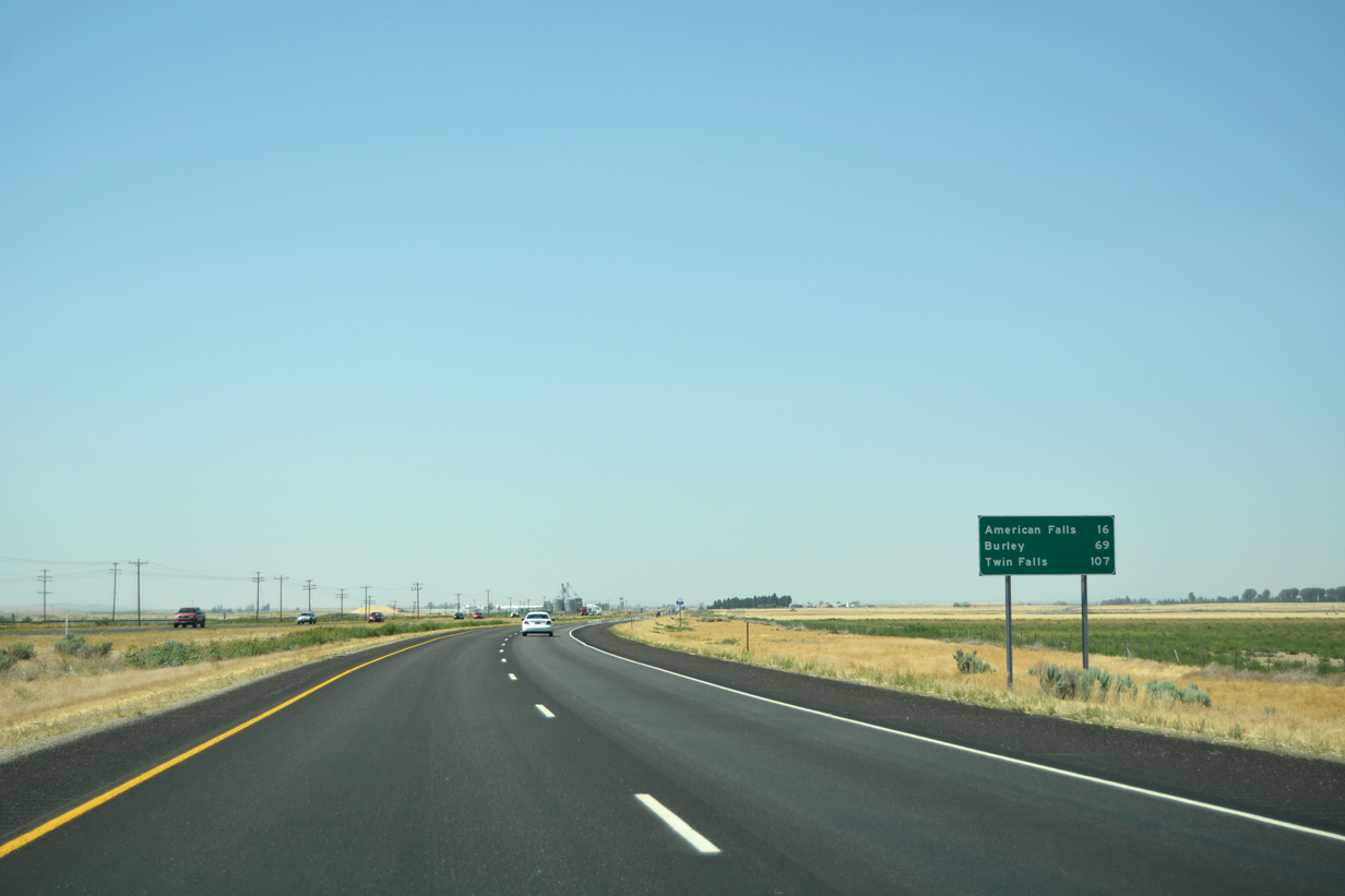
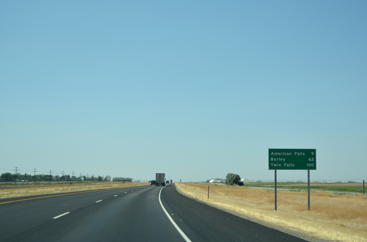
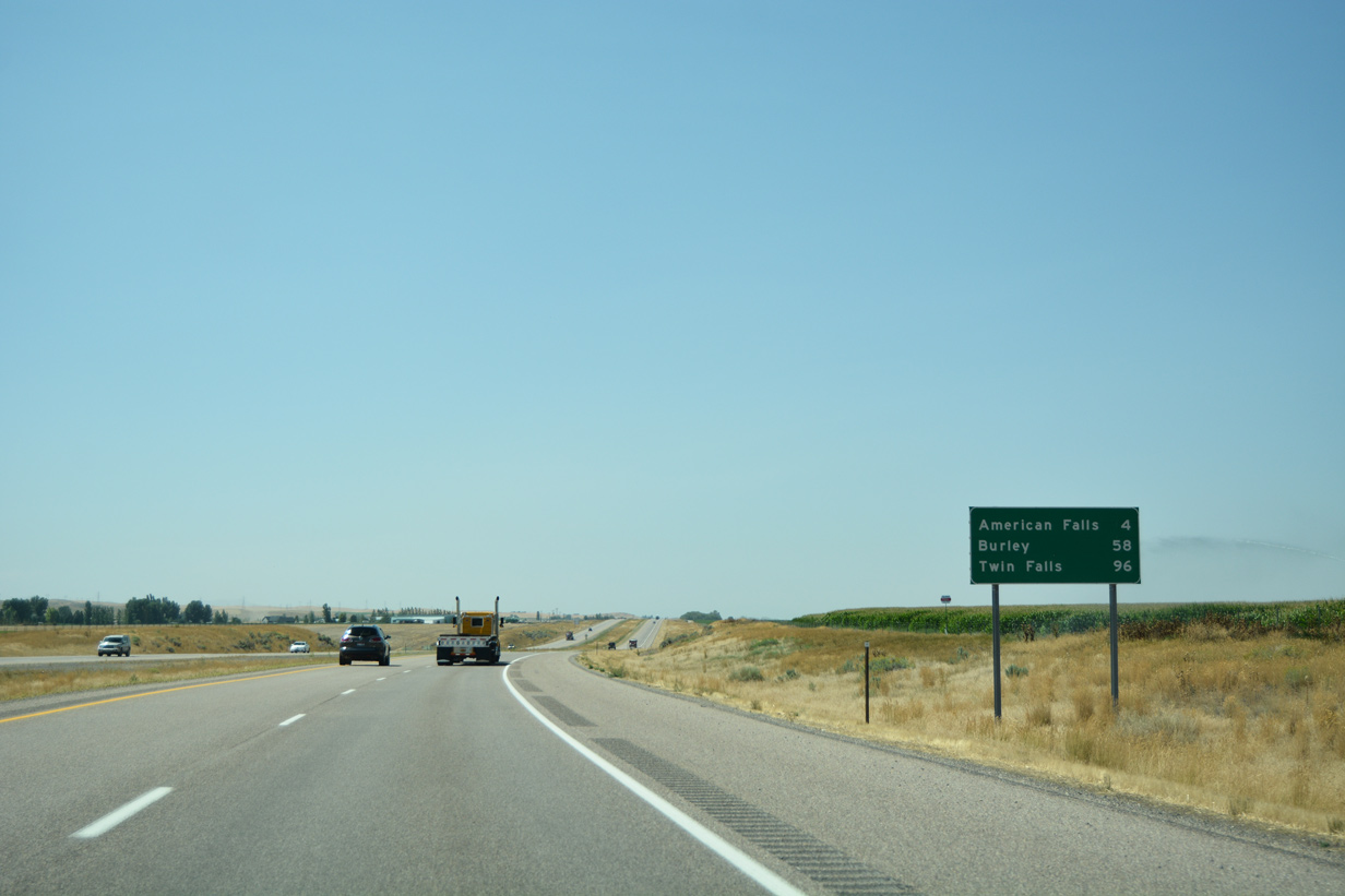
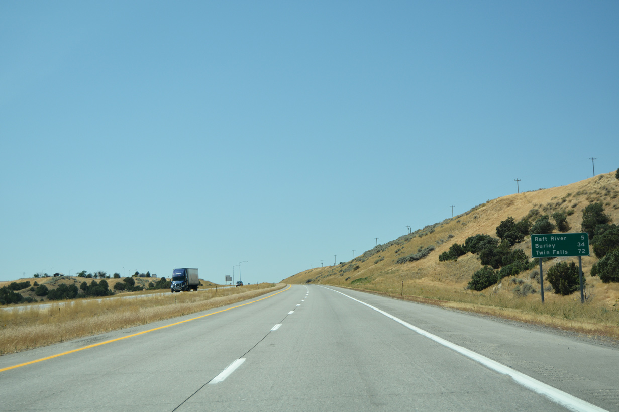
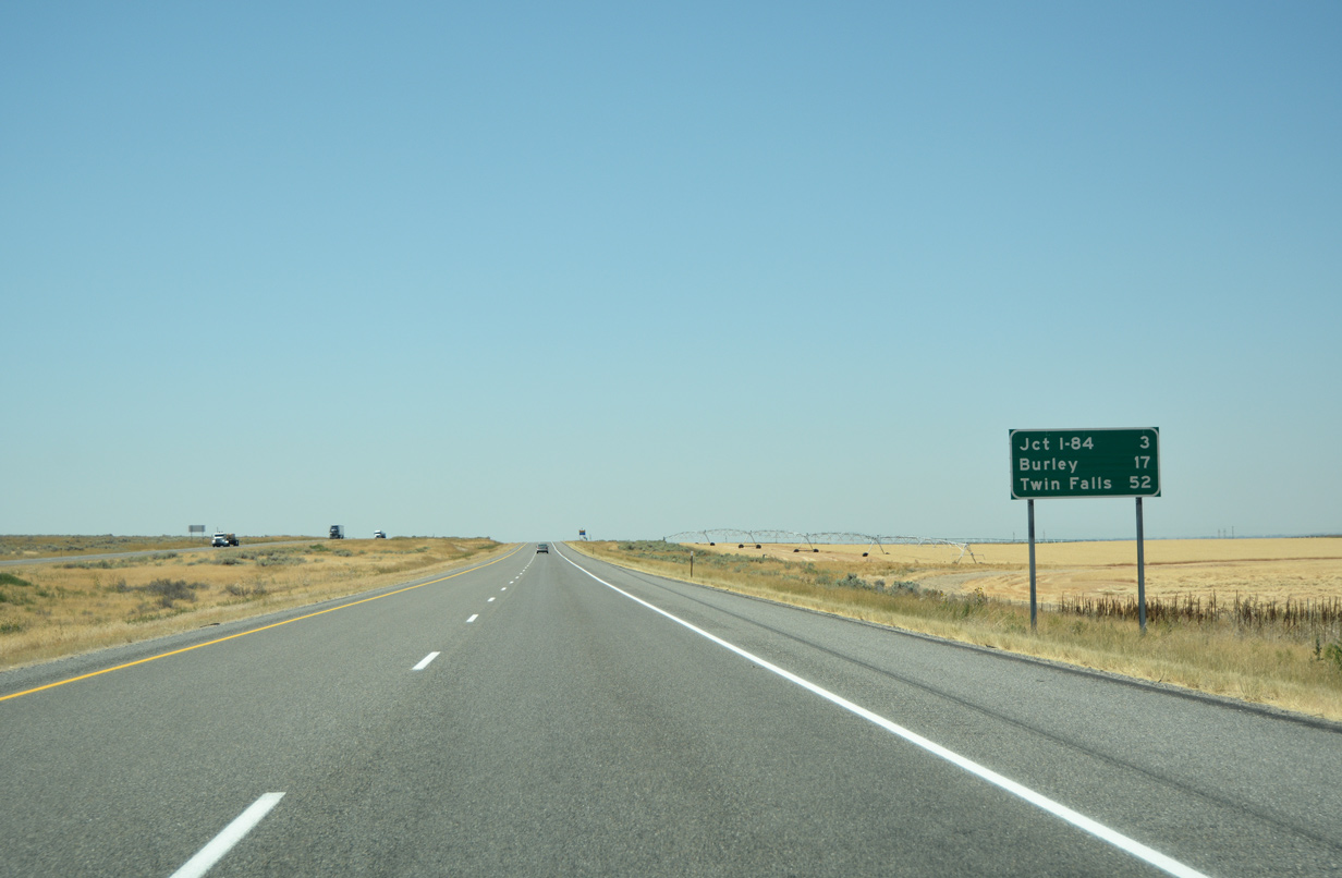
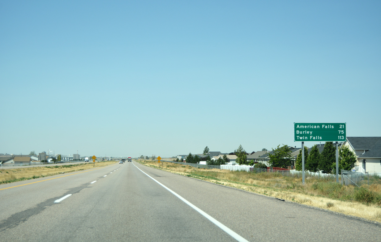
| Other than Chubbuck and Pocatello, American Falls (21 miles) represents the only other populous center along the I-86 corridor. Both Burley (75 miles) and Twin Falls (113 miles) lie south of Interstate 84 along the Snake River. 08/09/16 |
|
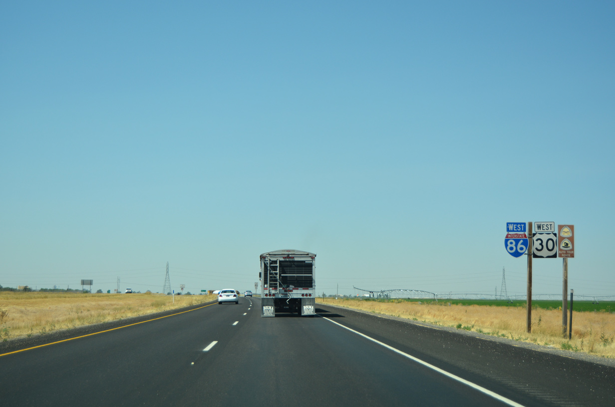
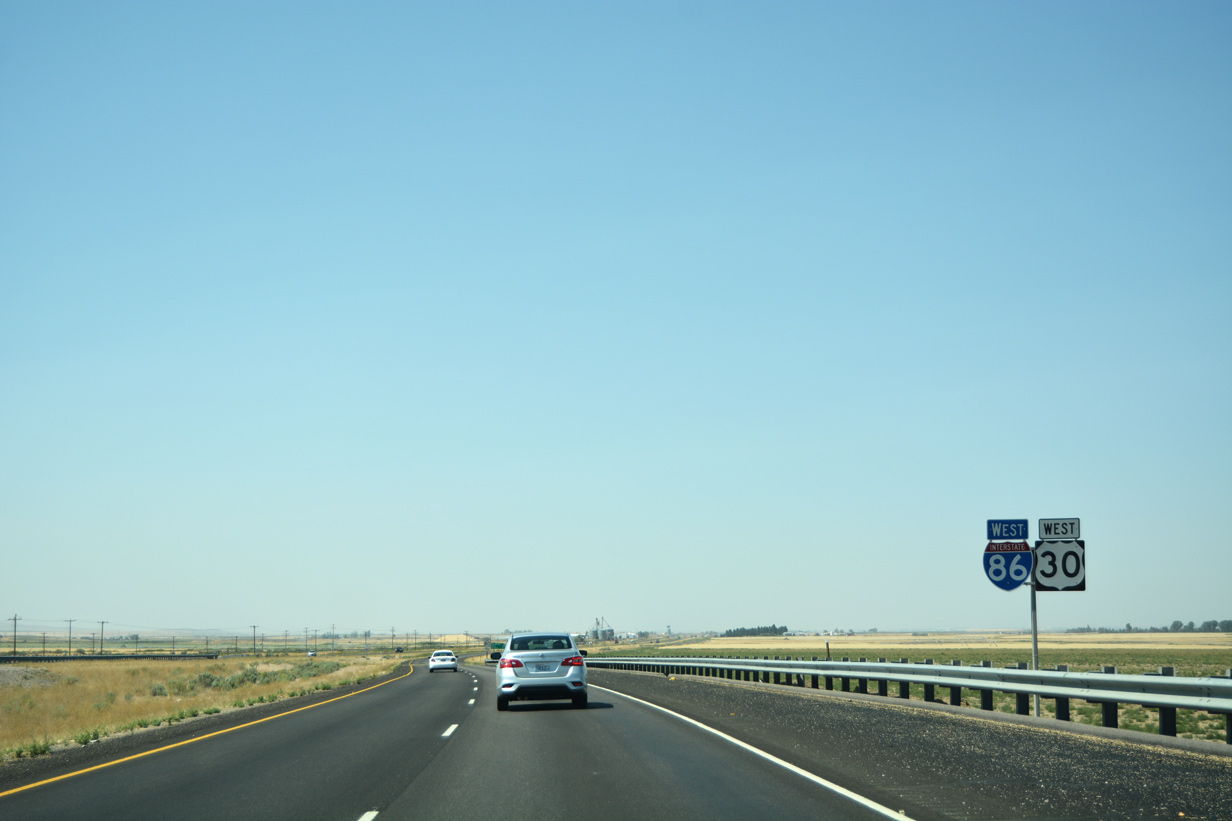
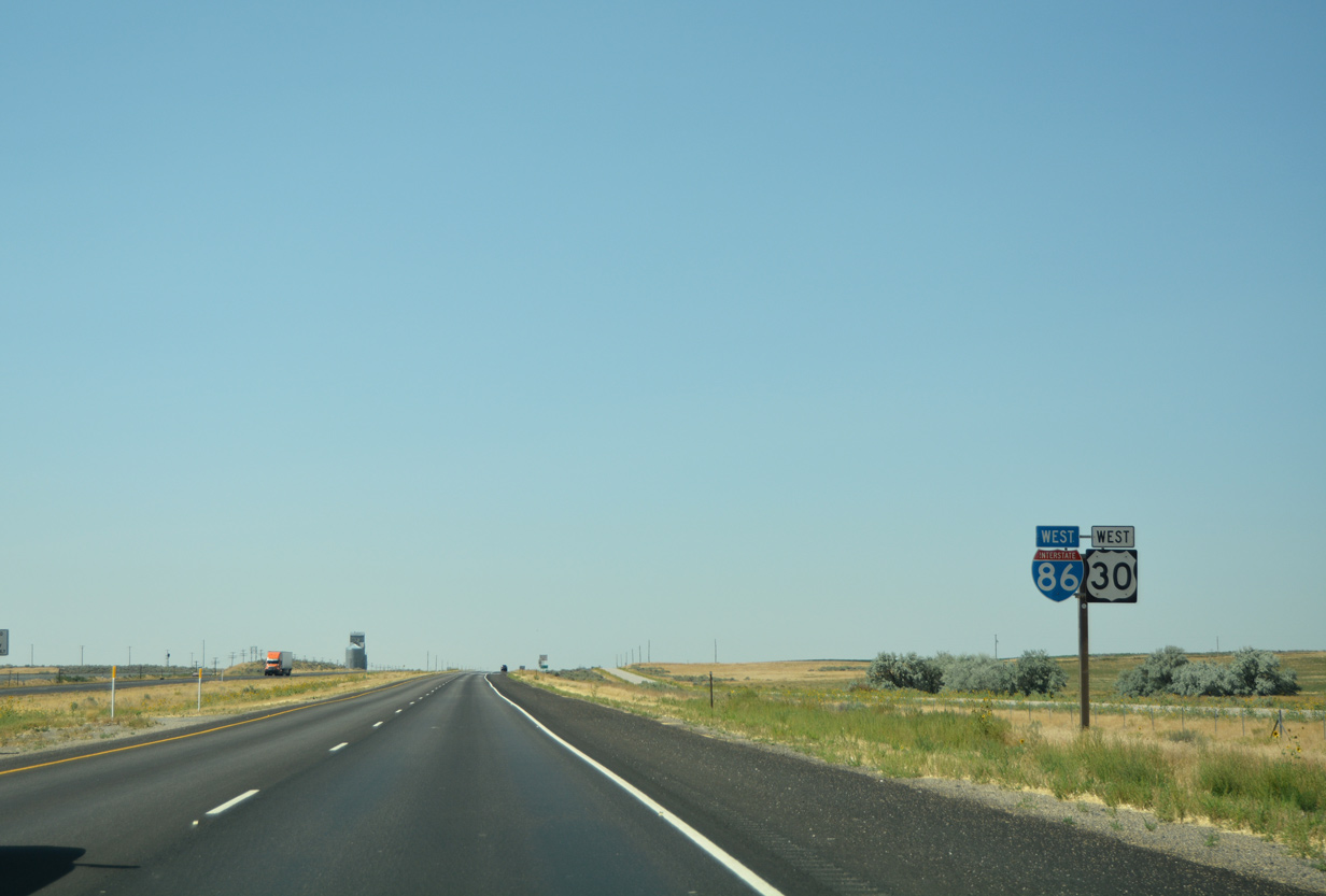
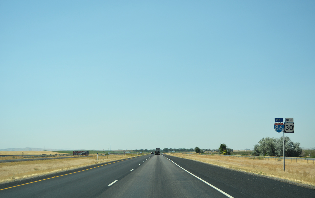
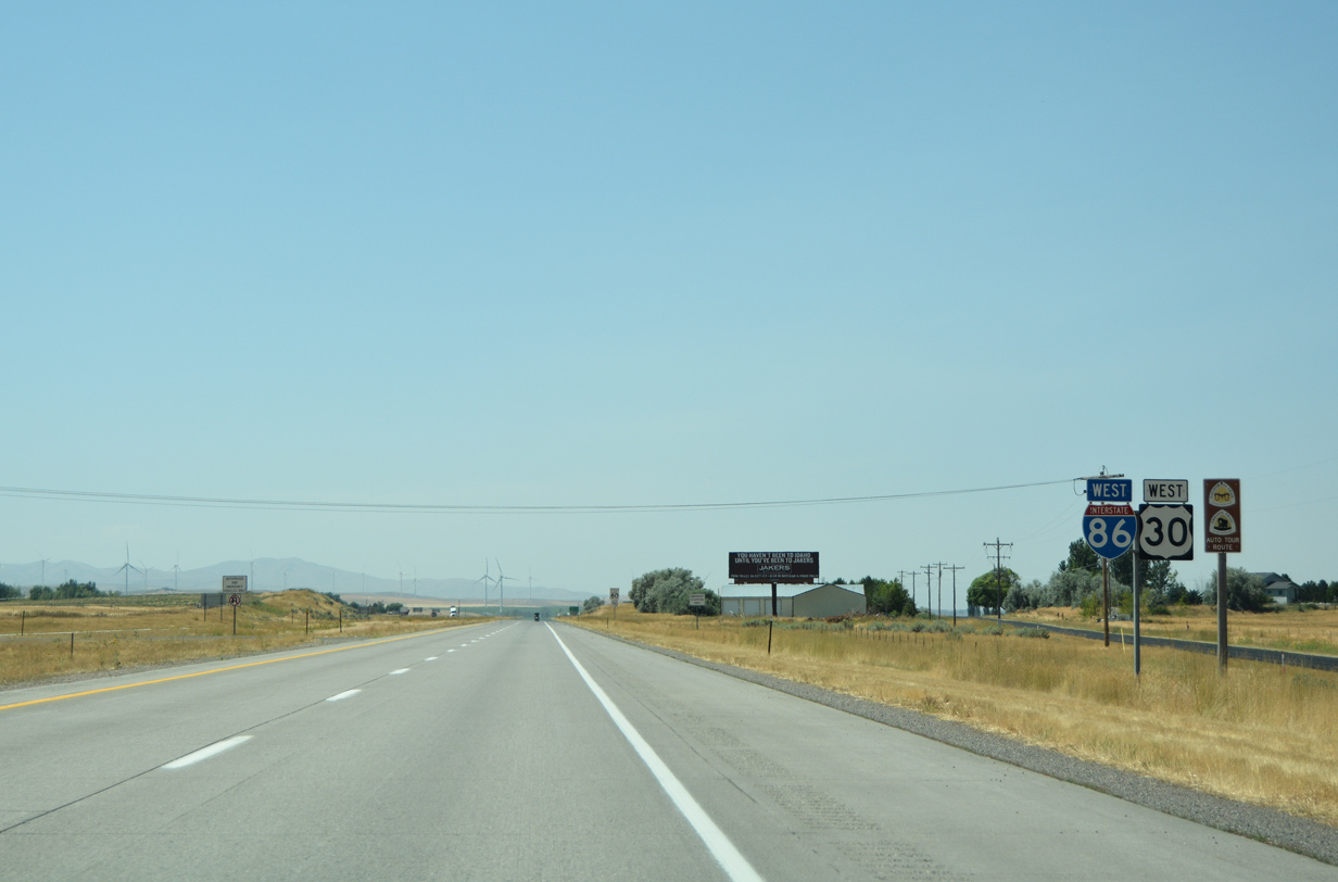
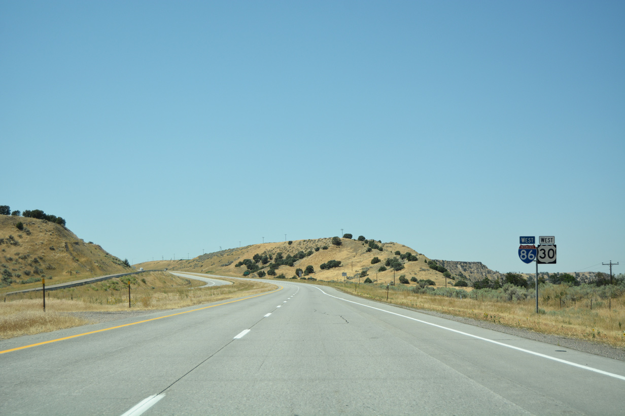
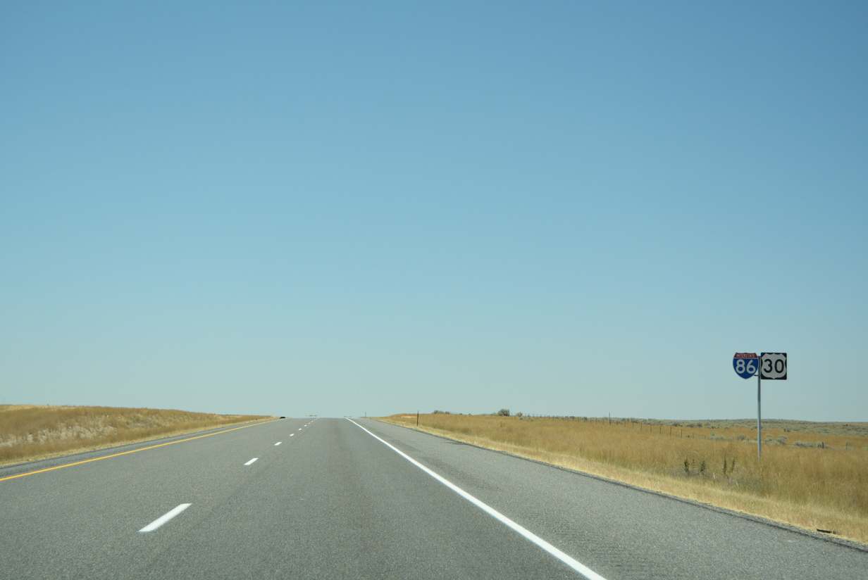
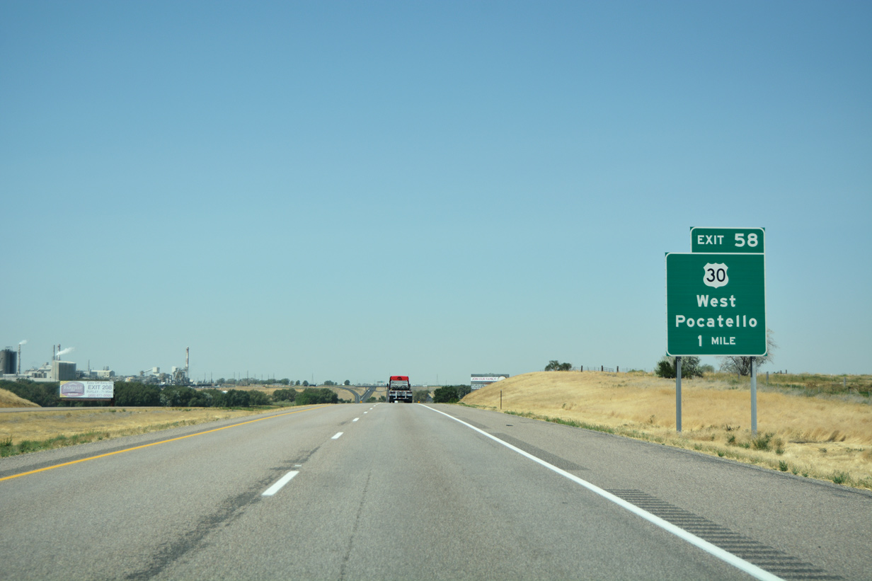
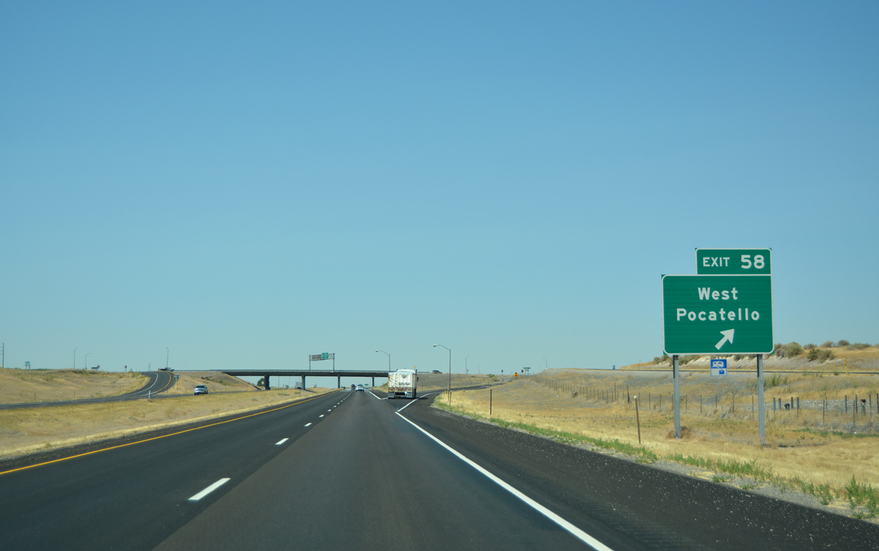
| Leaving Chubbuck and Pocatello behind, I-86 west next approaches U.S. 30 (Exit 58) to the western reaches of Pocatello. The US highway will join the freeway one mile ahead for the remainder of its course to I-84. 08/09/16 |
|
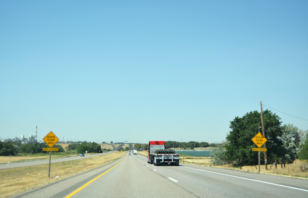
| This stretch of I-86 is more prone to summer and winter related events. Because of this advisory signs alerting drivers to the potential for severe weather in the surrounding area have been posted ahead of Exit 58. 08/09/16 |
|
| I-86 west crosses the Portneuf River into Power County on the final approach to U.S. 30 (Exit 58). The Portneuf River is one of the many tributaries of the Snake River. 08/09/16 |
|
| Though not recognized here, U.S. 30 east travels southeast from the diamond interchange through industrial areas into Downtown Pocatello, where the US highway joins U.S. 91 for points south. Tank Farm Road continues a short distance north of Exit 58, otherwise, U.S. 30 west joins I-86 beyond the forthcoming overpass. 08/09/16 |
|
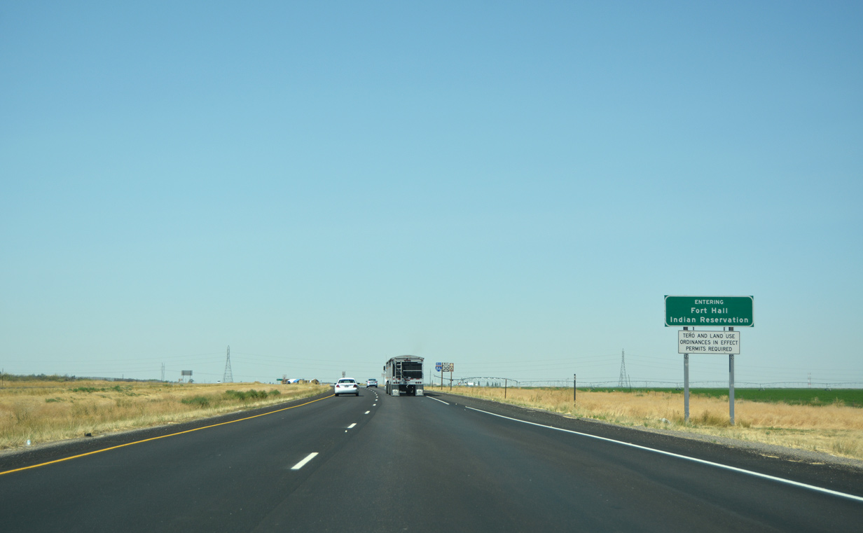
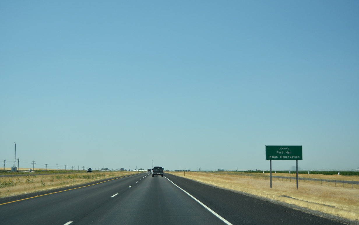
| I-86 & U.S. 30 west enters the Fort Hall Indian Reservation immediately following Exit 58. Spanning nearly 546,500 acres in Bannock, Bingham, and Power counties, the reservation is home to the Shoshone and Bannock Indian tribes.2 The reservation was originally established by the terms of the Fort Bridger Treaty of 1868 and has reduced to its present state through allotment and legislation processes.2. 08/09/16 |
|
| Another confirming marker for the California and Oregon Trails stand beside this assembly for I-86 & U.S. 30 west of Exit 58. The next indication for the Auto Tour route occurs beyond SH-37 (Exit 36) south of American Falls. 08/09/16 |
|
| I-86 makes its southwesterly turn 18 miles out from American Falls. Burley is reached in 71 miles via Exits 211 and 208 along I-84 west while Twin Falls is accessed using U.S. 93 south from I-84 (Exit 173) in 110 miles. 08/09/16 |
|
| A set of high transmission lines span the freeway one mile out from Airport Way (Exit 56) to Pocatello Regional Airport (PIH). 08/09/16 |
|
| Airport Way stems a short distance west from Interstate 86 & U.S. 30 to directly serve PIH. To the east, the local road connects with County Road. 08/09/16 |
|
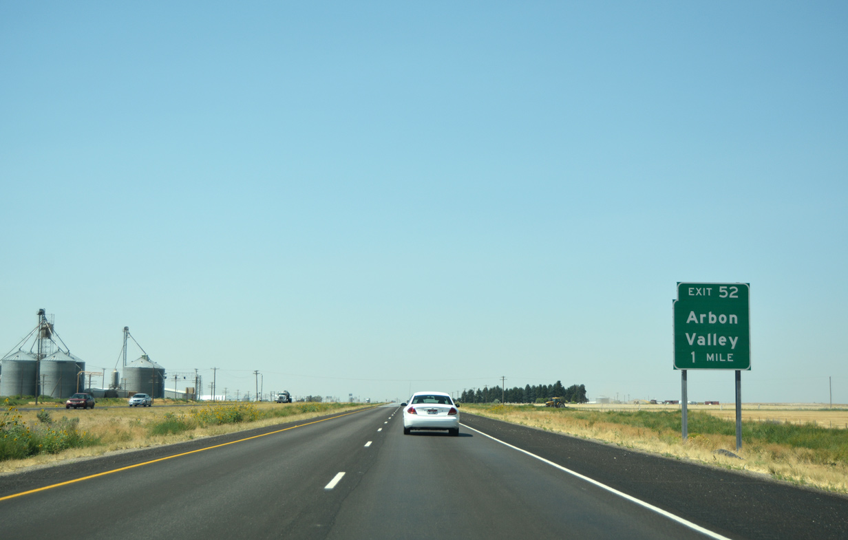
| I-86 & U.S. 30 west passes between agriculture fields south of Pocatello Regional Airport en route to a diamond interchange (exit 52) with Arbon Valley Highway. 08/09/16 |
|
| The freeway kinks to run parallel with County Road as drivers continue to American Falls (16 miles) and beyond. County Road represents the original alignment of U.S. 30 and its predecessor, U.S. 30N. 08/09/16 |
|
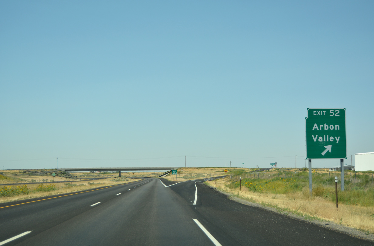
| Exit 52 connects I-86 & U.S. 30 with Arbon Valley in one mile. Arbon Valley covers a large portion of the Fort Hall Indian Reservation. 08/09/16 |
|
| Arbon Valley Highway extends south from the diamond interchange through the length of the reservation and Power County before continuing into neighboring Oneida County. 08/09/16 |
|
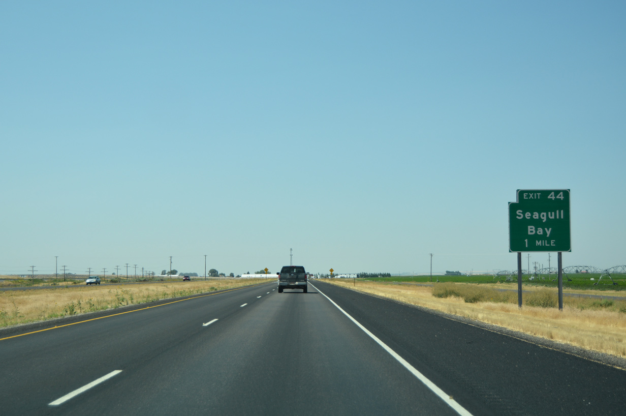
| A confirming assembly stands along Interstate 86 & U.S. 30 west beyond the ingress ramp from Exit 52. Sundance Road parallels as a frontage road alongside the north side of the freeway to Exit 44 (Seagull Bay). 08/09/16 |
|
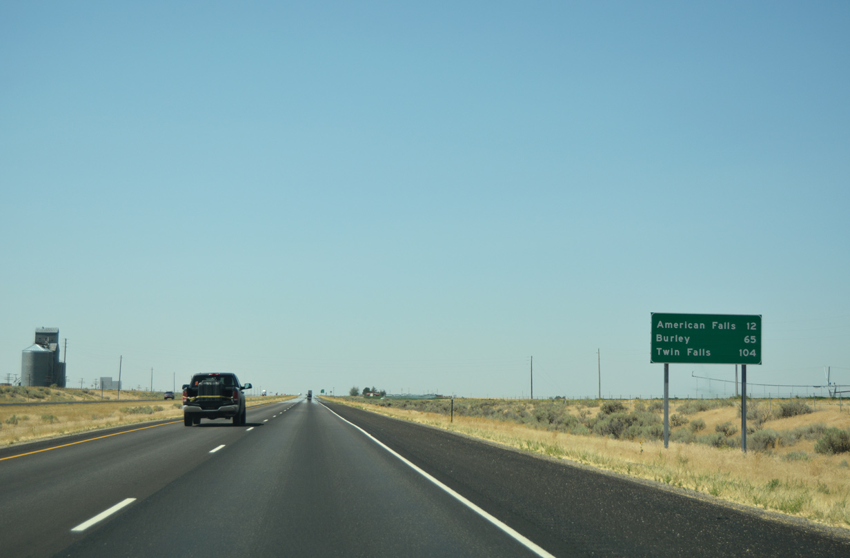
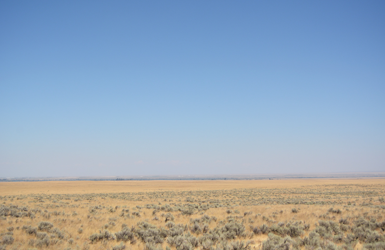
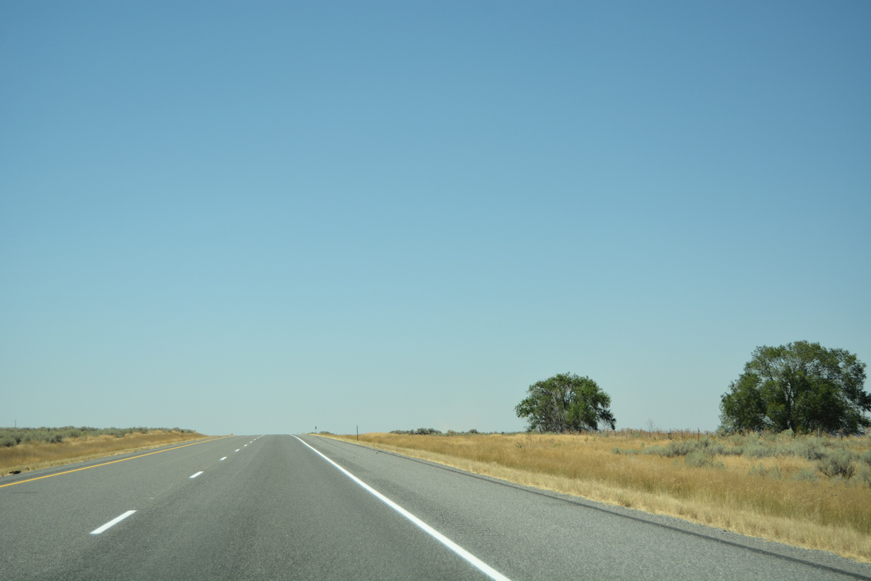
| The landscape along I-86 remains relatively flat as it continues on its southwesterly course toward American Falls (12 miles) and Burley (65 miles). Twin Falls, the largest city in the Magic Valley region of Idaho, remains a 104 mile drive. 08/09/16 |
|
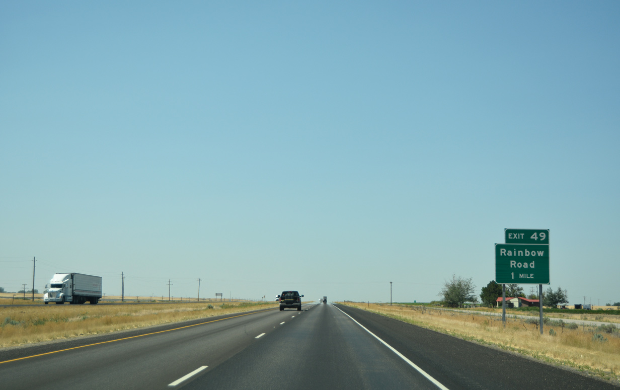
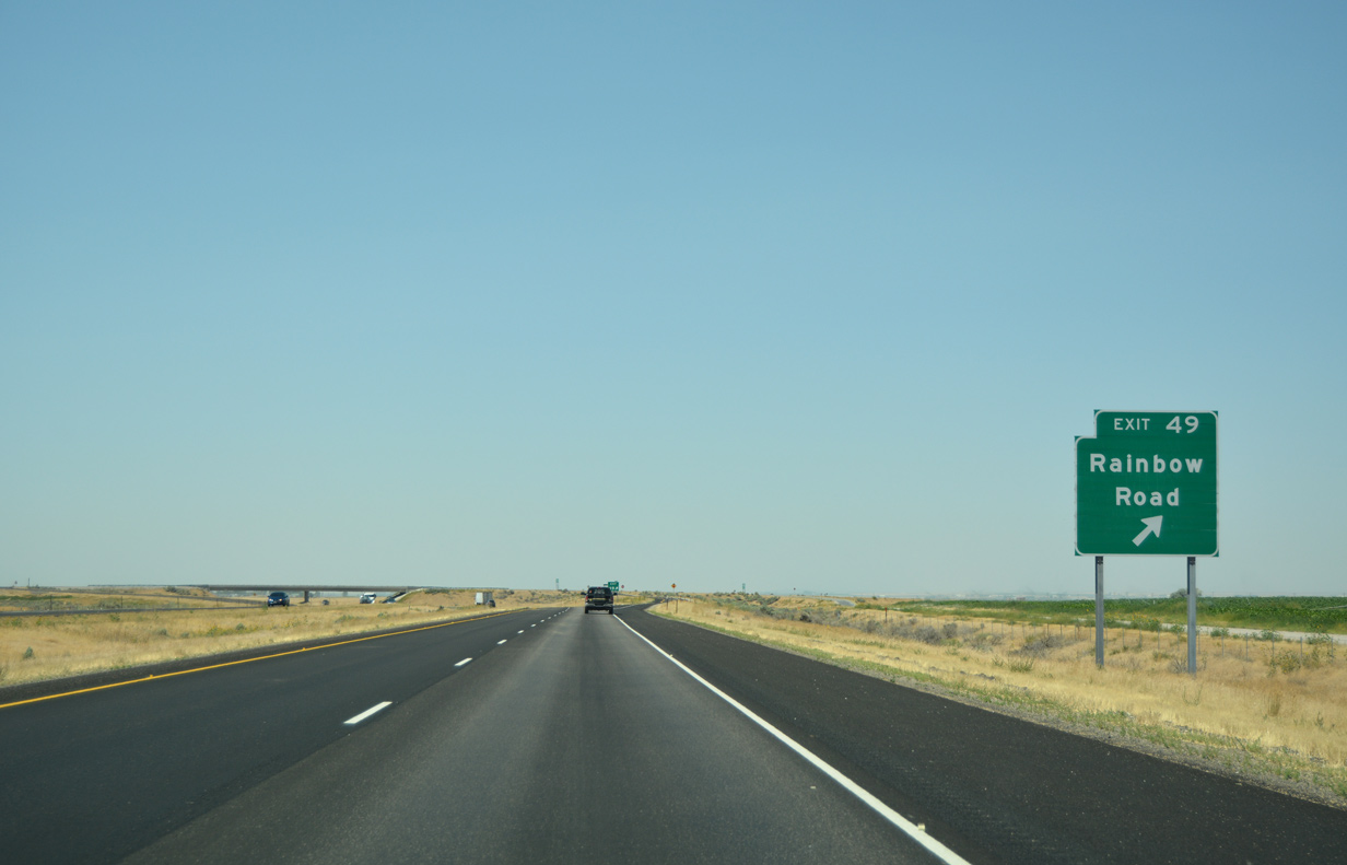
| Rainbow Road (Exit 49) provides a link to Rainbow Beach along the shores of the Snake River Reservoir in one mile. 08/09/16 |
|
| Drivers prepare to leave for the diamond interchange to Rainbow Road. South of I-86, Gas Plant Road continues into rural Power County. 08/09/16 |
|
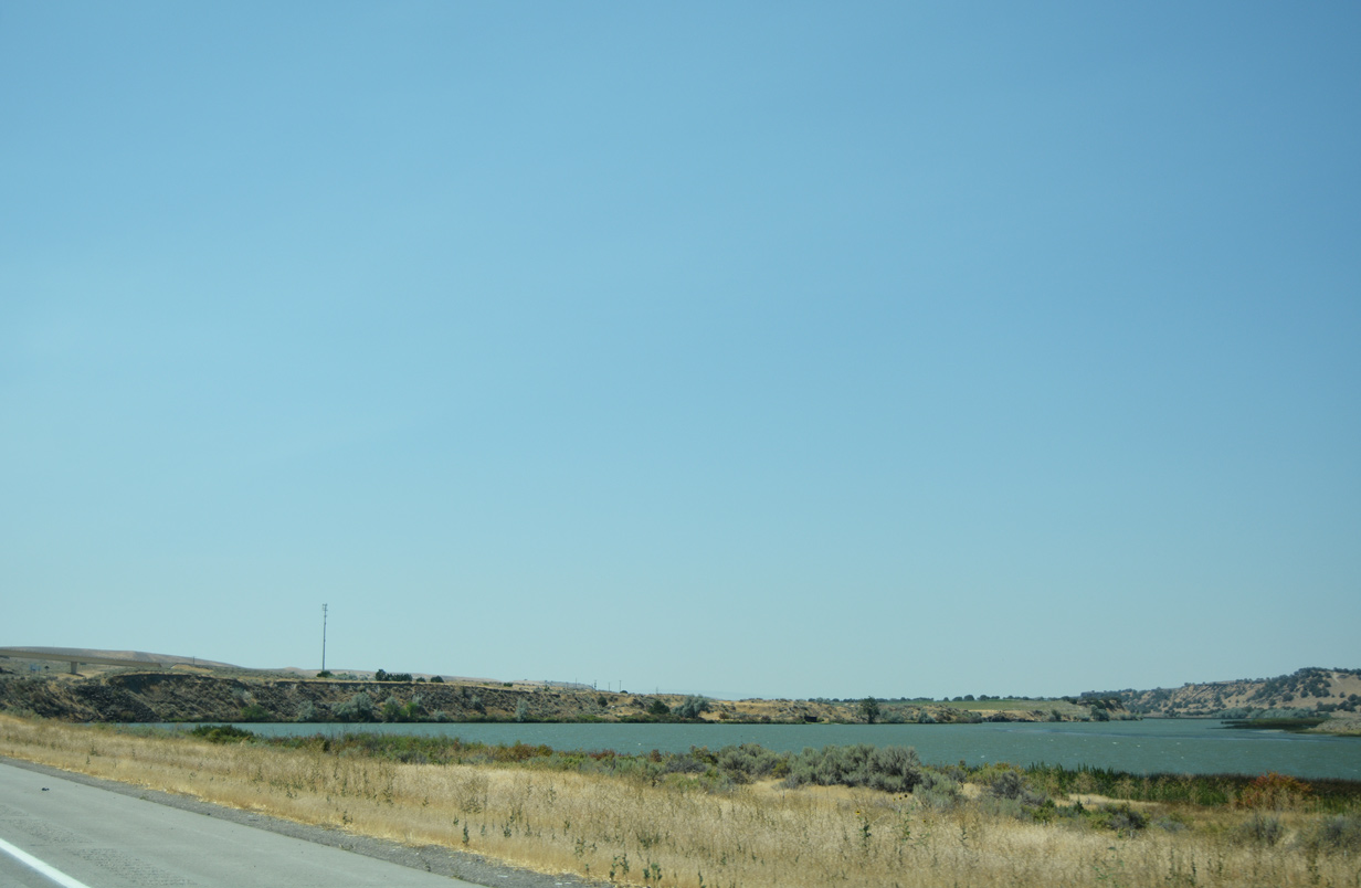
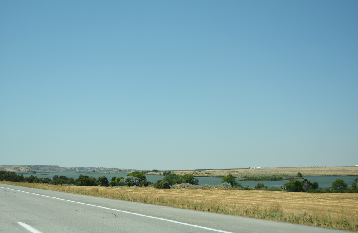
| Interstate 86 & U.S. 30 follow close to the Snake River Reservoir for the remainder to American Falls (9 miles). The freeway will parallel a portion of the 1,078 mile long river the remainder of its course to Interstate 84. 08/09/16 |
|
| The freeway officially leaves the Fort Hall Indian Reservation between mile markers 47 and 46. 08/09/16 |
|
| Seagull Bay Road (Exit 44) extends west and south from I-86 one mile ahead to reach the Seagull Bay inlet. 08/09/16 |
|
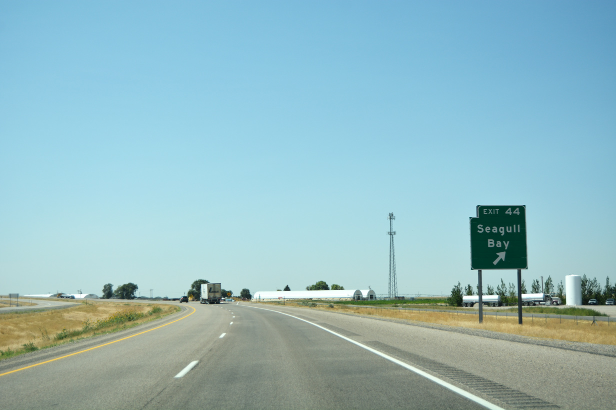
| I-86 & U.S. 30 briefly curve southward on the final approach to the egress ramp to Exit 44. Seagull Bay Road stems west from Sundance Road a short distance to the south. 08/09/16 |
|
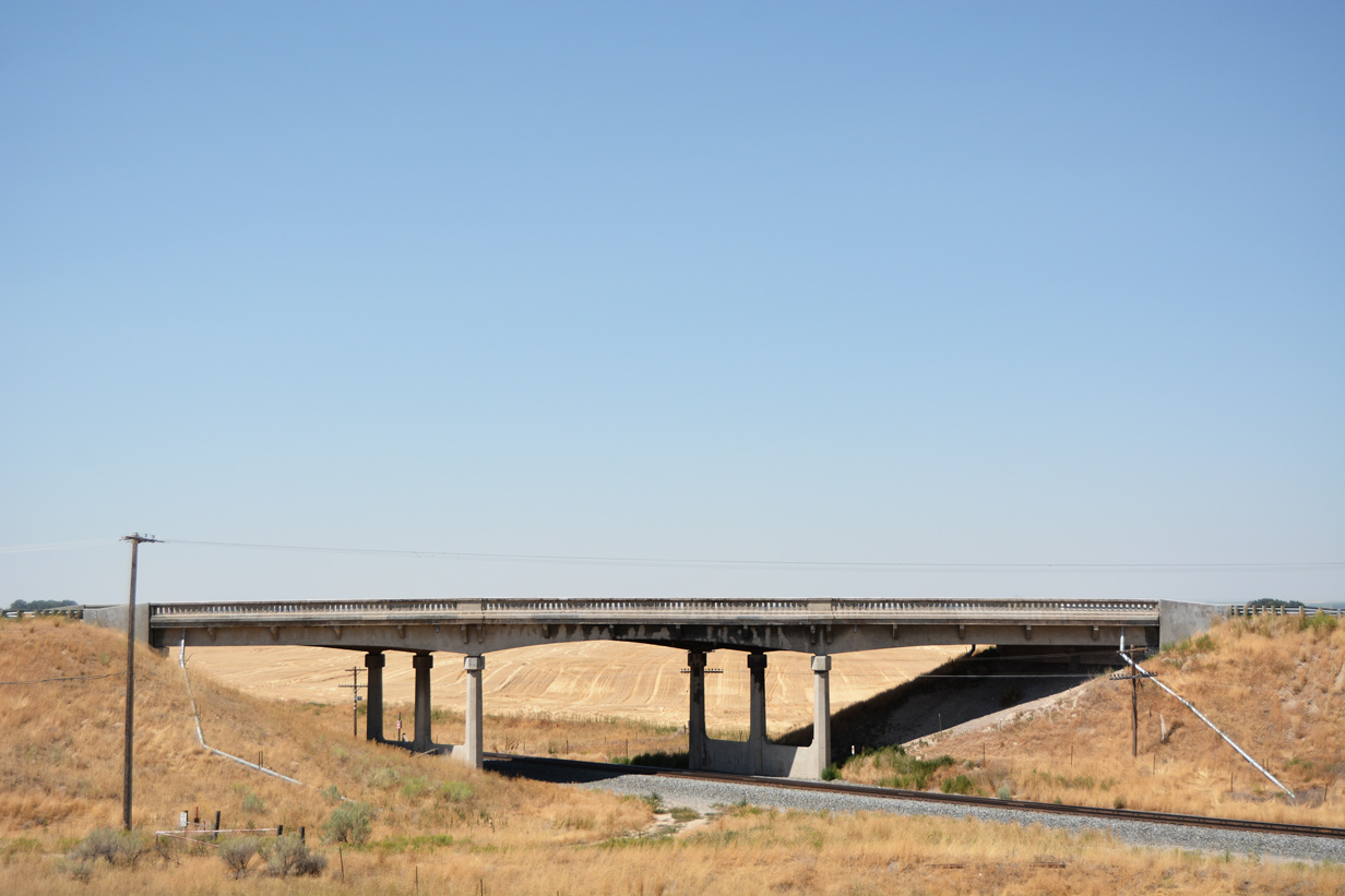
| A Union Pacific railroad line passes beneath both I-86 and Sundance Road as it beelines toward American Falls. The line continues west of American Falls aligning with SH-24 at Minidoka and a return to the I-84 freeway at Bliss. 08/09/16 |
|
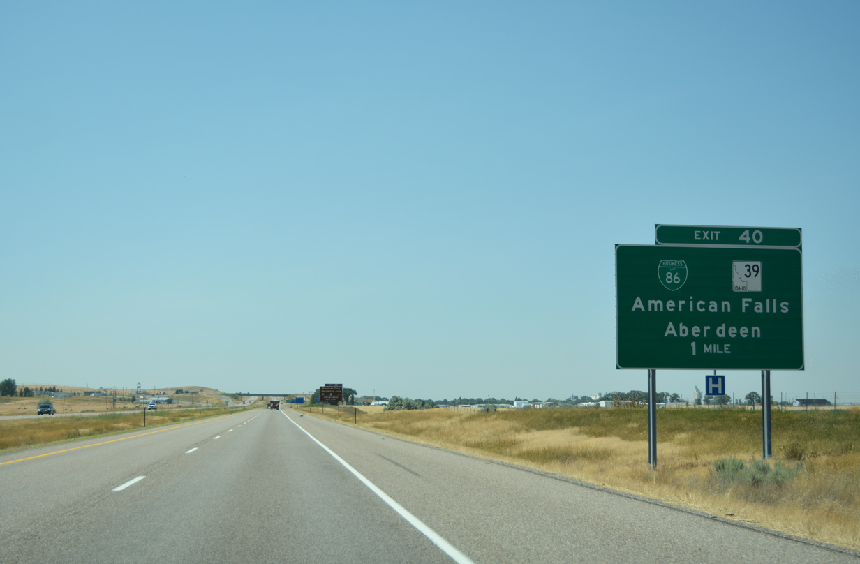
| Paps Mountain and Lone Rock begin to come into view as Interstate 86 & U.S. 30 return to a southwesterly component 58 miles out from Burley. Business Loop I-86 and SH-39 (Exit 40) represent the only link into American Falls from the east. Twin Falls is now under a 100 mile drive away. 08/09/16 |
|
| SH-39 begins a 52.9 mile trek to American Falls and Aberdeen in one mile. A lone business loop for I-86 follows SH-39 into American Falls before returning to the freeway at Exit 36. Drivers bound for the American Falls Recreation Area or its fairgrounds should depart ahead. 08/09/16 |
|
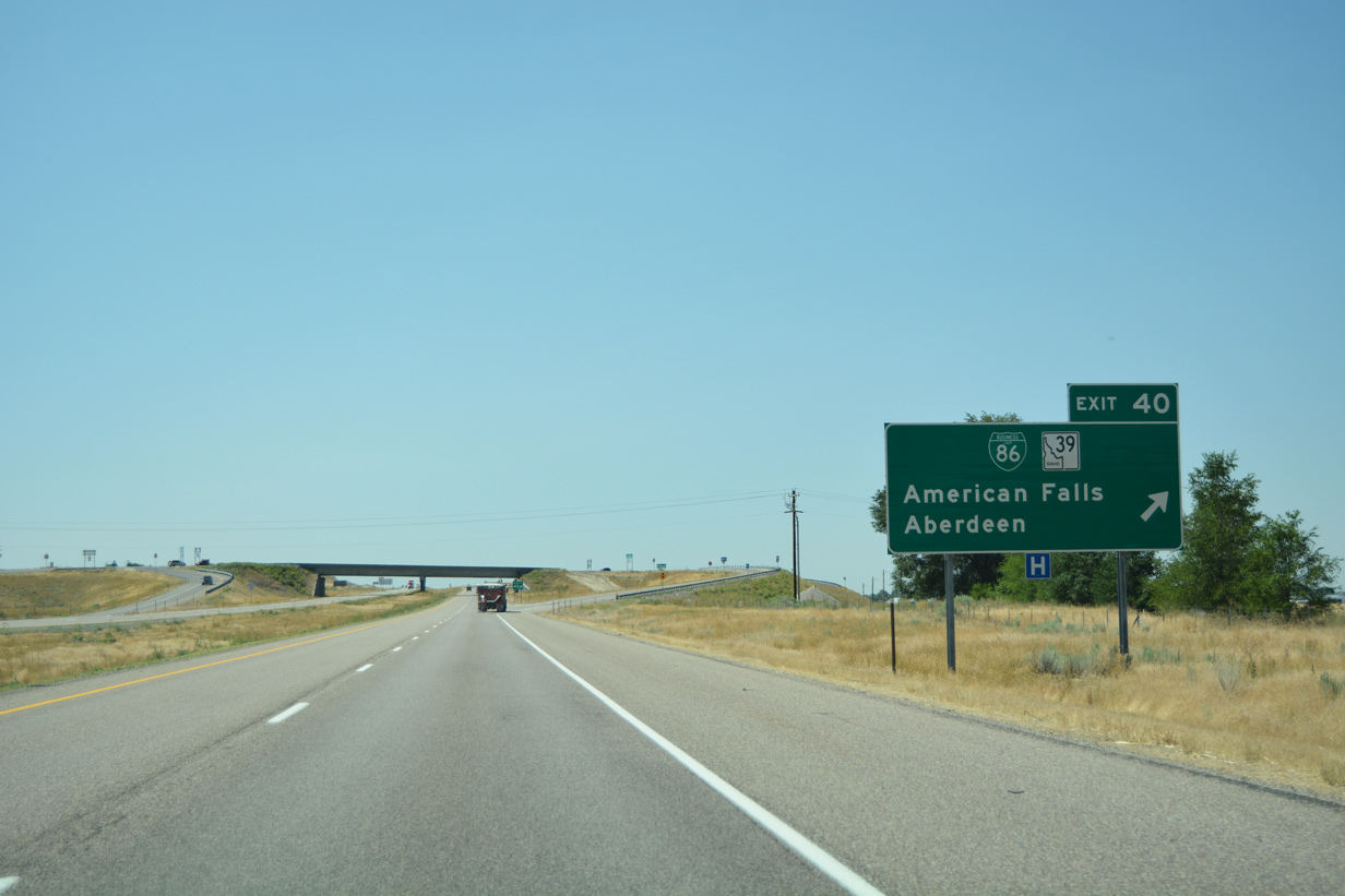
| Traffic leaves for the diamond interchange (Exit 40) with Business Loop I-86 and SH-39. The sole loop initially follows ID 39 around the north periphery of American Falls before departing along Idaho Street east to Fort Hall Avenue south. Business Loop I-86 ends its 5.34 mile run by way of Lincoln Street and Frontage Road. 08/09/16 |
|
| Both I-86 & U.S. 30 skirt American Falls to the south as the duo continue their course toward Burley and Twin Falls. 08/09/16 |
|
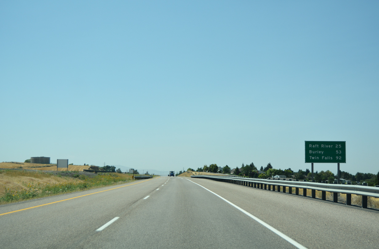
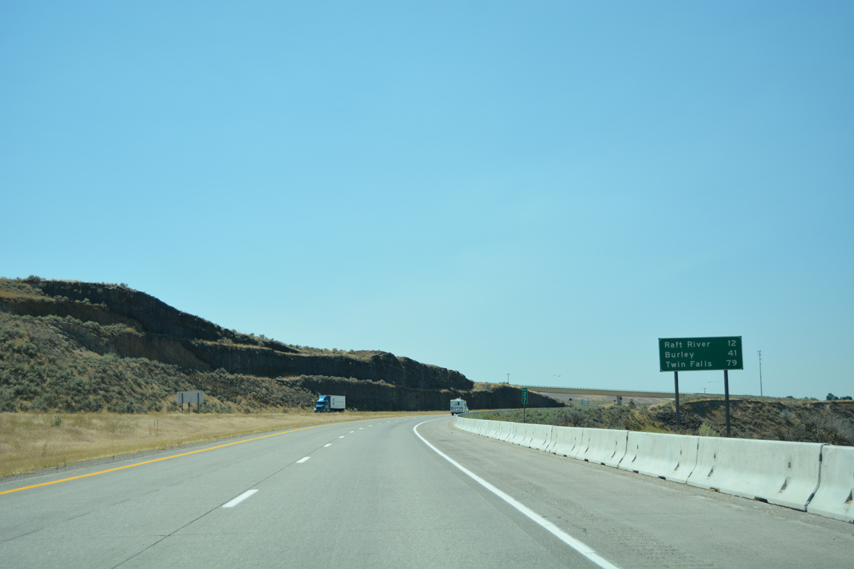
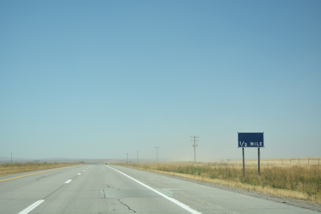
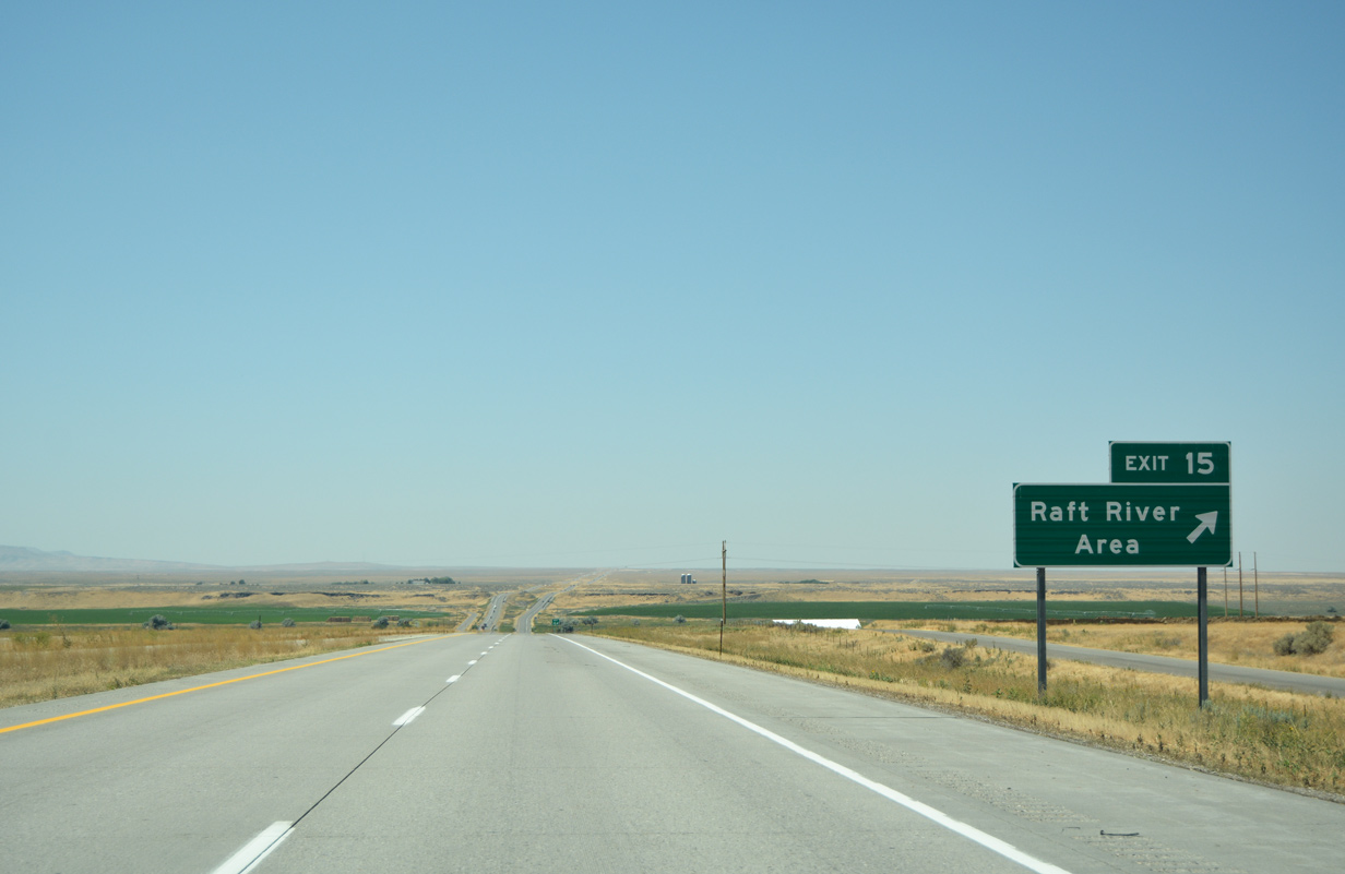
| Raft River makes its debut at 25 miles out while Burley is now a 45 minute drive away. Raft River represents the last interchange (Exit 15) along mainline I-86. 08/09/16 |
|
| Business Loop I-86 (Frontage Road) travels alongside I-86 & U.S. 30 west one mile out from SH-37 (Exit 36). 08/09/16 |
|
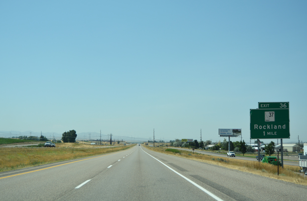
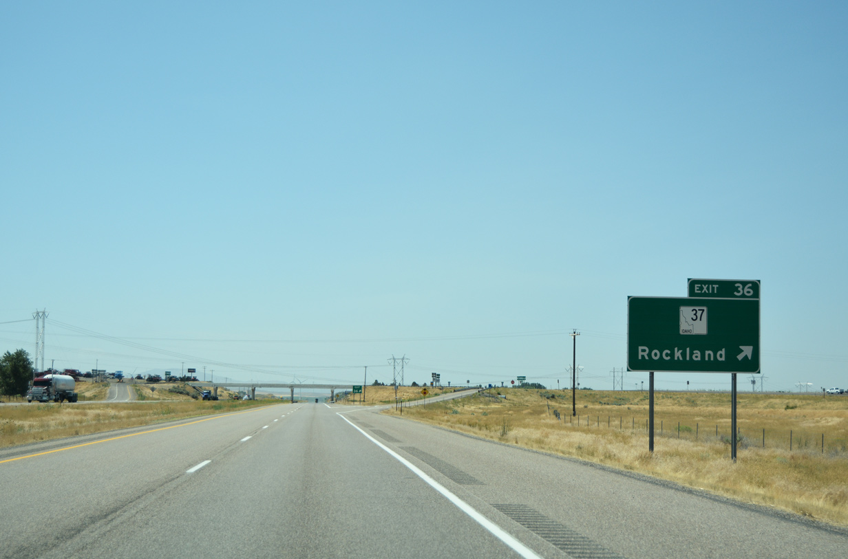
| SH-37 begins at the diamond interchange (Exit 36) with I-86 and heads south toward Rockland. The state highway travels 31.2 miles to the Oneida county line where it transitions into Rockland Highway. 08/09/16 |
|
| This shield assembly posted beyond the Exit 36 entrance ramp includes a California and Oregon Trail trailblazer, not seen since Airport Way (Exit 56). 08/09/16 |
|
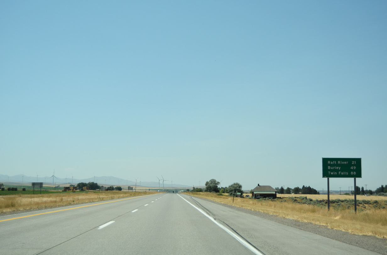
| I-86 & U.S. 30 inch closer to Burley (49 miles) and Twin Falls (88 miles) as the freeway passes through more agriculture fields. 08/09/16 |
|
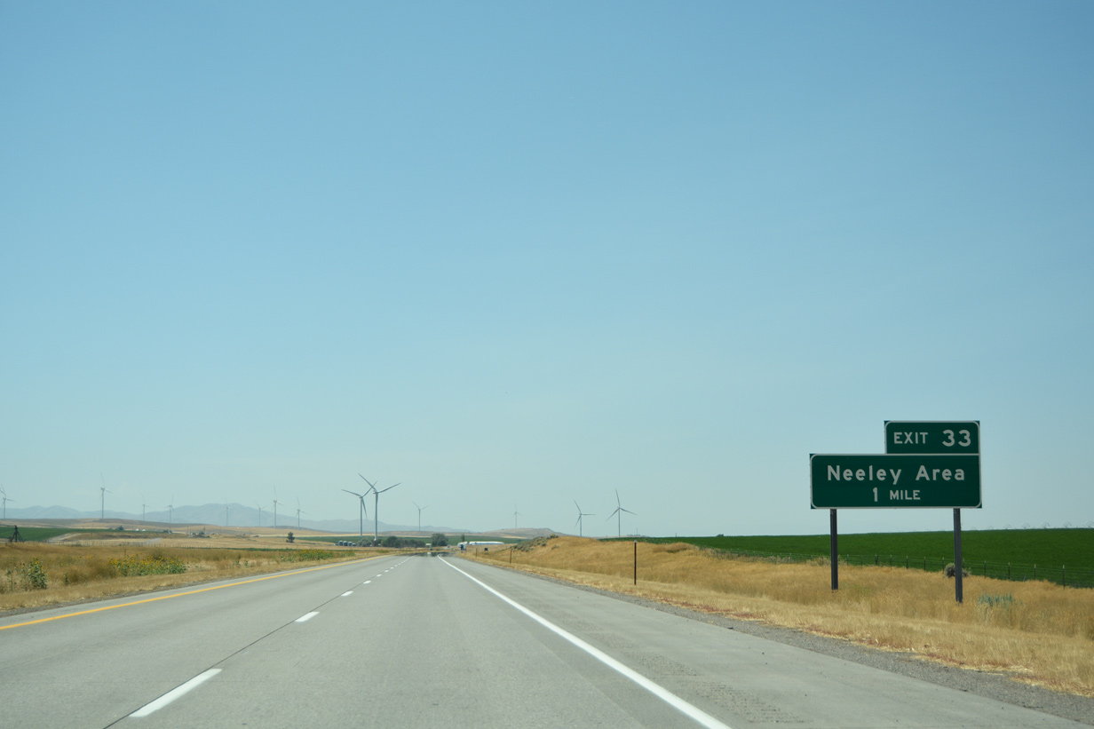
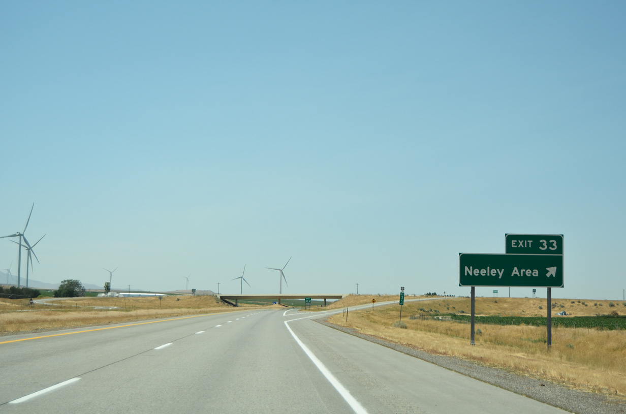
| Neeley is an unincorporated community lying five miles southwest of American Falls that connects to I-86 at Exit 33. 08/09/16 |
|
| Several wind turbines dot the Neeley Area south of the interchange (Exit 33) with I-86 & U.S. 30. The diamond interchange is also devoid of any traveler services. 08/09/16 |
|
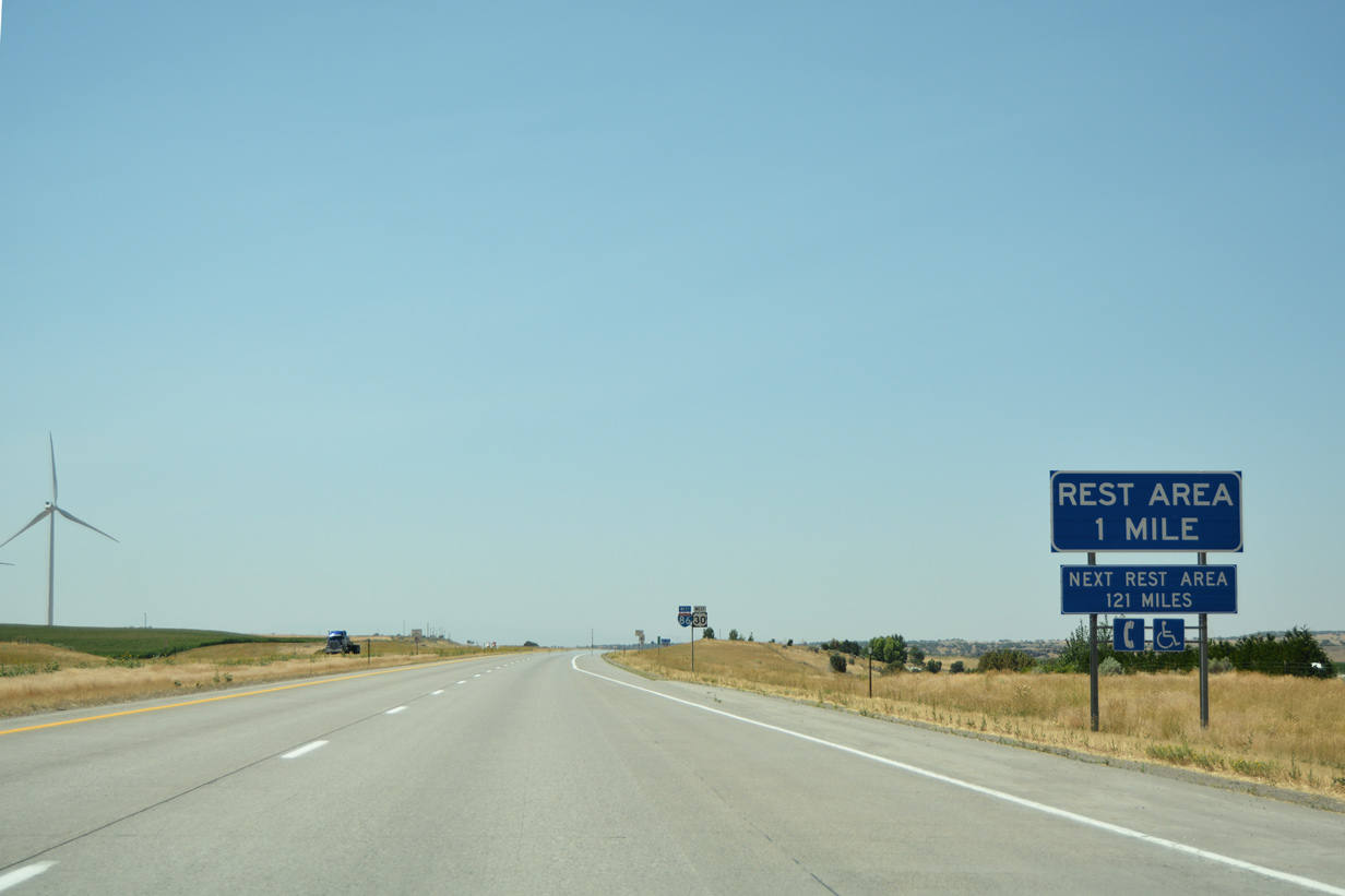
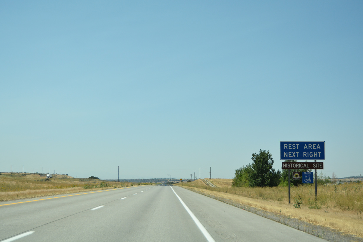
| A rest area serves motorists traveling along Interstate 86 & U.S. 30 west near mile marker 31. The following rest area lies along I-84 & U.S. 30 to the west of Bliss in 121 miles. 08/09/16 |
|
| The freeway stays relatively close to the Snake River as both remain on their southwesterly course through Power county. 08/09/16 |
|
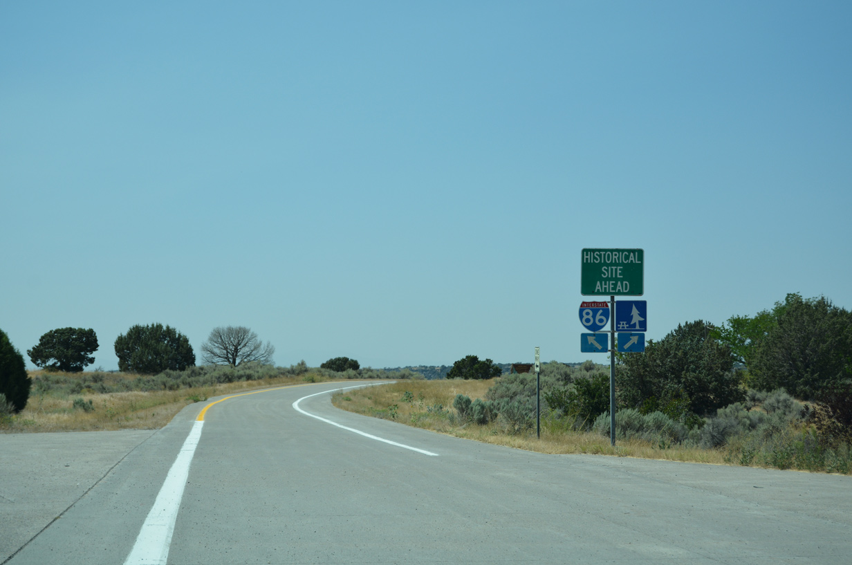
| Interests to an Oregon Trail historical site are advised to depart for the upcoming rest area. 08/09/16 |
|
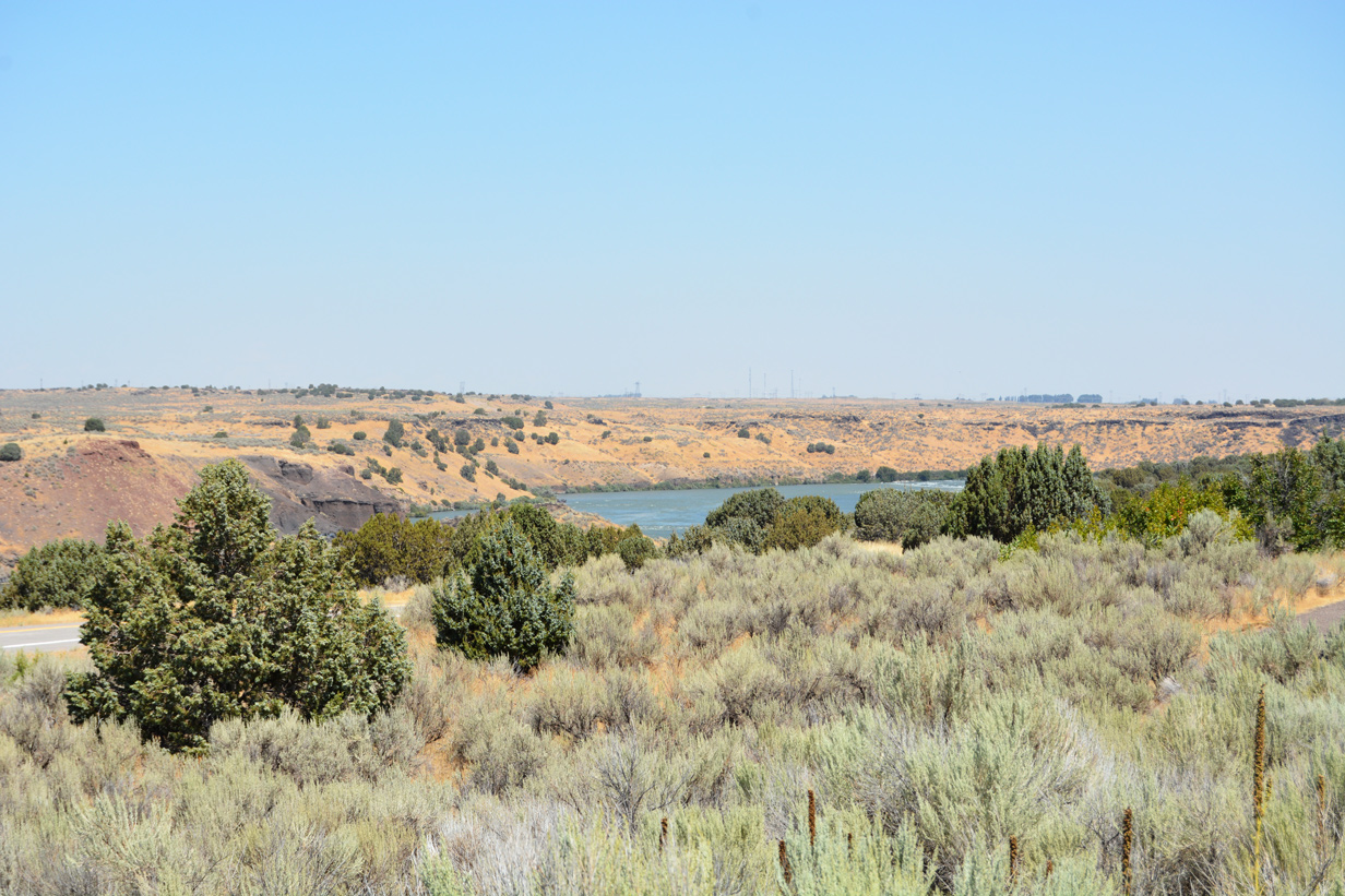
| Another scene of the Snake River as it meanders north of the rest area boundary along I-86 west. Drivers leave for a return to the I-86 mainline while continuing ahead leads to the Oregon Trail historical site. 08/09/16 |
|
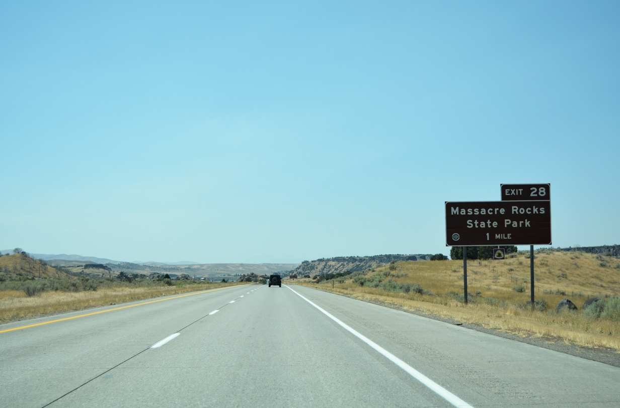
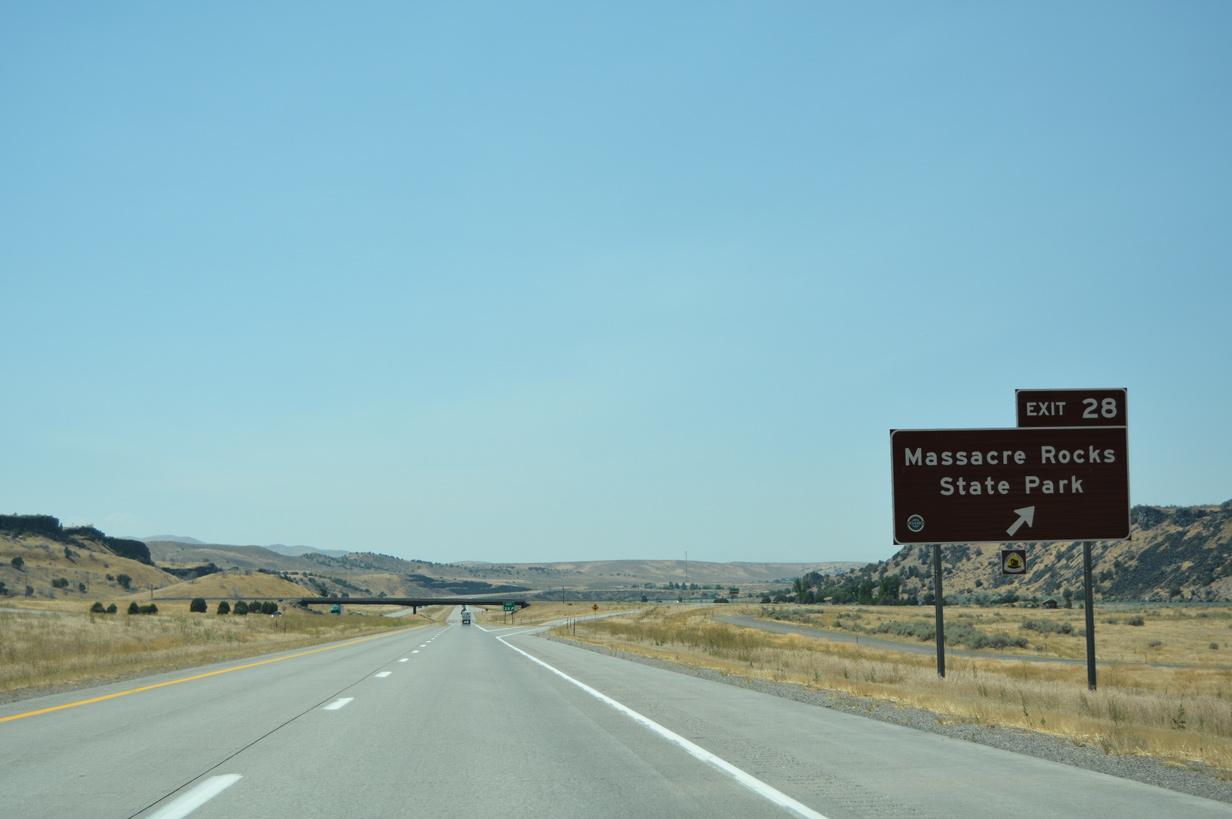
| Beyond the rest area, I-86 & U.S. 30 west pass to the south of Massacre Rocks State Park. Massacre Rocks was given its name by emigrants who engaged in wagon party skirmishes with native Indians near a narrow passage of rocks where the Oregon Trail traversed.3 Exit 28 provides the only access to the park in one mile. 08/09/16 |
|
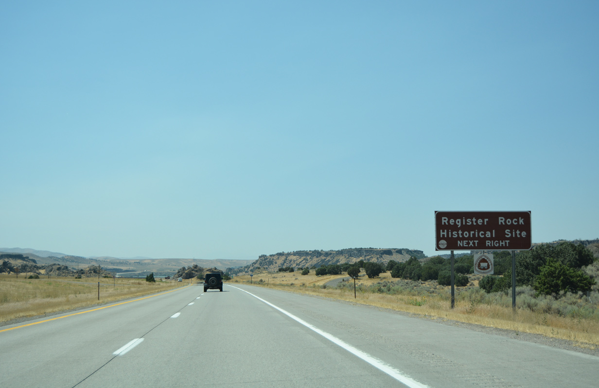
| Exit 28 also provides a link to the Register Rock historical site which resides two miles from Massacre Rock State Park. Register Rock is comprised of a huge boulder with the names of some of the original Oregon Trail travelers and emigrants who would stop for a evening of rest before continuing on their journey.3 08/09/16 |
|
| Park Lane leads north from I-86 and a diamond interchange (Exit 28) to the entrance of Massacre Rock State Park. Register Rock is situated further south adjacent to the I-86 mainline along Register Road. 08/09/16 |
|
| The Snake River briefly travels directly beside the westbound roadway of I-86 & U.S. 30 as it continues southwest from Exit 28. 08/09/16 |
|
| Interstate 86 passes near Register Rock in this scene with only 27 miles of freeway left. Otherwise, motorists are now within 12 miles of Raft River. 08/09/16 |
|
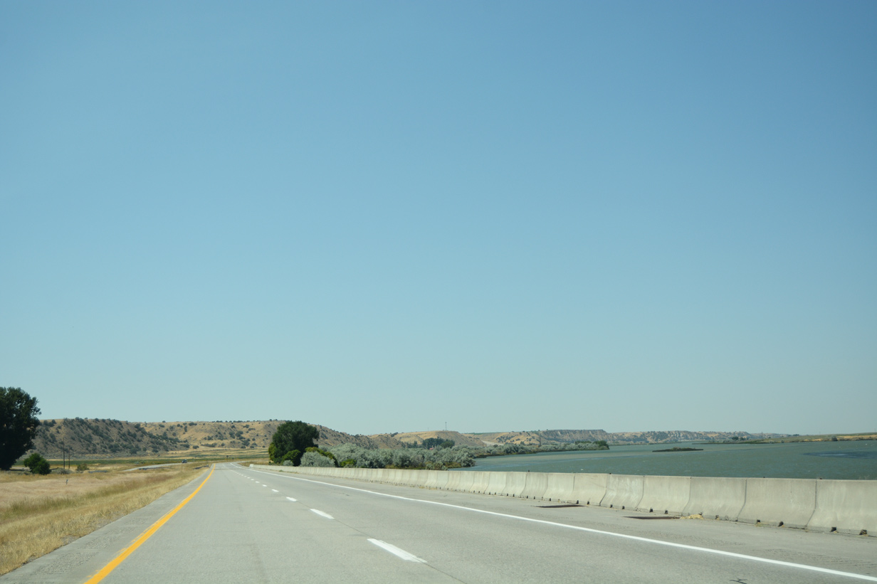
| Due to the closeness of the waters of the Snake River in this vicinity, barriers have been erected along the westbound lanes. Once beyond the Coldwater Area (Exit 21) I-86 & U.S. 30 diverge from the river as it flows into Lake Walcott. 08/09/16 |
|
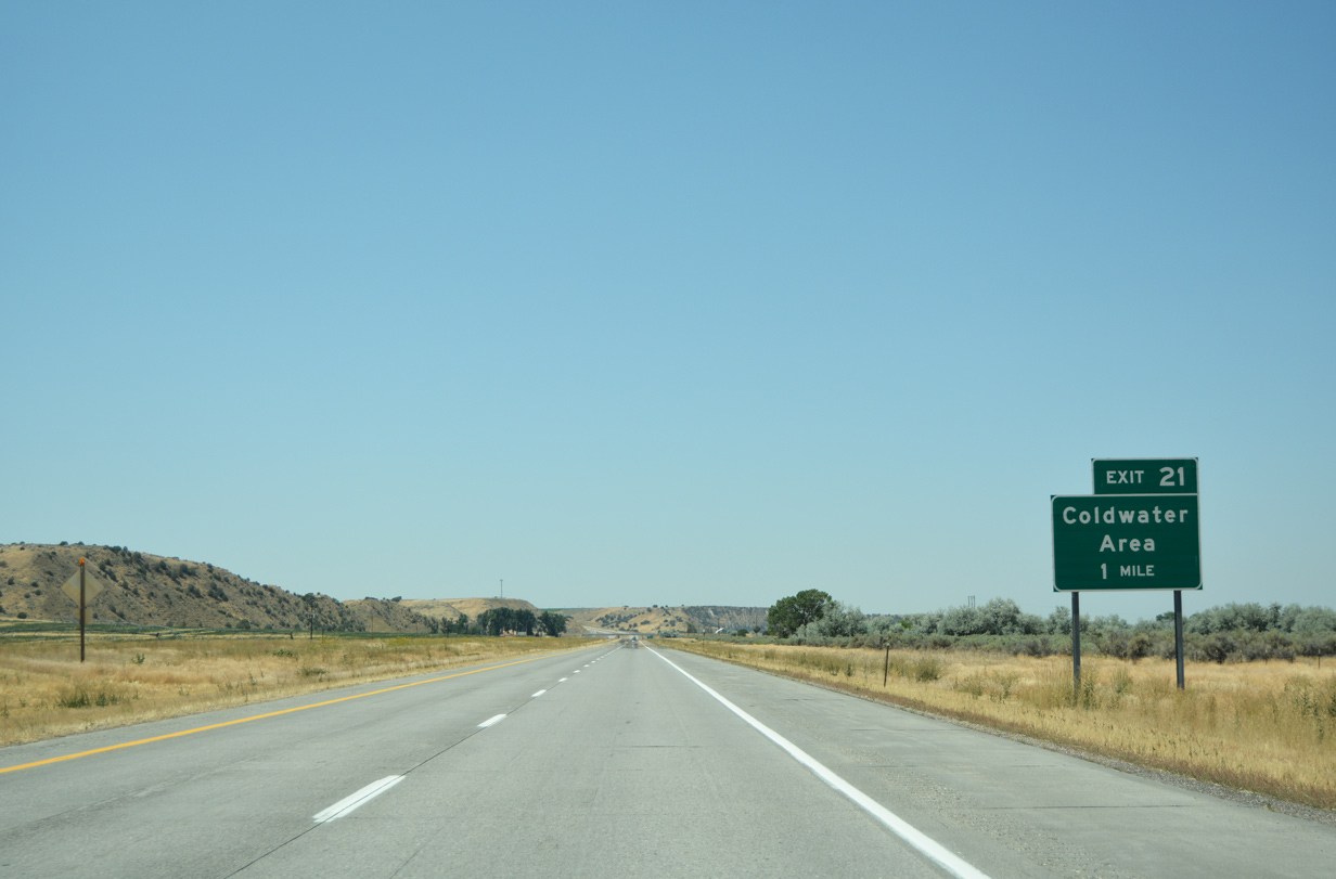
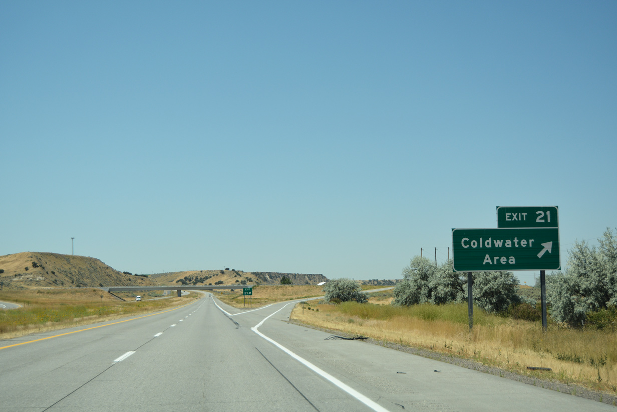
| I-86 & U.S. 30 west reach the Coldwater Area (Exit 21) interchange in one mile. 08/09/16 |
|
| Barkdull Road leads south from Exit 21 to connect with Cold Water Road. Otherwise I-86 continues on its course to Raft River and beyond. 08/09/16 |
|
| I-86 & U.S. 30 bend more southerly as Cold Water Road follows to the south toward Register Rock. A rest area lies along eastbound five miles out from Raft River. 08/09/16 |
|
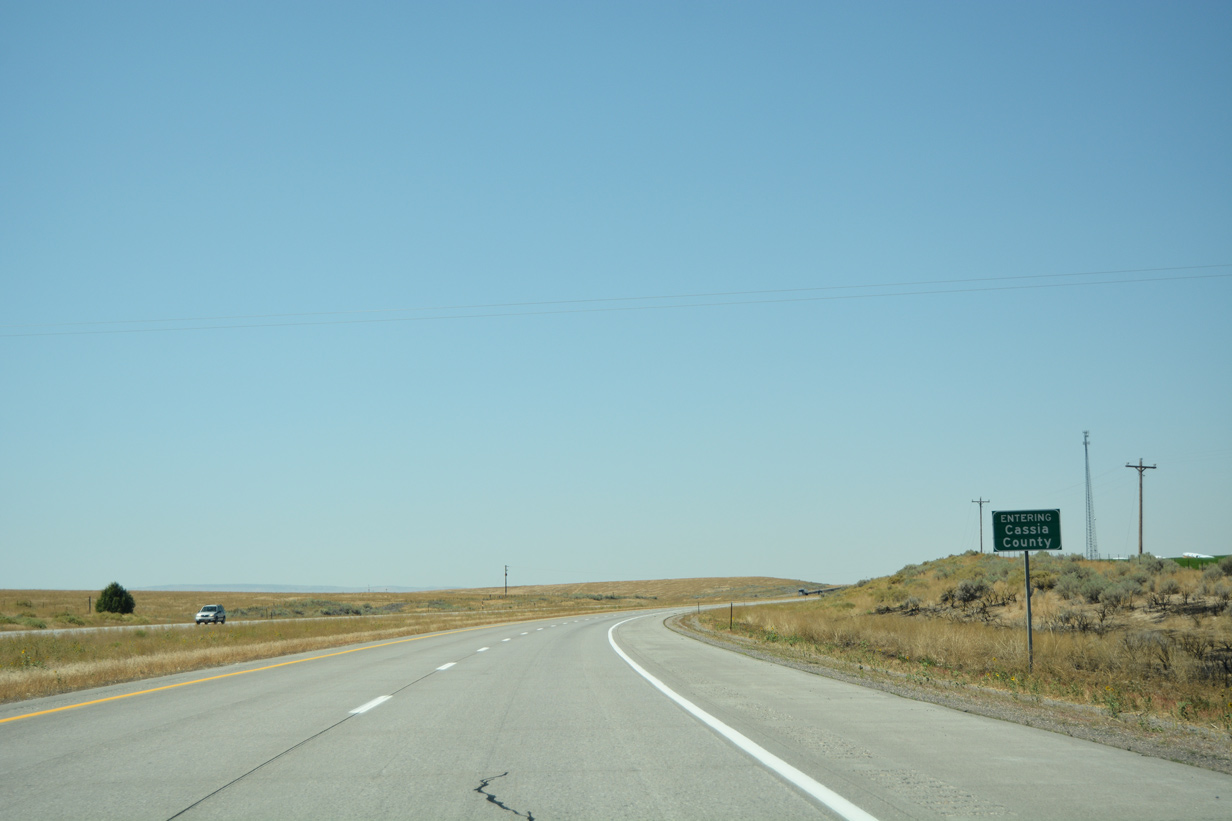
| Midway between Exit 21 and Raft River (Exit 15) motorists enter Cassia County. Burley, now a 30 minute drive, serves as the county seat. 08/09/16 |
|
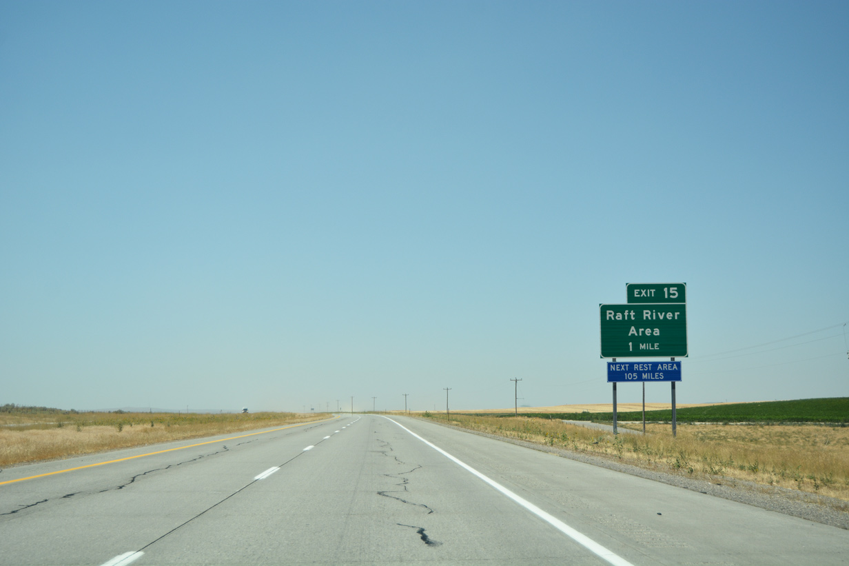
| The forthcoming Raft River Area (Exit 15) represents the final interchange along I-86 west one mile ahead. A placard is also in place reminding drivers of the long distance to the next mainline rest area (105 miles). 08/09/16 |
|
| An older service sign still lies along the I-86 & U.S. 30 shoulder on the approach to Exit 15 for a former service station near the interchange. 08/09/16 |
|
| Yale Road passes under the I-86 roadways, connecting with frontage roads on either side of the diamond interchange. A 15 mile exit less stretch awaits drivers bound for I-84 and points beyond. 08/09/16 |
|
| A set of confirming markers line I-86 & U.S. 30 west beyond the entrance ramp from Exit 15. The city of Rupert lies to the east of Burley in 24 miles. Otherwise, the freeway spans Baseline Road (former U.S. 30N) ahead of the terrain cuts. 08/09/16 |
|
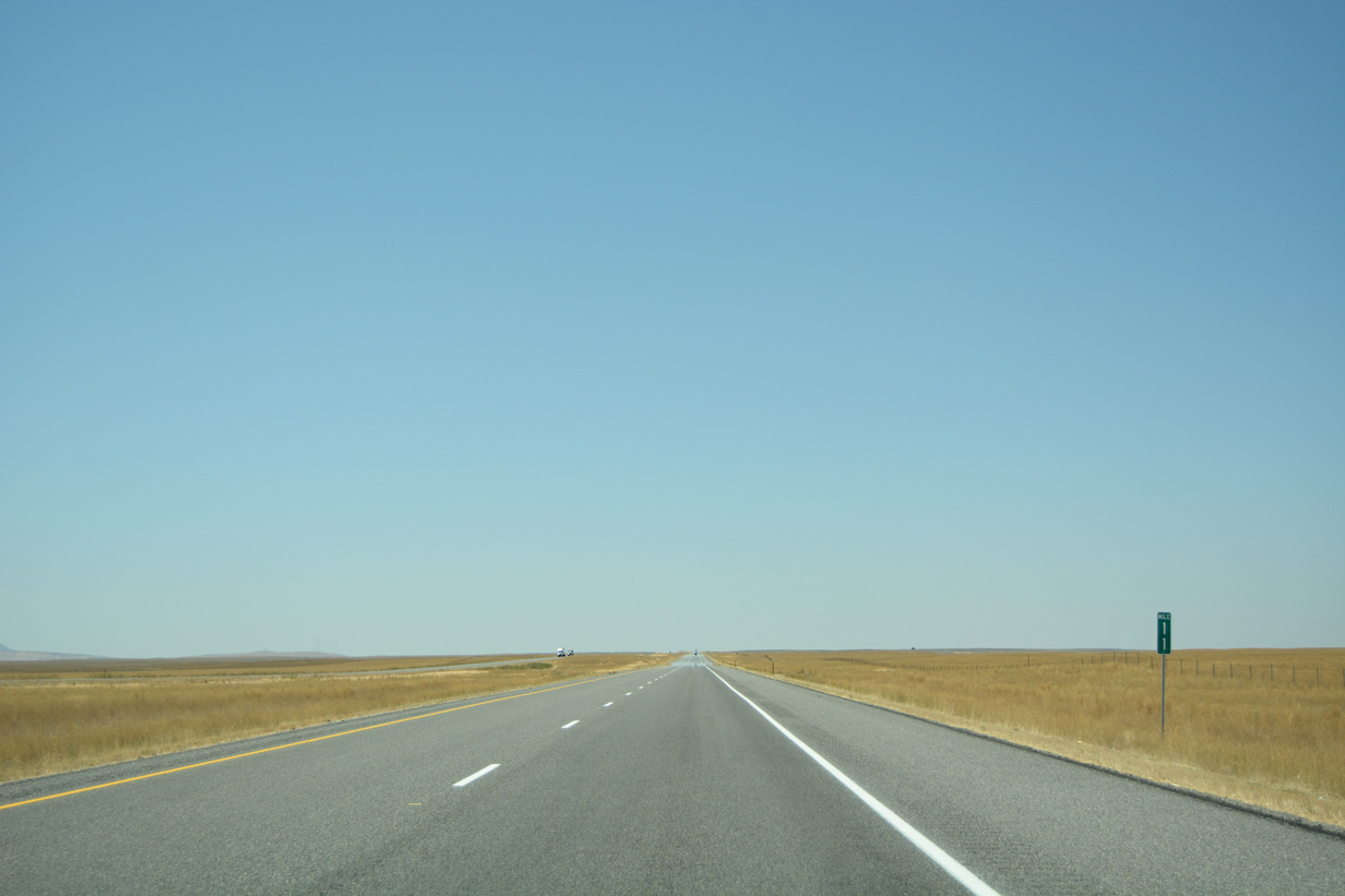
| In its remaining miles, I-86 traverses through a relatively flat and open grassy landscape. 08/09/16 |
|
| Motorists pass by one final set of reassurance markers for the Interstate en route to its end. 08/09/16 |
|
| Two trees are all that remains of previous rest areas that once lined both sides the freeway four miles out from Interstate 84. All other physical traces have long since been removed. 08/09/16 |
|
| A distance sign remains in place beyond the former rest area along I-86 west. Twin Falls is now only a 45 minute drive while drivers will reach Burley in 20 minutes. 08/09/16 |
|
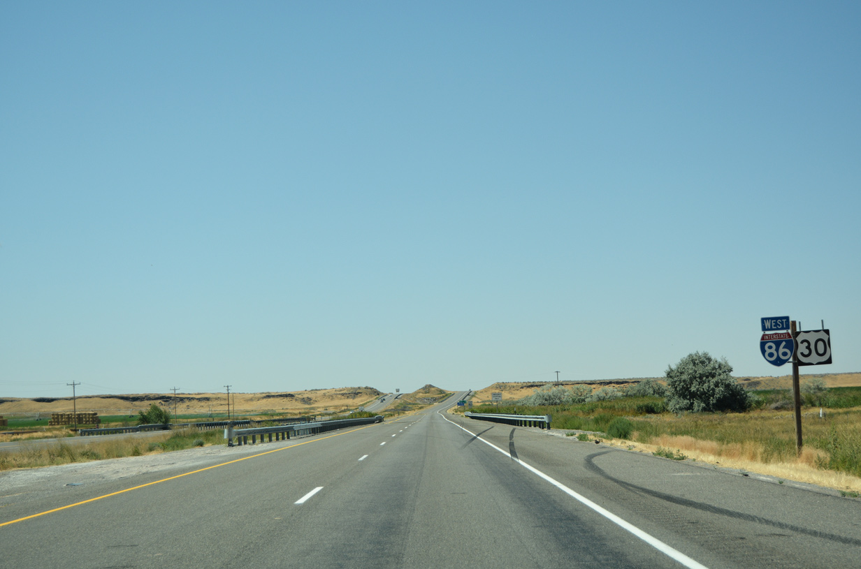
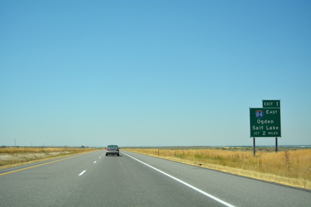
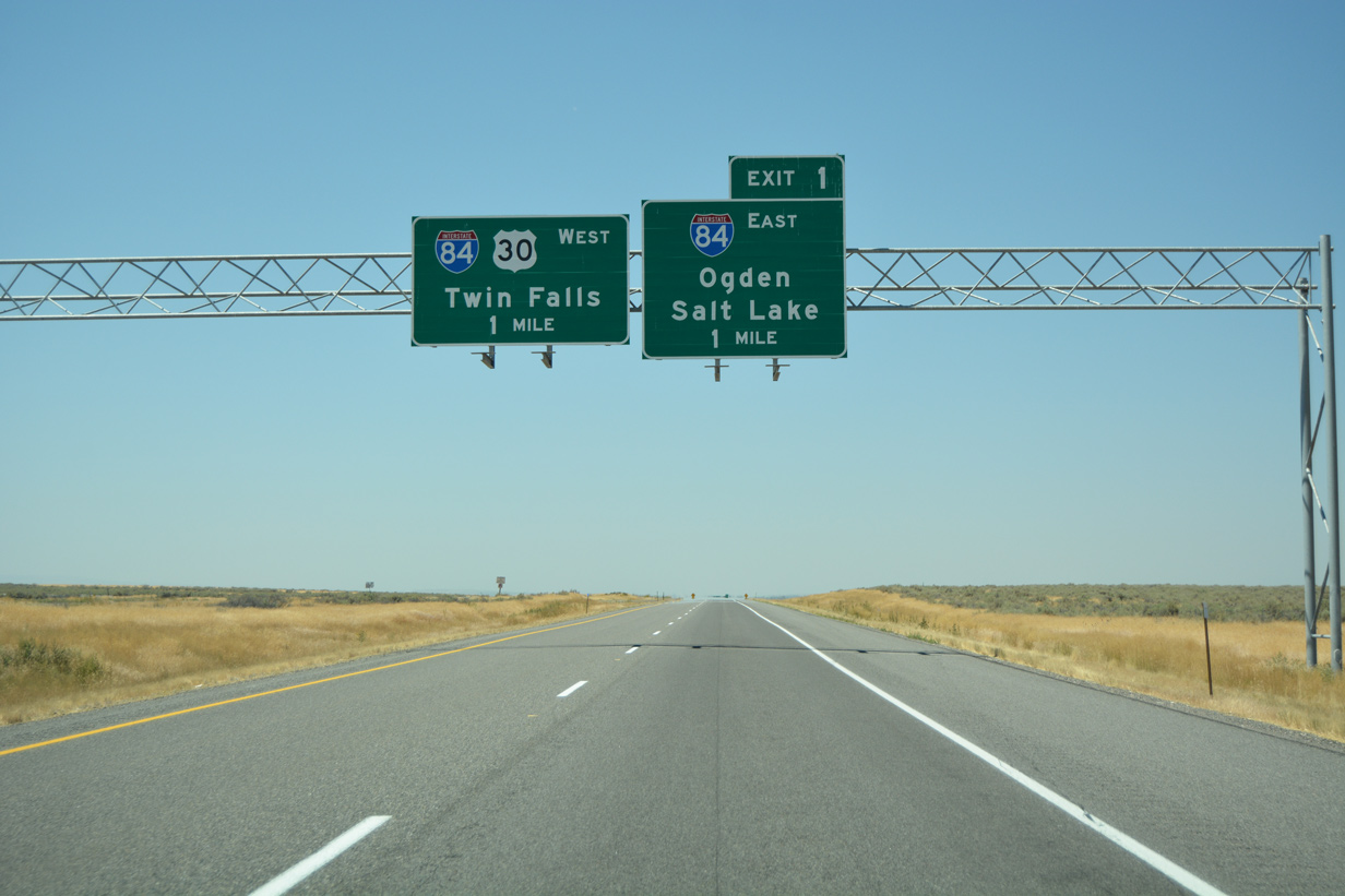
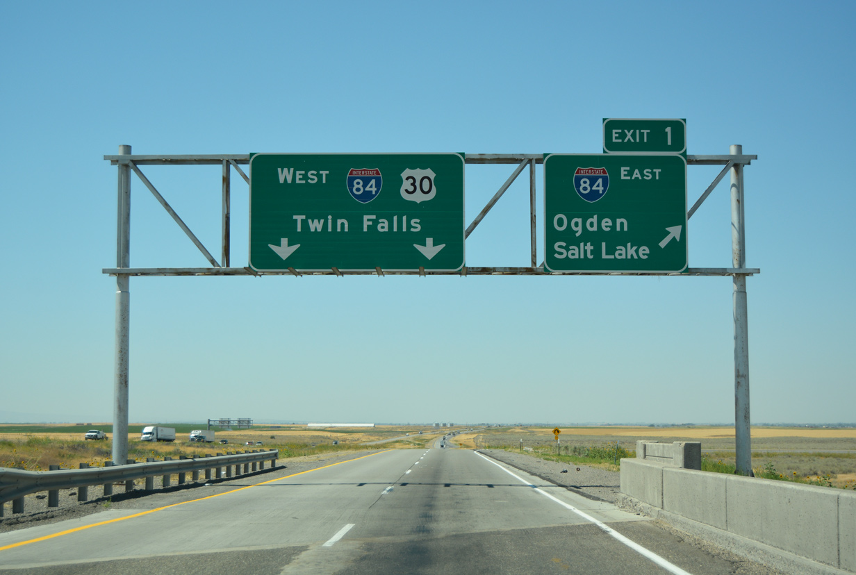
| Interstate 86 will come to an end in two miles when it connects with I-84 west to Burley and Twin Falls and east toward Ogden and Salt Lake City, Utah. 08/09/16 |
|
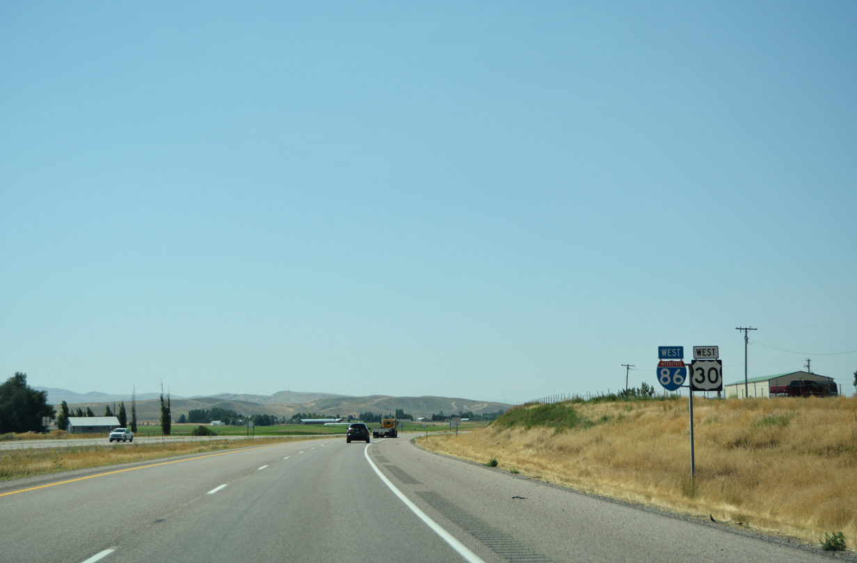
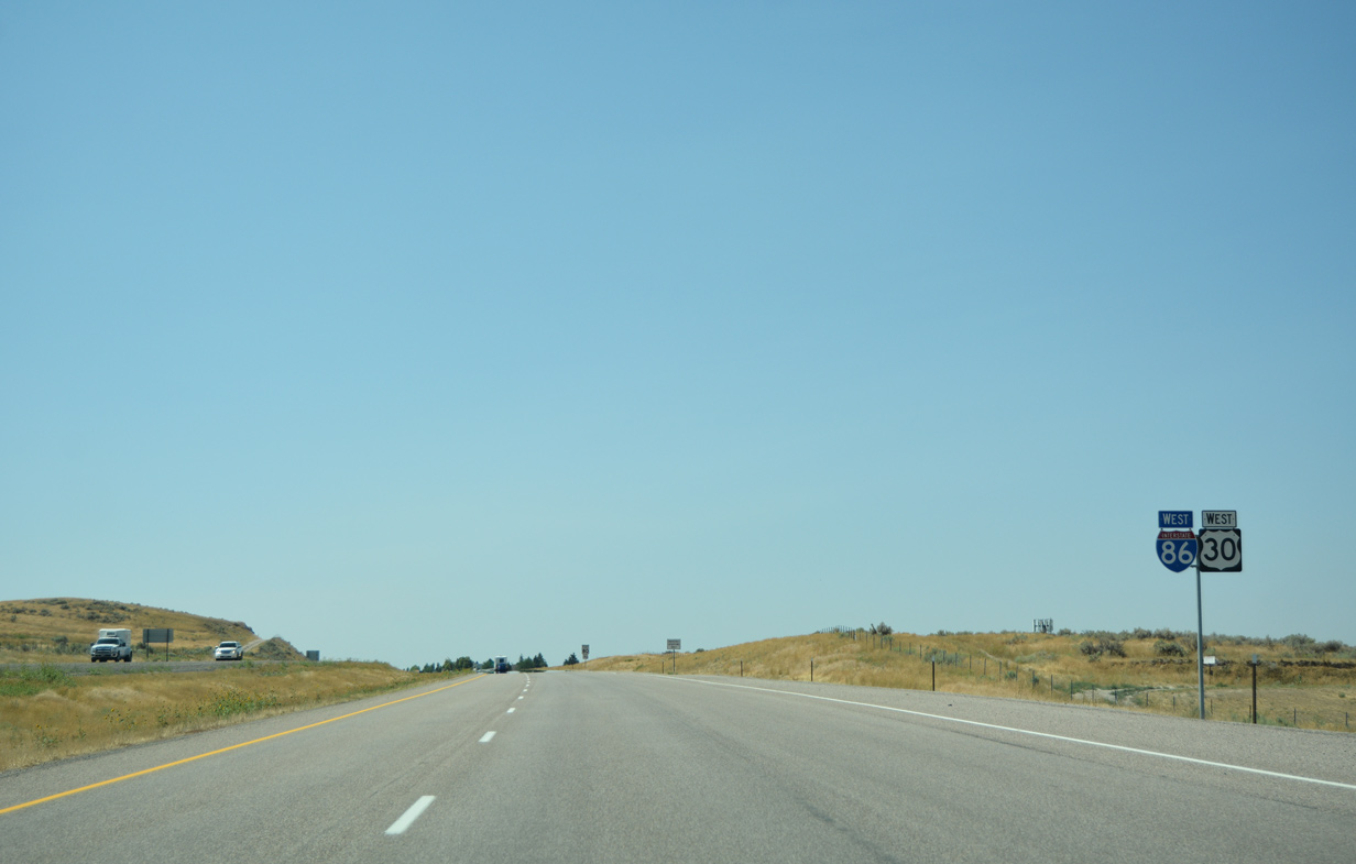
| The I-86 westbound mainline defaults onto I-84 west while a loop ramp facilitates movement onto I-84 east in one mile. The freeway travels on a southeast trajectory into Utah where it merges with I-15 south at Tremonton. The two freeways split at Ogden with I-84 heading southeast to its end at I-80 (Echo) while I-15 continues southward into Salt Lake. 08/09/16 |
|
| I-86 officially ends its 62.85 mile run as the freeway continues ahead to merge with I-84 west to Twin Falls. U.S. 30 follows I-84 west to SH-24 (Exit 24) where the US highway dips south into Heyburn and Burley. 08/09/16 |
Page Updated 08-29-2016.

 West
West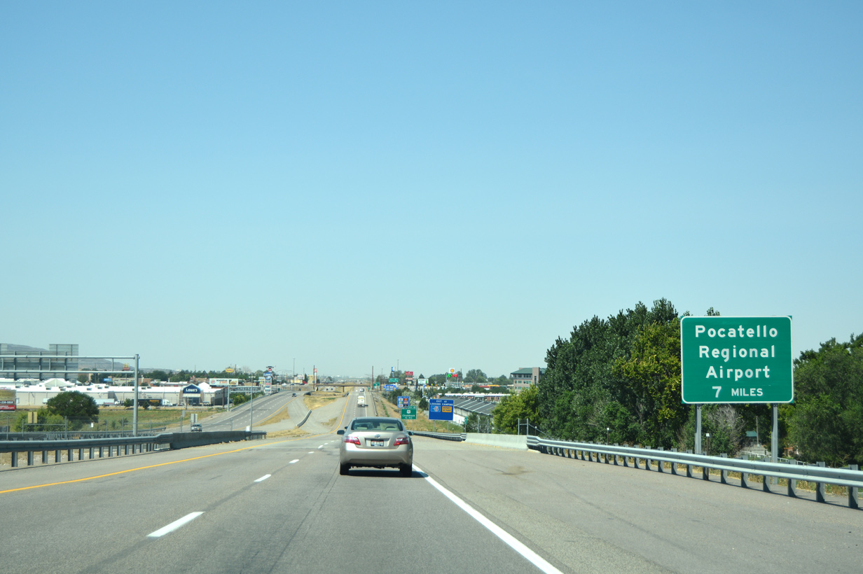

 West
West