|
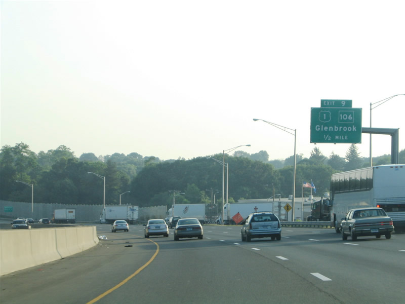
| U.S. 1 (Boston Post Road) returns to Interstate 95 via East Main Street in Stamford, crossing paths with the Connecticut Turnpike at Exit 9. The US highway loops south of the freeway between Exits 11 and 9 through Noroton.
Intersecting U.S. 1 nearby is the south end of Route 106 (Courtland Avenue), a north-south route linking east Stamford with New Canaan and Wilton to the northeast. 06/13/05 |
|
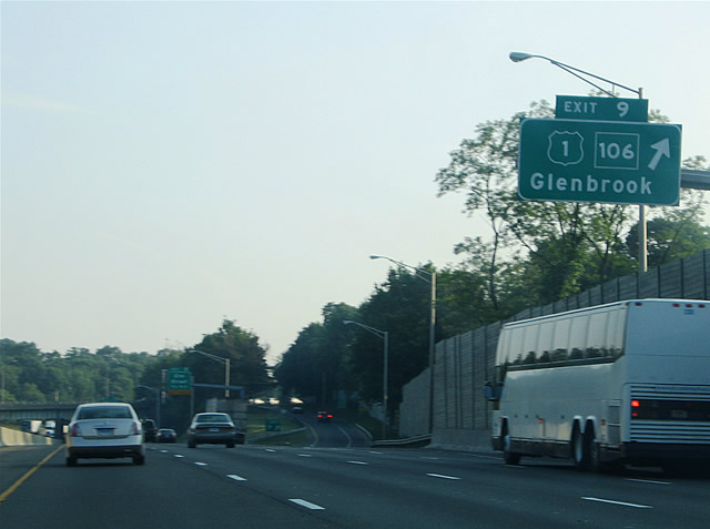
| Westbound (southbound) at the parclo interchange (Exit 9) with U.S. 1 (East Main Street). U.S. 1 continues west alongside Interstate 95 toward Downtown Stamford. Route 106 (Courtland Avenue) travels north to the Glenbrook, Belltown and Springdale neighborhoods of Stamford. The state route follows a 14.37 mile course north from Stamford to Route 53 at Wilton. 06/13/05 |
|
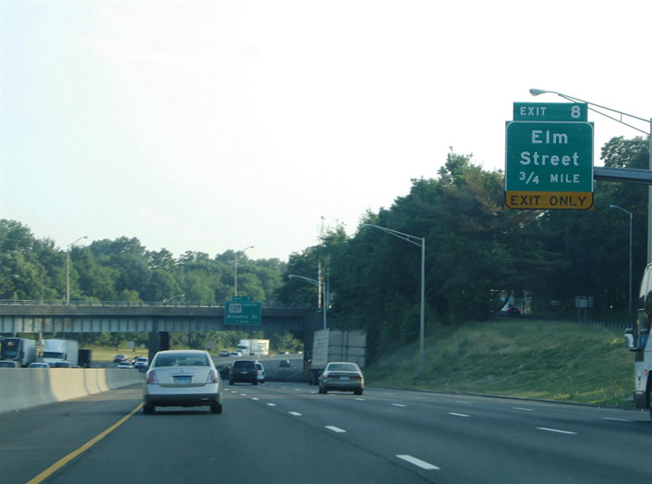
| Route 106 (Courtland Avenue) ends at the U.S. 1 intersection with the southbound on-ramp to Interstate 95. Drivers merging onto the freeway from there form an auxiliary lane to the off-ramp (Exit 8) to Elm Street and the Stamford Town center. Exit 8 forms the beginning of a westbound side frontage street (North State Street) from Elm Street to Washington Boulevard. 06/13/05 |
|
| The skyline of Downtown Stamford comes into view on the Interstate 95 southbound approach to Exits 8 and 7. Route 137 (Washington Boulevard) begins in Downtown at its junction with U.S. 1 (Tresser Boulevard). The state route heads northward from there to Turn of River, North Stamford, High Ridge and Pound Ridge, New York as NY 137. Elm Street travels diagonally from Main Street and U.S. 1 (Tresser Boulevard) southeast to Shippan Avenue at Cove Road. 06/13/05 |
|
| Exit 8 departs Interstate 95 over the Metro North Railroad and South State Street to meet Elm Street at North State Street. Elm Street intersects U.S. 1 (Tresser Boulevard) one block to the north en route to Broad Street as Grove Street. 06/13/05 |
|
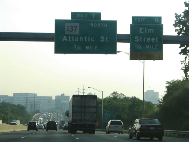
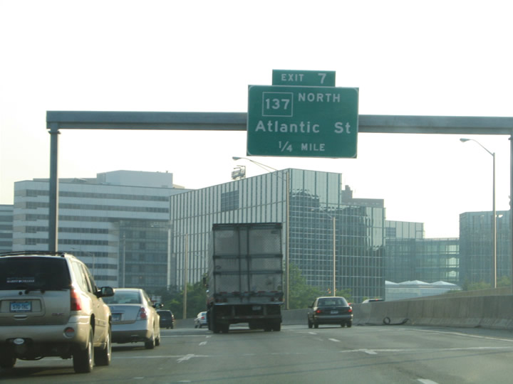
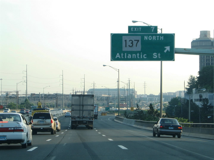
| Interstate 95 travels a six lane viaduct parallel to the railroad line on the southern periphery of Downtown Stamford. Exit 7 consists of a slip ramp onto adjacent North State Street ahead of its intersections with Canal Street, Atlantic Street and Washington Boulevard. Canal and Atlantic Streets lead north into the Stamford central business district; Washington Boulevard comprises a six to eight lane arterial northward from Interstate 95 to Route 104 (Long Ridge Road). 06/13/05 |
|
| Exit 7 ventures onto adjacent North State Street from Interstate 95 southbound. Atlantic Street constitutes a north-south street between Washington Boulevard and Broad and Bedford Streets in Downtown. CT 137 travels 9.33 miles within the Constitution State. 06/13/05 |
|
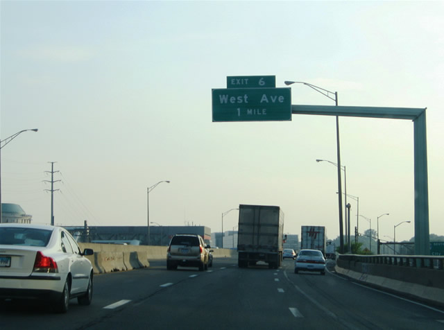
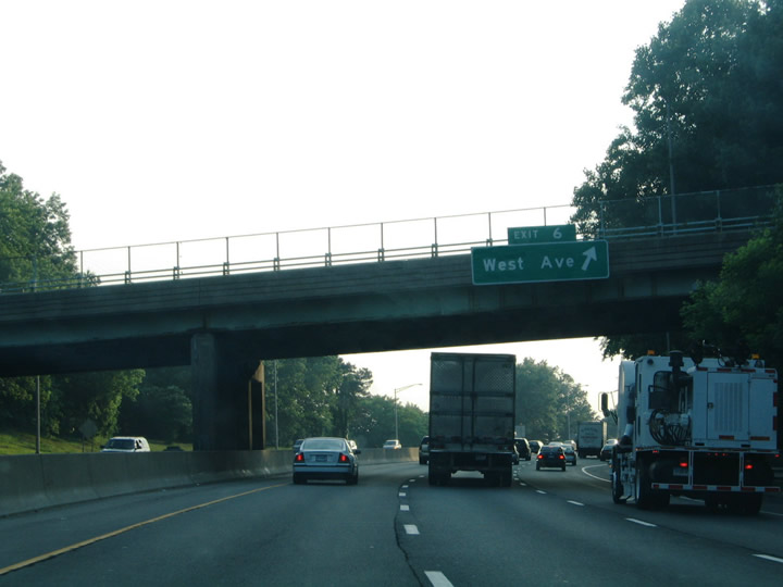
| The last Stamford interchange joins Interstate 95 with West Avenue via a split diamond interchange (Exit 6). West Avenue travels north-south between Selleck Street, U.S. 1 (West Main Street) and Stillwater Avenue. 06/13/05 |
|
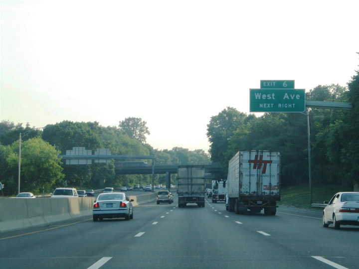
| Fairfield and Wilson Avenues pass over Interstate 95 ahead of the off-ramp (Exit 6) to West Avenue. Grenhart Road and Baxter Avenues provide the movements to West Avenue as the frontage streets of the freeway. 06/13/05 |
|
| Drivers bound for West Avenue to U.S. 1 (West Main Street) and Stillwater Avenue north to the Ridgeway and Palmers Hill neighborhoods, depart Interstate 95 southbound at Exit 6. U.S. 1 and Interstate 95 both cross the Greenwich Town line nearby. 06/13/05 |
|
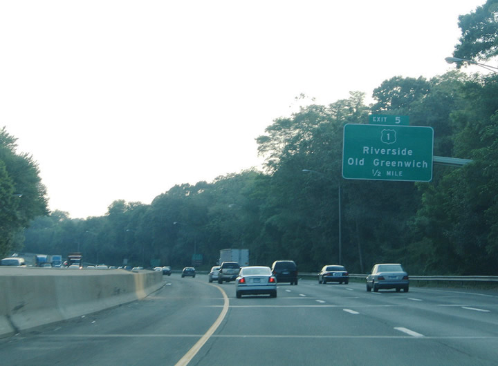
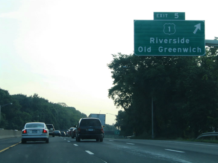
| The final four interchanges of Interstate 95 south in Connecticut serve the Town of Greenwich. Exit 5 comprises a trumpet interchange and access road to parallel U.S. 1 (East Putnam Avenue) at Riverside in east Greenwich. South Beach Avenue stems south from U.S. 1 close by to the community of Old Greenwich at Greenwich Cove. 06/13/05 |
|
| Interstate 95 southbound at the ramp departure (Exit 5) to U.S. 1 (East Putnam Avenue). U.S. 1 travels close to the freeway through a commercial strip toward its crossing of Mianus Pond. Riverside encompasses the neighborhood south of Interstate 95 along Riverside Avenue and Cos Cob Harbor. Interests to Mianus and Putnam Cottage should use U.S. 1 west. Mianus lies north along Valley Road north next to the Mianus River. 06/13/05 |
|
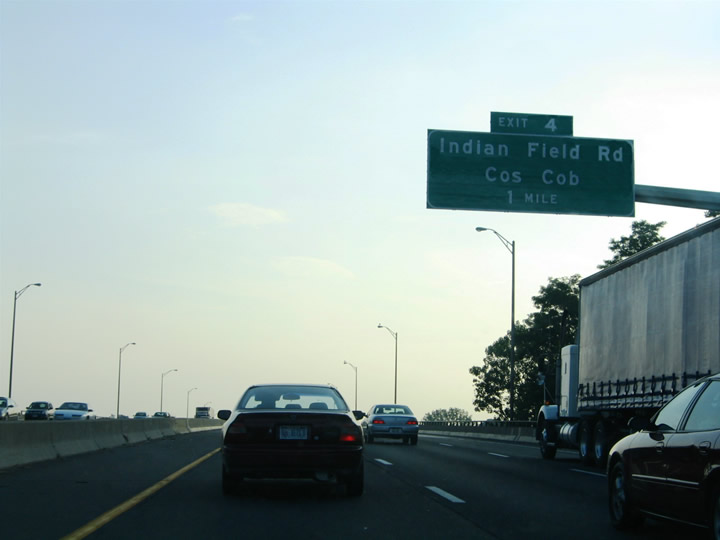
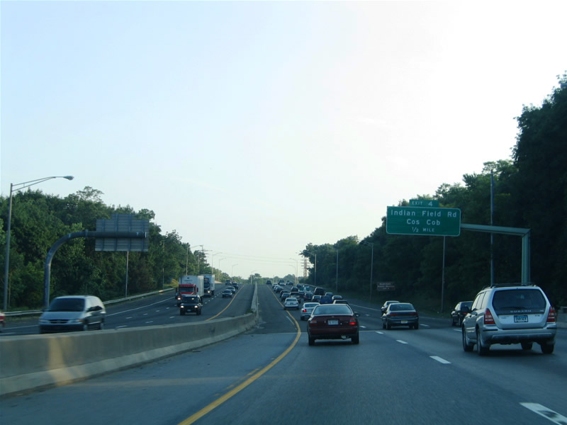
| Interstate 95 spans Cos Cob Harbor on the approach to diamond interchange (Exit 4) with Indian Field Road. Indian Field Road leads south from U.S. 1 (Putnam Avenue) and Cos Cob to Davis Avenue and Captain Harbor. 06/13/05 |
|
| Cos Cob lies along U.S. 1 (Putnam Avenue) midway between the Mianus River and Greenwich Town center. Indian Field Road ends at Putnam Avenue 0.75 miles north of Exit 4. 06/13/05 |
|
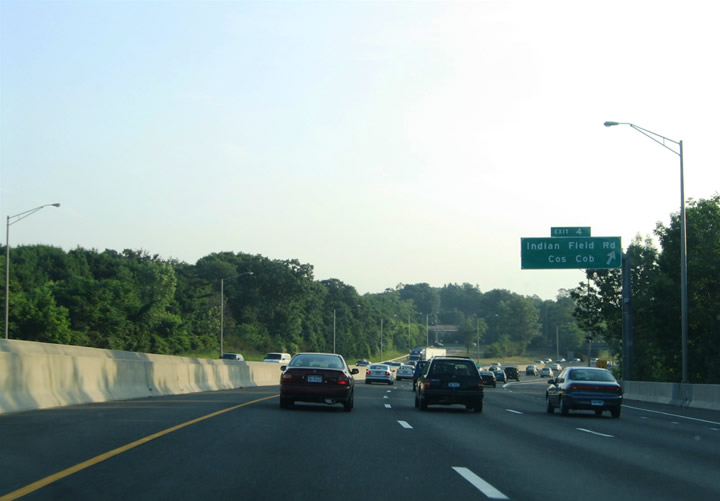
| Interstate 95 southbound at the ramp departure (Exit 4) to Indian Field Road for Cos Cob. Indian Field Road southbound, in conjunction with Davis Avenue, serves Bruce Park. 06/13/05 |
|
| Downtown Greenwich lies north of Interstate 95 via Arch Street, Sound View Drive and Field Point Road at U.S. 1 (West Putnam Avenue). Museum Drive ties into Arch Street at Steamboat Road near the aforementioned Bruce Park. 06/13/05 |
|
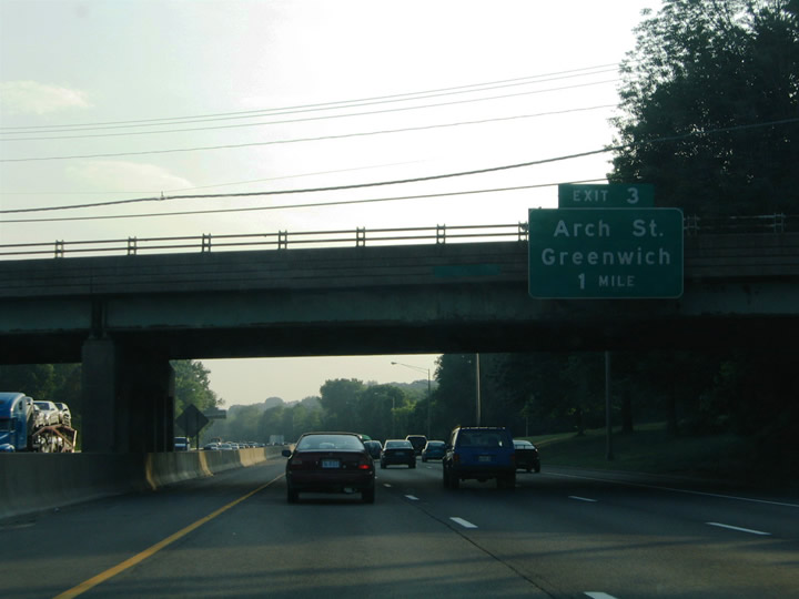
| One half mile east of the diamond interchange (Exit 3) with Arch Street. The surrounding neighborhoods consist of tightly packed row homes along narrow streets as Interstate 95 straddles the northern reaches of Greenwich Harbor. The central business district centers around U.S. 1 (West Putnam Avenue) at Greenwich Avenue and Field Point Road. Museum Drive east leads to Davis Avenue and Indian Field Road as well. 06/13/05 |
|
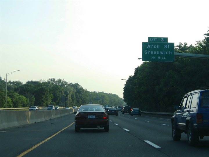
| Exit 3 descends from Interstate 95 southbound to Arch Street near its intersections with Railroad Avenue and Sound View Drive. Three quarters of a mile separate Exit 3 from Downtown Greenwich. 06/13/05 |
|
| Interstate 95 continues to the Byram section of Greenwich near the New York state line. Meeting with the freeway ahead is Delavan Avenue at Ritch Avenue, Byram Road and Byram Shore Road. 06/13/05 |
|
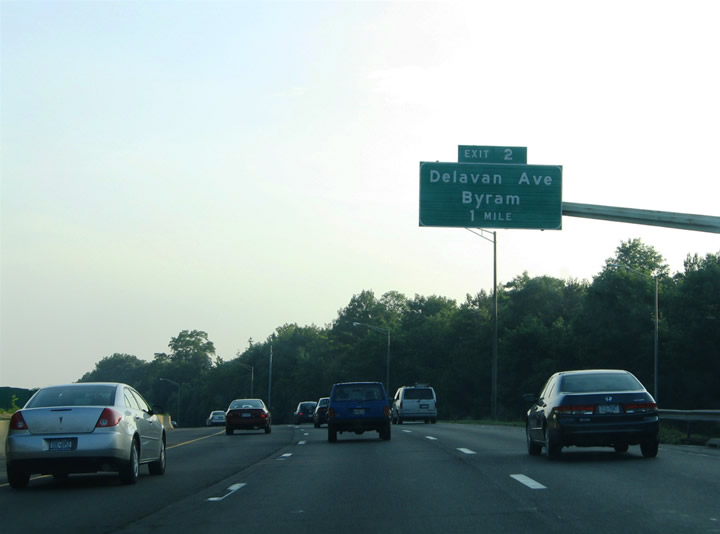
| One half mile east of the diamond interchange (Exit 2) with Delavan Avenue. The interchange ties into the existing road network of Doran and Ritch Avenues on the northbound side and Loudon Street and Byram Road on the southbound side. Byram Road leads north through Byram to U.S. 1 (West Putnam Avenue) at the Byram River. Delavan Avenue travels west to Mill Street and its crossing into Port Chester, New York. 06/13/05 |
|
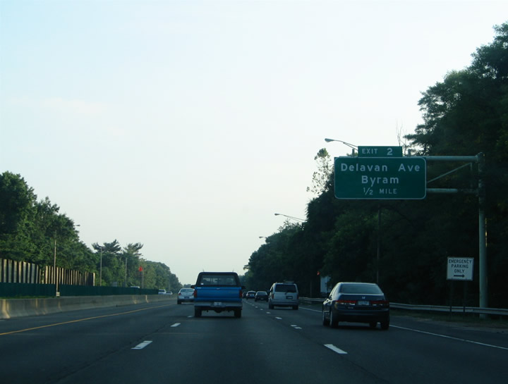
| Exit 2 leaves Interstate 95 southbound for Delavan Avenue west, Byram Road north and Ritch Avenue east. Ritch Avenue parallels Interstate 95 north to Hamilton Avenue and Old Field Point Road, tying into the aforementioned Railroad Avenue near Exit 3. Byram Shore Road spurs south from Delavan and Ritch Avenues to a neighborhood bound by the Byram River and Long Island Sound, the southernmost point of mainland Connecticut. 06/13/05 |
|
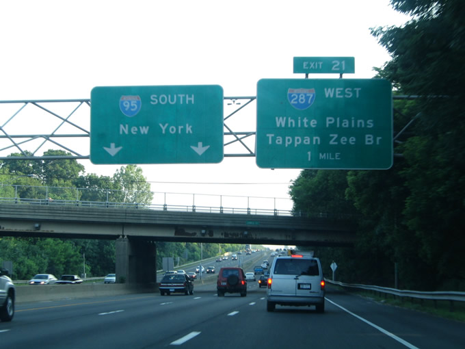
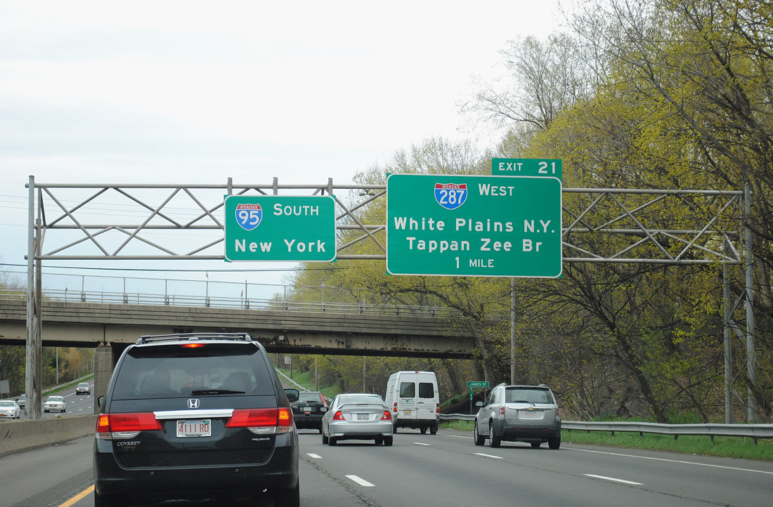
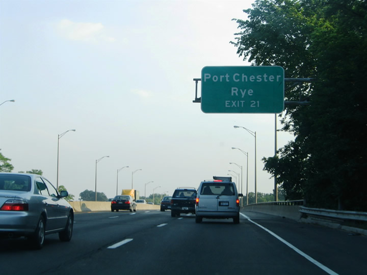
| James Street spans Interstate 95 between Mead Avenue and Byram Shore Road, one mile north of the Interstate 95 wye and folded diamond interchanges with Interstate 287 (Cross Westchester Expressway) west and Midland Avenue (Exit 21). Midland Avenue heads north through the Purdys Grove community to U.S. 1 (Main Street) in Port Chester via Grace Church Street. Interstate 287 constitutes the greater New York bypass between Rye, New York and Edison, New Jersey. 06/13/05, 04/21/11 |
|
| Exit 21 serves both Port Chester and Rye via the Exit 21 ramps onto Midland Avenue at the split with Interstate 287 west. Port Chester is a village along U.S. 1 on the Byram River and Connecticut state line. Rye also lies along U.S. 1, but to the south of its crossings of both Interstates 95 and 287. Interstate 95 spans the Byram River here and transitions into the New England Thruway. 06/13/05 |
Page Updated 01-14-2015.

 South
South