|
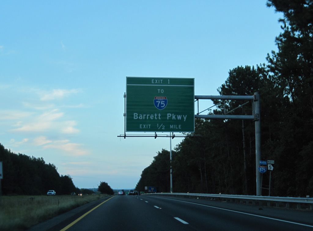
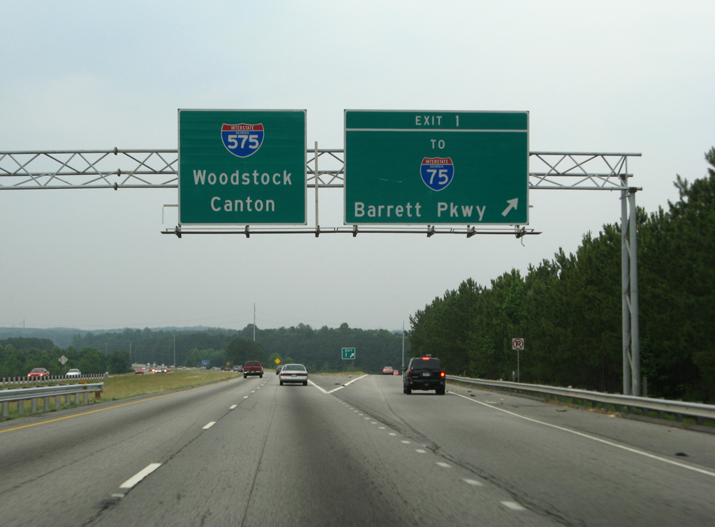
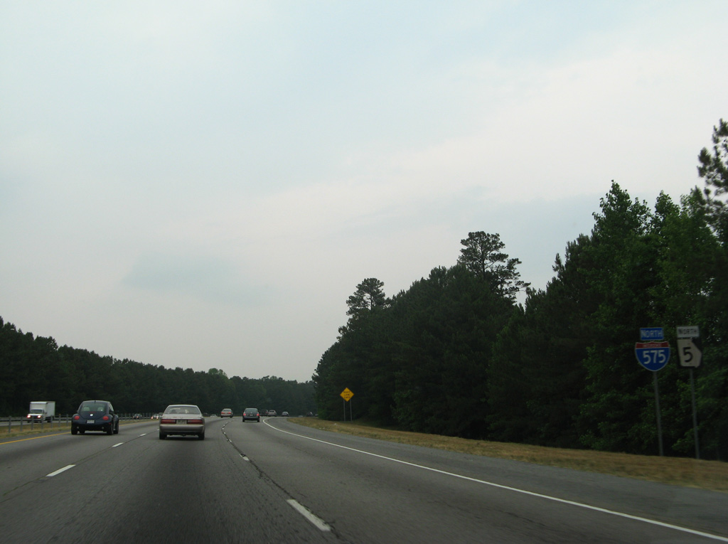
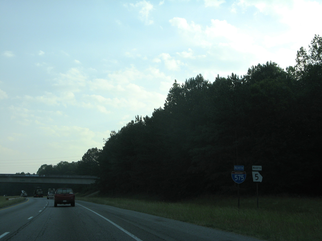
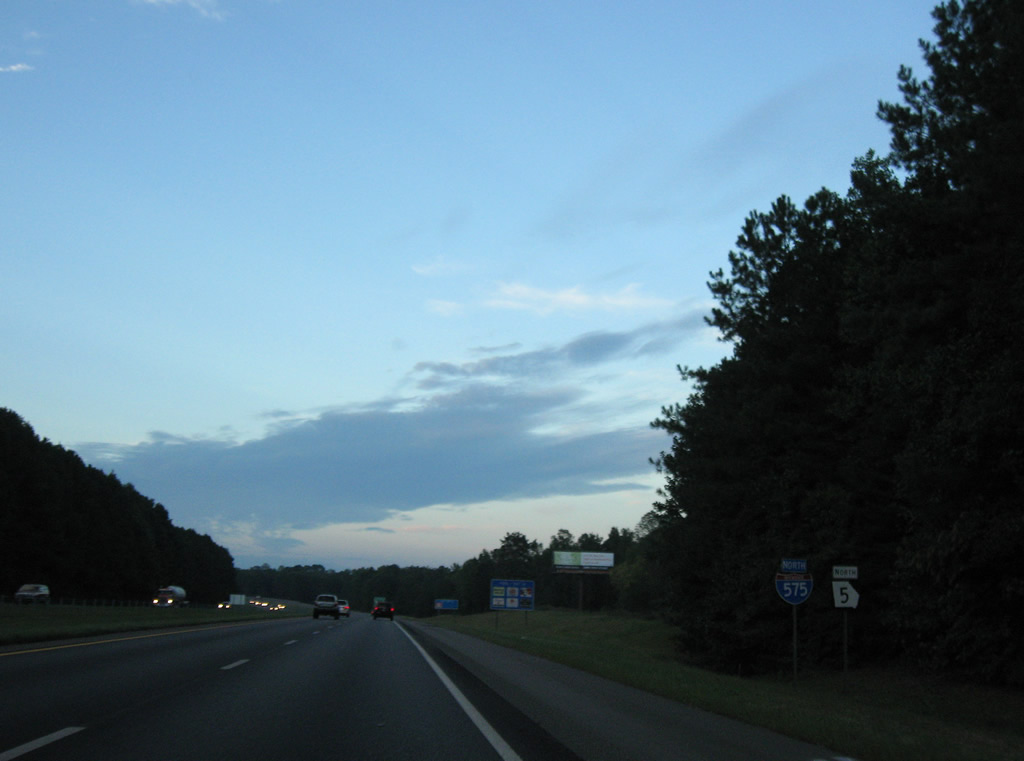
| I-575/SR 5 diverge from I-75 and quickly meet Barrett Parkway at a diamond interchange (Exit 1). 09/28/10 |
|
| Ernest W. Barrett Parkway constitutes a six lane commercial arterial angling southwest from Piedmont Road to Town Center at Cobb Mall, I-75, and U.S. 41 (Cobb Parkway). 06/01/07 |
|
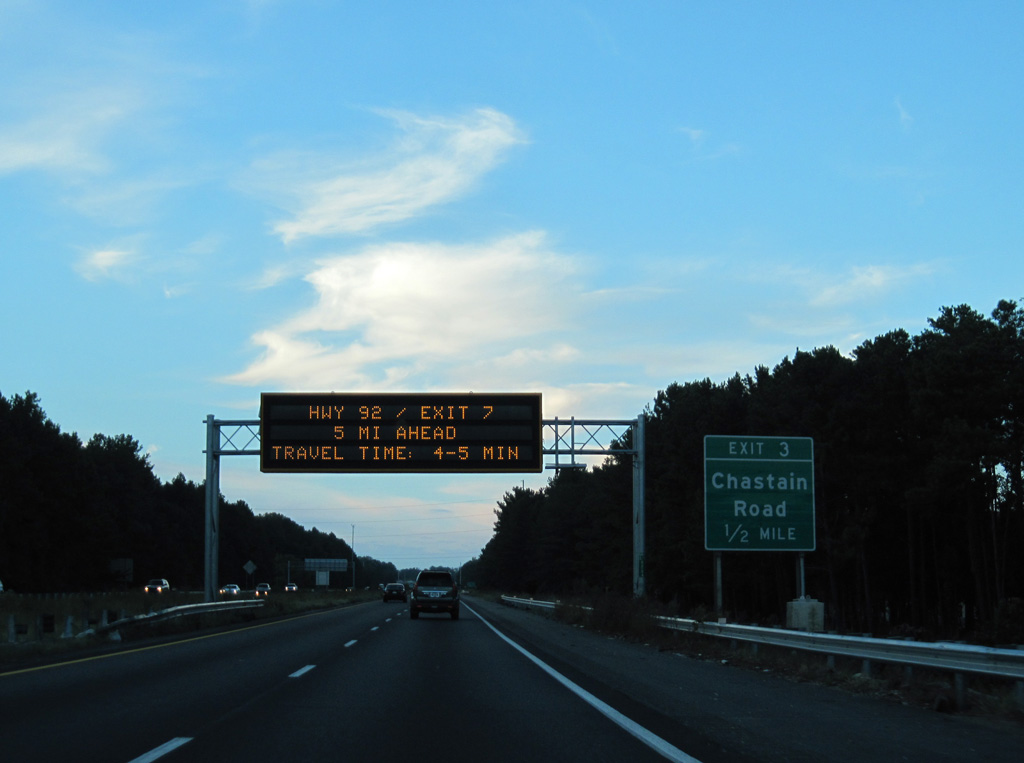
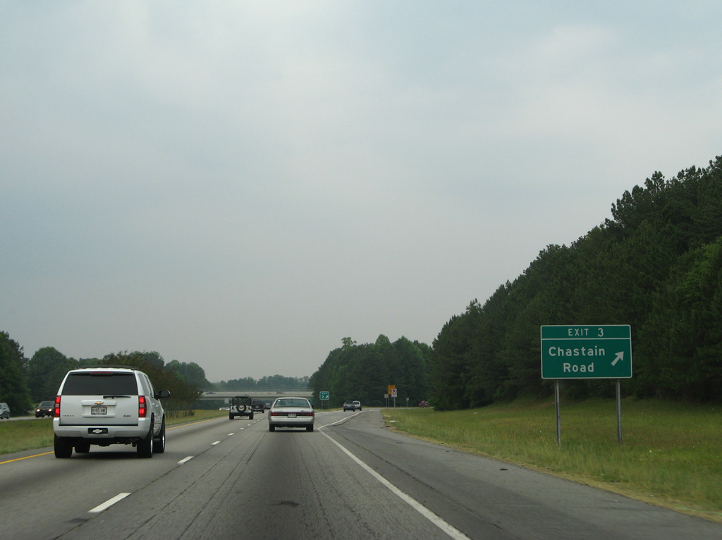
| The subsequent exit along I-575/SR 5 north is the diamond interchange (Exit 3) with Chastain Road. Chastain Road heads east from the freeway by the Chastain Lakes community to Bells Ferry Road. New Chastain Road extends the suburban arterial east from there to Canton Road (old SR 5). 09/28/10 |
|
| Chastain Road constitutes a four to six lane arterial west from Exit 3 to Interstate 75 and Kennesaw State University. 06/01/07 |
|
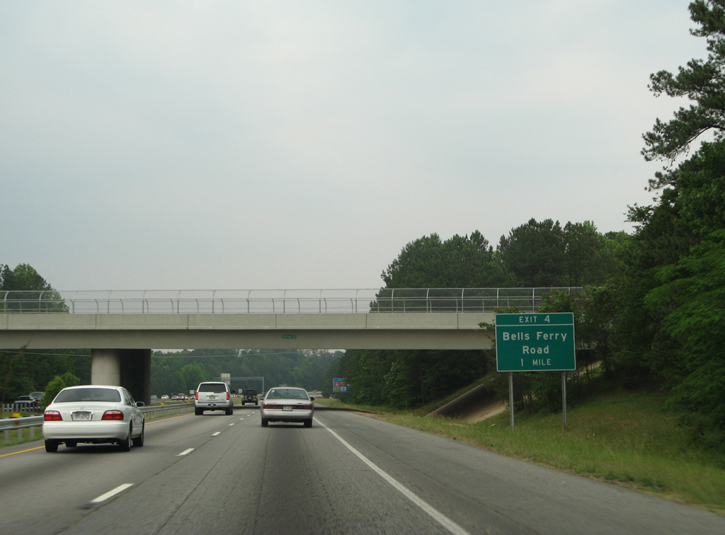
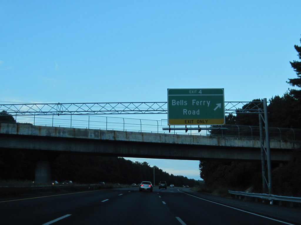
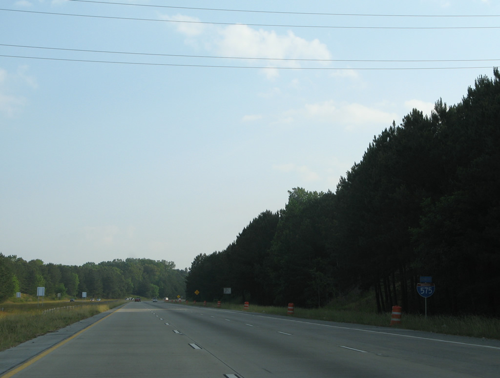
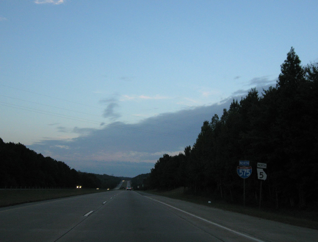
| Bells Ferry Road and Interstate 575 come together at the succeeding northbound exit in one mile. 06/01/07 |
|
| Bells Ferry Road parallels I-575 to the east from Marietta to Exit 4. Formerly a part of SR 92 and SR 205, Bells Ferry Road loops north to Allatoona Lake and east to South Canton near Exit 16. 09/28/10 |
|
| SR 92 is a 98 mile long route hooking north from U.S. 19/41 at Griffin to Douglasville and Acworth and east across I-575 at Woodstock to SR 9 in Roswell. 06/01/07 |
|
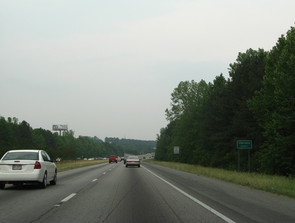
| I-575 is the Phillip M. Landrum Memorial Highway. The freeway crosses into Cherokee County north of the Shallowford Road overpass and the Tower Grove subdivision. 06/01/07 |
|
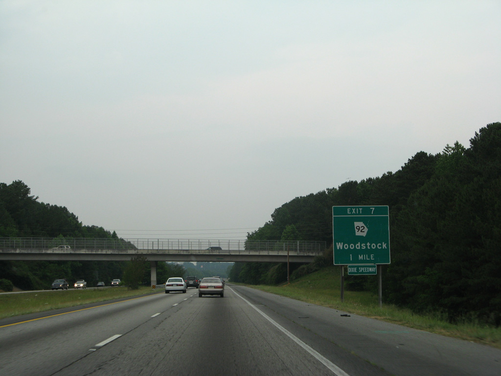
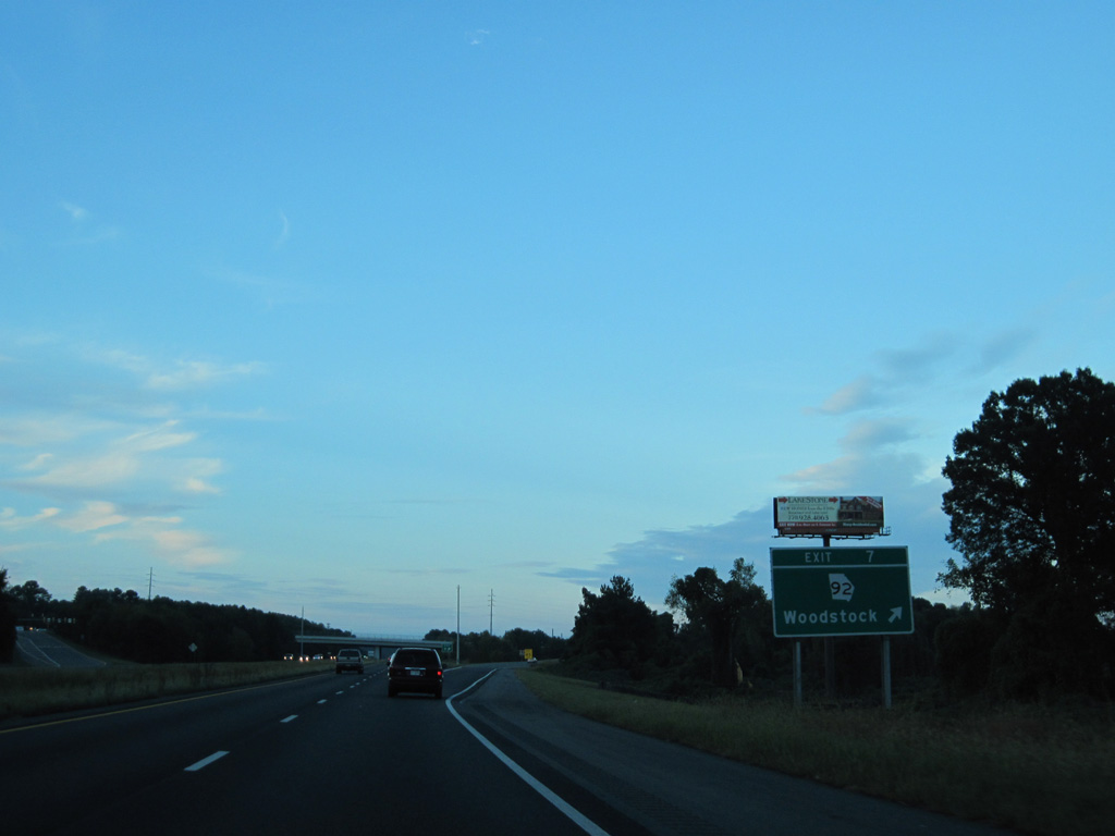
| SR 92 runs across the south side of the Woodstock city limits as a commercial arterial. A diamond interchange joins the state route with I-575/SR 5 at Exit 7. 09/28/10 |
|
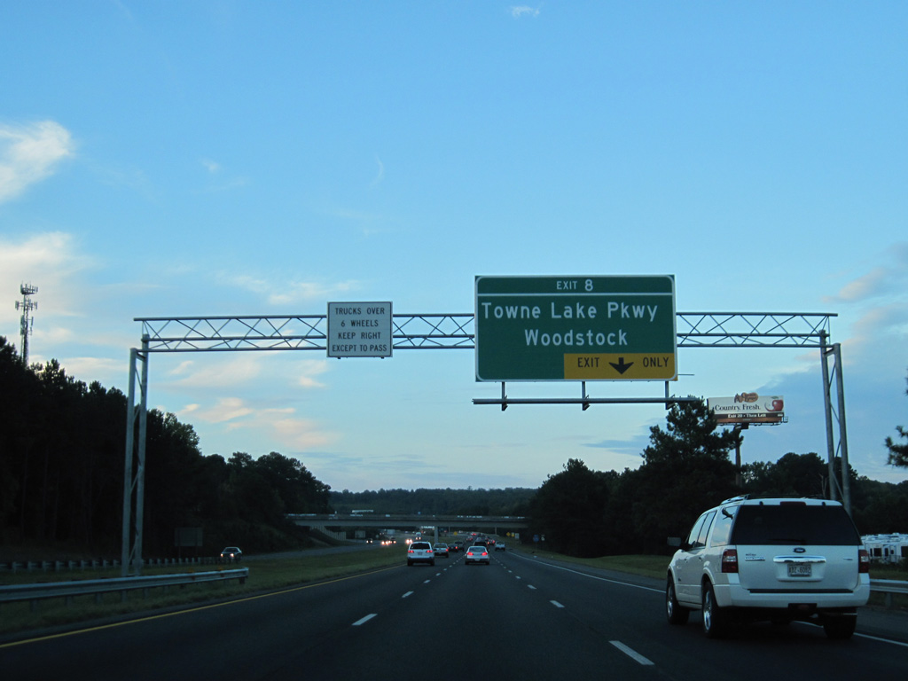
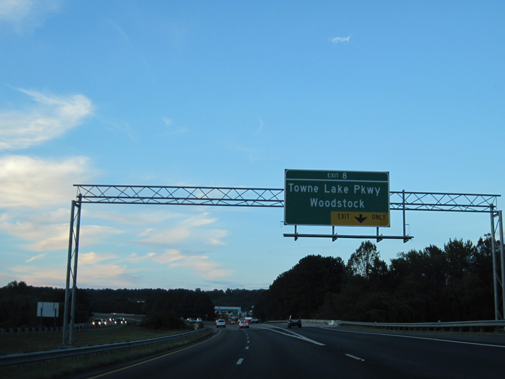
| Towne Lake Parkway extends west from Arnold Mill Road and Main Street (old SR 5) from the Woodstock city center to a diamond interchange (Exit 8) with Interstate 575. 09/28/10 |
|
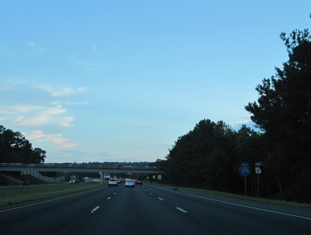
| These reassurance markers for I-575/SR 5 stand east of the Village at Town Lake subdivision and west of Noonday Creek. 09/28/10 |
|
| The auxiliary lane added from SR 92 to I-575/SR 5 north parts ways with the freeway at Exit 8. The lane was completed in November 2007 at the cost of $6.3 million.1 Towne Lake Parkway continues west to the Towne Lake community, and as Eagle Drive to Bells Ferry Road (old SR 92). 09/28/10 |
|
| Interstate 575 curves eastward alongside the Deer Run Trails and Deer Run North subdivisions to Ridgewalk Parkway, where a new diamond interchange opened to traffic on November 16, 2012. Work on the new exit commenced in May 2010 at a cost of $17.10 million.2 06/01/07 |
|
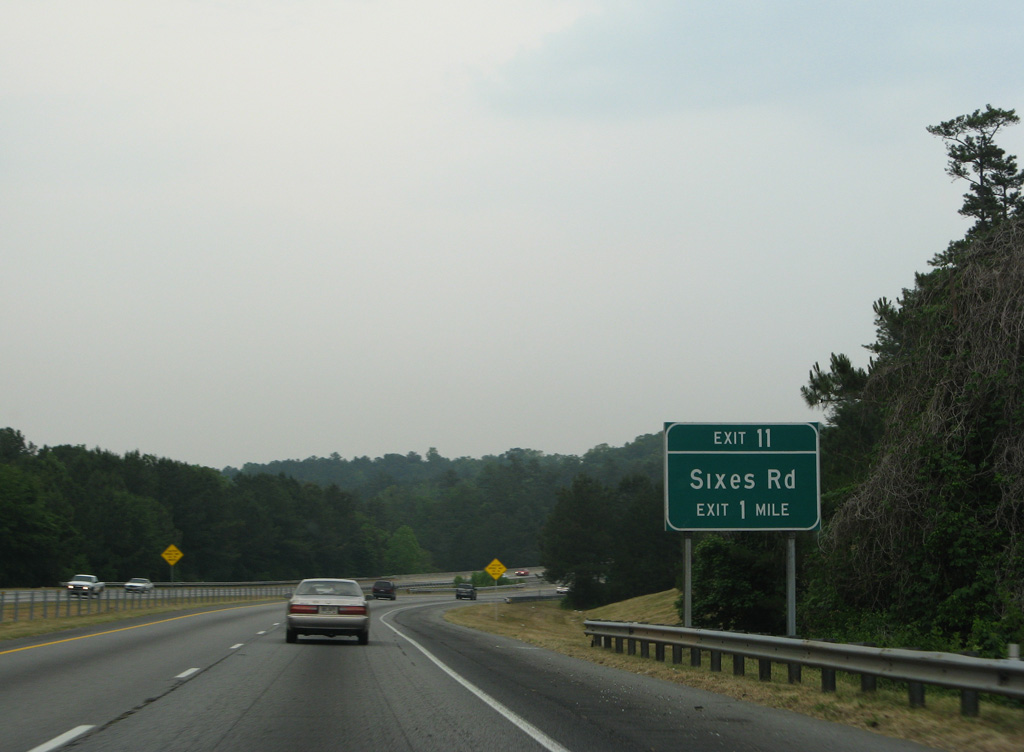
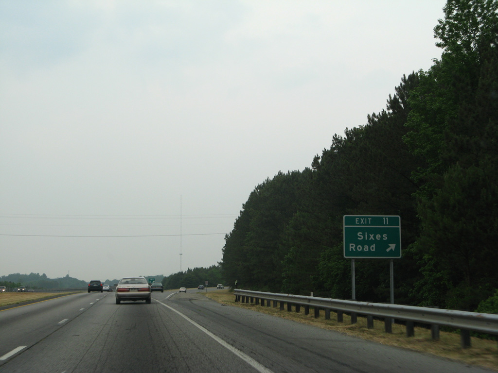
| Advancing north from Ridgewalk Parkway, I-575/SR 5 bend northeast between the Brookshire neighborhood and Olde Rope Mill Park. A diamond interchange (Exit 11) follows with Sixes Road. 06/01/07 |
|
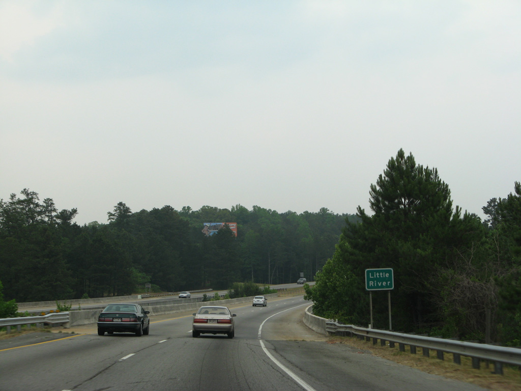
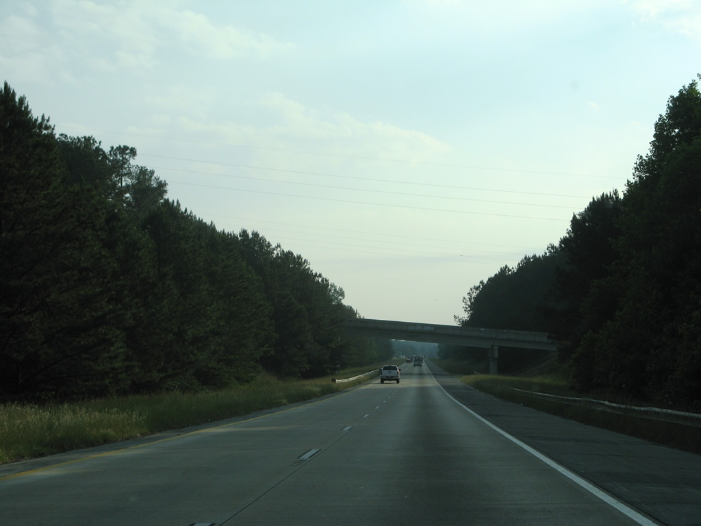
| Crossing the Little River through north Woodstock on I-575 north. Construction through 2018 includes expansion of the northbound bridge here to accomodate the Northwest Corridor Express Lanes. 06/01/07 |
|
| The reverisble express lanes along Interstate 575 will end at Sixes Road. Sixes Road branches northwest from Main Street (old SR 5) at Lebanon in south Holly Springs to Blankets Creek Bike Trails park and the community of Sixes at Bells Ferry Road (old SR 205 until 1985). 06/01/07 |
|
| I-575/SR 5 enter the city of Holly Springs beyond the Sixes Road overpass. 05/29/07 |
|
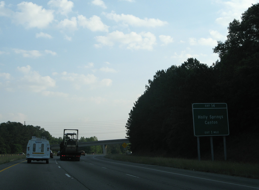
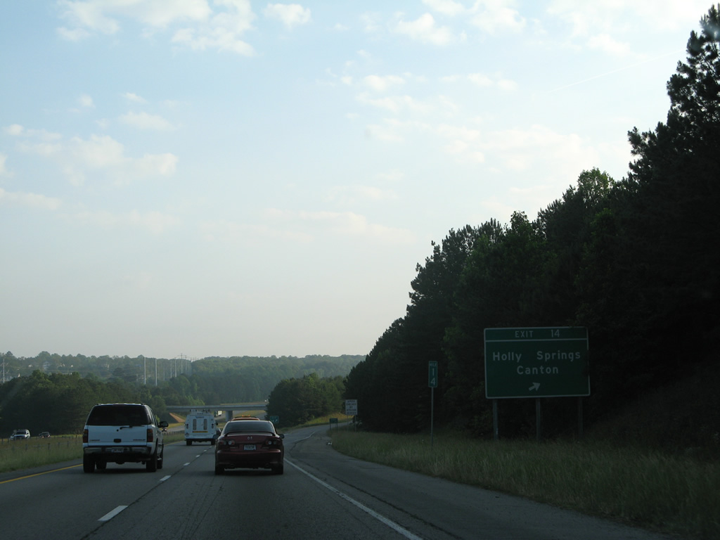
| Old SR 5 winds east of the freeway to the Holly Springs city center along Main Street. The former state route expands to a commercial arterial (Holly Springs Parkway) northward to meet I-575/SR 5 at a diamond interchange (Exit 14) in one mile. 05/29/07 |
|
| Marietta Highway curves northwest as old SR 5 by the Prominence Point and Cottonwood Creek subdivisions in south Canton. Marietta Highway travels north from Exit 14 to SR 20 (Knox Bridge Highway). 05/29/07 |
|
| I-575/SR 5 become more rural north of the Univeter Road overpass through Canton. 09/28/10 |
|
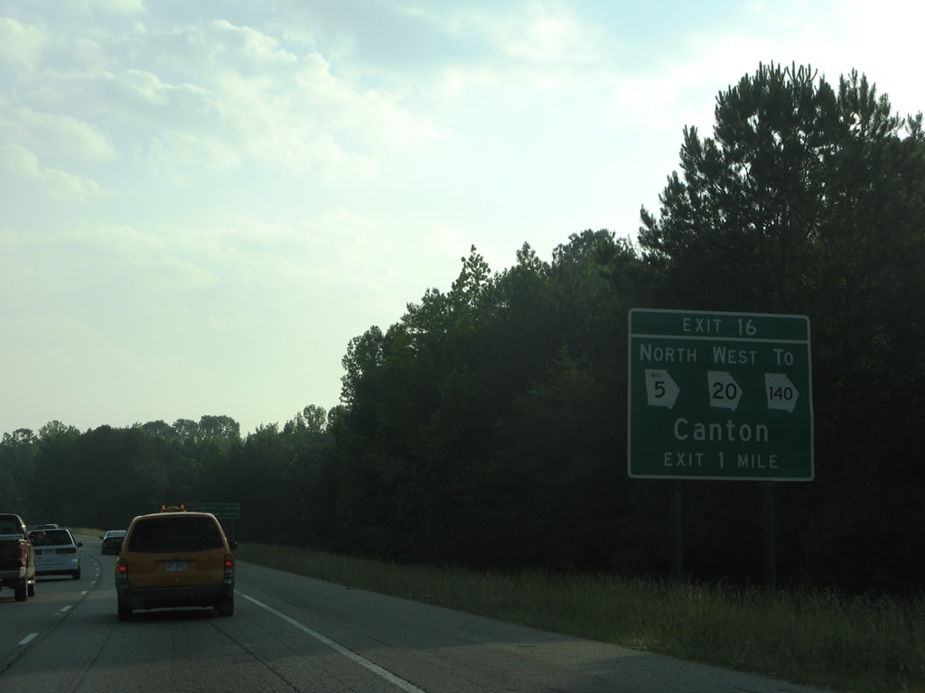
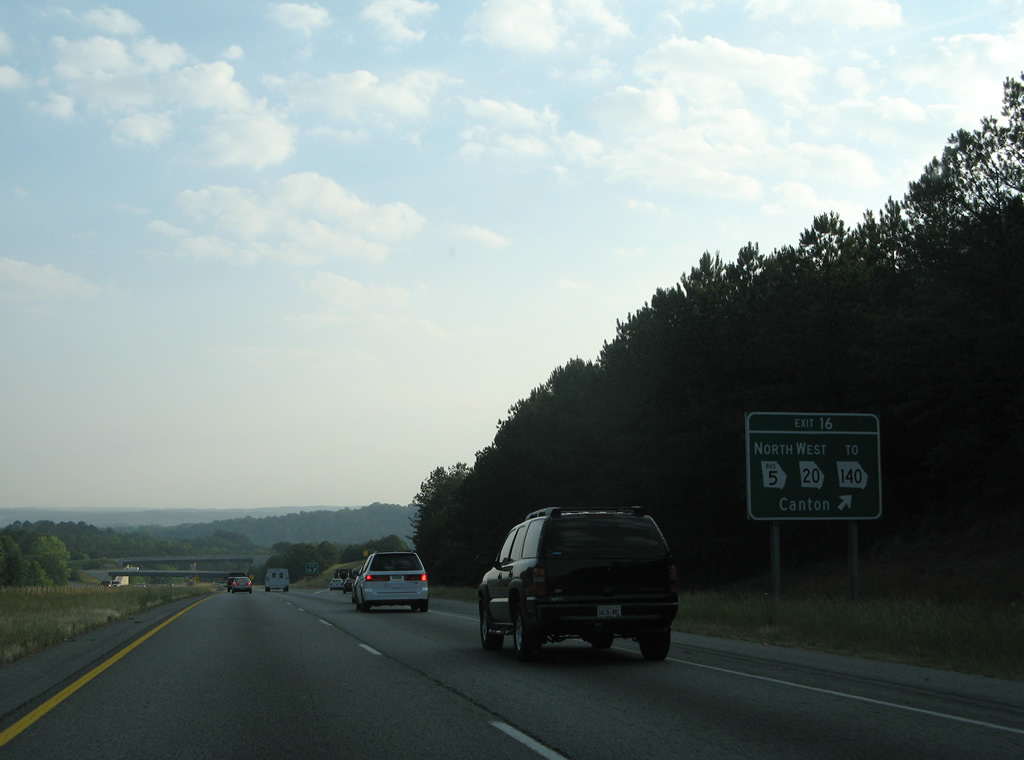
| SR 20/140 east tie into I-575/SR 5 at a semi directional T interchange (Exit 16) in one mile. Exit 16 also represents the beginning of the Canton Business Loop for SR 5. 05/29/07 |
|
| Exit 16 departs as a distributor roadway for SR 20-140 west, SR 5 Business north and SR 140 (Hickory Flat Highway) east. The three routes spur west along an expressway to Marietta Highway, where SR 5 Business/140 turn north around the Canton city center. SR 20 travels 19 miles west to Cartersville. 05/29/07 |
|
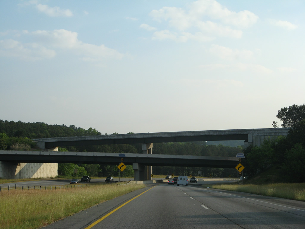
| SR 140 east crosses overhead to run along the east side of I-575 to Hickory Flat Highway. SR 20 merges with I-575/SR 5 for 1.1 miles. 05/29/07 |
|
| SR 20 east joins I-575 north to bypass the southeast side of Canton. The state route departs the city along Cumming Highway east to Buffington, Lathemtown and Free Home in eastern Cherokee County. 05/29/07 |
|
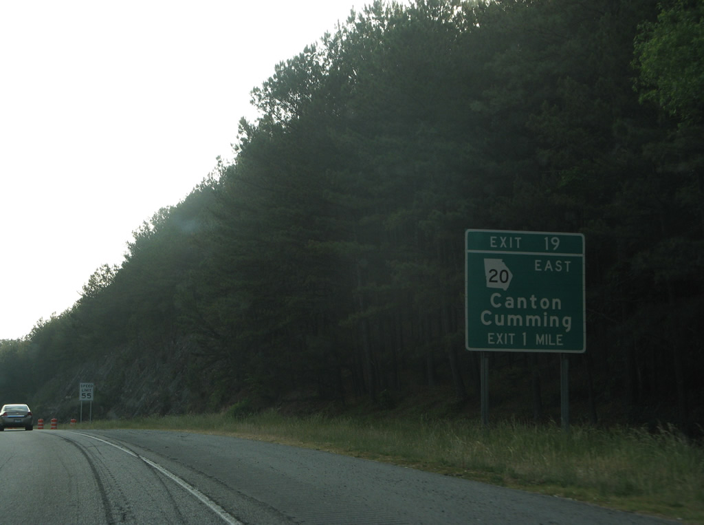
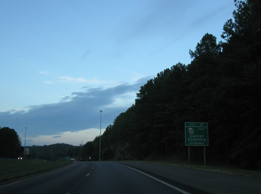
| One half mile from the distributor roadway (Exit 19) for SR 20 (Cumming Highway) east and Main Street (old SR 20 west) on Interstate 575 north. 09/28/10 |
|
| Reassurance markers posted beyond milepost 18. SR 20 previously followed Main Street west to Downtown Canton, where SR 20 Connector bypassed the business district along Dr. John T. Pettit Street to SR 140 and 205 along Marrieta Street / Road south. 09/28/10 |
|
| The $41 million project to add ramps on the south side of Interstate 575 and SR 20 (Cumming Highway) ran between January 2007 and September 2008. The construction eliminated two left turns previously in place at Cumming Highway.3 09/28/10 |
|
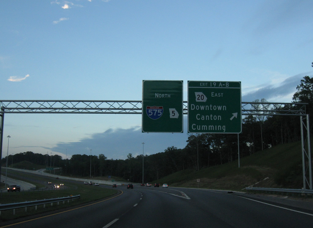
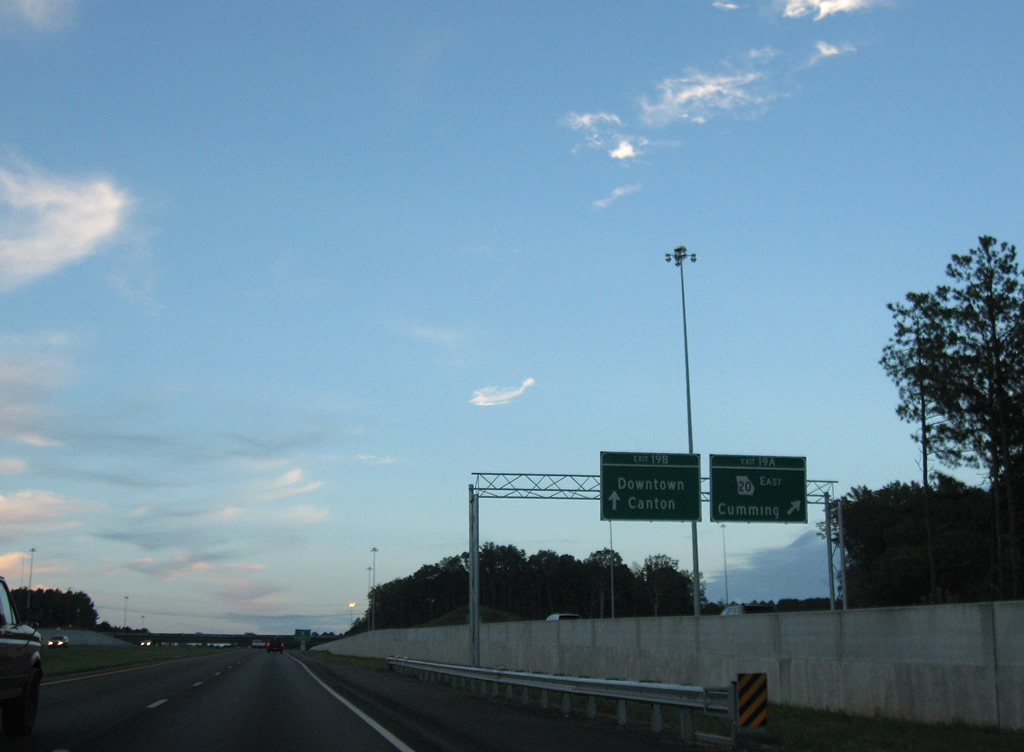
| A loop ramp carries motorists onto Main Street west to Downtown Canton. SR 20 ventures east 22 miles to the Forsyth County seat of Cumming. 09/28/10 |
|
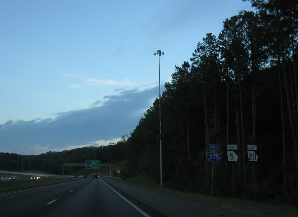
| Looking at the then folded diamond interchange (Exit 19) with the split of SR 20 east from I-575/SR 5 north. 05/29/07 |
|
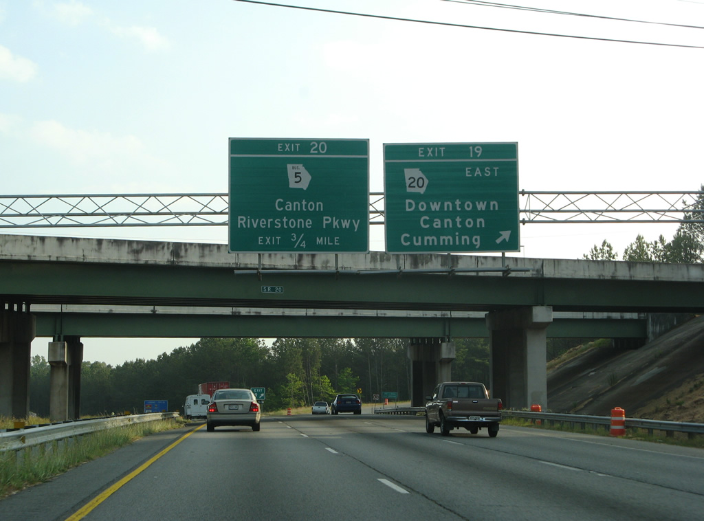
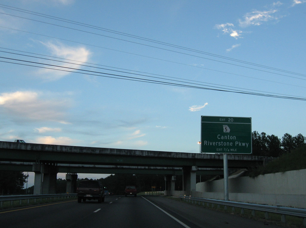
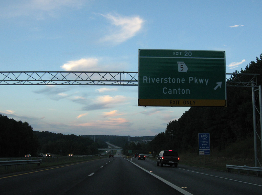
| SR 5 Business separates with SR 140 (Waleska Street) to circle around the north side of Canton along Riverstone Parkway, a four lane commercial arterial east to I-575/SR 5 at Exit 20. 09/28/10 |
|
| A new auxiliary lane opened from Exit 19 north to Exit 20 / SR 5 Business (Riverstone Parkway) by November 2007. The expansion project was undertaken during work to upgrade Exit 19.1 09/28/10 |
|
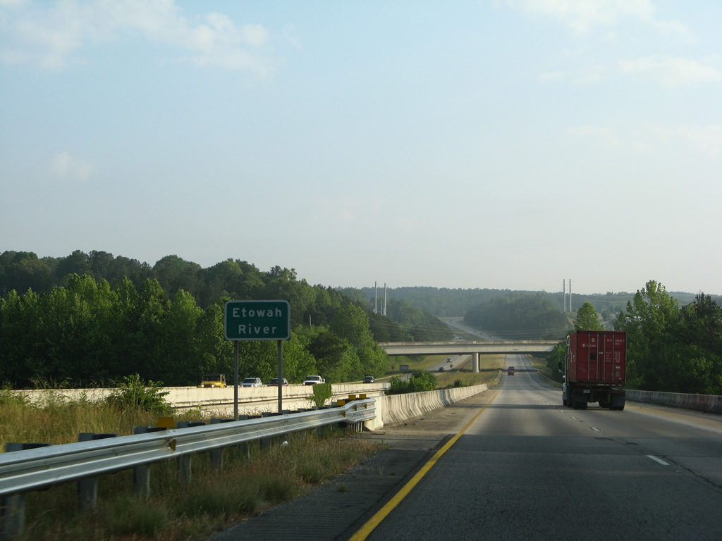
| I-575/SR 5 span the Etowah River at the diamond interchange (Exit 20) with Riverstone Parkway south and Canton Highway (old SR 5) north. 05/29/07 |
|
| Confirming marker for I-575 posted north of Exit 20. The freeway turns northeast and leaves the Canton city limits along the ensuing rural stretch. 05/29/07 |
|
| A wide forested median separates traffic for 1.5 miles as Interstate 575 passes north of Keithsburg. 05/29/07 |
|
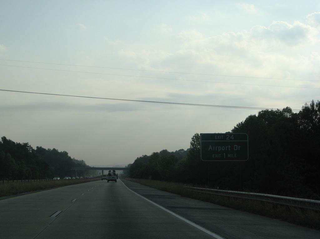
| Airport Drive stems northwest from Ball Ground Highway (old SR 5) to connect with Interstate 575 at a diamond interchange (Exit 24) in one mile. 05/29/07 |
|
| Exit 24 departs I-575/SR 5 north for Airport Drive and nearby Cherokee County Regional Airport (CNI). 09/28/10 |
|
| I-575/SR 5 bee line northeast to the city of Ball Ground from Airport Drive. 09/28/10 |
|
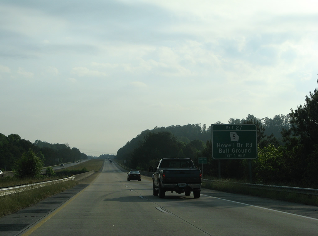
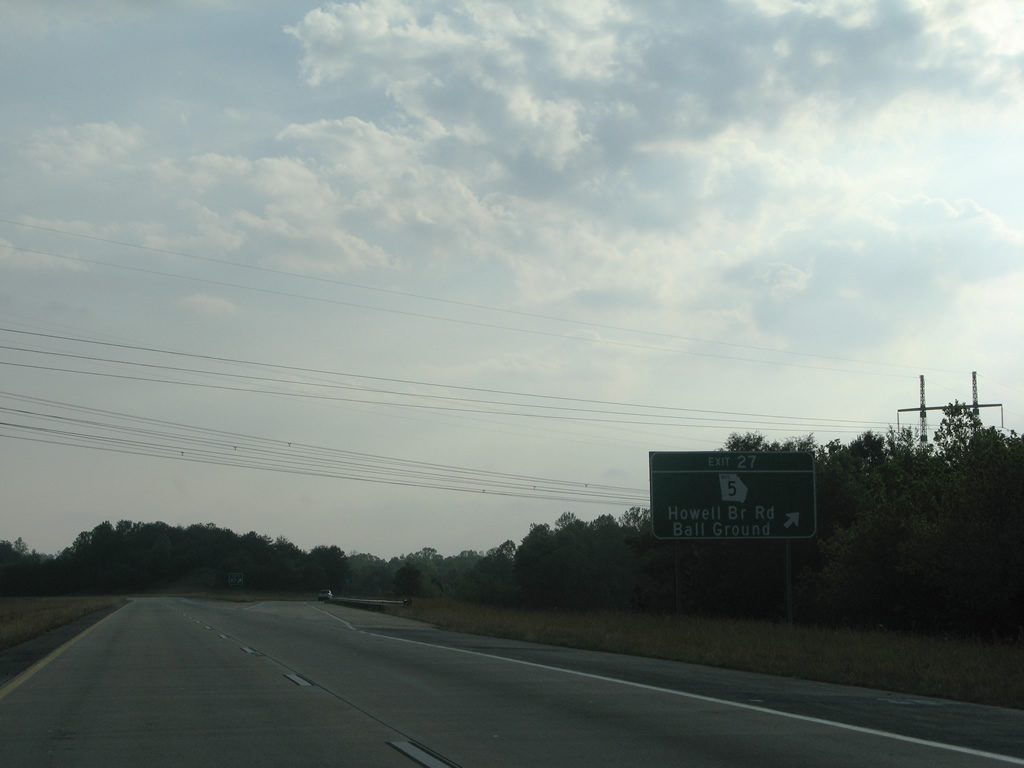
| SR 5 Business loops east from Interstate 575 via Howell Bridge Road, Ball Ground Highway and Appalachian Highway along a 5.1 mile course starting at Exit 27. 05/29/07 |
|
| Howell Bridge Road meanders east from Long Road along a rural route to the diamond interchange (Exit 27) with Interstate 575. SR 5 Business (Ball Ground Highway) leads north to the Ball Ground city center and SR 372 (A.W. Roberts Drive) south. 05/29/07 |
|
| Interstate 575 runs just west of Ball Ground in the hills near Sharp Mountain Creek. 05/29/07 |
|
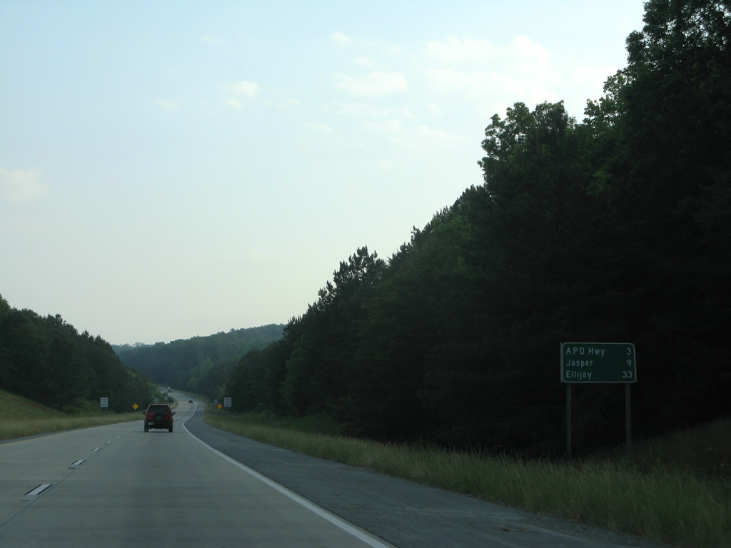
| Continuing north from Ball Ground, the Appalachian Development Highway (SR 515) takes over for the ending I-575, traveling nine miles to the Pickens County seat of Jasper and 33 miles to Ellijay. 05/29/07 |
|
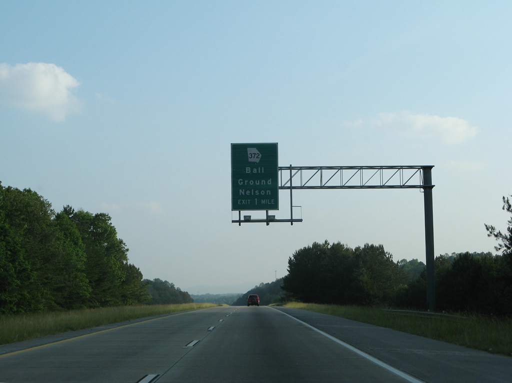
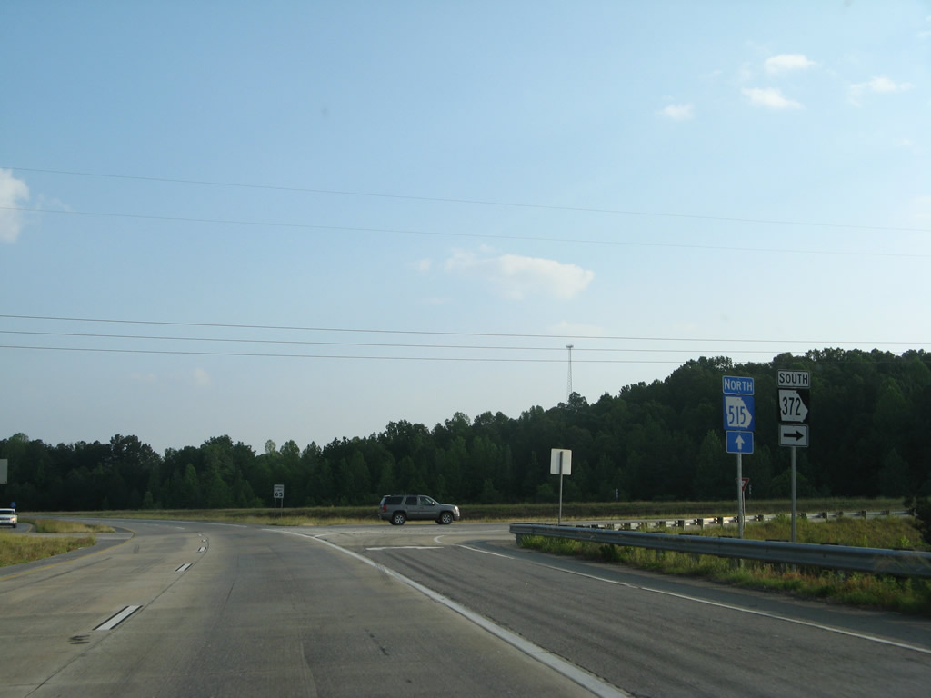
| SR 372 combines with SR 5 Business along Ball Ground Highway and a short expressway to end at I-575/SR 5 in one mile. 05/29/07 |
|
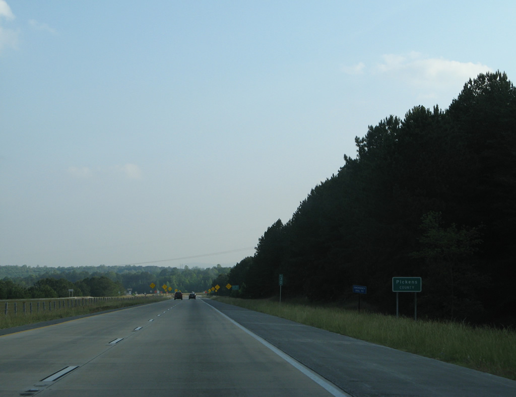
| Motorists along the final section of I-575 enter Pickens County, the Marble Capital of Georgia. 05/29/07 |
|
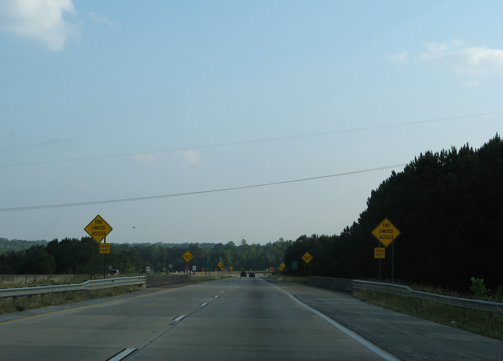
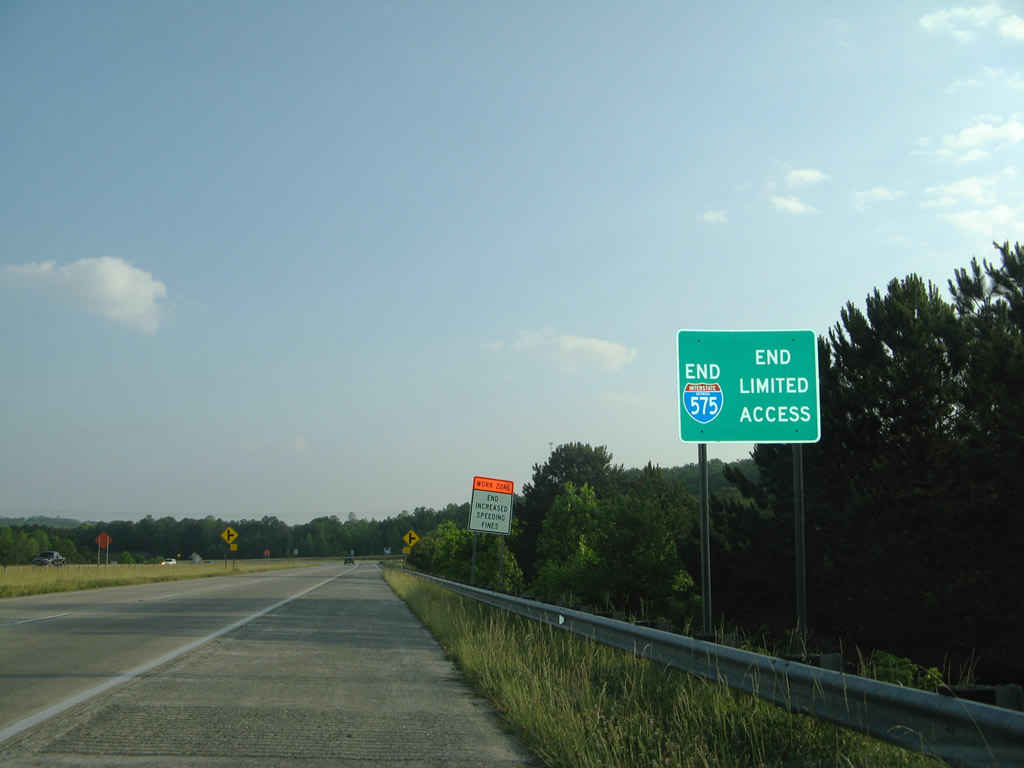
| A series of end limited access and intersection ahead regulatory signs precede the transition of Interstate 575 to the Appalachian Development (APD) Highway, an at-grade expressway extending SR 5 north to U.S. 76 at Ellijay. 05/29/07 |
|
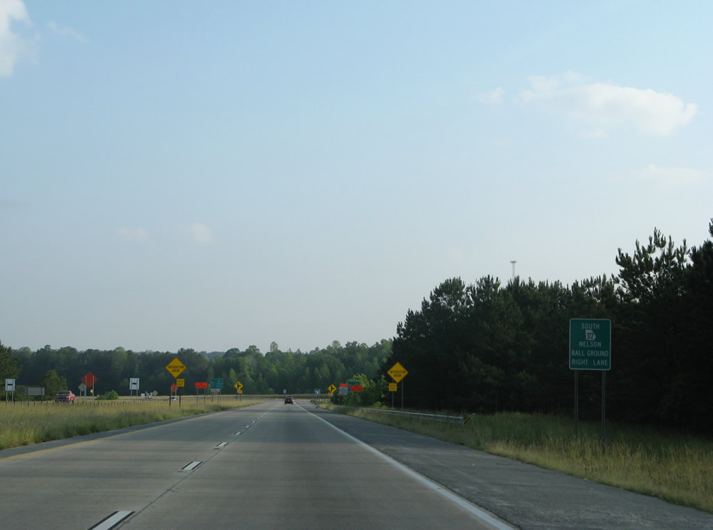
| A right turn takes drivers onto SR 5 Business/372 (Appalachian Highway) southeast back into Ball Ground. Canton Road (old SR 5) leads north from the pair into the rural city of Nelson. 05/29/07 |
|
| An end sign for Interstate 575 stands ahead of the at-grade intersection with SR 372 south. Similar signs are found at the north end of Interstate 985 in Gainesville. 05/29/07 |
|
| SR 515 commences a 75 mile route as I-575 ends. The route is marked with blue and whites shields, relating to its status as Appalachian Development Corridor A. 05/29/07 |
|
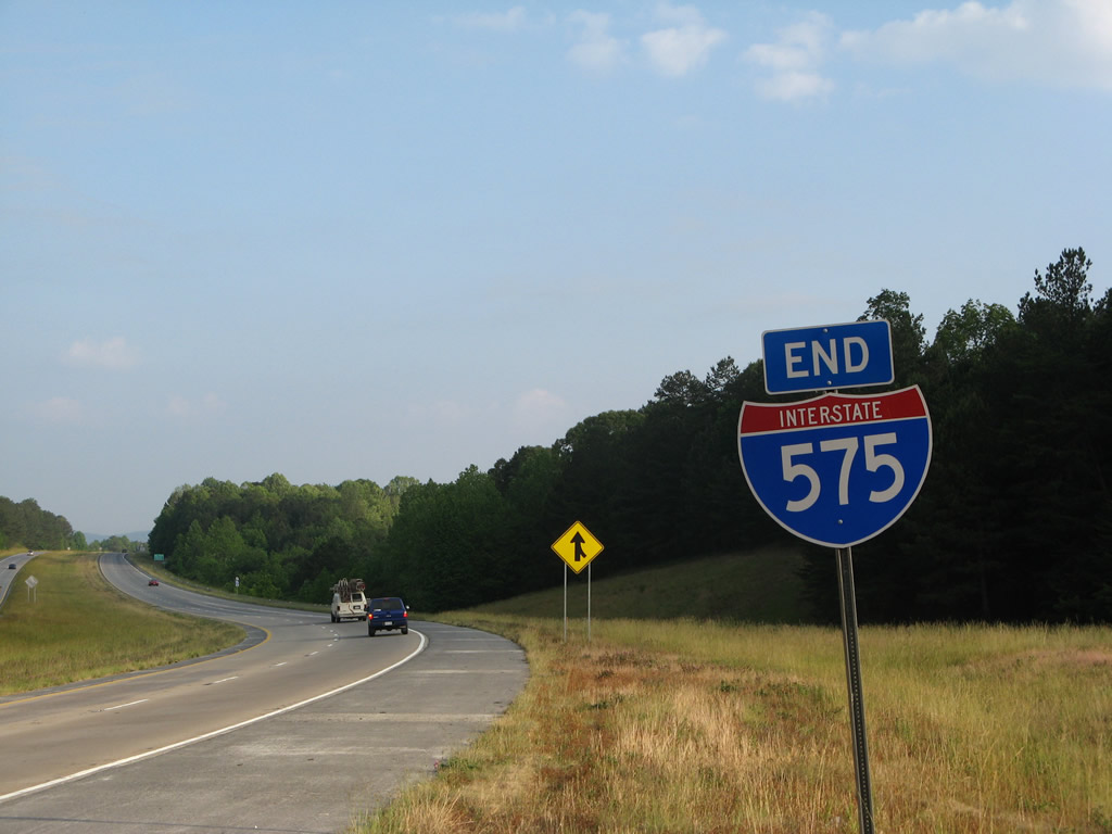
| A second end assembly for Interstate 575 stands ahead of the ramp merge of SR 5 Business/372 north. SR 5/515 are also known as the Zell Miller Mountain Parkway. 05/29/07 |
Page Updated 07-07-2017.


 North
North