|
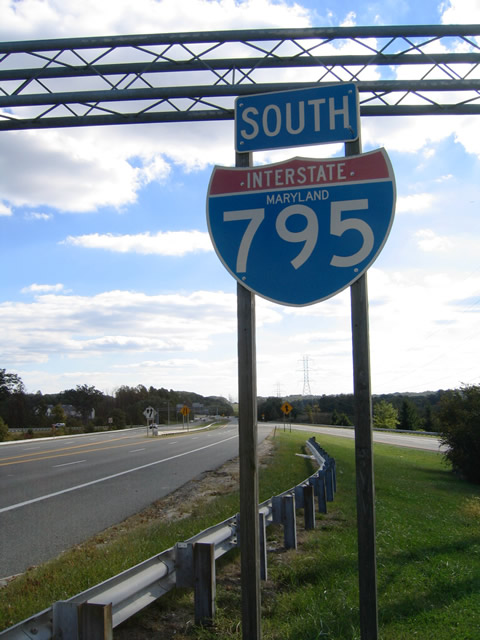
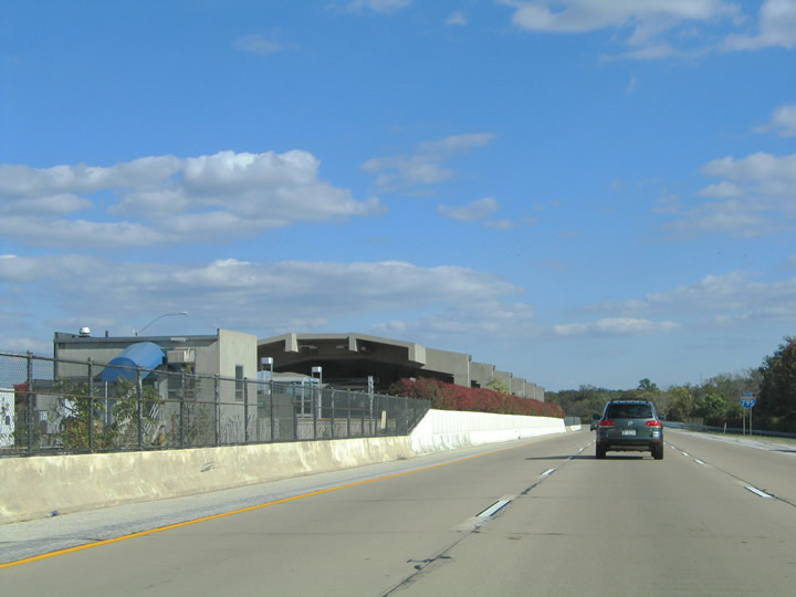
| Traffic from both directions of MD 140 (Westminster Pike) and MD 128 south (Butler Road) are provided with a ramp onto Interstate 795 southbound at their junction. MD 128 curves southwest one half mile from MD 30 (Hanover Road) at Glyndon to become the southbound on-ramp. An Interstate 795 Maryland shield was posted ahead of the ramp merge with the MD 140 eastbound ramp. This shield and the one further south were replaced by 2010. 10/10/04, 08/27/05 |
|
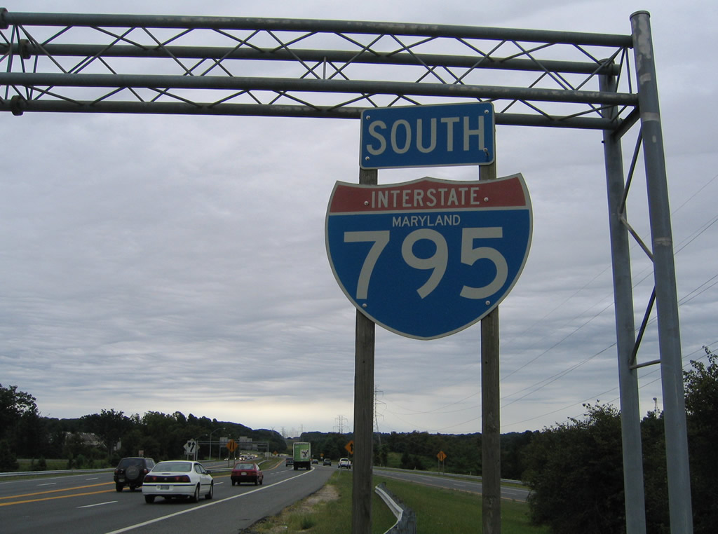
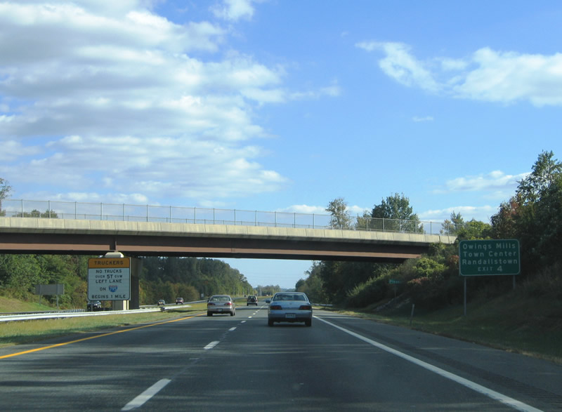
| A second Interstate 795 shield appears at the Cockeys Mill Road underpass. The Northwest Expressway maintains four overall lanes from MD 140 to Owings Mills Boulevard (Exit 4). 08/27/05 |
|
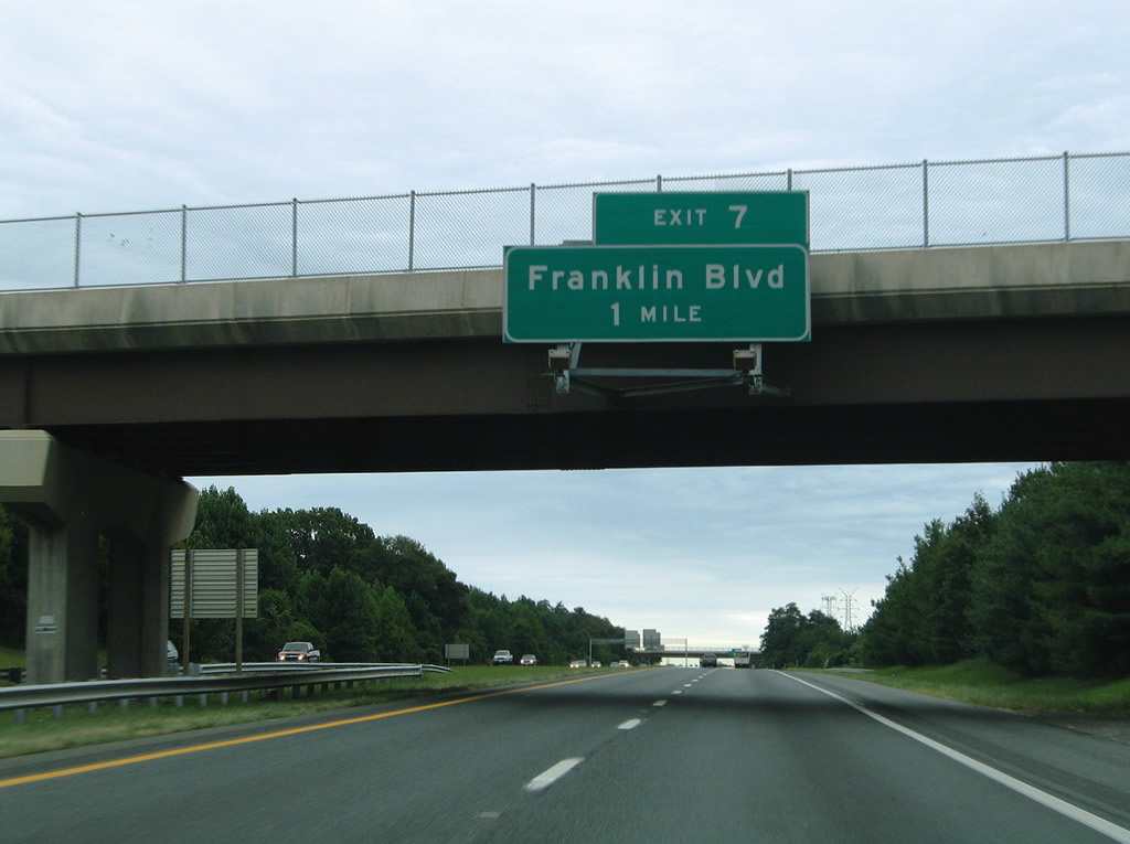
| One mile north of the Exit 7 off-ramp to Franklin Boulevard at the Stocksdale Road over crossing. Franklin Boulevard serves Reistertown to the east and Church Road & Red Run Boulevard to the west. 08/27/05 |
|
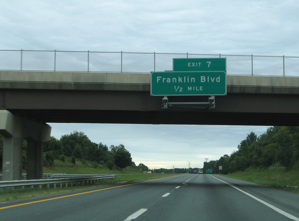
| Nearing the Franklin Boulevard parclo interchange on Interstate 795 southbound at the Berrymans Lane overpass. Franklin Boulevard becomes Cherry Hill Road at MD 140 (Reistertown Road) one half mile to the east. Nicodemus Road stems northwest from the Exit 7 interchange to Berrymans Lane and Ivy Mill Road before crossing Liberty Lake into Carroll County. 08/27/05 |
|
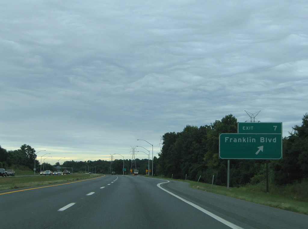
| Exit 7 leaves Interstate 795 (Northwest Expressway) south for Nicodemus Road ahead of its intersection with Franklin Boulevard. A six-ramp parclo interchange joins Franklin Boulevard with the freeway overall. 08/27/05 |
|
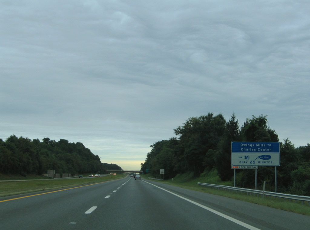
| One of a handful of signs touting the benefits of the Baltimore Metro subway line. The Metro line begins at the Owings Mills Station at Exit 4 and ends downtown at the Johns Hopkins University Hospital. 08/27/05 |
|
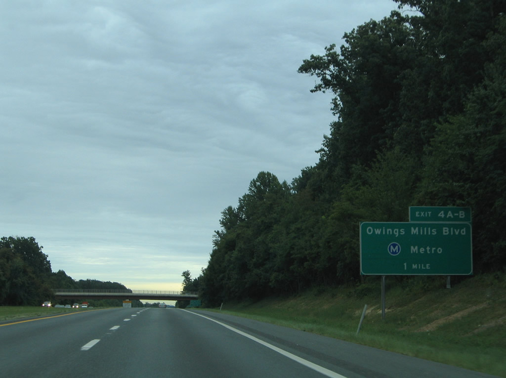
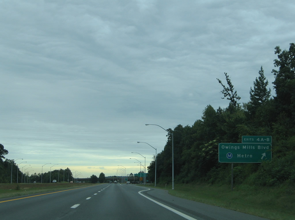
| One mile guide sign for the Exit 4B/A directional cloverleaf interchange with Owings Mills Boulevard on Interstate 795 south. Owings Mills itself is the community centered around the Owings Mills Boulevard intersection with MD 140 (Reistertown Road) to the east of the Northwest Expressway. The Owings Mills Metro station resides off Painters Mill Road south of the Exit 4B off-ramp. 08/27/05 |
|
| Pleasant Hill Road passes over Interstate 795 at the community of Belltown. Signed below the bridge are signs for the left-lane truck restriction south of Exit 4 and an auxiliary guide sign for Randallstown and Owings Mills Town Center. Randallstown is accessible via surface road connections from Owings Mills Boulevard via Painters Mills and McDonough Road. The Owings Mills Town Center mall resides between Owings Mills Boulevard and Painters Mills Road off Red Run Boulevard. 10/10/04 |
|
| Interstate 795 southbound at the ramp departure for Exit 4 (Owings Mills Road and Owings Mills Town Center). A distributor roadway leaves the Northwest Expressway mainline for ramps to Owings Mills Boulevard east and west and the Owings Mills Metro Station itself. 08/27/05 |
|
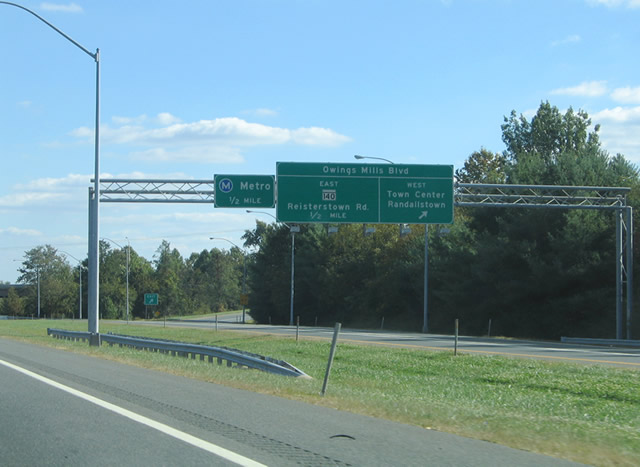
| Exit 4B diverges from Interstate 795 southbound for Owings Mills Boulevard westbound and a direct ramp to the Owings Mills Town Center and Mill Run Circle. MD 140 (Reistertown Road) is referrenced for the Exit 4A cloverleaf ramp. 10/10/04 |
|
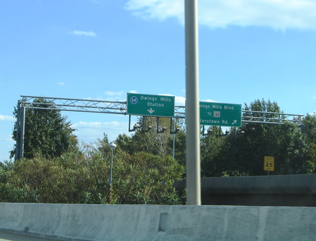
| The Exit 4A loop ramp descends onto Owings Mills Boulevard eastbound 0.9 miles from its junction with MD 140 (Reistertown Road). The surface boulevard continues from there northeast 1.6 miles to Gwynnbrook Avenue. Traffic otherwise defaults into the parking area for the Metro. 10/10/04 |
|
| The platform of the Owings Mills Metro Station rises above the travel lanes of Interstate 795 within the median of the Northwest Expressway. The subway line flows southeastward with Interstate 795 to the junction with Interstate 695. 10/10/04 |
|
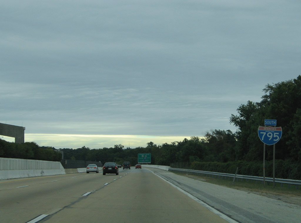
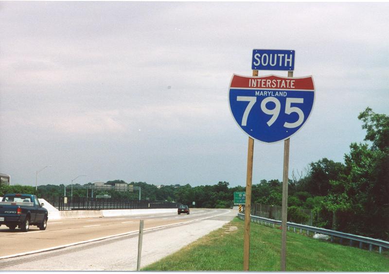
| The final southbound Interstate 795 reassurance shield (since replaced), complete with the state name, posted after the Exit 4 interchange at Owings Mill. The Northwest Expressway expands to six overall lanes for its final four miles. 08/27/05, 06/17/00 |
|
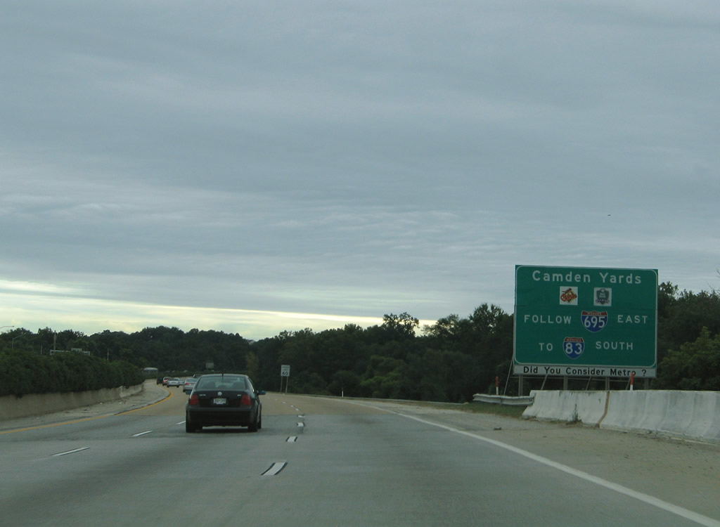
| Auxiliary guide sign for the downtown Baltimore destinations of Camden Yards including M&T Bank Stadium (home of the NFL's Baltimore Ravens) and Oriole Park (home of MLB's Baltimore Orioles). Note the placard advising the Metro. The transit line continues southeast from Interstate 795 at 695 along Wabash Boulevard (planned Interstate 795) into Baltimore City. 08/27/05 |
|
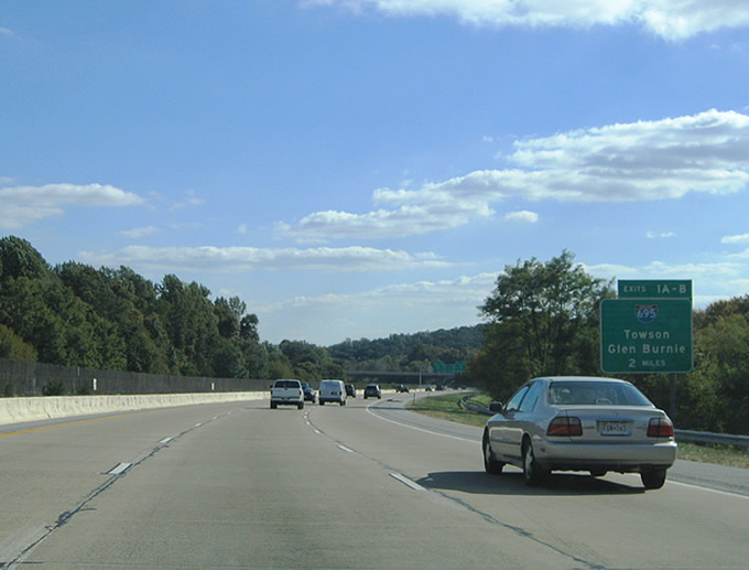
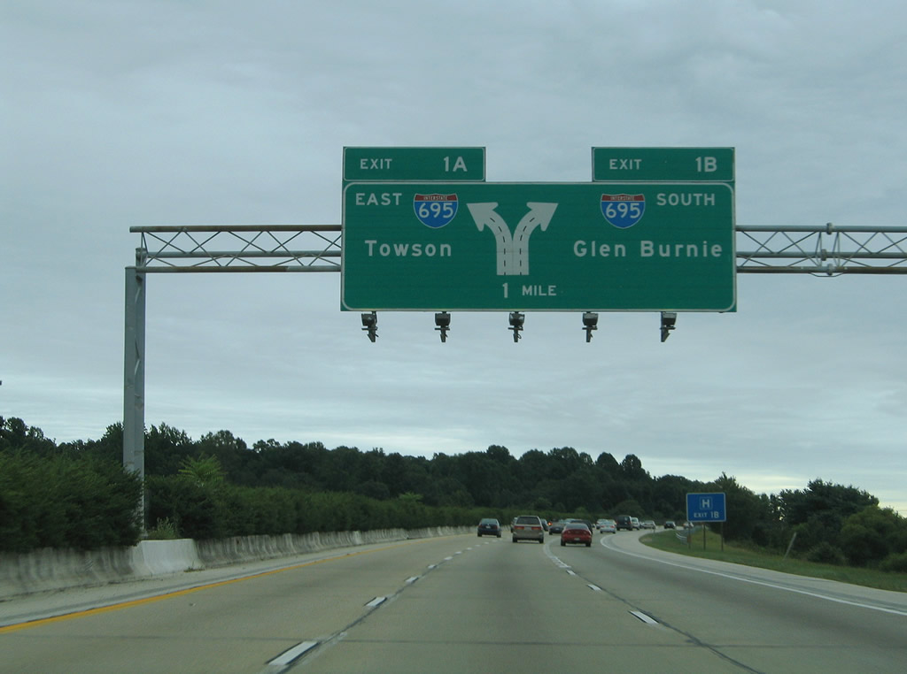
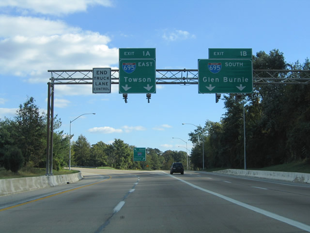
| Two mile guide sign for the Exits 1B/A terminus with Interstate 695 (Baltimore Beltway). Interstate 695 interchanges with Interstate 795 midway between the Reistertown Road (MD 140) and Liberty Road (MD 26) exits. 10/10/04 |
|
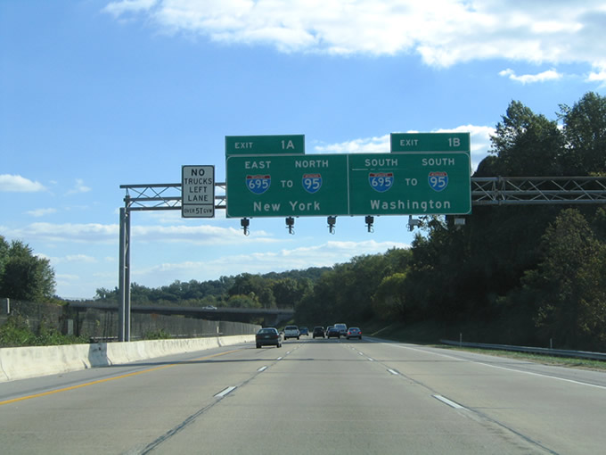
| Nearing the McDonogh Road overpass on Interstate 795 south. Guide signs for Interstate 695 include partitioning for Interstate 95 bound traffic for Washington and New York. Interstate 695 overlaps with Interstate 83 five miles to the east and Interstate 70 four miles to the south as well. 10/10/04 |
|
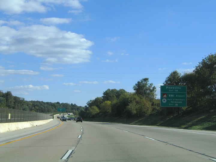
| The Northwest Expressway and Baltimore Metro progress southward. An auxiliary sign indicates the Beltway destinations of Pikesville (via MD 140 east), Baltimore-Washington International Airport (via MD 295 south) and Port of Baltimore Terminals (via MD 157). 10/10/04 |
|
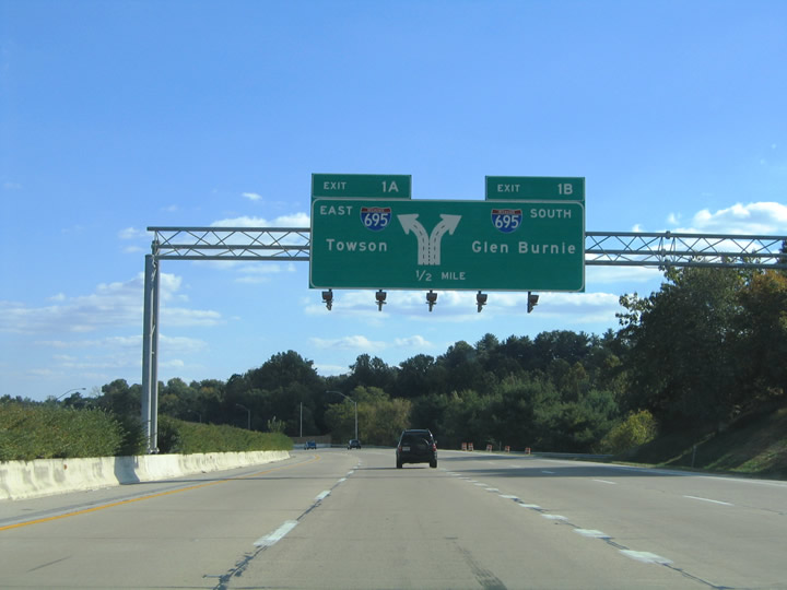
| Interstate 695 varies between six and eight lanes throughout the Pikesville and Towson vicinity north of the city. Towson lies south of Exit 27 (MD 45) to the east. Glen Burnie is where I-97 ties into the Beltway at Exit 4 south of the city. 08/27/05 |
|
| One half mile from the split of Exits 1B/A for Interstate 695. A fourth lane opens to the dual lane ramps for the Baltimore Beltway. 10/10/04 |
|
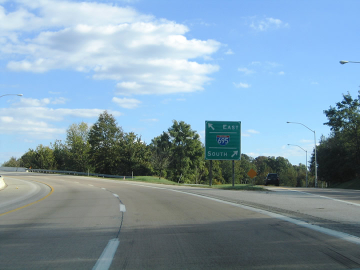
| Sweeping ramps carry Interstate 795 travelers onto the respective directions of Interstate 695 at the southern terminus of the Northwest Expressway. Had all of the expressway been built, Interstate 795 would continue southeast through Pikesville into the Mount Hope section of Baltimore via Wabash Boulevard. 10/10/04 |
|
| The Exit 1B/A gore point of Interstate 795's southern terminus. The Baltimore Metro line passes below all of the ramps and Interstate 695 mainline. The Metro-Old Court Station lies south of the interchange on Old Court Road. 10/10/04 |
Page Updated 08-27-2010.

 South
South