|
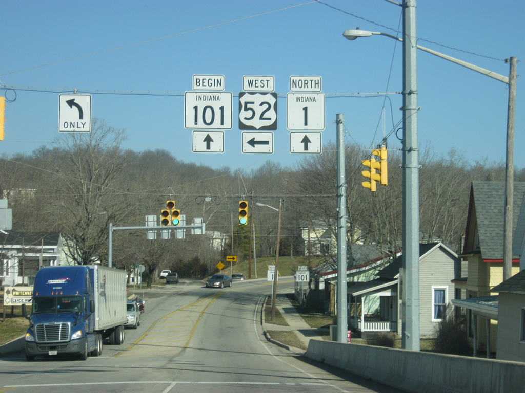
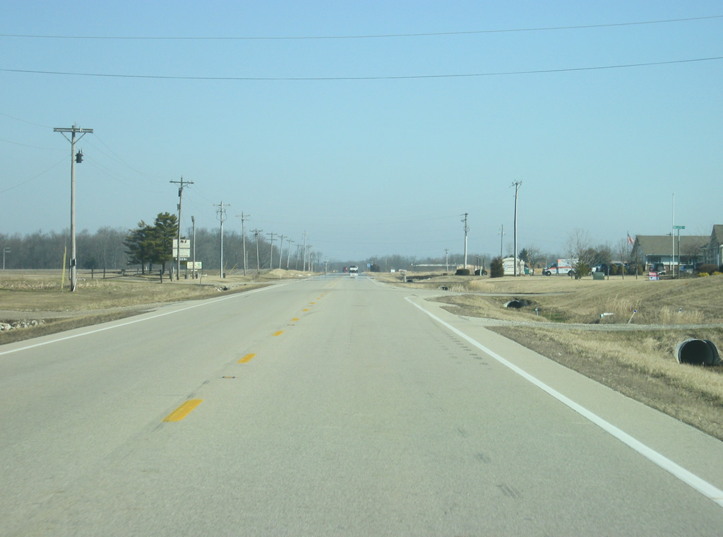
| SR 101's third segment (from the south) begins at the split with U.S. 52 and SR 1 in the Franklin County seat of Brookville. In Indiana U.S. 52 runs for 171 miles from west of Kentland, through Lafayette, Lebanon, Indianapolis, Rushville and Brookville before leaving along Interstate 74 near Harrison, Ohio. Nationally, the highway travels for 2,072 miles from Portal, North Dakota to Charleston, South Carolina. 01/19/12 |
|
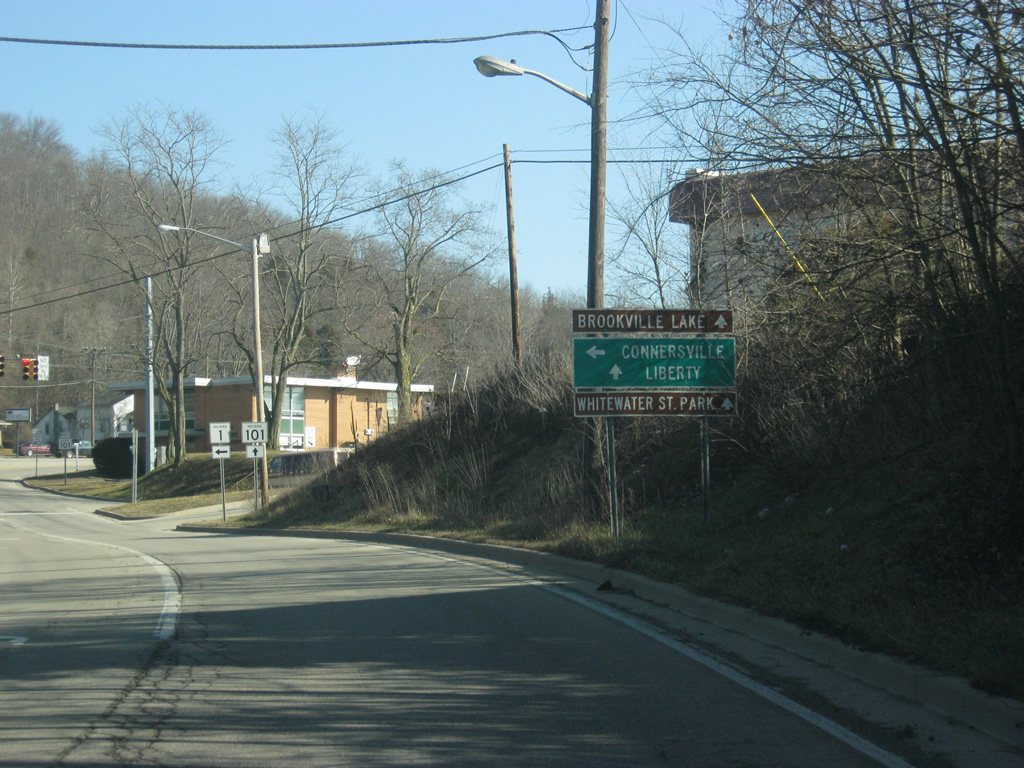
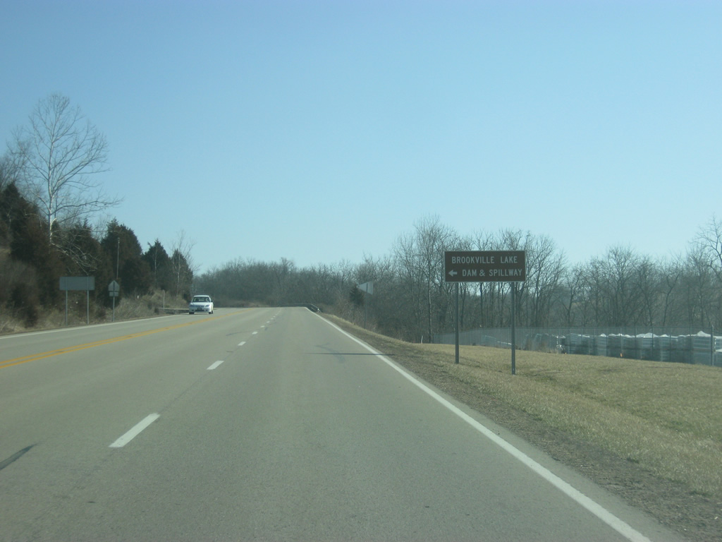
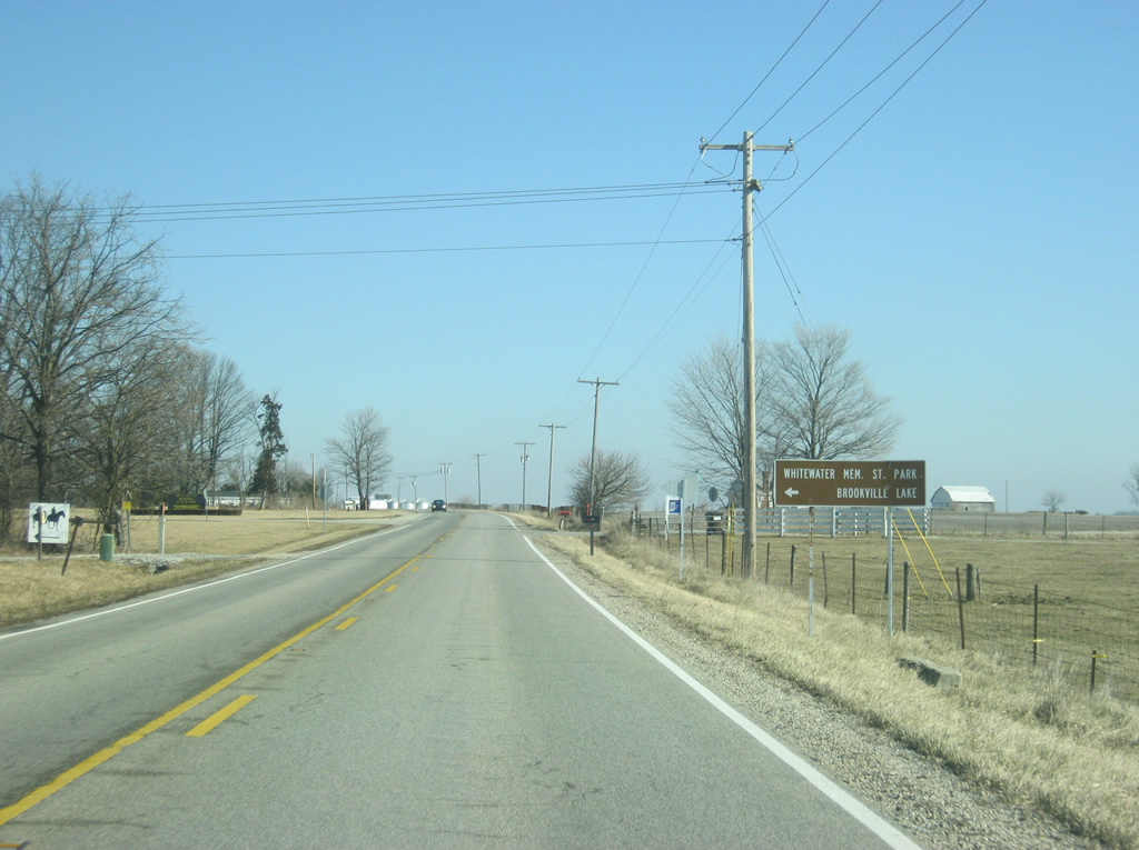
| SR 101 is multiplexed with SR 1 for a very short stretch on the north side of Brookville. Both Brookville Lake and the Whitewater Memorial State Park can be reached by taking SR 101 to the north, along with the Union County seat of Liberty. 01/19/12 |
|
| SR 1 breaks off to the left as it continues north for its 16 mile trek to the Fayette County seat of Connersville. SR 1 travels for nearly 200 miles in two disconnected stretches from Lawrenceburg north through Brookville, Connersville and Bluffton before ending at Interstate 469 south of Fort Wayne. The second section begins at Interstate 69 north of Fort Wayne and heads northeast to U.S. 20, east of Angola. 01/19/12 |
|
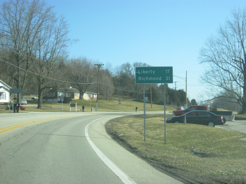
| North of the junction with SR 1, SR 101 is 17 miles from its northern terminus at Liberty. Richmond, reached via U.S. 27 north, is 31 miles away. 01/19/12 |
|
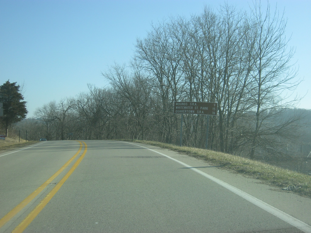
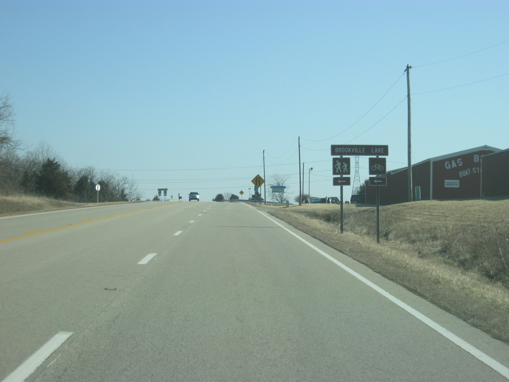
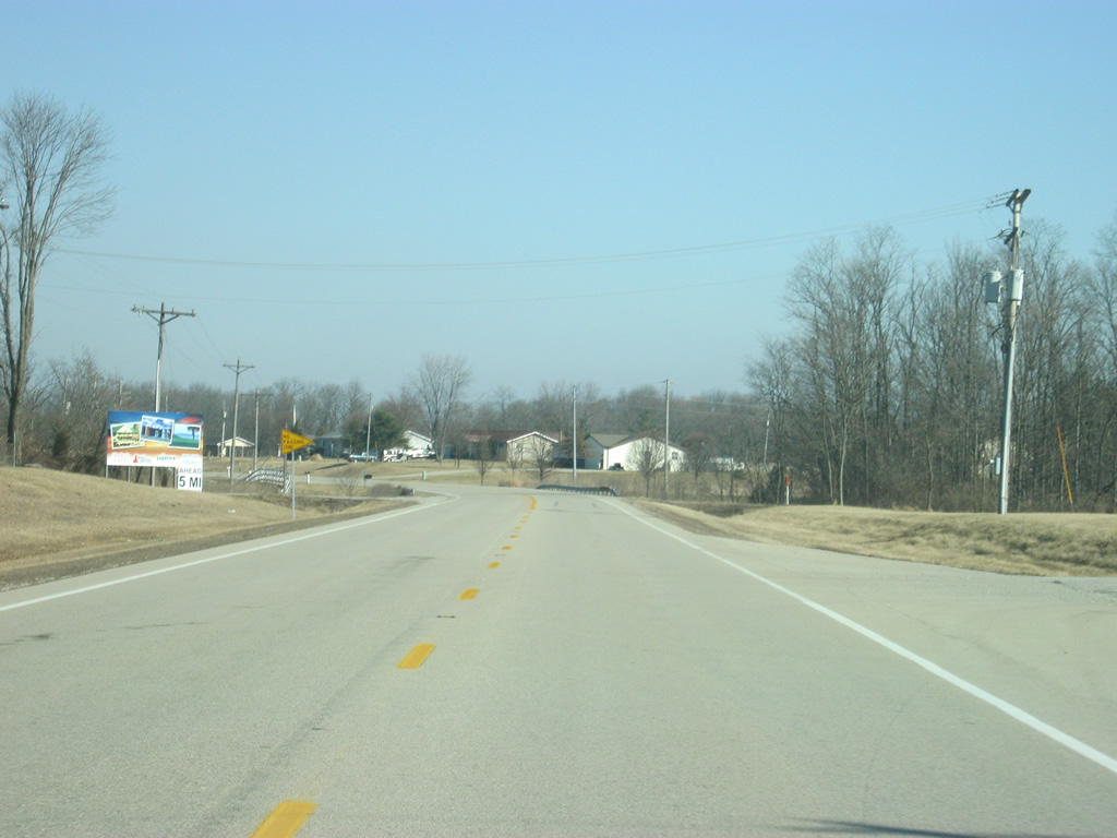
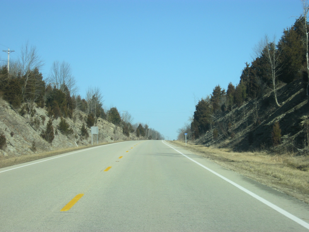
| SR 101, besides connecting Brookville with Liberty, primarily serves the recreation areas surrounding Brookville Reservoir. Mounds State Recreational Area is nine miles away, Whitewater Memorial State Park is 15 miles away with Quakertown State Recreational Area at 16 miles. 01/19/12 |
|
| A view of SR 101 as it heads northeast out of the town of Brookville. The hill ahead is part of the dam holding Brookville Reservoir. 01/19/12 |
|
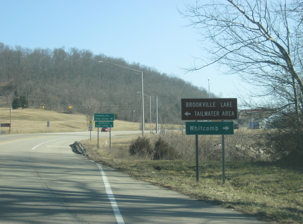
| Wildcat Lane ventures south from SR 101 to Franklin County High School and Brookville Elementary and Middle Schools. The local road connects with Oxford Pike which heads east to the town of Whitcomb. As the name suggests, Oxford Pike reaches the city of Oxford, Ohio, home to Miami University. Brookville Lake's Tailwater Area is just north of SR 101 near the base of the damn for Brookville Reservoir. 01/19/12 |
|
| SR 101 begins to climb from the valley of the Whitewater River Valley as it passes by the Brookville Lake Dam and Spillway. 01/19/12 |
|
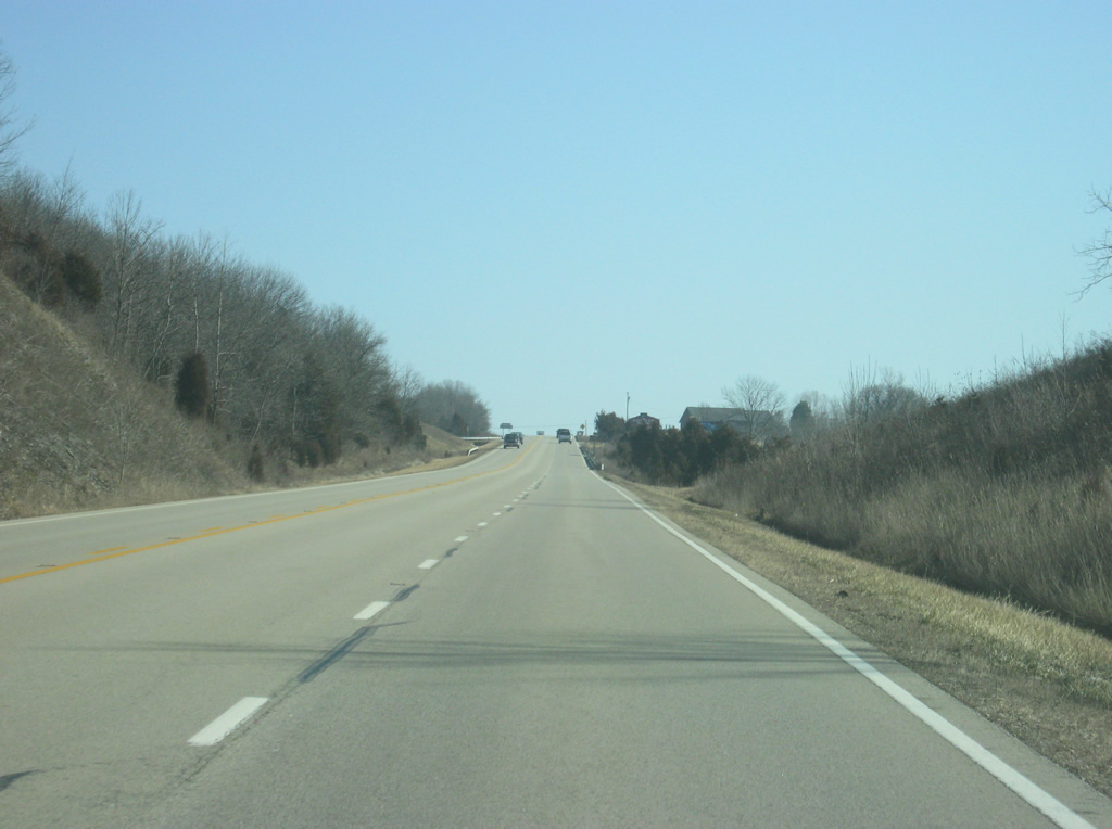
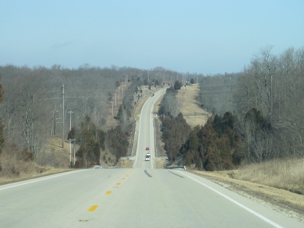
| A view of SR 101 as it continues to climb up the hill that abuts Brookville Reservoir to the southeast. A climbing lane is necessary so that traffic can pass the vehicles carrying boats that frequent the highway. 01/19/12 |
|
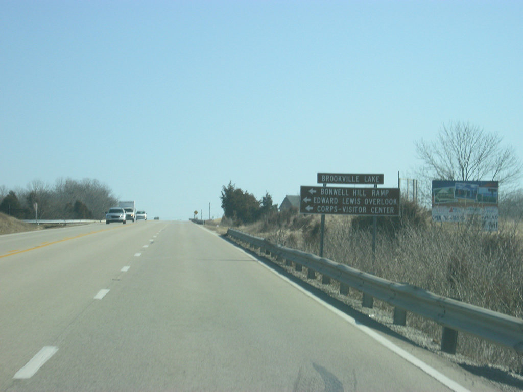
| Recreational interests to the southern part of Brookville Lake, such as the Bonwell Ramp, Edward Lewis Overlook and the Corps-Visitor Center are directed to an unnamed road that leads north to those attractions near the lake. Following the intersection, the highway loses the climbing lane. 01/19/12 |
|
| SR 101 starts to curve toward the north as it continues along the eastern side of the Brookville Reservoir area. 01/19/12 |
|
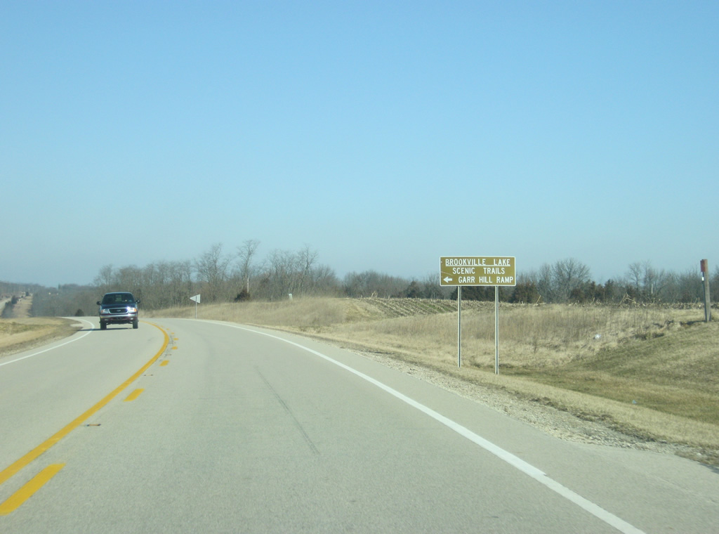
| SR 101 passes by the intersection with Pea Ridge Road, which heads west to the Garr Hill Ramp off of Brookville Lake. 01/19/12 |
|
| SR 101 descends and then ascends from the valley of a tributary of Brookville Lake to the north of Pea Ridge Road. 01/19/12 |
|
| Mounds State Recreational Area and its beach are located to the west of SR 101 along Farm Hill Road. Fox Hill Road continues the road to the east toward Mud Road. 01/19/12 |
|
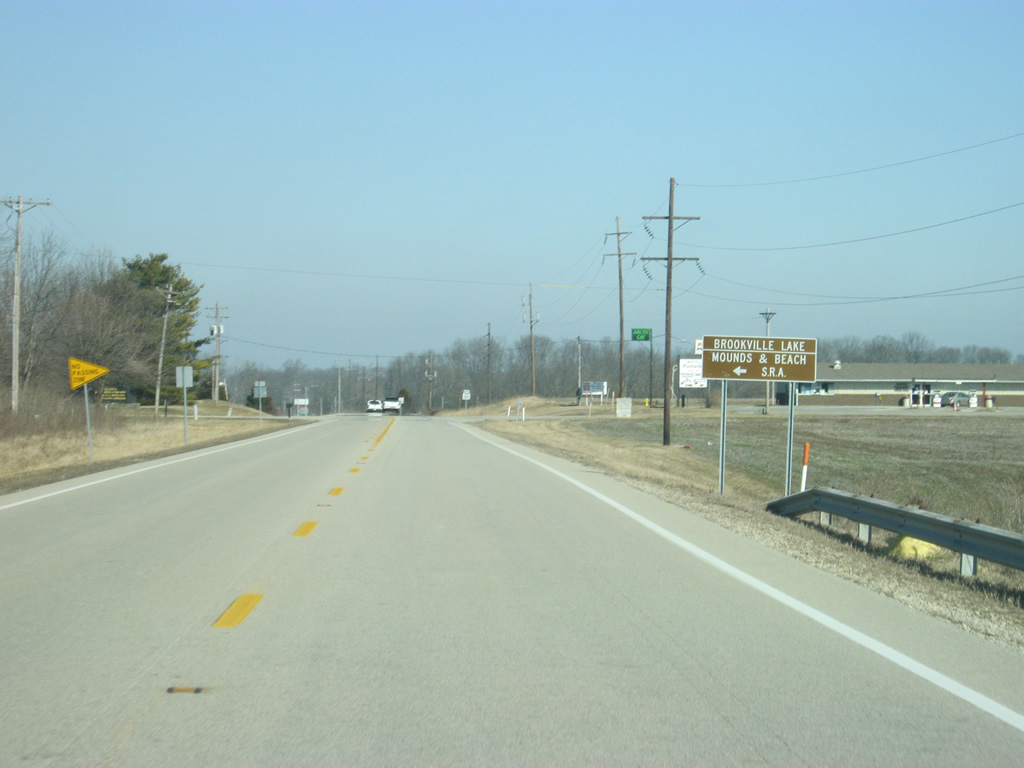
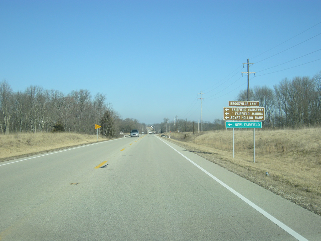
| North of the intersection with Farm Hill and Fox Hill Roads, SR 101 approaches the intersection with Fairfield Causeway Road. The east-west road heads across Brookville Lake and connects with the town of New Fairfield before connecting with SR 1 in Blooming Grove. The Fairfield Causeway, Fairfield Marina and Egypt Hollow Ramp are all west along Fairfield Causeway Road. 01/19/12 |
|
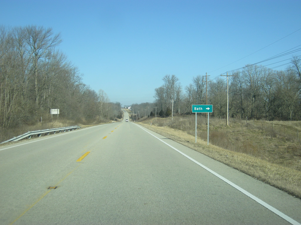
| The town of Bath is to the east along Bath Road off of SR 101. 01/19/12 |
|
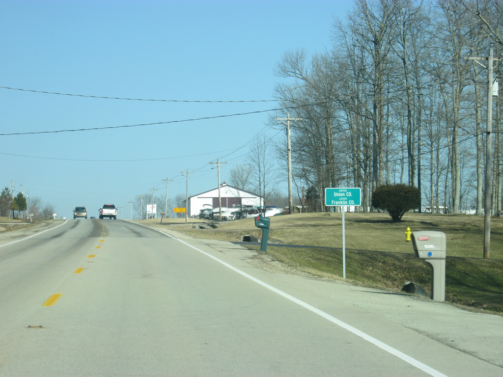
| SR 101 crosses into Union County (population 7,516). 01/19/12 |
|
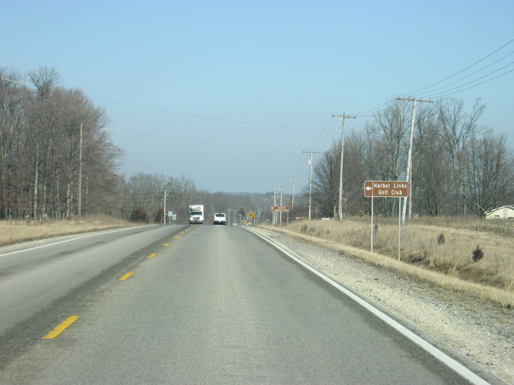
| The Harbor Links Golf Club and Fairfield Ramp to Brookville Lake are west of SR 101 along Old State Road 101. Old State Road 101 used to carry the state highway's routing until Brookville Lake was created, flooding part of the route and forcing a reroute along the east side of the lake. 01/19/12 |
|
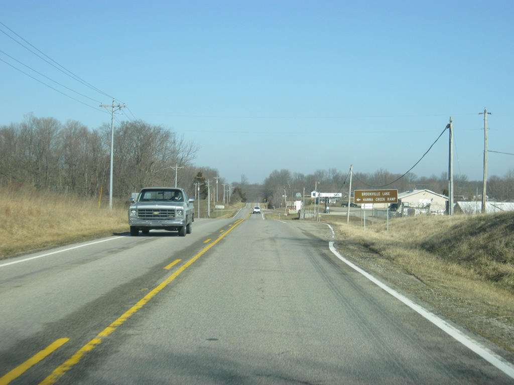
| Arthur Curry Road heads west from SR 101 to the Hanna Creek Ramp. 01/19/12 |
|
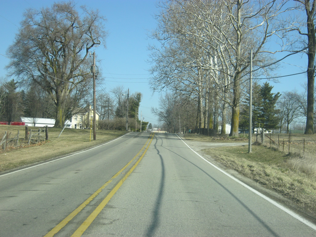
| A view of SR 101 to the north of Arthur Curry Road passing through some woods. 01/19/12 |
|
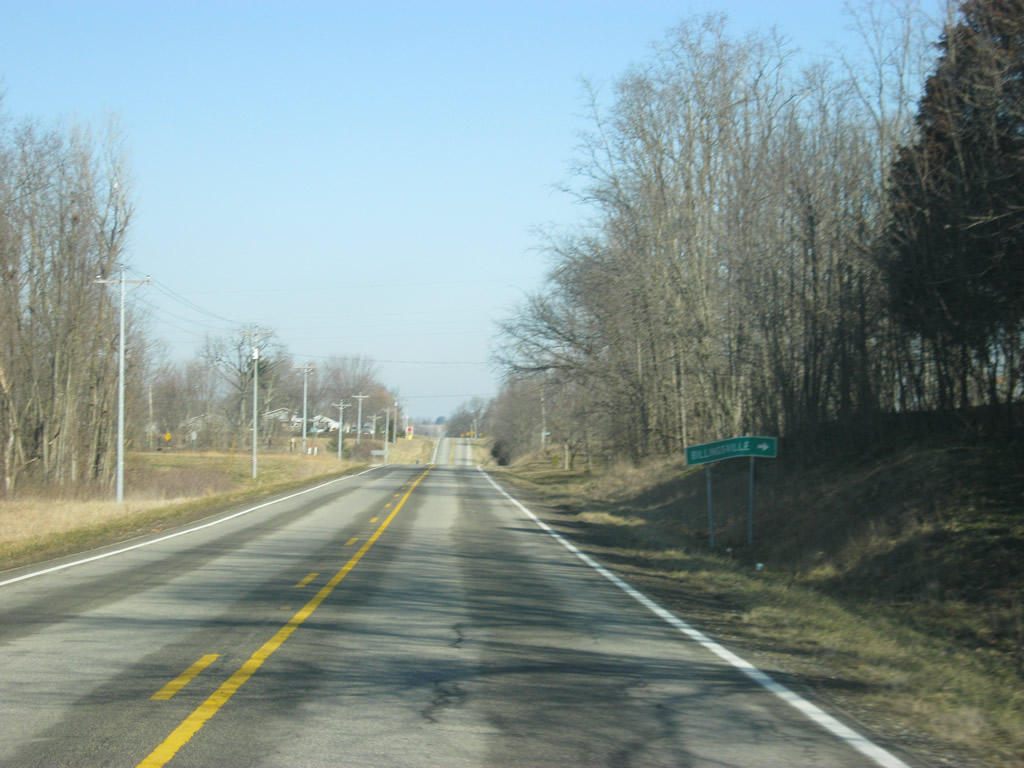
| SR 101 passes by the intersection with Contreras Pike, heading east to the town of Billingsville. 01/19/12 |
|
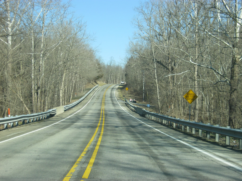
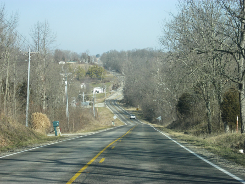
| SR 101 passes over some hilly terrain to the north of Contreras Pike. 01/19/12 |
|
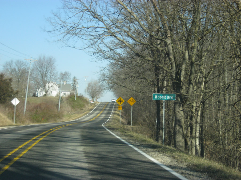
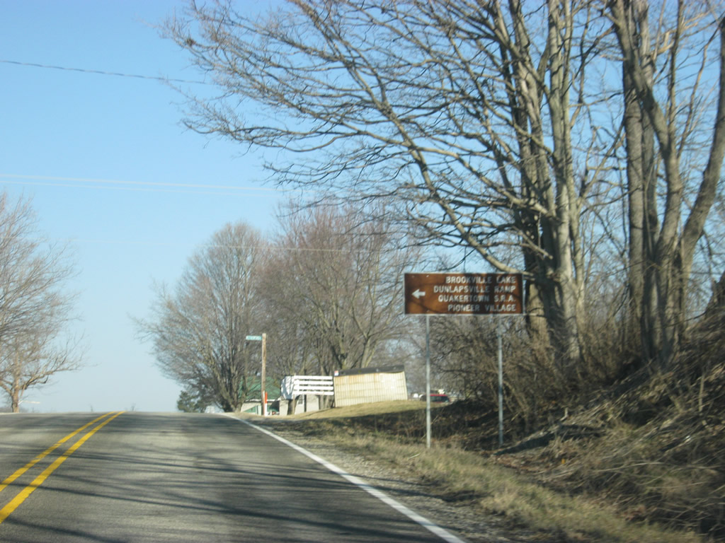
| SR 101 enters the town of Roseburg. In Roseburg, highway meets up with Dunlapsville Road, which leads to the town of Dunlapsville along with the Dunlapsville Ramp to Brookville Lake, the Quakertown State Recreational Area and Pioneer Village. 01/19/12 |
|
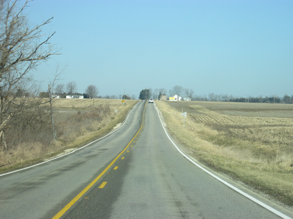
| SR 101 is only a few miles from Liberty as it heads north from Roseburg and the intersection with Dunlapsville Road. 01/19/12 |
|
| The entrance to the Whitewater Memorial State Park is to the left along SR 101 in between Roseburg and Liberty. 01/19/12 |
|
| SR 101 north of Whitewater Memorial State Park as it nears the town of Liberty. 01/19/12 |
|
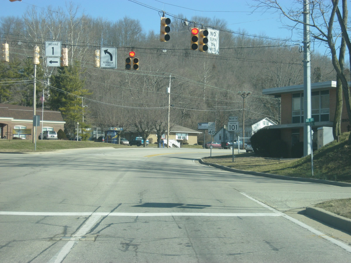
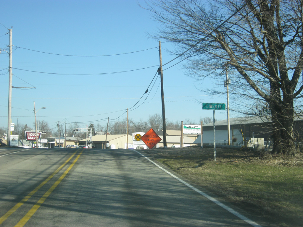
| SR 101 enters the Union County seat of Liberty (population 2,061). In Liberty, SR 101 follows Main Street to its northern terminus at SR 44. 01/19/12 |
|
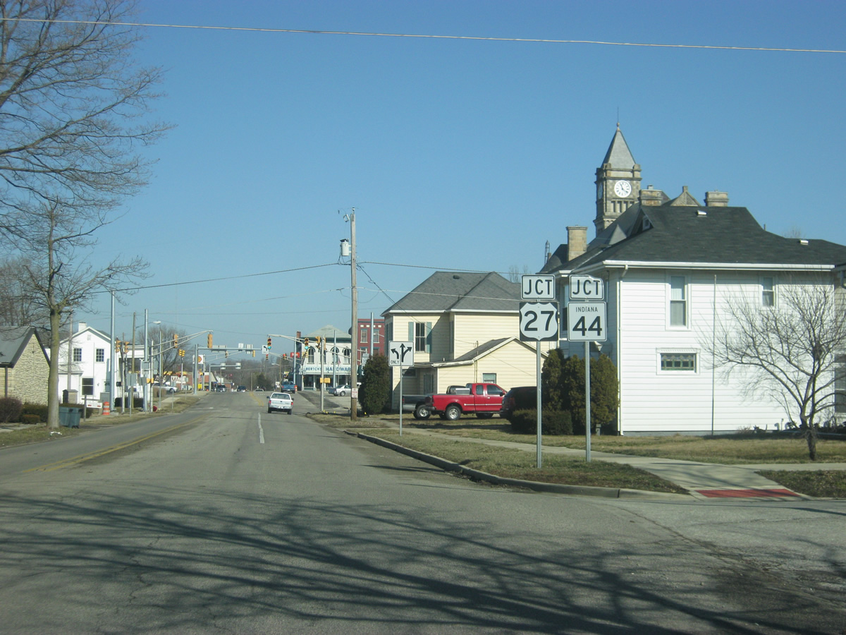
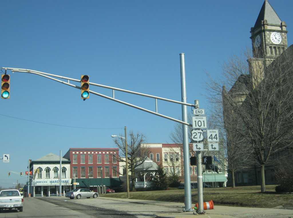
| It is not far inside Liberty before SR 101 meets up with its northern terminus at U.S. 27 and SR 44. U.S. 27 (Seminary Street) goes for 1,373 miles from Interstate 69 in Fort Wayne and south through Decatur, Portland, Winchester, Richmond and Cincinnati, Ohio en route to its southern terminus in Miami, Florida. 01/19/12 |
|
| SR 101 ends at the intersection of Main and Seminary Streets at the southwest corner of the Union County Courthouse. SR 44 goes for 90 miles from SR 37 in Martinsville east through Franklin, Shelbyville, Rushville, Connersville and Liberty before leaving at the Ohio border. In Liberty, both U.S. 27 and SR 44 follow Seminary Street from the east and Main Street north of this intersection. While SR 44 breaks off to the west at Union Street, one block to the north en route to Connersville, U.S. 27 continues to the north along Main Street toward the Wayne County seat of Richmond, twelve miles to the north. 01/19/12 |
Page Updated 08-09-2012.