The New Jersey Turnpike north from I-295 and U.S. 40 at Deepwater to the Pennsylvania Turnpike at Mansfield Township is officially designated as State Route 700 (unsigned). Major construction underway between 2009 and late 2014, expanded the toll road to 12 overall lanes from a point just south of Exit 6 northward to Exit 9. This work lengthened the four Roadway section of the Turnpike southward to Exit 6.
|
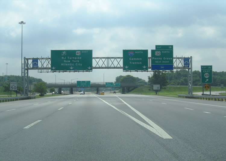
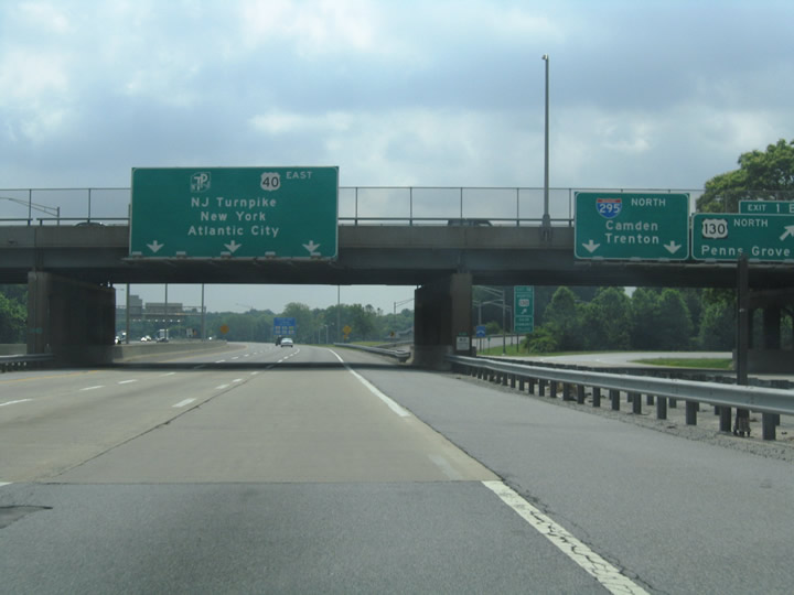
| The New Jersey Turnpike & U.S. 40 quickly split with Interstate 295 after the Delaware Memorial Bridge. The partition occurs within the three quarter cloverleaf interchange at U.S. 130 north & Route 49 east (Broadway) in Deepwater. 06/13/05 |
|
| Three lanes of the New Jersey Turnpike north & U.S. 40 east parallel Interstate 295 northbound through the Exit 1A/B interchange with the northbound beginning of U.S. 130 and eastbound beginning of Route 49. 06/13/05 |
|
| Interstate 295 curves northward over Salem Canal and the New Jersey Turnpike & U.S. 40 ahead of their split (Exit 1). A southbound on-ramp crosses over the turnpike in the foreground from Interstate 295 south to Salem County 551 (Hook Road). Button copy signs attached to the over crossing, since replaced, prepare motorists for U.S. 40 eastbound continuation onto Wiley Road via Exit 1 ramp. 06/25/05 |
|
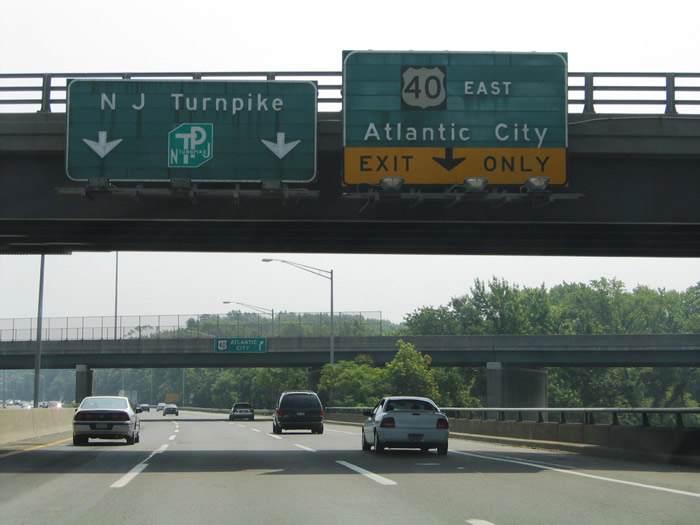
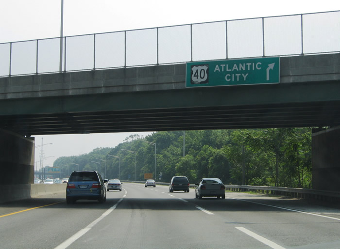
| Nearing the Exit 1 off-ramp for U.S. 40 (Wiley Road) east to Woodstown, Malaga, Mays Landing, and Atlantic City. All drivers not destined for the New Jersey Turnpike north to Camden and Newark must use the last exit before the toll plaza onto U.S. 40. A set of trailblazers indicate that Exit 1 also serves Route 140 west and Salem County 540 east (Deepwater Slapes Corner Road). 06/25/05 |
|
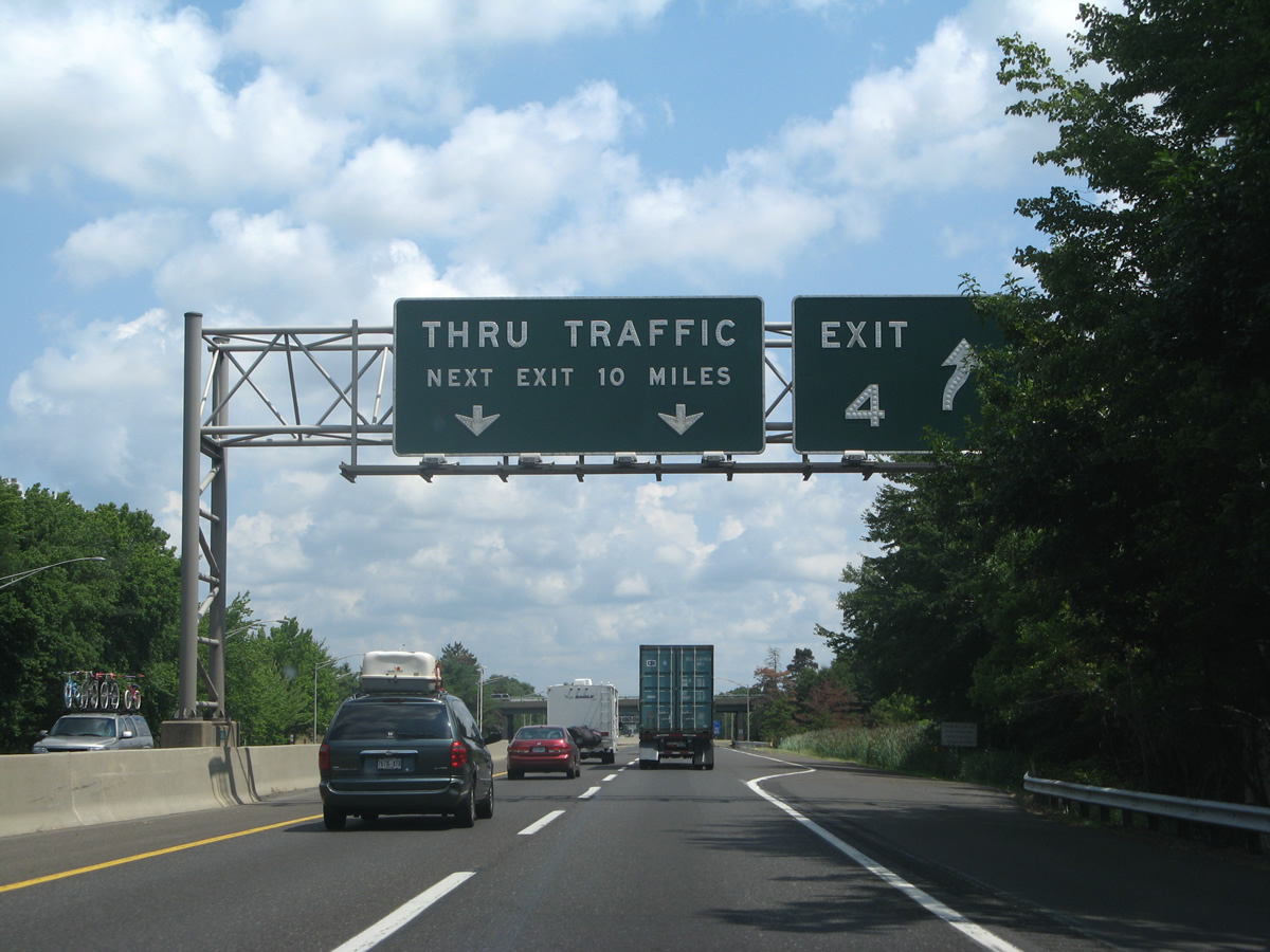
| Exit 1 departs the New Jersey Turnpike northbound for U.S. 40 (Wiley Road) eastbound. U.S. 40 comprises the main route between the Delaware Memorial Bridge and Atlantic City.
Atlantic City lies 62 miles to the east along the New Jersey coast. Connections with Route 55 and Route 47 serve Vineland, Wildwood, and Cape May. An Interstate 95 trailblazer advises motorists to remain on the New Jersey Turnpike through until Exit 6. 06/25/05 |
|
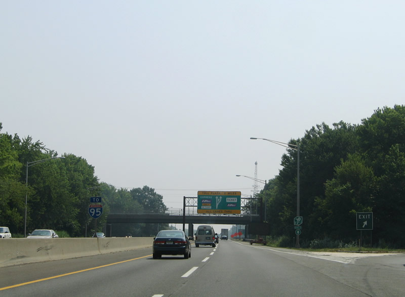
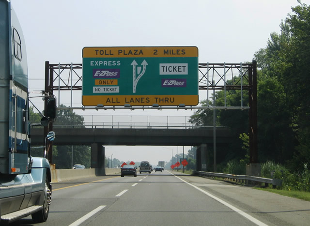
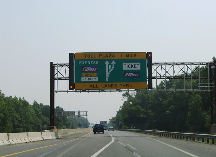
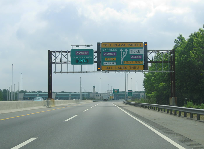
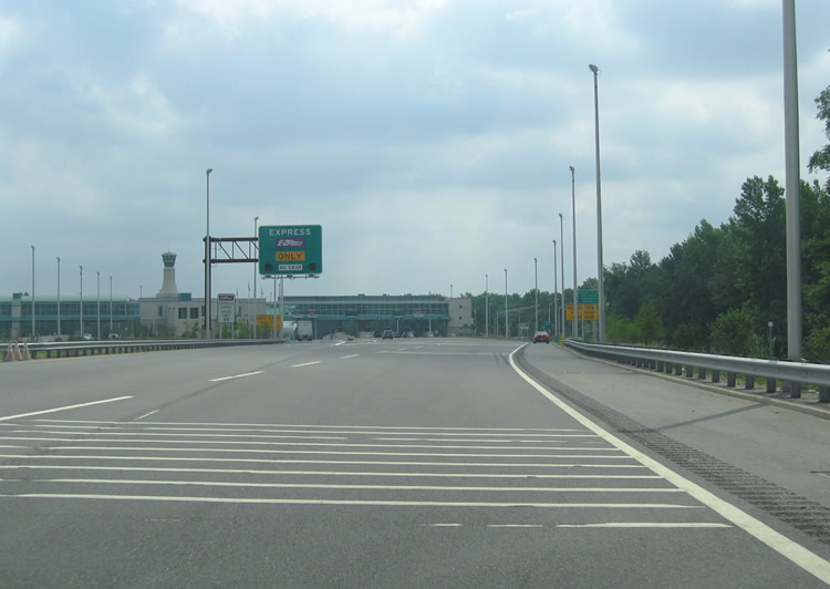
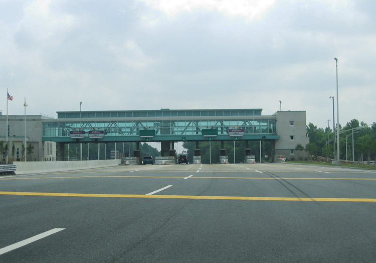
| Turnpike travelers pass underneath Route 140 at the Exit 1 parclo interchange, two miles south of the gateway toll plaza. Newly constructed in 2005, the massive toll barrier provides high-speed lanes for EZ-Pass holders within the inside lanes of the sprawling plaza. 06/25/05 |
|
| A pair of welcome signs precede the Exit 1 gateway toll plaza on the New Jersey Turnpike northbound. Barriers visible here remained from the removal of the original toll booths just east of Route 140. The new plaza was constructed two miles east of the U.S. 40 split to offset traffic overflow onto Interstate 295 during times of peak congestion, such as those during Holiday travel periods. In addition the new plaza was constructed away from the old one due to space constraints from the path of nearby U.S. 40 (Wiley Road) to the south and Soders Road to the north. 06/25/05, 06/13/05 |
|
| Leaving the area of the original Exit 1 gateway toll plaza one mile south of the new toll plaza. The configuration of the EZ-Pass high speed lanes is similar to that of Pike Pass lanes in Oklahoma and other open road tolling setups nationwide. That means that cash paying customers must exit the turnpike mainline to pay an attendant while electronic toll tag carriers may continue through at freeway speeds uninterrupted. 06/25/05 |
|
| Traveling through the Exit 1 gateway toll plaza on the New Jersey Turnpike northbound. Two high speed lanes travel through the inside of the plaza and five booths lie along the outside lanes. Dynamic message boards allow the Turnpike Authority to close the high-speed lanes at any time. Also note the tall airport like control tower at the center of the plaza and the number of toll booths for the southbound direction. The original plaza was the site of lengthy back-ups during peak travel times and so the new plaza was greatly expanded with attended 14 toll booths and two E-ZPass lanes to handle the volume. 06/13/05 |
|
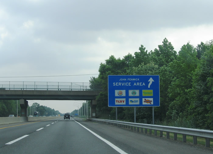
| Pennsgrove Auburn Road (Salem County 641) passes over the New Jersey Turnpike northbound ahead of the John Fenwick Service Plaza. The 122 mile toll road features service plazas at regular intervals that provide gas, food, and tourist information. 06/13/05 |
|
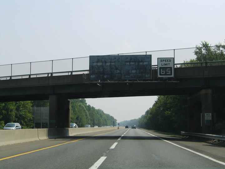
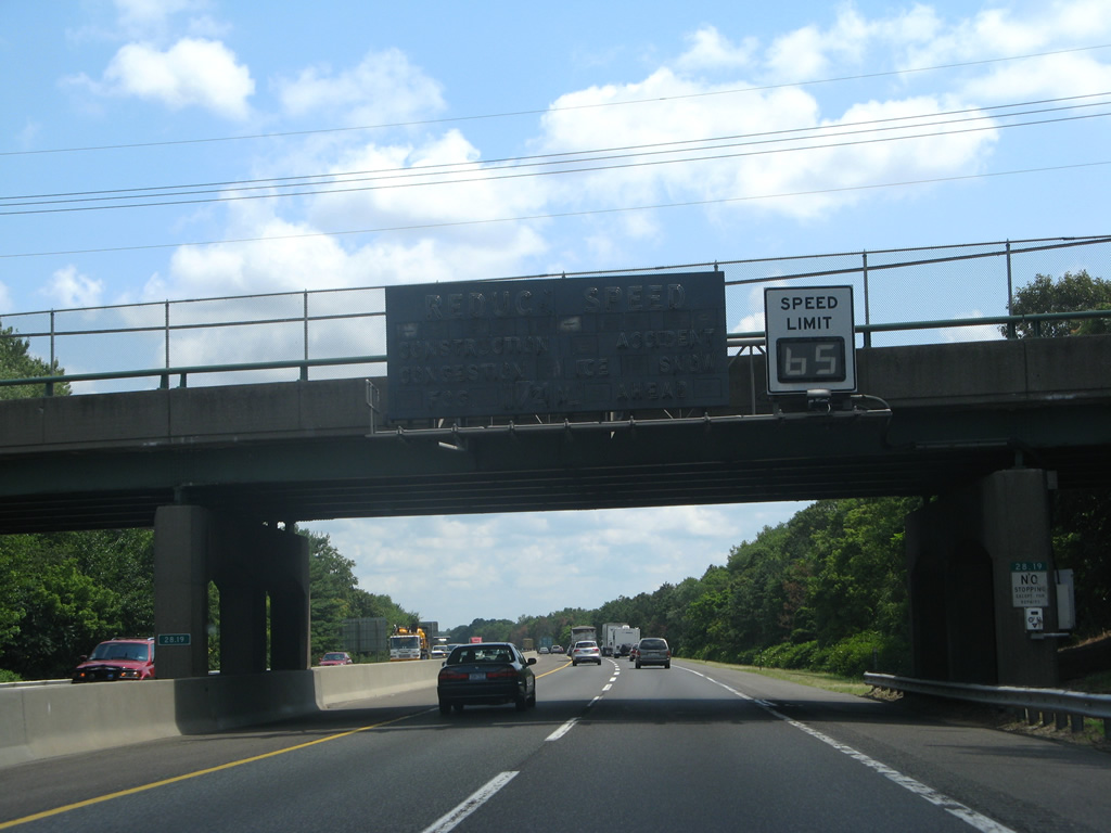
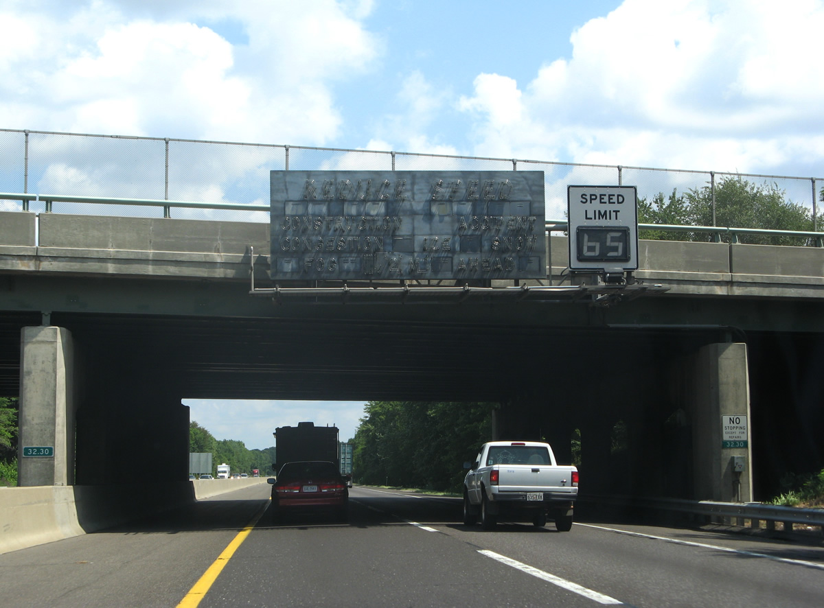
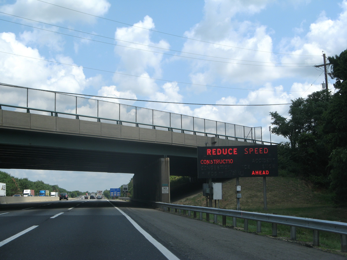
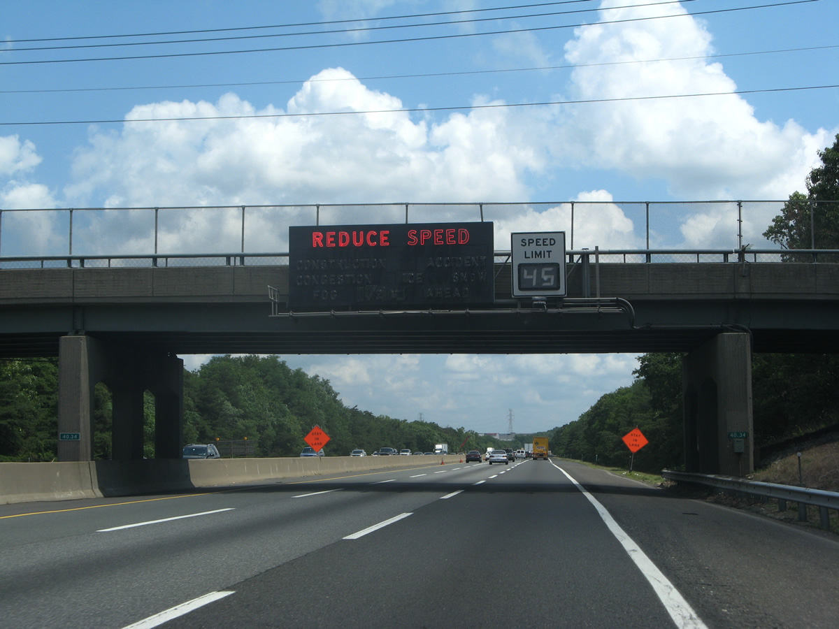
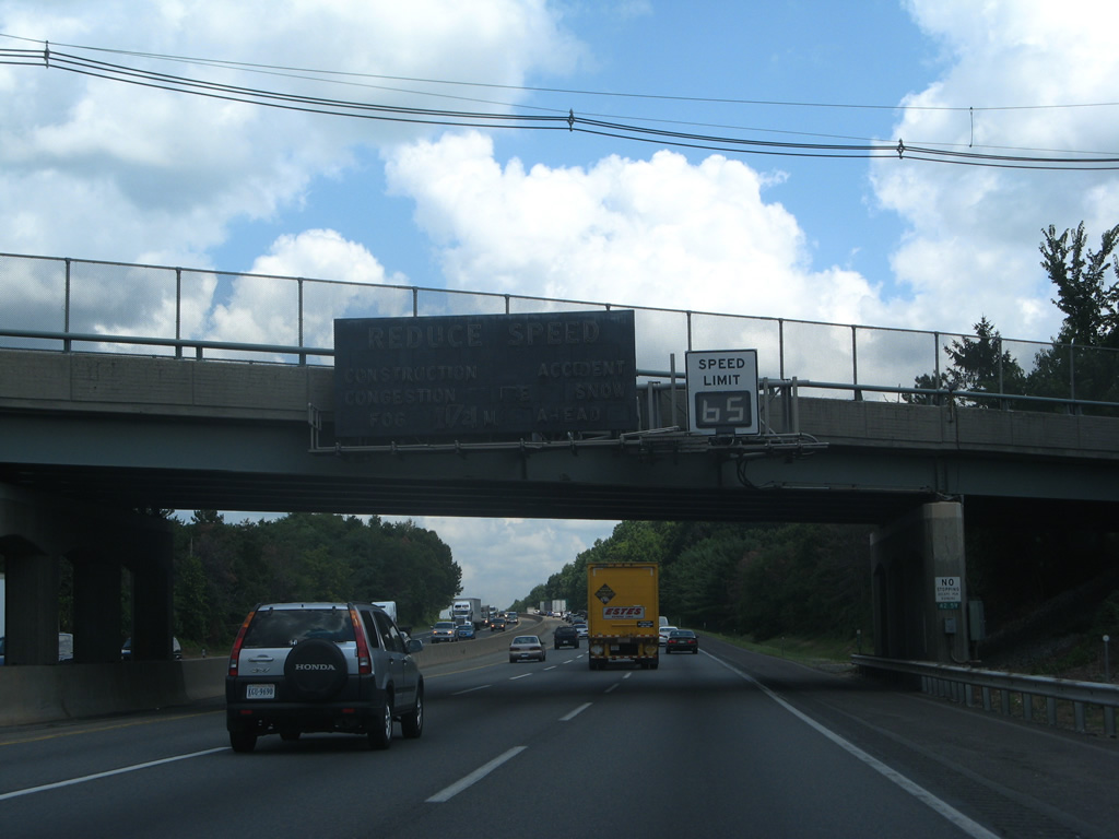
| Neon-lighted message boards were used throughout the New Jersey Turnpike to advise motorists of travel delays due to congestion, accidents, and stormy weather. These boards were phased out for LED-based dynamic message signs in the 2010s.
Pictured here was a neon-light based board attached to the Stumpy Lane overpass north of the John Fenwick Service Plaza. The original message signs generally accompanied a variable speed limit sign. 06/25/05 |
|
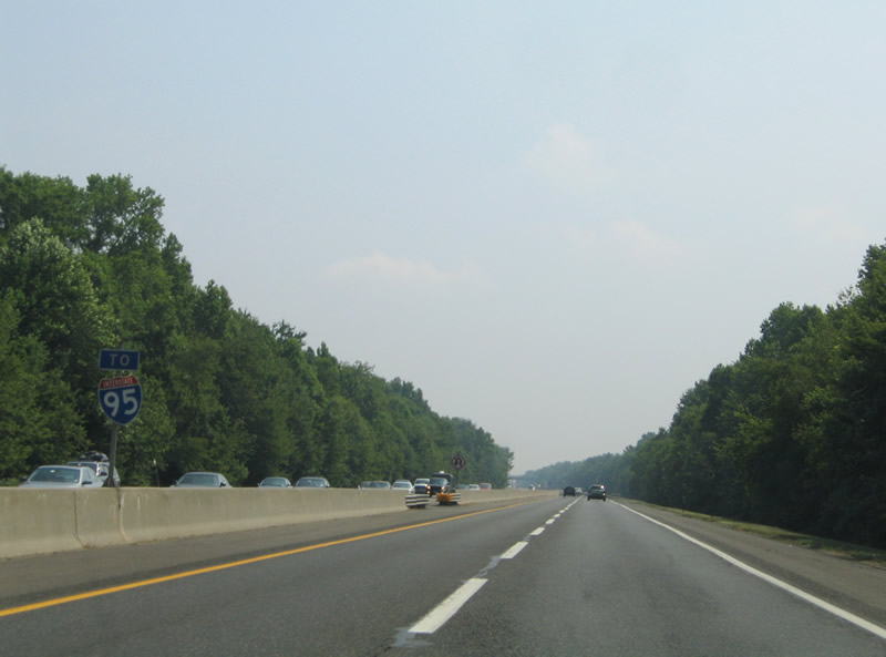
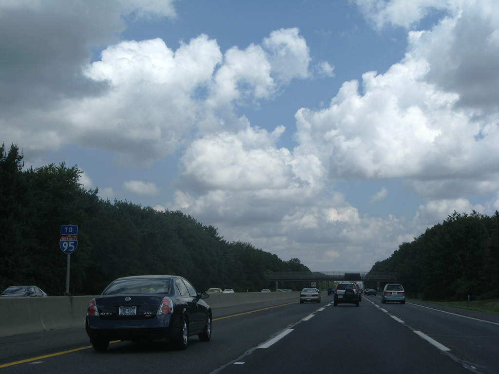
| A second Interstate 95 trailblazer resides within the median of the New Jersey Turnpike near Stumpy Lane in Oldmans Township, Salem County. 06/25/05 |
|
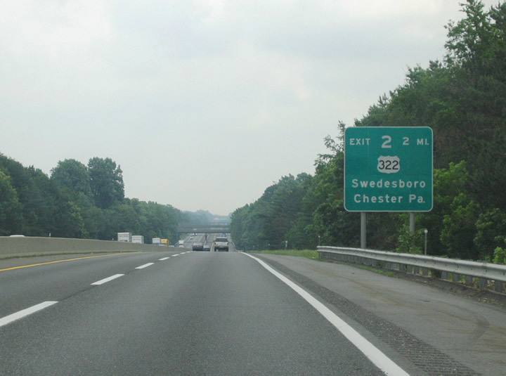
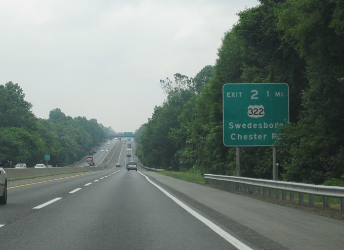
| The first New Jersey Turnpike mainline interchange joins the toll road with U.S. 322 at Exit 2, 14 miles northeast of Deepwater in Gloucester County. Pictured here is the two mile guide sign for U.S. 322, an east-west highway linking Chester, Pennsylvania with Atlantic City, New Jersey. Crossing overhead in the background are Monroeville and Franklinville Roads (Gloucester County 538).
Sign replacements for Exit 2 replaced Chester, Pa. with Glassboro for U.S. 322 east. 06/13/05 |
|
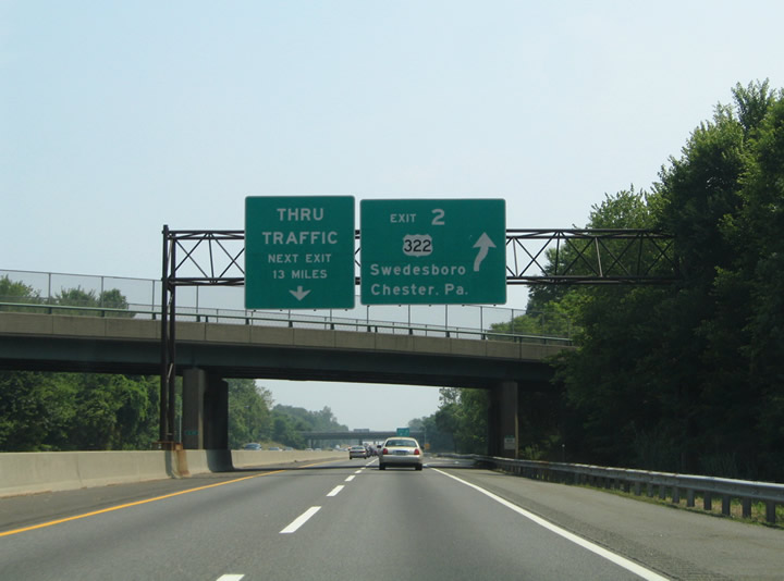
| One mile south of the trumpet interchange (Exit 2) with U.S. 322. U.S. 322 travels five miles west to Interstate 295. Connections with Gloucester County 551 (Kings Highway) lead drivers south into the borough of Swedesboro. The US highway meanwhile turns north from its cloverleaf interchange with Interstate 295 one mile to U.S. 130 at Bridgeport and five miles to merge with Interstate 95 in Chester, Pennsylvania. 06/13/05 |
|
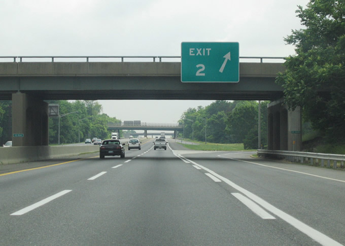
| Exit 2 leaves the New Jersey Turnpike beyond the Back Creek Road overpass east of Swedesboro. U.S. 322 crosses the tolled Commodore Barry Bridge over the Delaware River between Bridgeport and Chester, Pennsylvania.
Sign changes made here include the replacement of the Next Exit 13 miles sign with a pull-through panel for the NJ Turnpike with New York as the control city. 06/26/05 |
|
| East from the Exit 2, U.S. 322 travels three miles to Mullica Hill and an overlap with Route 45, five miles to an exchange with the Route 55 freeway, and seven miles to Route 47 at Glassboro. U.S. 322 provides an alternate route to the Atlantic City Expressway and U.S. 30 between Williamstown and Atlantic City. 06/13/05 |
|
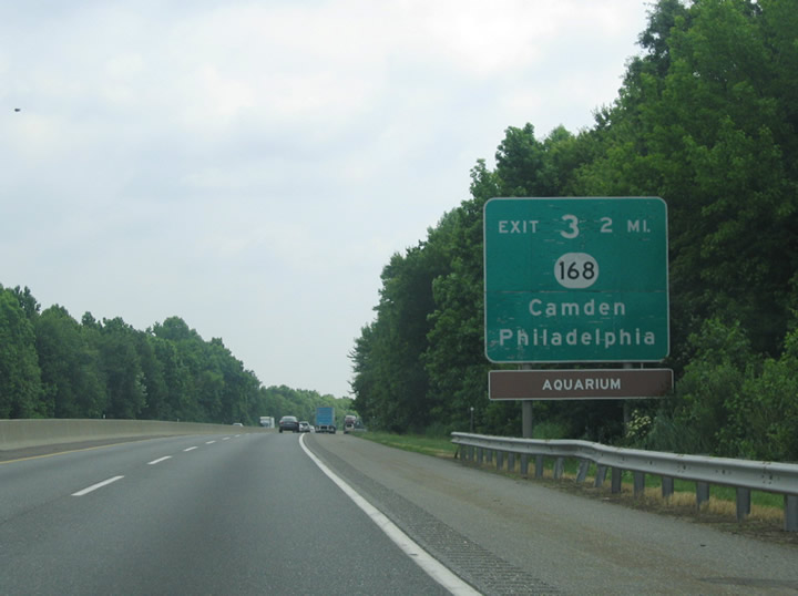
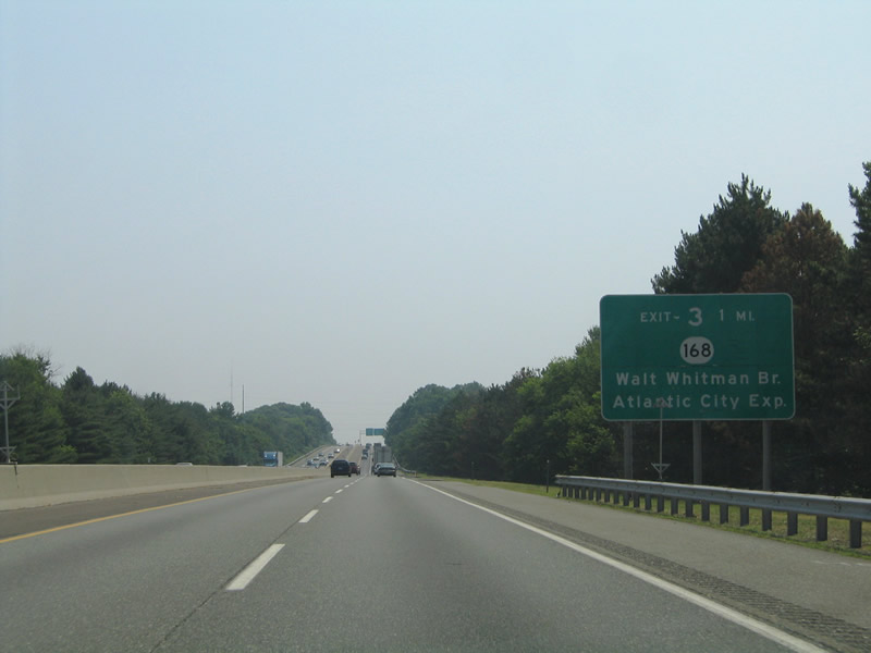
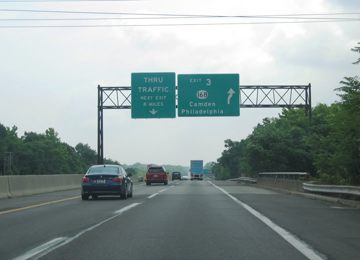
| The New Jersey Turnpike enters the thick of the Camden-Philadelphia metropolitan area from Woodbury northward to Moorestown. A pair of interchanges serve interests in this part of South Jersey. The first of these is Exit 3 with Route 168 (Black Horse Pike) at Runnemede. Route 168 provides the connection to Interstate 76 west (Walt Whitman Bridge), Interstate 676 north, and Route 42 (North-South Freeway) south via Interstate 295 nearby at Bellmawr. There is no direct access to the highways otherwise from the turnpike. 06/13/05 |
|
| The one mile guide sign, since replaced, indicated the Route 168 (Black Horse Pike) connections to the Walt Whitman Bridge for Philadelphia and Atlantic City Expressway east. Route 42 continues the North-South Freeway south from Interstate 76 & 295 to the Atlantic City Expressway beginning at Turnersville. The state route overtakes Black Horse Pike from Route 168 at Turnersville to Williamstown while the Atlantic City Expressway commences as a toll road east to Hammonton, Egg Harbor City, Pleasantville, and Atlantic City. Interstate 76 meanwhile crosses the Walt Whitman suspension Bridge over the Delaware River into south Philadelphia, Pennsylvania. 06/26/05 |
|
| Turnpike travelers pass over the Black Horse Pike ahead of the Exit 3 trumpet interchange to Route 168. Route 168 travels north 10.75 miles from Turnersville to Ferry Avenue on the Camden city line, serving such communities as Blackwood, Glendora, Runnemede, Somerdale, Bellmawr, Barrington, Mount Ephraim, and Audubon Park along the way. Connections with Interstate 76C from Route 168 lead drivers west to U.S. 130 (Crescent Boulevard) and the Walt Whitman Bridge. 06/13/05 |
|
| A small distance sign within the Exit 3 trumpet interchange, since removed, listed New York City. The 90 miles referenced the George Washington Bridge (I-95) crossing of the Hudson River between Fort Lee and Manhattan Island. Distance signs generally are a misnomer along the New Jersey Turnpike. 06/25/05 |
|
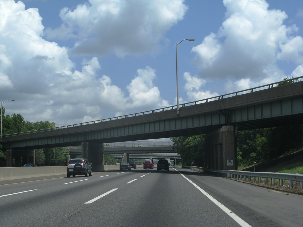
| An Interstate 95 trailblazer appears within the Turnpike median ahead of the Route 41 (Clements Bridge Road) overpass. 07/27/07 |
|
| Turnpike motorists pass over U.S. 30 (White Horse Pike) at the borough of Lawnside ahead of this overpass carrying CR 669 (Warwick Road). 07/27/07 |
|
| Another former neon travel conditions sign was attached to the Kresson Road (CR 671) overpass above the northbound Turnpike. Interstate 295 parallels the toll road closely along this stretch to the west. 07/27/07 |
|
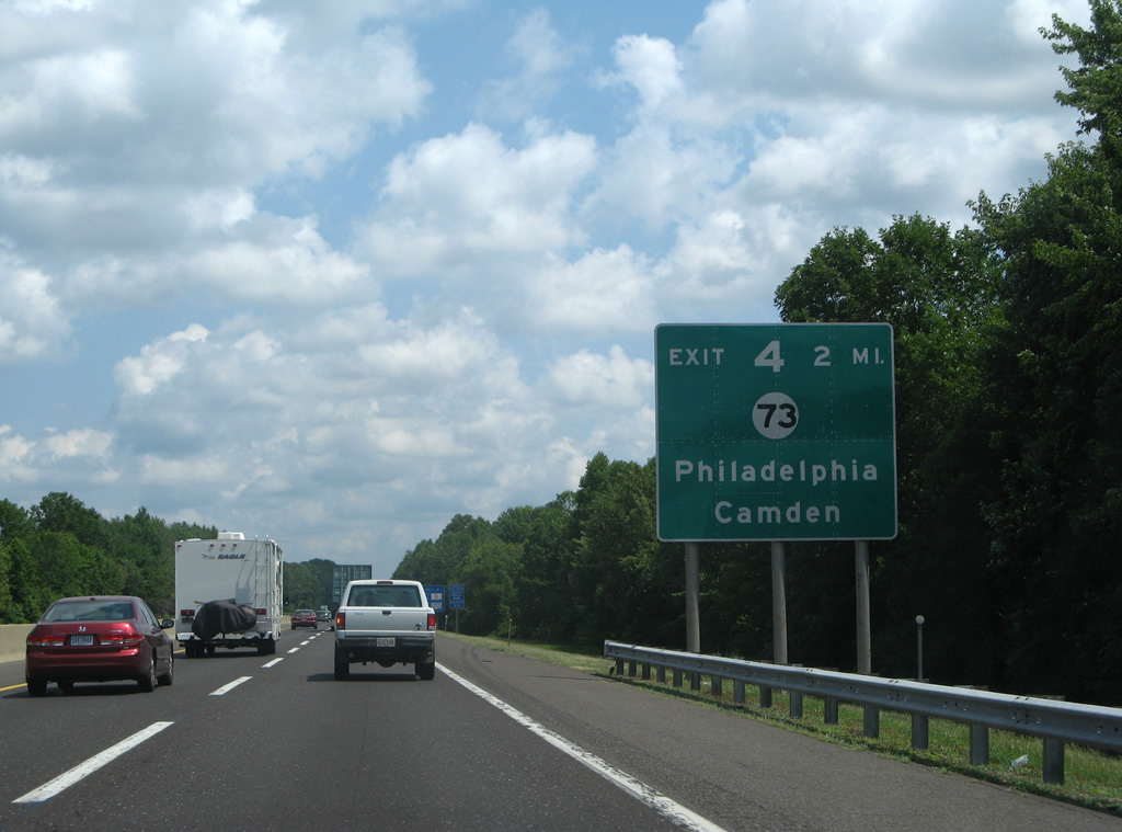
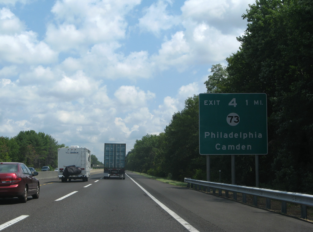
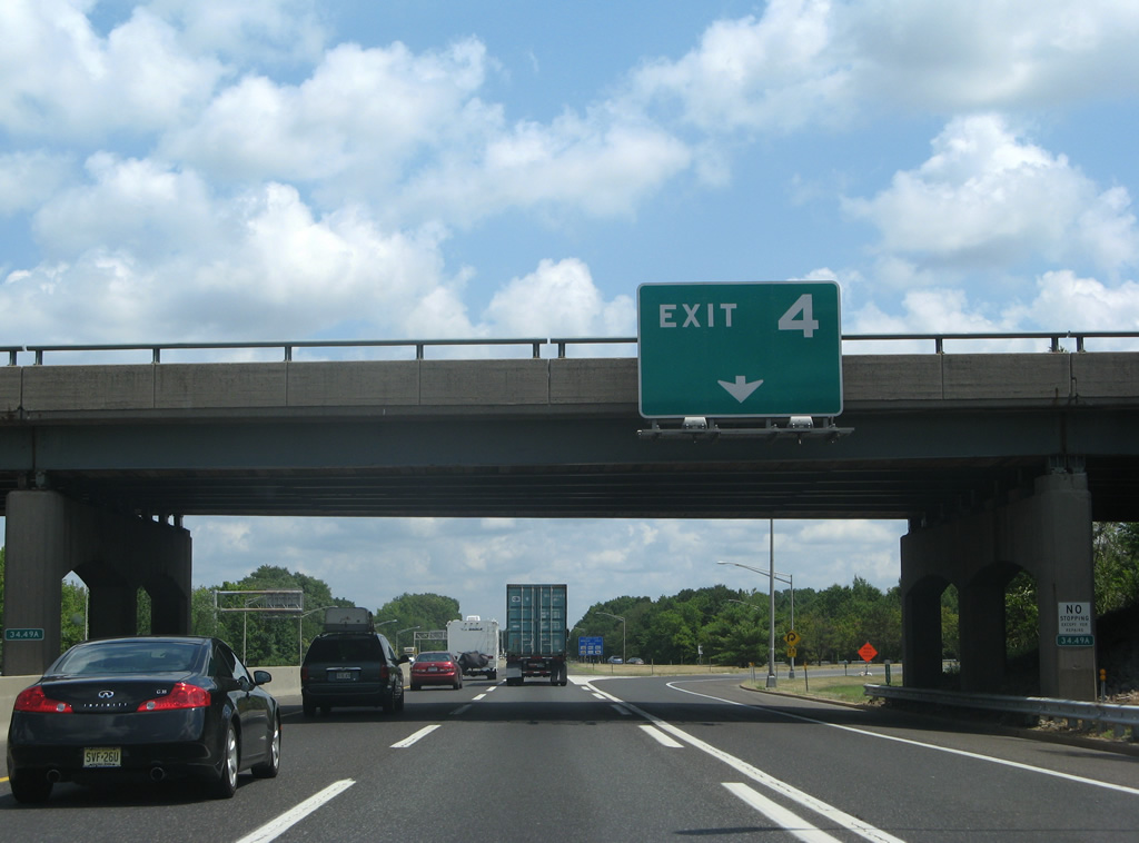
| Continuing northward into Cherry Hill township, next in line for the NJ Turnpike is Exit 4 with Route 73 at Ramblewood. Constituting a major north-south arterial, Route 73 travels south from the Tacony-Palmyra Bridge to Voorhees and Berlin.
Sign changes made for Exit 4 replace Philadelphia with Mount Laurel. 07/27/07 |
|
| One mile south of the Exit 4 trumpet interchange with Route 73. Route 73 northbound provides two connections to Philadelphia, Pennsylvania. Route 90 splits from the state route five miles to the northwest as a freeway directly to the Betsy Ross Bridge. Route 73 meanwhile transitions into PA 73 via the arched Tacony-Palmyra Bridge into the Tacony section of Philadelphia. Route 90 joins Interstate 95 at the Bridesburg section of the city. 07/27/07 |
|
| Button copy guide signs, since replaced, at the Exit 4 ramp departure to Route 73 in Mount Laurel township. 07/27/07 |
|
| Route 73 sees interchanges with Route 38 (Kaighan Avenue) & 41 (Kings Highway) nearby at Maple Shade township to the north. To the south the state route crosses paths with Route 70 (Marlton Pike) in three miles at Marlton. All three intersecting routes lead west from Route 73 to Cherry Hill and U.S. 30 (White Horse Pike). 07/27/07 |
|
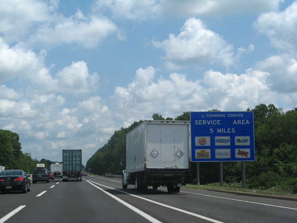
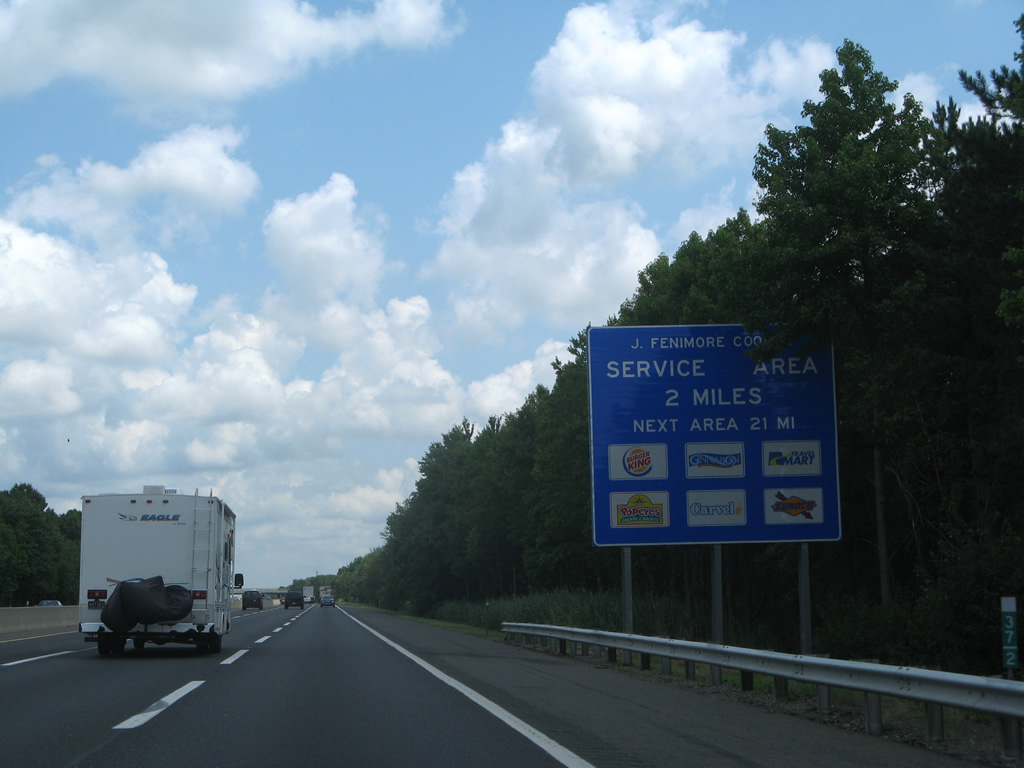
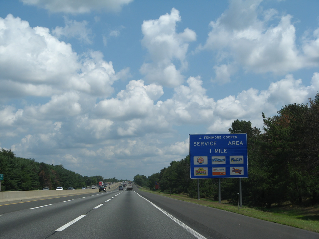
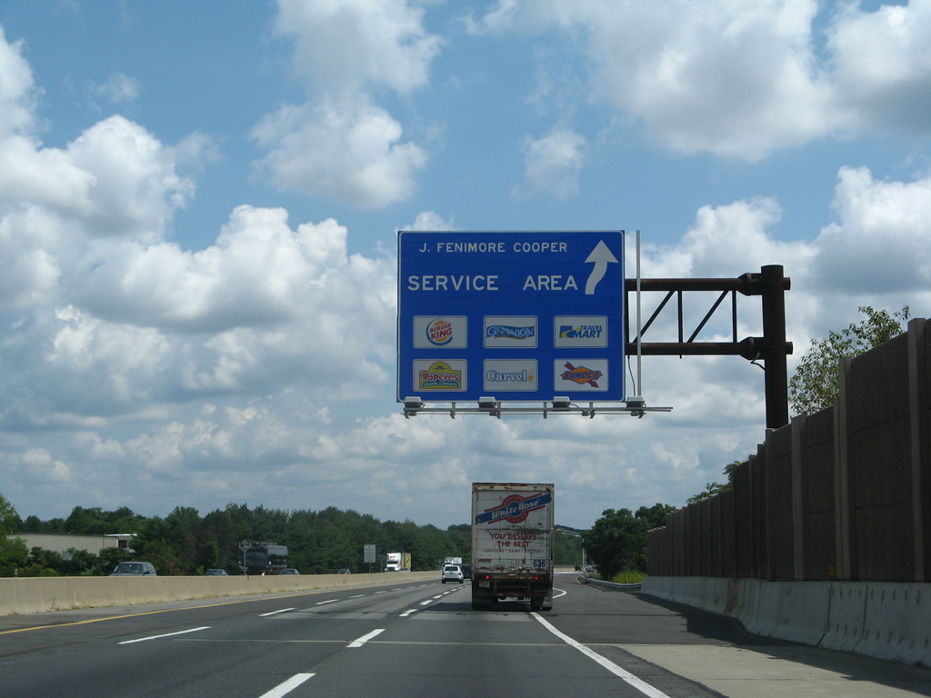
| New Jersey Turnpike northbound next meet the J. Fenimore Cooper Service Area near the community of Masonville. 07/27/07 |
|
| The toll road widens to six overall lanes north of Route 73 (Exit 4). 07/27/07 |
|
| Two miles south of the northbound side service area in Mount Laurel Township. 07/27/07 |
|
| Route 38 passes over the NJ Turnpike adjacent to its exchange with Interstate 295. A ground level neon advisory sign was posted at the overpass. 07/27/07 |
|
| One mile south of the J. Fenimore Cooper Service Area on the northbound turnpike. Burlington County 537 (Marne Highway) travels under the toll road in the distance. 07/27/07 |
|
| Northbound at the ramp departure to J. Fenimore Cooper Service Plaza on the New Jersey Turnpike. 07/27/07 |
|
| Creek Road (CR 635) crosses over the NJ Turnpike just north of the service plaza and south of Rancocas Creek. 07/27/07 |
|
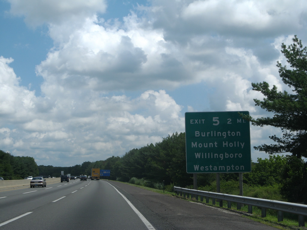
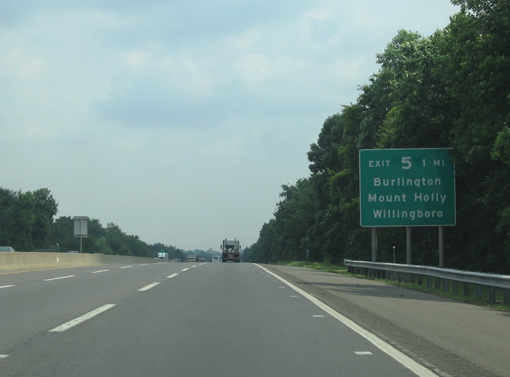
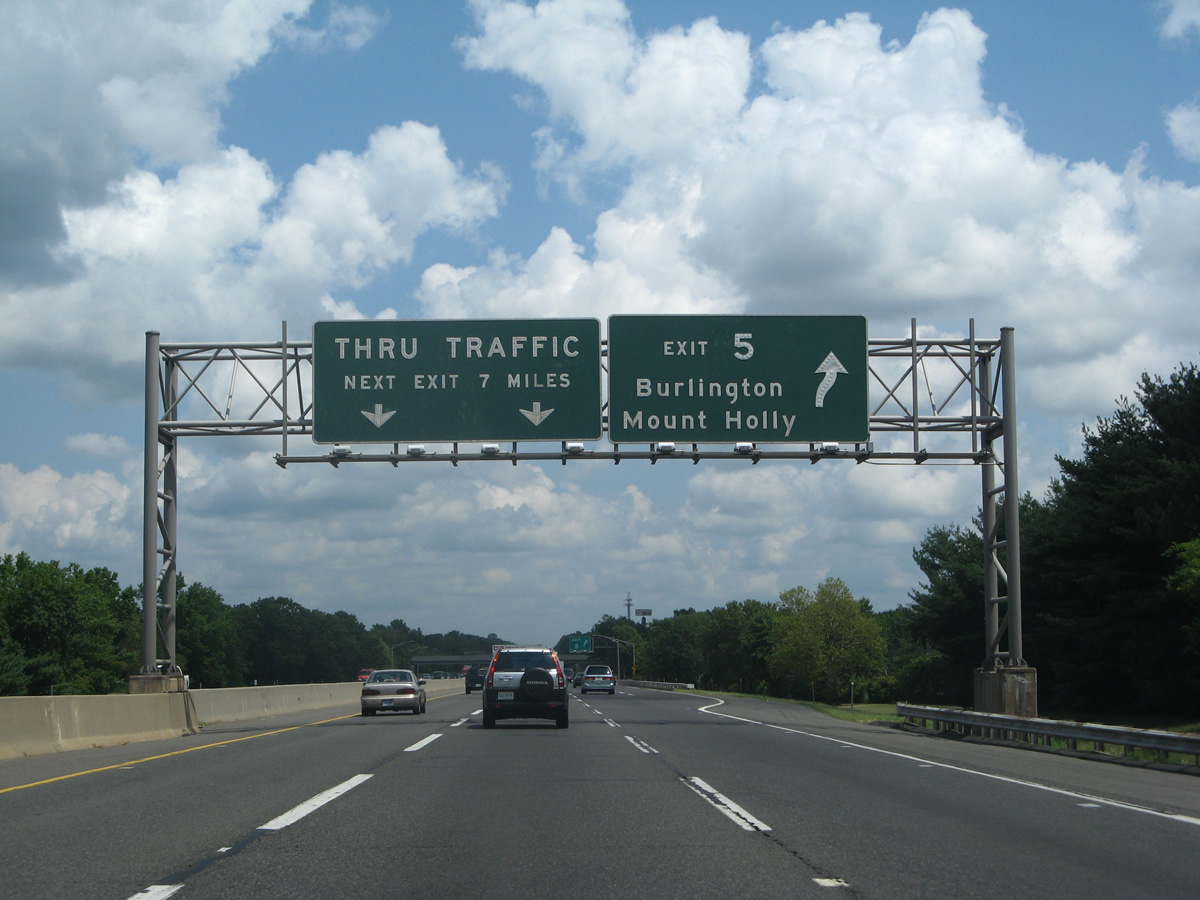
| The New Jersey Turnpike enters Westhampton Township ahead of the Exit 5 interchange with Burlington County 541 (Burlington-Mt. Holly Road). Burlington-Mt. Holly Road constitutes a north-south arterial between the Burlington County seat of Mt. Holly and Springside.
Sign changes made at Exit 5 removed Willingboro and Westampton as destinations for CR 541. 07/27/07 |
|
| Rancocas Road (CR 626) spans the NJ Turnpike east of its cloverleaf interchange with I-295. 07/27/07 |
|
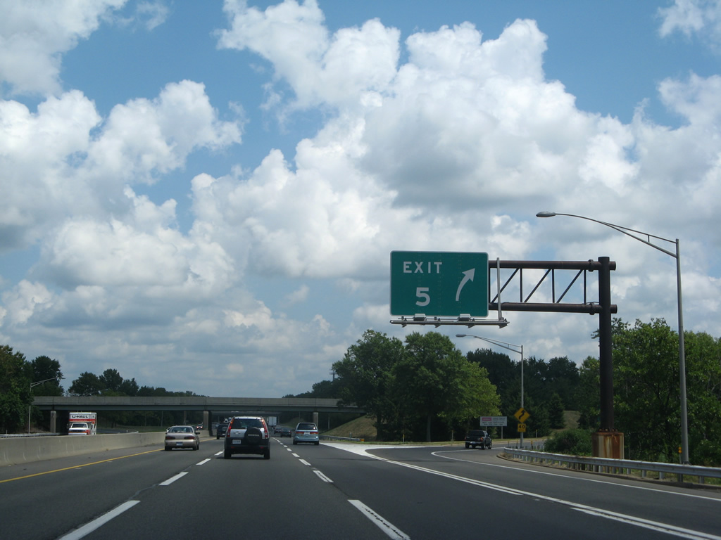
| One mile south of the Exit 5 trumpet interchange with Burlington County 541. CR 541 intersects Route 38 five miles to the south in Mount Holley. North of Exit 5, the county route meets Interstate 295 in two miles and ends at U.S. 130 in five miles at Burlington. U.S. 130 provides the connection to the Burlington-Bristol Bridge (PA 413) across the Delaware River. 06/13/05 |
|
| Original guide signs that were posted at the Exit 5 off-ramp for Burlington County 541 (Burlington-Mt. Holly Road). CR 541 totals 23.84 miles from U.S. 206 in Shamong township to U.S. 130 in the city of Burlington. 07/27/07 |
|
| Sunset Road (CR 634) provides the main route from Burlington County 541 to Willingboro. The Westhampton Township center lies south of Exit 5 via Irick Road (CR 637). 07/27/07 |
|
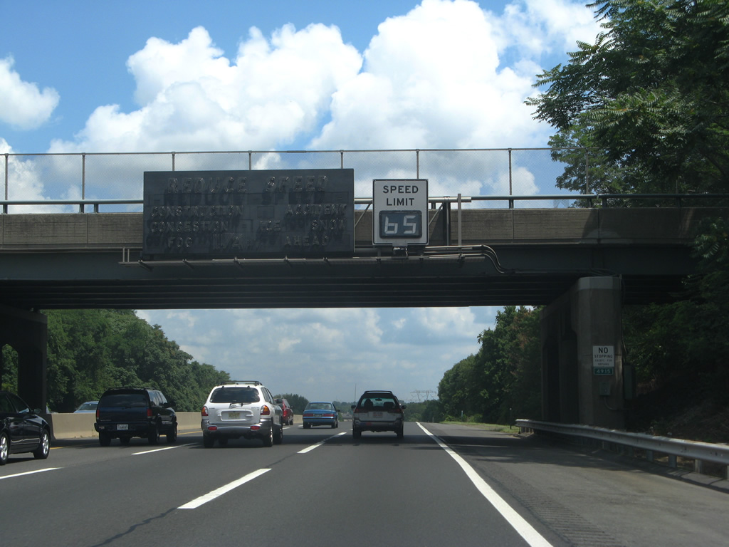
| The New Jersey Turnpike sees another I-95 trailblazer north of Exit 6 in Westampton Township. 07/27/07 |
|
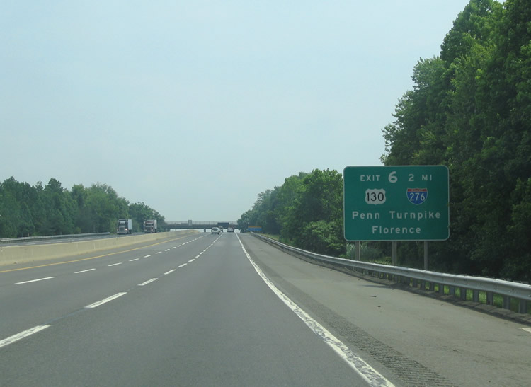
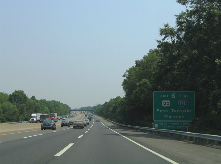
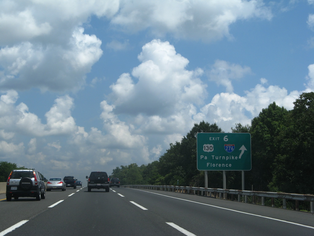
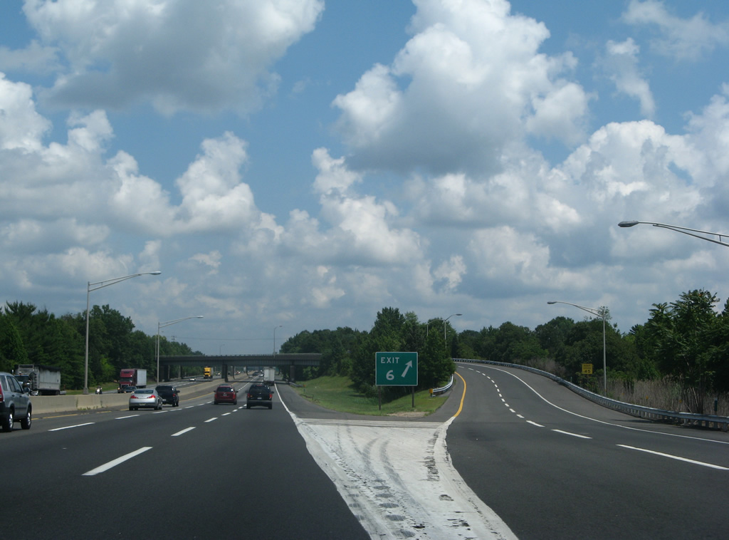
| Approaching the Pearl Harbor Memorial Turnpike Extension (Exit 6) on the New Jersey Turnpike northbound. Signs for Exit 6 include Interstate 276 shields for the connection to the Pennsylvania Turnpike. 06/13/05 |
|
| Passing under the former overpass carrying Burlington County 543 (Columbus Road) above the New Jersey Turnpike mainline. This bridge was replaced to accommodate expansion of the toll road. 07/27/07 |
|
| The New Jersey Turnpike Extension was named the Pearl Harbor Memorial Turnpike Extension in honor of those veterans that fought and died in Hawaii during WWII. The six lane toll road provides a seamless connection between the New Jersey Turnpike mainline and Pennsylvania Turnpike mainline between Florence, New Jersey and Bristol, Pennsylvania. Exit 6A of the Extension provides access to U.S. 130 for Florence, Bordentown, and Burlington. Interstate 276 otherwise commences on the Pennsylvania Turnpike from Bristol west to Valley Forge. 06/26/05 |
|
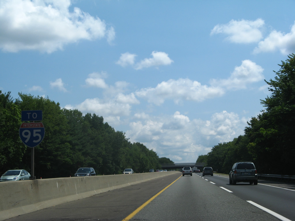
| New Jersey Turnpike northbound drivers pass over Mill Lane ahead of the Exit 6 ramp split to the Pearl Harbor Memorial Turnpike Extension westbound. The Extension and Pennsylvania Turnpike west to Bristol Township will become a part of I-95 in 2017 when two new flyovers open at I-276. Interstate 95 previously ended at the interchange with U.S. 1 and I-295 northeast of Trenton. The route resumed officially along the New Jersey Turnpike at Exit 7A (I-195) for its continuation northeast to Newark and New York City. 07/27/07 |
|
| Ramps for Interstate 95 south to I-276 west depart from both the Inner and Outer Roadways. A three-wye interchange joins the two toll roads, with Columbus Hedding Road (CR 678) passing in between. 07/27/07 |
Page Updated 04-14-2014.


 North
North