
Portions of Toll 130 open as of November 2007 include all of the route from SH 71 near Austin-Bergstrom International Airport (AUS) north to IH 35 at Georgetown. Extensions southward from SH 71 in east Austin to U.S. 183 at Mustang Ridge were completed in Spring 2008. The toll road was completed south to Interstate 10 near Seguin in 2012.
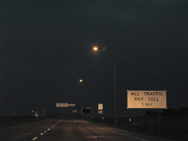
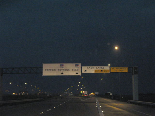
Tolls along SH 130 are collected with TxTag transponders or toll-by-plate. SH 130 switched to cashless tolling along with other Austin area toll roads on January 1, 2013. SH 130 is the only highway in the United States with an 85 mile per hour speed limit.
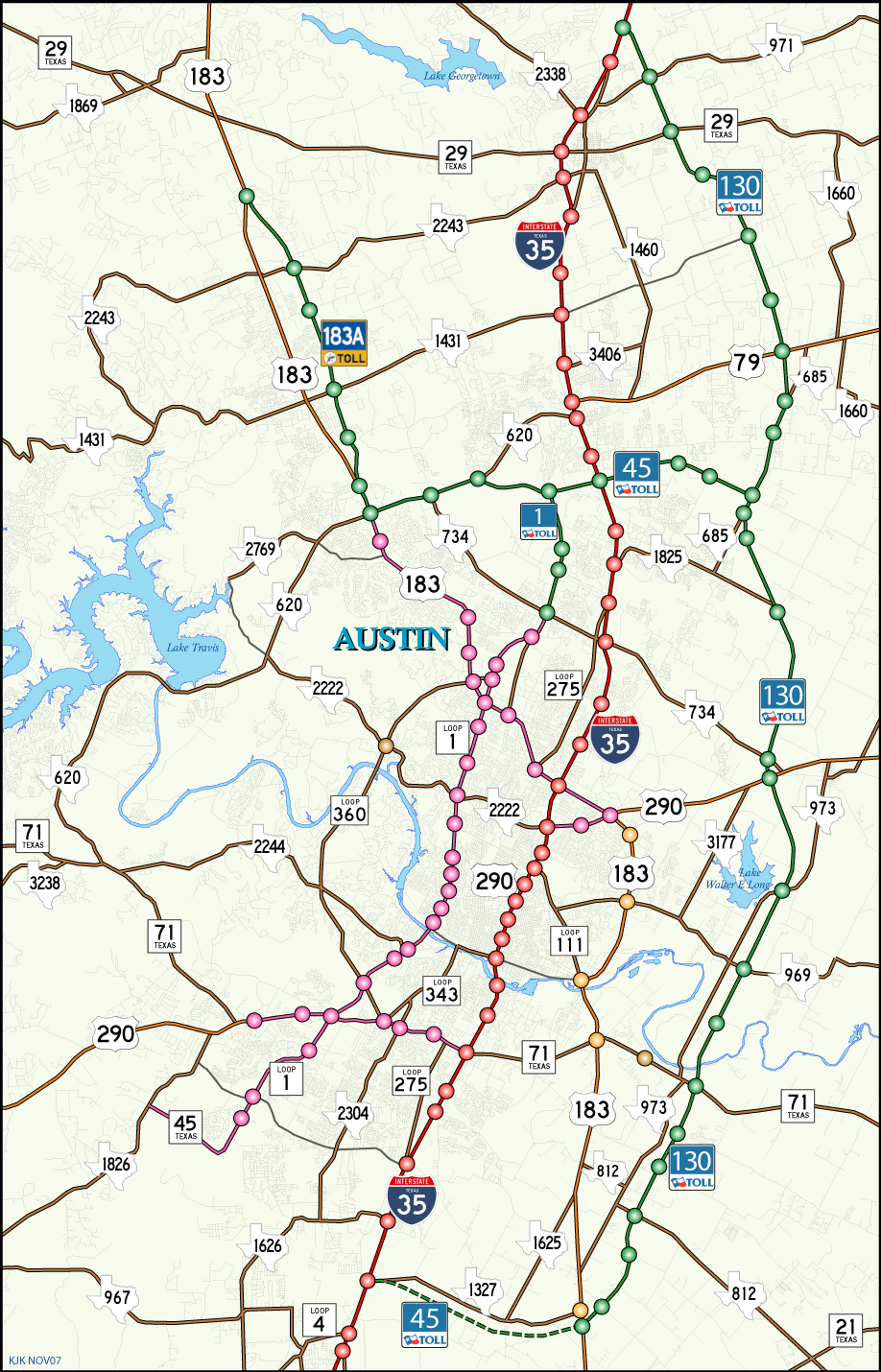
SH 130 travels around the east side of Austin from U.S. 183 at Mustang Ridge to SH 45 N in Pflugerville.
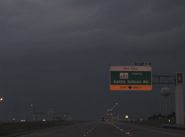 | FM 685 follows the frontage road system of SH 130 north from its merge with the toll road at Pflugerville to its split at Hutto. A split diamond interchange provides access to the frontage road at Gattis School Road along the Pflugerville city line. 09/29/07 |
 | Northbound SH 130 at the off-ramp (Exit 426) onto FM 685 north for Gattis School Road. Gattis School Road travels west from SH 130 to Round Rock at Redbud Lane. Williamson County 138 continues the road east into growing suburban areas. 09/29/07 |
 | FM 685 splits from the SH 130 frontage roads one half mile south of Exit 423 to U.S. 79. FM 685 ends at U.S. 79 in Hutto, a short distance east of the diamond interchange with SH 130. 09/29/07 |
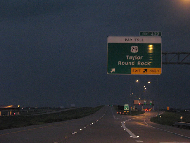 | Two lanes depart SH 130 north for Exit 423 to U.S. 79. U.S. 79 travels west to Round Rock and its terminus at Interstate 35 and east to Hutto, Taylor, Thorndale and Rockdale 09/29/07 |
 | SH 130 north continues toward the north Hutto area main line toll plaza. A half diamond interchange brings a northbound on-ramp from Limmer Loop CR 109) on the ensuing stretch. 09/29/07 |
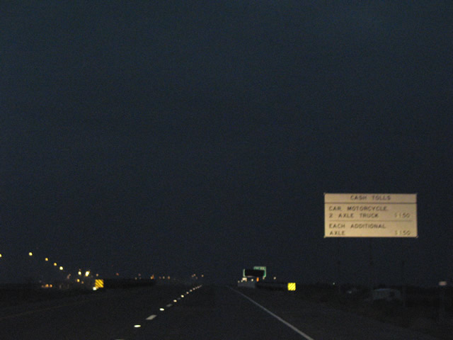 | Toll schedule sign posted at the Williamson County 118 underpass. 09/29/07 |
 | The former cash lanes along SH 130 north remain open as Exit 419 to Chandler Road and University Boulevard. 09/29/07 |
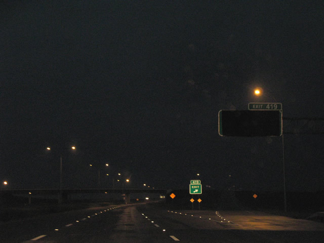 | Exit 419 departs from SH 130 north to University Boulevard west and Chandler Road east. University Boulevard travels southwest to Round Rock and the Texas State University Round Rock Campus. Chandler Road is a newer highway extending east from University Boulevard. 09/29/07 |
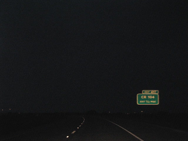 | Continuing northwest, SH 130 next meets Williamson County 104 at a diamond interchange east of Georgetown. CR 104 travels north to SH 29 and southwest to the intersection of CR 105 and 110. 09/29/07 |
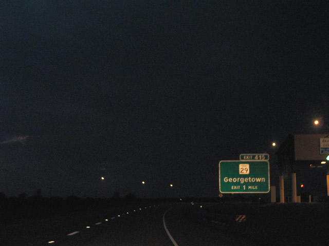 | SH 29 (East University Avenue) crosses paths with SH 130 on the eastern outskirts of Georgetown. The east-west highway joins Georgetown with Jonah and Circleville (SH 95) to the east and Liberty Hill and Bertram to the west. University Avenue ventures west to Southwestern University, Downtown Georgetown, and IH 35 at the Wolf Ranch Town Center. 09/29/07 |
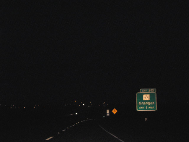 | SH 130 converges with FM 971 (Weir Road) in northeast Georgetown. FM 971 travels east from Georgetown to Weir, Granger and Granger Lake. 09/29/07 |
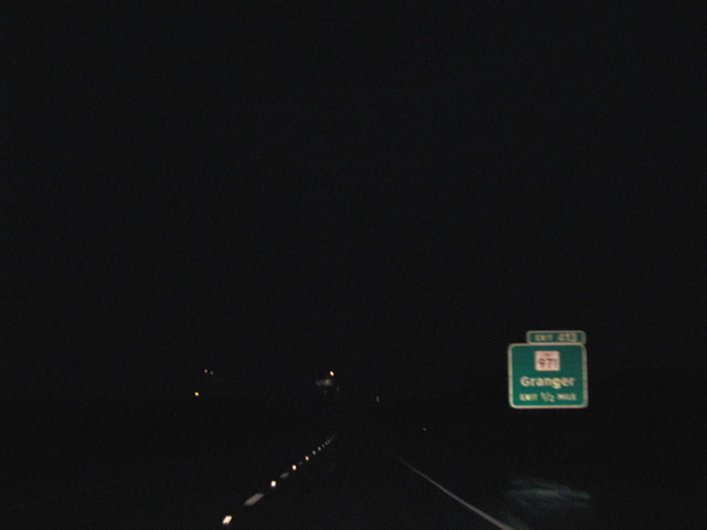 | A diamond interchange joins SH 130 with FM 971 at Exit 413. Westward, FM 971 ends at SS 158 (Austin Avenue), the former Business Loop I-35 through Georgetown. 09/29/07 |
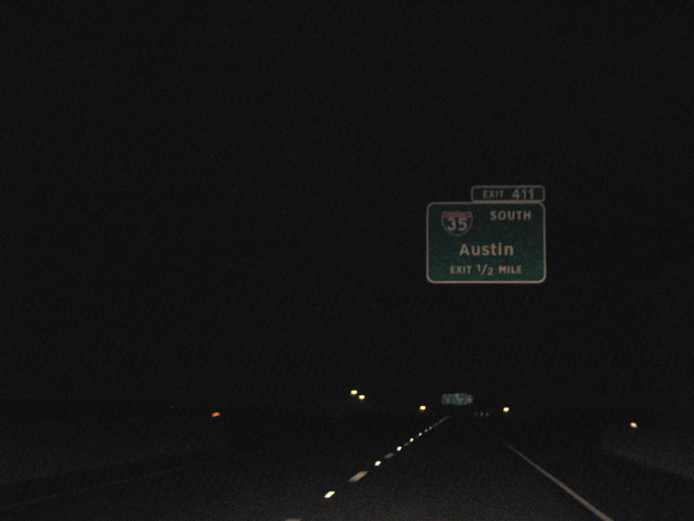
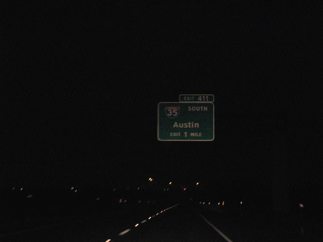 | SH 130 defaults onto Interstate 35 north at Georgetown. Exit 411 provides connections to IH35 south via the freeway frontage road system. 09/29/07 |
 | One half mile south of the merge onto IH 35 north on SH 130. Exit 411 carries travelers south to Lakeway Drive across from SS 158 (Austin Avenue). The connection provides access to Georgetown Municipal Airport (GTU) and western reaches of the city. 09/29/07 |
Photo Credits:
09/29/07 by AARoads
Connect with:
Interstate 35
State Highway 45
Page Updated 11-11-2007.