|
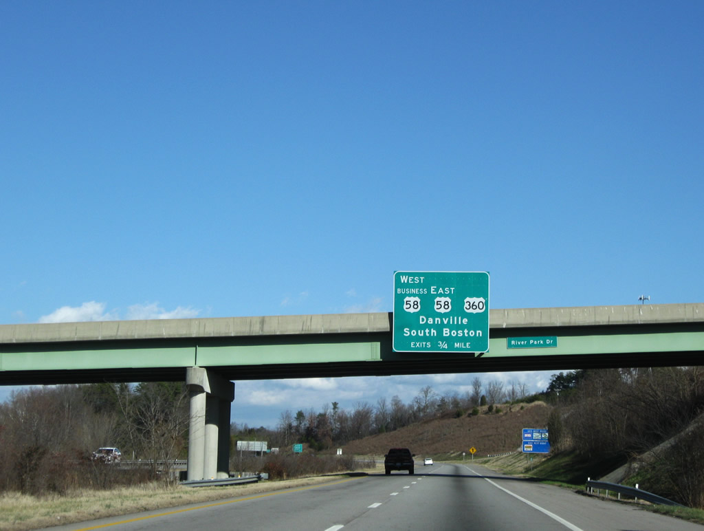
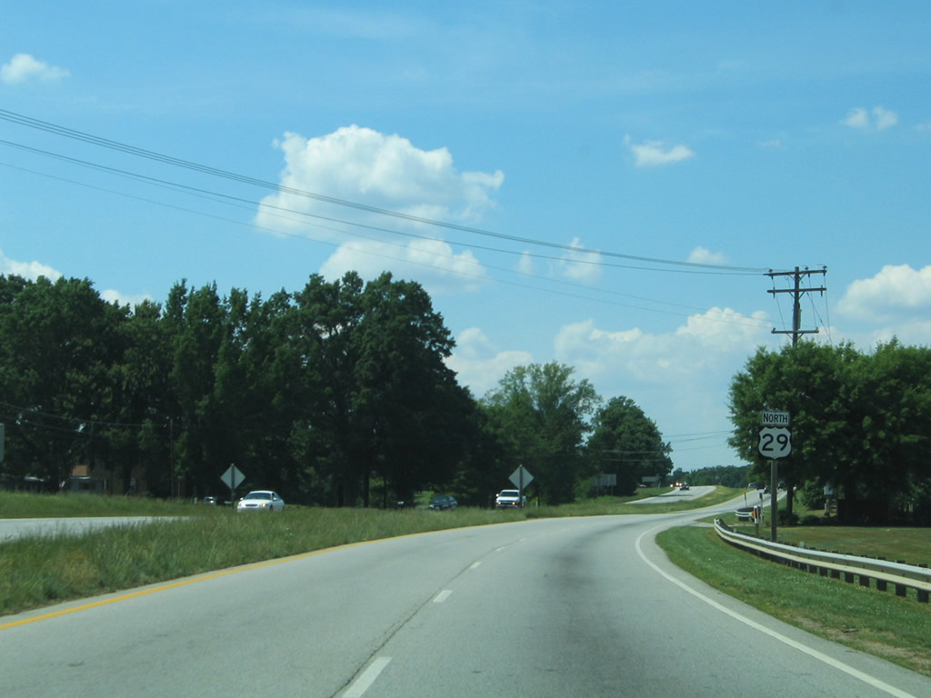
| U.S. 29 combines with U.S. 58 (Danville Expressway) from a directional cloverleaf interchange along the North Carolina state line. A Norfolk Southern Railroad line passes through the exchange. 05/30/05 |
|
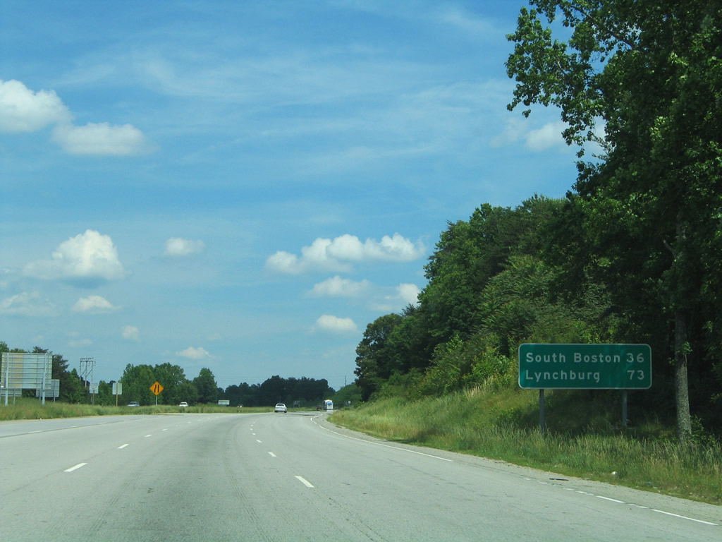
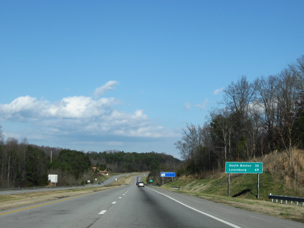
| Sign listing the distances to the U.S. 29 control city of Lynchburg and U.S. 58 destination of South Boston. The two highways overlap 6.96 miles along the Danville Expressway. 05/30/05 |
|
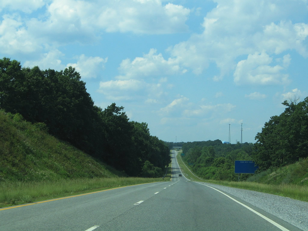
| An at-grade intersection lies east of the Corning Drive half diamond interchange with Elizabeth Street. Access is only available to southbound Elizabeth Street to Holland Road and Whitetown, North Carolina. Ramp stubs are in place for a future interchange between the two roads. 05/30/05, 12/21/08 |
|
| Future ramps to Elizabeth Street will tie into U.S. 29/58 (Danville Expressway) ahead of the Holland Road overpass. 05/30/05 |
|
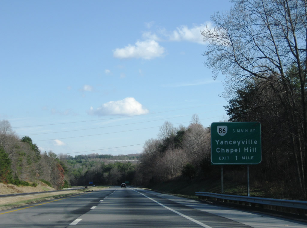
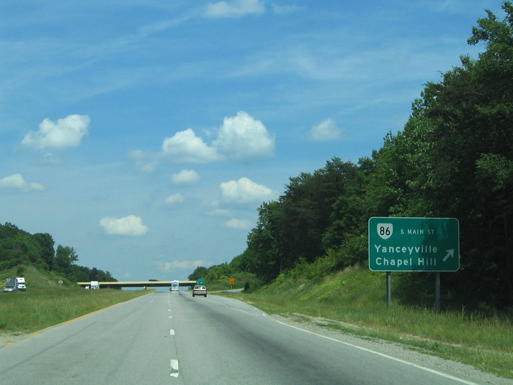
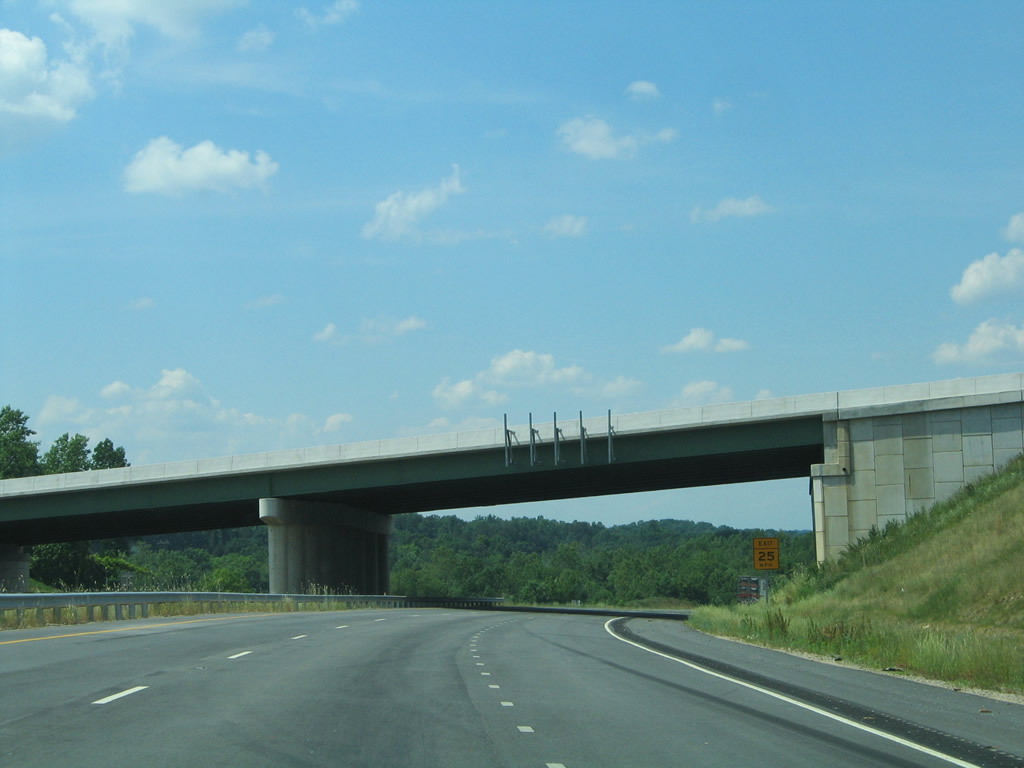
| A diamond interchange links the Danville Expressway wuth SR 86 (S Main Street). Points of interest at the ensuing exit include the Danville and AAF Tank Museums, Averett University, and Danville Community College among others. 12/21/08 |
|
| SR 86 travels four miles south from Downtown Danville to NC 86 near Gatewood and Pleasant Grove. MSR 86 continues south 53 miles to Chapel Hill, North Carolina. 05/30/05 |
|
| Turning northeast along U.S. 29/58 (Danville Expressway) from SR 86. U.S. 29 shifted to the expressway in 1998, replacing the SR 265 designation along the previously opened sections of freeway.1 05/30/05 |
|
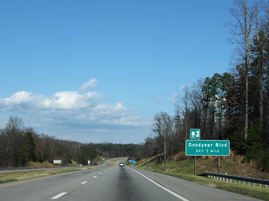
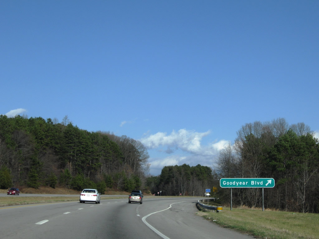
| Goodyear Boulevard travels south from Industrial Avenue to meet U.S. 29/58 at a six-ramp parclo interchange opposite the Dan River. 12/21/08 |
|
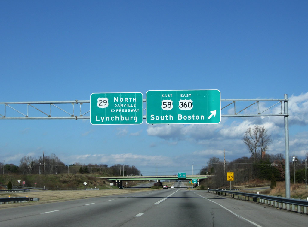
| Ahead of Pumpkin Creek, U.S. 29/58 east passes a second distance sign for Lynchburg and South Boston. 12/21/08 |
|
| Drivers bound for Goodyear Boulevard (SR 737) depart the northbound Danville Expressway. SR 737 loops southwest to Pleasant Grove, ending at SR 86 (South Main Street). 12/21/08 |
|
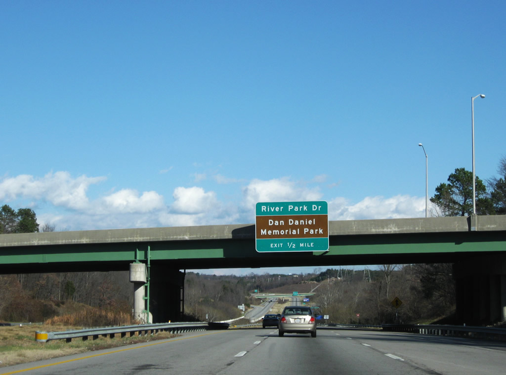
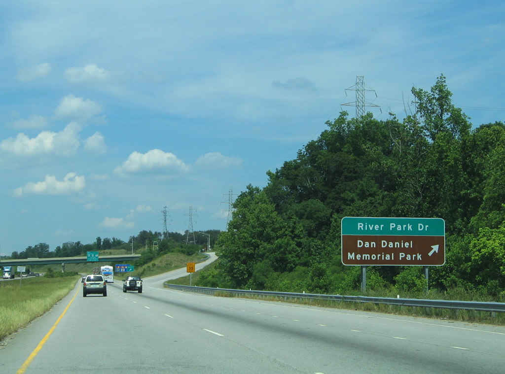
| U.S. 29/58 east continue one half mile to the River Park Drive diamond interchange adjacent to Dan Daniel Memorial Park. 12/21/08 |
|
| Spanning the Dan River along U.S. 29/58 east. Travelers seeking tourist information are provided with a Visitor Information Center on River Park Drive. 05/30/05 |
|
| River Park Drive spurs west from Stinson Drive (SR 1224) to Dan Daniel Memorial Park. The local road was added around the time of the Danville Expressway's construction. Stinson Drive connects the area with Danville Regional Airport and Airport Drive. 05/30/05 |
|
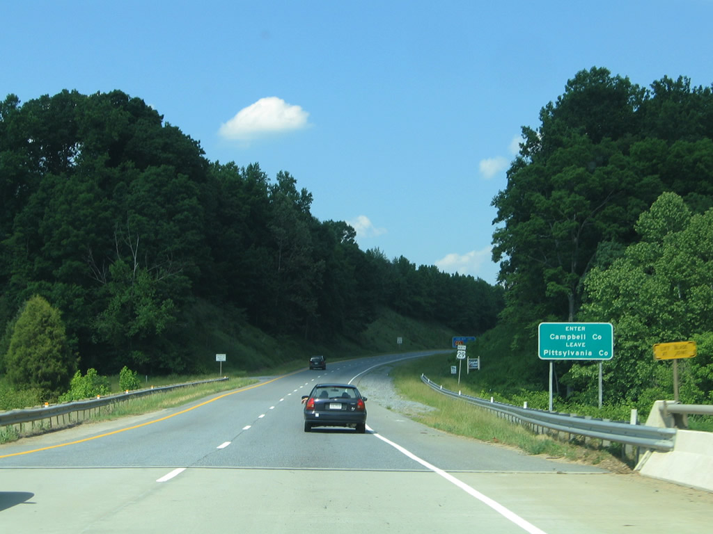
| U.S. 29/58 next part ways at a cloverleaf interchange with U.S. 360 (South Boston Road). U.S. 360 begins in Danville at the intersection joining Riverside Drive (U.S. 58 Business) with SR 293 (Main Street) across the Dan River from Downtown. U.S. 58/360 overlap 27.80 miles eastward from the Danville Expressway. 12/21/08 |
|
| U.S. 58 east joins U.S. 360 along South Boston Road leading away from the Danville Expressway. U.S. 58 Business heads west through the city. Interests to Danville Regional Airport (DAN) are directed to follow U.S. 58/360 east to Airport Drive south. 12/21/08 |
|
| U.S. 58 Business & 360 (South Boston Road) travel 1.76 miles westward to SR 293 (Main Street). The business route connects U.S. 29 with the Danville Science Center and Historic District. Overall U.S. 360 travels 225.16 miles between Danville and Reedville off Chesapeake Bay. 05/30/05 |
|
| U.S. 29 continues north along the Danville Expressway to an exit of the city at the crossing of Little Fall Creek. SR 360 (Old Richmond Road) passes over the freeway in the distance. 05/30/05 |
|
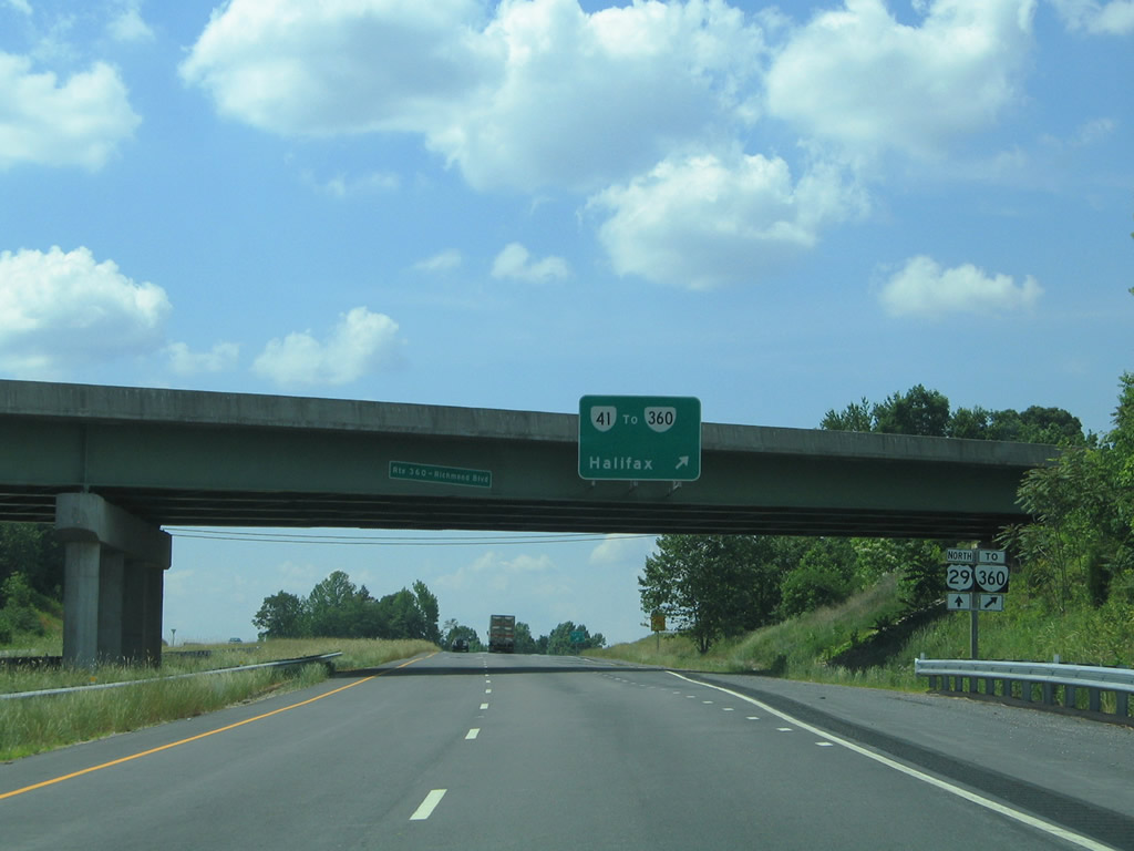
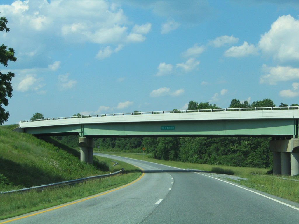
| A six-ramp parclo interchange joins U.S. 29 with a short access road joining the Danville Expressway with the adjacent SR 360 (Old Richmond Road). The four lane divided highway was built in anticipation of extending SR 41 southeast from its current terminus at U.S. 29 Business (Piney Forest Road) in north Danville. It is unclear when that extension may open, and since this photo was shot, the SR 48 shield was greened out. 05/30/05 |
|
| Empty brackets on the future SR 41 overpass over U.S. 29 north, awaiting signage for SR 41 north to Franklin Turnpike. SR 360 otherwise ventures northeast from Danville to Halifax north of South Boston. The route represents the pre-1984 alignment of U.S. 360.2 05/30/05 |
|
| U.S. 29 parallels Lawless Creek leading north from Danville toward Blairs. Twin Arch Drive (SR 695) passes over the freeway southeast of Blairs. 05/30/05 |
|
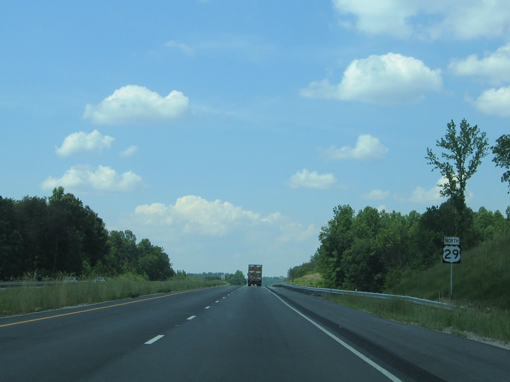
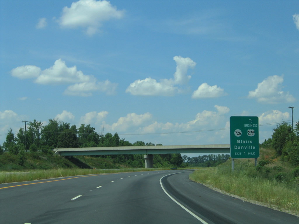
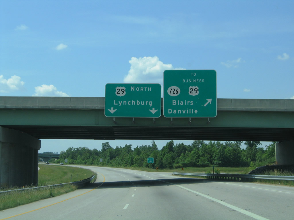
| U.S. 29 stays east of Blairs to the interchanges with SR 726 (Malmaison Road) and U.S. 29 Business. SR 726 connects U.S. 29 north with U.S. 29 Business south to Blairs and Danville. 05/30/05 |
|
| A loop ramp connects U.S. 29 (Danville Expressway) north with Malmaison Road west to U.S. 29 Business. SR 726 travels east to SR 360, Kentuck, and south to Ringgold and U.S. 58/360. 05/30/05 |
|
| A wye interchange joins U.S. 29 and U.S. 29 Business north of Blairs. 05/30/05 |
|
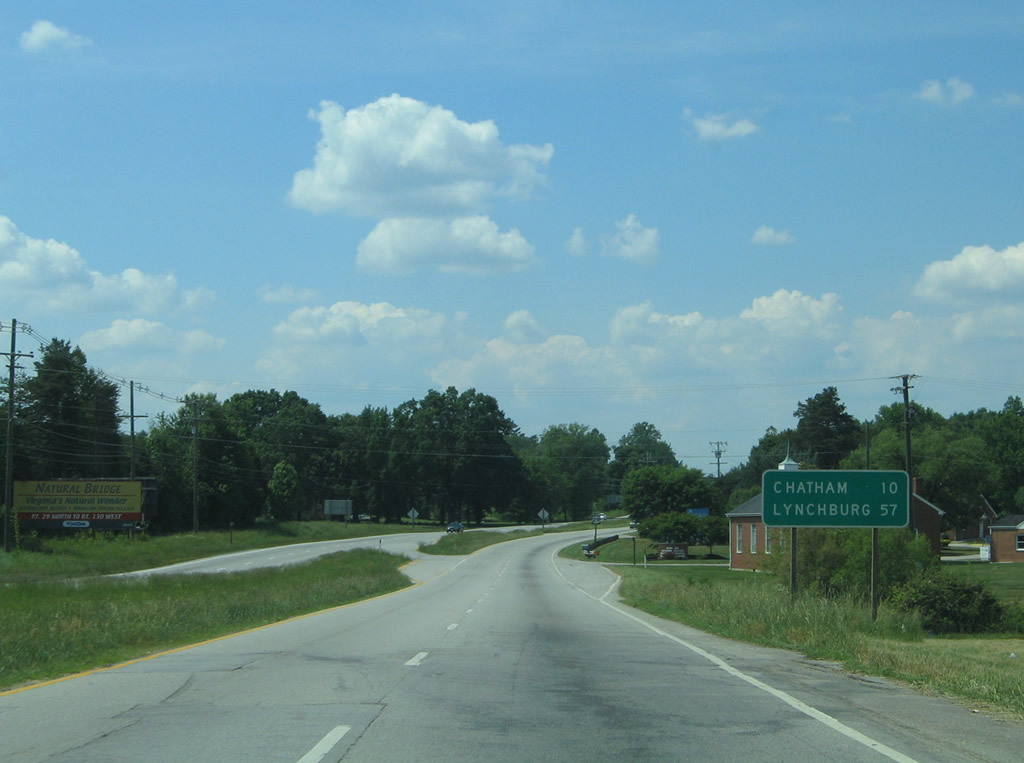
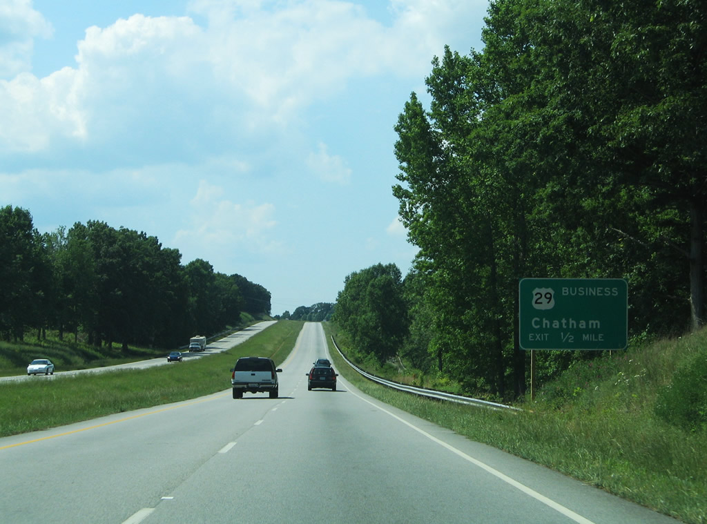
| Leaving Blairs, U.S. 29 reverts to a four lane surface highway leading north ten miles to Chatham. 05/30/05 |
|
| U.S. 29 meets SR 703 (Tight Squeeze Road west / Fairview Road east) at Tight Squeeze, north of the Banister River. SR 703 leads west to Jones Mill and SR 41 and east to SR 832 near White Oak Mountain. 05/30/05 |
|
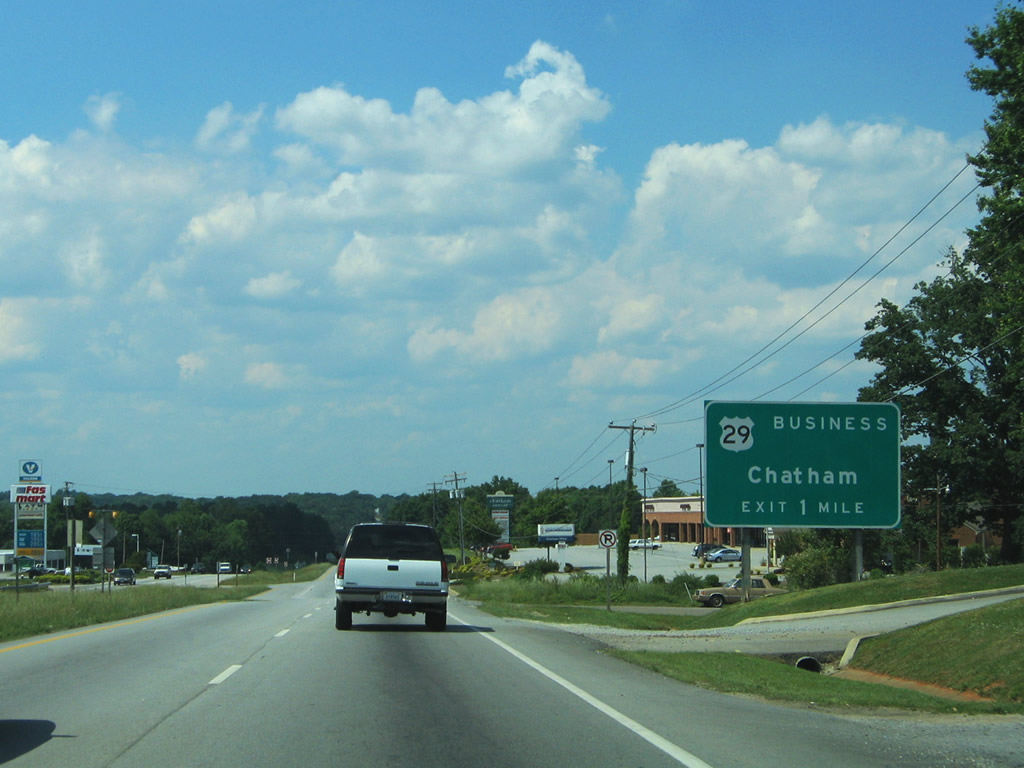
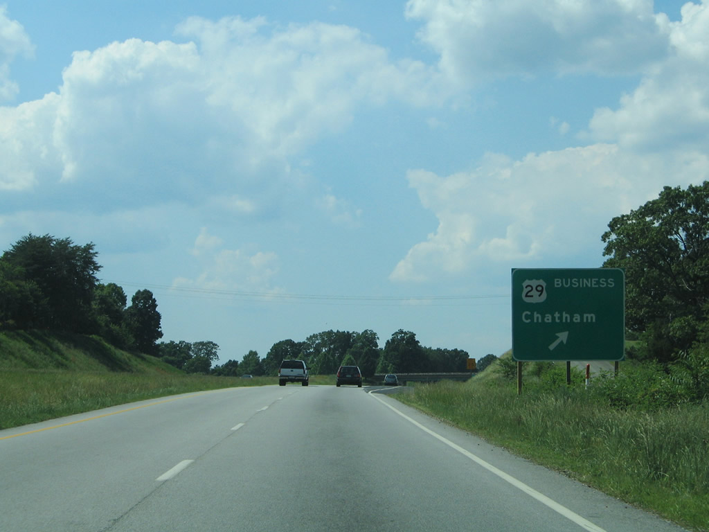
| U.S. 29 bypasses the Pittsylvania County seat of Chatham via a freeway bypass to the east. U.S. 29 Business follows Main Street town. 05/30/05 |
|
| Northbound view of U.S. 29 between Tight Squeeze and H.G. Magee Drive. 05/30/05 |
|
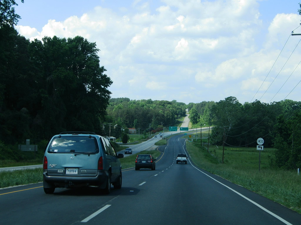
| SR 1433 (Cherrystone Road) leads southwest from U.S. 29 near the split with U.S. 29 Business to Tight Squeeze Road (SR 703). 05/30/05 |
|
| A wye interchange constitutes the south end of the Chatham business loop for U.S. 29 (Main Street). U.S. 29 shifted to bypass Chatham in 1965.1 05/30/05 |
|
| Angling northeast along U.S. 29 at the split with South Main Street. U.S. 29 Business merges with SR 57 west (Halifax Road) in one mile. 05/30/05 |
|
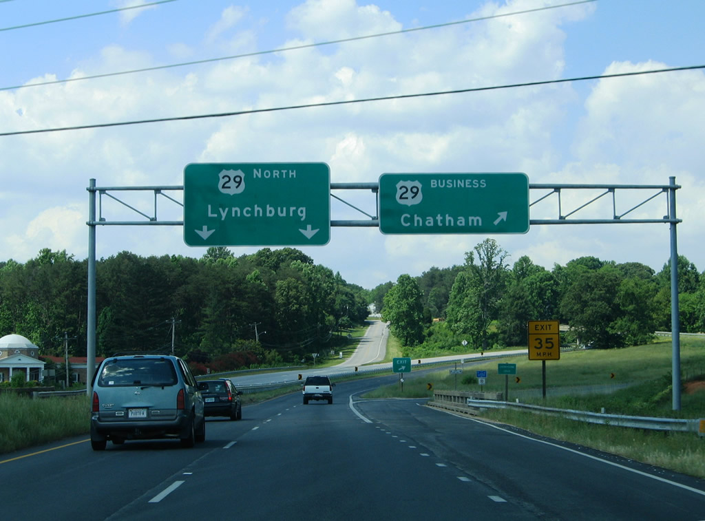
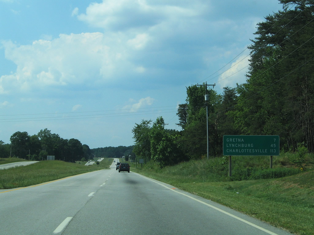
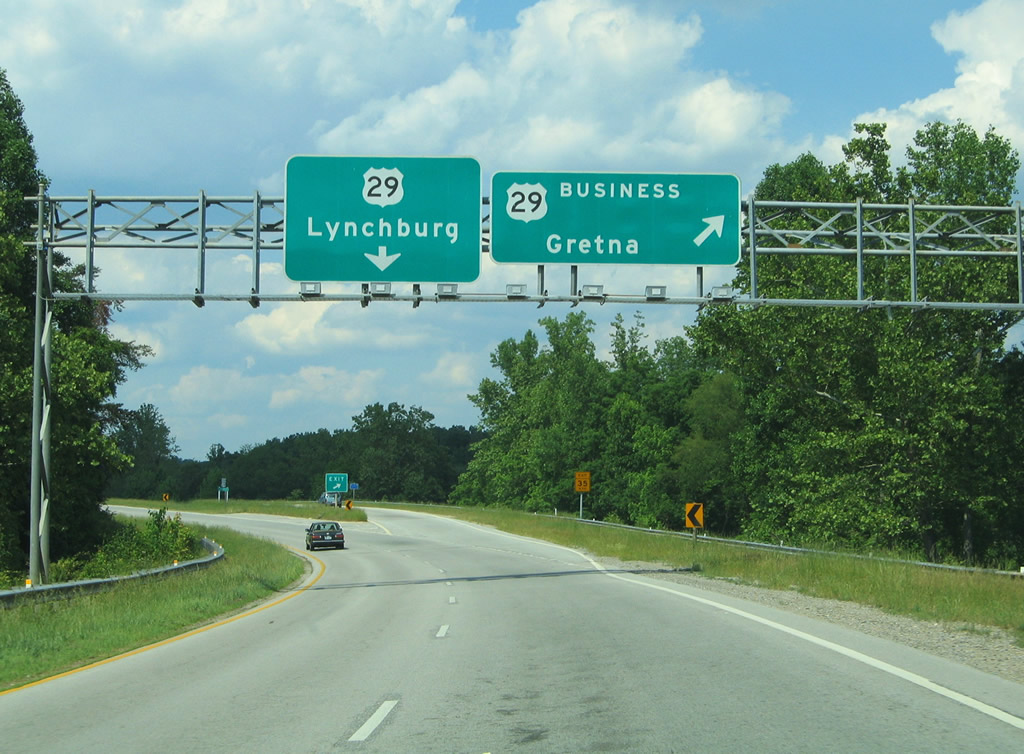
| The next population center along U.S. 29 north is Gretna. Lynchburg is still 49 miles to the north. 05/30/05 |
|
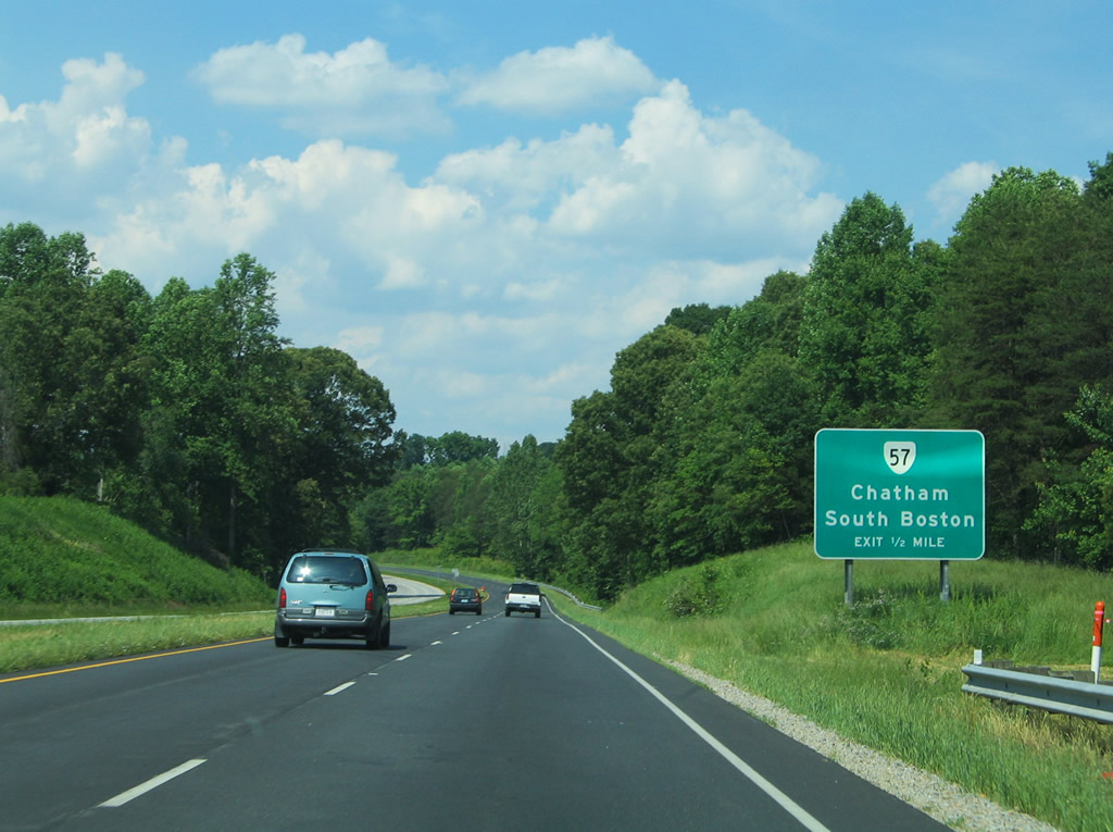
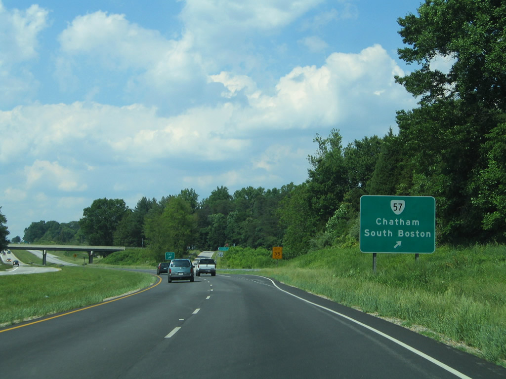
| One mile south of the diamond interchange with SR 57 (Halifax Road) along U.S. 29 north. SR 57 joins Chatham with SR 360 west of Halifax and north of South Boston. The state route replaced SR 832 east from Chatham by 2002, a routing that it used previously until 1953.3 05/30/05 |
|
| Drivers bound for SR 57 (Halifax Road) depart U.S. 29 north. SR 57 continues west from U.S. 29 Business and Chatham to Callands and Martinsville. Overall the state route travels 91 miles from SR 8 in Patrick County to SR 360. 05/30/05 |
|
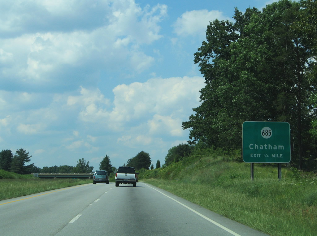
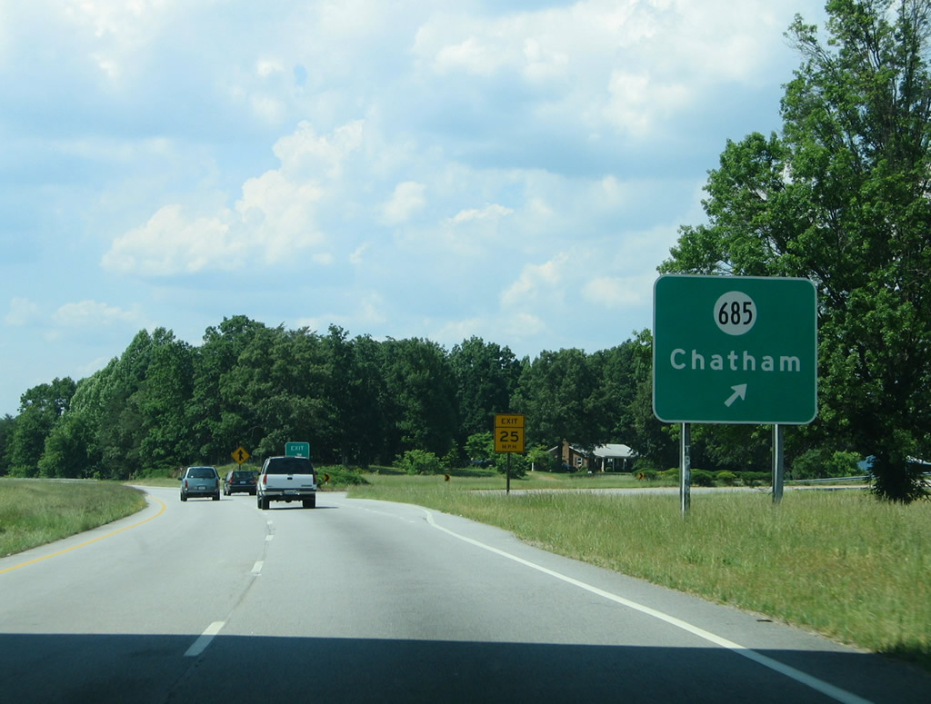
| A folded diamond interchange joins U.S. 29 north of SR 57 with SR 685 (Chalk Level Road). 05/30/05 |
|
| SR 685 follows Hurt Street east from U.S. 29 Business (Main Street) at Military Drive to Sheva, Sonans, Chalk Level, and SR 40 east of Greenfield. Military Drive stems west from the Hurt Street to Chatham Hall Hargrave Military Academy. 05/30/05 |
|
| U.S. 29 Business (North Main Street) returns to U.S. 29 at a diamond interchange. Mill Creek Road (SR 691) begins and travels east from U.S. 29 Business to SR 685 (Chalk Level Road). 05/30/05 |
|
| Northbound U.S. 29 at the U.S. 29 Business (North Main Street) southbound beginning. A loop ramp formerly carried U.S. 29B onto U.S. 29. 05/30/05 |
|
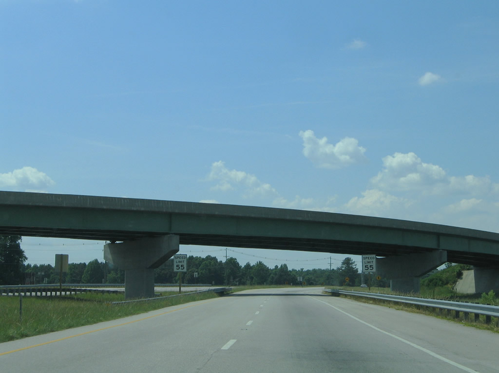
| Speed limits reduce again to 55 mph as U.S. 29 transitions back from a freeway into a surface arterial. Gretna is seven miles out. 05/30/05 |
|
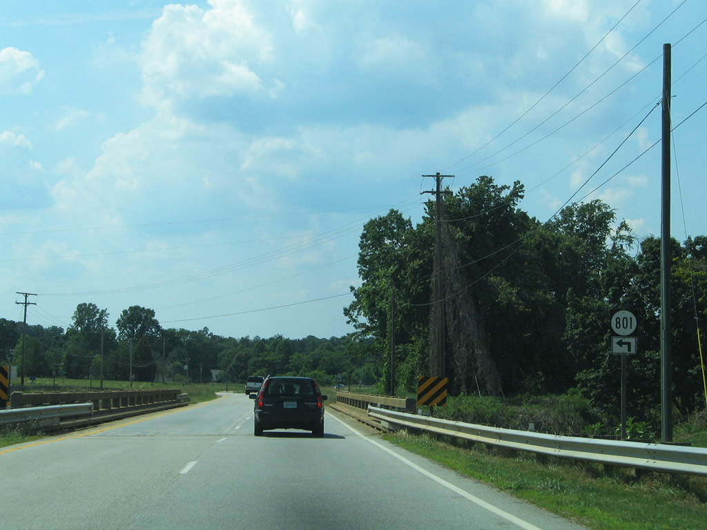
| SR 801 (Dry Bridge Road) ends at U.S. 29 north of its crossing over the Norfolk Southern Railroad. SR 801 leads south to SR 803 (Hodnetts Mill Road) at Falls Lake. 05/30/05 |
|
| SR 1401 follows as an old alignment of U.S. 29, serving a handful of homes west of the four lane divided highway. 05/30/05 |
|
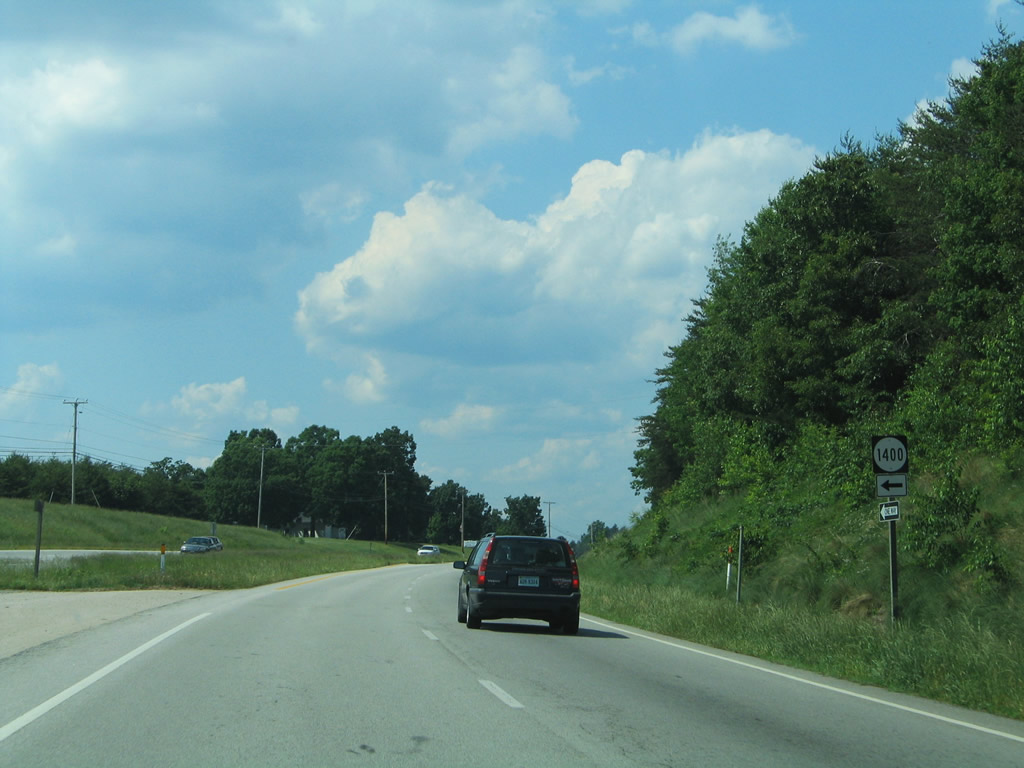
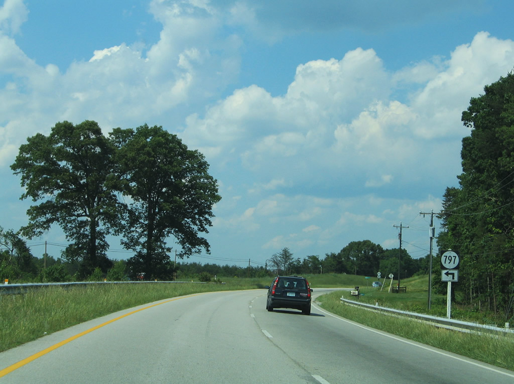
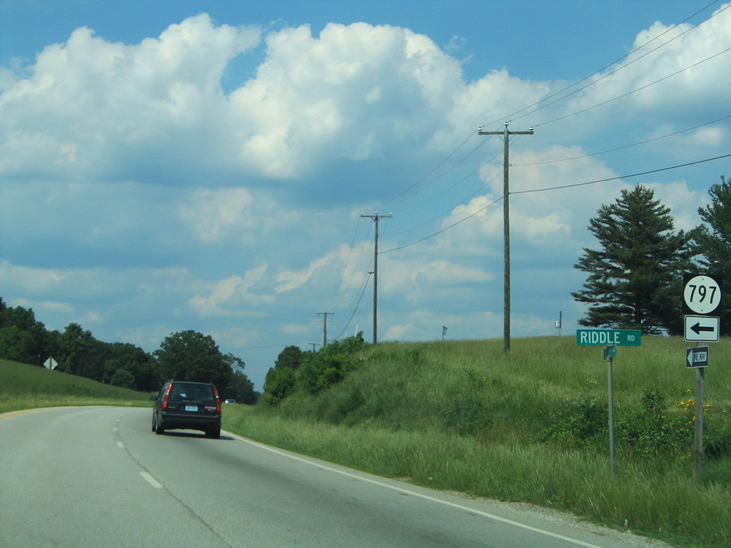
| Riddle Road (SR 797) heads west from U.S. 29 to Anderson Mill Road (SR 790). 05/30/05 |
|
| U.S. 29 again bypasses a former alignment south of Galveston. SR 1080 (Belair Road) represents the original path of the route. 05/30/05 |
|
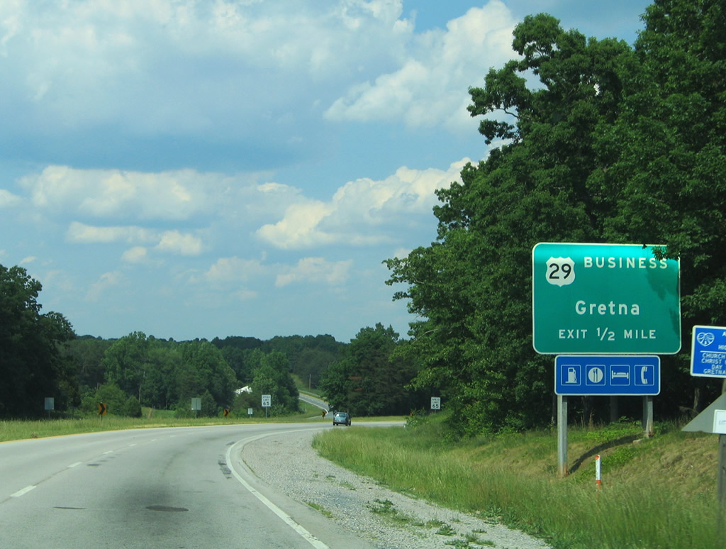
| A wide wye interchange lies one mile ahead at the U.S. 29 separation with the business route (Main Street) to Gretna. 05/30/05 |
|
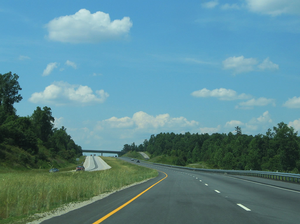
| U.S. 29 again upgrades to a full freeway, traveling west of Gretna and the U.S. 29 Business loop along Main Street. 05/30/05 |
|
| U.S. 29 reassurance shield posted after the split with U.S. 29 Business. The business loop initially travels a four lane divided highway to Taylors Mill Road (SR 676). 05/30/05 |
|
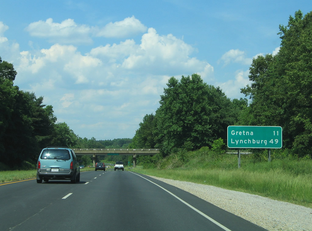
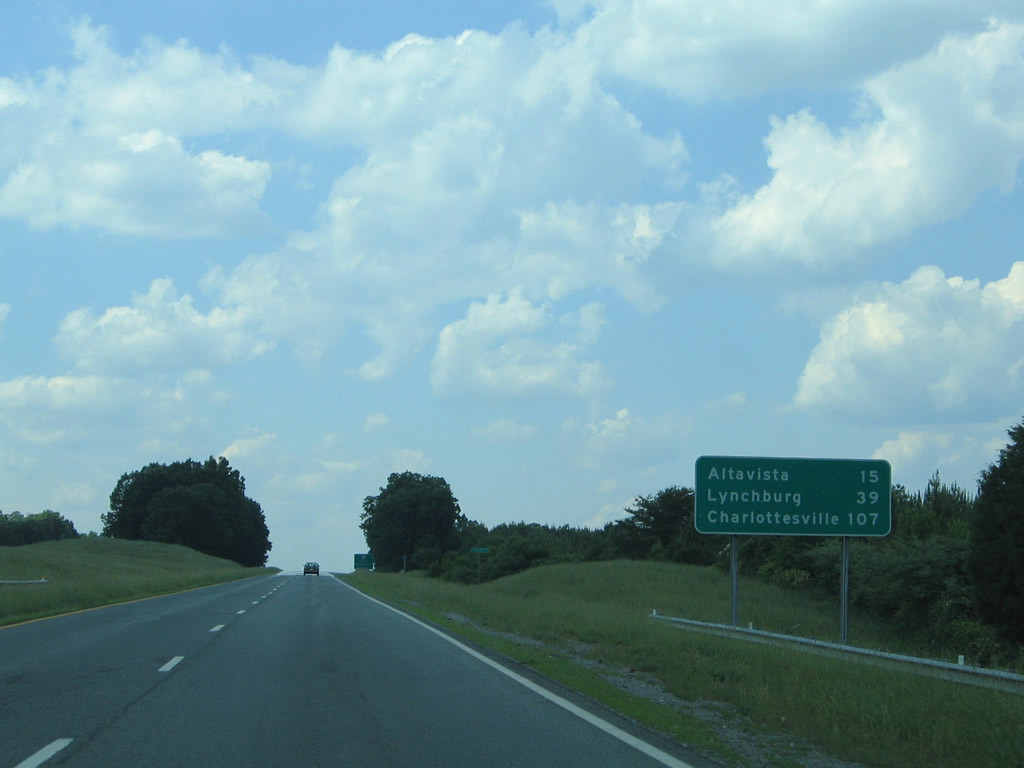
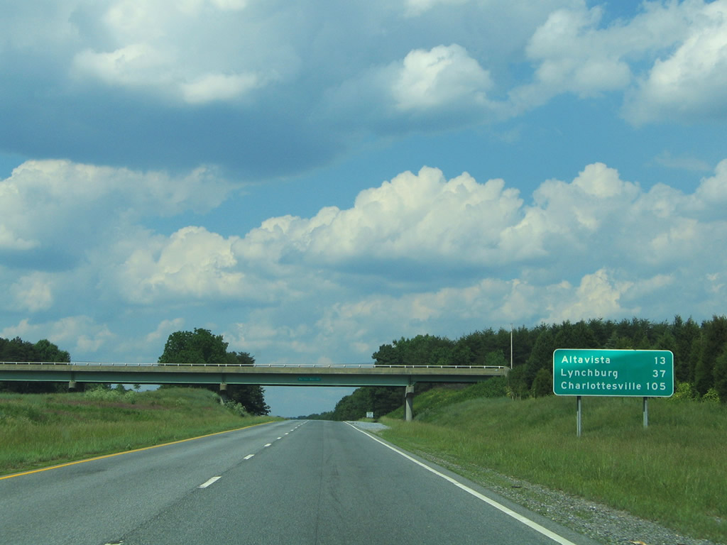
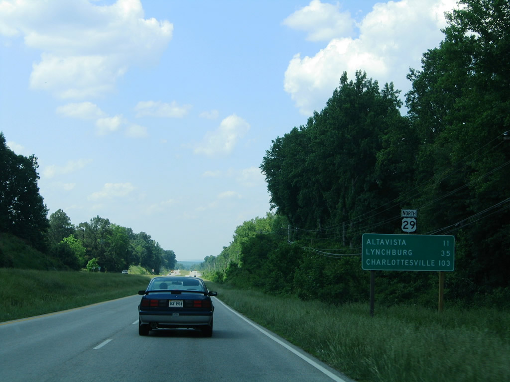
| Northbound distance sign highlighting the distance to Altavista (15 miles), Lynchburg (39 miles) and Charlottesville (107 miles). 05/30/05 |
|
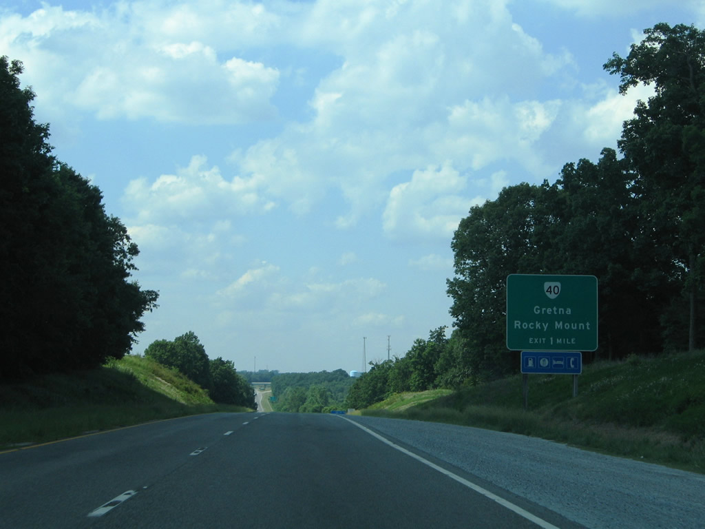
| SR 40 (Gretna Road west / Vaden Drive east) crosses paths with U.S. 29 at a diamond interchange outside of Gretna. 05/30/05 |
|
| A generous roadway separation obscures U.S. 29 south from northbound along the approach to SR 40. 05/30/05 |
|
| Northbound U.S. 29 at the SR 40 off-ramp. SR 40 is a lengthy route at 233 miles. The highway joins Gretna with Smith Mountain Dam and Rocky Mount (U.S. 220) to the west and Mt. Airy, Brookneaf, and Keysville to the east. 05/30/05 |
|
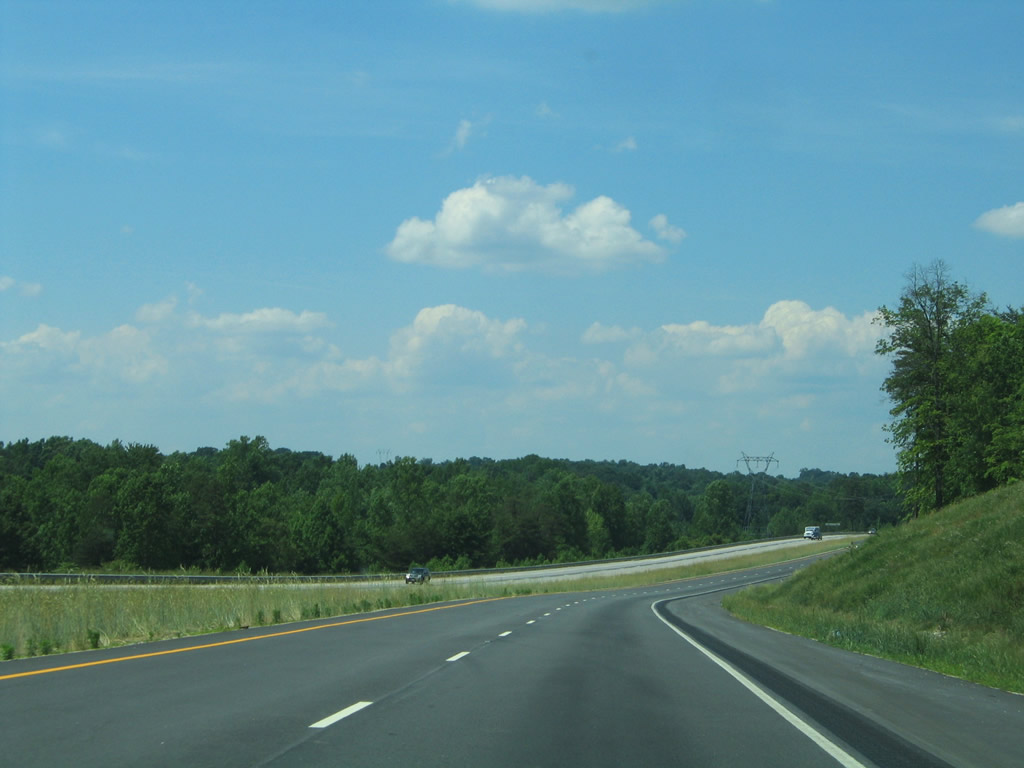
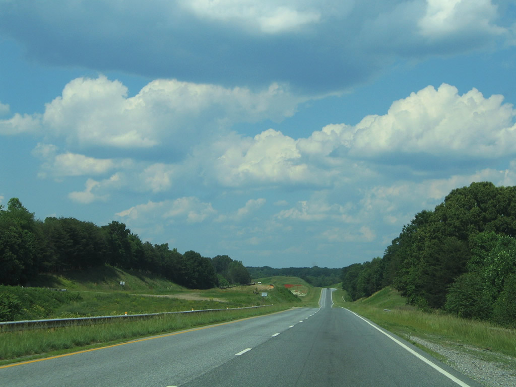
| Curving northeast along U.S. 29 between SR 40 and SR 760 (Music Street). 05/30/05 |
|
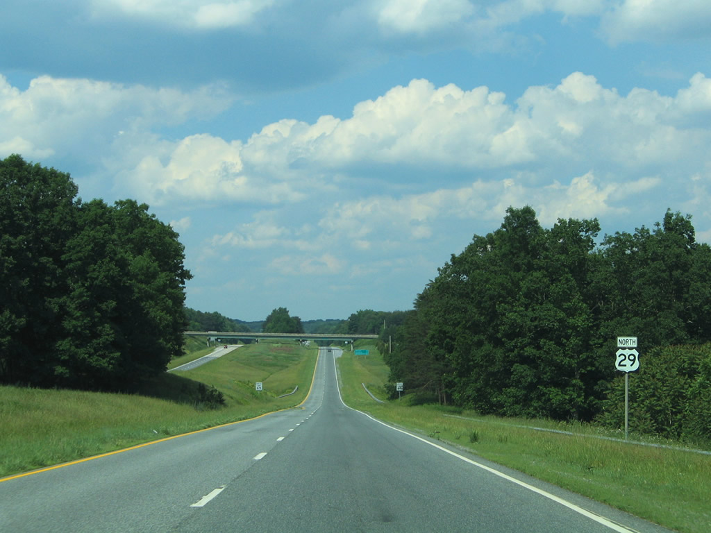
| U.S. 29 Business (North Main Street) returns to U.S. 29 north at another wye interchange. 05/30/05 |
|
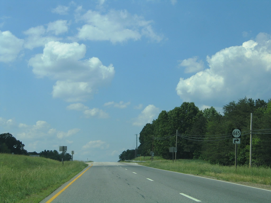
| SR 665 (Rockford School Road) ties into U.S. 29 north of its freeway end. SR 665 ventures southeasterly to Blue Ridge Drive and SR 40 between Ray and Greenfield. 05/30/05 |
|
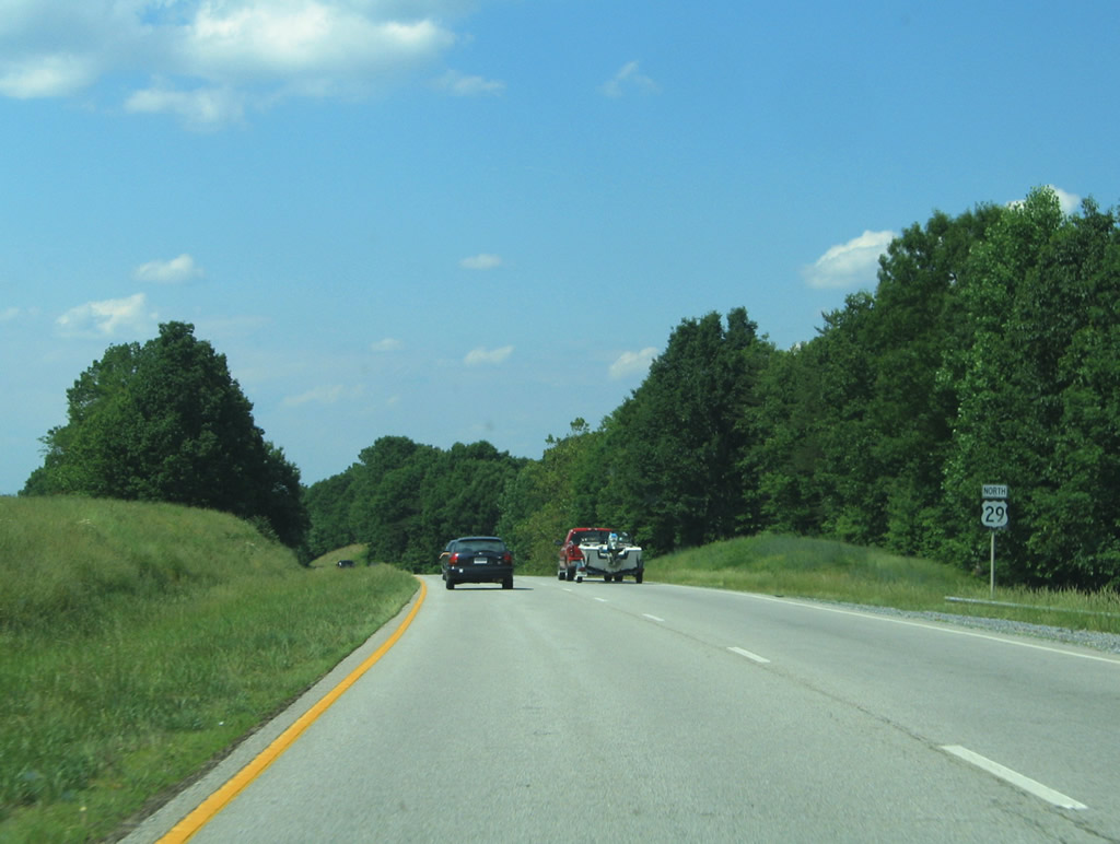
| Continuing north from SR 665 along U.S. 29. Altavista remains 11 miles to the north. 05/30/05 |
|
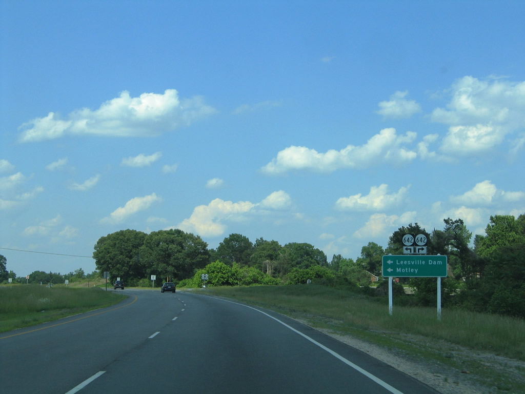
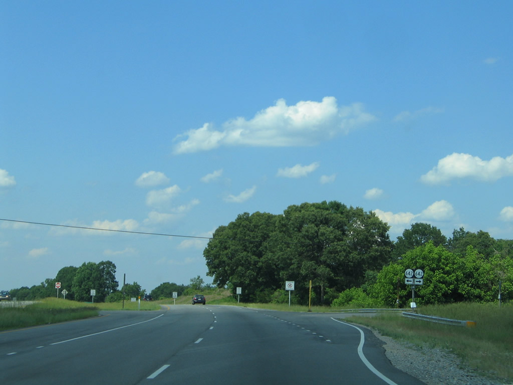
| SR 642 (Shula Drive) intersects U.S. 29 near Motley. SR 642 ventures northwest to an end at Leesville Lake and southeast to Brutus. 05/30/05 |
|
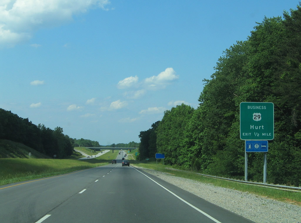
| SR 988 (Highway View Road) stems north from SR 642 as the old alignment of U.S. 29 through Motley. SR 988 transitions to U.S. 29 Business (Main Street) leading northeast to Hurt at the forthcoming diamond interchange. 05/30/05 |
|
| U.S. 29 upgrades to a freeway again and bypasses both Hurt and Altavista. U.S. 29 Business was commissioned with the bypass opened by 1974.1 05/30/05 |
|
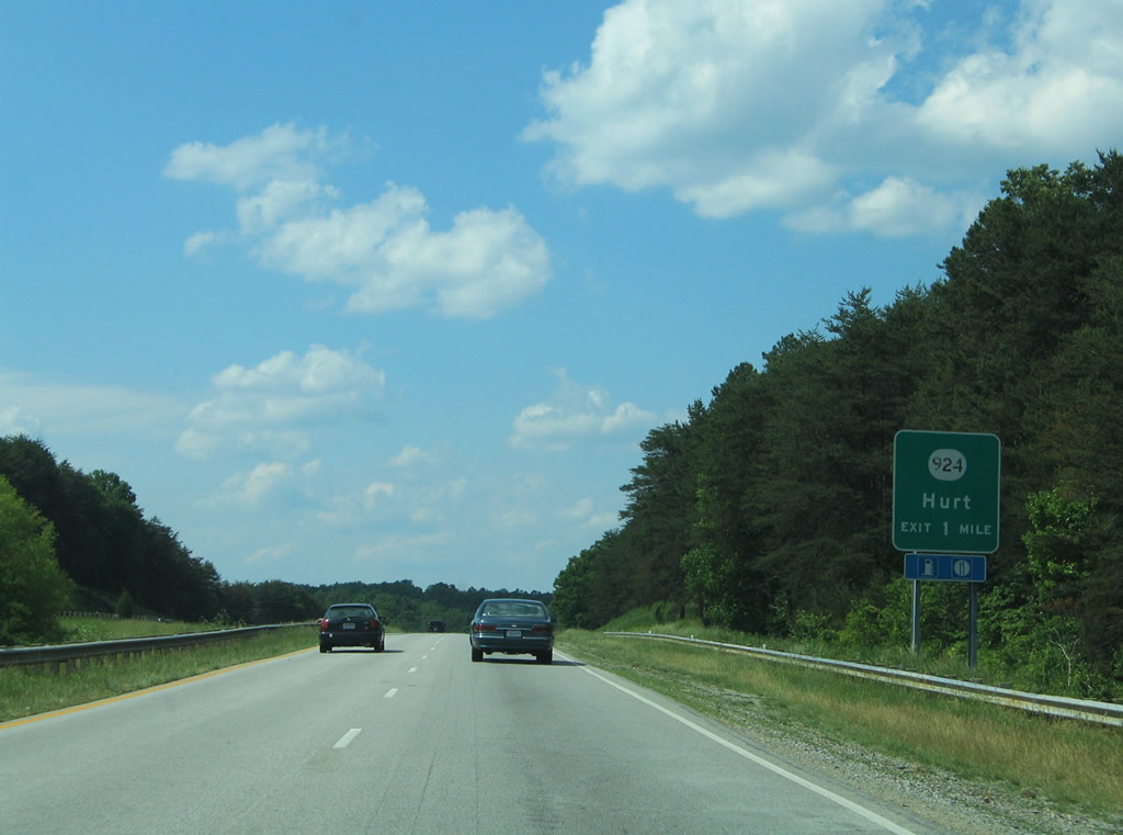
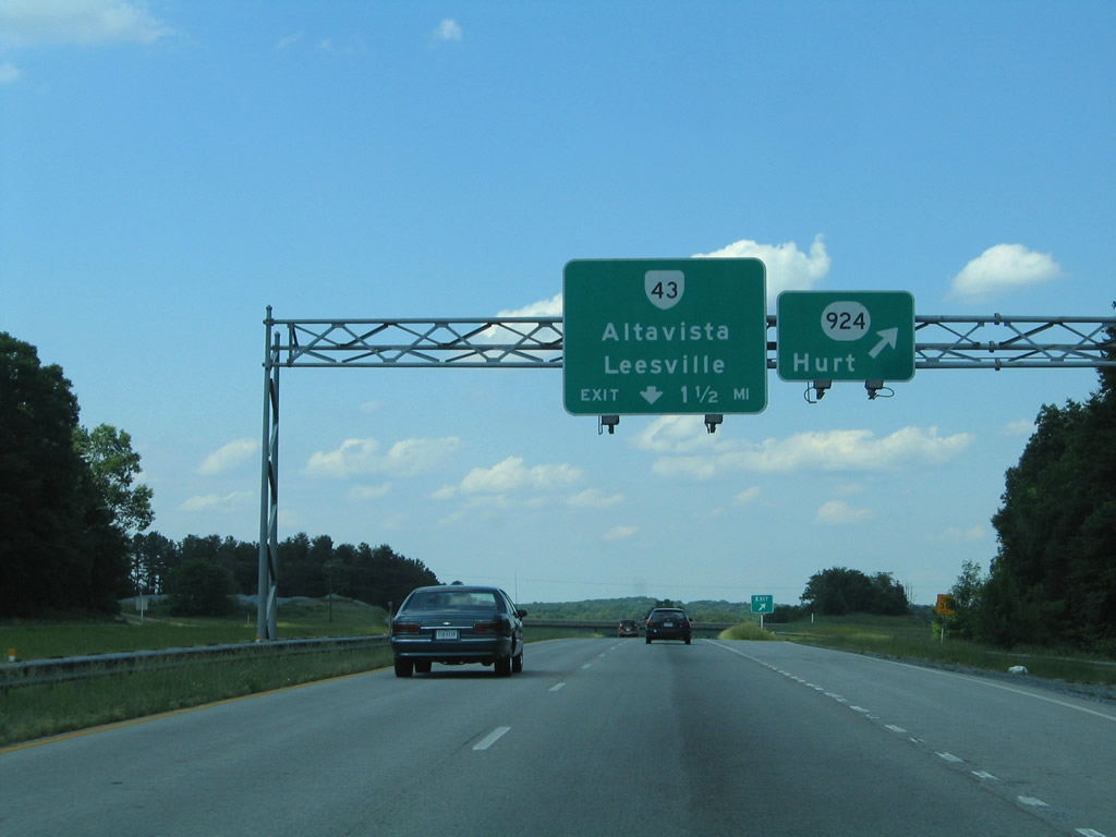
| A diamond interchange joins SR 924 (Pocket Road) west of Hurt. SR 924 ends at U.S. 29 Business (Main Street) in Hurt. 05/30/05 |
|
| The final exit in Pittsylvania County departs U.S. 29 north for SR 924. Pocket Road continues west from U.S. 29 to Rockford School Road (SR 665) and a rural end near the Roanoke River.
SR 43 (Bedford Avenue) travels north from Altavista to U.S. 29 at the next exit, and west to Leesville and Bedford. 05/30/05 |
|
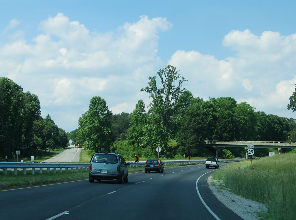
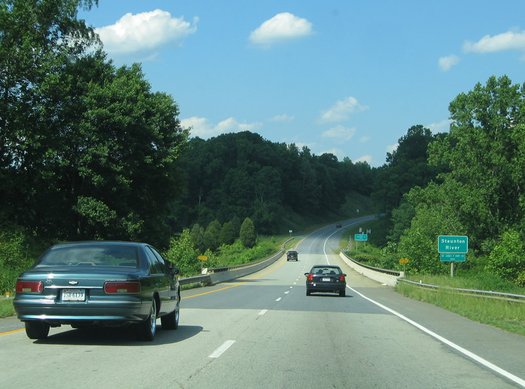
| Crossing the Staunton River on U.S. 29 north, which the USGS Quad displays as the Roanoke River, into Campbell County. 05/30/05 |
Page Updated 03-09-2010.

 North
North  East
East