|
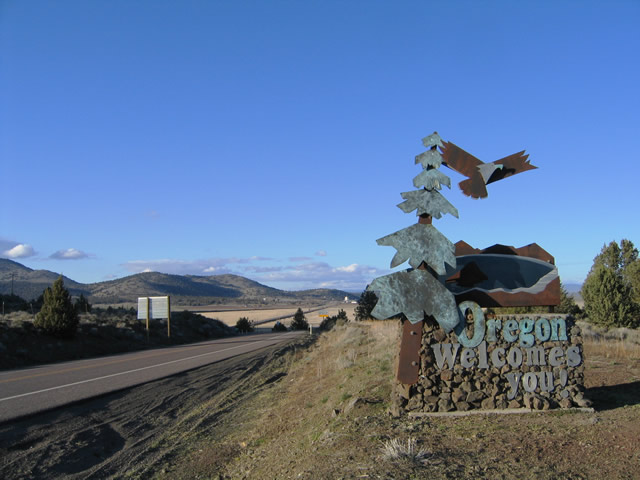
| Welcome to Oregon sign posted just north of the California state line. Hamaker Mountain (elevation 6,596 feet) rises along the northwestern horizon. 04/01/05 |
|
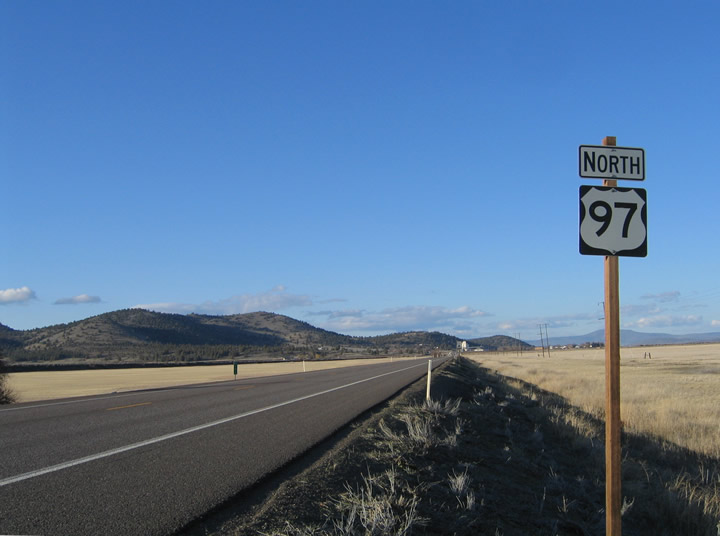
| U.S. 97 descends into the Lower Klamath National Wildlife Refuge from the California state line near Indian Lake. Pictured here is the first reassurance marker, posted at a meadow between the border and Worden. 04/01/05 |
|
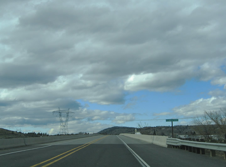
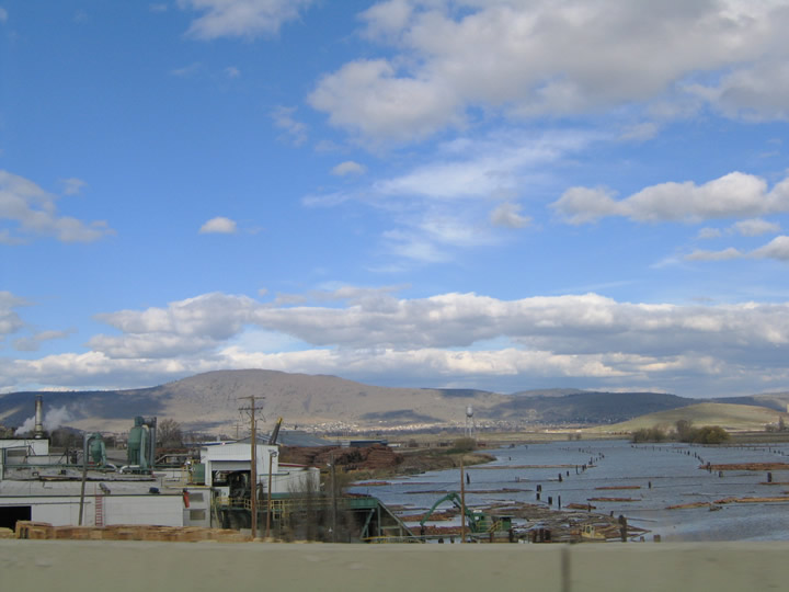
| U.S. 97 northbound enters the greater Klamath Falls area and crosses the Klamath River and Southern Pacific Railroad line. The river feeds Lake Ewauna at the city itself to the north. Logging mills reside along the north banks of the river adjacent to U.S. 97 at its crossing. 04/01/05 |
|
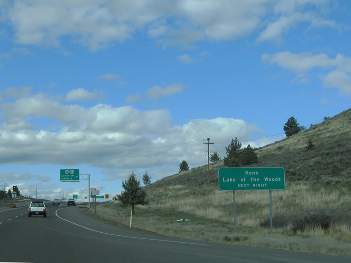
| U.S. 97 intersects the entrance to the Reames Golf and Country Club ahead of its transition into the Klamath Falls west bypass. The first interchange of the freeway serves OR 66 west & OR 140. OR 66 begins here and travels west nine miles to Keno. OR 140 ventures northwest 31 miles to Lake of the Woods. 04/01/05 |
|
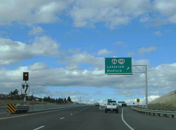
| A parclo interchange facilitates the movements between U.S. 97 and OR 66 & 140. OR 140 follows the South Side Expressway east 3.2 miles to Klamath Falls International Airport and 5.8 miles to OR 39. OR 140 is part of the greater Winnemucca to the Sea Highway, linking Klamath Falls with Lakeview in southeast Oregon to the east and Medford to the west. OR 66 comprises the main route between Ashland and Klamath Falls, a distance of 57 miles. 04/01/05 |
|
| A lone off-ramp joins U.S. 97 northbound with parallel Green Springs Drive at Memorial Drive in southwest Klamath Falls. Green Springs Drive stems north from OR 140 (South Side Expressway) to Riverside Drive. 04/01/05 |
|
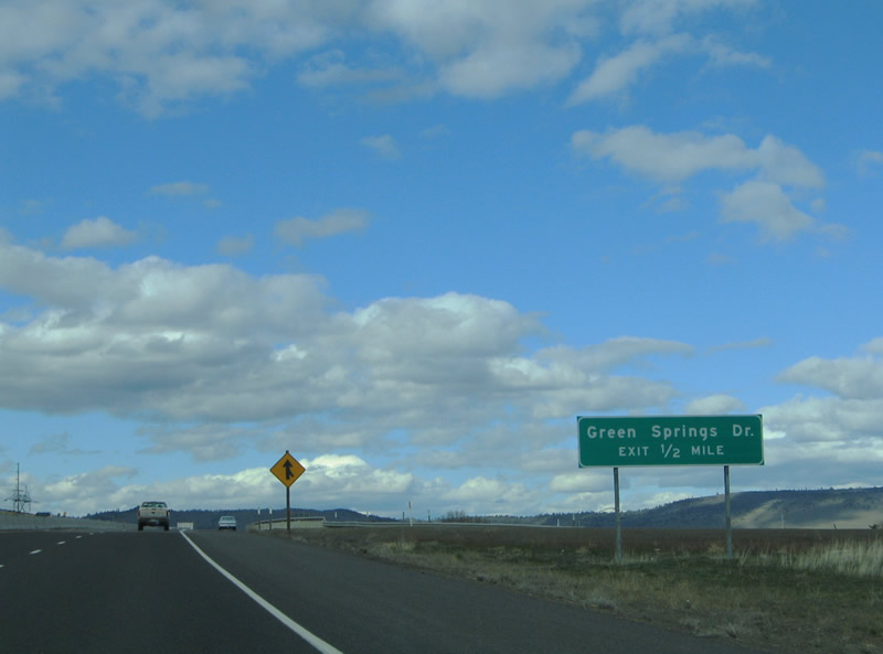
| Northbound at the Green Springs Drive off-ramp on U.S. 97 north. Green Springs Drive loops east into industrial areas along Lake Ewauna. Riverside Drive branches northwest from the road to Carroll, Main, and Mill Streets west of the freeway. 04/01/05 |
|
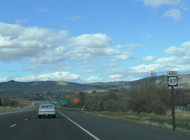
| U.S. 97 reassurance marker posted after the Green Springs Drive off-ramp. The southern most extent of the Klamath Falls west bypass is a four lane divided freeway. 04/01/05 |
|
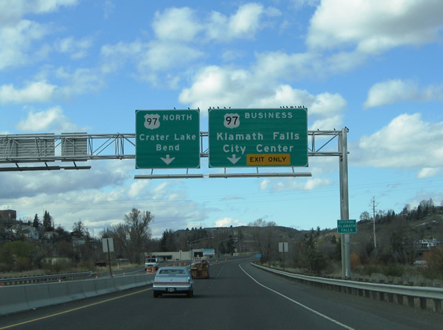
| One mile south of the split with U.S. 97 Business (Main Street) and downtown Klamath Falls on U.S. 97 northbound. 04/01/05 |
|
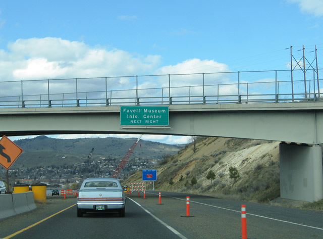
| Attached to the Riverside Drive overpass is an auxiliary guide sign for U.S. 97 Business referencing a tourist information center and the Favell Museum. 04/01/05 |
|
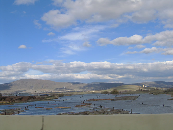
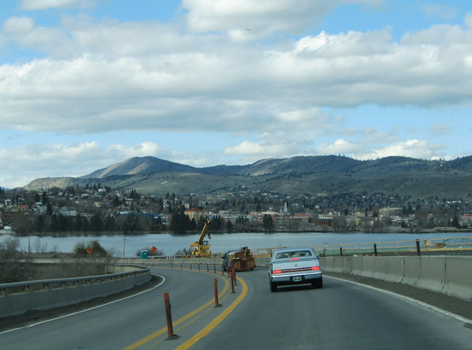
| Scenic views of Lake Ewauna and the Klamath Falls city center are afforded to northbound motorists as U.S. 97 crosses the Greensprings Bridge. A bridge replacement project was underway for the Greensprings Bridge at the time of the photograph with completion of the project expected by early 2006. 04/01/05 |
|
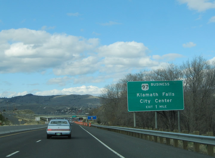
| U.S. 97 ascends from the Lake Ewauna area toward the split with U.S. 97 Business (Main Street) northbound. U.S. 97 Business loops through the Klamath Falls central business district to OR 39 (East Side Bypass). 04/01/05 |
|
| Drivers bound for downtown Klamath Falls and U.S. 97 Business depart U.S. 97 northbound for Main Street east. U.S. 97 Business splits into the one way street couplet of Main Street (south) and Klamath Avenue (north) through downtown. The loop returns via the East Side Bypass with OR 39 at the north end of the U.S. 97 freeway. 04/01/05 |
Page Updated 11-22-2005.

 north
north