|
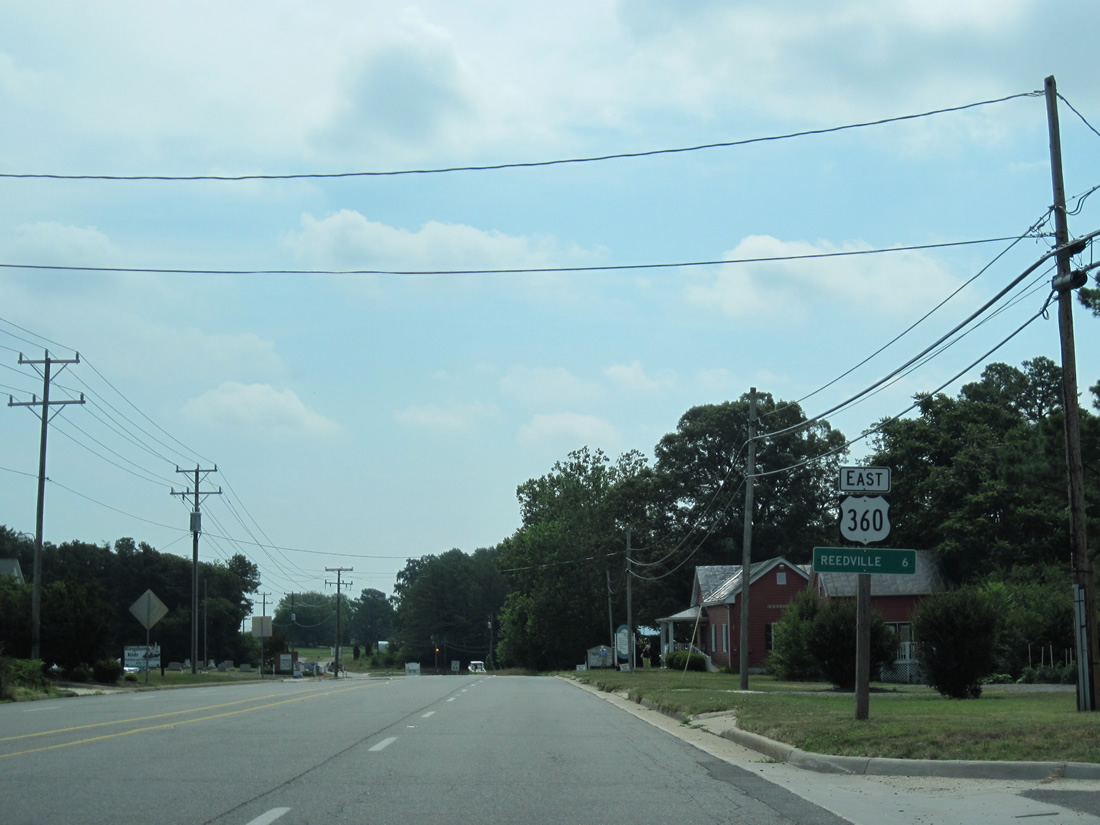
| U.S. 360 (Northumberland Highway) east after the intersection with SR 200 (Jessie Dupont Memorial Highway) in Burgess. The highway carries four lanes from here to Lillian on the six mile drive to Reedsville. 06/25/10 |
|
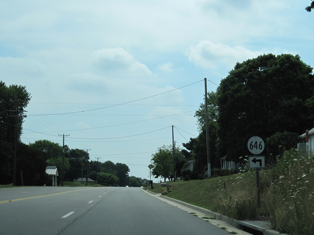
| SR 646 follows Folly Road north from U.S. 360 at Walkers Store to Gonyon. 06/25/10 |
|
| SR 646 includes a southern branch from U.S. 360 (Northumberland Highway) along Brickyard Road to Waverly Road. 06/25/10 |
|
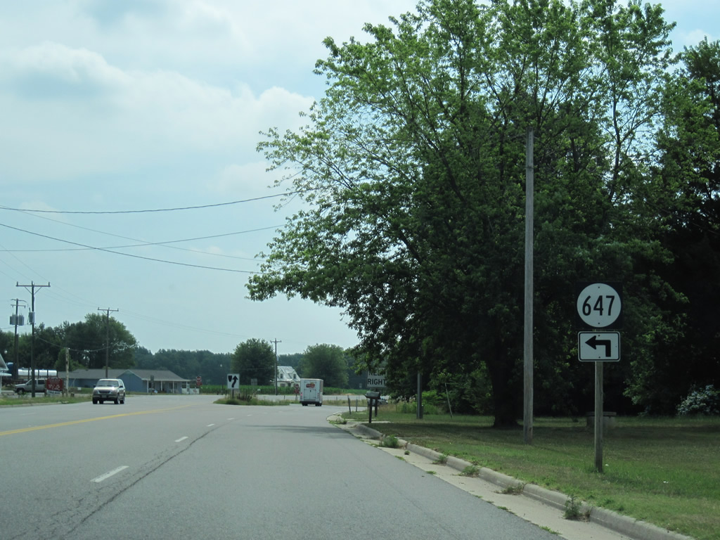
| U.S. 360 begins to turn south at Folly. SR 647 (Greenfield Point Drive) stems east from here to Greenfield Point on the Little Wicomico River. 06/25/10 |
|
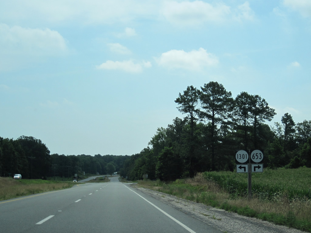
| The last intersection on the four lane stretch of U.S. 360 (Northumberland Highway) sees SR 653 (Whays Creek Road) north and SR 1301 (Locksley Hall Road) west come together near Surprise Hill. 06/25/10 |
|
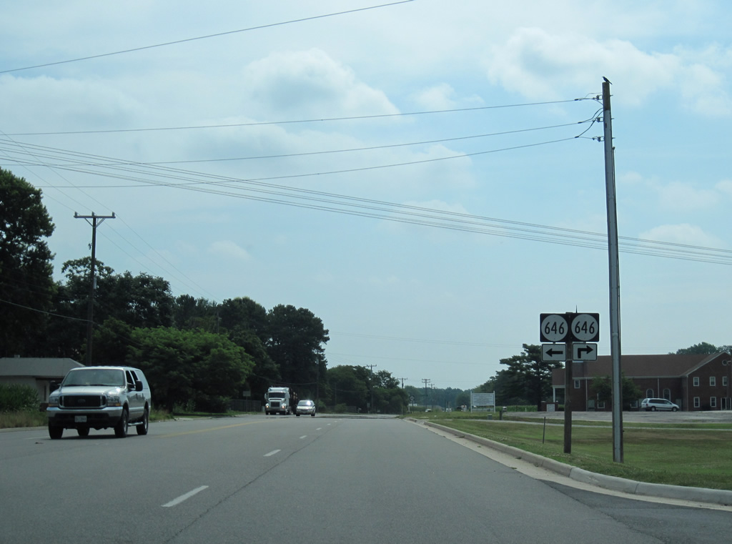
| SR 646 returns to U.S. 360 via Waverly Road east as U.S. 360 reduces to two lanes. 06/25/10 |
|
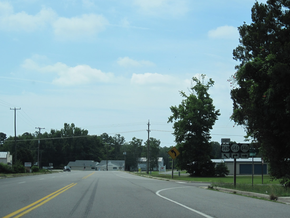
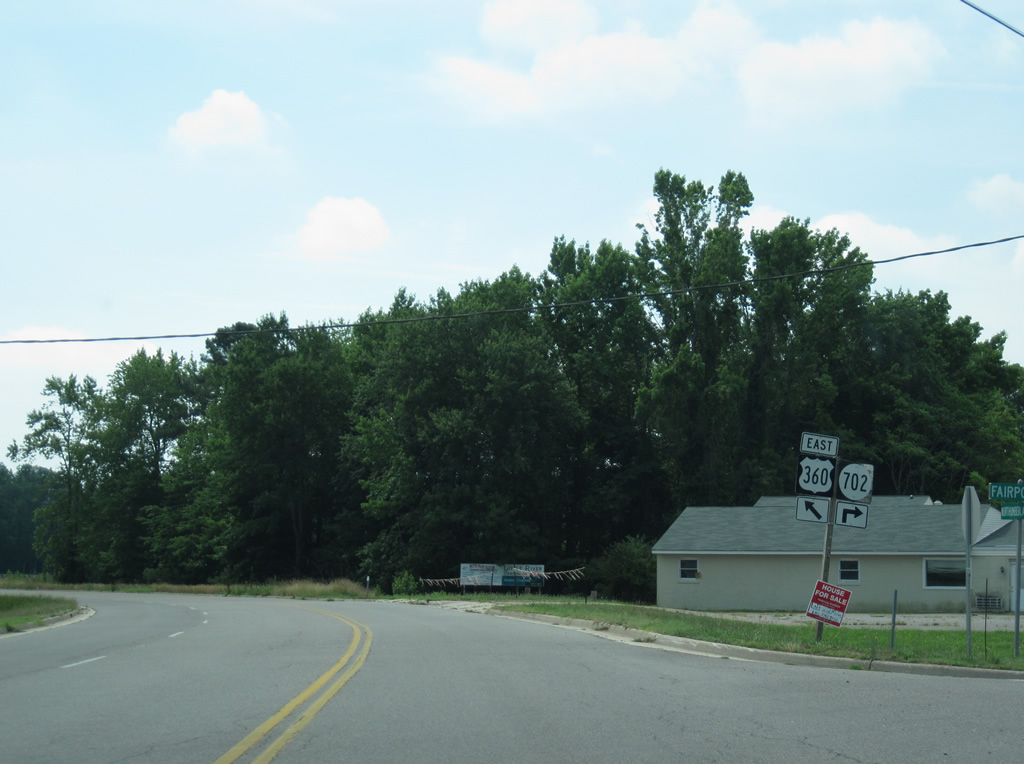
| Fairport Road spurs south from U.S. 360 at Lillian as the continuation of SR 646 south to Fairport and Cockrell Point. SR 702 (Lillian Lane) connects Fairport Road with U.S. 360 east. 06/25/10 |
|
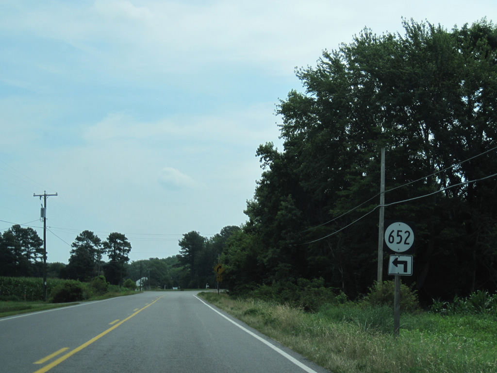
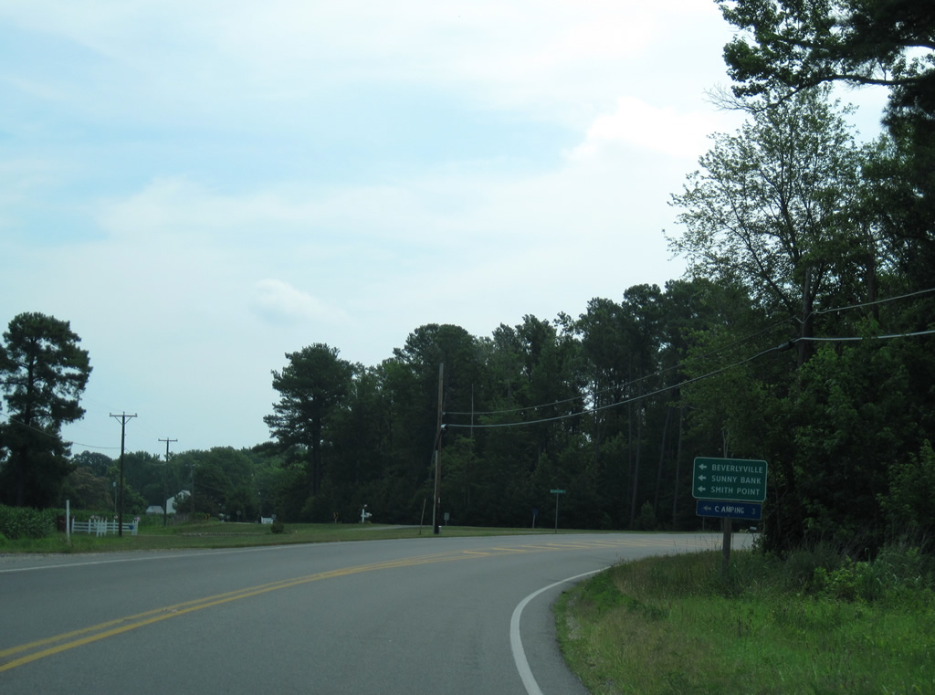
| U.S. 360 leads east from Lillian to Beverlyville and SR 652 (Sunnybank Road). 06/25/10 |
|
| SR 652 follows Sunnybank Road to Gaskins Beach Road east to Gaskin Pond off Chesapeake Bay. Connections with SR 644 lead motorists north to Sunny Bank on the Little Wicomico River and SR 802 north to Smith Point and the mouth of the Potomac River. 06/25/10 |
|
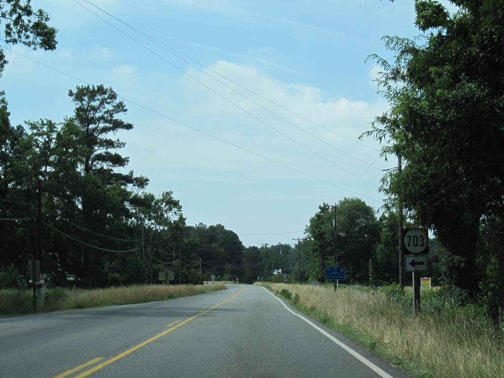
| Old Bethany Drive (SR 703) provides a cut off to SR 652 (Sunnybank Road) east from U.S. 360 west. Old Bethany Drive north to Sunnybank Road east of U.S. 360 is the old alignment of the US route. 06/25/10 |
|
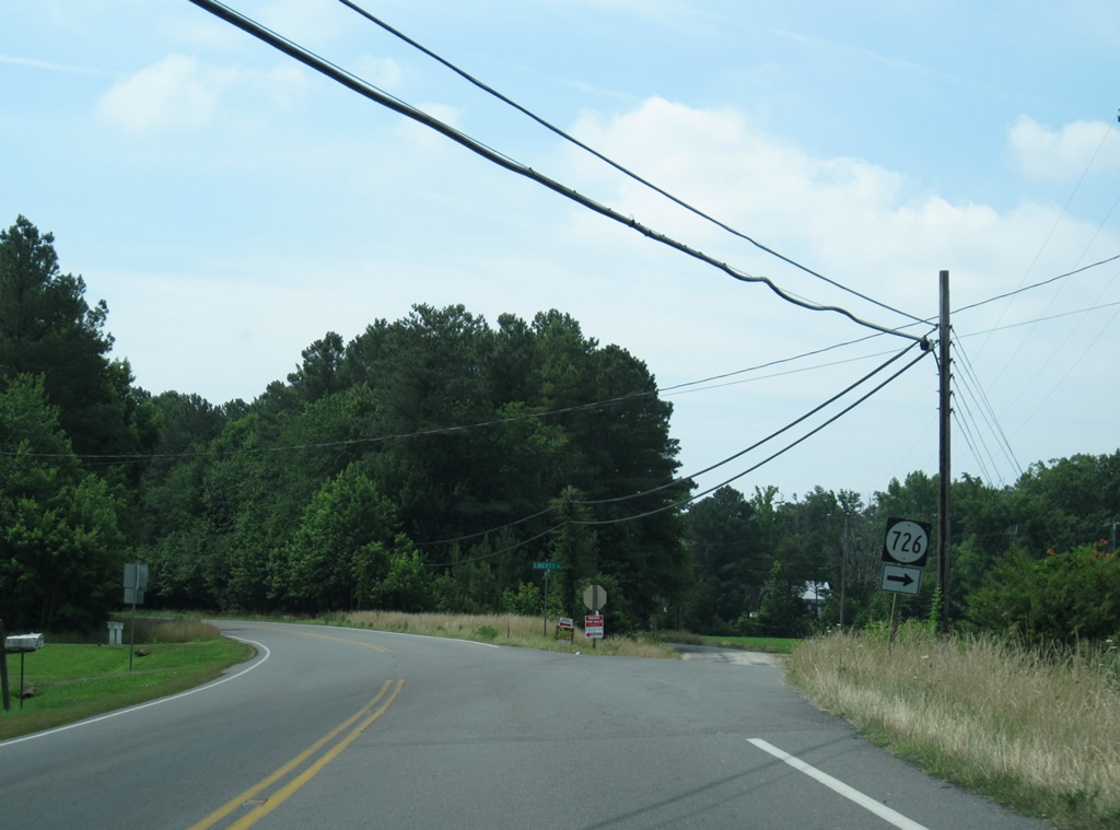
| SR 726 loops west from U.S. 360 (Northumberland Highway) along Liberty Street, another former course of U.S. 360. 06/25/10 |
|
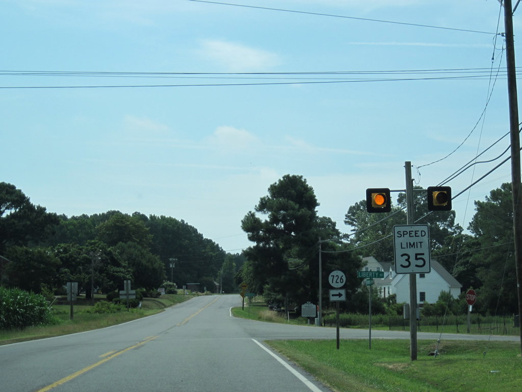
| SR 726 returns to U.S. 360 by an arm of Cockrell Creek as speed limits on Northumberland Highway reduce to 35 miles per hour. 06/25/10 |
|
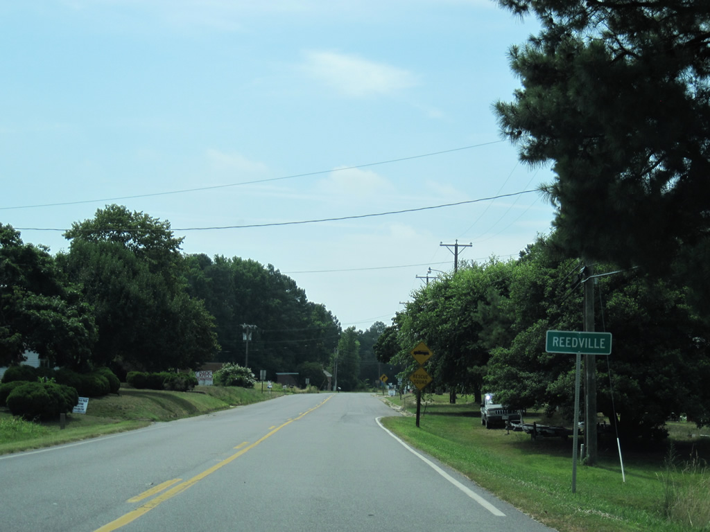
| U.S. 360 enters the unincorporated town of Reedville as the US route transitions from Northumberland Highway to Main Street. 06/25/10 |
|
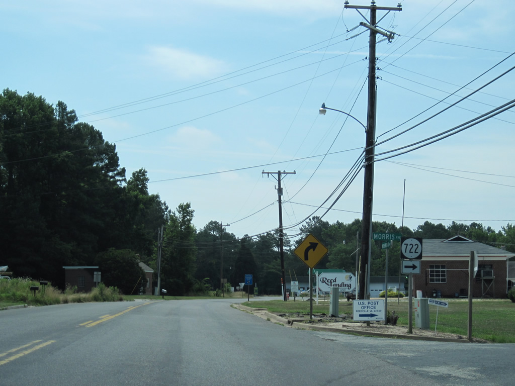
| Morris Avenue splits from U.S. 360 east as SR 722 south to Crowder Drive in Reedsville. 06/25/10 |
|
| SR 657 veers southeast from U.S. 360 (Main Street) along Fleeton Road to Tibitha, Bull Neck and Fleeton. According to a 1944 and 1961 USGS Quadrangle map of the area, U.S. 360 followed the path of SR 657 south to Fleeton. This was likely a cartographic error. 06/25/10 |
|
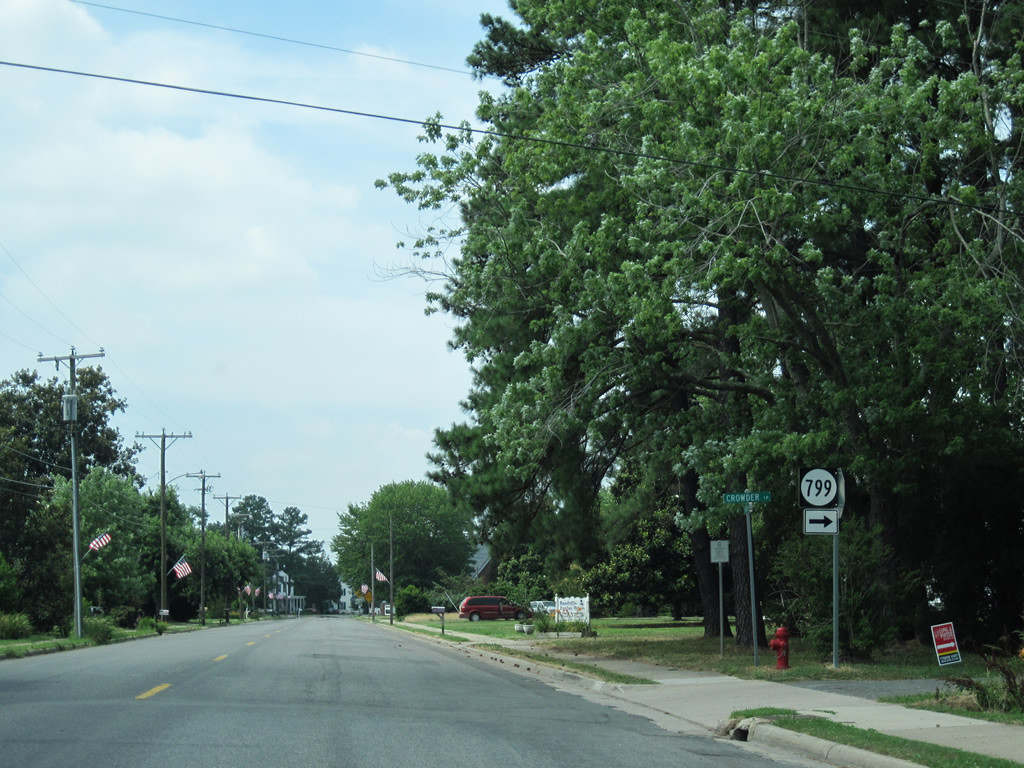
| Crowder Lane (SR 799) spurs west from Main Street in Reedsville to Cockrell Creek. 06/25/10 |
|
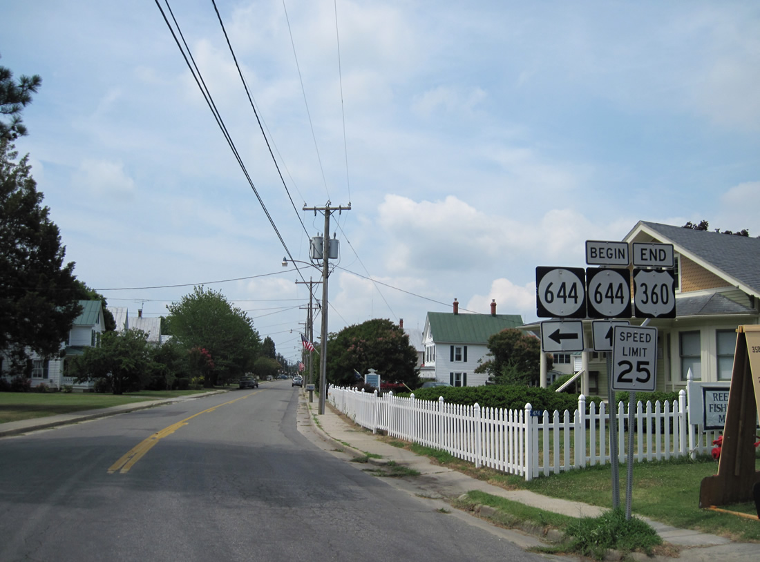
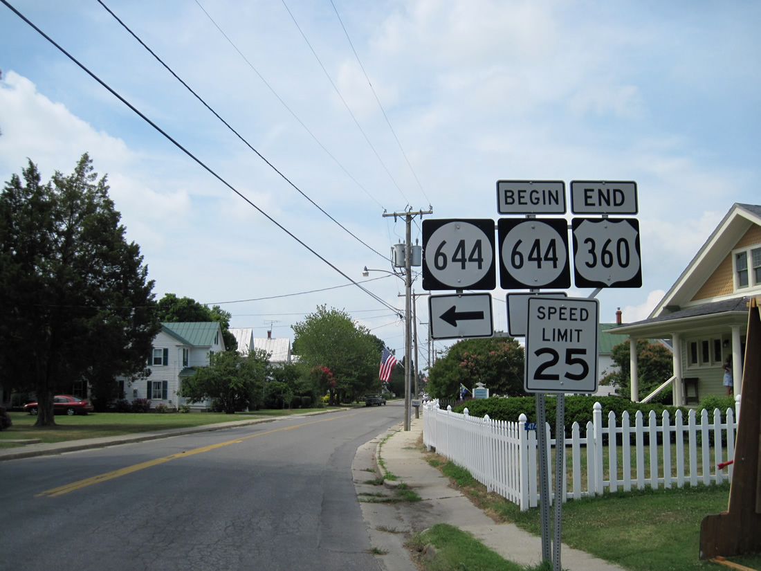
| U.S. 360 ends at the Main Street intersection with Reed Avenue in Reedsville. SR 644 follows Reed Avenue south from Fleeton Road and overtakes Main Street from U.S. 360 to the Cockrell Creek waterfront. This was also a part of U.S. 360 until 1954.1 06/25/10 |
Page Updated 02-12-2013.

 East
East