Wabash Avenue comprises a six-lane boulevard between W. Cold Spring Lane and Patterson Avenue in northwestern Baltimore. The surface road begins as a one-way street from the north end of Hilton Road. From there the roadway travels northwest to Dorithan Road where northbound joins southbound as a divided boulevard. Stub ends exist both at Hilton Road (south end) and Vincennes Avenue (north end). A disjointed segment of Wabash Avenue spurs north from MD 26 (Liberty Heights Avenue) to a point just south of the Hilton Road transition into the northern portion of Wabash Avenue.
Interstate 795 stems northwest from the Baltimore Beltway (Interstate 695) to the Baltimore County suburbs of Owings Mill and Reistertown while also providing a high-speed route between MD 140 and I-695. The four to six lane freeway opened November 1985 between Interstate 695 and Owing Mills and October 1986 from Owing Mills to Reistertown. Meanwhile a planned extension inside the beltway entailed a routing roughly parallel to the Baltimore Metro subway line. The Northwest Expressway was to have continued through Sudbrook Park to the Mount Hope and Forest Park sections of Baltimore city.
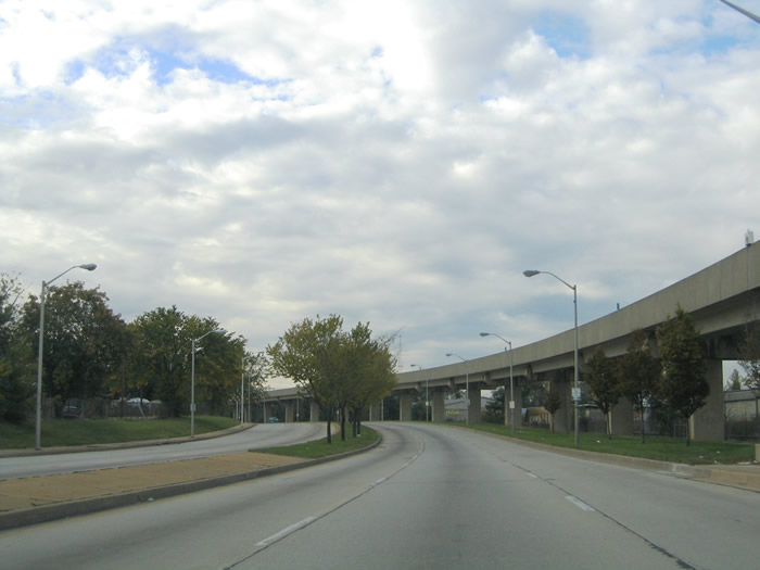
The Northwest Expressway extension within the beltway was ultimately curtailed both as a freeway and surface boulevard. All that was constructed was the six-lane concrete boulevard of Wabash Avenue between Patterson Avenue and Hilton Road. The same corridor reserved for Interstate 795 was reutilized for the Baltimore Metro line. Pictured below are scenes along Wabash Avenue showing what was actually built in the 1970s and 80s.
|
| Hilton Road northbound on the approach to Wabash Avenue in the Forest Park neighborhood. Hilton Road ends at Wabash Avenue. Wabash Avenue was to have continued north from MD 26 to Hilton Road. However the segment between Hilton Road and Dorithan Road was never completed and a stub end to Wabash Avenue exists at Hilton Road to the right. 10/13/04 |
|
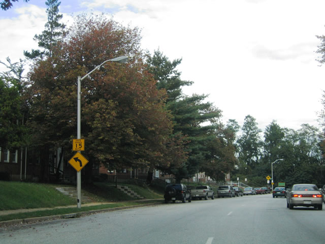
| Wabash Avenue northbound at W. Cold Spring Lane. Southbound traffic defaults onto Dorithan Road southbound beyond Belle Avenue. W. Cold Spring Lane provides a through route between Garrison Avenue, Interstate 83 (Jones Falls Expressway), Roland Avenue, and other north-south arterials. 10/13/04 |
|
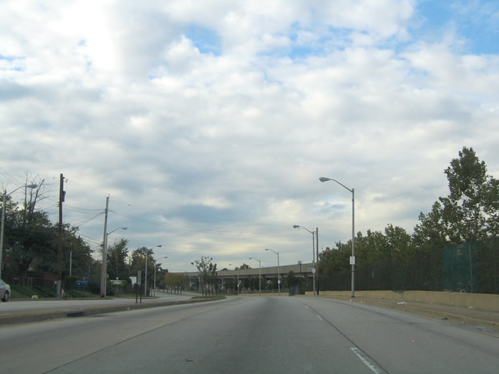
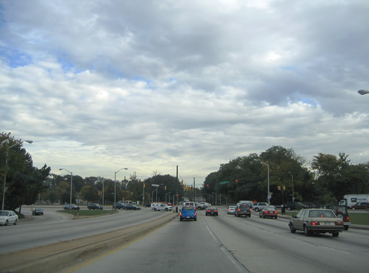
| Six lanes of Wabash Avenue continue north from W. Cold Spring Lane. The Baltimore Metro transit line comes into view as it parallels Wabash Avenue to the east. 10/13/04 |
|
| Continuing on Wabash Avenue northbound after Lewin Avenue in Forest Park Baltimore. Lewin Avenue is discontinuous between Wabash Avenue and MD 140 (Reistertown Road) due to the Baltimore Metro line and its companion CSX Railroad corridor. 10/13/04 |
|
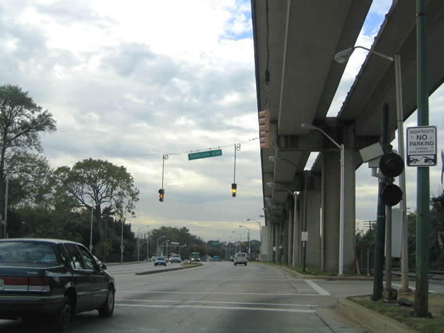
| Northbound at the signalized intersection with Garrison Boulevard. The Baltimore Metro transit line parallels Wabash Avenue almost directly above the northbound lanes. The CSX Railroad line crosses Garrison Boulevard at-grade otherwise. Garrison Boulevard loops through Forest Park and Windsor Hills in northwest Baltimore. 10/13/04 |
|
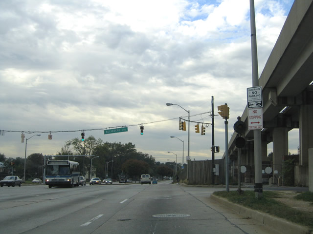
| One block west of Garrison Boulevard at Belvedere Avenue on Wabash Avenue northbound. Again a railroad signal coincides with the traffic lights on Wabash Avenue for the adjacent CSX Railroad crossing. Belvedere Avenue provides a through route between Wabash Avenue to MD 140, MD 129 (Park Heights Avenue), Pimlico Race Track, and Northern Parkway. 10/13/04 |
|
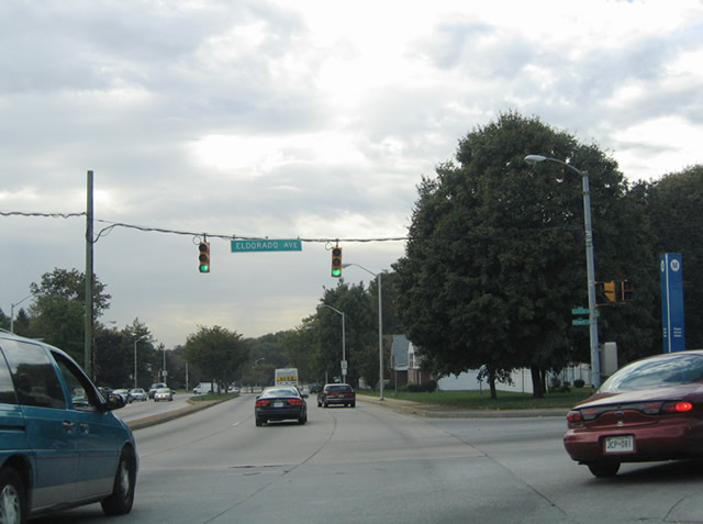
| Wabash Avenue turns westerly at the intersection with Eldorado Avenue. Eldorado Avenue flows southbound between Wabash Avenue to MD 26 (Liberty Heights Avenue) and Carleview Road. To the right is the Eldorado Avenue end at Haywood Avenue and the Rodgers Avenue Station of the Metro. Haywood Avenue otherwise continues northeast to Pimlico Race Track. 10/13/04 |
|
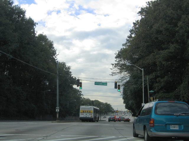
| Wabash Avenue northbound at Rogers Avenue at Arlington Cemetery. Rodgers Avenue travels north from Hillside Park, Howard Park, and West Arlington to Northern Parkway at Pimlico Park. Traffic signal replacement was underway at the time of the photo. 10/13/04 |
|
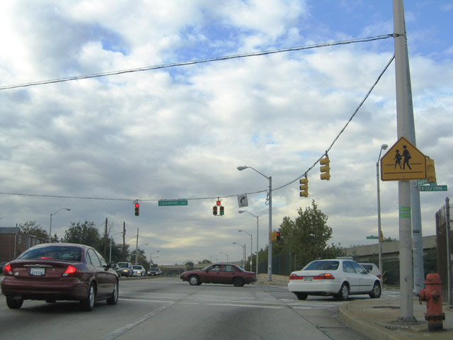
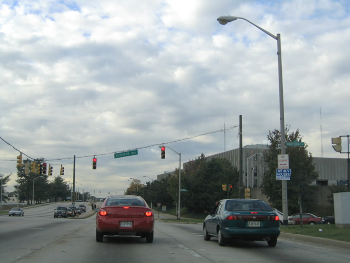
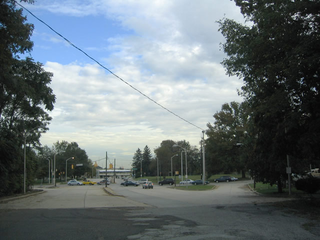
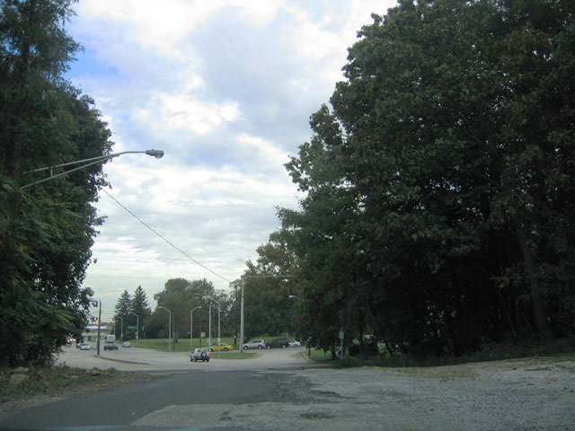
| A busy intersection exists where Wabash Avenue crosses Northern Parkway. Northern Parkway arcs across northern Baltimore as the main arterial between MD 26 and U.S. 1 (Belair Road). The highway, like W. Cold Spring Lane, also sees an interchange with Interstate 83 to the east. 10/13/04 |
|
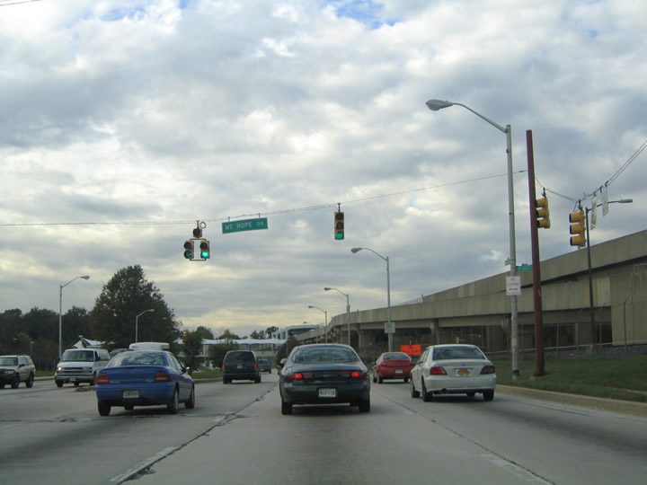
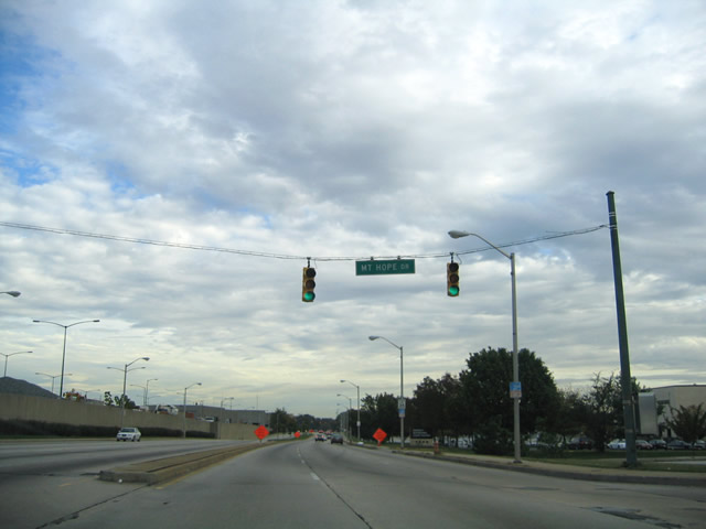
| Wabash Avenue north at Mount Hope Drive west to Metro Drive. Mount Hope Drive provides access to the adjacent MTA's park-n-ride bus loop for Reisterstown Plaza subway (Metro) station and serves the Social Security Administration Building on Metro Drive. 10/13/04 |
|
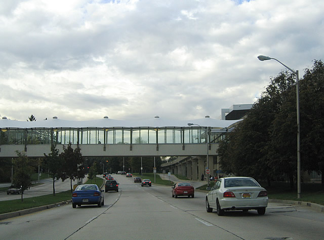
| A catwalk crosses overhead between the Mount Hope Drive park and ride lot and the Reistertown Road Metro Station of the Baltimore subway line. 10/13/04 |
|
| Wabash Avenue northbound at Patterson Avenue in the Mount Hope neighborhood of Baltimore city. Patterson Avenue links MD 26 (Liberty Road) and Lochearn in Baltimore County to MD 140 (Reistertown Road). Wabash Avenue ahead defaults onto Vincennes Avenue. 10/13/04 |
|
| Six lanes of concrete roadway for Wabash Avenue end abruptly as Vincennes Avenue. Vincennes Avenue continues as a narrow asphalt roadway 150 feet to Ridge Avenue. The roadway serves local traffic only to Armstrong Avenue and a return to Patterson Avenue. 10/13/04 |
|
| Vincennes Avenue southbound at the beginning of Wabash Avenue. Six lanes of concrete commence ahead of the signalized intersection with Patterson Avenue. The concrete roadway to the right is considered a part of Vincennes Avenue. 10/13/04 |
|
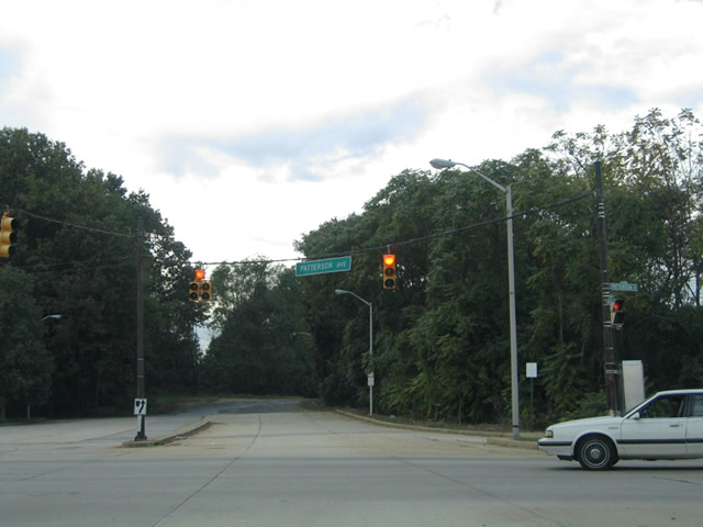
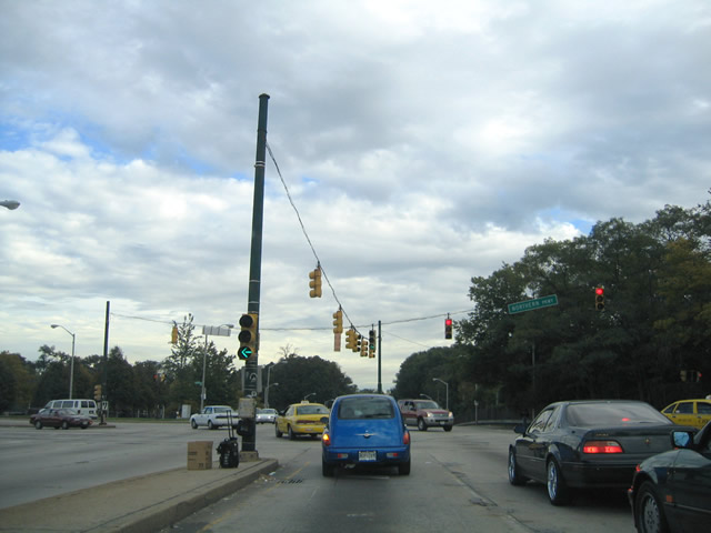
| Span wire supported traffic lights govern the intersection of Wabash and Patterson Avenues in the Mount Hope section of Baltimore. Patterson Avenue travels 1.2 miles southwest to MD 26 outside the city of Baltimore at Lochearn. Turn left ahead onto Patterson Avenue for a 0.3 mile drive to MD 140 (Reistertown Road). 10/13/04 |
|
| Wabash Avenue southbound at Mount Hope Drive near the Reistertown Road Station of the Baltimore Metro line. Wabash Avenue maintains six overall lanes with no shoulders between Patterson Avenue and W. Cold Springs Lane. 10/13/04 |
|
| Approaching the intersection with Northern Parkway on Wabash Avenue southbound. Northern Parkway constitutes a four to six lane arterial throughout northern Baltimore. The divided highway begins 1.1 miles to the southwest at MD 26 (Liberty Heights Avenue). 10/13/04 |
|
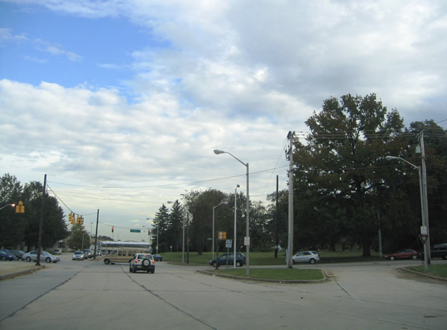
| A ground level turn signal compliments the span wire mounted signals above on Wabash Avenue southbound at Northern Parkway. Northern Parkway passes under the Baltimore Metro and CSX Railroad lines to the left. Three miles separate Wabash Avenue from Interstate 83 (Exit 10) through the Pimlico and Coldspring neighborhoods of the city. 10/13/04 |
|
| Vincennes Avenue travels what would be one block between Patterson & Wabash Avenues to Ridge Avenue. The roadway is undeveloped as it passes through the right-of-way for never built Wabash Avenue alongside the Baltimore Metro & CSX Railroad lines. 10/13/04 |
|
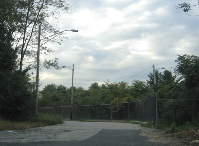
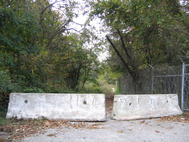
| A set of concrete barriers blocked an abandoned stretch of Armstrong Avenue, north of Ridge Avenue and just south of the Baltimore Metro and CSX Railroad right-of-way. Wabash Avenue would have continued through this stretch had it been extended northward. 10/13/04 |
|
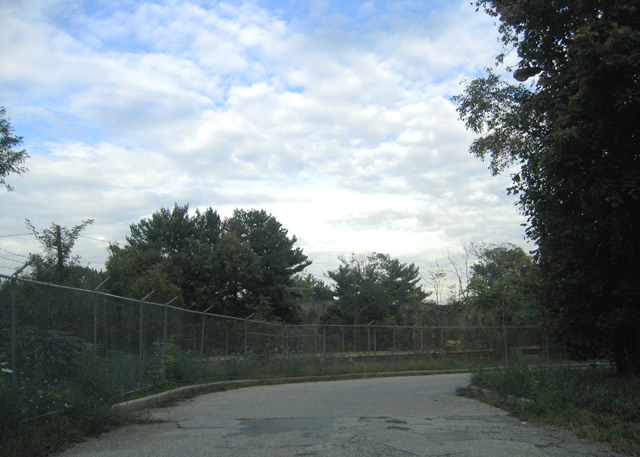
| Vincennes Avenue southbound between Ridge Avenue and Wabash Avenue. The Baltimore Metro and CSX Railroad lines come into view as they parallel the corridor to the east. 10/13/04 |
|
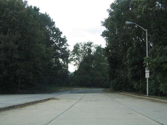
| A small asphalt stub end for Wabash Avenue exists at the Vincennes Avenue transition into Wabash Avenue. Vincennes Avenue continues one-half block to Patterson Avenue southbound to the right. 10/13/04 |
|
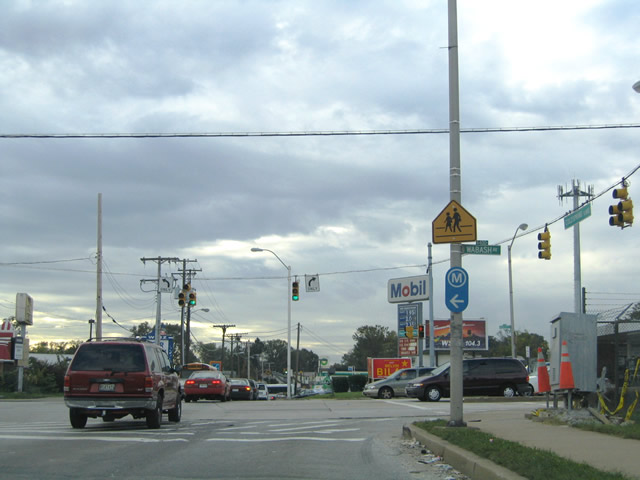
| W. Cold Spring Lane westbound at Wabash Avenue in the Arlington neighborhood of Baltimore city. W. Cold Spring Lane passes underneath the Baltimore Metro line and over the CSX Railroad line between Wabash Avenue and East Wabash Avenue. The Cold Spring Metro Station lies nearby. 10/13/04 |
Page Updated 11-24-2004.