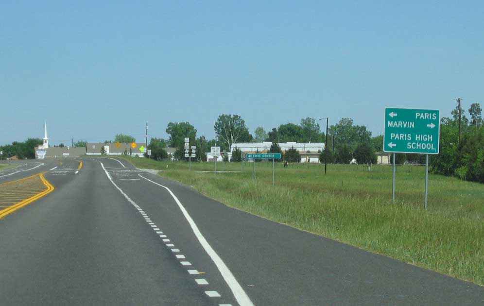
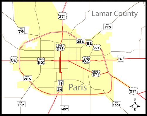
Paris, a city of around 25,000, lies in northeastern Texas near the Oklahoma border. Seat of Lamar County, the city was founded in 1839 as an inland port for pecans and cotton. Over time, Paris became a worldwide jewelry production and research hub, and the city bills itself as the second largest "Paris" in the world.
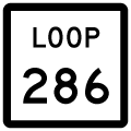
Many Texas cities have loops, and Paris is no exception. Loop 286 forms an oval shaped route around the city, varying as a rural two lane highway to the south and a mix of four-lane arterial and freeway sections to the north. TxDot has no plans currently to upgrade Loop 286 to a full freeway.
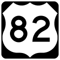
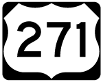
U.S. 82 accompanies Loop 286 to bypass Downtown Paris to the north. U.S. 271 joins the commercialized stretch of SL 286 through northeast Paris. Overall SL 286 totals 14.46 miles.
|
| Loop 286 expands from two lanes into a freeway north through the diamond interchange with U.S. 82 west and U.S. 82 Business (Bonham Street) east. 2005 |
|
| Loop 286 north at the western junction with U.S. 82. U.S. 82 provides a link to Sherman and Wichita Falls. 2005 |
|
| U.S. 82 east combines with Loop 286 north, with the two briefly continuing onward as a freeway to Campbell Street. 2005 |
|
| Cross roads and private driveways tie into the ensuing stretch of Loop 286. The next interchange lies one half mile ahead with FM 79 (19th Street NW). 2005 |
|
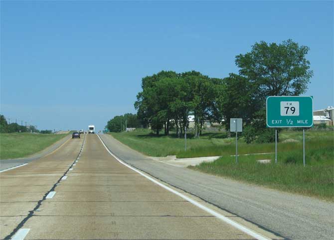
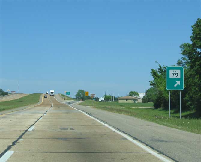
| Entering the diamond interchange with FM 79 on Loop 286 east. FM 79 follows 19th Street NW south to end opposite FM 137 at U.S. 82 Business (Bonham Street). The 26.92 mile highway spurs northwest from Paris to farm communities in the Red River Valley. 2005 |
|
| The loop advances east as a four lane at-grade highway across the industrial north side of Paris. Paris is home to large Campbell's Soup and Kimberly-Clark facilities. 2005 |
|
| One half mile ahead of the diamond interchange with U.S. 271. U.S. 82 & SL 286 narrow on the succeeding stretch to pass below a Kiamichi Railroad Company overpass. 2005 |
|
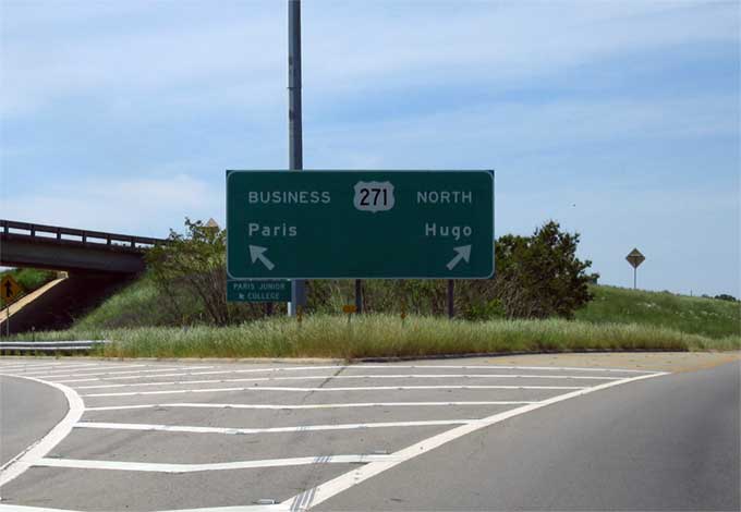
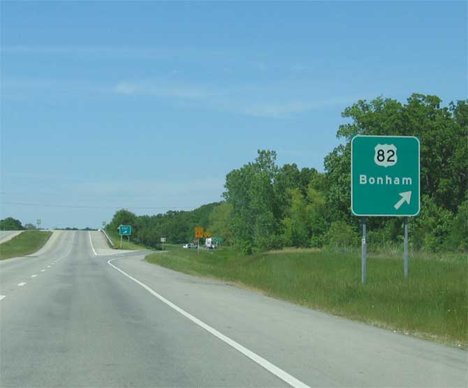
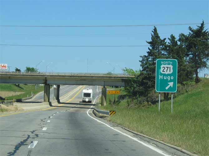
| U.S. 82 & Loop 28 east at U.S. 271 north and U.S. 271 Business (North Main Street) south. U.S. 271 connects Paris with Hugo, Oklahoma, located 23 miles to the north. 2005 |
|
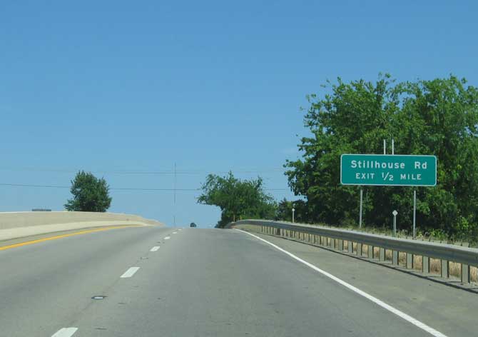
| U.S. 271 south combines with Loop 286 on the southward turn preceding Fitzhugh Avenue south and Stillhouse Road north. 2005 |
|
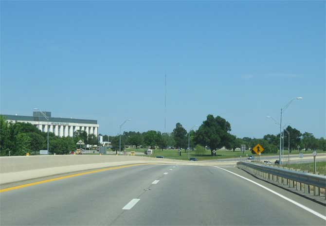
| U.S. 82-271 & SL 286 pass by Paris Regional Medical Center and through the main retail areas of the city over the ensuing stretch. 2005 |
|
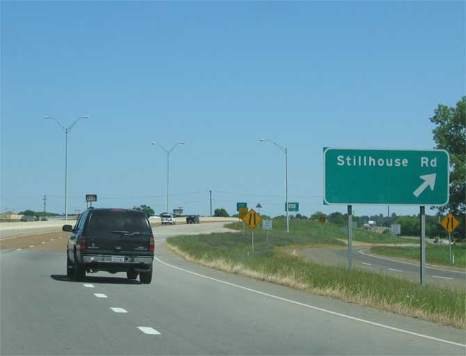
| Frontage roads accompany the freeway to the diamond interchange with Fitzhugh Avenue south and Stillhouse Road north to the adjacent medical center and residential areas. 2005 |
|
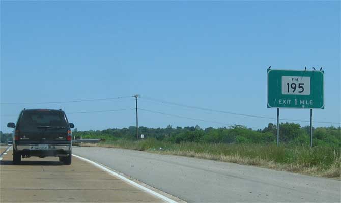
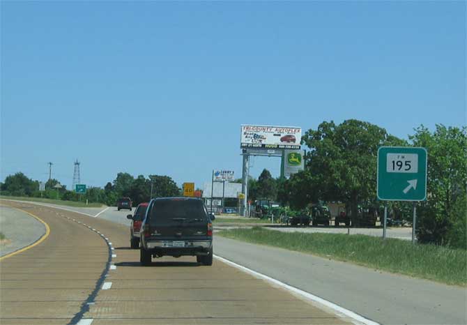
| The succeeding exit along Loop 286 eastbound is located one mile ahead with FM 195 (20th Street NE). 2005 |
|
| The first reassurance assembly for the U.S. 82-271 & SL 286 overlap. The loop again transitions into an at-grade arterial here. 2005 |
|
| FM 195 stems north from U.S. 82 Business (Lamar Avenue) along 20th Street NE to meet U.S. 82-271 & Loop 286 at a diamond interchange. The FM road continues through northeastern Paris residential areas to farming communities in northeastern Lamar County. 2005 |
|
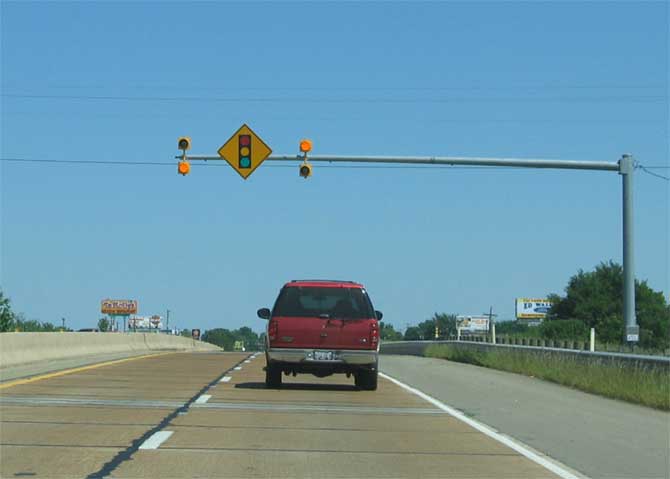
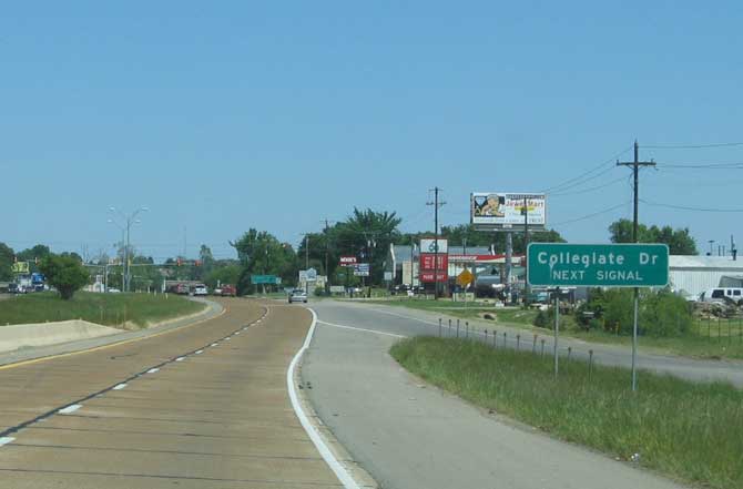
| Loop 286 turns southward and transitions into an at-grade arterial for 0.9 miles. Traffic lights operate at forthcoming Collegiate Drive south. 2005 |
|
| Collegiate Drive heads south from Loop 286 through eastern Paris to Paris Junior College at U.S. 271 Business (Clarksville Street). 2005 |
|
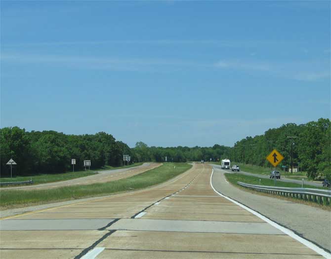
| U.S. 82-271 & SL 286 upgrade to a freeway again south of 34th Street NE to U.S. 82 Business (Lamar Street). 2005 |
|
| U.S. 271 & Loop 286 advance south from the split with U.S. 82 at-grade to the ramp for U.S. 271 Business (Clarksville Street) north. This is the lone reference for any U.S. business route along the 14 mile loop. 2005 |
|
| Loop 286 and U.S. 271 part ways just beyond the merge with U.S. 271 Business (Clarksville Street). The freeway spans the Northeast Texas Trail here. 2005 |
|
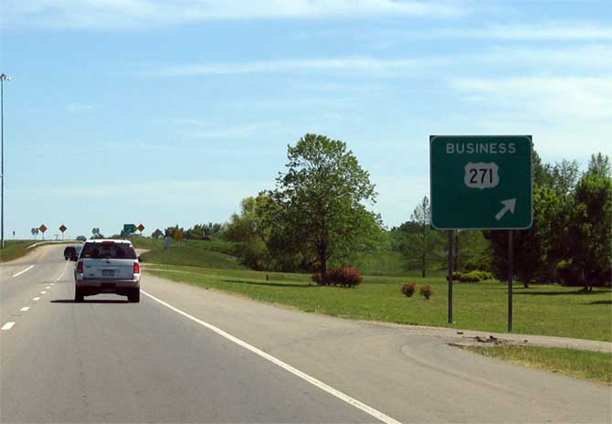
| Loop 286 continues southward as U.S. 271 branches southeast via a left side ramp toward Deport, Bogata, Mount Pleasant and IH 30. A loop ramp follows for Loop 286 north for motorists originating from U.S. 271 Business south. 2005 |
|
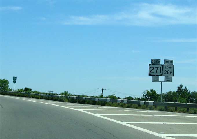
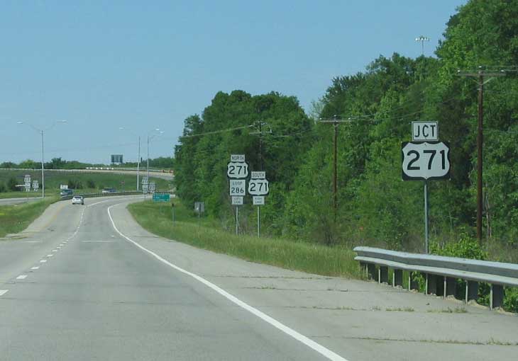
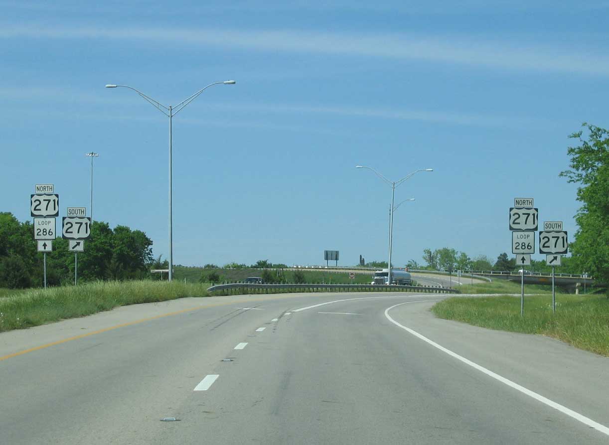
| U.S. 271 south at the return ramp for U.S. 271 & SL 286 north. A hybrid trumpet interchange joins the two routes. 2005 |
|
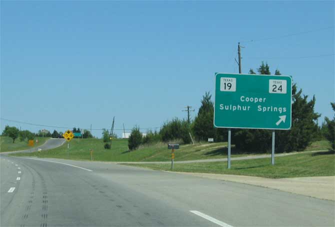
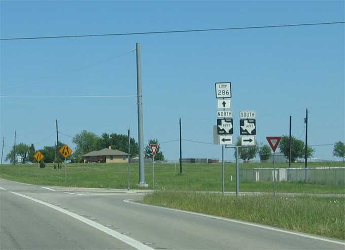
| Traveling west across the rural south side of Paris, SL 286 reduces to two lanes. The state highway expands again through the intersection with FM 1497 (3rd Street SE) and the diamond interchange with SH 19 & 24 (South Church Street). 2005 |
|
| FM 1417 and SL 286 intersect just east of the diamond interchange with SH 19 & 24 (South Church Street). A 21 mile highway, FM 1417 (3rd Street SE) heads south from Paris to Biardstown and agricultural areas north of the Sulphur River. 2005 |
|
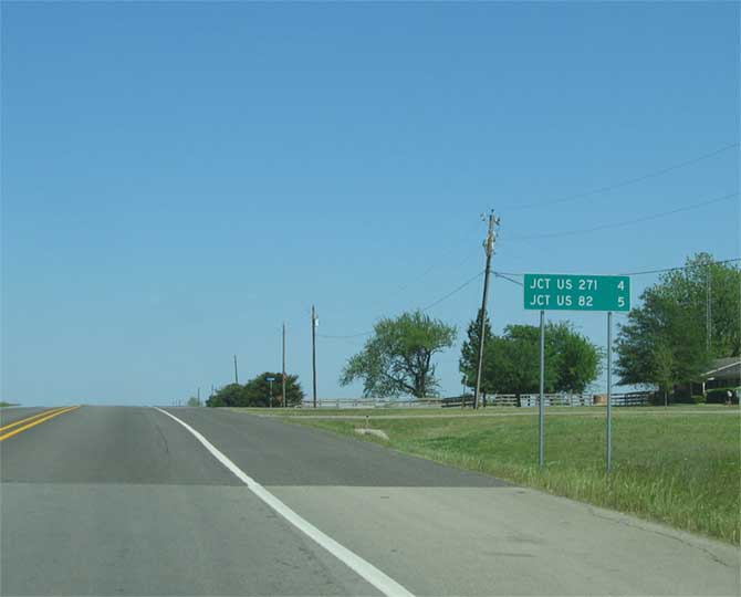
| Removed by 2008, this distance sign referenced the junctions with U.S. 271 south and U.S. 82 east along Loop 286 east after FM 1497. 2005 |
|
| Advancing 2.6 miles east from FM 1417, SL 286 approaches the intersection with FM 1507 (Jefferson Road). FM 1507 runs for 3.46 miles between SH 19 & 24 and FM 905, wholly within the city of Paris. 2005 |
|
| Turning north from FM 905 (41st Street SE), Loop 286 expands into a four lane freeway to the merge with U.S. 271. 2005 |
|
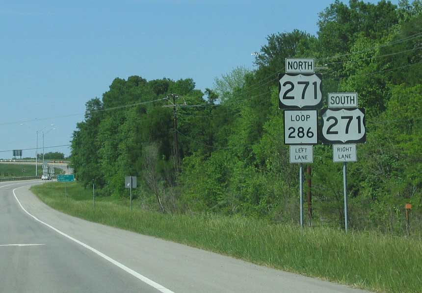
| Traffic partitions into single lane ramps for U.S. 271 south and the continuation of Loop 286 north. 2005 |
|
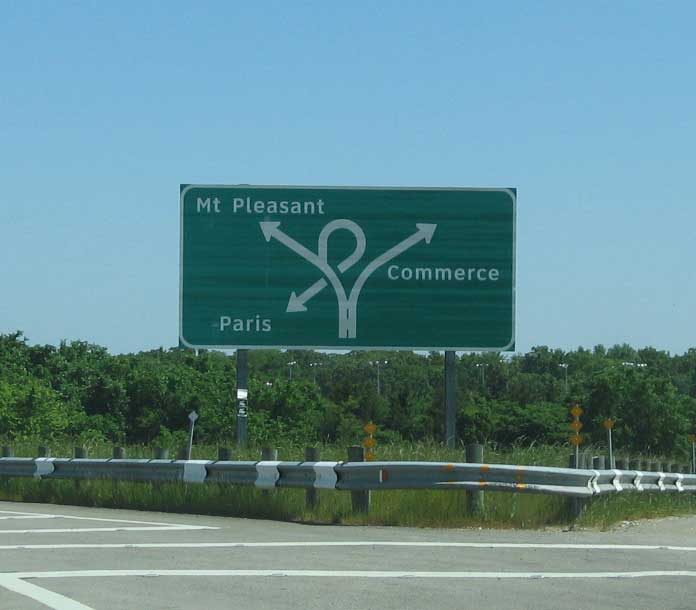
| U.S. 271 travels southeast from Paris to Mount Pleasant and IH 30. The route overlaps with Loop 286 to bypass the east and north sides of the city. 2005 |
|
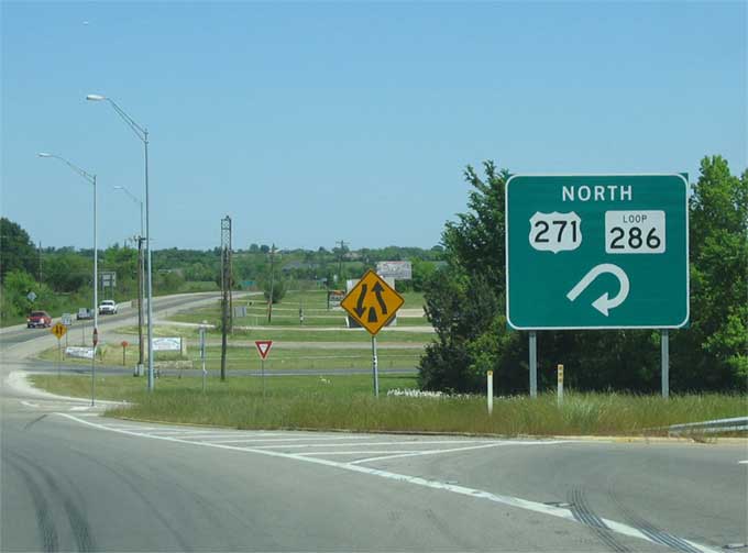
| A trumpet style interchange joins U.S. 271 north with Loop 286. 2005 |
|
| U.S. 271 north at the access road linking the highway with SL 286 south. 2005 |
|
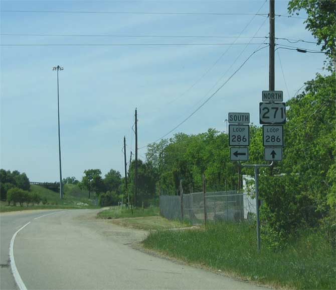
| Confirming markers for U.S. 271 & SL 286 posted after the split with U.S. 271 Business. 2005 |
|
| A weaving traffic scenario unfolds as U.S. 271 north merges onto the right side of Loop 286 west just ahead of the wye interchange with U.S 271 Business (Clarksville Street) north toward Downtown Paris. 2005 |
|
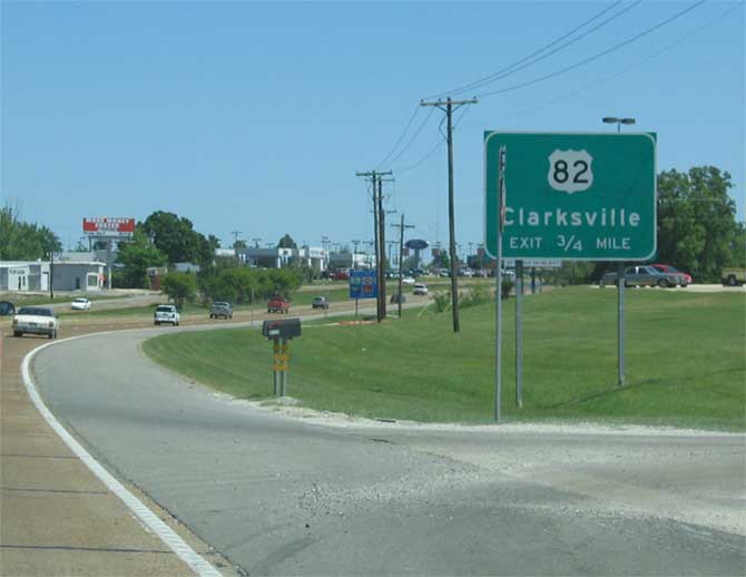
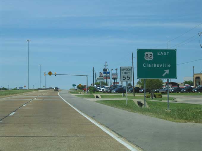
| U.S. 271 & Loop 286 travel northward to a commercialized diamond interchange with U.S. 82 Business (Lamar Street) west and U.S. 82 east to Clarksville. 2005 |
|
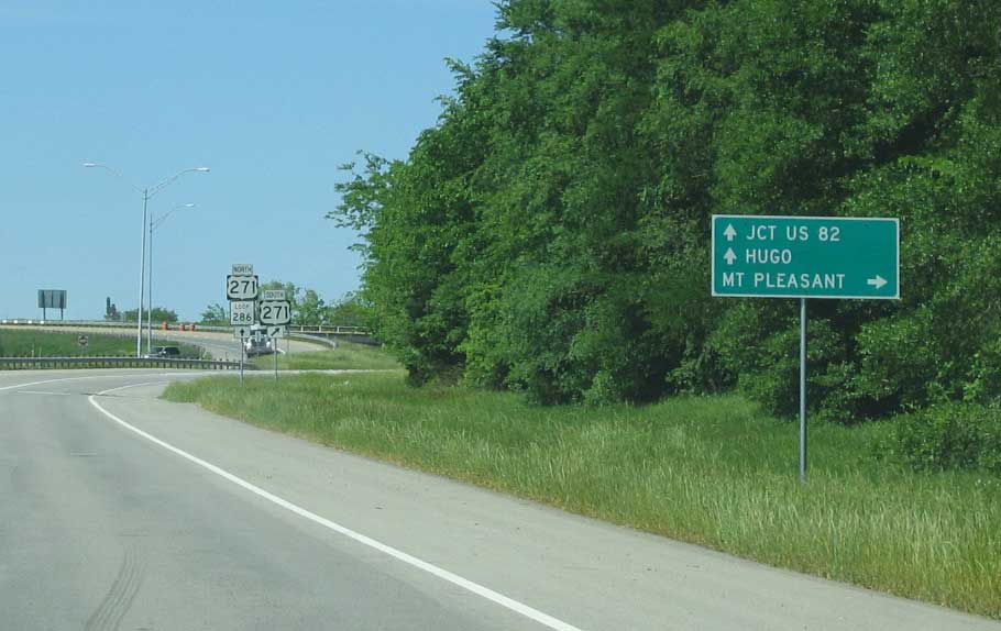
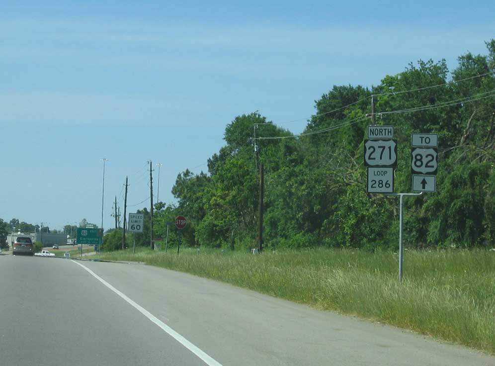
| U.S. 82 leads east from Loop 286 along a five lane arterial route through the east Lamar County cities of Reno, Sun Valley and Blossom. U.S. 82 west joins the Loop 286 freeway north across Pine Mill Road. 2005 |
Page Updated 01-30-2018.


 South
South