Covering Interstate 5 southbound in the Eugene and Springfield metropolitan area.
|
| Southbound at the cloverleaf interchange with the OR 569 (Belt Line Highway) at Eugene. The Belt Line Highway provides a freeway bypass across north reaches of the Eugene metropolitan area between Barger Drive and I-5. Belt Line Road continues the highway east as a surface arterial into north Springfield. Exit 195A comprises a loop ramp onto Belt Line Road east ahead of Gateway Street. Gateway Street travels south to Gateway Mall and Harlow Road. 04/01/05 |
|
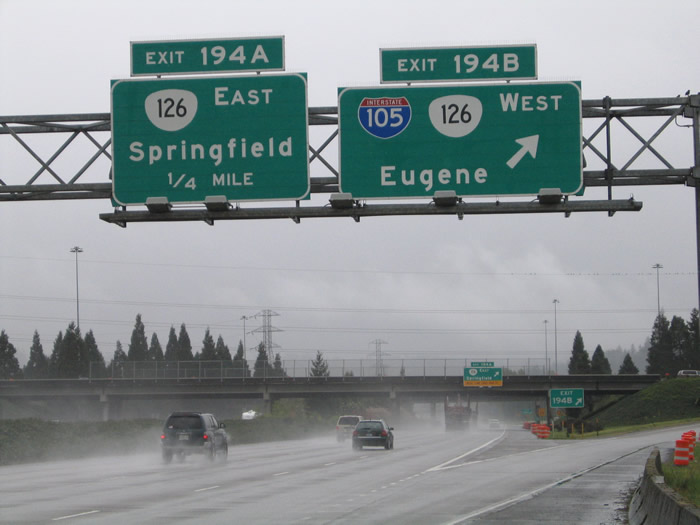
| Interstate 5 continues south to meet Interstate 105 west and OR 126 at Exits 194B/A. A directional cloverleaf interchange joins the two freeways. I-105 follows OR 126 west to Delta Highway (a north-south freeway in Eugene) and south across the Willamette River to Downtown Eugene. OR 126 replaced the route of U.S. 126 from U.S. 101 on the Oregon Coast east into the Cascade Range. OR 126 follows a freeway bypass of Springfield west to I-5 and I-105. The state highway leaves Downtown Eugene via Garfield Street and 11th Avenue en route to Florence. Shifting east to Springfield, the freeway continues to 52nd Street before transitioning into an at-grade highway at OR 126 Business (Main Street). OR 126 follows the McKenzie Highway east to U.S. 20 and Redmond (U.S. 97). 04/01/05 |
|
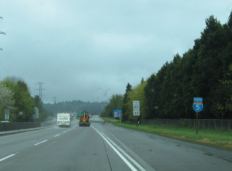
| Reassurance marker posted along Interstate 5 southbound after the interchange with Interstates 105 & OR 126. The four lane freeway approaches the Willamette River crossing at Alton Baker Park. 04/01/05 |
|
| The Willamette River Bridge previously paralleled an abandoned bridge section bypassed to the east. 04/01/05 |
|
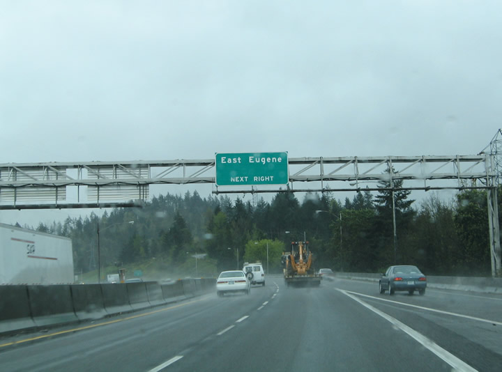
| Forthcoming Glenwood Boulevard travels northeast from Laurel Hill Drive to OR 126 Business (Franklin Boulevard) in eastern reaches of Eugene. The community of Glenwood lies between the city limits of Eugene and Springfield along Franklin Boulevard. 04/01/05 |
|
| Traffic interests to east Eugene can use Glenwood Boulevard north to OR 126 Business (Franklin Boulevard) west toward the central business district. 04/01/05 |
|
| Interstate 5 curves east at the folded diamond interchange (Exit 191) with Glenwood Boulevard. Areas of east Eugene mix between residential and industrial areas. OR 126 Business (Franklin Boulevard) passes underneath I-5 at the Willamette River en route to Downtown Springfield. 04/01/05 |
|
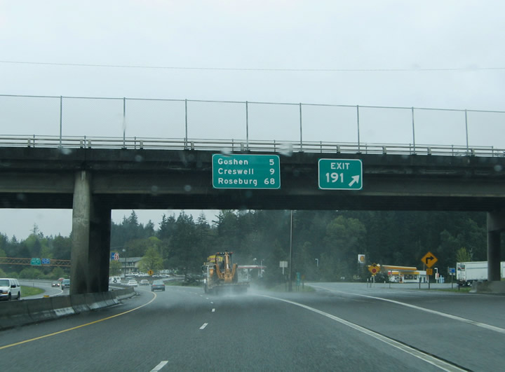
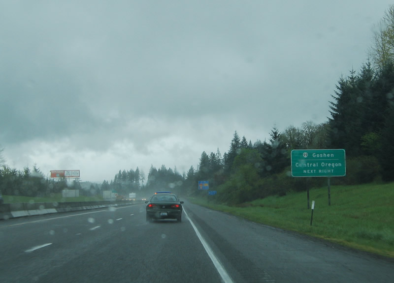
| Exit 191 leaves Interstate 5 southbound at the Glenwood Boulevard over crossing. OR 99 merges onto the freeway briefly between Franklin Boulevard and Goshen. A distance sign attached to the overpass lists the distances to Goshen and Creswell, two communities on the fringes of the Eugene metropolitan area, and Roseburg. 04/01/05 |
|
| Interstate 5 & OR 99 leave the city of Eugene and turn southward to Goshen, paralleling both Old U.S. 99 (Franklin Boulevard) and the Southern Pacific Railroad corridor. Franklin Boulevard splits from OR 126 Business at Glenwood. The ensuing exit is a split diamond interchange for 30th Avenue west. 04/01/05 |
|
| Exit 189 joins I-5 & OR 99 with McVay Highway just north of the intersection with 30th Avenue. McVay Highway splits from Franklin Boulevard to parallel the freeway southbound. 30th Avenue constitutes an expressway west from I-5 & OR 99 to Lane Community College and southeast Eugene. 04/01/05 |
|
| One and a half miles north of the trumpet interchange (Exit 188) with OR 58 (Willamette Highway) eastbound at the McVay Highway over crossing. OR 58 begins ahead and connects the Interstate 5 corridor with the U.S. 97 corridor east of Crescent Lake. 04/01/05 |
|
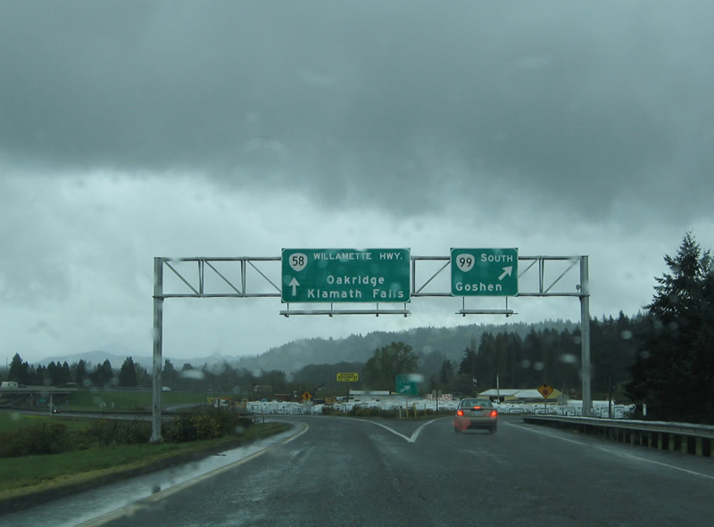
| Advancing south from the 30th Avenue overpass, I-5 & OR 99 continue one mile to the separation with OR 58 (Willamette Highway) at Exit 188A. Willamette Highway leads east to Oakridge, a town located within Willamette National Forest by Willamette Pass (elevation 5,128 feet) in the Cascade Range. 04/01/05 |
|
| OR 99 splits from Interstate 5 southbound at Exit 188A, rejoining the original U.S. 99 alignment through Goshen. OR 99 parallels the freeway west along the Goshen-Divide Highway to Creswell and Cottage Grove before converging with I-5 again. The Central Oregon reference here refers to the OR 58 connection to U.S. 97 between Bend and Klamath Falls. 04/01/05 |
|
| Interstate 5 passes over the Southern Pacific Railroad line and Franklin Boulevard (Old U.S. 99) ahead of the Exit 188A split with OR 99 south and OR 58 (Willamette Highway) east. Named the Willamette Highway because of the river it parallels, OR 58 leads east four miles to Pleasant Hill, 13 miles to Lowell, and 34 miles to Oakridge. 04/01/05 |
|
| Exit 188A leaves I-5 southbound for OR 58 east and 99 south. OR 58 ventures east to U.S. 97 near Crescent Lake east of Willamette Pass. OR 58, in conjunction with U.S. 97, carries travelers 165 miles southeast to Klamath Falls in southern Oregon. 04/01/05 |
|
| Exit 188A partitions into ramps for OR 58 (Willamette Highway) east and OR 99 south. OR 99 turns onto Old Willamette Highway west to its end at Franklin Boulevard (Old U.S. 99). 04/01/05 |
Page Updated 11-14-2005.

 South
South