|
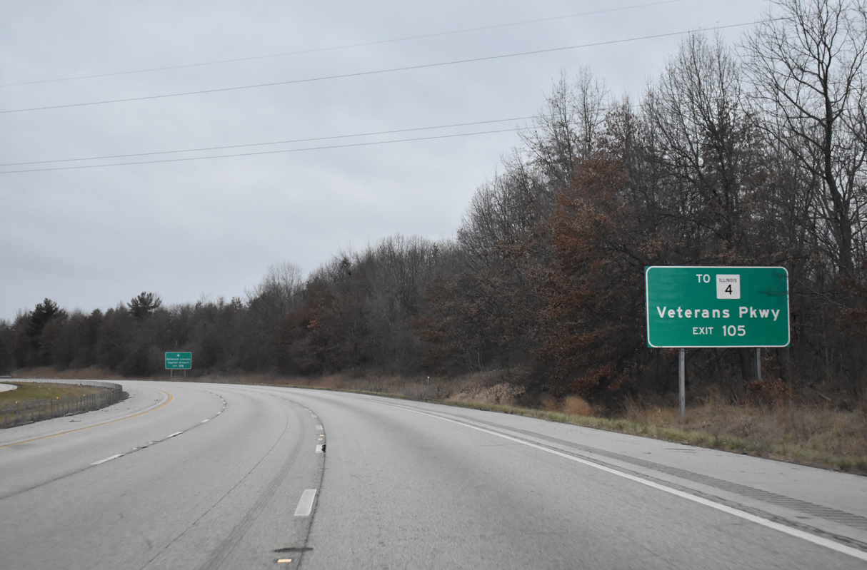
| Historic U.S. 66 emerges from Interstate 55 as the freeway arcs west to Exit 105, the first of six interchanges for the Illinois capital city. 12/31/23 |
|
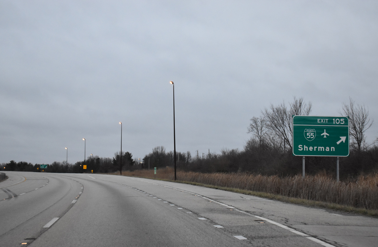
| Business Loop I-55 lines U.S. 66 south from Exit 105 through the village of Sherman. Points of interest for Exit 105 include the Illinois State Military Museum. 12/31/23 |
|
| A number of suburban style subdivisions lie between Interstate 55 and Business Loop I-55 (Historic U.S. 66) through Sherman as the freeway advances south into the greater Springfield area. A folded diamond interchange (Exit 105) joins I-55 with old U.S. 66, with the exception of the northbound on-ramp, which uses Historic U.S. 66 north to its overlap with I-55. 12/31/23 |
|
| Business Loop I-55 enters the city of Springfield south of the Sangamon River. Southwest from there, the business route splits with IL 4 (Veterans Parkway), an arterial style beltway encircling the west side of the city to Interstate 72. 12/31/23 |
|
| IL 4 (Veterans Parkway) west from Business Loop I-55 connects with IL 29 (J. David Jones Parkway) north to Abraham Lincoln Capital Airport (SPI). 12/31/23 |
|
| Wolf Creek Road spans I-55 by this Historic U.S. 66 trailblazer referencing Exit 105. Historic U.S. 66 follows all of Business Loop I-55 through Springfield. 12/31/23 |
|
| Exit 105 parts ways with Interstate 55 south for Business Loop I-55. 12/31/23 |
|
| A southbound rest area follows between I-55 and parallel Zimmerman Drive. 05/06/18 |
|
| The 12 mile long business loop from I-55 runs along the east side of Downtown Springfield, seven blocks from the State Capitol. 05/24/18 |
|
| The Railsplitter Rest Area lines I-55 southbound at milepost 104. 12/31/23 |
|
| Interstate 55 reduces from six to four overall lanes ahead of the Sangamon River at Sherman. 12/31/23 |
|
| The northbound Railsplitter Rest Area lies south of the Sangamon River. 12/31/23 |
|
| A pair bridges built in 1963 span the Sangamon River along Interstate 55. 12/31/23 |
|
| IL 54 angles southwest from Clinton and Mt. Pulaski to end at a cloverleaf interchange (Exits 100 B/A) joining Interstate 55 with Sangamon Avenue in two miles. 12/31/23 |
|
| Bissell Road spans Interstate 55 one mile north of Exit 100 B onto Sangamon Avenue west into Springfield. IL 54 follows part of old U.S. 54 leading northeast from Springfield to Onarga. U.S. 54 was truncated from the Windy City to a point west of Pittsfield as approved by AASHTO on June 21, 1971. 12/31/23 |
|
| Sangamon Avenue extends west from Exit 100B to become part of IL 29 between Dirksen Parkway (historic U.S. 66 Bypass) and Peoria Road at the Illinois State Fairgrounds. Exit 109 B leads to Benedictine University at Springfield and the Illinois war memorials as well. 12/31/23 |
|
| Exit 100 B departs I-55 south for Sangamon Avenue two miles ahead of Interstate 72. A loop ramp follows for IL 54 northeast to Riverton and Spaulding. 12/31/23 |
|
| IL 54 runs 117 miles to the northeast, reaching the DeWitt County seat of Clinton in 41 miles. 12/31/23 |
|
| Interstate 55 passes under a Norfolk Southern Railroad line beyond this confirming marker south of IL 54. 12/31/23 |
|
| Forthcoming Clear Lake Avenue (former IL 97) provides the most direct route to Downtown Springfield and the Illinois State Capitol. The capitol complex lies 3.5 miles west from Exit 98 B. 05/06/18 |
|
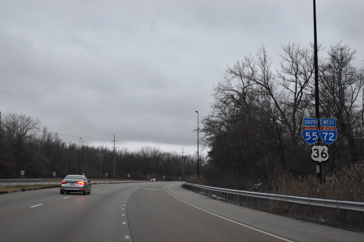
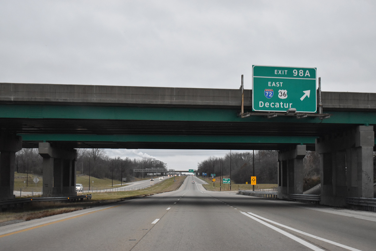
| I-72/U.S. 36 meet Interstate 55 south next as part of their overlap between Hannibal, Missouri and Decatur. Clear Lake Avenue (former IL 97 and old U.S. 36) ties into the exchange with I-72 east from the Springfield central business district. 12/31/23 |
|
| I-72 travels 179.29 miles overall from U.S. 61 in Hannibal east across central Illinois to the city of Champaign. 12/31/23 |
|
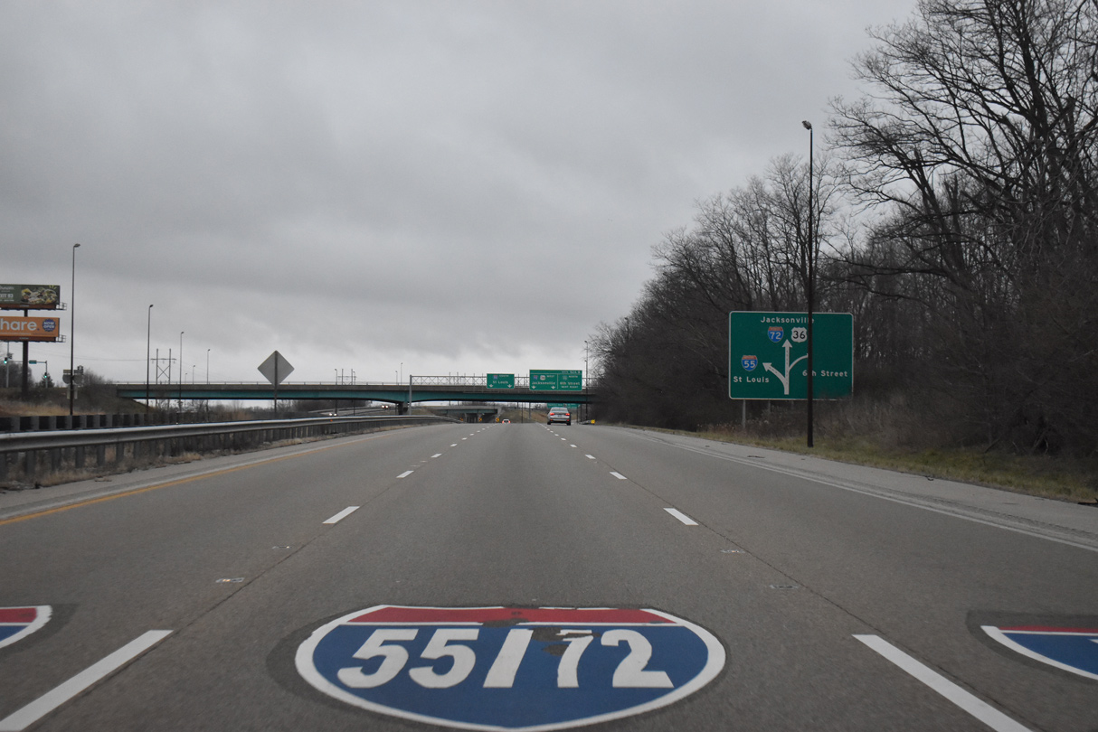
| Formerly a 110 mile long route toward Galesburg, IL 97 began at the cloverleaf interchange (Exits 98 B/A) with I-55/72. The state route was truncated east of Business Loop I-55 along the couplet of Madison / Jefferson Streets outside Downtown and from Clear Lake Avenue. 12/31/23 |
|
| Downtown Springfield hosts a bevy of historical sites including the Abraham Lincoln Presidential Museum and Library. IL 97 reaches the central business district beyond Historic U.S. 66 (Business I-55) in 2.4 miles. 12/31/23 |
|
| Southbound I-55 at Exit 98 B to Clear Lake Avenue (old IL 97) west. A loop ramp (Exit 98 A) follows onto I-72/U.S. 36 east. I-72 directly replaced U.S. 36 between Springfield and Decatur. The route was approved by AASHTO on June 23, 1969 between I-55 and Champaign. 12/31/23 |
|
| IL 29 parallels I-55/72 south along Dirksen Parkway to meet the pair at a cloverleaf interchange (Exit 94) one mile south from where they combine. 12/31/23 |
|
| I-72/U.S. 36 weave northeast from Springfield by the villages of Clear Lake and Riverton along a rural course extending east for 30 miles to the outskirts of Decatur. Old U.S. 36 parallels the freeway to the north. 12/31/23 |
|
| I-55 south and I-72 west overlap for 5.2 miles while encircling the southeast side of Springfield. I-72 was extended west from the capital city in 1995. 12/31/23 |
|
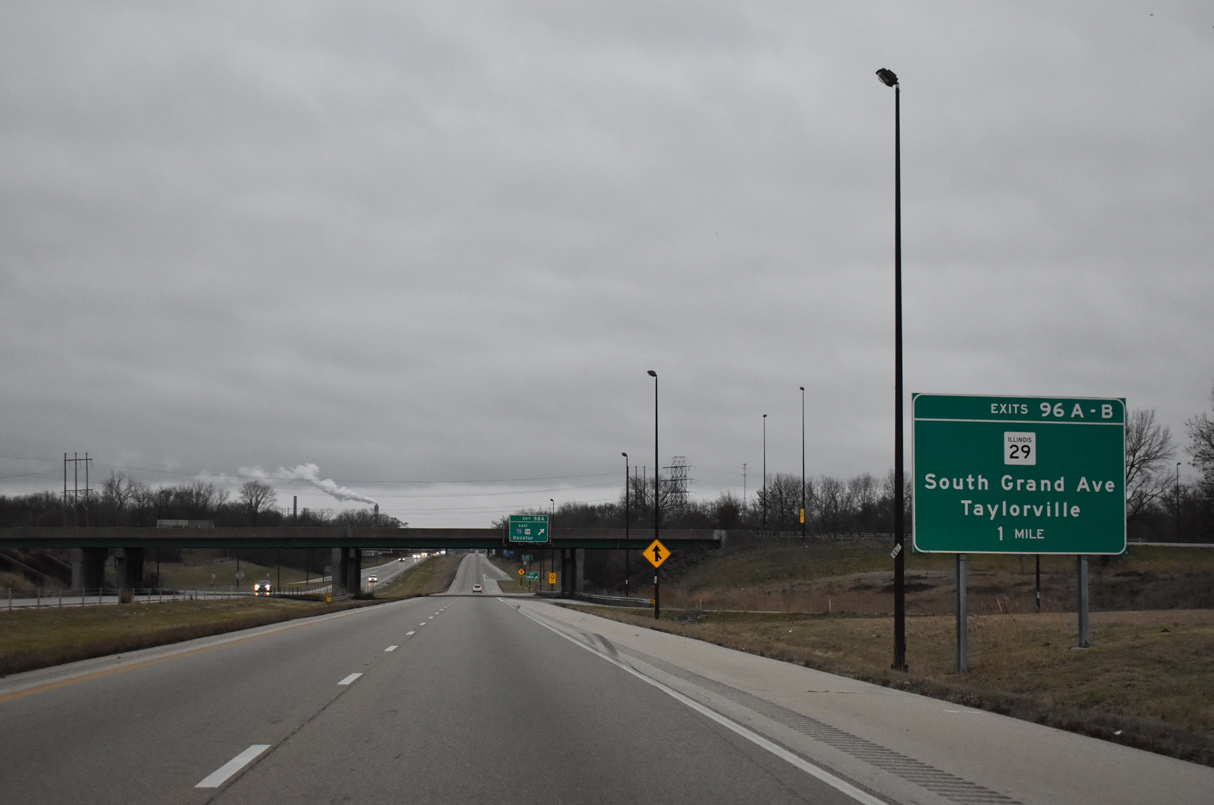
| One quarter mile north of Exit 96 B for IL 29 north along S Grand Avenue. E Cook Street passes overhead. 12/31/23 |
|
| S Grand Avenue extends west from IL 29 and Dirksen Parkway across the Springfield residential street grid to Washington Park. 12/31/23 |
|
| Leaving Springfield, IL 29 follows a four lane divided highway southeast to Rochester and the Christian County seat of Taylorsville. A 6.3 mile stretch of the route was expanded to include a bypass constructed around Edinburg between 2012-14. 12/31/23 |
|
| I-55-72/U.S. 36 continue south by Sugar Creek toward Spaulding Dam and Lake Springfield. 12/31/23 |
|
| A City Water, Light & Power (municipal utility for Springfield) plant comes into view along the east side of I-55/72 along adjacent Lake Springfield. 05/07/10 |
|
| Stevenson Drive east and Lake Shore Drive west come together at a folded diamond interchange (Exit 94) with I-55/72 west in one half mile. 12/31/23 |
|
| Stevenson Drive stems west from Exit 94 to Business Loop I-55 while Lake Shore Drive encircles Lake Springfield southward to Exit 88 with I-55.
I-72/U.S. 36 part ways with I-55 south in two miles at a wye interchange (Exit 92 A). 12/31/23 |
|
| I-55/72-U.S. 36 arc southwest by Lake Springfield and the Lake Springfield Estates neighborhood ahead of their separation. 12/31/23 |
|
| I-72/U.S. 36 run 30 miles west from Springfield to Jacksonville. The pair reach I-172 north to Quincy in 93 miles. 12/31/23 |
|
| Interests to Business Loop I-55 (6th Street) north back to Downtown Springfield initially take I-72 west from Exit 92 B to Exit 92 A. 12/31/23 |
|
| A CN Railroad line spans I-55/72-U.S. 36 south just ahead of their partition at Exit 92 B. 12/31/23 |
|
| The middle lane connects with both the continuation of I-55 south and I-72/U.S. 36 west. 12/31/23 |
|
| A diagrammatic sign precedes Exit 92 A for I-72/U.S. 36 west and Exit 92 A to 6th Street. Business Loop I-55 (Historic U.S. 66) south ends at a subsequent wye interchange beyond the cloverleaf with Interstate 72. 12/31/23 |
|
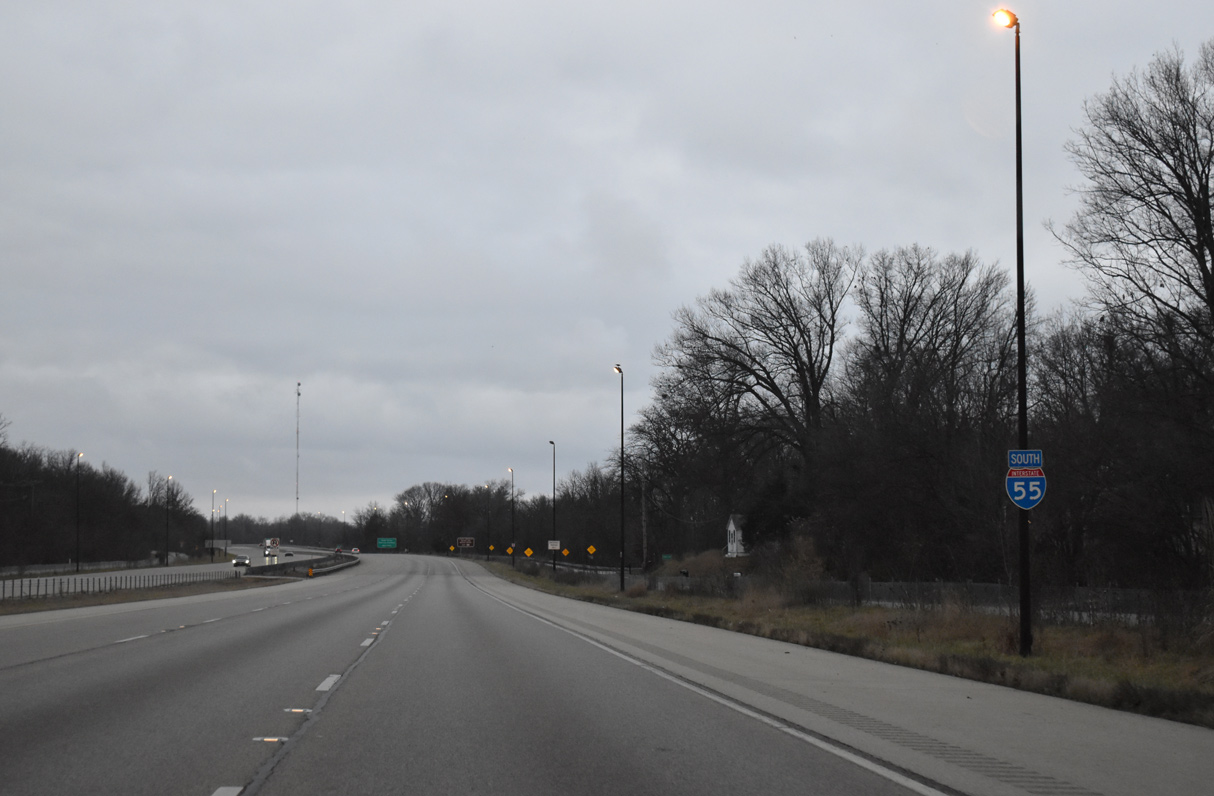
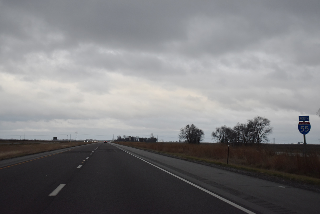
| Two lanes continue southward along Interstate 55 for Edwardsville, Collinsville and St. Louis, Missouri. Exit 92 B branches west with two lanes as well for I-72/U.S. 36 (Central Illinois Expressway) across the suburban south side of Springfield. 12/31/23 |
|
| Looking at the departing Exit 92 A for Business Loop I-55 (Historic U.S. 66) north to Southern View and Downtown Springfield. Another three exits line I-72/U.S. 36 for the capital city ahead of the rural drive to Jacksonville. 12/31/23 |
|
| Traffic from Business Loop I-55 (6th Street) merges with Interstate 55 south ahead of the Southwind Road underpass. 12/31/23 |
|
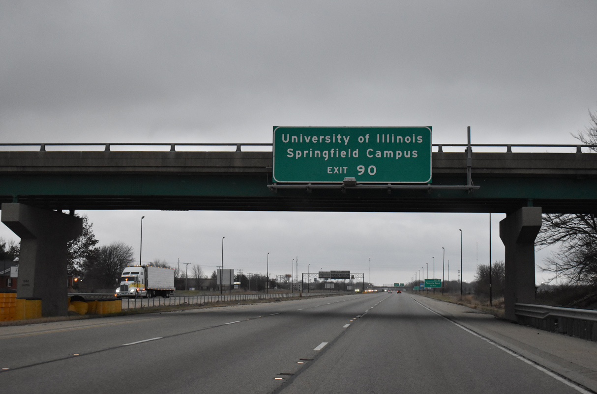
| A diamond interchange (Exit 90) connects I-55 south with Toronto Road next in one mile. 12/31/23 |
|
| Toronto Road connects the freeway with the University of Illinois at Springfield campus to the east and with Woodside Road to the west. 12/31/23 |
|
| Toronto Road intersects Cotton Hill Road, the second historic alignment of U.S. 66, 0.63 miles east of Exit 90. The original route for U.S. 66 followed mostly what is now IL 4 southwest from Chatham to Carlinville. 12/31/23 |
|
| Exit 90 departs I-55 south for Toronto Road. Toronto Road west becomes Woodside Road in 1.14 miles. Woodside Road overlaps a short portion of Historic U.S. 66 by Old Chatham Road. 12/31/23 |
|
| Interstate 55 and the service roads of Canadian Cross Drive and 6th Street Frontage Road continue south toward Lake Springfield. I-55 directly replaced the final alignment of U.S. 66 across the man made reservoir. 12/31/23 |
|
| Striped for six lanes, the bridges over Lake Springfield include shoulders on both sides and decorative lighting. The southbound span was replaced in 2001, followed by the northbound bridge a year later. 12/31/23 |
|
| Leaving Lake Springfield, Interstate 55 quickly enters the parclo interchange with E Lake Shore Drive and Palm Road south. 12/31/23 |
|
| Palm Road represents Historic U.S. 66 from adjacent Waters Edge Boulevard south to Glenarm. Chatham Road stems west from the frontage road to become Walnut Street in nearby Chatham. 12/31/23 |
|
| E Lake Shore Drive encircles Lake Springfield east and north from Exit 88 to I-55 at Exit 94 and Adlai Stevenson Drive. A portion of the road was the second route of U.S. 66 at East Cotton Hill Park. 12/31/23 |
|
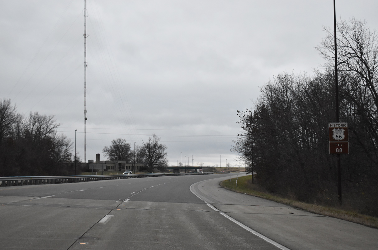
| Interstate 55 navigates through an S-curve southwest from Exit 88 to directly overlay the four lane portion of U.S. 66 that extends south toward Litchfield. Palm Road, along the west side of the freeway, remains as a drivable portion of Historic U.S. 66 to Douglas Street in Glenarm. 12/31/23 |
|
| The succeeding exit on I-55 south is for IL 104 in six miles. East St. Louis follows in 86 miles ahead of Downtown St. Louis in 89 miles. 12/31/23 |
|
| Nearing the settlement of Glenarm, Interstate 55 spans a Chicago & Illinois Midland Railroad line within a mile of Exit 83. 12/31/23 |
|
| A diamond interchange joins I-55 with Old Route 66 on the south side of Glenarm. The second alignment of U.S. 66 enters from the northeast to combine with the third alignment via Frazee Road. Adjacent Burtle Lane here was the original U.S. 66 into Glenarm. Construction of I-55 made that portion discontinuous. 12/31/23 |
|
| Exit 83 leaves Interstate 55 south, 1.75 miles north of the folded diamond interchange (Exit 82) with IL 104. Historic U.S. 66 remains along the west side of the freeway via Frazee Road to IL 104 at Cimic. 05/06/18 |
|
| Upcoming IL 104 connects Interstate 55 with Sangchris Lake State Park, located 14 miles to the east in Christian County. 12/31/23 |
|
| IL 104 overall travels 106 miles from Quincy to the west and Taylorville to the east. 12/31/23 |
|
| Interstate 55 reduces from six to four overall lanes south of Exit 82. IL 104 runs six miles west to Auburn, where the original U.S. 66 passes through between Virden and Chatham. Eastward, IL 104 reaches Pawnee in three miles. 12/31/23 |
|
| Confirming marker for I-55 south posted after the Illinois & Midland Railroad and IL 104 under crossing. Brush Creek Road appears ahead as a discontinuous section of Historic U.S. 66 spurring north from Ping Road. 12/31/23 |
|
| Three bridges span Brush Creek at this guide sign for Exit 80 / Divernon. The I-55 mainline utilizes bridges built in 1972 while Brush Creek Road dates from 1949 as Historic U.S. 66. 12/31/23 |
|
| A diamond interchange (Exit 80) joins Interstate 55 with Brown Street at Divernon. Brown Street becomes Divernon Road beyond the village limits to adjacent farm land as Historic U.S. 66 resumes along Reichert Road on the west side of I-55. 12/31/23 |
|
| Interstate 55 and parallel Historic U.S. 66 continue three miles south from Divernon to the Montgomery County line. 12/31/23 |
Page Updated 01-08-2024.

 South
South


 West
West