|
| Longdale Furnace Road (SR 632) parallels I-64/U.S. 60 along Wilson Mountain to the south as the former US highway alignment. 09/23/14 |
|
| SR 269 east overtakes Longdale Furnace Road from SR 632 just south of the diamond interchange at Exit 29, southeast to Longdale Furnace and Exit 35. The 6.8 mile long state route follows former U.S. 60. 09/23/14 |
|
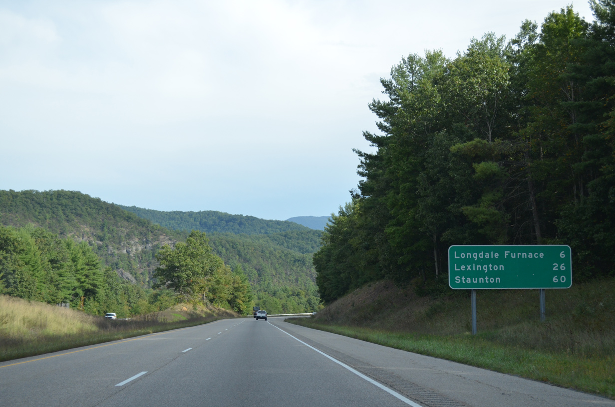
| SR 42 comprises a segmented route stretching 207 miles overall from SR 91 at Broadford to U.S. 11 in Woodstock. SR 42 ventures north from Exit 29 along the Cowpasture River to Millboro Springs and east through Panther Gap to Goshen. 09/23/14 |
|
| Curving south, I-64/U.S. 60 encircle Mill Mountain over the next several miles. 09/23/14 |
|
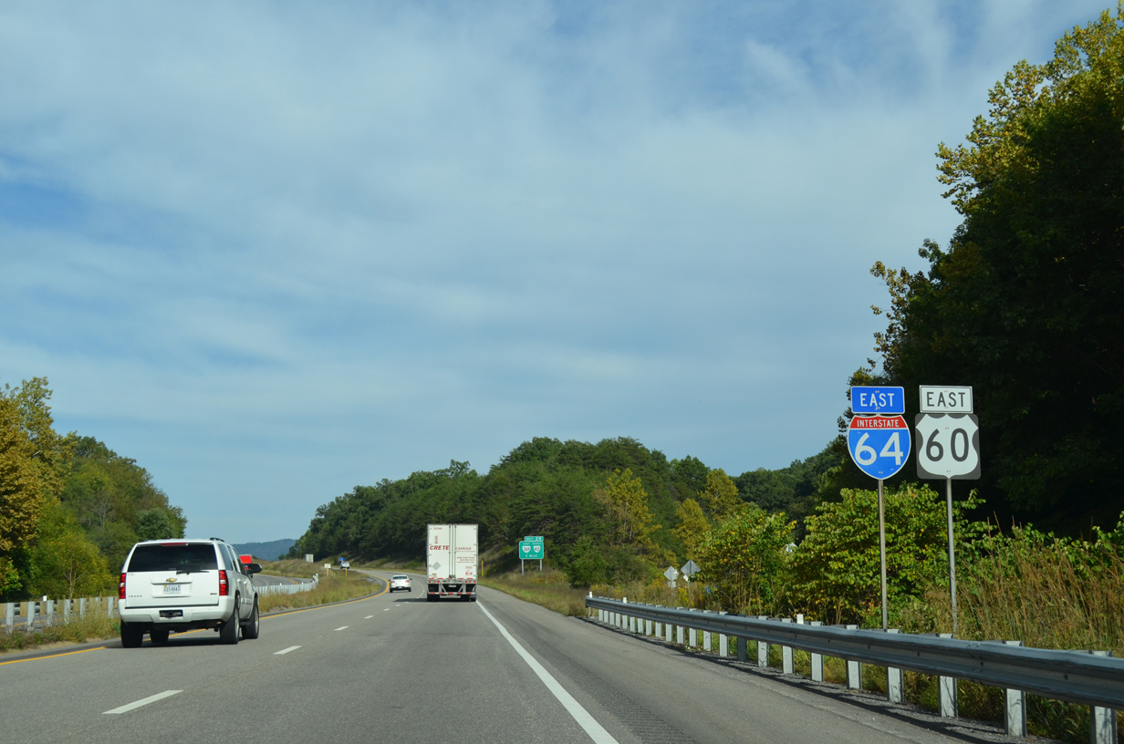
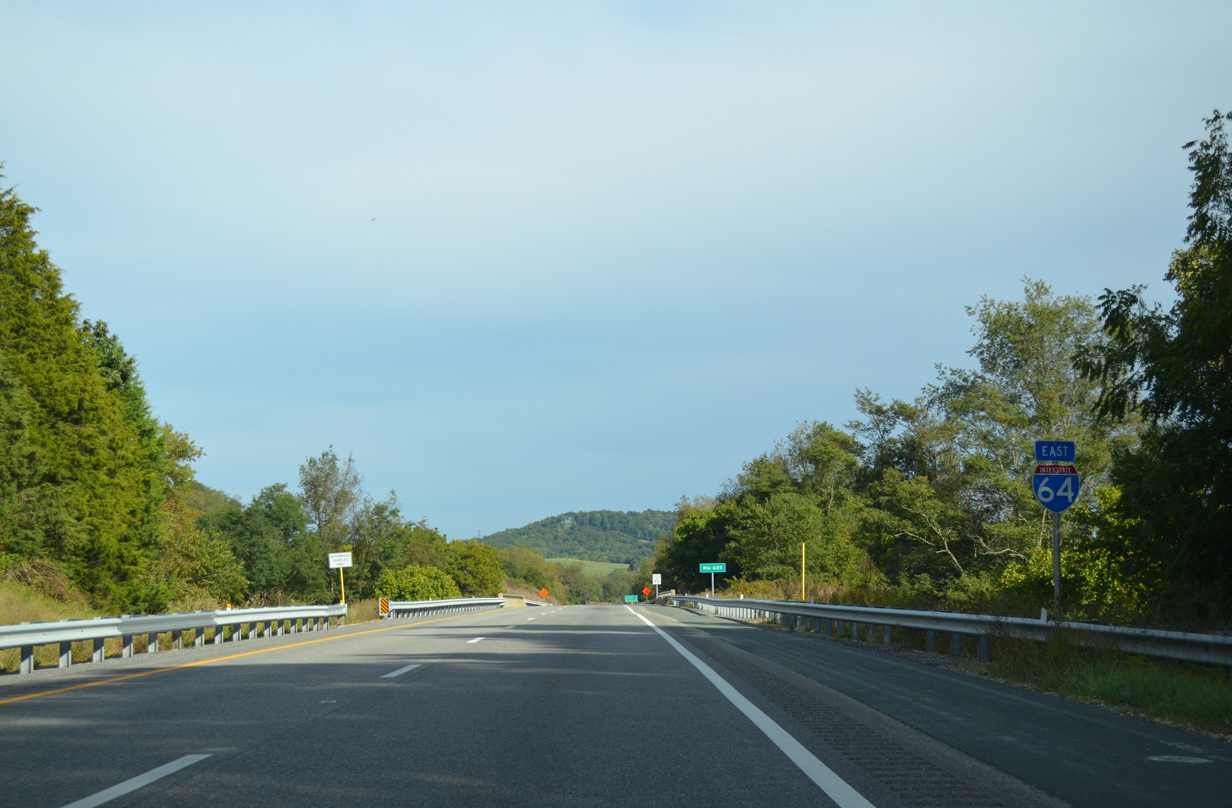
| Interstate 64 continues another 26 miles east to Lexington, near where it merges with I-81 north to Staunton. 09/23/14 |
|
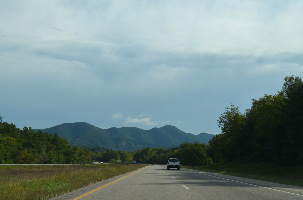
| Facing south ahead of Anthony Knobs (el. 2,398 ft) and Sandbank Mountain (el. 3,205 ft) along I-64/U.S. 60 east. 09/23/14 |
|
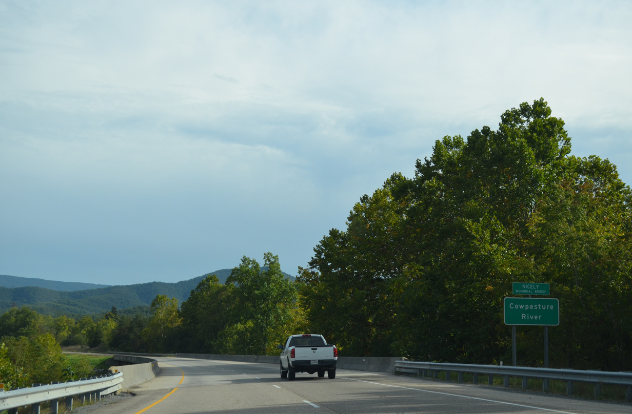
| Spanning the Cowpasture River, the 84.4 mile long chief tributary of the James River, on Interstate 64 east. This bridge was dedicated as the Nicely Memorial Bridge by Virginia legislature on April 4, 2006. 09/23/14 |
|
| A truck rest area along I-64/U.S. 60 east lies south of Mill Mountain in one mile. 09/23/14 |
|
| North Mountain spreads along the southeastern horizon by the eastbound truck rest area. The companion westbound rest area was closed. 09/23/14 |
|
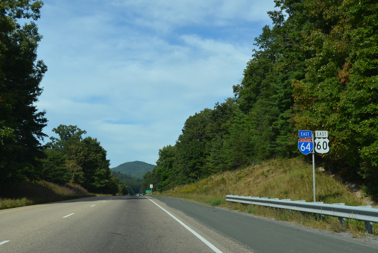
| SR 269 (Longdale Furnace Road) returns to I-64/U.S. 60 at a diamond interchange (Exit 35) in one mile. 09/23/14 |
|
| SR 269 heads west from Exit 35 to the nearby settlement of Longdale Furnace while SR 850 continues the old alignment of U.S. 60 (Mountain Road) east to Kerrs Creek. 09/23/14 |
|
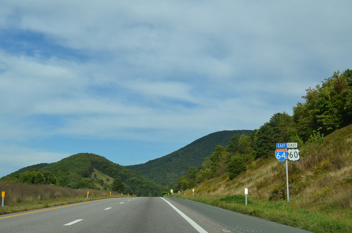
| I-64/U.S. 60 run northeast alongside Simpson Creek through a valley between Mill and North Mountains. 09/23/14 |
|
| Travelers on I-64 reach Lexington in 20 miles, Staunton in 55 miles and Richmond in 155 miles. Previous distance signage indicated a 101 mile separation between Staunton and the capital city. 09/23/14 |
|
| SR 850 (old U.S. 60) remains west of the adjacent Simpson Creek along a winding course through a series of hair pin turns. 09/23/14 |
|
| Only 7,400 vehicles per day (vpd) were recorded along the rural stretch of I-64/U.S. 60 between Exit 35 and 43 in 2013. 09/23/14 |
|
| I-64/U.S. 60 cross the Rockbridge County line through a gap between Brushy and North Mountain. 09/23/14 |
|
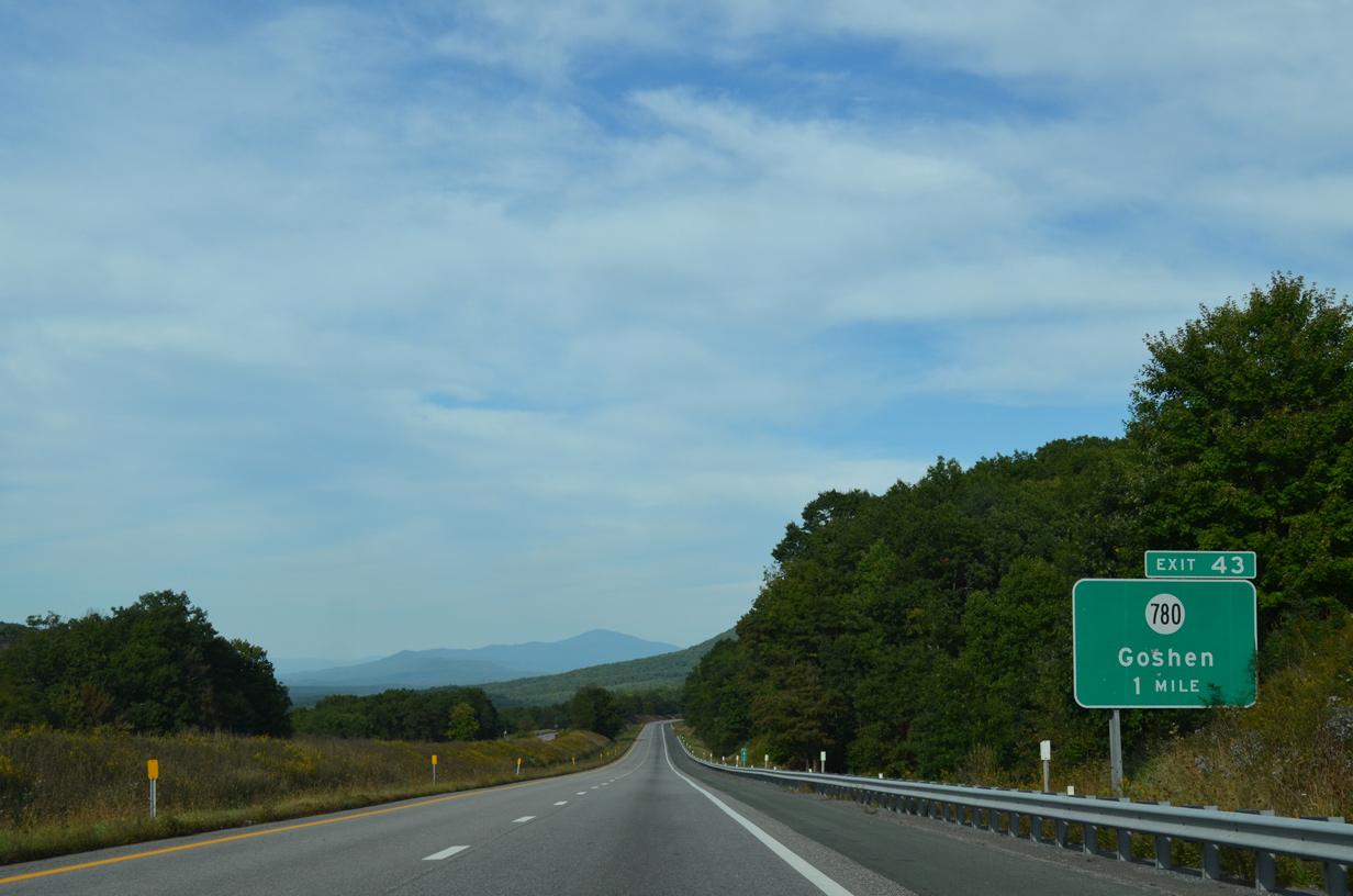
| A short distance east of the Alleghany County line is a diamond interchange (Exit 43) joining I-64/U.S. 60 with SR 780 (Scenic Drive). 09/23/14 |
|
| Scenic Drive meanders southwest along the western slopes of North Mountain from Exit 43. SR 780 shares an implied overlap with SR 850 (Midland Trail / old U.S. 60) west to a northward alignment to the settlement of California and SR 39 outside Goshen. 09/23/14 |
|
| SR 850 (Midland Trail) takes a hairpin turn south from I-64/U.S. 60 to Denmark as the freeway stays north by Dale Mountain (el. 3,251 ft). 09/23/14 |
|
| Lexington is just a 13 mile drive to the southeast via Interstate 64. Staunton and Richmond are 48 and 148 miles away respectively. 09/23/14 |
|
| The Blue Ridge Mountains spread into view as I-64/U.S. 60 descend toward the SR 629 (White Rock Road) overpass. 09/23/14 |
|
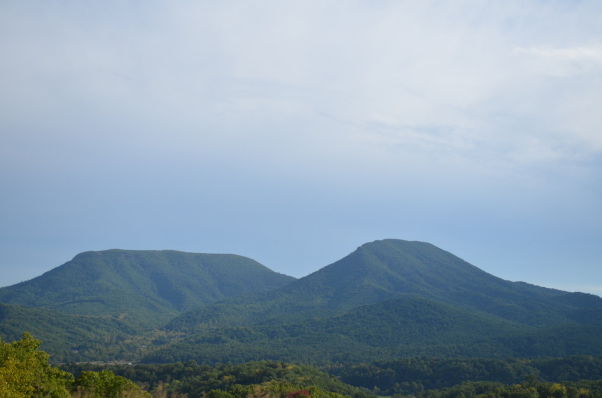
| Looking south, Big House Mountain (el. 3,645 ft) and Little House Mountain (el. 3,386 ft) rise prominently. 09/23/14 |
|
| A lengthy straight away takes I-64/U.S. 60 east into agricultural areas north of Kerrs Creek and west of Adair Hill (el. 1,706 ft). 09/23/14 |
|
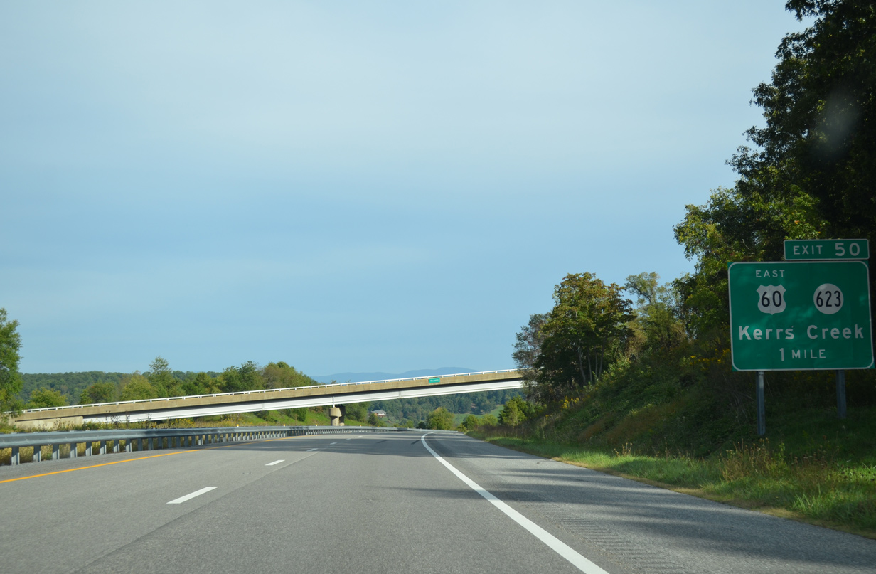
| Sycamore Valley Drive (SR 627) crosses over I-64/U.S. 60 one mile ahead of their separation at the diamond interchange (Exit 50) with Fredericksburg Road. 09/23/14 |
|
| U.S. 60 branches southwest from Interstate 64 along Fredericksburg Road to rejoin Midland Trail (SR 850) near Kerrs Creek. Midland Trail carries the route southeast into Lexington. 09/23/14 |
|
| SR 623 extends Fredericksburg Road north from Exit 50 and U.S. 60 to SR 621 at the settlement of Fredericksburg. SR 621 continues the drive north to SR 39 near Rockbridge Baths. 09/23/14 |
|
| Interstate 64 remains parallel to Kerr Creek on the southeasterly course toward Lexington. 09/23/14 |
|
| Lexington is an independent city south of Interstate 64 at the cross roads of U.S. 11/60 while Staunton is 40 miles to the northeast. 09/23/14 |
|
| Kerrs Creek flows southward into the Maury River below a pair of 845 foot long bridges carrying I-64. The 43-foot wide spans were designed in 1969 and constructed in 1976. A $15.5 million project rehabilitated the two bridges with deck replacement, reconstruction of the abutments and repairing of the structural steel support frames.1 Work ran from Spring 2014 through Fall 2016. 09/23/14 |
|
| The Maury River flows 42.8 miles wholly within Rockbridge County from near Lake Merriweather south to Glasgow. 09/23/14 |
|
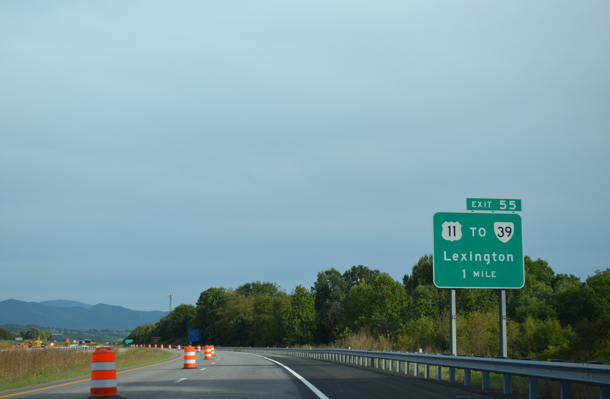
| U.S. 11 (Lee Highway) joins I-64 with the east end of SR 39 (Maury River Road) near Exit 55 at East Lexington.
Construction of I-64 severed the original alignment of SR 39 along Greenhouse Road to the west, resulting in a realignment along adjacent Maury River Road. MSR 39 is 164 mile long route from U.S. 11 west to Goshen, Warm Springs and Gauley Bridge, West Virginia. 09/23/14 |
|
| The first sign for Interstate 81 appears as Exit 55 departs I-64 east for U.S. 11 (Lee Highway) south into Lexington and north to SR 39. U.S. 11 parallels I-81 south to Bristol and eastern Tennessee and north to Winchester and Harrisburg, Pennsylvania. 09/23/14 |
|
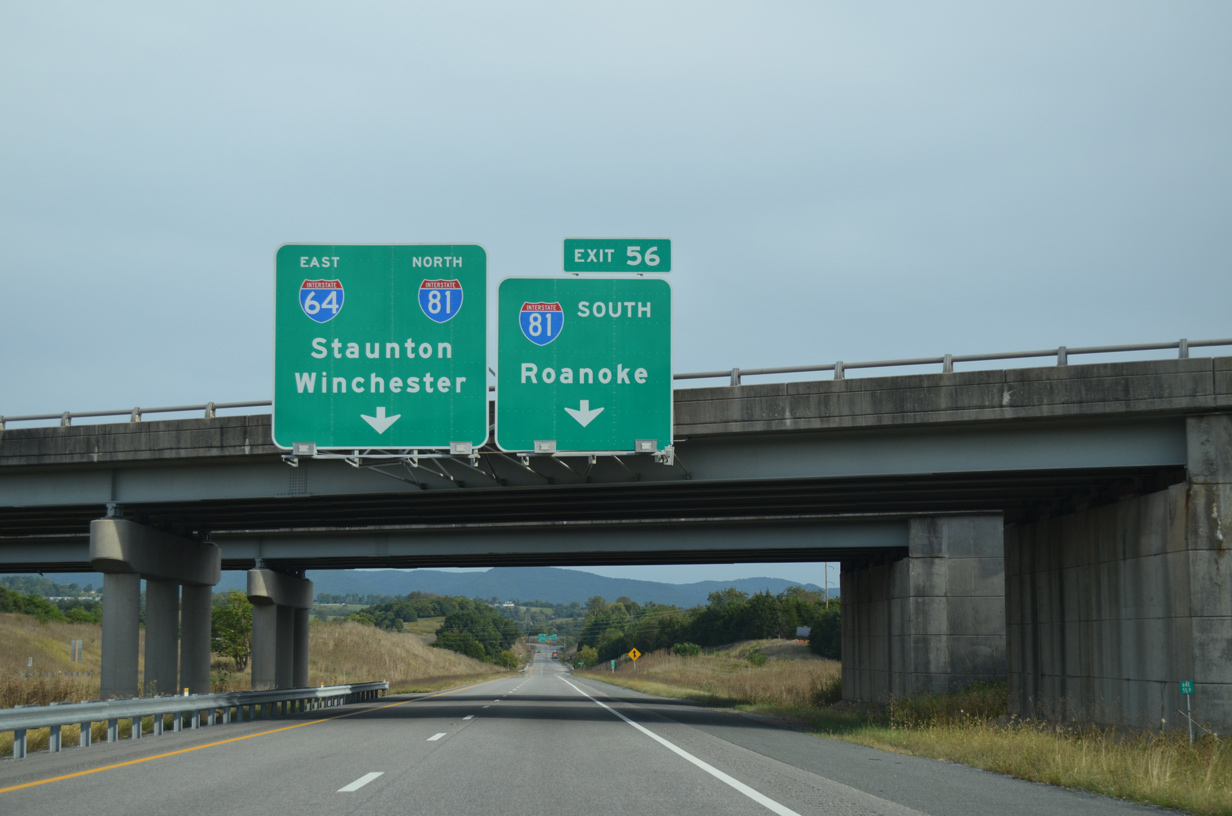
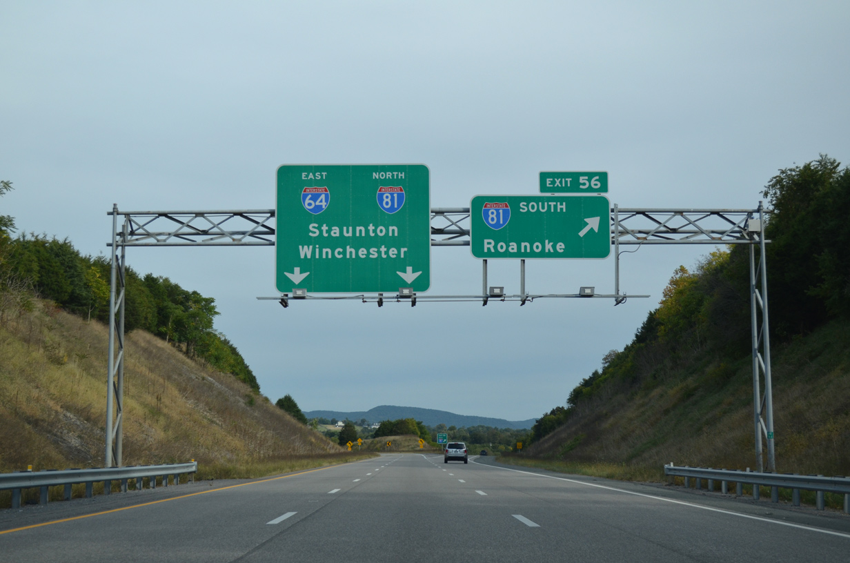
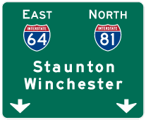
| The directional T interchange (Exit 56) with Interstate 81 lies 0.7 miles beyond the U.S. 11 (Lee Highway) overpass. 09/23/14 |
|
| I-64 east / I-81 north combine for 30.40 miles toward Staunton. Interstate 81 south continues 50 miles to Roanoke.
I-81 stretches 325 miles statewide as a busy trucking corridor between Bristol and Winchester. 09/23/14 |
|
| Turning northward onto I-81 from I-64 east at Exit 56. Travelers joining the southbound freeway next meet U.S. 60 outside of Lexington and Buena Vista. 09/23/14 |
Page Updated 04-18-2010.


 East
East