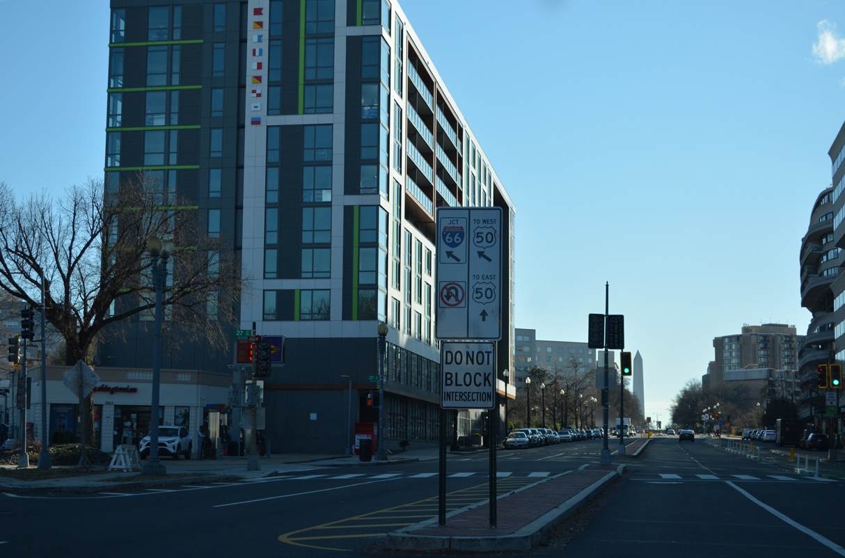
Just barely entering the city of Washington, Interstate 66 concludes the relatively short route in the District of Columbia at U.S. 29 near George Washington University. I-66 enters the city across the Theodore Roosevelt Memorial Bridge alongside U.S. 50 before turning northward along the Potomac River Freeway. The east end of I-66 ties into K Street east and the Whitehurst Freeway west. Exits are unnumbered for I-66 in the Nation's Capital.
I-66 was originally planned to continue east from the Whitehurst Freeway through a tunnel along K Street (North Leg Freeway). The North Leg Freeway would have extended I-66 east to an end at I-95 (Center Leg Freeway), a short distance north of where I-395 concludes at New York Avenue (U.S. 50). Provisions in the 1960s were made at the interchange with the Whitehurst Freeway for the North Leg Freeway. The unused ramps were later demolished when the Whitehurst was reconstructed in the late 1990s.1
Interstate 66 utilizes a 0.9 mile portion of the West Leg Freeway, a component of the Washington Inner Loop system planned in 1955.1 The West Leg was to tie into the South Leg Freeway (I-695) running southeast by the Tidal Basin to the ramps connecting Maine Avenue and I-395 (Southwest Freeway). Directional ramps with Ohio Drive remain from the South Leg Freeway plan.
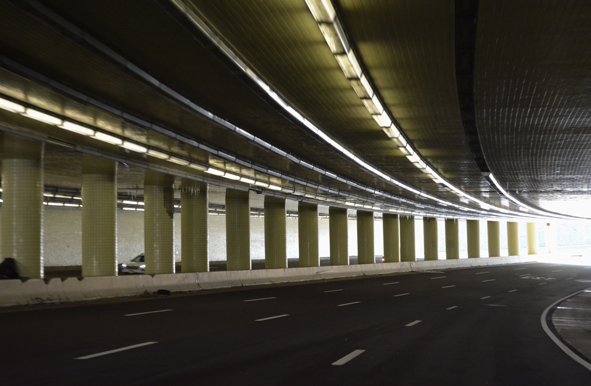
Work commenced on the Potomac River Freeway section of I-66 in 1960. The Roosevelt Bridge opened in June 1964, but with ramps just to Constitution Avenue (U.S. 50). Progress along I-66 to the north followed with a July 1965 opening to the E Street Expressway. Further work completed by late 1965 included the cut and cover tunnel below Virginia and New Hampshire Avenues to the east of the Watergate Complex.1
|
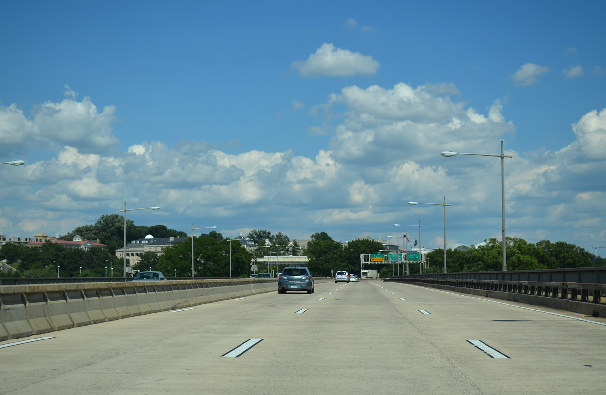
| Interstate 66 curves eastward over George Washington Parkway and combines with U.S. 50 at the Little River, just beyond the D.C. line. I-66/U.S. 50 span the Potomac River across the Theodore Roosevelt Bridge. 08/04/13 |
|
| I-66/U.S. 50 overlap for 0.4 miles across the Theodore Roosevelt Bridge. U.S. 50 shifts east from the bridge end onto Constitution Avenue NW to the National Mall and Downtown. I-66 continues northward onto the Potomac River Freeway through Foggy Bottom. 08/04/13 |
|
| Opened in June 1964, the Theordore Roosevelt Bridge is seven lanes wide, with a reversible median that can be adjusted to accommodate heavier flows in each direction. 08/04/13 |
|
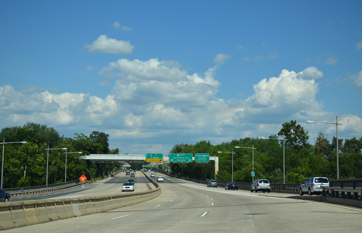
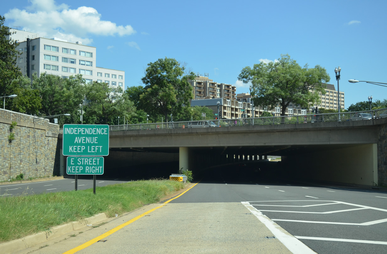
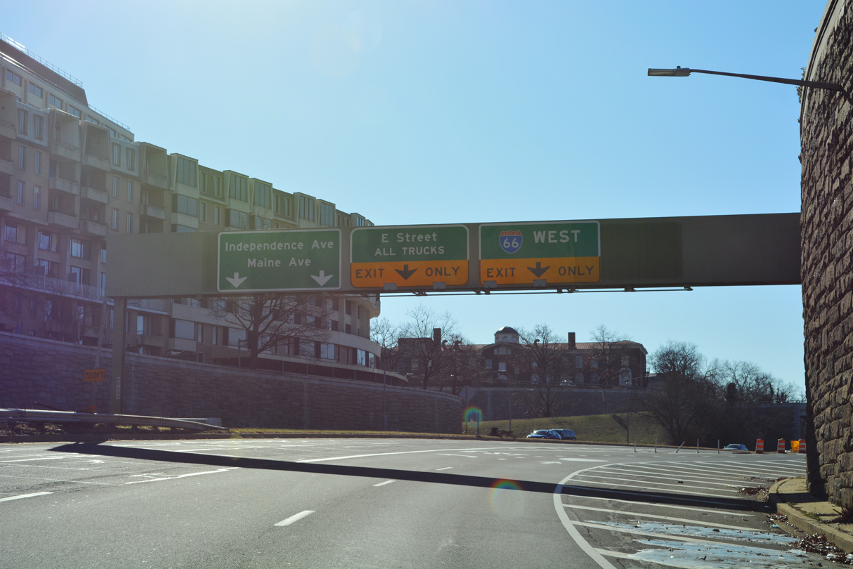
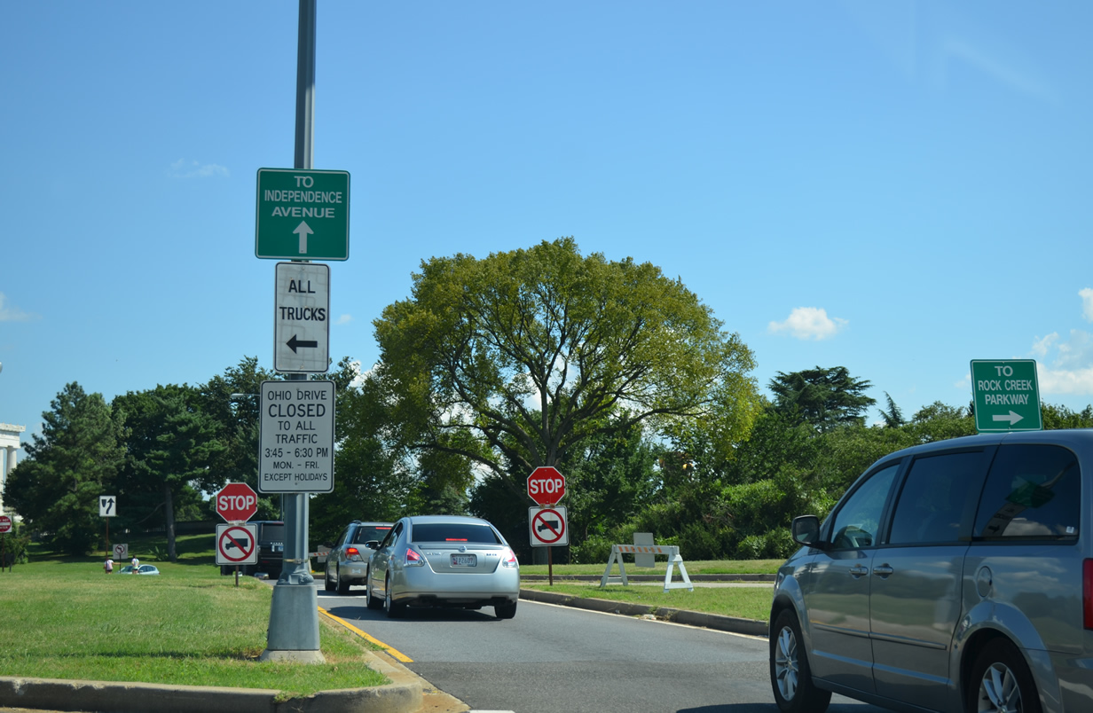
| A separate exit from U.S. 50 departs from I-66 east to the south end of the Potomac River Freeway at Rock Creek and Potomac Parkway NW and Ohio Drive south. Independence Avenue extends east from Ohio Drive, beyond the Lincoln Memorial, along the south side of the National Mall. 08/04/13 |
|
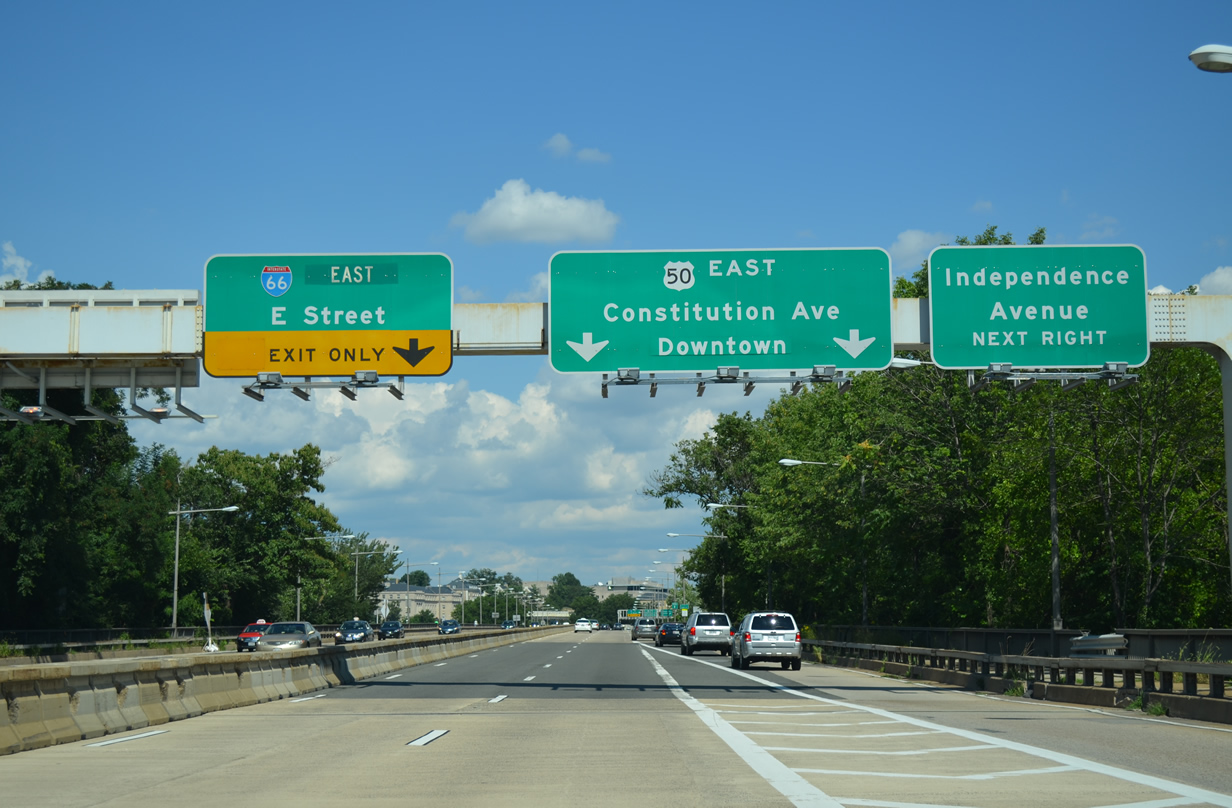
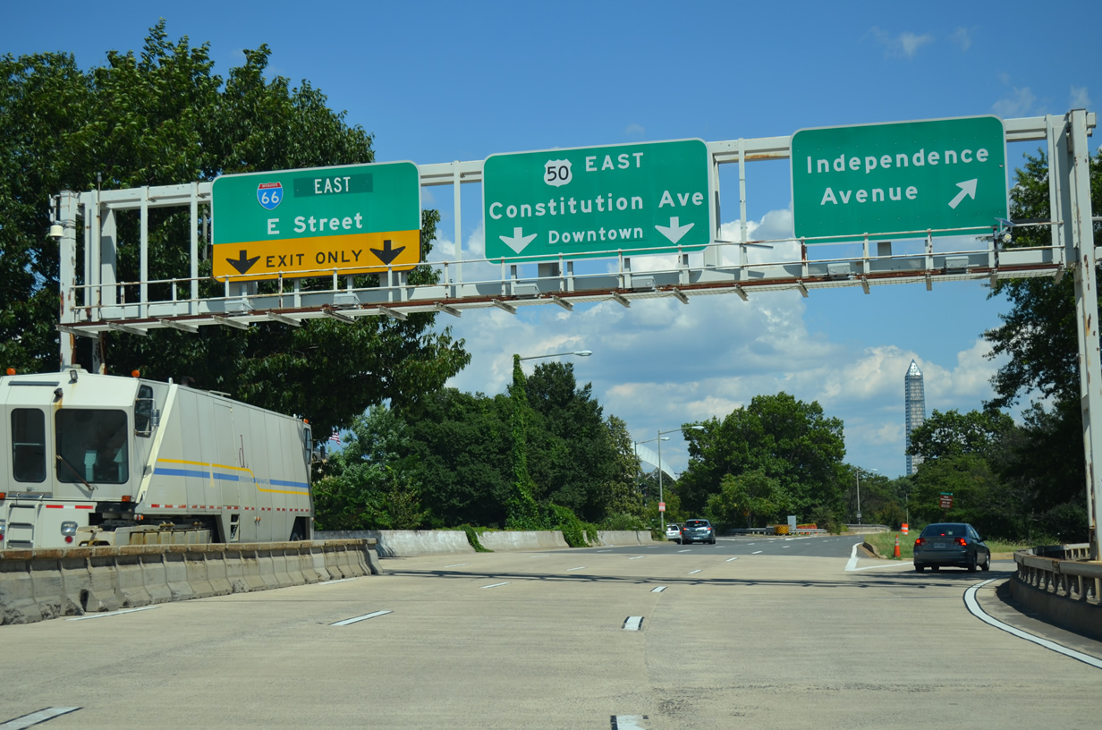
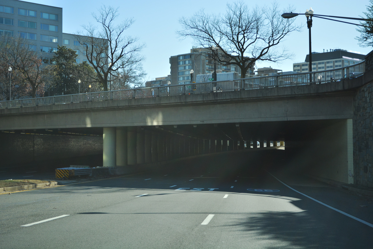
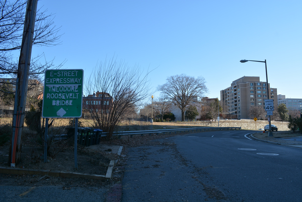
| Eastbound Interstate 66 joins the Potomac River Freeway north, a short freeway that was intended to be a much longer route (part of which was proposed as I-70S). The exit for the E Street Expressway east to Foggy Bottom quickly follows at the U.S. 50 westbound overpass. 08/04/13 |
|
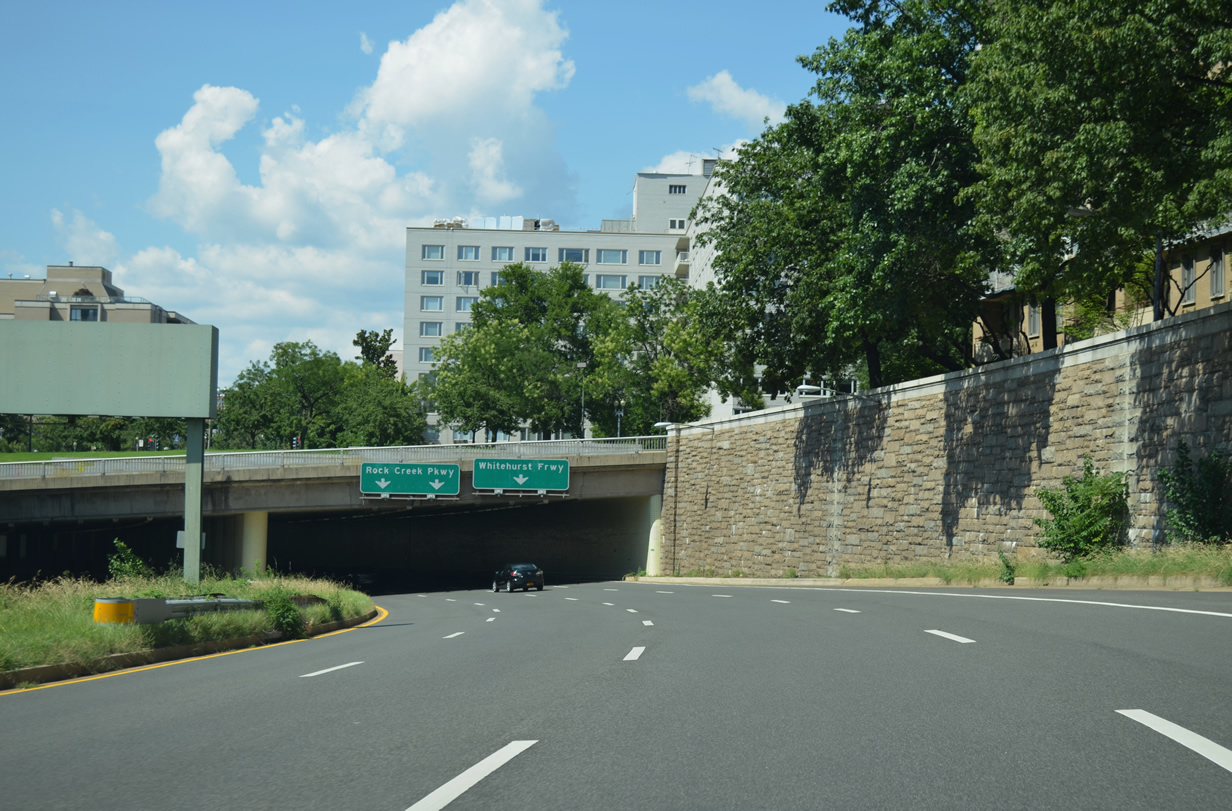
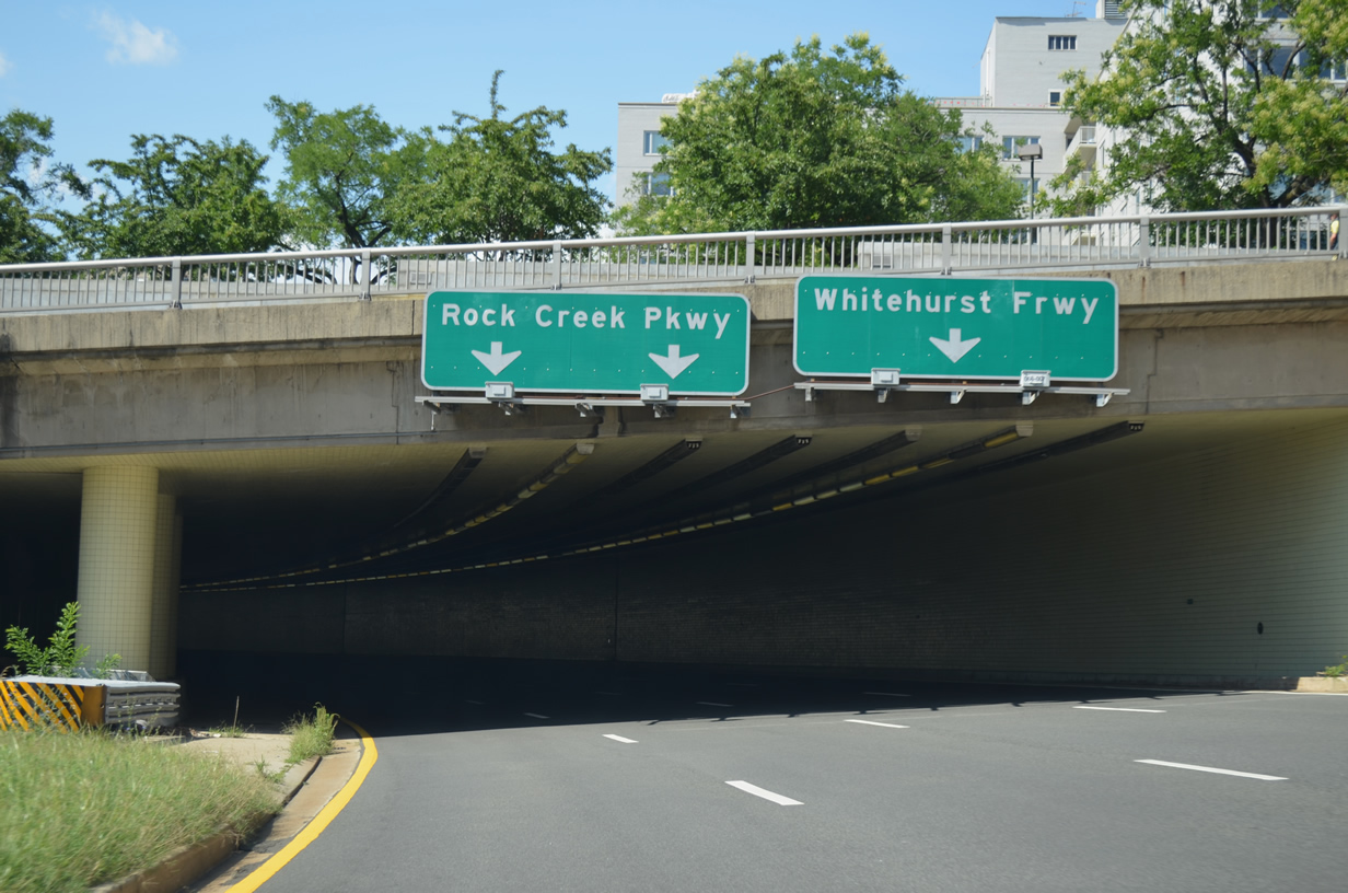
| Interstate 66 (Potomac River Freeway) advances north from the directional T interchange with the E Street Expressway a quarter mile to the left exit for Rock Creek and Potomac Parkway via 27th Street NW. 08/04/13 |
|
| The entrance ramp from E Street west joins I-66 (Potomac River Freeway) eastbound ahead of a cut and cover tunnel below New Hampshire and Virginia Avenues. 08/04/13 |
|
| Rock Creek and Potomac Parkway extends north from below the exchange joining I-66 and U.S. 29 (K Street) along Rock Creek through Kalorama Heights and Adams-Morgan en route to Connecticut Avenue NW. 08/04/13 |
|
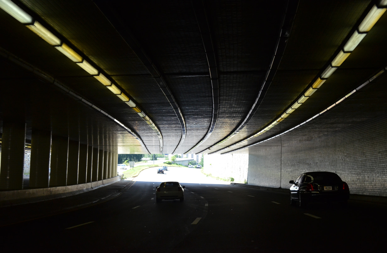
| Interstate 66 passes below the Watergate Complex area through. This stretch of freeway opened last in December 1965. 08/04/13 |
|
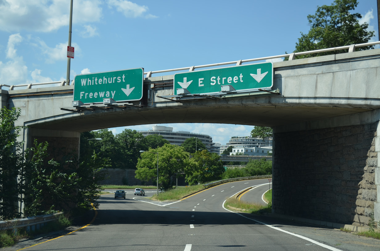
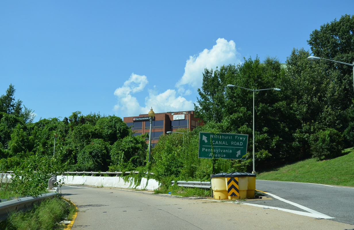
| Beyond the two lane exit to 27th Street NW, Interstate 66 east partitions into ramps for U.S. 29 (Whitehurst Freeway) south to Georgetown and L Street east to Pennsylvania Avenue. 08/04/13 |
|
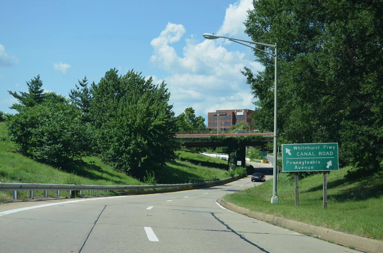
| Pennsylvania Avenue leads southeast from L Street nearby to U.S. 29 north / K Street, Washington Circle, George Washington University and the White House. U.S. 29 follows the elevated Whitehurst Freeway west to the Francis Scott Key Bridge at Canal Road west / M Street east. 08/04/13 |
|
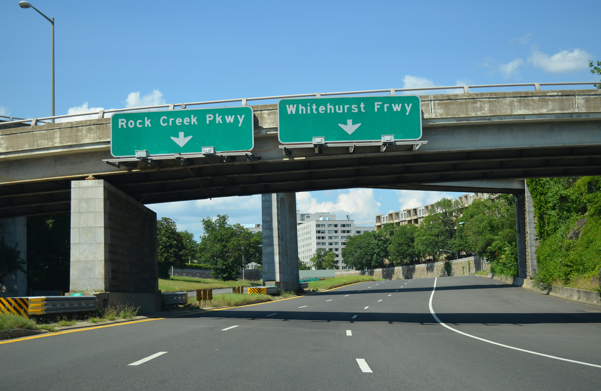
| Interstate 66 west begins along a flyover from U.S. 29 (Whitehurst Freeway) north across Rock Creek, Rock Creek and Potomac Parkway and 27th Street NW. Substandard guide signs reference the two D.C. exits from I-66 along the Potomac River Freeway. 08/04/13 |
|
| Westbound Interstate 66 expands to four lanes beyond the entrance ramp from I Street NW. 12/27/22 |
|
| Interstate 66 passes through a cut and cover tunnel below the traffic circle joining Virginia and New Hampshire Avenues. 12/27/22, 08/04/13 |
|
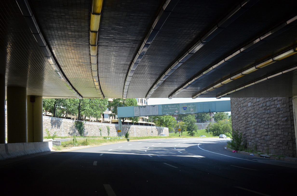
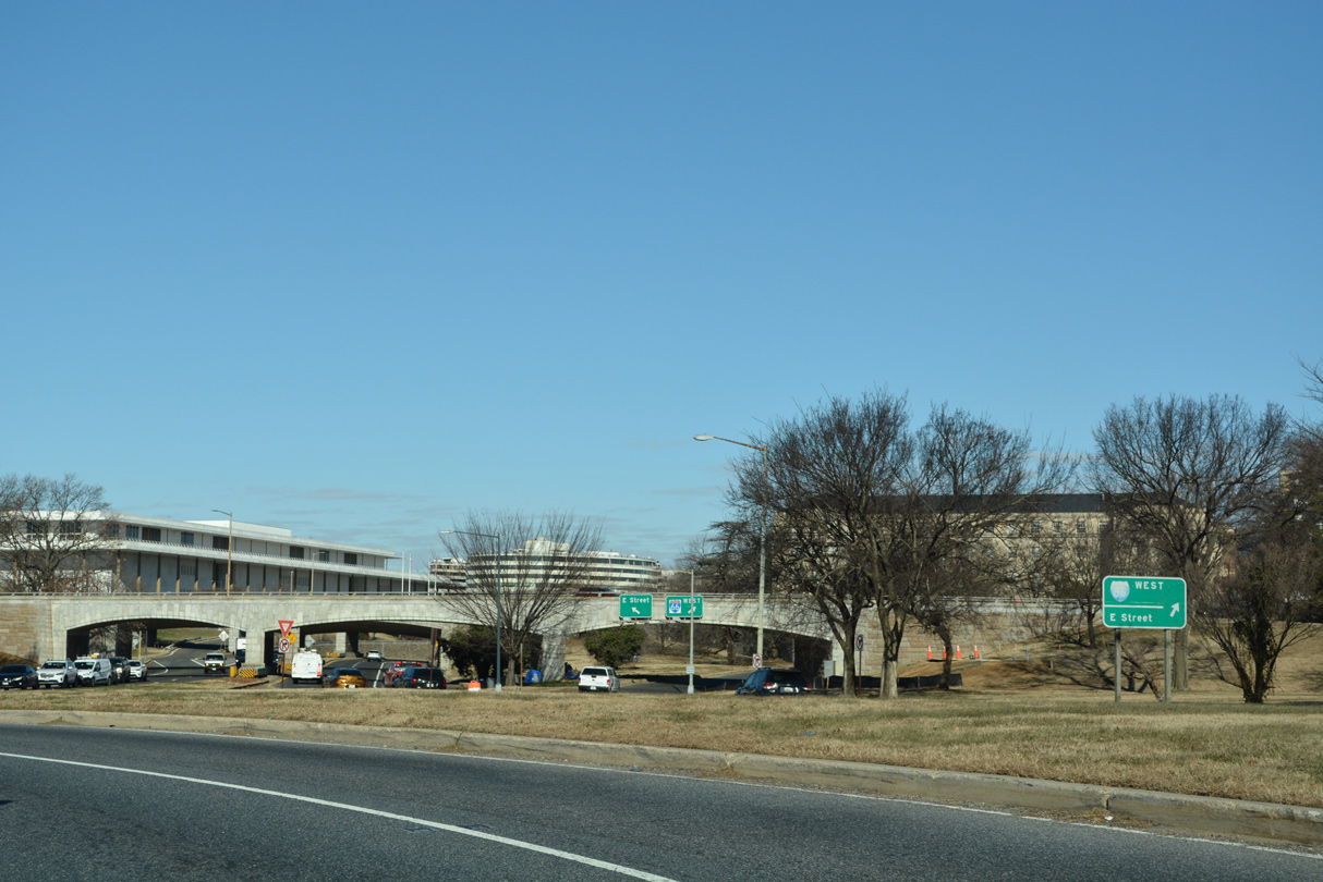
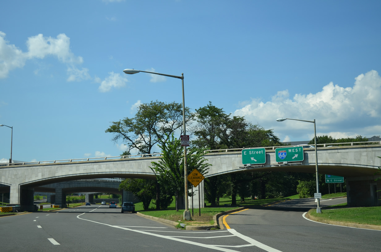
| Interstate 66 emerges from the tunnel by the Watergate Complex at a directional T interchange with the E Street Expressway. Previous overheads here coincided with panels covering guide signs referencing unconstructed I-695 (South Leg Freeway) east to the Southwest Freeway (I-395). 08/04/13 |
|
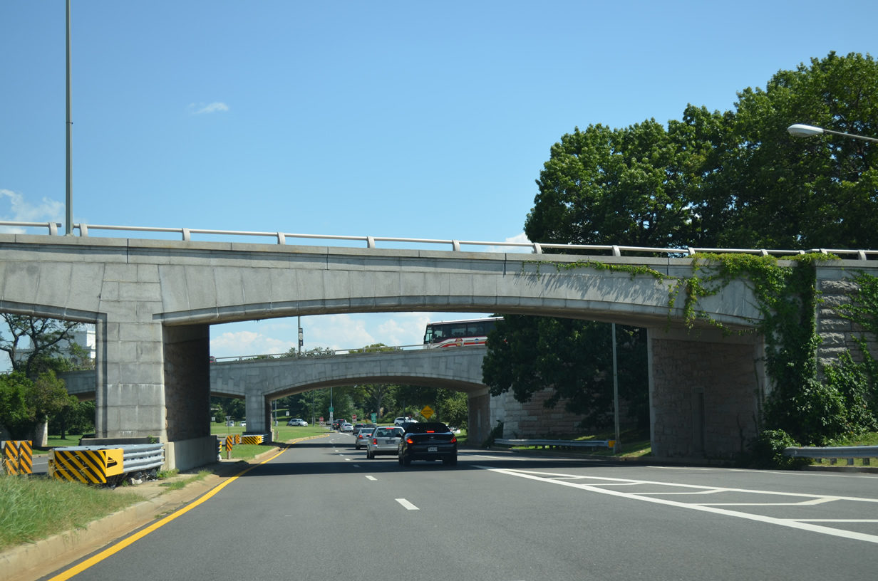
| The Potomac River Freeway extends 0.4 miles south from the separation with I-66 westbound to Ohio Drive and Rock Creek and Potomac Parkway. Ohio Drive leads to Independence Avenue. 12/27/22 |
|
| Interstate 66 continues from the Potomac River Freeway along a single lane ramp leading to the flyover ramp for the E Street Expressway and the Theodore Roosevelt Memorial Bridge. 12/27/22 |
|
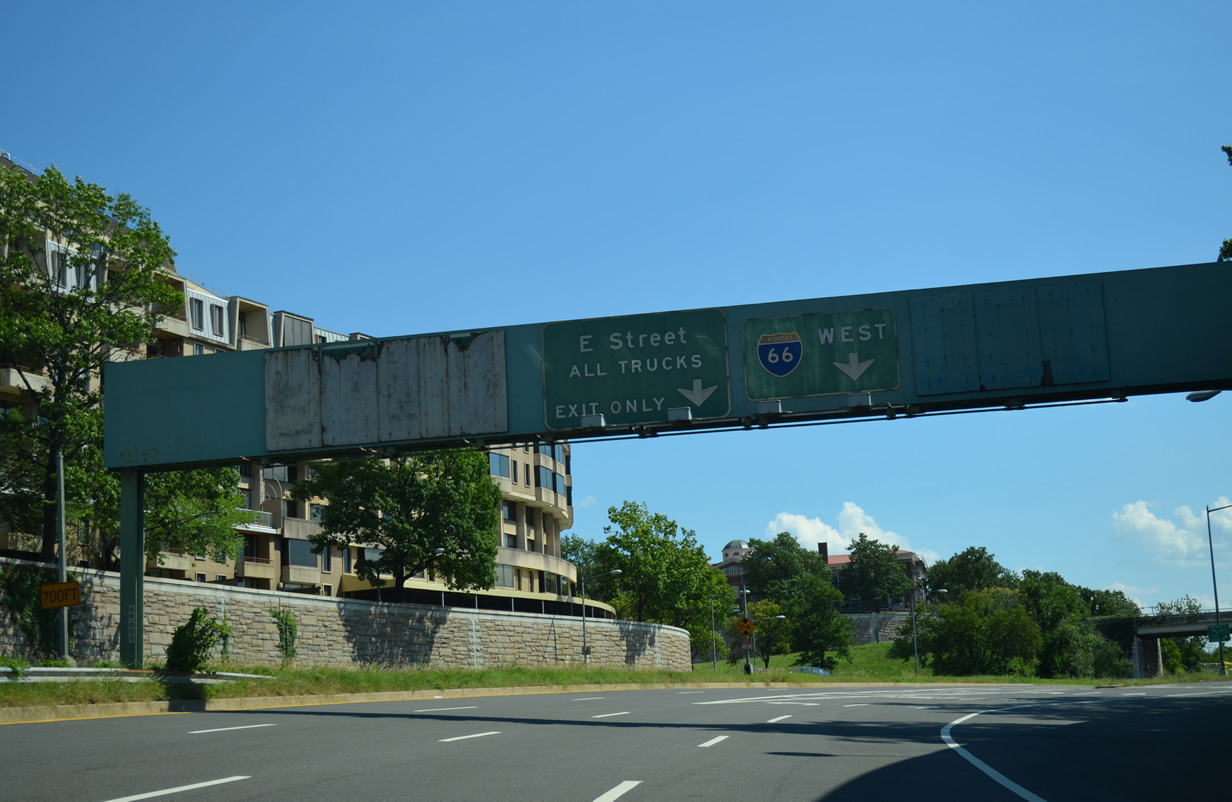
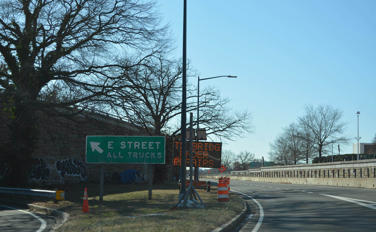
| The E Street Expressway spurs east to Virginia Avenue and E Street NW at 20th Street NW in Foggy Bottom. All trucks are required to depart I-66 by this point, as they are prohibited from the freeway west to the Capital Beltway. 12/27/22 |
|
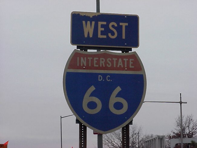
| The lone reassurance marker for Interstate 66 in Washington appeared between the E Street Expressway and the entrance ramp for U.S. 50 west from Constitution Avenue NW. It was removed by 2007. 01/20/00 |
|
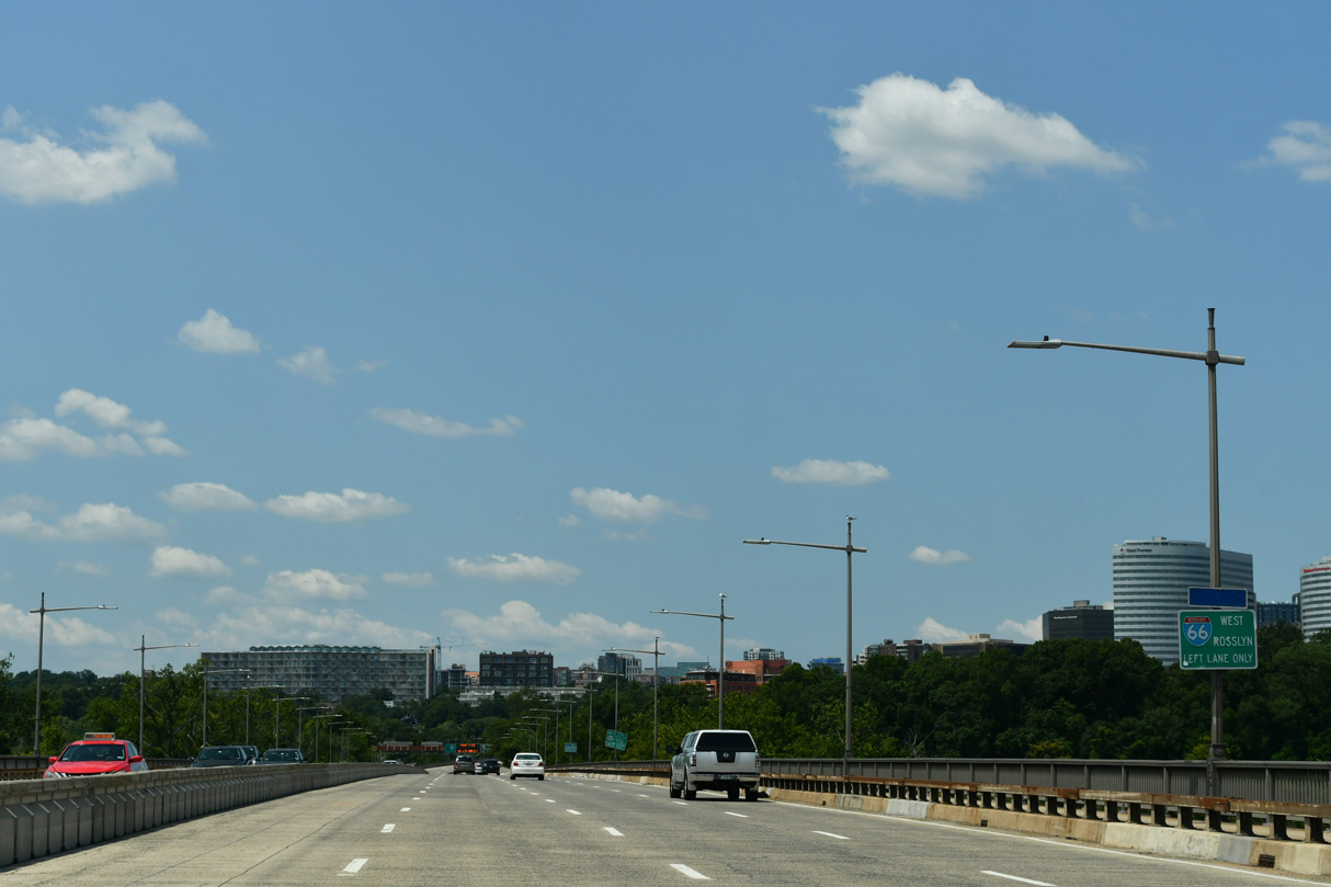
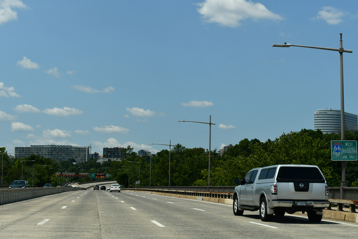
| I-66/U.S. 50 west overlap for 0.4 miles across the Theodore Roosevelt Memorial Bridge. 07/28/24 |
|
| The Theodore Roosevelt Bridge is seven lanes wide with a zipper barrier separating the roadways. I-66 continues northward with two lanes at the westbound split with U.S. 50. 07/28/24 |
|
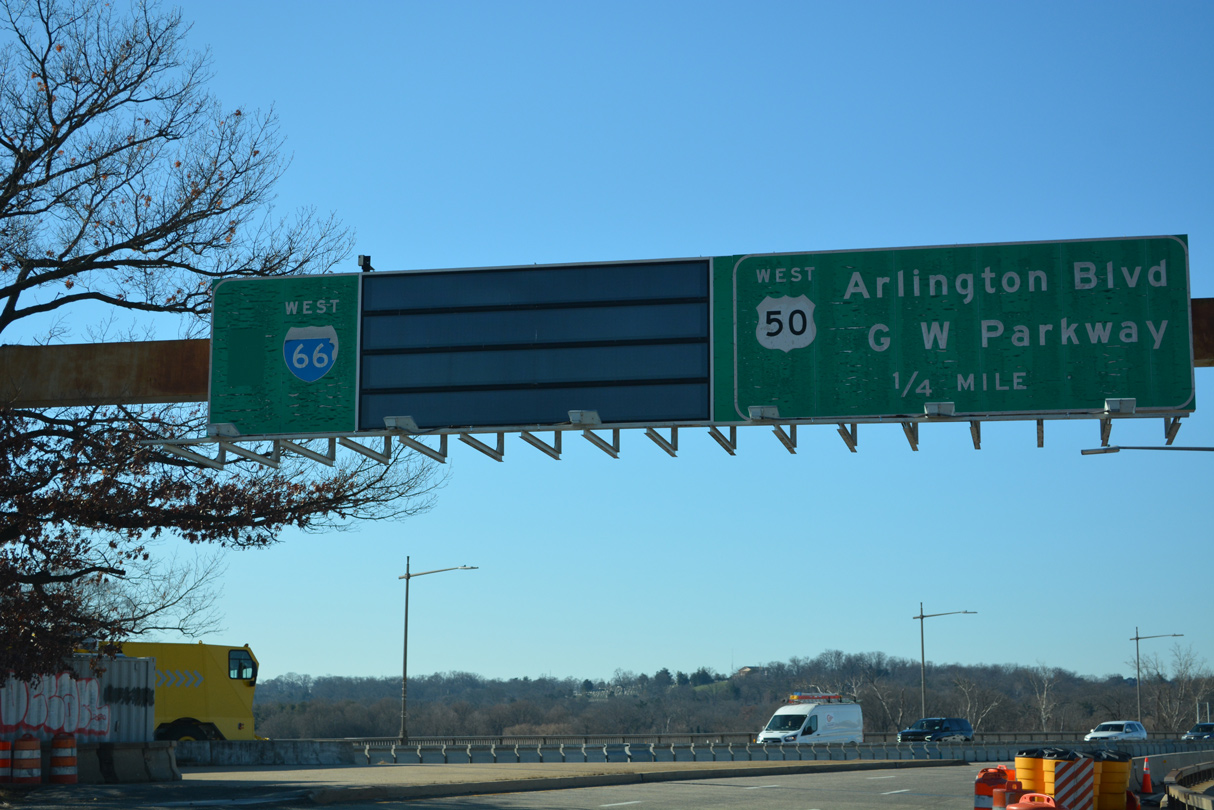
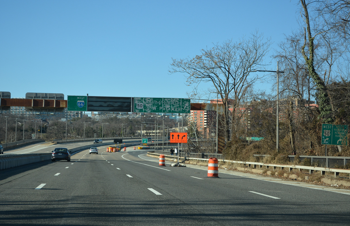
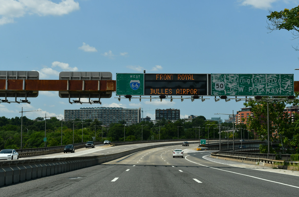
| U.S. 50 shifts onto Arlington Boulevard west beyond the exit for George Washington Parkway north. Arlington Boulevard arcs southwest around Fort Myer along an expressway to SR 27 (Washington Boulevard). 07/28/24 |
|
| Pedestrian walkways line both directions of the Theodore Roosevelt Bridge. 07/28/24 |
|
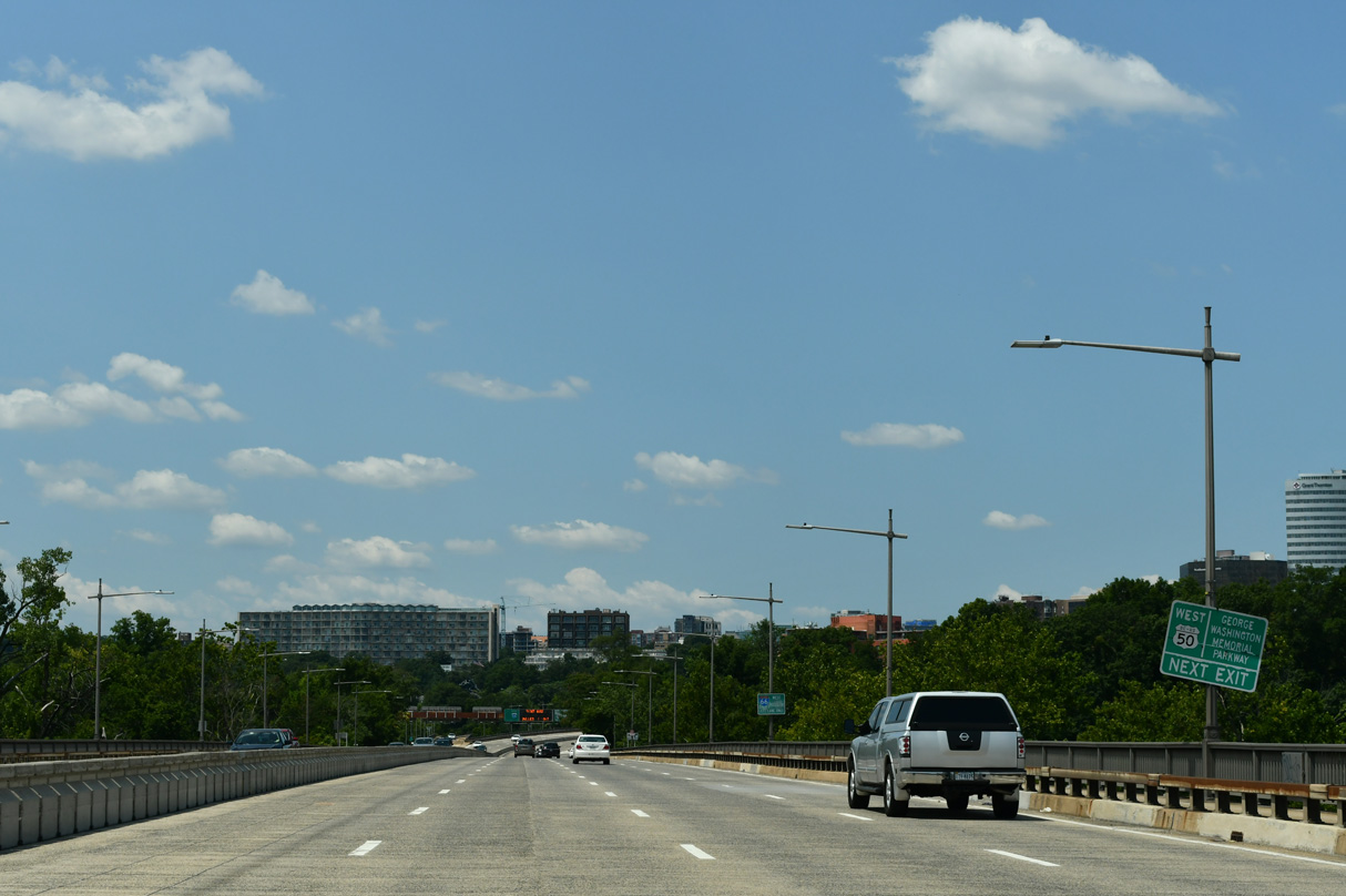
| The unnumbered exit for U.S. 50 (Arlington Boulevard) west partitions with a ramp to George Washington Parkway north to Langley and the Capital Beltway. 12/27/22 |
|
| U.S. 50 travels west between Rosslyn and Fort Myer then across Arlington to Seven Corners and West Falls Church. 07/28/24 |
|
| Virginia Avenue NW branches southeast from Rock Creek and Potomac Parkway just ahead of 27th Street NW and I Street NW east to Interstate 66 (Potomac River Freeway). 12/27/22 |
|
| A vintage trailblazer for Interstate 66 appears at 27th Street NW at I Street NW just north of Virginia Avenue NW. 12/27/22 |
|
| The short section of I Street east from Virginia Avenue NW ties into the entrance ramp for Interstate 66 westbound ahead of the E Street Expressway. 12/27/22 |
|
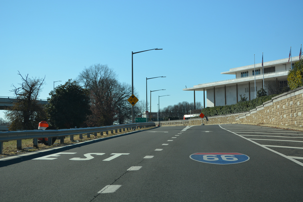
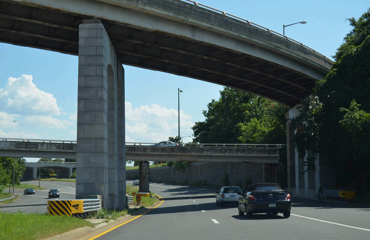
| The Potomac River Freeway begins north from Ohio Drive. This would have been the west end of I-695 (South Leg Freeway) had it been built. 12/27/22 |
|
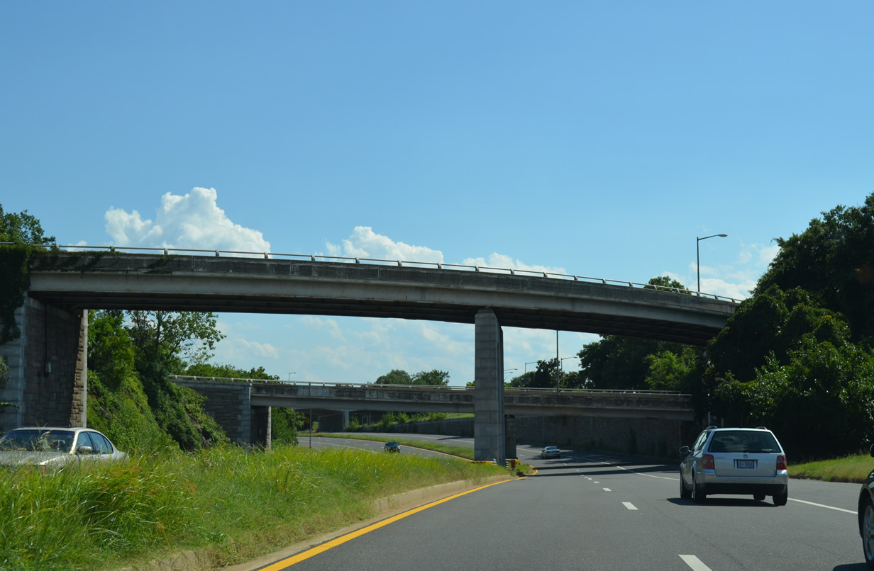
| Ramps quickly follow along the Potomac River Freeway north for I-66/U.S. 50 west across the Theodore Roosevelt Bridge and E Street Expressway east. 08/04/13 |
|
| An arch bridge carries U.S. 50 east to Constitution Avenue NW above Potomac River Freeway north. 08/04/13 |
|
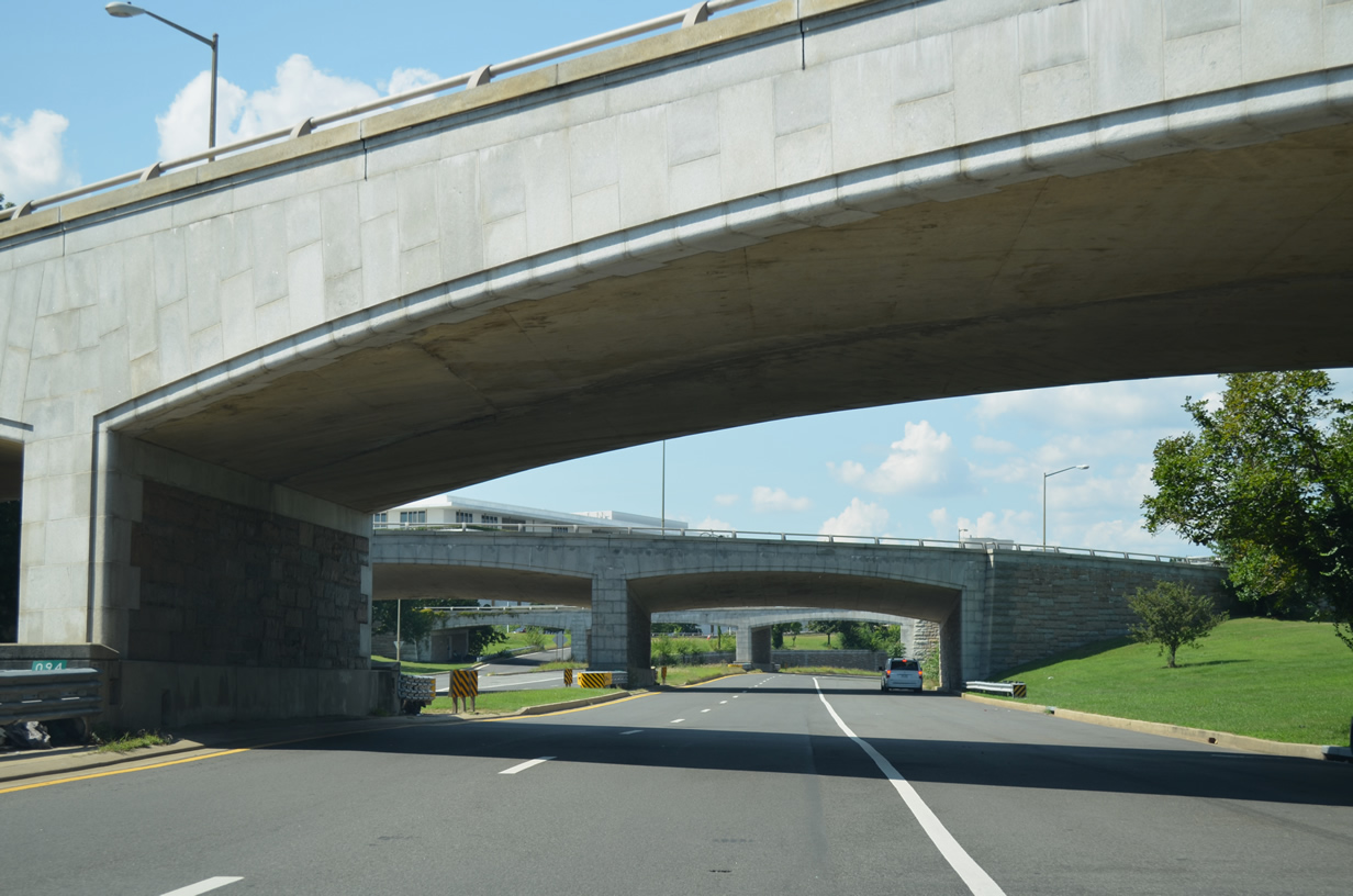
| The Potomac River Freeway advances north through the directional T interchange linking I-66, U.S. 50 (Constitution Avenue) and the E Street Expressway. 08/04/13 |
|
| Succeeding arch overpasses carry I-66 east and U.S. 50 east beyond their split from the Theodore Roosevelt Memorial Bridge over the ending Potomac River Freeway south. 08/04/13 |
|
| A U-turn ramp at the Potomac River Freeway end allows return access to northbound at the ramps for I-66/U.S. 50 west and E Street Expressway east. Continuing south yields options for Rock Creek and Potomac Parkway north and Ohio Drive south to Independence Avenue east. 08/04/13 |
Photo Credits:- 01/20/00 by Jeff Royston.
- 08/04/13 by AARoads.
- 12/27/22 by AARoads.
- 07/28/24 by AARoads.
Connect with:
U.S. 29
U.S. 50
E Street Expressway
Page Updated 12-17-2024.


 East
East