|
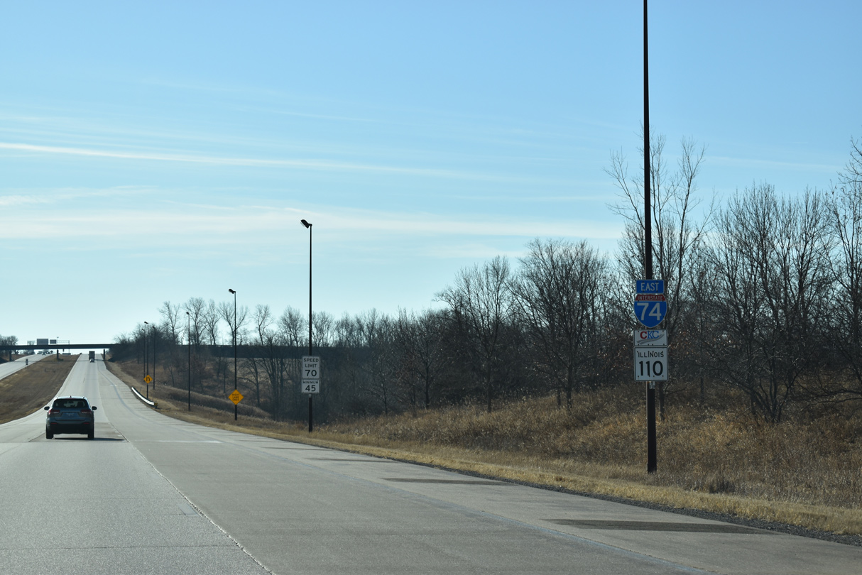
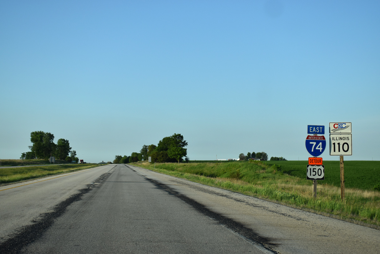
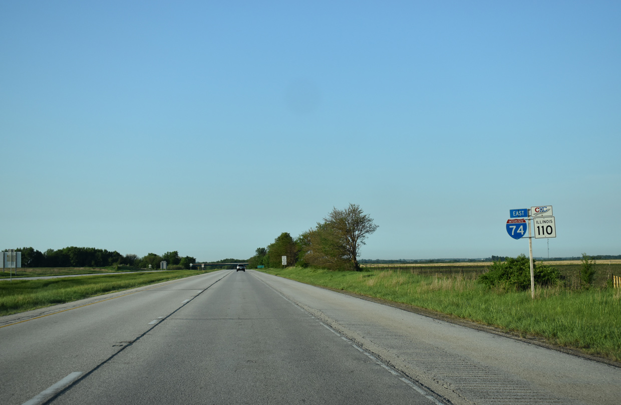
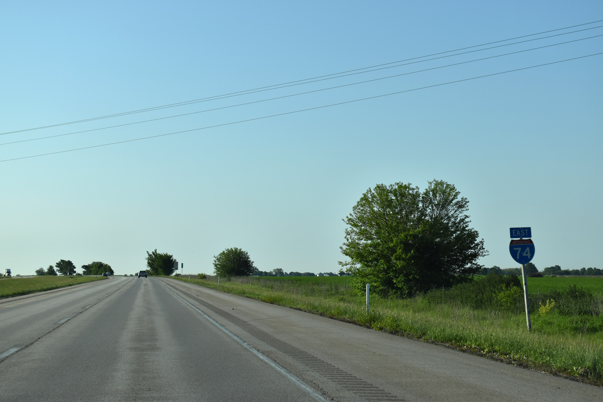
| Leaving the Big X Interchange with I-80/280, I-74/IL 110 (Chicago Kansas City Expressway) advabce south uninterrupted for 9.3 miles. N 1900th Avenue passes over the freeway beyond these shields and Mud Creek. 12/25/19 |
|
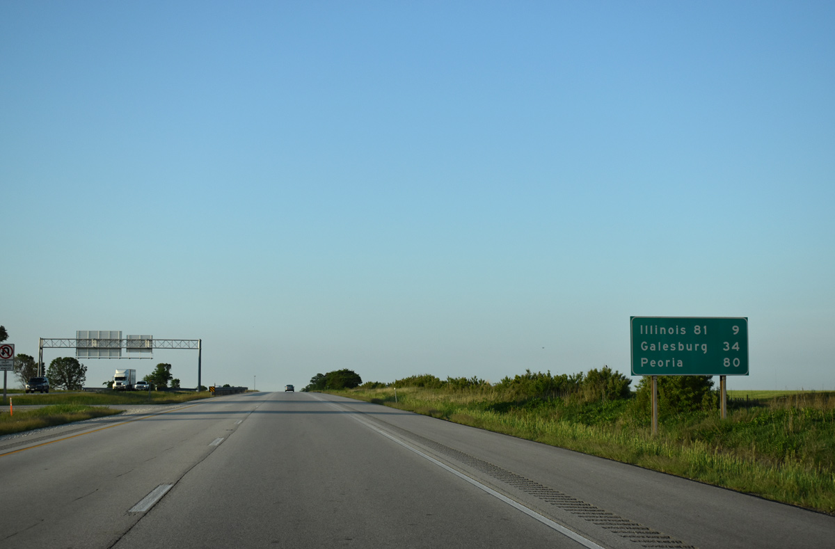
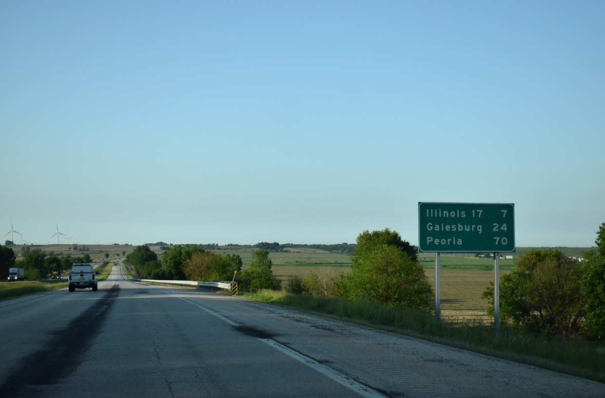
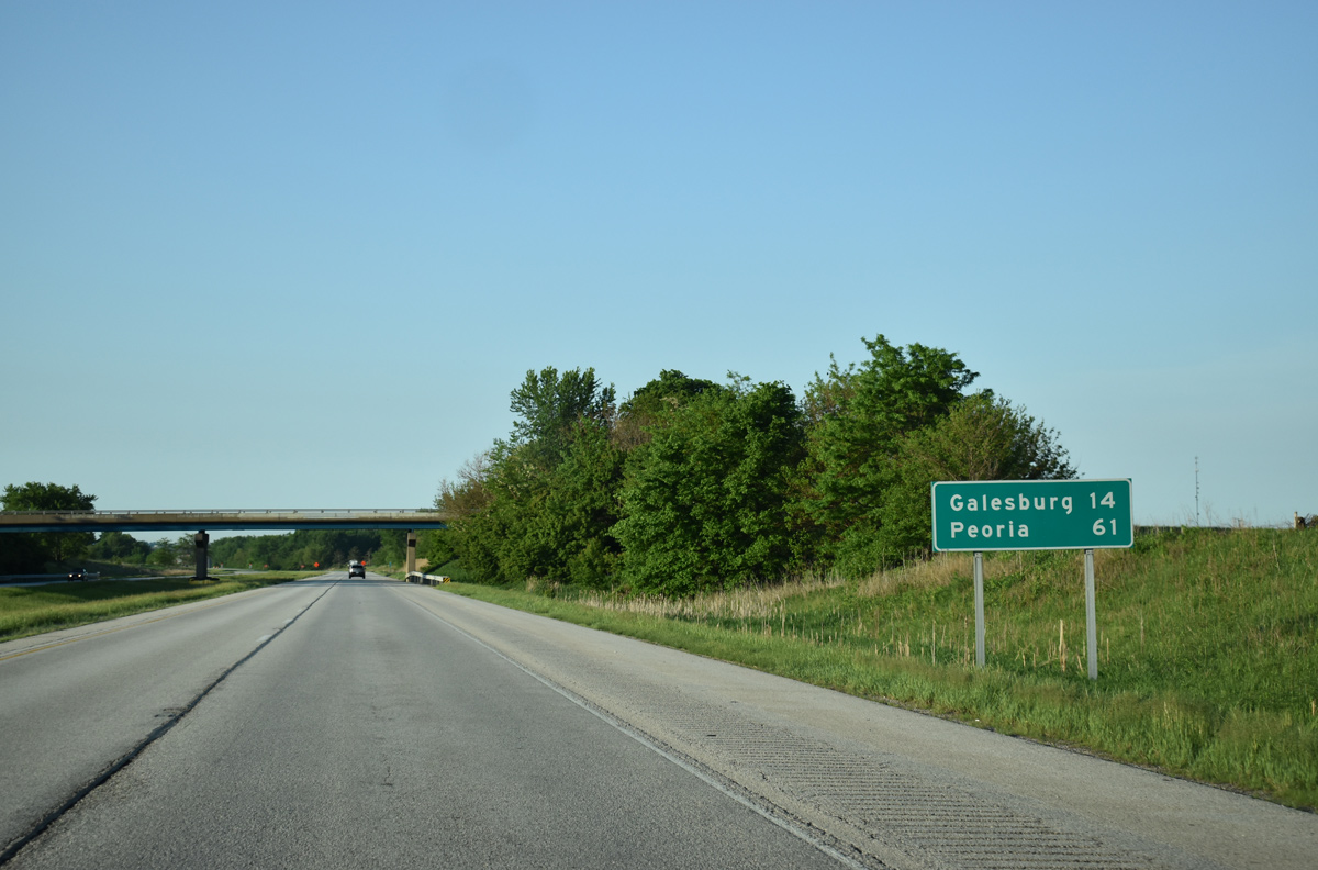
| Eastbound distance sign posted nine miles ahead of the diamond interchange (Exit 24) with IL 81. Galesburg follows in 34 miles. 05/24/18 |
|
| A curve along Interstate 74 eastbound after the Henry County Rooute 32 (N 1350th Avenue) under crossing near Orion. 12/25/19 |
|
| Lowering south to the crossing over Camp Creek on I-74/IL 110 (CKC) east near the communities of Andover and Lynn Center. 12/25/19 |
|
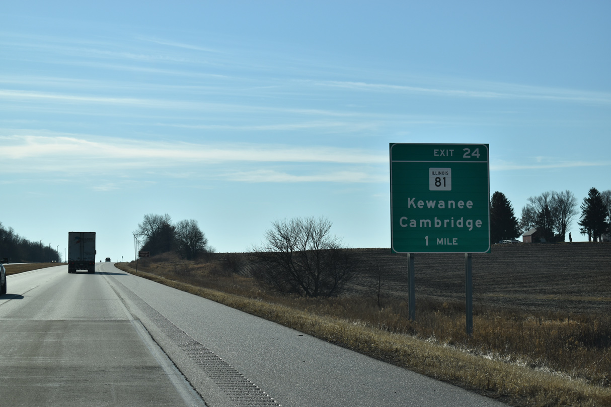
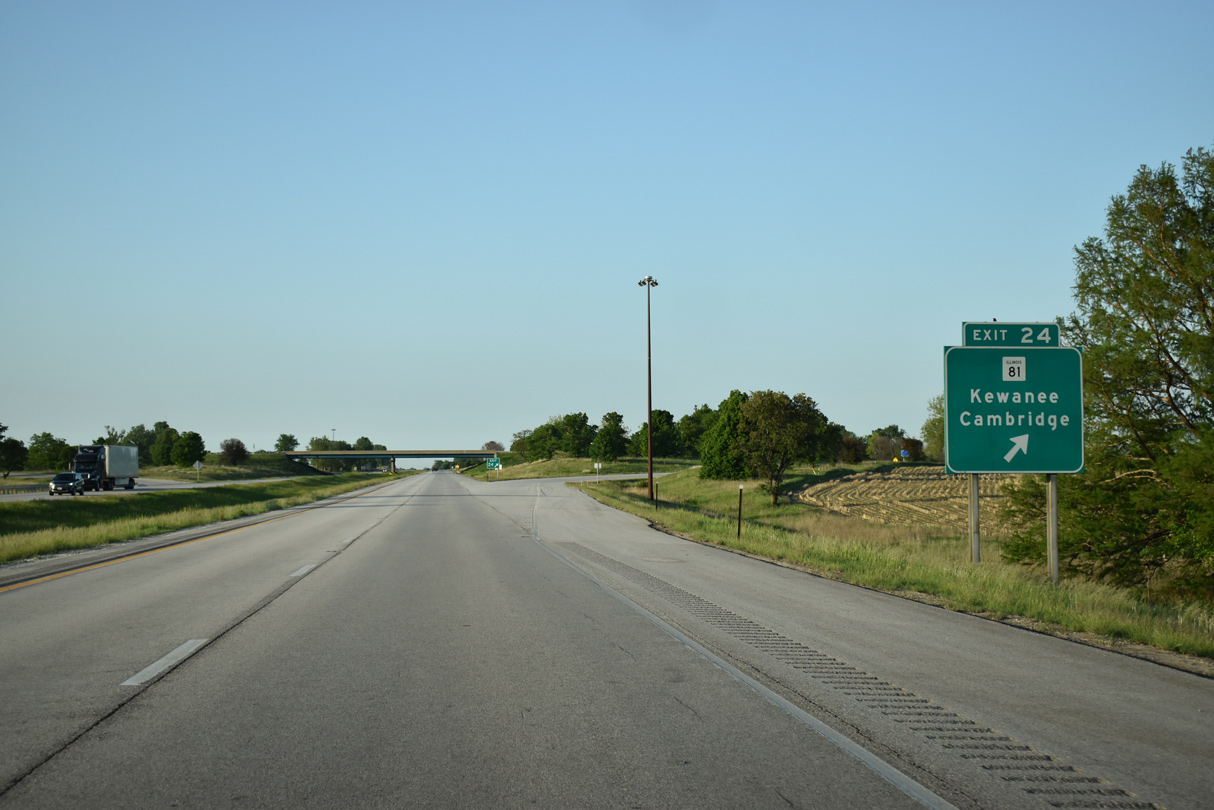
| IL 81 meets Interstate 74 at Exit 24 midway between Lynn center and Andover. 12/25/19 |
|
| IL 81 travels 25.78 miles overall from U.S. 150 at Lynn Center west of Exit 24 to IL 78 at Kewanee. 05/24/18 |
|
| IL 81 runs 2.24 miles west from I-74/IL 110 at Exit 24 to U.S. 150 at CR 7. IL 81 heads 8.44 miles east to IL 82 in the village of Cambridge. 05/24/18 |
|
| South of Exit 24, Interstate 74 east and IL 110 (CKC) west travel around 750 feet above sea level. 05/24/18 |
|
| Interstate 74 traverses areas of open farmland south seven miles to the succeeding exit for IL 72. 05/24/18 |
|
| I-74/IL 110 descends from a low ridge to cross the Edwards River around 680 feet above sea level. 12/25/19 |
|
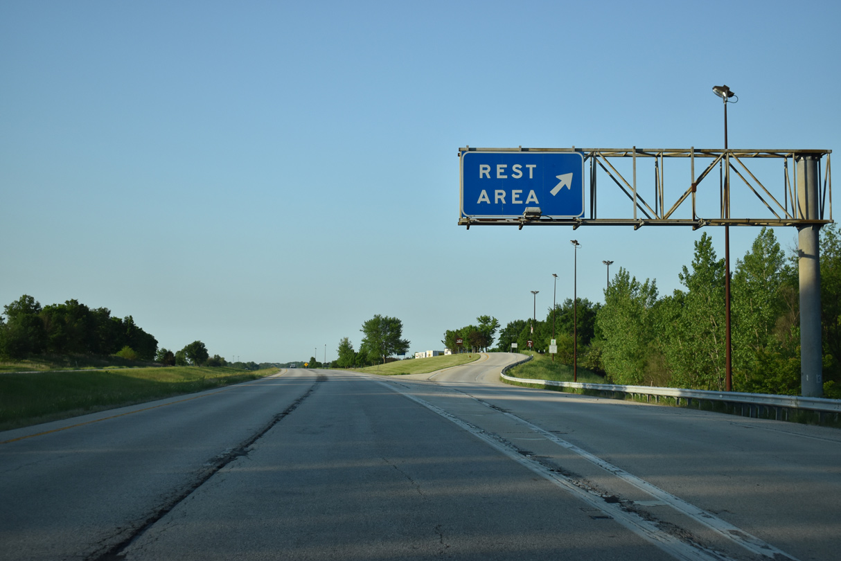
| The Krisdala Baka Rest Area is located along Interstate 74 midway between Exits 24 and 32. 05/24/18 |
|
| Interstate 74 east at the Krisdala Baka Rest Area in southwest Henry County. The westbound facility lies one mile to the south. 05/24/18 |
|
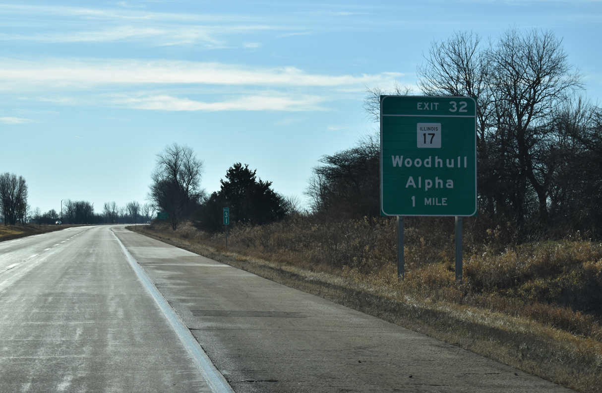
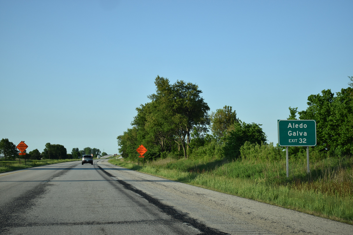
| A folded diamond interchange (Exit 32) joins I-74/IL 110 (CKC) with IL 17 (Highway Avenue in the village of Woodhull next. 12/25/19 |
|
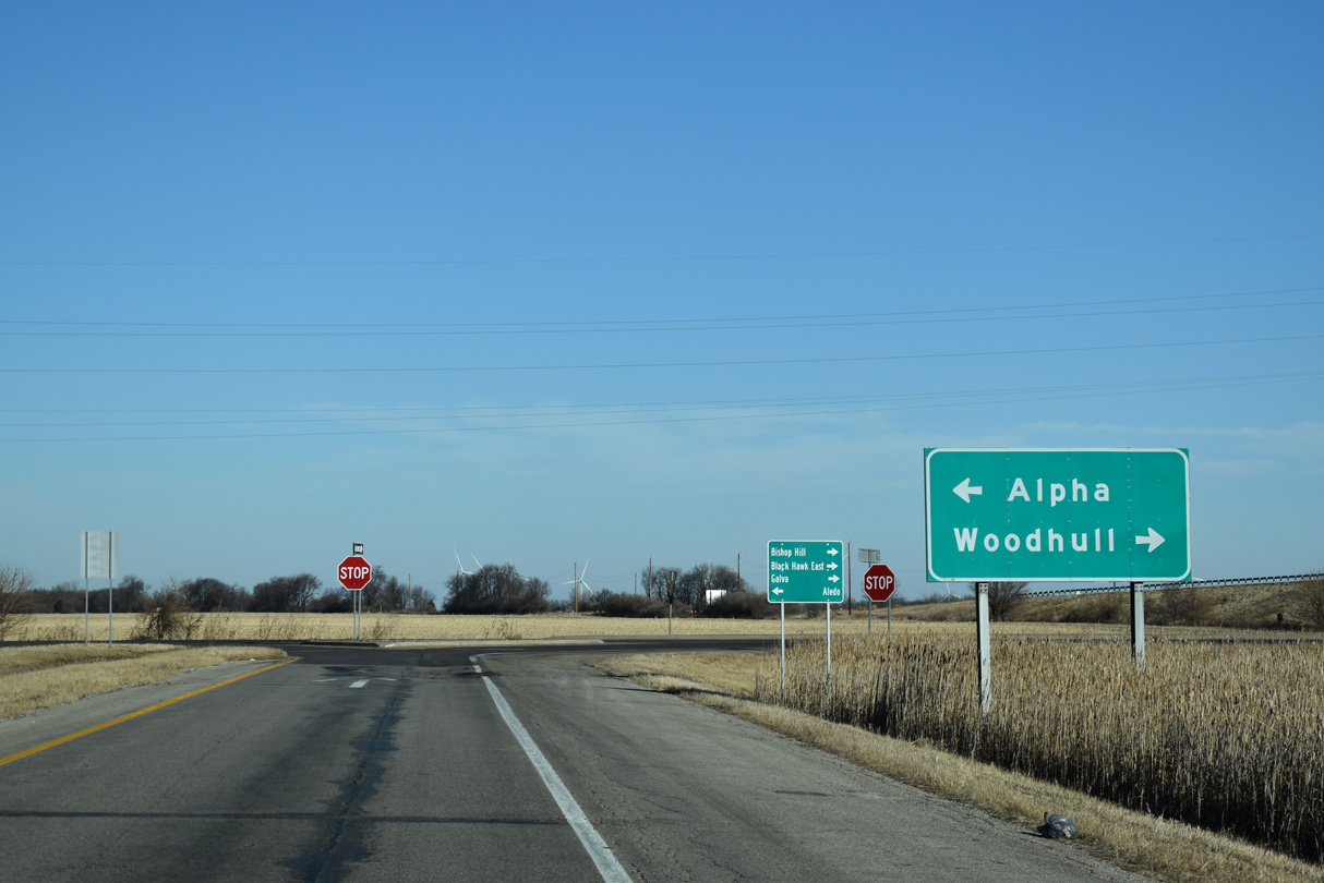
| IL 17 heads 2.51 miles west from I-74/IL 110 to an overlap with U.S. 150 through the village of Alpha. 05/24/18 |
|
| Exit 32 loops away from I-74 east to IL 17 (Highway Avenue) by a truck stop in Woodhull. IL 17 constitutes a cross state route traveling 170 miles between New Boston on the Mississippi River and the Indiana state line east of Shelburne. 05/24/18 |
|
| Eastward from Woodhull, IL 17 converges with U.S. 34 in 8.47 miles beyond Nekoma. U.S. 34/IL 17 overlap east to Galva. The Black Hawk College East Campus lies further east on U.S. 34 by IL 78. 12/25/19 |
|
| IDOT recorded 15,200 vehicles per day (vpd) along I-74/IL 110 (CKC) south of Woodhull in 2017. 05/24/18 |
|
| Progressing south, I-74/IL 110 pas under the N 100th Avenue overpass 14 miles from Galesburg. 05/24/18 |
|
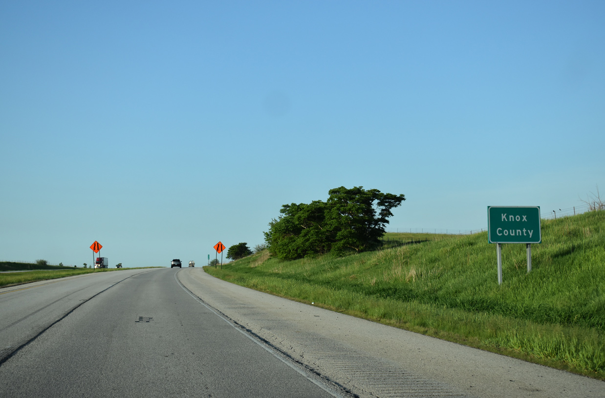
| Interstate 74 east enters Knox County after 26.07 miles through Henry County. 05/24/18 |
|
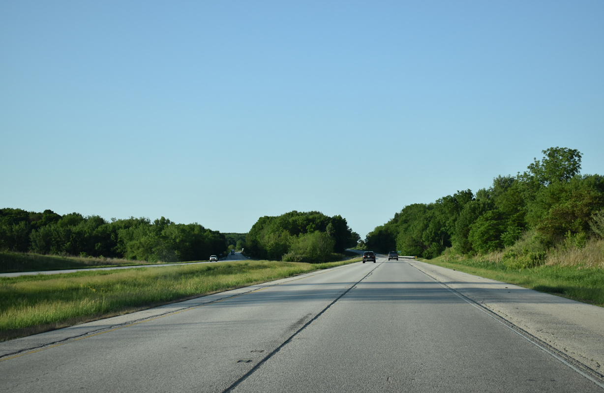
| The roadways of Interstate 74 separate ahead of Pope Creek. A tributary of the waterway flows between the two directions along this stretch. 05/24/08 |
|
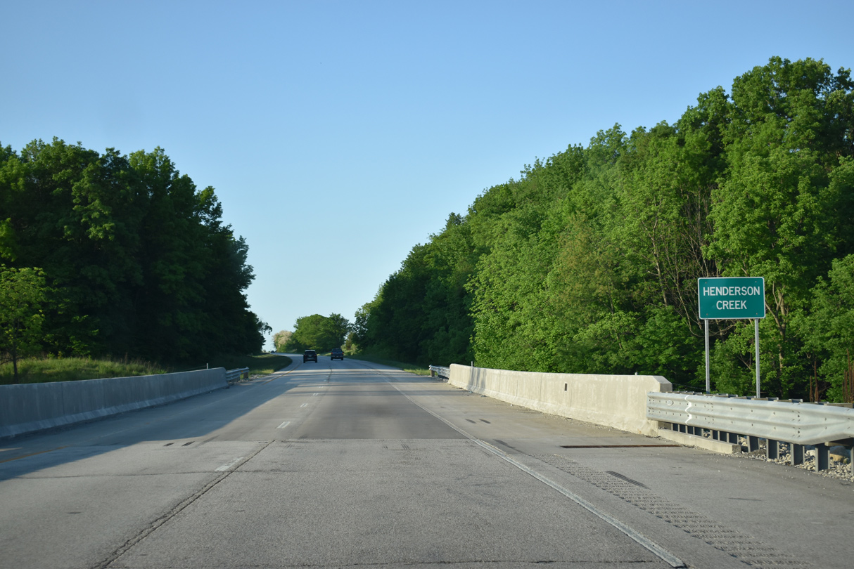
| Interstate 74 again separates south of Knox County Route 35 to cross Henderson Creek. 05/24/18 |
|
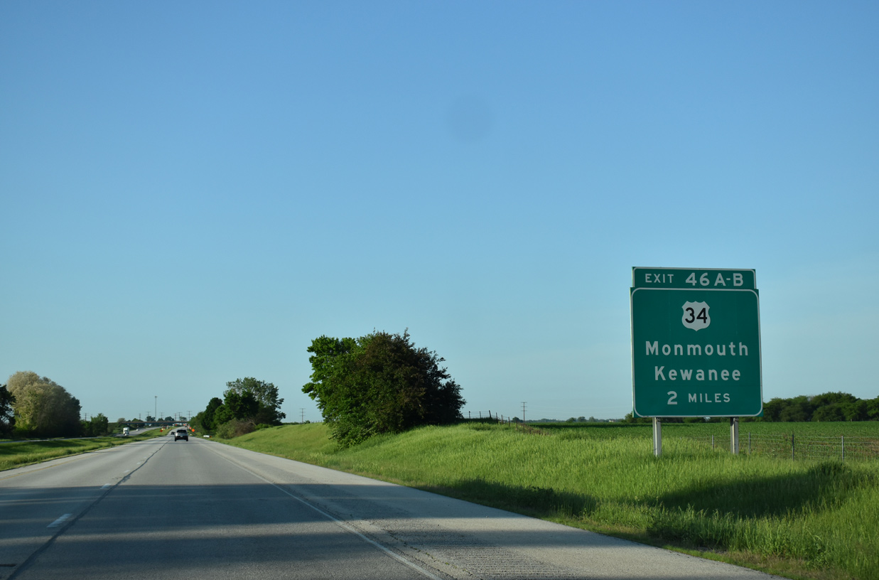
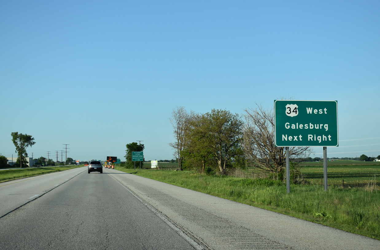
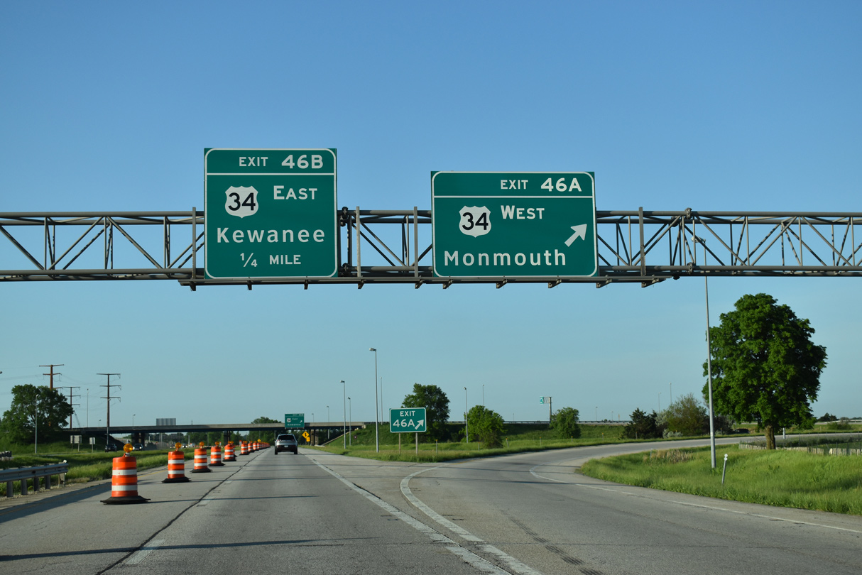
| The first of two exits for the city of Galesburg joins I-74 with freeway leading U.S. 34/IL 110 (CKC) west to Monmouth. 05/24/18 |
|
| U.S. 34 stretches 223 miles across Illinois from the Mississippi River opposite Burlington, Iowa northeast to the end in Berwyn, outside Chicago. 05/24/18 |
|
| Built in the 1970s, U.S. 34 bypasses Galesburg along a freeway leading southwest by Sandburg Mall and Galesburg Municipal Airport (GBG) to Warren County. The freeway west to Monmouth was constructed during the 1980s. 05/24/18 |
|
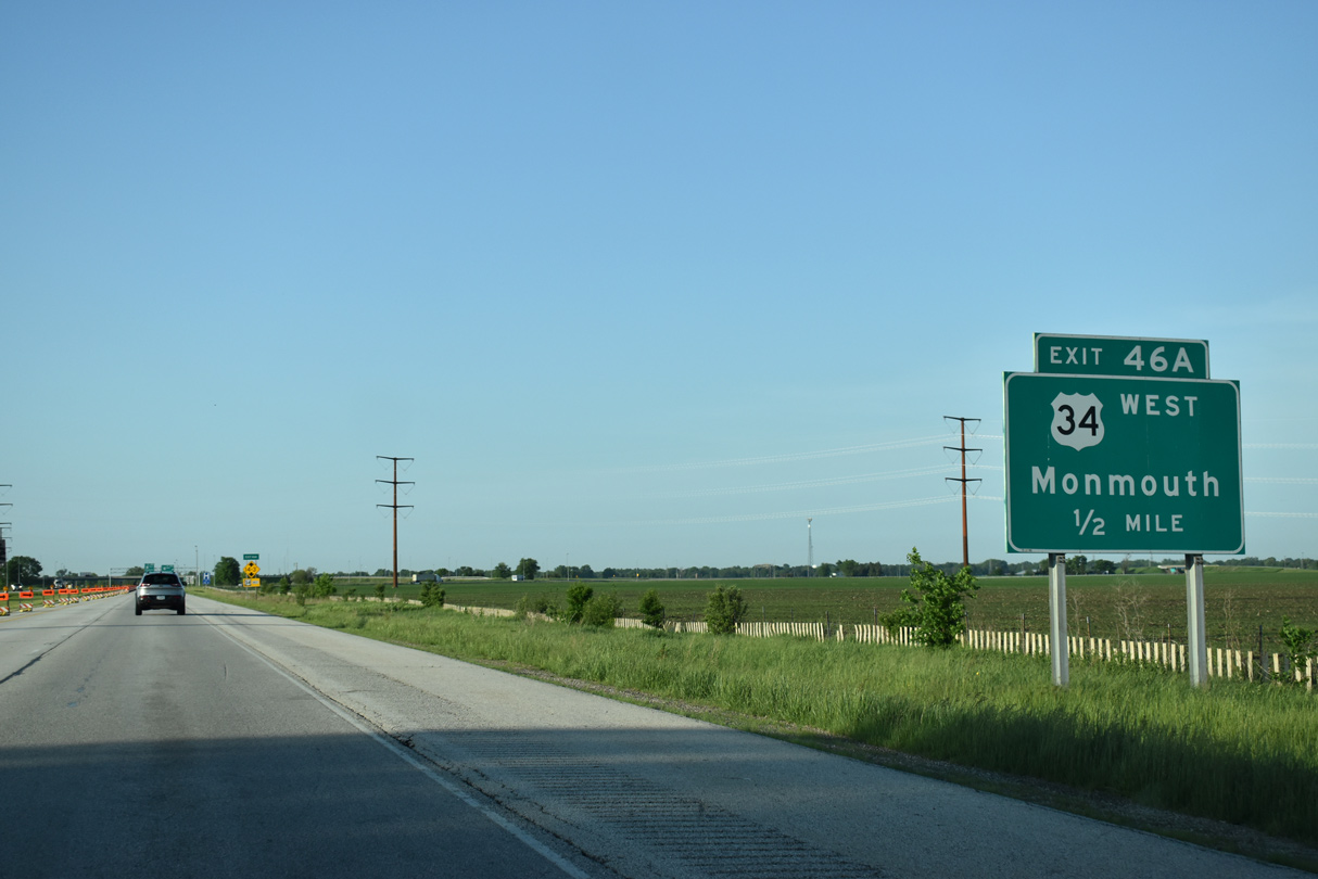
| Forthcoming Exit 46 A to Monmouth serves a number of colleges including Knox College, Carl Sandburg Community College, Monmouth College and Western Illinois University. 05/24/18 |
|
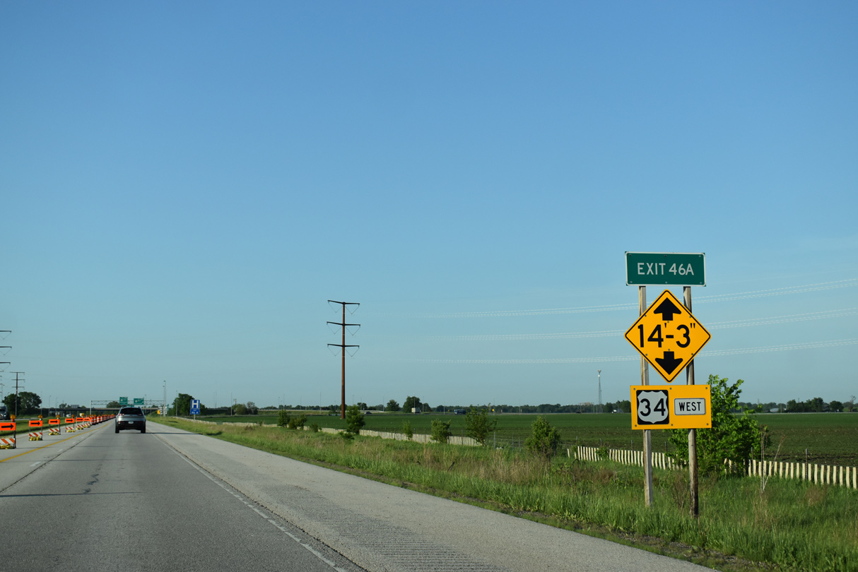
| The substandard overpass for Knox Road 500 E precludes trucks exceeding 14 feet 3 inches in height from using Exit 46 A to U.S. 34 west. 05/24/18 |
|
| A trailblazer for the Chicago Kansas City Expressway trailblazer directs IL 110 westward onto U.S. 34 to U.S. 67 south from Monmouth. 05/24/18 |
|
| Entering the cloverleaf interchange with U.S. 34 and IL 110 (CKC) west on I-74 eastbound. U.S. 34 overlaps with U.S. 67 south on the bypass of Monmouth in 18 miles and crosses the Great River Bridge into Burlington, Iowa in 47.4 miles. 05/24/18 |
|
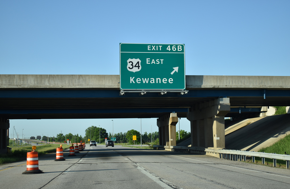
| East from Exit 46 B, U.S. 34 downgrades from the freeway bypass around Galesburg and turns northeast to Wataga, Oneida and Altona in northeast Knox County. Kewanee in southeast Henry County, is a 35 mile drive via U.S. 34 east. 05/24/18 |
|
| Interstate 74 elevates to pass over both a BNSF Railroad line and Lincoln Street (CR 40) just south of U.S. 34. The BNSF line doubles with AMTRAK service between Galesburg and Chicago. 06/01/11 |
|
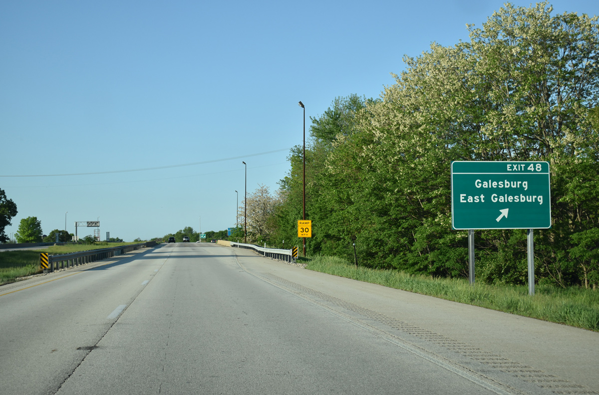
| E Main Street meets Interstate 74 at a parclo interchange (Exit 48) next in one mile. 05/24/18 |
|
| Exit 48 serves interests to the Knox College Lincoln-Douglas Debate Site and the Carl Sandburg Birth Place as well as providing the most direct link to the Galesburg AMTRAK station. 05/24/18 |
|
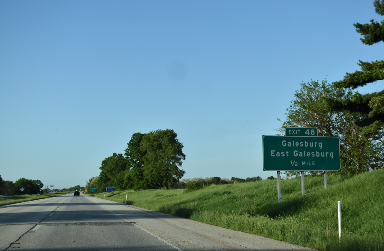
| Exit 48 departs Interstate 74 east as the freeway spans another BNSF Railroad line. E Main Street leads directly to Downtown Galesburg, becoming U.S. 150 west from Grand Avenue. Main Street extends east from Galesburg into the adjacent village of East Galesburg. 05/24/18 |
|
| Curving southeast toward rural areas of Galesburg, Interstate 74 passes by Kiwanis Park ahead of the Knox Street overpass. 05/24/18 |
|
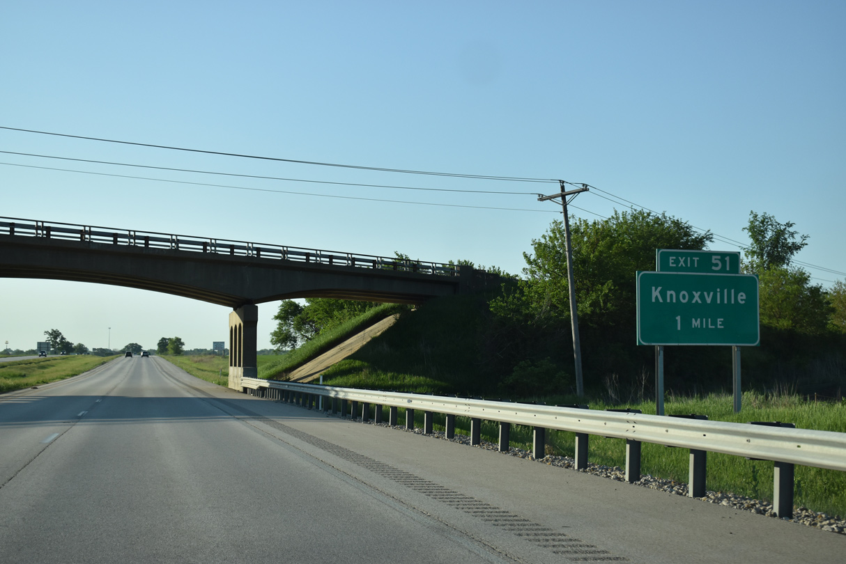
| One mile west of the diamond interchange (Exit 51) with County Route 9 and the city of Knoxville on Interstate 74 east. 05/24/18 |
|
| Knox County Route 9 links Henderson Street in Knoxville with State Street through East Galesburg to the north of Exit 51. CR 10 ties into CR 9 nearby as a southerly bypass of Galesburg west to IL 41. 05/24/18 |
|
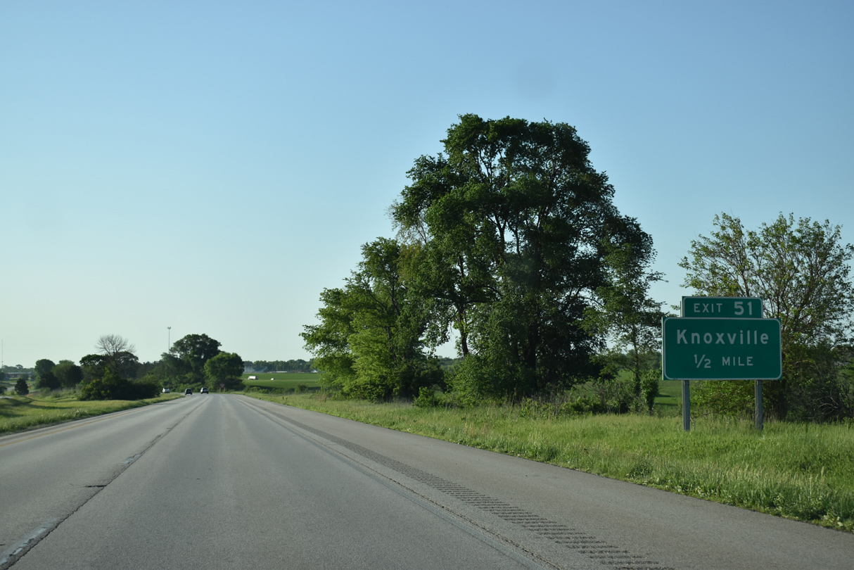
| Exit 51 leaves Interstate 74 east for Knox County Route 9. Henderson Road stems south from the county road to U.S. 150 (Galesburg Road), west of the Knoxville business district. 05/24/18 |
|
| Interstate 74 stays just north of Knoxville by Market Street in this eastbound scene. 05/24/18 |
|
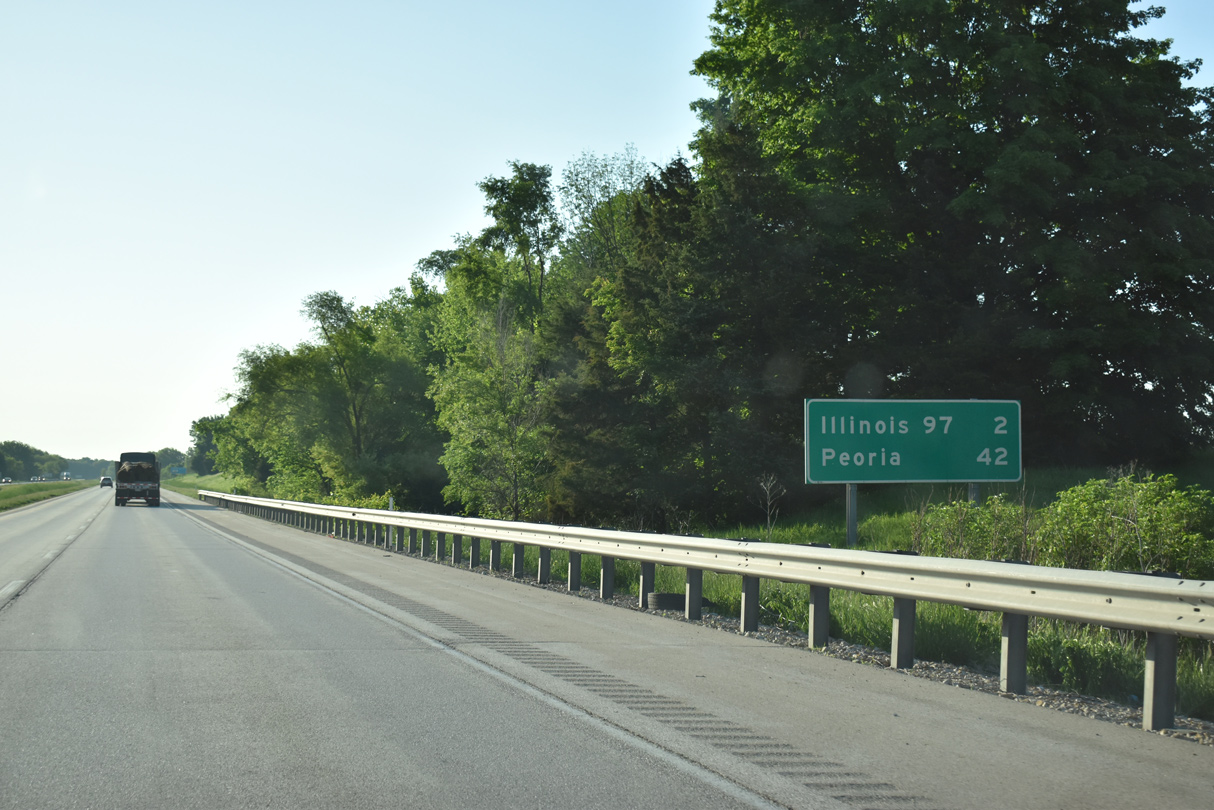
| The succeeding exit from Interstate 74 east is with U.S. 150/IL 97 in two miles. Peoria is another 40 miles away. 05/24/18 |
|
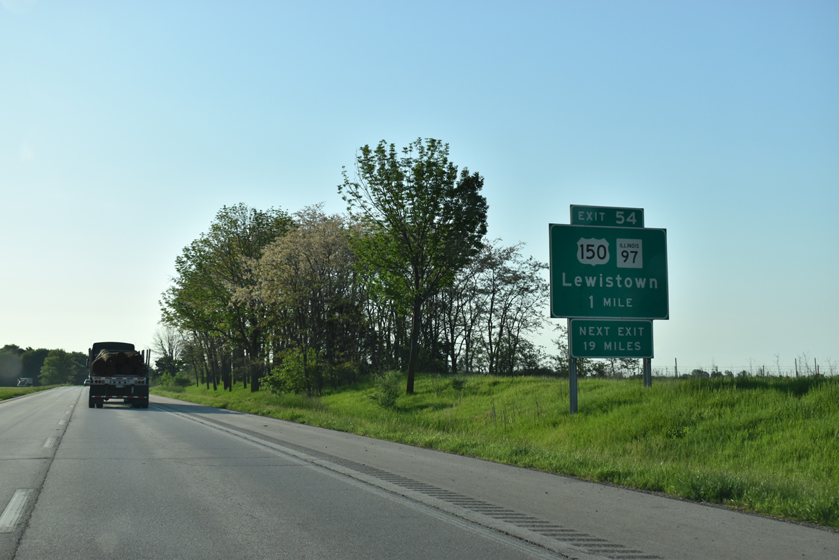
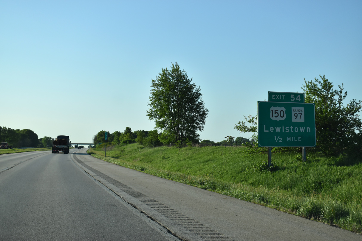
| U.S. 150 follows Main Street east from central Knoxville to dog leg north alongside IL 97 to Exit 54. A 19 mile exit less stretch ensues east of the forthcoming exchange. 05/24/18 |
|
| The original construction of Interstate 74 displaced a portion of U.S. 150 east of Knoxville. IL 97, a 110 mile long highway leading south to Lewiston, Havana and Springfield, begins at Exit 54. 05/24/18 |
|
| Exit 54 leaves Interstate 74 east for U.S. 150, IL 97 south and Knox Road 1020 E north. 05/24/18 |
|
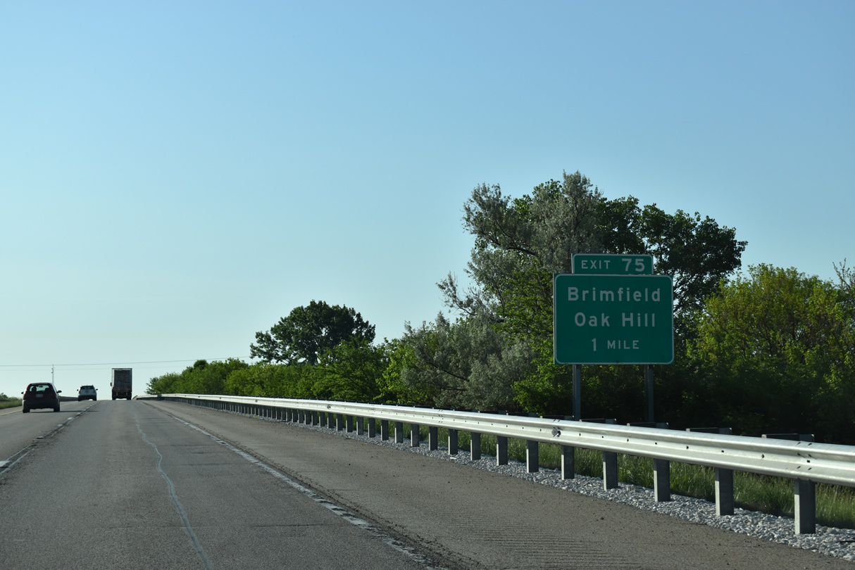
| The village of Brimfield lies 23 miles to the east along U.S. 150 and between Exits 71 and 75 along Interstate 74. 05/24/18 |
|
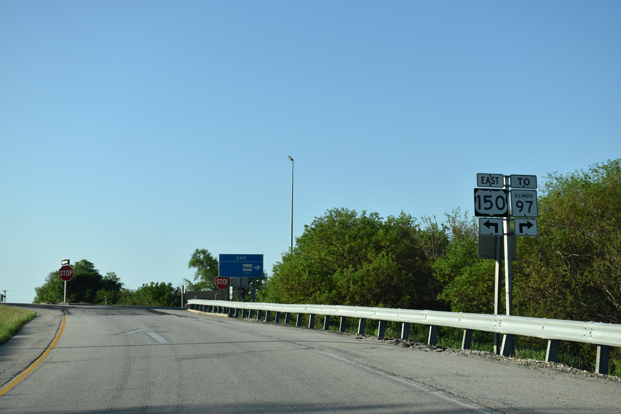
| U.S. 150 stays north of I-74 from Exit 54 to Peoria while IL 97 branches southeast 41 miles to the Fulton County seat of Lewiston. 05/24/18 |
|
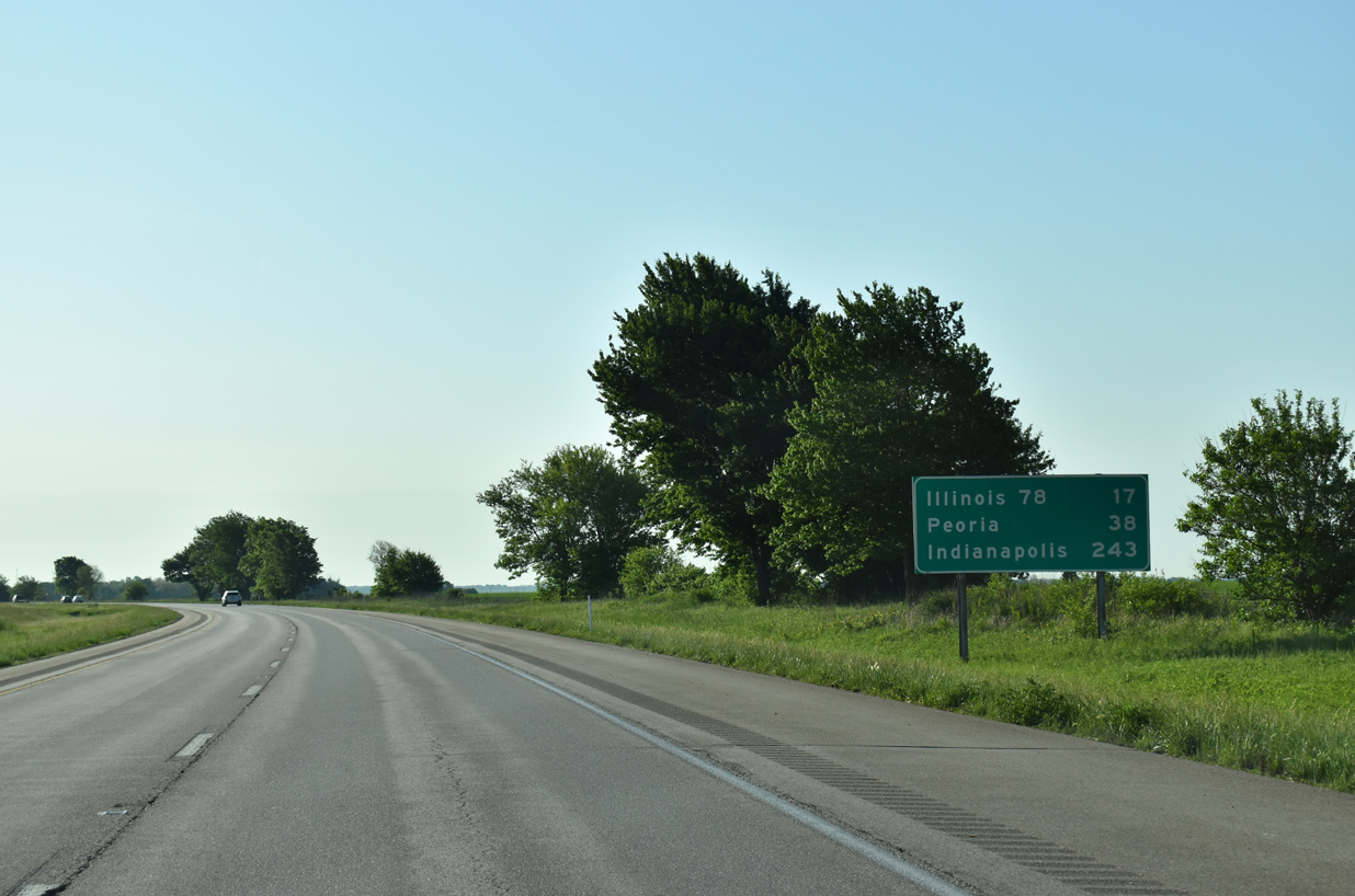
| The longest exit less stretch of Interstate 74 overall between the Quad Cities and Cincinnati traverses open farm land east to the Spoon River. 05/24/18 |
|
| Indianapolis debuts on Interstate 74 distance signs at 243 miles out. Peoria is the next city along the freeway in 38 miles. 05/24/18 |
|
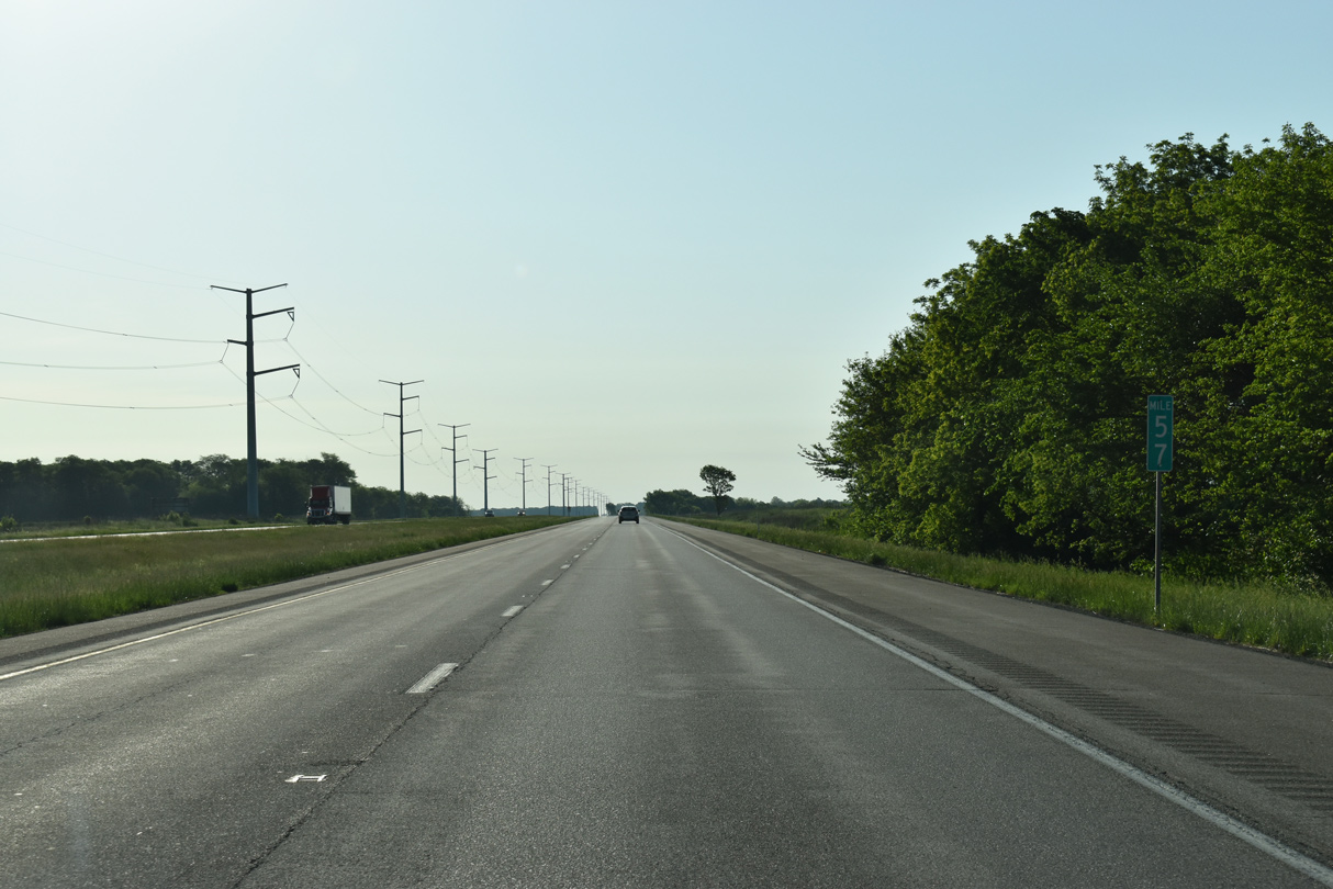
| A long straight away on I-74 runs along a transmission line east from milepost 57. 05/24/18 |
|
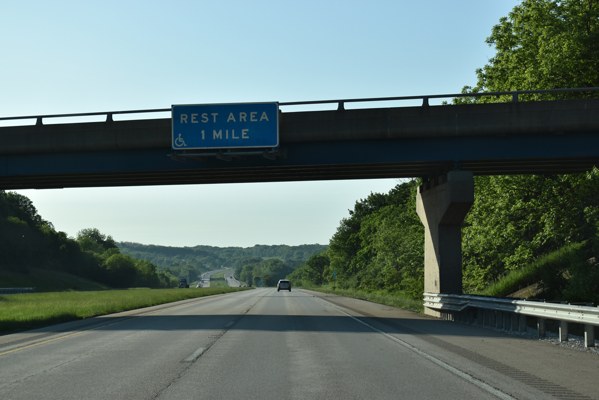
| The second rest area for Interstate 74 east breaks the uninterrupted stretch through eastern Knox County. 05/24/18 |
|
| The Spoon River Rest Areas line both sides of Interstate 74 just beyond the Spoon River. 05/24/18 |
|
| Interstate 74 bends southeasterly through a forested valley at French Creek. 05/07/10 |
|
| Interstate 74 enters Peoria County, the fourth in Illinois along eastbound since the Mississippi River, ahead of Swab Run. Formed in 1825 out of a larger Fulton County, Peoria County derives its name from the Illiniwek tribe of Peoria.1 05/24/18 |
|
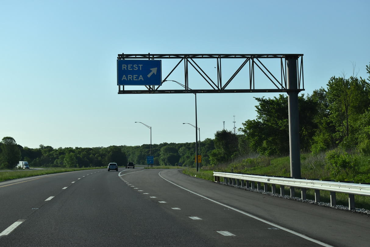
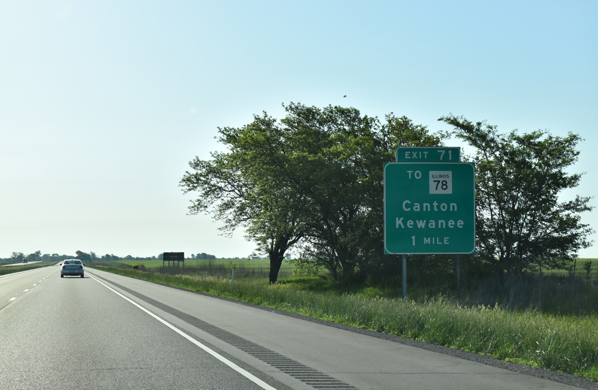
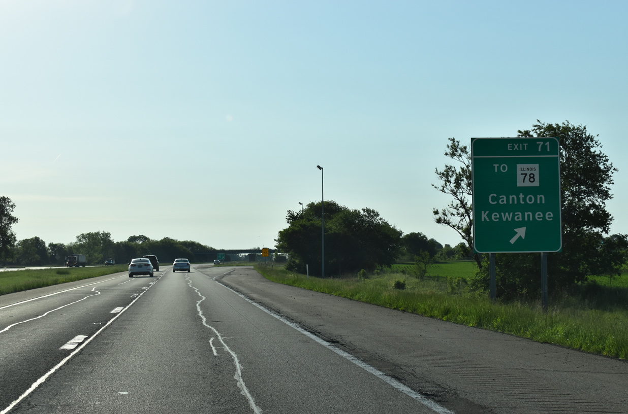
| IL 78 crosses over Interstate 74 two miles west of Exit 71. Curving east, IL 78 combines with U.S. 150 just north of the upcoming diamond interchange with County Route R18 (Bell School Road). 05/24/18 |
|
| IL 78 constitutes a lengthy route southward to Canton and Jacksonville and northward to Kewanee. The 210 mile long highway concludes as Wisconsin Trunk Highway 78, north of Warren. 05/24/18 |
|
| County Route R18 (Bell School Road) leads south from adjacent U.S. 150 to IL 8, east of Elmwood. IL 78 leads north from U.S. 150, 4.3 miles to Laura and 25 miles to Kewanee. 05/24/18 |
|
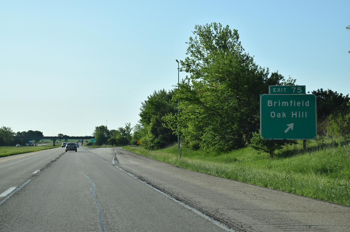
| Interstate 74 curves southward from Exit 71 and parallels U.S. 150 through Brimfield. 05/24/18 |
|
| Peoria County Route R25 (Maher Road) meets I-74 at a diamond interchange in one mile. 05/24/18 |
|
| Maher Road joins Interstate 74 with adjacent U.S. 150 west into the village of Brimfield. 05/24/18 |
|
| South from Exit 74, County Route R25 (Maher Road) continues 2.6 miles to IL 8 at Oak Hill. 05/24/18 |
|
| Frye Road runs adjacent to Interstate 74 by this confirming marker. 05/24/18 |
|
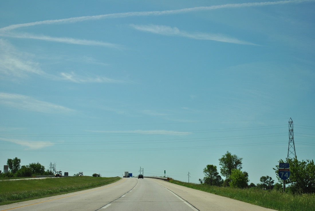
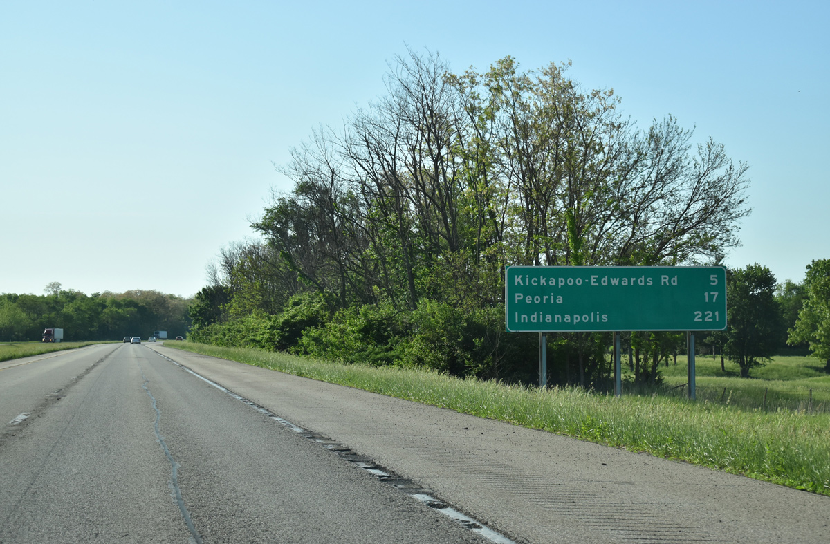
| Interstate 74 travels another 17 miles to Peoria and 221 miles to the Indiana capital city. 05/24/18 |
|
| Crossing Kickapoo Creek along a forested stretch of Interstate 74 east. 05/24/18 |
|
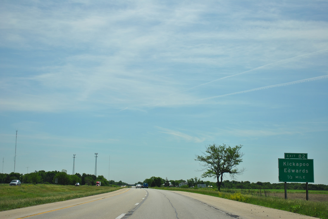
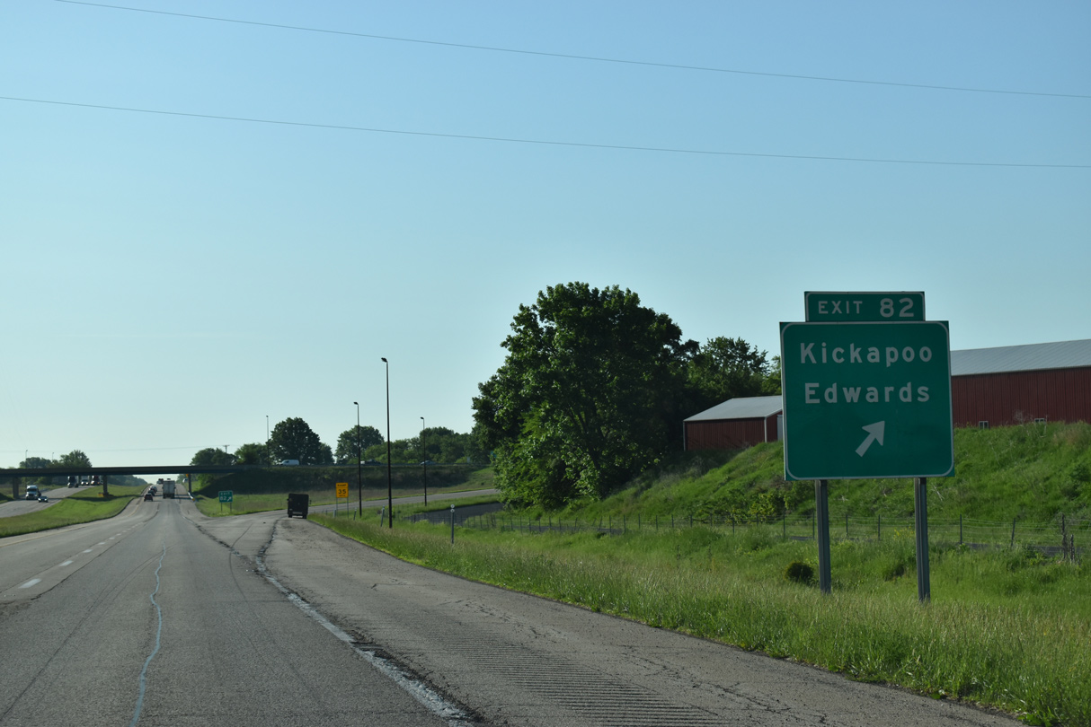
| A diamond interchange links Interstate 74 and Peoria County Route R40 (Kickapoo-Edwards Road) at Exit 82 in one mile. 0000 |
|
| County Route R40 heads 1.18 miles north from Exit 82 to U.S. 150 at Vine Street in the unincorporated community of Kickapoo. U.S. 150 travels west from Kickapoo west to Jubilee College State Park and east to Orange Prairie. 06/01/11 |
|
| Kickapoo-Edwards Road (CR R40) extends southward 2.09 miles from Exit 82 to IL 8 (Southport Road) at Edwards and Taylor Road to Wildlife Prairie Park. 05/24/18 |
|
| A long straight away opens along Interstate 74 forested hills northeast of Wildlife Prairie Park and across north Kinsley Park. 05/24/18, 05/07/10 |
|
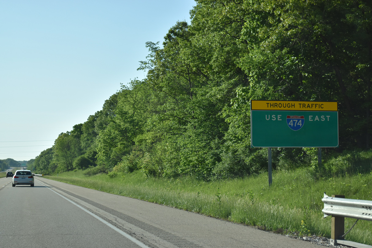
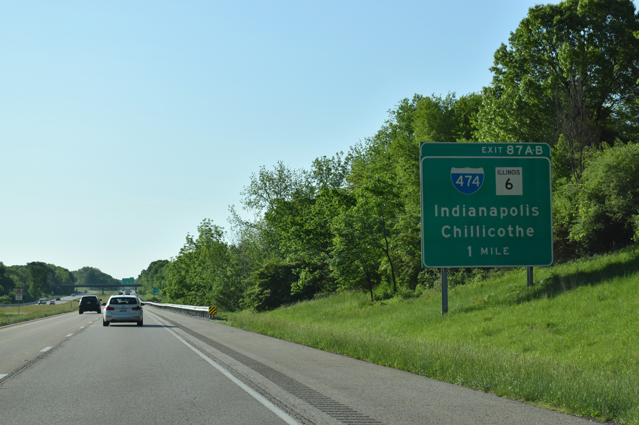
| IL 6, a 10.01 mile long freeway spur leading north to Mossville, ties into the directional cloverleaf interchange (Exit 87) joining I-74 with Interstate 474. 14.88 miles in length, I-474 provides a bypass of Peoria to the south. 05/24/18 |
|
| Through traffic to Bloomington-Normal and Champaign-Urbana is directed onto Interstate 474 east. The bypass is 2.51 miles miles longer than I-74 through Peoria. 05/24/18 |
|
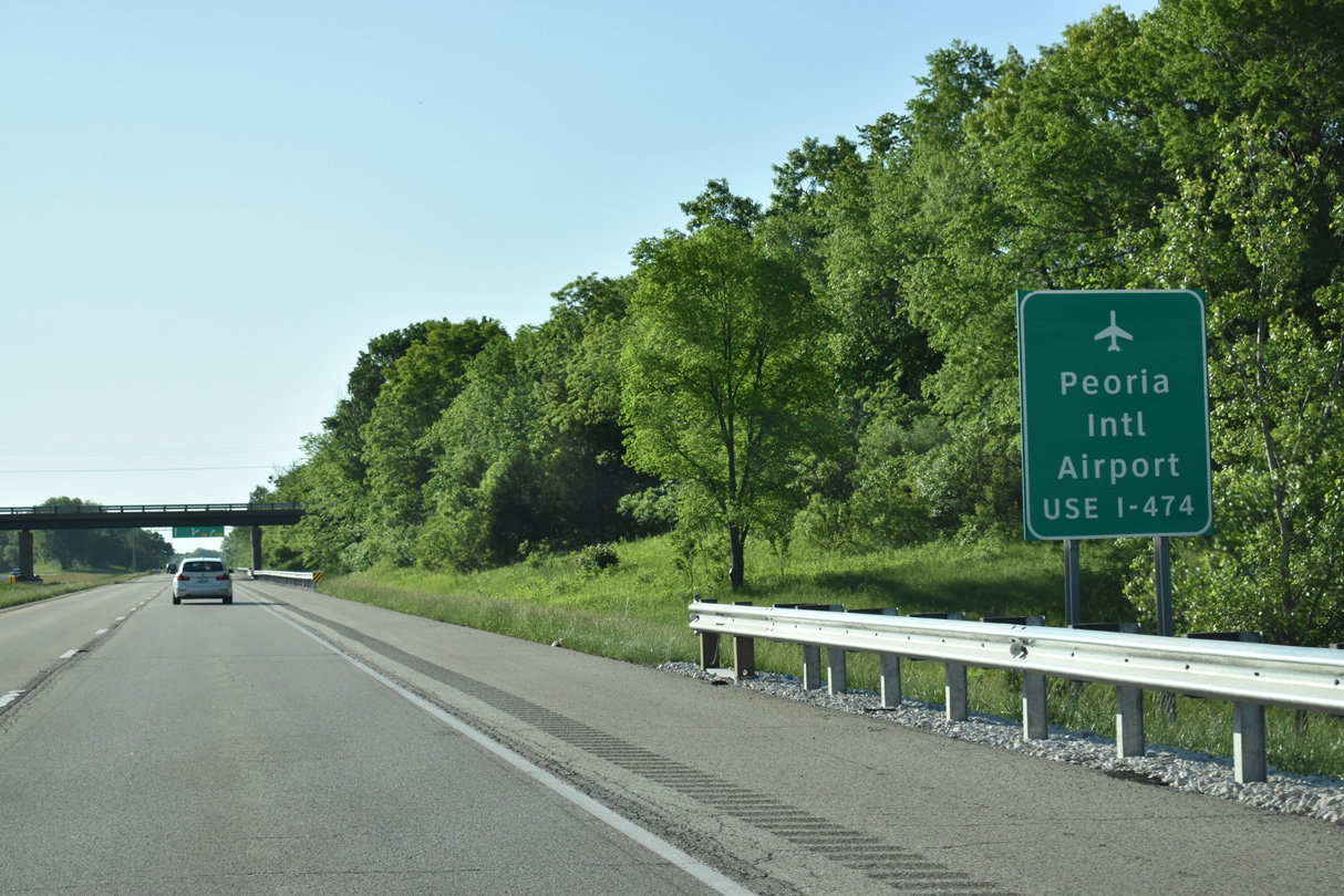
| I-474 serves the west and south suburbs of Bartonville, Bellevue and Creve Coeur as well as General Wayne A. Downing Peoria International Airport (PIA) and Pekin. 05/24/18 |
|
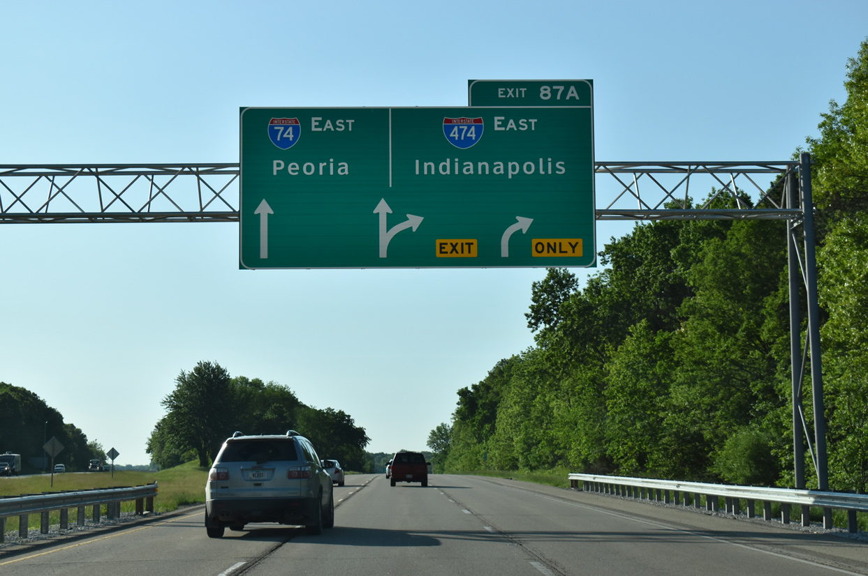
| The roadways of Interstate 74 separate to accommodate a left side ramp from I-474 west to I-74 west. Exit 87 A departs soon thereafter for Interstate 474 south to Bellevue while I-74 immediately enters the city limits of Peoria. 05/24/18 |
|
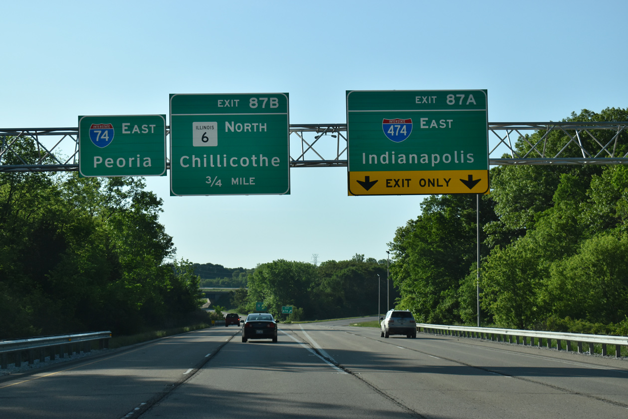
| I-74 continues with two lanes east to Peoria and Exit 87 B for IL 6 north to Chillicothe while two lanes branch southward onto Interstate 474 for through traffic interests to Indianapolis. 05/24/18 |
|
| IL 6 extends from the end of I-474 to northern reaches of Peoria, Alta and Mossville. The freeway ends at a trumpet interchange and connector road to IL 29, eight miles south of Chillicothe. 05/24/18 |
|
| Exit 87 B loops away from Interstate 74 north onto IL 6 north. Previous plans for IL 6 outlined extending the route north to Interstate 180 via an expressway along IL 29 or turning the route across the Illinois River to East Peoria. 05/24/18 |
Page Updated 12-09-2023.

 East
East  West
West