|
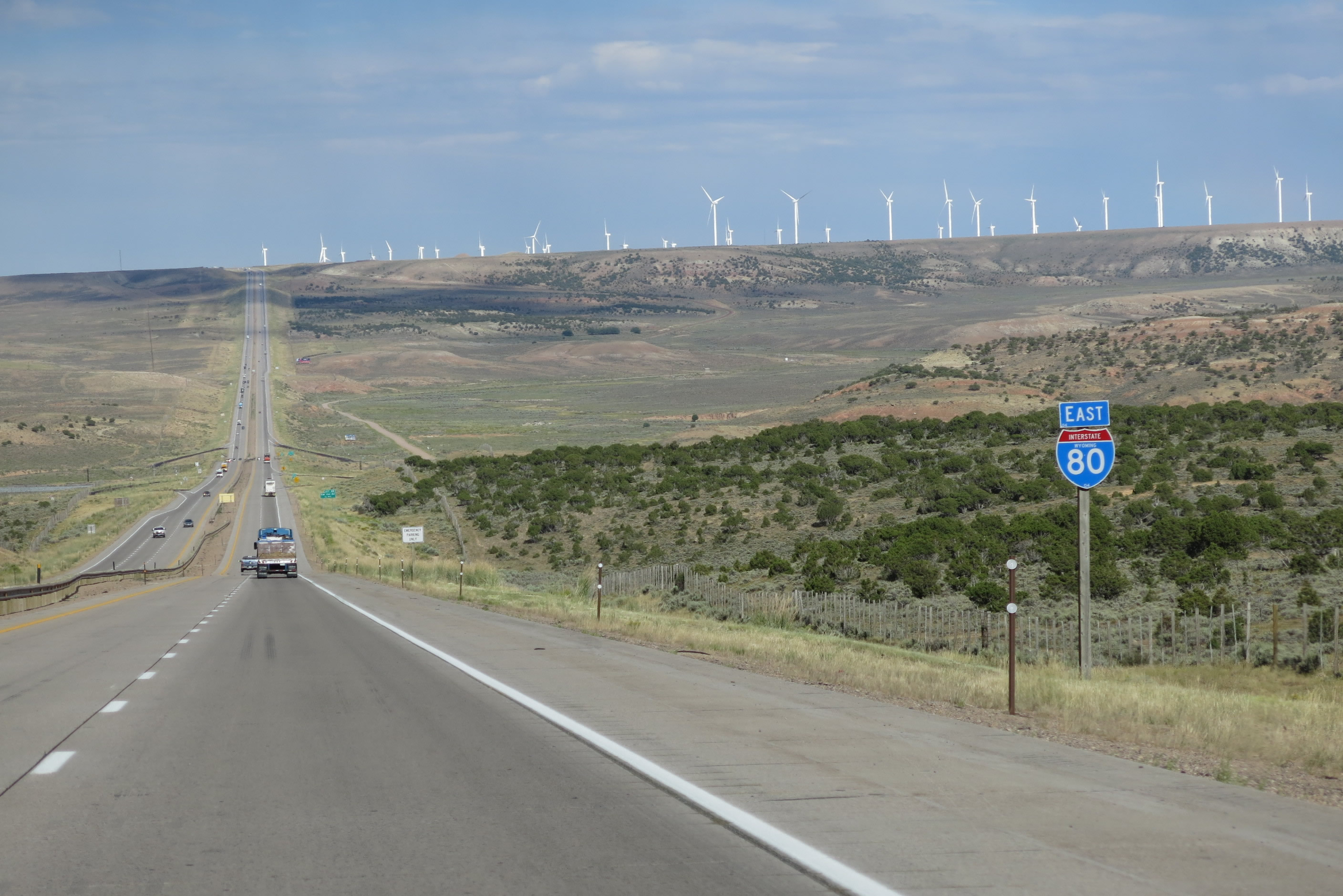
| Interstate 80 proceeds on its own with no companion U.S. routes until it links with U.S. 30 at Exit 66. Prior to 1972, this segment of Interstate 80 was overlapped with U.S. 30S. 08/01/16 |
|
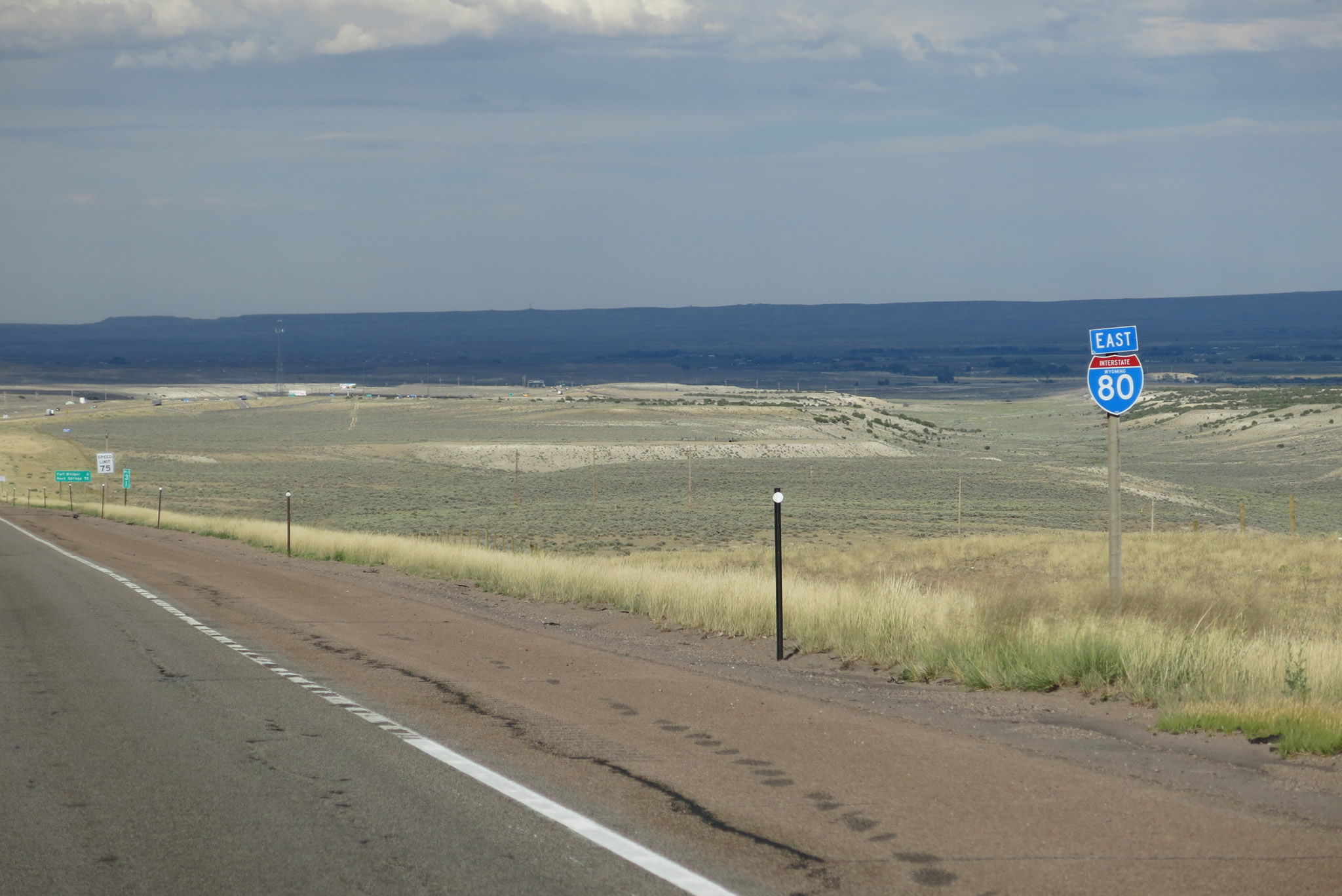
| East from U.S. 189, I-80 advances 18 miles to Fort Bridger and 23 miles to Lyman. A third climbing lane begins for slow moving trucks as the freeway ascends the second of the Three Sisters. 08/01/16 |
|
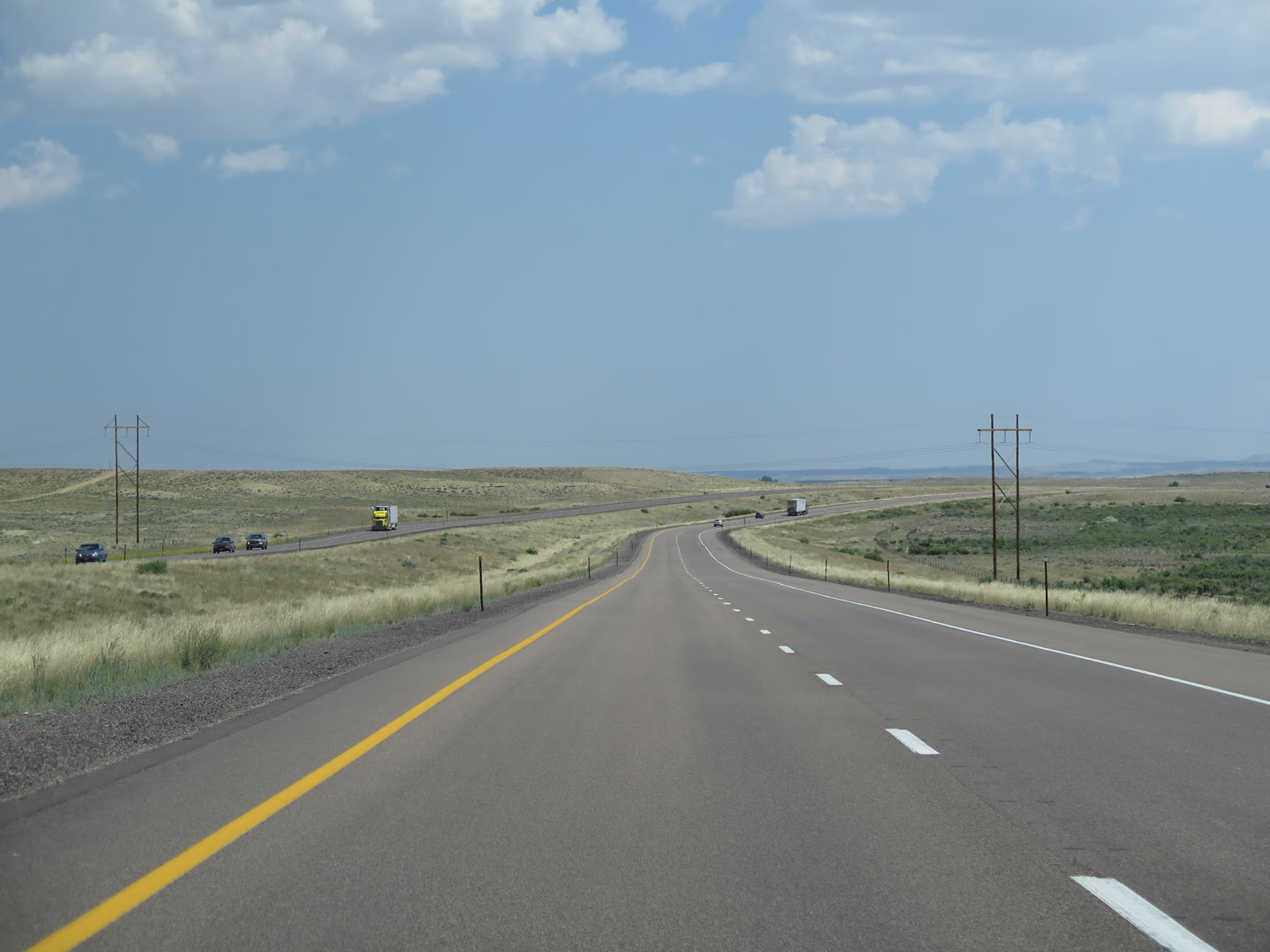
| On this day, a summer thunderstorm competed with sunny skies to create a unique view looking east on Interstate 80. 08/05/13 |
|
| Even with three eastbound lanes, motorists may encounter three lanes of trucks. This view is about midway up the second sister. 08/05/13 |
|
| Eastbound Interstate 80 continues uphill with three lanes. A guardrail replacement project removed this railing in summer 2016. In the westbound direction, a three-lane segment comes to its end. 08/05/13 |
|
| The climbing lane concludes as I-80 east reaches the top of the second Sister. A very long downgrade to Mussleman Creek ensues. 08/05/13 |
|
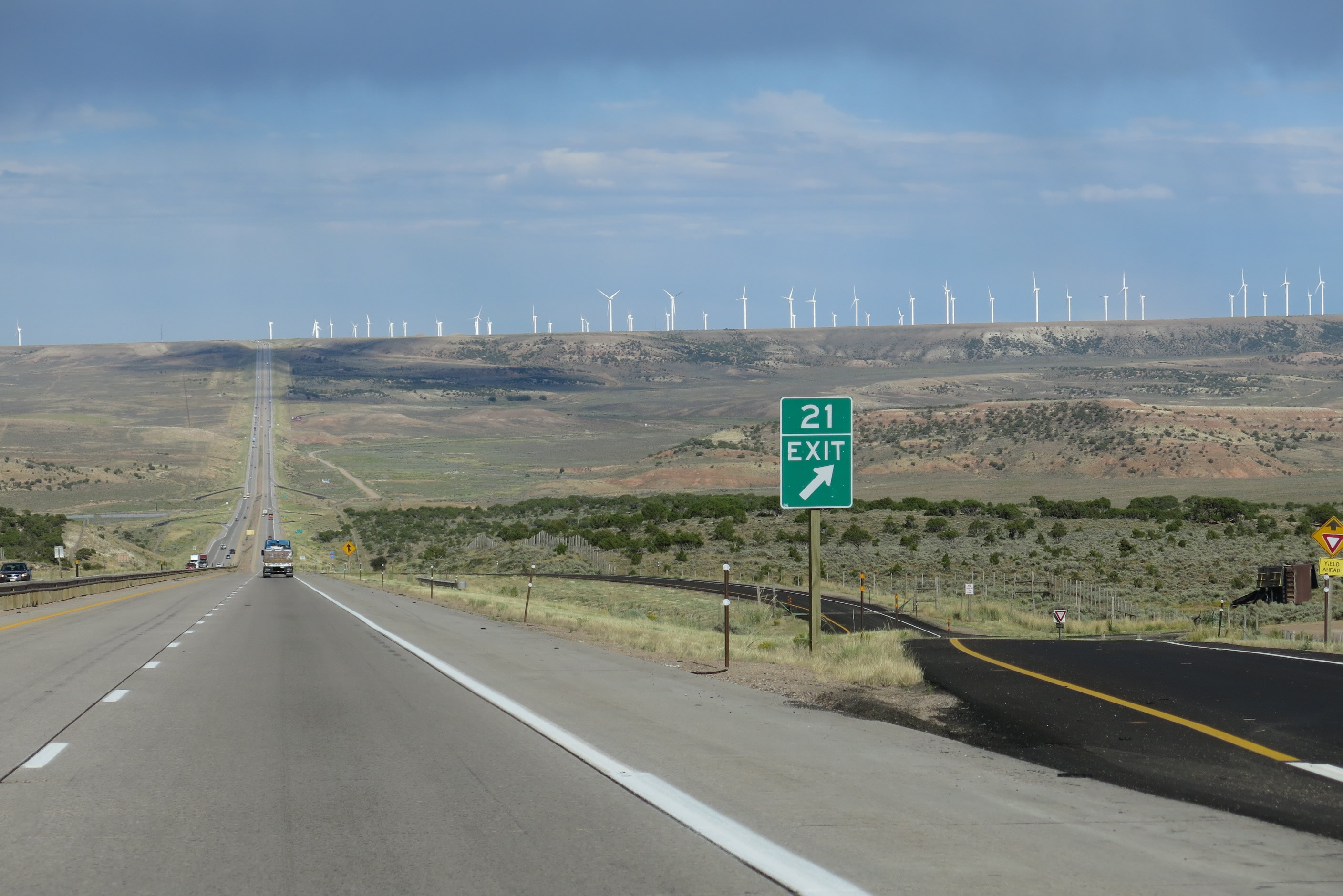
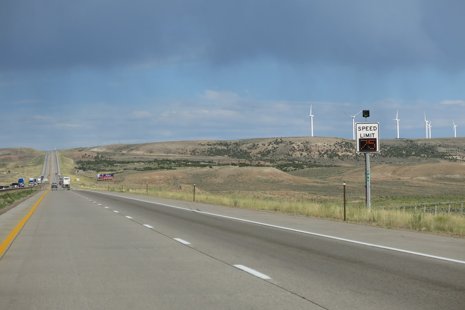
| Milepost 21 marks the summit of the second sister. A variable speed limit sign posts the speed limit at 75 miles per hour, but this can change based on weather condition, traffic and construction activities. 08/05/13 |
|
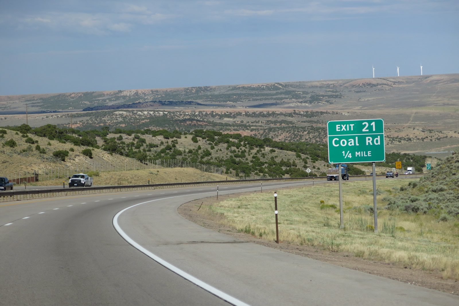
| The next exit along Interstate 80 east is Exit 21, Coal Road. 08/05/13 |
|
| While a summer thunderstorm looms overhead, sunshine illuminates the freeway and the distant wind farm positioned on the summit of the third sister. Interstate 80 takes a direct shot downhill to Mussleman Creek and a Union Pacific Railroad crossing, then rises onto the ridge toward Fort Bridger. 08/05/13 |
|
| Eastbound Interstate 80 meets Exit 21, Coal Road. This exit provides local and ranch access, and no motorist services are available. 08/05/13 |
|
| An Interstate 80 east reassurance marker appears along the descent from Exit 21. 08/05/13 |
|
| Bar Hat Road ties into I-80 at a ranch exit in one quarter mile. This exit connects to the Union Pacific Railroad service roadway. 08/05/13 |
|
| Eastbound Interstate 80 meets Exit 23, Bar Hat Road at a diamond interchange. In the distance is the Edison Mission Group Mountain Wind farm. These turbines populate the distant ridge of the third and final sister. 08/05/13 |
|
| Leroy Road (CR 141) north and Piedmont Road (CR 173) south come together at a ranch exit with I-80 in one quarter mile. Here, the Union Pacific Railroad passes underneath the freeway. The railroad travels north and then west toward Granger and eventually Green River, avoiding the Bridger Valley area (Fort Bridger, Lyman, Urie, and Mountain View). 08/05/13 |
|
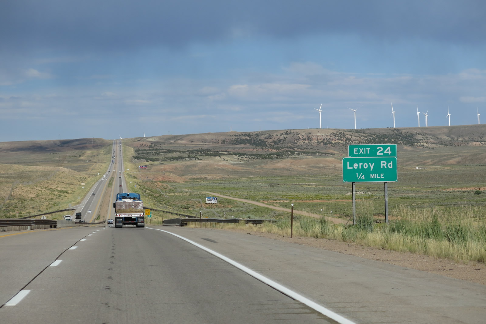
| Exit 24 departs from I-80 east. Uinta County 173 (Piedmont Road) leads south to Piedmont beyond a section of the Old Lincoln Highway. 08/05/13 |
|
| Speed limits are set at 75 miles per hour during optimal conditions along Interstate 80 east to the third Sister range. 08/05/13 |
|
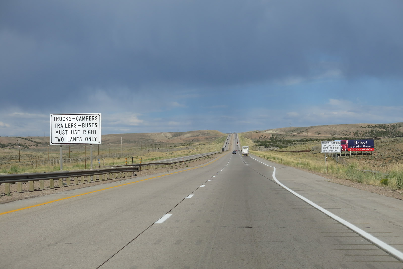
| Climbing over the third Sister range, eastbound Interstate 80 again gains a truck climbing line. The freeway crests east of milepost 27. 08/05/13 |
|
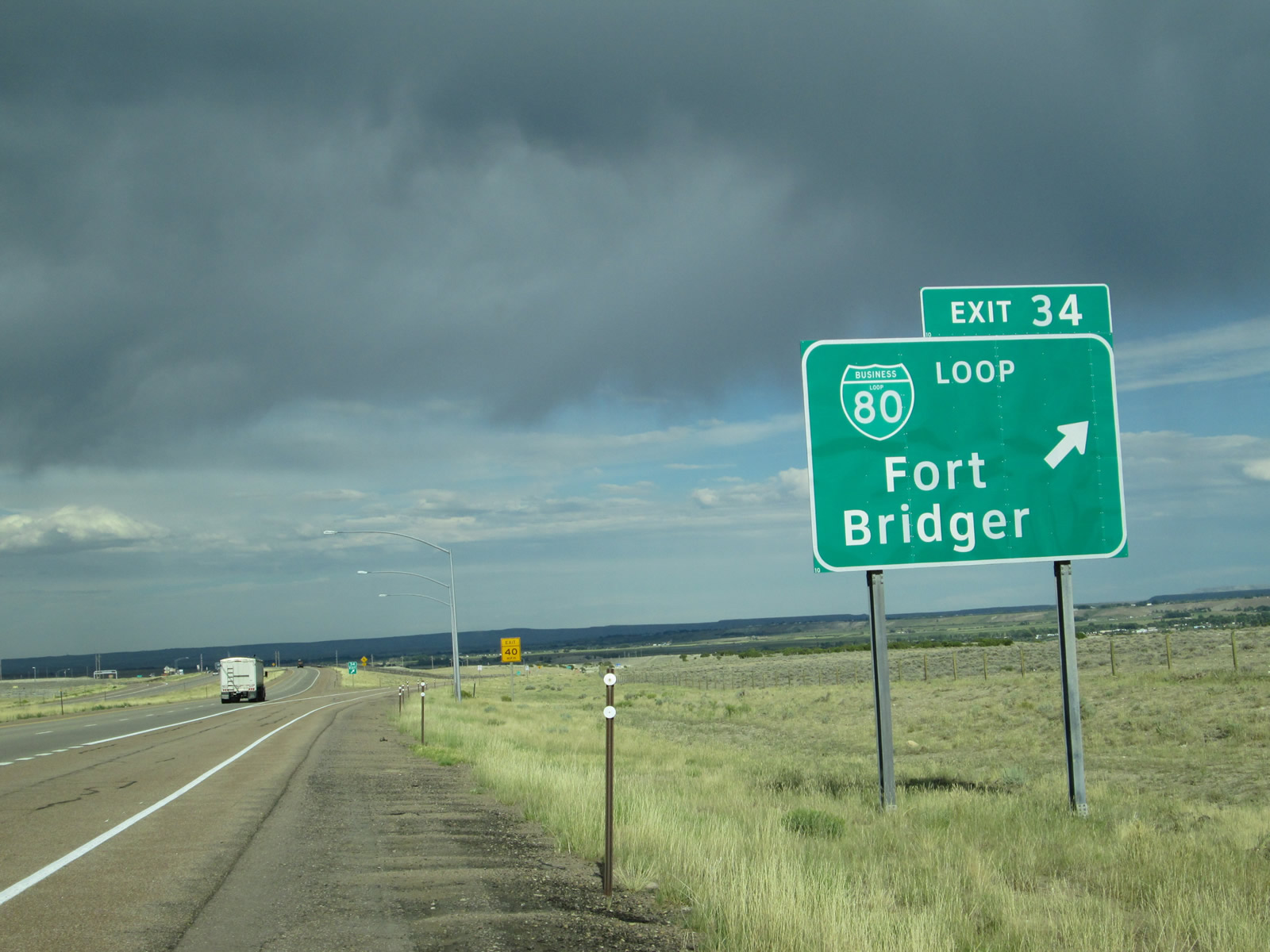
| Take Exit 34 (Business Loop I-80) to Fort Bridger State Historic Site. 08/01/16 |
|
| Nearing the top of the grade, Interstate 80 again loses its climbing lane and reverts to two eastbound lanes. 08/05/13 |
|
| To the south of Interstate 80 is Edison Mission Group Mountain Wind farm, which takes advantage of ridgetop winds to generate electricity. Many of these have sprung up along Interstate 80 due to the near-constant presence of wind along the southern tier of Wyoming. 08/05/13 |
|
| Interstate 80 proceeds along comparably flat terrain from the third Sister east to Fort Bridger. 08/05/13 |
|
| No motorist services are available at the approaching ranch exit with French Road. 08/05/13 |
|
| Eastbound Interstate 80 reaches the diamond interchange (Exit 28) with French Road. 08/05/13 |
|
| An Interstate 80 east reassurance shield is posted after the French Road interchange. 08/05/13 |
|
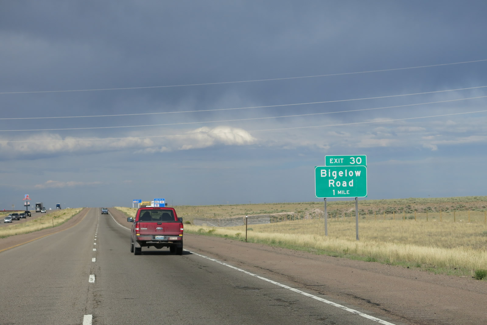
| Exit 30 with Bigelow Road is home to a large truck stop. The addition of a service at what would otherwise be a ranch exit necessitates two guide signs from I-80 instead of one. 08/05/13 |
|
| Entering the diamond interchange (Exit 30) with Bigelow Road (Uinta County 207) on Interstate 80 east. Access to the nearby wind farm and Old Lincoln Highway are available from this interchange. 08/05/13 |
|
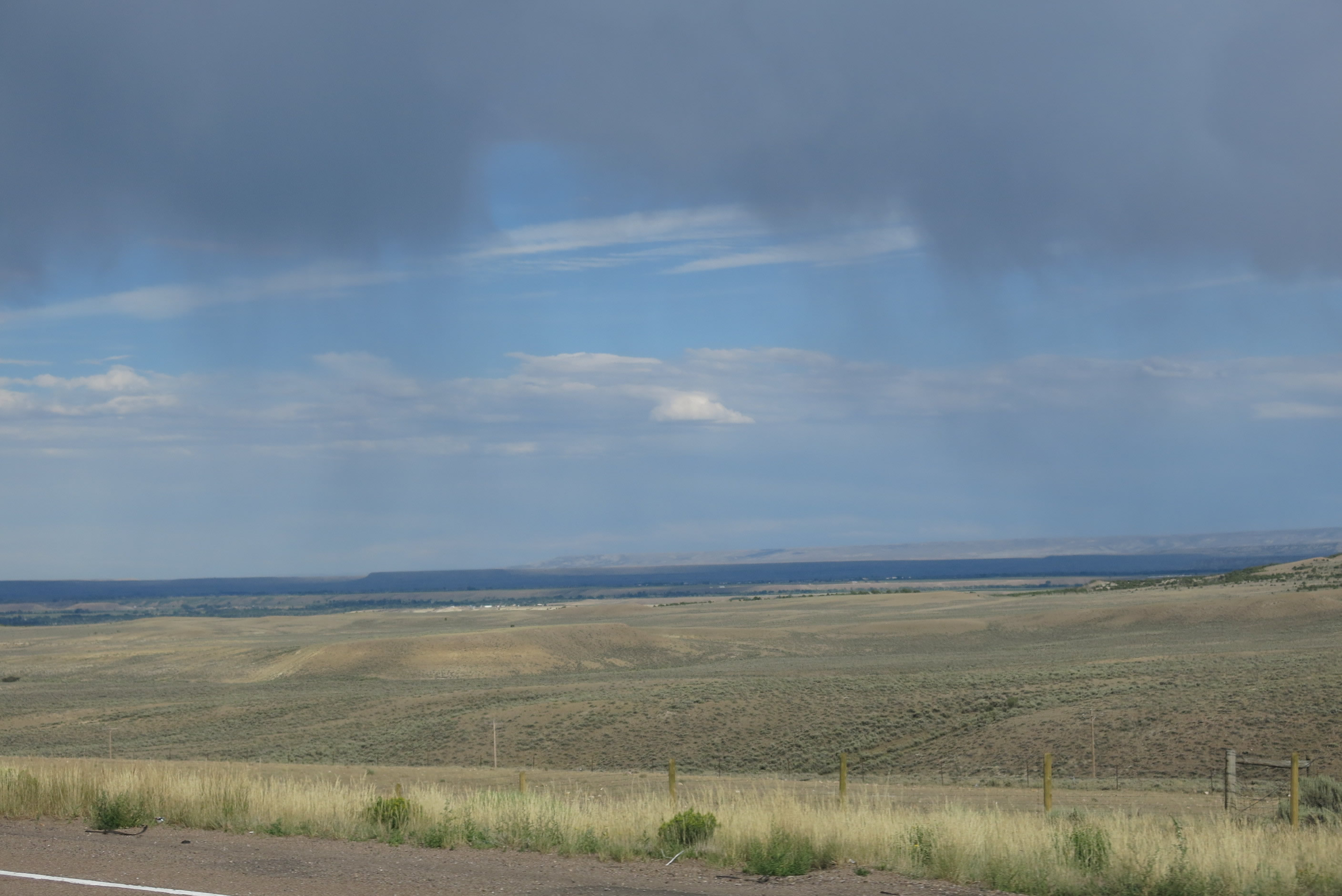
| This view looks south from the Interstate toward the Uinta Mountains in Utah. Rain clouds helped to shield the view of the mountains but offered a different perspective on the Wyoming late-afternoon sky. 08/05/13 |
|
| Interstate 80 lowers from milepost 31 to the north of Quarry Creek. 08/05/13 |
|
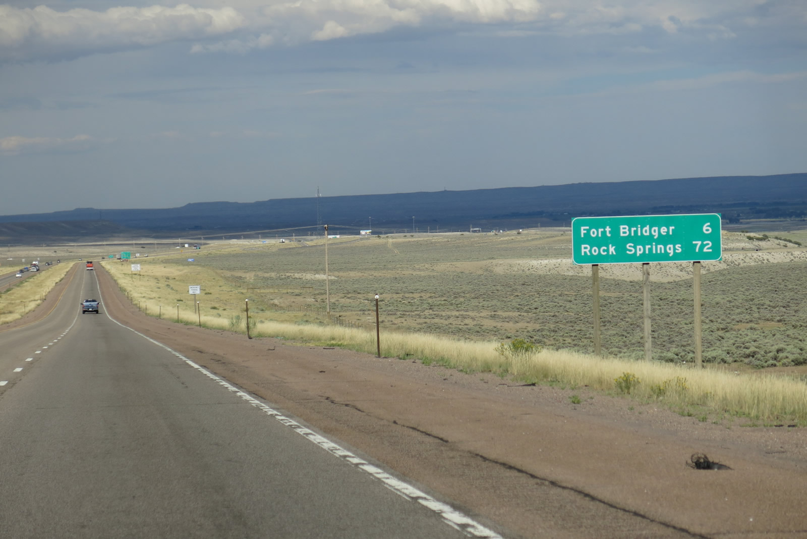
| Distance sign for I-80 east posted six miles from Fort Bridger and 72 miles from Rock Springs. 08/05/13 |
|
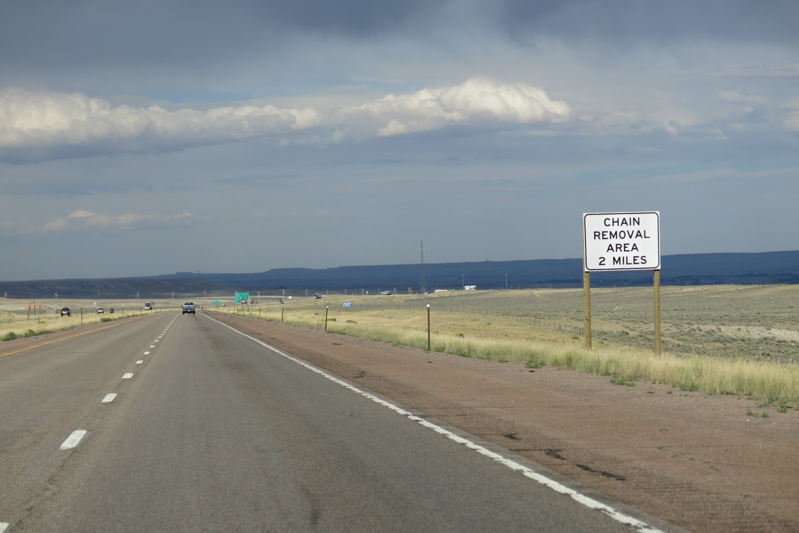
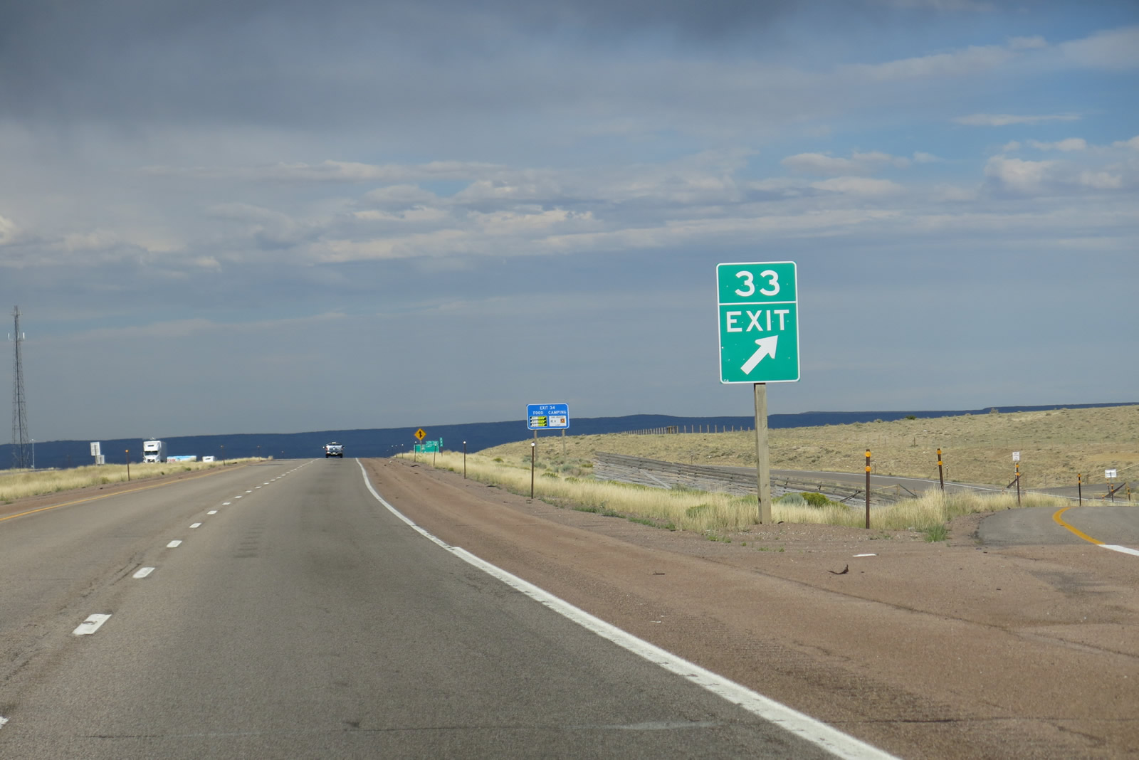
| The next two exits along Interstate 80 east are Exit 33, Union Road and a parking area for tire chain installation/removal during inclement winter weather. 08/05/13 |
|
| Business Loop I-80 connects Fort Bridger, Urie, Mountain View, and Lyman along former U.S. 30S. Today, the business route links agricultural and historical areas along the Bridger Valley Historic Byway, which also incorporates a short segment of Wyoming 414 between Urie and Mountain View. 08/05/13 |
|
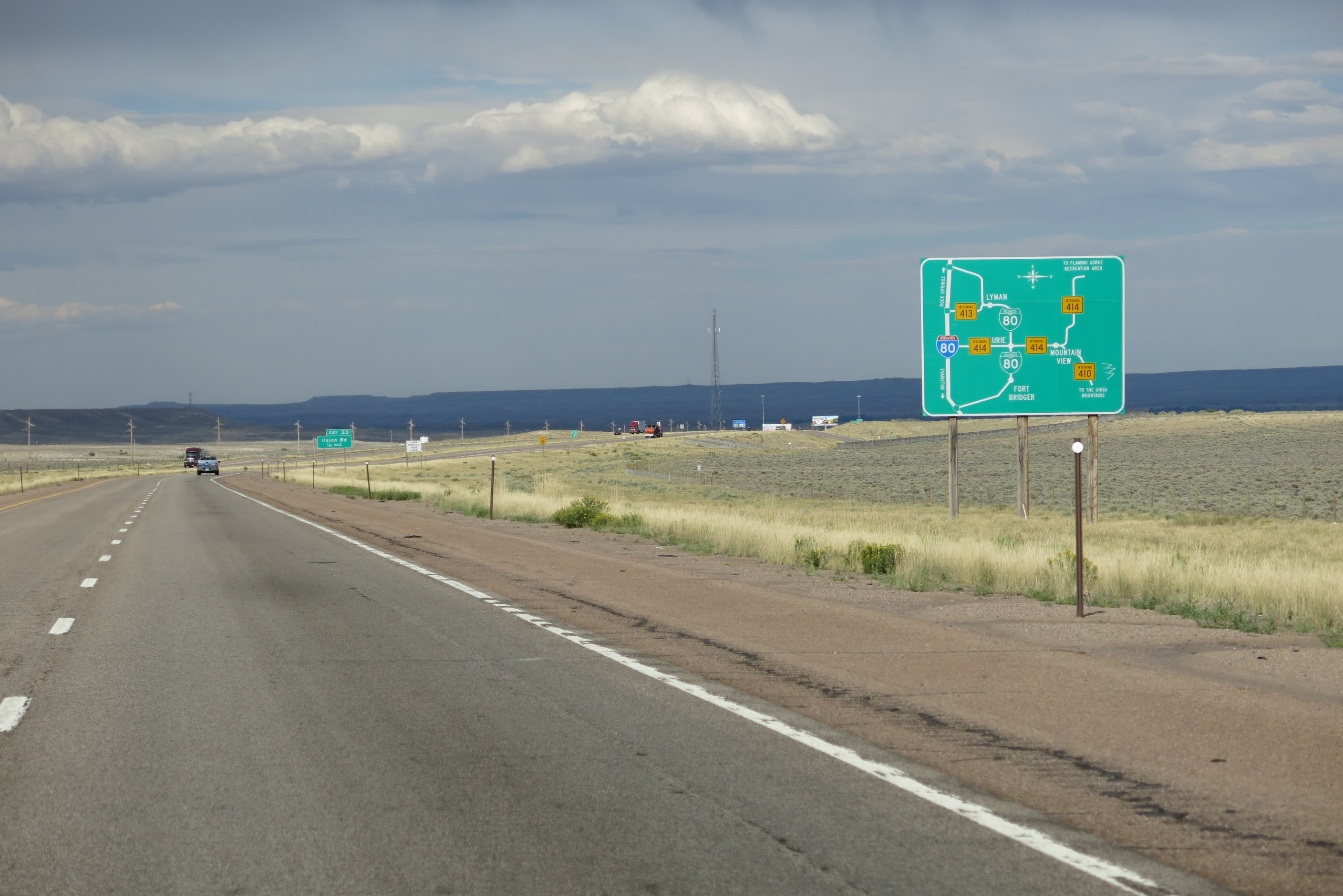
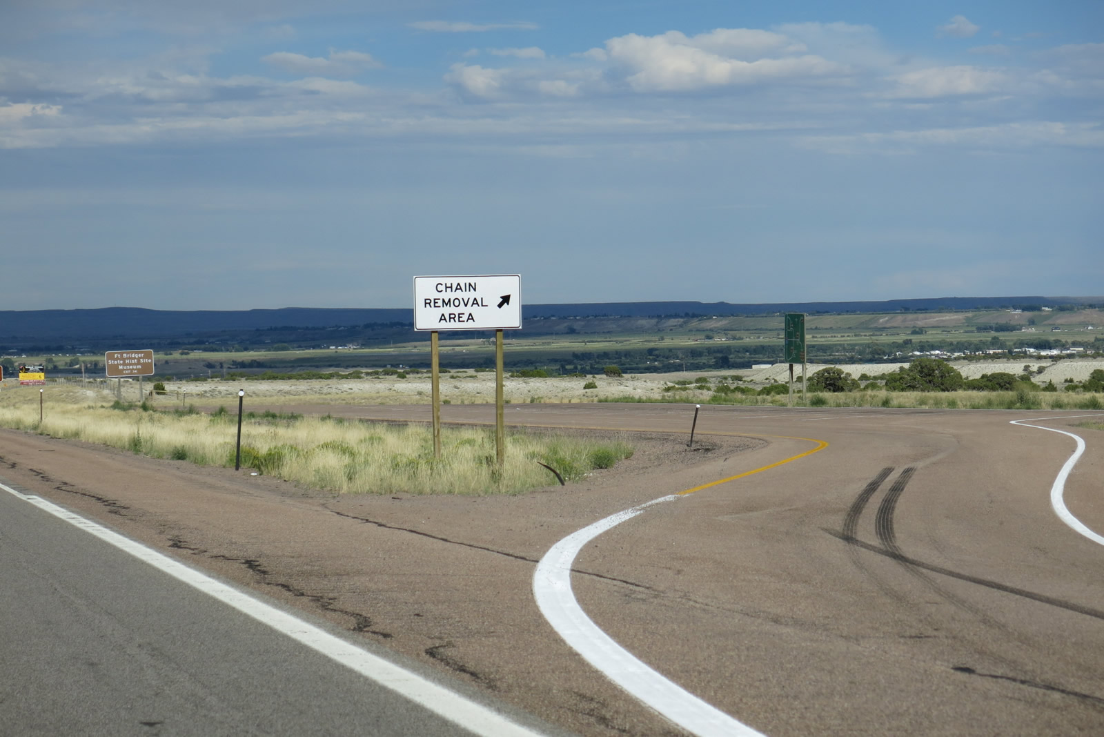
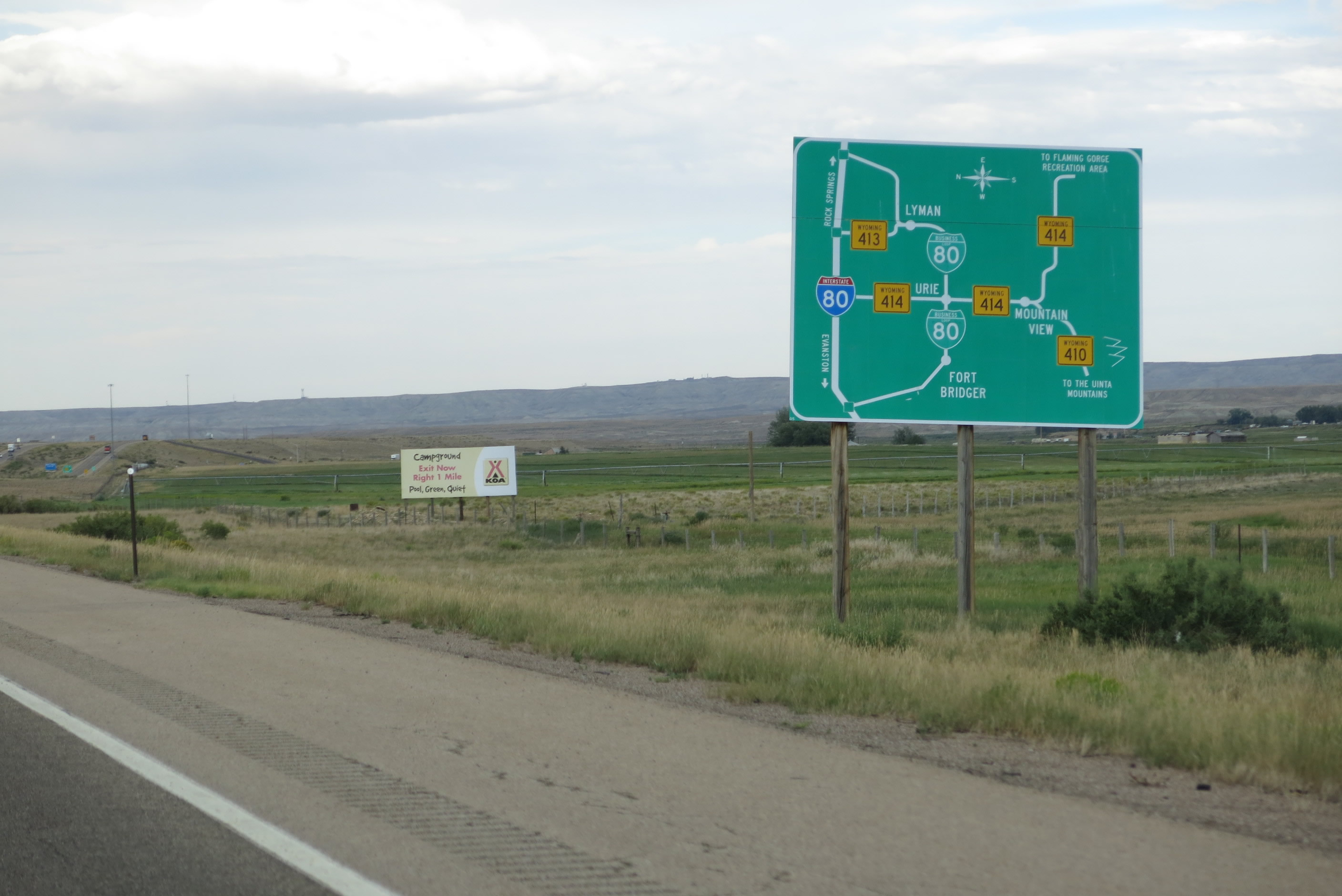
| During the mid-2000s, WyoDOT placed several signs like this one showing the linkages created between Interstate 80, Business Loop I-80, WYO 414, WYO 413, and WYO 410 in Bridger Valley. Upon closer inspection, this map shows I-80 traveling between Rock Springs and Evanston, WYO 414 traveling southeast toward Flaming Gorge National Recreation Area, and WYO 410 traveling southwest to the Uinta Mountains. A similar sign for easier reading is located at the Parking Area (Chain Installation/Removal Area) situated between Exits 33 and 34. 08/05/13 |
|
| Union Road links Interstate 80 with the north side frontage road (Uinta County 220) at a ranch exit in one quarter mile. 08/05/13 |
|
| The succeeding off-ramp of I-80 east serves the aforementioned chain installation / removal area and another Bridger Valley diagrammatic sign for truckers. 08/05/13 |
|
| Eastbound Interstate 80 reaches Exit 33, Union Road. Adjacent CR 220 parallels I-80 east to Exit 34. 08/05/13 |
|
| The Fort Bridger business loop branches south from I-80 east in one mile. The longest Interstate business loop in Wyoming, the route through the Bridger Valley spans 15.66 miles. 08/05/13 |
|
| Business Loop I-80 leaves Interstate 80 at Exit 34 to connect to Fort Bridger, then travels east to Urie and Lyman via old U.S. 30S. While gas, food, and lodging are available along the route, motorists must drive into the individual towns to find the services. 08/05/13 |
|
| Motorists with installed tire chains from the long drive over the Three Sisters may remove them at the parking area located between Exits 33 and 34. The pull off doubles as a truck parking area. 08/05/13 |
|
| Another guide sign with map is posted in the chain installation/removal parking area. Different than the previous sign on the mainline freeway, it has brown recreation logo signs and much smaller font for the state highway designations. 08/01/16 |
|
| Use Business Loop I-80 east to Fort Bridger State Historic Area and Museum. Jim Bridger and Louis Vasquez established Fort Bridger in 1843 as an emigrant supply stop along the Oregon Trail. It was obtained by the Mormons in the early 1850s; a few years later in 1858, it became a military outpost. In 1933, the property was dedicated as a state historical landmark and museum, the role it serves today. 08/01/16 |
|
| Three routes connect Interstate 80 with Flaming Gorge National Recreation Area: WYO 414 between the Bridger Valley and Manila, Utah; WYO 530 between Green River and Manila, Utah; and U.S. 191 between Rock Springs and Dutch John, Utah. Travelers with extra time should consider traveling the scenic loop to Flaming Gorge National Recreation Area and Ashley National Forest via a combination of these three routes. U.S. 191, crosses over the dam on the Green River that creates Lake Flaming Gorge. 08/01/16 |
|
| I-80 reaches the diamond interchange (Exit 34) with Business Loop I-80 to the immediate east of the chain removal area. The business route angles southeast to Fort Bridger and then east to Urie, Mountain View, and Lyman via the Bridger Valley Historic Byway. 08/05/13 |
|
| Interstate 80 stays north of the Bridger Valley and old U.S. 30S (Business Loop I-80) to WYO 413 (Exit 41). 08/05/13 |
|
| This view of Interstate 80 is taken along eastbound between Exits 34 and 39. 08/01/16 |
|
| To the south, the Uinta Mountains hazily come into view above the Bridger Valley. These east-west trending mountains stay well south of Interstate 80 and are mostly south of the Wyoming-Utah State Line. It is fairly common to see summer thunderstorms pop up in the afternoon along the Uinta Mountains. The tallest peak of the chain, and Utah overall, is Kings Peak (el. 13,528 ft). Well north of here, in the Wind River Range along the Continental Divide, is Wyoming's tallest mountain: Gannett Peak (el. 13,804 ft). 08/01/16 |
|
| Power lines cross over Interstate 80, which starts to turn northeast through the Bridger Valley and eastern Uinta County. The freeway will again turn east once it meets U.S. 30 near Granger. 08/01/16 |
|
| Fair weather cumulus clouds dominate the sky as Interstate 80 proceeds northeast. This type of weather pattern is fairly common during the summer. Cloudless mornings lead to fair weather cumulus clouds late morning/early afternoon, and those clouds sometimes can gather into thunderstorms by late afternoon. 08/01/16 |
|
| Wyoming 414 travels south from I-80 at Exit 39 to Urie and Mountain View, then turns east and southeast to serve Lonetree and McKinnon before crossing the state line to become Utah 43 en route to Manila, Utah, and Flaming Gorge National Recreation Area. and Jackson. 08/01/16 |
|
| Wyoming 412 travels northwest from Exit 39 to Carter and U.S. 189. This route links the Bridger Valley with areas along the U.S. 189 corridor, such as Kemmerer, Big Piney and Jackson. 08/05/13 |
|
| The eastern edge of the Bridger Valley comes into view after Exit 39. Interstate 80 will climb out of the valley and head into the high altitude desert plateau after Exit 48. The desert plateau dominates most of the drive along the southern tier of Wyoming. 08/01/16 |
|
| Agricultural areas front both sides of Interstate 80 between Exits 39 and 41. 08/05/13 |
|
| A third diagrammatic sign for the Bridger Valley precedes the link with Wyoming 413 south to Lyman. 08/05/13 |
|
| Wyoming 413 is a short connector route linking I-80 with Business Loop I-80 in the town of Lyman. The Clearview based sign posted one mile ahead of Exit 41 was installed in 2014. 08/01/16 |
|
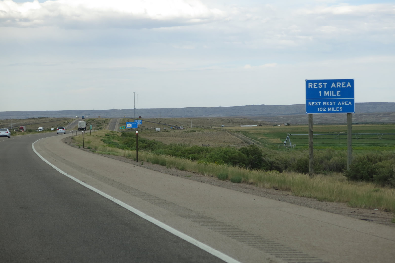
| An off freeway rest area for I-80 resides to the southeast of Exit 41 along WYO 413. The next rest area is located east of Rock Springs at Bitter Creek near milepost 143. 08/05/13 |
|
| Exit 41 leaves Interstate 80 east for Wyoming 413 south to Lyman. CR 231 ties into the diamond interchange with I-80 from the north. 08/01/16 |
|
| A 5.7 mile exit less stretch takes Interstate 80 east to the final Bridger Valley interchange. 08/05/13 |
|
| Nearing the Blacks Fork, Interstate 80 crosses the historical route of the Oregon Trail, California Trail, Mormon Pioneer Trail, and Pony Express. These trails follow a similar path here, but they diverge in route and purpose west of here. WyoDOT makes a good effort to sign the historical alignments of these trails wherever they cross over one of its highways. 08/05/13 |
|
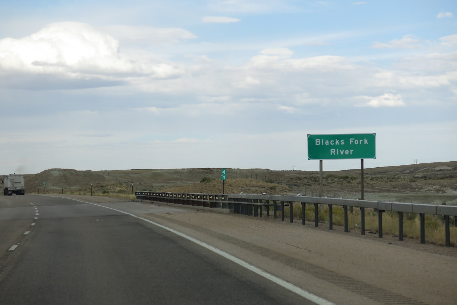
| Interstate 80 crosses over the Blacks Fork of the Green River, which was named for trapper Arthur Black. The river drains a portion of the Uinta Mountains and flows northeast toward Granger, then southeast ultimately into the Flaming Gorge Reservoir (Green River). 08/05/13 |
|
| Business Loop I-80 ventures northeast from Lyman along a rural stretch to end in a remote area at Exit 48. An unpaved ranch road stems north from the approaching diamond interchange. 08/05/13 |
|
| Business Loop I-80 leads motorists seven miles back to Lyman, where mostorists services are available. The 15.66 mile route is the longest Interstate business loop posted in Wyoming. 08/05/13 |
|
| A white regulatory sign advises of the penalty if motorists continue past the gates when flashing lights advise that the road ahead is closed (often due to inclement weather such as ice and wind). If the gates are down, motorists must turn back toward Lyman and Mountain View until the road reopens. 08/05/13 |
|
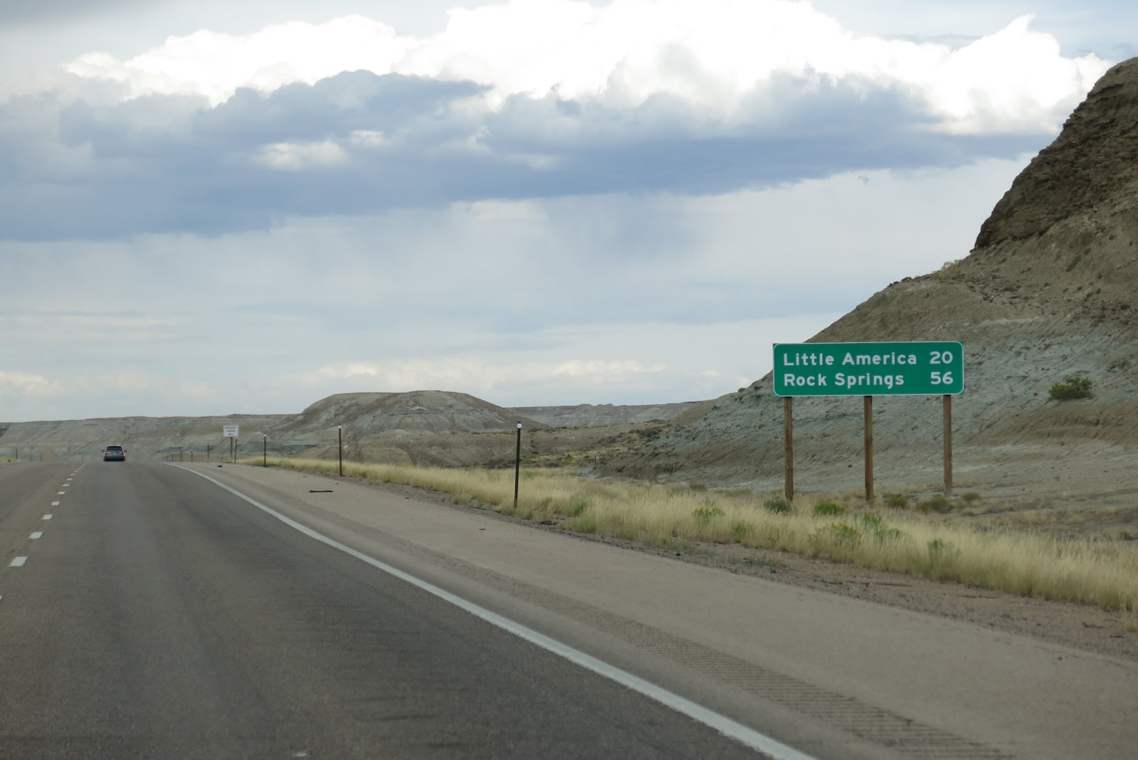
| East from Bridger Valley, the freeway will gain elevation on the 20 mile drive to Little America. Rock Springs is now 56 miles away. 08/05/13 |
|
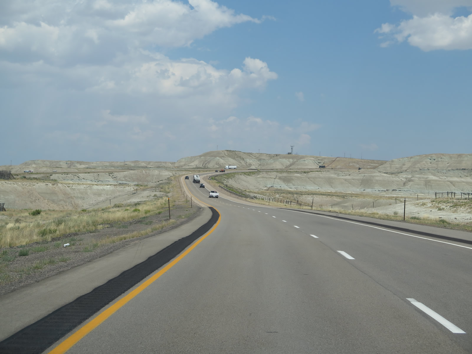
| For a mile or two, the roadways of Interstate 80 separate, with the westbound lanes and eastbound lanes having as much as a mile between them as they climb toward Church Butte. Interstate 80 directly overlays former U.S. 30S between Exit 48 and Exit 53. 08/01/16 |
|
| The topography is reminiscent of the Badlands in South Dakota, with limited vegetation, colored strata in the rock formations and an arid feel to the area. 08/05/13 |
|
| Cliffs like these for the next hundred miles or so will dominate Interstate 80. A feature of Interstate 80 in both directions across Wyoming, billboards tout Little America, which includes three locations along I-80: Salt Lake City, Little America and Cheyenne. The community of Little America at Exit 68 (Wyoming 374) includes a hotel, gas station/truck stop and restaurant. 08/05/13 |
|
| Towering snow fences line the ditches between the two directions of Interstate 80 (former U.S. 30S). These snow fences help catch wind-blown snow and develop large drifts of snow away from the freeway, which reduces snow removal activities and helps keep snow off the travel lanes. 08/01/16 |
|
| The seemingly random placement of snow fences between the two directions of Interstate 80 are scientifically identified to minimize snow impacts to the travel lanes. 08/01/16 |
|
| At the top of this rise, the two roadways of Interstate 80 rejoin. 08/01/16 |
|
| Watch for slowing traffic on this brief uphill segment of Interstate 80. After Exit 53, the freeway flattens somewhat before passing by the trona mines located west of Green River. 08/01/16 |
|
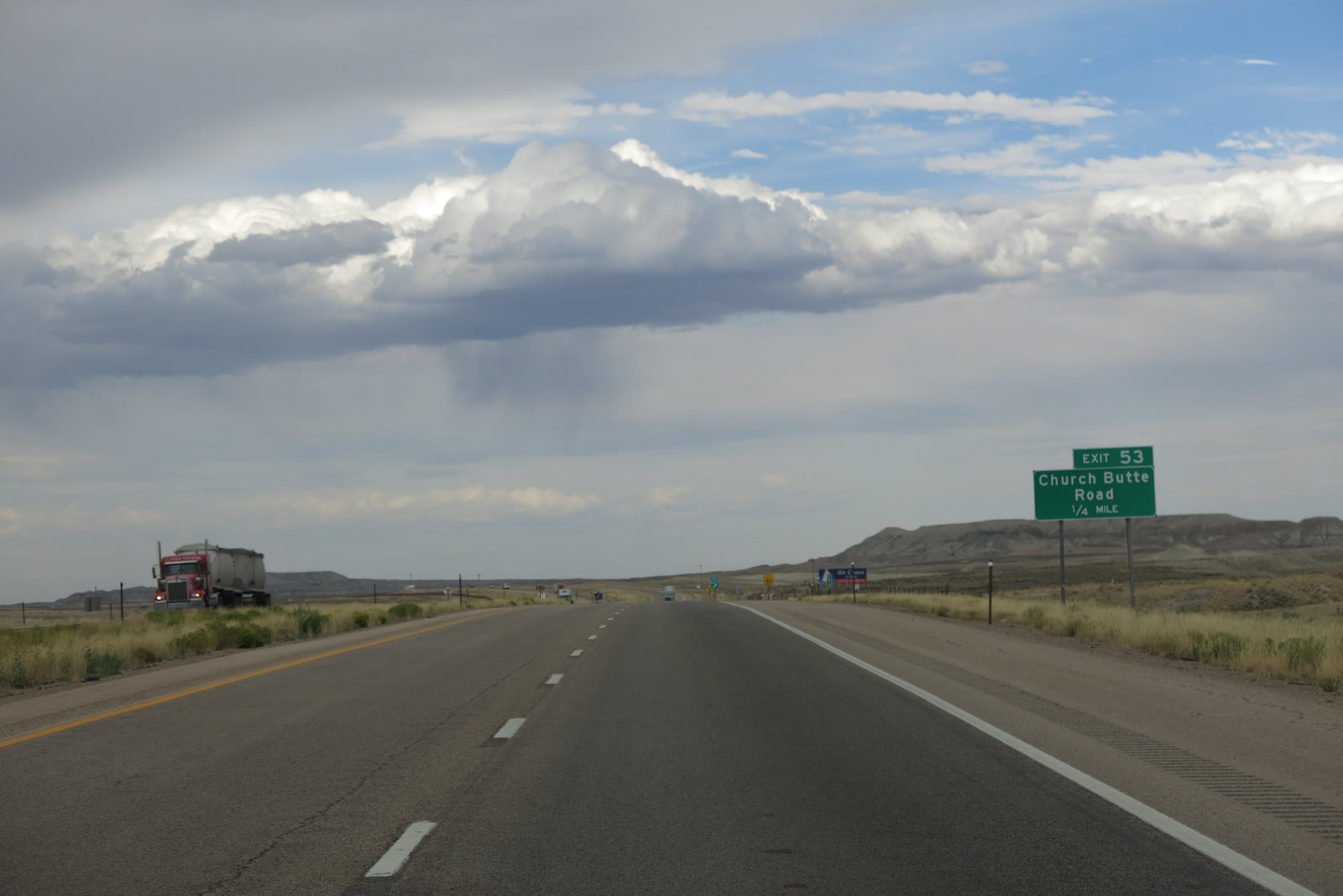
| The next exit along Interstate 80 east is Exit 53, Church Butte Road east to Granger. An extant section of Old U.S. 30S remains in service on the north side of Interstate 80 between Exit 53 and U.S. 30 near Exit 66. Old U.S. 30S between Exits 53 and 61 is unpaved, but the section between Exits 61 and 66 is paved and is maintained as part of Wyoming 374. 08/05/13 |
|
| Eastbound Interstate 80 reaches Exit 53, Church Butte Road. The Little America billboard advertised 75-cent ice cream cones in 2016; they were 50 cents in 2013 and 25 cents during the 1990s. 08/01/16 |
|
| First noted by AARoads in 1990, the reassurance route markers for Interstate 80 in both directions after Church Butte Road (Exit 53) erroneously include a companion U.S. 30 shield. Since U.S. 30 does not join Interstate 80 until Exit 66, which is about 13 miles east of here, WyoDOT's inclusion of U.S. 30 on this route marker assembly is incorrect. 08/01/16 |
|
| The topography flattens out as Interstate 80 continues east toward Granger and Green River. 08/01/16 |
|
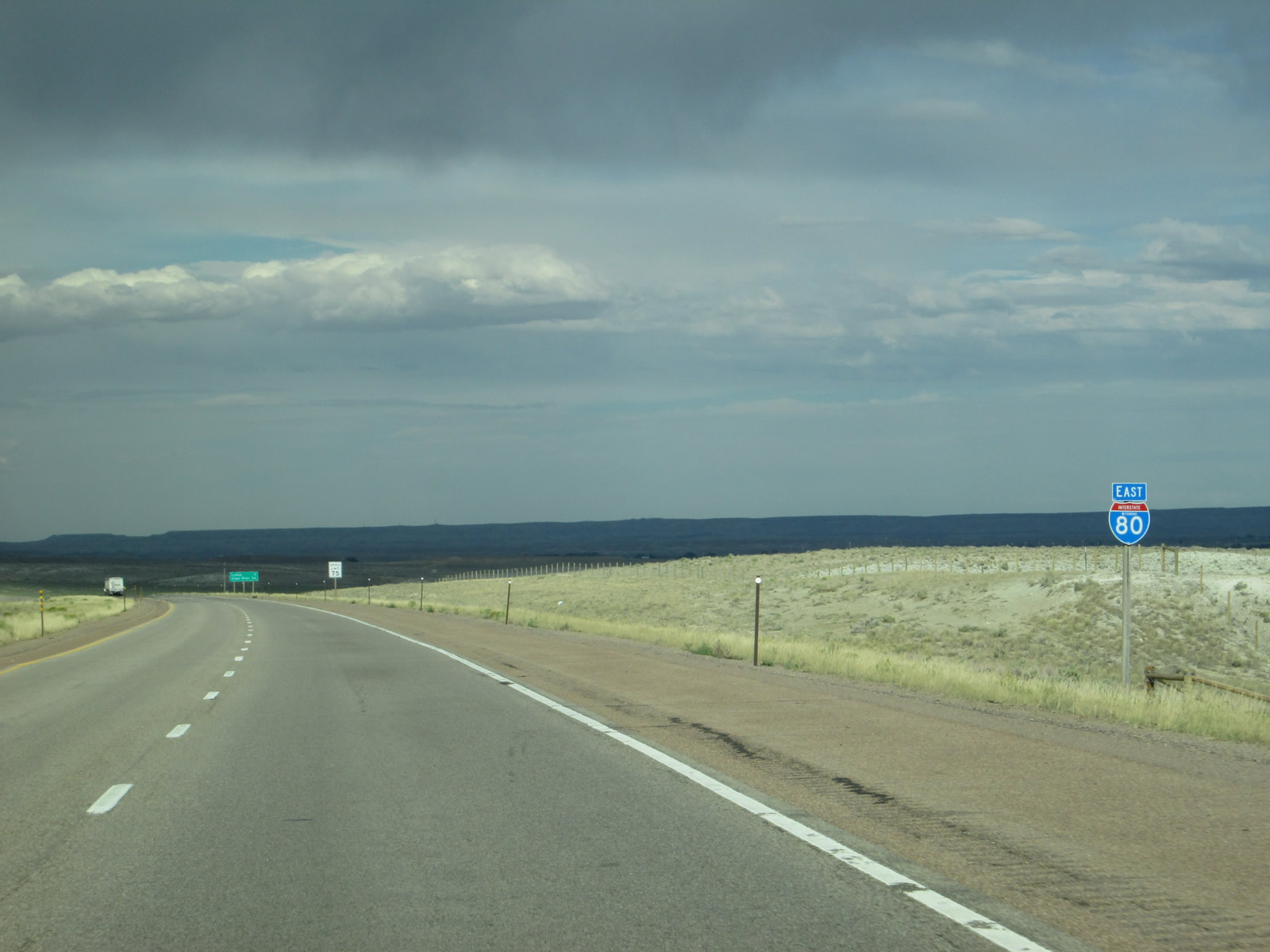
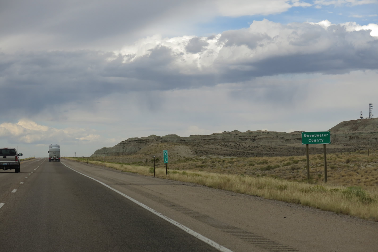
| At Mile 57.4, Interstate 80 leaves Uinta County and enters Sweetwater County. Interstate 80 will stay within Sweetwater County until around Milepost 199, a distance of about 142 miles. Interstate 80 spends more time in Sweetwater County than any other county as it crosses the southern tier of Wyoming. 08/01/16 |
Page Updated 03-31-2017.

 East
East